
Hawaiʻi Weather
On This Page

Hawaiʻi Weather Overview
Hawaiʻi enjoys one of the most consistent and pleasant climates on the planet, and that consistency is the first thing visitors notice. Daytime temperatures across the coastal lowlands hover near 80 to 85 degrees Fahrenheit through most of the year, nights settle into the 60s and 70s, and the ocean stays warm enough for swimming every month. There is no true winter in the sense that most travelers understand it. Palm trees grow at sea level while snow dusts a 13,000 foot summit a few miles away, and that improbable pairing captures the essential truth about Hawaiʻi weather: it is gentle in the aggregate and astonishingly varied in detail.
The archipelago sits near 20 degrees north latitude, squarely in the tropics but moderated by the surrounding Pacific. The ocean acts as a giant thermostat, warming slowly in summer and releasing that warmth through the winter months, which keeps seasonal temperature swings small compared to mainland destinations at similar latitudes. Honolulu averages about 78 degrees in January and 82 in August, a spread so narrow that many visitors pack the same clothes regardless of when they travel. Humidity is generally comfortable, especially along the coasts where the near constant trade winds keep the air moving and the sweat evaporating.
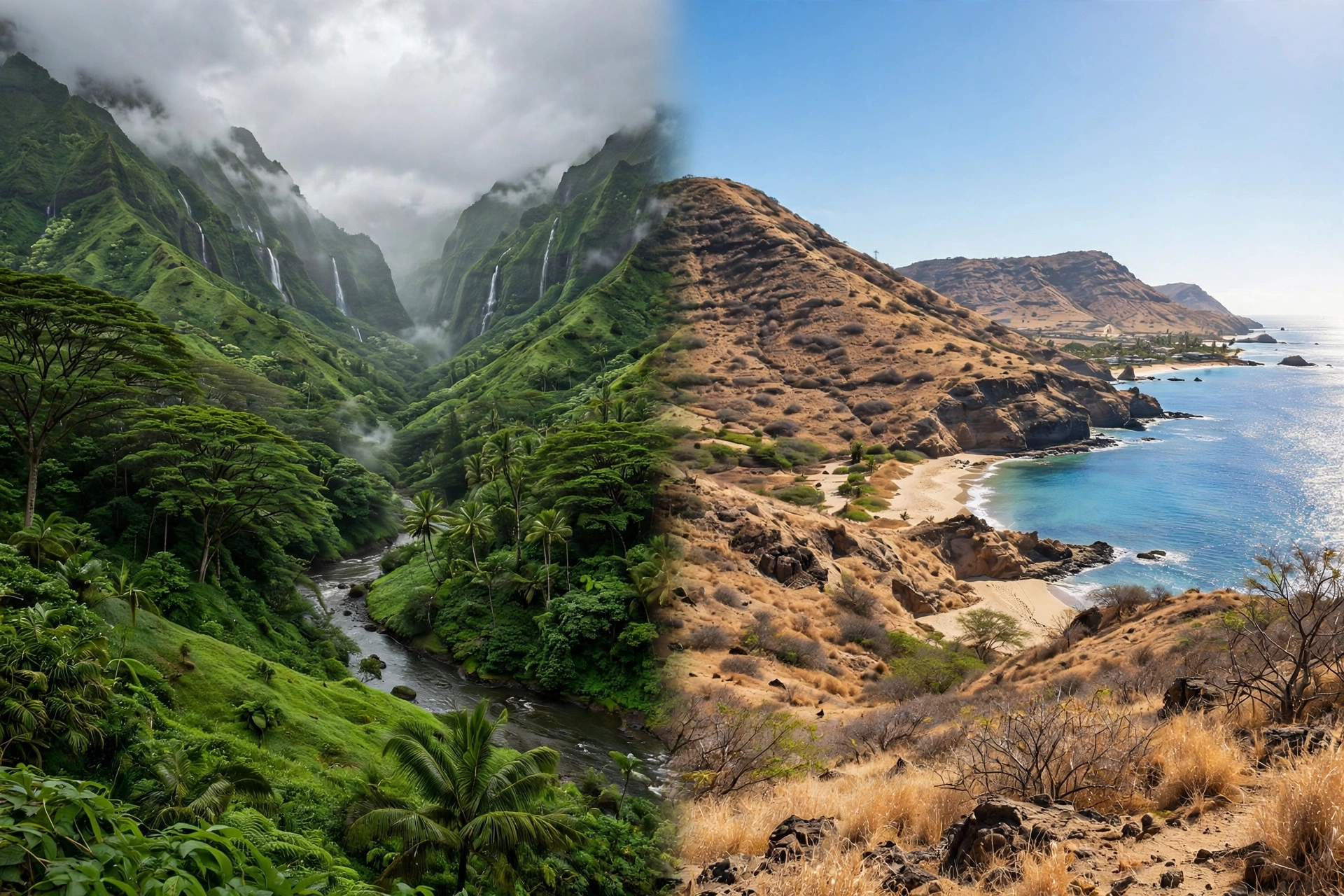
Rainfall, not temperature, is the variable that shapes trip planning. Hawaiʻi contains some of the wettest and driest places on Earth within a single island chain. Mount Waiʻaleʻale on Kauaʻi, one of the rainiest spots on the planet, averages more than 400 inches of rain per year. Meanwhile the leeward coasts of the Big Island and Maui can receive fewer than 15 inches in the same period. The difference comes down to the trade winds and the mountains they collide with, a dynamic that creates the famous windward and leeward microclimates. On any given day it can be pouring on one side of an island while the other side bakes in sunshine, and locals plan their days around that split without a second thought.
Hawaiʻi recognizes two seasons rather than four. Kau, the warm season, runs roughly from May through October. Hoʻoilo, the cooler season, runs from November through April. The distinction matters less for temperature, which barely moves, and more for rainfall, surf, and the character of the wind. Winter brings larger surf to north facing shores, more frequent rain, occasional Kona wind episodes, and the arrival of humpback whales. Summer brings calmer seas on the south shores, stronger and more reliable trade winds, and the driest, most settled weather of the year. Neither season is a bad time to visit. The right choice depends on what you want to do.
One practical note shapes everything else on this page: Hawaiʻi is a hub, not a single destination. Each island has its own weather personality, and this page covers the statewide patterns that they share. For detail on a specific island, the island weather guides linked below go deeper into regional conditions, microclimates, and seasonal planning. Use this page to understand how Hawaiʻi weather works, then drill into the island you are visiting for the specifics that affect your days.

The Two Seasons
Summer: Warm, Dry, and Breezy
Summer in Hawaiʻi, roughly May through October, is the warmest and driest part of the year, and it is when the trade winds blow strongest and most consistently. Daytime highs at sea level typically reach 84 to 88 degrees, with nights in the low to mid 70s. Humidity rises compared to winter, but the steady trades keep the air moving and make the heat feel milder than the thermometer suggests. Rain is at its annual minimum, especially on the leeward coasts, where weeks can pass without a measurable shower. When rain does fall in summer, it usually arrives as brief overnight or early morning showers on the windward slopes, the classic pattern of trade wind weather.
Ocean conditions in summer favor the south facing shores. The large winter swells that pound the north shores fade, and the south shores pick up gentle, long period swells generated by storms in the Southern Hemisphere. Water temperatures climb to their annual peak, generally 80 to 82 degrees, warm enough that many snorkelers skip the wetsuit entirely. Visibility for snorkeling and diving tends to be excellent, especially on the calm leeward coasts. Summer is also the season for the flattest seas on the popular south and west facing beaches, which is why families with young children often prefer these months.
There are a few summer caveats worth knowing. Hurricane season runs from June through November, and while direct hits are rare, the season does bring occasional tropical moisture and elevated surf. Summer is also peak visitor season, particularly June through August, so the best weather coincides with the biggest crowds and the highest prices. Vog can be a factor during summer Kona wind episodes, though it is usually a minor one outside the immediate vicinity of the Big Island’s active volcanic areas. And the heat, while moderate by tropical standards, can feel intense during midday hikes at low elevation, so plan strenuous activities for the cooler morning hours.
Winter: Cooler, Wetter, and Changeable
Winter in Hawaiʻi, roughly November through April, is the cooler and wetter season, though “cooler” is relative. Daytime highs at sea level sit near 76 to 80 degrees, and nights can dip into the low 60s, especially on the windward coasts and at elevation. The temperature change is modest, but the feel of winter is distinct: more clouds, more frequent rain, stronger surf on the north shores, and wind patterns that shift more often. The trades weaken and become less reliable, blowing perhaps half the days instead of the near constant flow of summer, which opens the door to Kona winds, Kona storms, and the occasional multi day rainy spell.
Rainfall peaks in winter across nearly the entire state. The wettest months are typically November through March, and the rain arrives in several forms: steady trade wind showers on the windward slopes, brief intense downpours that can trigger flash floods in mountain valleys, and the occasional Kona storm, a low pressure system that brings widespread heavy rain and southerly winds for several days. Most winter days are not washouts. The typical pattern is morning clouds and showers giving way to afternoon clearing, or rain confined to the mountains while the coasts stay dry. But winter is when Hawaiʻi earns its reputation for changeable weather, and flexibility in daily plans pays off.
Winter also brings the year’s most dramatic ocean conditions. Large swells generated by North Pacific storms pound the north facing shores from roughly October through March, producing the legendary surf of the North Shore of Oʻahu and the towering waves of Peʻahi on Maui. These months are spectacular for watching surf and terrible for casual swimming on exposed northern coasts. The south shores, meanwhile, turn calm and glassy, making winter the best season for snorkeling and swimming on the leeward sides. Winter is also whale season: humpback whales arrive in Hawaiian waters around December and remain through April, with February typically the peak month for sightings.

Trade Winds and Kona Winds
The northeast trade winds are the engine of Hawaiʻi weather. These steady breezes blow from the northeast across the central Pacific, driven by the clockwise circulation around the Pacific High, a semi permanent high pressure system north of the islands. In summer the Pacific High is strong and sits to the north, and the trades blow on roughly 80 to 90 percent of days at 10 to 20 miles per hour. In winter the high weakens and shifts south, and trade wind frequency drops to around 50 to 60 percent of days. When the trades are blowing, Hawaiʻi weather follows a predictable script: clouds and showers pile against the windward mountain slopes, the leeward coasts stay sunny and dry, and the air feels fresh and comfortable.
The trades also create the temperature inversion that caps cloud development over the islands. Warm air above roughly 6,000 to 8,000 feet acts as a lid, trapping moisture below and keeping the trade wind clouds as shallow, flat bottomed puffs that hug the mountain slopes. This is why the summits of Haleakalā and Mauna Kea often poke above a sea of clouds into brilliant sunshine: the inversion keeps the cloud deck below them. On days when the inversion is strong, even the windward slopes stay relatively dry, and the whole island can enjoy sunshine. When the inversion weakens or breaks, clouds build taller and rain becomes heavier and more widespread.
When the trades fail, Kona winds take their place. Kona winds blow from the south or southwest, the opposite direction of the trades, and they bring a completely different weather regime: warm, humid, still air, hazy skies, and the possibility of heavy rain if a low pressure system is involved. Kona wind episodes are most common in autumn and spring, particularly October and April, and they can last from a day or two to more than a week. Surfers welcome Kona winds because the offshore flow grooms the waves on the north shores into perfect shape. Everyone else tends to find Kona weather muggy and oppressive compared to the crisp trade wind days, and vog haze becomes noticeably worse during Kona episodes because the southerly flow carries volcanic emissions up the island chain.
Kona storms are a separate and more serious phenomenon. These are low pressure systems that approach from the south or southwest, the “Kona” direction, and they can bring several days of heavy rain, strong winds, high surf on the south facing shores, and occasionally flooding. Kona storms are most common in winter and can affect the entire state at once, unlike the localized trade wind showers. They are infrequent, typically a few per winter season, but they are the main source of widespread disruptive weather in Hawaiʻi. When a Kona storm is forecast, the National Weather Service office in Honolulu issues watches and warnings, and visitors should take them seriously, particularly regarding flash flooding and ocean conditions.

Microclimates Across the Islands
The single most important concept for understanding Hawaiʻi weather is the microclimate. Because the islands are tall volcanic mountains rising from the sea, and because the trade winds blow moisture against them from one direction, each island is divided into dramatically different climate zones over very short distances. The wettest and driest places in the state can sit less than 20 miles apart. Visitors who grasp this pattern can make smarter daily decisions than any forecast alone allows: when the windward side is socked in, the leeward side is often glorious, and the drive between them can take under an hour.
Windward Versus Leeward
The windward side of each island faces the northeast trade winds. Moist ocean air is forced upward by the mountain slopes, cools as it rises, and condenses into clouds and rain, a process called orographic lifting. The result is lush, green, waterfall laced terrain that receives the bulk of each island’s rainfall. The windward coasts of Oʻahu, Maui, Kauaʻi, and the Big Island are the green Hawaiʻi of postcards: dense vegetation, rushing streams, and rainbows after passing showers. Temperatures run a degree or two cooler than the leeward side, clouds are more common, and brief showers can arrive at any time, though they usually pass quickly.
The leeward side sits in the rain shadow of the mountains. By the time the trade wind air descends the leeward slopes, it has lost most of its moisture, and it warms as it sinks, which suppresses cloud formation. The result is the sunny, dry, resort coast Hawaiʻi: Waikīkī, Kāʻanapali, Poʻipū, and the Kona coast all sit on leeward shores, and their locations are no accident. Leeward coasts receive a fraction of the windward rainfall, sometimes less than a tenth, and they enjoy far more sunshine hours. The tradeoff is heat and dryness: leeward areas run warmer, browner, and dustier, and they depend on irrigation or imported water for landscaping.
The practical rule for visitors is simple. If it is raining where you are, drive to the other side of the island. The windward to leeward contrast is so reliable that locals treat it as a planning tool rather than a weather event. Morning is often the cloudiest part of the day on the windward side, with clearing by afternoon. On the leeward side, the pattern reverses slightly: mornings tend to be calm and clear, with clouds building over the mountains by afternoon and occasionally spilling toward the coast as brief showers. Learning your island’s version of this rhythm takes a day or two, and it transforms a trip.
Elevation Changes Everything
Temperature drops about 3 to 4 degrees Fahrenheit for every 1,000 feet of elevation gain, which means altitude matters enormously in Hawaiʻi. Sea level Honolulu at 82 degrees and the 10,023 foot summit of Haleakalā can differ by 30 degrees or more on the same afternoon. The summit areas of the Big Island’s Mauna Kea and Mauna Loa, approaching 14,000 feet, regularly see freezing temperatures and winter snow, while beachgoers swim in 78 degree water an hour’s drive below. This vertical range packs climate zones from tropical to alpine into a single island, a compression found almost nowhere else on Earth.
Elevation also reshapes rainfall. The wettest zones on each island sit not at the coast but partway up the windward slopes, where the orographic lifting is strongest. Above that band, rainfall often decreases again near the summits, which poke through the moist layer into drier air. The saddle regions between the Big Island’s great volcanoes sit in a high desert rain shadow and receive very little precipitation. Upcountry Maui, the Waimea region of the Big Island, and the central plateaus of Lānaʻi and Molokaʻi all sit high enough to feel distinctly cooler than the coasts, with misty mornings, chilly winter nights, and a need for layers that surprises first time visitors.
For trip planning, elevation is the hidden variable behind packing mistakes. A day that starts with a beach morning and ends with a sunset at a 10,000 foot summit can span a 40 degree temperature range, and the wind at exposed summits makes it feel colder still. The standard advice from park rangers at Haleakalā and Hawaiʻi Volcanoes National Park is blunt: bring warm layers even in summer, because visitors arrive in shorts and shiver through sunset every single day. The same principle applies at a smaller scale to upcountry drives, mountain hikes, and the highland towns of every island.
Island-by-Island Summaries
Each island expresses the statewide patterns in its own way, shaped by its size, height, and orientation. What follows is a brief summary of each island’s weather personality. The linked island weather guides cover each one in full detail, with regional breakdowns, seasonal guidance, and packing advice specific to that island.
Oʻahu has the mildest and most predictable weather in the chain. The Koʻolau mountains wring rain out of the trades on the windward side, keeping towns like Kāneʻohe green, while Honolulu and Waikīkī on the leeward side stay sunny and dry. The island’s modest elevation means fewer temperature extremes, and the urban heat island around Honolulu adds a degree or two. See the Oʻahu weather guide for the full breakdown.
Maui shows the sharpest windward to leeward contrast of any island. The windward slopes of Haleakalā and the West Maui Mountains catch enormous rainfall, feeding the waterfalls of the Road to Hāna, while South Maui and West Maui sit in deep rain shadow with near desert dryness. Upcountry Maui adds a cool highland zone, and Haleakalā summit brings true alpine cold. See the Maui weather guide for the full breakdown.
Kauaʻi is the wettest island overall and the oldest, its deeply eroded mountains catching trade wind moisture with legendary efficiency. Mount Waiʻaleʻale anchors the wet extreme, while Poʻipū on the south shore sits in relative rain shadow and enjoys the island’s sunniest weather. Kauaʻi’s compact size means the microclimates shift quickly, and the Nā Pali Coast faces the full force of winter surf. See the Kauaʻi weather guide for the full breakdown.
Big Island of Hawaiʻi contains nearly every climate zone on Earth, from tropical rainforest to alpine desert to snow capped summits. The windward Hilo side is famously rainy, the Kona coast famously sunny, and the high saddles and summits bring cold, thin air. Kīlauea’s volcanic activity adds vog to the island’s weather story in a way no other island experiences. See the Big Island weather guide for the full breakdown.
Molokaʻi packs sharp contrasts into a small footprint: the dry, sunny west end around Kaluakoʻi, the comfortable central plateau around Kaunakakai, the wet and lush east end, and the cool, misty Kamakou summit cloud forest. The north shore faces open ocean exposure and winter swells. See the Molokaʻi weather guide for the full breakdown.
Lānaʻi is the driest inhabited island, with a two zone personality: the cool, misty central plateau around Lānaʻi City and the hot, dry, sunny Mānele coast below. The Lānaʻihale summit catches fog drip that sustains a remnant cloud forest, while the west end near Keahiakawelo is arid and exposed. See the Lānaʻi weather guide for the full breakdown.
Rainfall and Storms
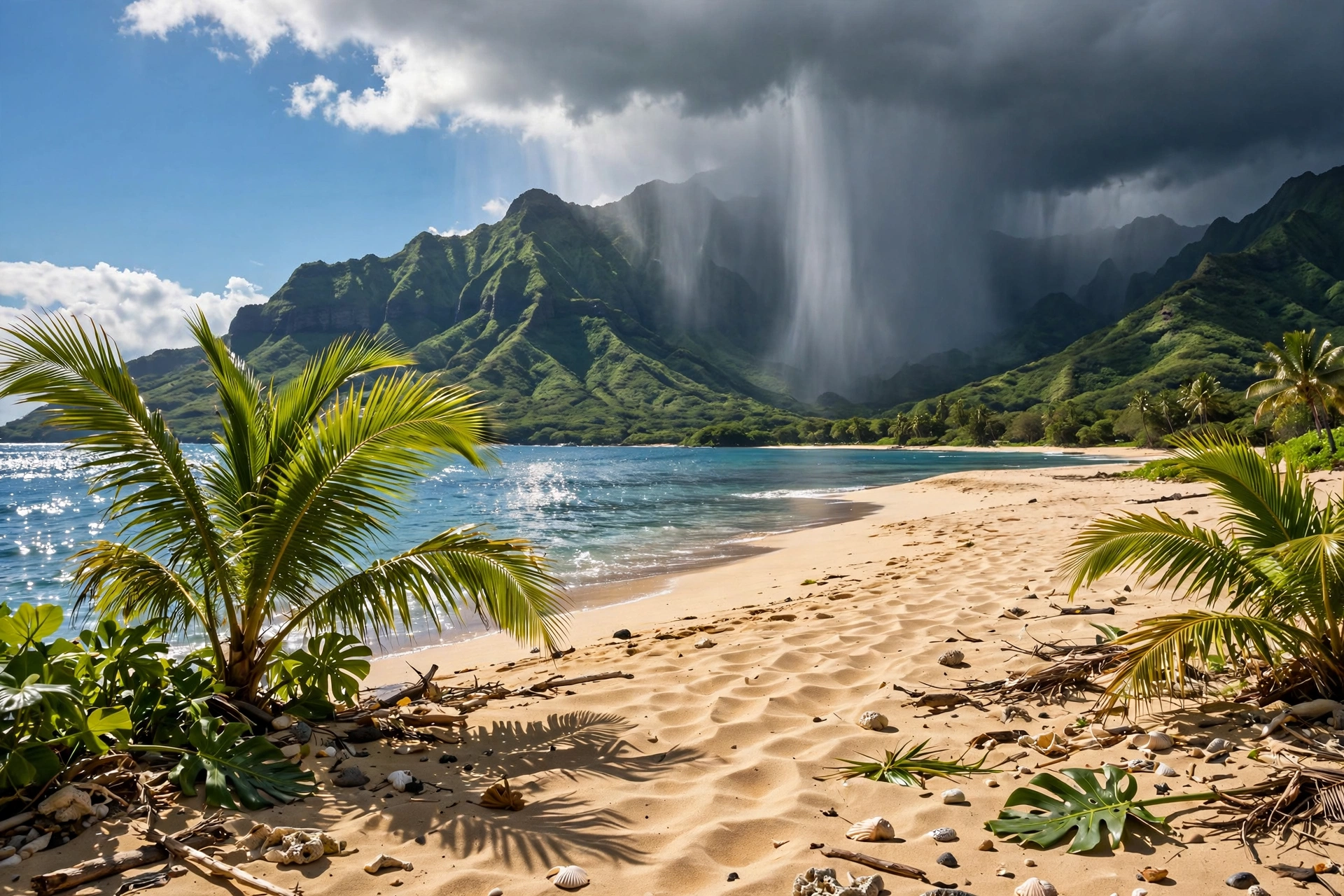
Rainfall in Hawaiʻi is a story of extremes. The statewide range runs from under 10 inches per year on the driest leeward coasts to over 400 inches on the wettest mountain slopes, a forty fold difference within a single archipelago. Most visitors experience the gentle middle of that range: brief passing showers, usually at night or in the early morning, that green the landscape without disrupting plans. The rain that matters for trip planning comes in three forms: the daily trade wind showers that are more scenery than obstacle, the winter storm systems that can soak an entire island for days, and the flash flood events that turn peaceful streams into hazards with little warning.
The seasonal rhythm is consistent statewide. November through March brings the bulk of the annual rainfall, with December and January typically the wettest months. Summer months, particularly June through September, are the driest, and leeward coasts can go weeks without measurable rain. But “wet season” does not mean constant rain. Even in the wettest months, most coastal areas see sunshine for the majority of each day, and the rain that does fall tends to arrive in concentrated bursts rather than all day drizzles. The windward coasts and mountain slopes are the exception: they can stay socked in for days during active weather patterns, which is why the leeward escape route matters.
Hurricane Season
The Central Pacific hurricane season runs from June 1 through November 30, with the peak months typically August through October. Hawaiʻi is struck by hurricanes far less often than the Caribbean or the Gulf Coast, thanks to a combination of cooler surrounding waters, persistent wind shear that tears developing storms apart, and the islands’ small target area in a vast ocean. Direct landfalls are rare events measured in decades rather than years. The most destructive recent example, Hurricane ʻIniki, struck Kauaʻi in 1992 as a Category 4 storm and remains the benchmark for hurricane damage in the islands.
Rarity is not the same as immunity. Tropical storms and hurricanes passing near the islands can bring heavy rain, high surf, strong winds, and flooding even without a direct hit, and the mountainous terrain amplifies rainfall dramatically as tropical moisture is forced upslope. Visitors traveling during hurricane season should monitor forecasts from the Central Pacific Hurricane Center and the National Weather Service in Honolulu, and should understand that a storm hundreds of miles away can still generate dangerous surf and heavy rain on the islands. Travel insurance that covers weather disruptions is worth considering for trips during the peak months of August through October.
It is worth keeping perspective. The overwhelming majority of hurricane seasons pass without any significant impact on the islands, and summer remains the most popular and most reliably pleasant travel season. The hurricane risk is real but small, and it is heavily outweighed for most travelers by the excellent weather, calm seas, and long daylight hours of the summer months. Awareness and a flexible attitude toward itinerary changes are sufficient preparation for all but the most risk averse visitors.
Flash Flooding
Flash flooding is the most dangerous weather hazard the average visitor is likely to encounter in Hawaiʻi, more so than hurricanes or high surf. The mechanism is straightforward: intense rain falls on steep mountain slopes, often miles inland and out of sight, and the runoff funnels into narrow valleys and stream channels within minutes. A sunny morning at a waterfall or in a narrow valley can turn dangerous by afternoon if heavy rain is falling on the ridges above, even if not a drop is falling where you stand. Hawaiʻi’s streams can rise from a trickle to a torrent in under an hour.
The National Weather Service issues flash flood watches and warnings for the islands, and visitors should check them before hiking into valleys, visiting waterfalls, or crossing streams. The basic safety rules are simple and non negotiable: never cross a flooded road or stream, never hike in a narrow valley during heavy rain or when a flash flood watch is in effect, and be especially cautious around waterfalls during and after winter storms. Slot canyons and narrow gulches deserve particular respect. Most flash flood deaths in Hawaiʻi involve people who underestimated how quickly conditions can change, not people caught by unforecast events.
The islands’ road network can also be affected. Heavy rain triggers rockfalls and landslides on mountain roads, and low lying coastal roads can flood during the heaviest downpours. The state highway department closes roads when conditions warrant it, and those closures should be respected absolutely. After major rain events, brown water advisories are issued for coastal waters near stream mouths, warning swimmers and surfers away from runoff that can carry bacteria and debris. These advisories typically clear within a day or two of the rain ending.
Ocean Conditions
Hawaiʻi’s ocean is as seasonal as its weather, and understanding the surf calendar is essential for safe beach days. The North Pacific generates large swells in winter that strike the north and west facing shores from roughly October through March, while the South Pacific generates smaller swells in summer that favor the south facing shores from roughly April through September. The east facing shores catch the near constant trade wind swells year round, and the west facing shores sit in the swell shadow of neighboring islands, staying calmer than their exposure would suggest. Every beach in Hawaiʻi has a season when it shines and a season when it demands respect.
Water temperatures follow a gentle annual curve, from about 77 degrees in the winter months to about 82 degrees in late summer. The water never gets cold by mainland standards, but the five degree swing is noticeable, especially for snorkelers spending long sessions in the water. Many visitors swim comfortably without a wetsuit year round; those who chill easily or plan extended snorkel sessions often appreciate a thin rash guard or shorty wetsuit in winter. Children and leaner swimmers feel the cold sooner. Ocean temperatures lag air temperatures, so the warmest water arrives in August and September, a month or two after the warmest air.
Winter is the season of extremes. North facing shores can see surf of 20 feet or more during the largest swells, conditions suitable only for expert big wave surfers and spectacular for everyone else to watch from shore. During these swells, swimming at exposed northern beaches is dangerous even for strong swimmers, and beachgoers should choose protected southern or western beaches instead. Summer reverses the pattern: the north shores turn calm and swimmable, sometimes glassy flat for weeks, while the south shores pick up fun, manageable surf. The shoulder months of April, May, September, and October often deliver the best of both worlds, with moderate conditions on most coasts.
Two ocean hazards deserve mention in any statewide weather discussion because they are weather driven. The first is high surf itself, which the National Weather Service forecasts with high surf advisories and warnings. The second is the combination of surf with shorebreak and strong currents, which varies beach by beach and day by day. Hawaiʻi has no lifeguards at many beaches, particularly on the neighbor islands, and ocean drownings are the leading cause of visitor fatalities in the state. The safe approach is consistent: check the surf forecast, swim at lifeguarded beaches when possible, never turn your back on the ocean, and when in doubt, stay out.

Vog: Volcanic Smog
Vog, short for volcanic smog, is the haze formed when sulfur dioxide and other gases from Kīlauea volcano react with sunlight, oxygen, and moisture in the atmosphere. It is a uniquely Big Island phenomenon in its origin, but its effects travel. During trade wind weather, the trades blow the volcanic plume southwest, away from the populated areas, and vog impacts stay concentrated near the volcano and along the Kona coast. During Kona wind episodes, the southerly flow carries the plume northward up the island chain, and hazy, sulfur scented air can reach Maui, Oʻahu, and occasionally Kauaʻi. The severity depends entirely on the volcano’s current level of activity, which varies enormously from year to year.
For most visitors, vog is a minor aesthetic issue: hazy horizons, muted sunsets, a faint rotten egg smell near the source. For people with asthma, respiratory conditions, or unusual sensitivity to air pollution, it can be a genuine health concern, causing coughing, throat irritation, and difficulty breathing during significant episodes. The Hawaiʻi Department of Health and the National Park Service publish vog forecasts and air quality data, and sensitive visitors should check them, particularly when staying on the Big Island near the volcano or along the Kona coast during Kona wind patterns. On most days on most islands, vog is undetectable.
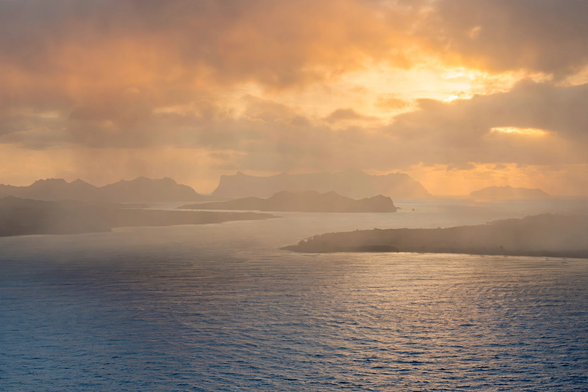
Vog also has a visual signature that photographers learn to read. It softens distant views, washes out the blue of the sky into a milky white, and can turn sunsets an eerie orange red. Some visitors mistake heavy vog for ordinary haze or pollution from traffic, but its source is entirely natural. Periods of high volcanic activity can produce vog thick enough to reduce visibility across the channels between islands, while quiet periods can leave the air crystalline for months. Because Kīlauea’s activity level changes, vog is one of the few elements of Hawaiʻi weather that cannot be described by seasonal averages. Check current conditions rather than relying on historical patterns.
What to Pack
Packing for Hawaiʻi is simpler than the microclimate discussion might suggest, because one versatile kit covers nearly every scenario. The foundation is lightweight, breathable clothing for warm coastal days: shorts, t shirts, swimwear, and sandals. Add a light rain shell or packable rain jacket, because brief showers can arrive anywhere and the windward coasts produce them daily. Add one warm layer, a fleece or light sweater, for cool evenings, air conditioned spaces, and any trip above 3,000 feet. Add sun protection as a category unto itself: reef safe sunscreen, a wide brimmed hat, sunglasses, and a long sleeved rash guard for extended water time. That kit handles 95 percent of Hawaiʻi itineraries in any season.
The remaining five percent depends on your plans. Summit trips to Haleakalā or Mauna Kea demand real warmth: winter jacket, long pants, closed shoes, and ideally gloves and a beanie for sunrise visits, when summit temperatures can sit near freezing with wind chill well below. Mountain hikes call for proper footwear with grip, because wet trails and stream crossings are slippery, and a dry bag or waterproof phone case for the downpours that arrive without invitation. Winter travelers should add one warmer outfit for the coolest evenings, particularly on the windward coasts and at elevation. Summer travelers can pack lighter but should not skip the rain shell, since mountain showers ignore the calendar.
A few items earn their place through local knowledge rather than obvious need. Reef shoes or water shoes protect feet on rocky entries and sea urchin dotted reefs at many beaches. A small daypack carries the layers, water, and snacks that every hike and summit trip requires. Insect repellent matters for windward hikes and evening outings, as mosquitoes are present statewide. And a reusable water bottle is essential, because the combination of sun, wind, and activity dehydrates faster than most visitors expect, and the tap water across the islands is excellent. Pack for the beach you will spend most time on, and carry the layers for everywhere else you might go.

Hawaiʻi Weather FAQ
What is the weather like in Hawaiʻi year round?
Coastal temperatures stay near 80 to 85 degrees in summer and 76 to 80 in winter, with nights in the 60s and 70s. Rain varies far more than temperature: leeward coasts are sunny and dry most days, windward coasts and mountain slopes see frequent showers, and winter brings the bulk of the annual rainfall statewide. The ocean stays swimmable every month, from about 77 degrees in winter to 82 in late summer.
When is the rainy season in Hawaiʻi?
The wetter season runs roughly November through April, with December through February typically the wettest months. Rain arrives as trade wind showers on the windward slopes, brief intense downpours, and occasional multi day Kona storms. Even in the wettest months, most coastal areas see sunshine for much of each day, and summer, May through October, is the driest and most settled season.
Does it snow in Hawaiʻi?
Yes. The summits of Mauna Kea and Mauna Loa on the Big Island, approaching 14,000 feet, receive snow most winters, and Haleakalā on Maui, at 10,023 feet, sees occasional snow and frequent freezing temperatures. Winter storms can close the summit roads temporarily. Watching snow fall while standing above a sea of clouds, with tropical beaches an hour below, is one of Hawaiʻi’s signature experiences.
What are Kona winds?
Kona winds blow from the south or southwest, opposite the normal northeast trade winds. They bring warm, humid, still air and hazy skies, and they are most common in autumn and spring. Kona winds make vog worse by carrying volcanic emissions up the island chain, and they groom north shore surf into excellent shape for surfers. Most visitors find Kona weather muggy compared to crisp trade wind days.
When is hurricane season in Hawaiʻi?
The Central Pacific hurricane season runs June 1 through November 30, peaking August through October. Direct hurricane hits on Hawaiʻi are rare, measured in decades, but nearby tropical systems can bring heavy rain, high surf, and flooding. Visitors traveling in late summer and fall should monitor forecasts from the Central Pacific Hurricane Center and consider travel insurance covering weather disruptions.
Which side of each island has the best weather?
The leeward sides, generally the south and west coasts, are sunnier and drier thanks to the rain shadow of the mountains, which is why most resort areas sit there. The windward sides, generally the north and east coasts, are lusher, greener, and rainier. When it rains on one side, the other side is often sunny, and the drive between them is usually under an hour, so check both forecasts before changing plans.
What is vog and should I worry about it?
Vog is volcanic smog from Kīlauea’s sulfur dioxide emissions, and its severity depends on the volcano’s current activity. Most visitors notice nothing, or just hazy horizons and vivid sunsets. People with asthma or respiratory conditions should check air quality forecasts, especially on the Big Island near the volcano. Vog is worst during Kona wind episodes, which carry the plume up the island chain, and negligible during normal trade wind weather on most islands.
What should I pack for Hawaiʻi’s weather?
Lightweight warm weather clothing, swimwear, and sandals form the base. Add a packable rain shell for passing showers, one warm layer for cool evenings and elevation, and serious sun protection including reef safe sunscreen. Summit trips to Haleakalā or Mauna Kea require winter grade warmth even in summer. Reef shoes, a daypack, insect repellent, and a reusable water bottle round out the kit for most itineraries.
Related Guides
- Maui Weather : trade wind patterns, Upcountry cool, and Haleakalā summit conditions
- Oʻahu Weather : Honolulu sunshine, windward showers, and North Shore surf seasons
- Kauaʻi Weather : the wettest island, microclimates, and Nā Pali exposure
- Big Island Weather : eleven climate zones, vog, and snow on Mauna Kea
- Molokaʻi Weather : west end dry, east end wet, and Kamakou mist
- Lānaʻi Weather : the driest island’s two climate zones
- Best Time to Visit Hawaiʻi : month by month planning, crowds, and seasonal highlights
- Hawaiʻi Beaches : matching beach choices to surf seasons and ocean conditions
Reading Hawaiʻi’s Skies
Hawaiʻi weather rewards a particular mindset: respect the patterns, but read the sky in front of you. The statewide systems described on this page, the trades, the seasons, the windward and leeward divide, explain most of what you will experience. But the islands are small enough and the mountains tall enough that conditions change over minutes and miles, and the best days often come from adapting rather than planning. Check the forecast, learn which side of your island is which, keep a rain shell and a warm layer within reach, and let the microclimates work for you instead of against you. The weather here is rarely an obstacle. More often, it is the reason the islands look the way they do.