
Big Island Weather
Understanding Big Island weather is the key to planning a great Hawaiʻi Island trip, because no other Hawaiian island packs this much climate variety into one place. The Big Island holds 8 of the world’s 13 Köppen climate zones, from steamy tropical rainforest to alpine desert, and you can drive through several of them in a single afternoon. One coast bakes in near-perpetual sunshine while the other soaks up more rain than almost anywhere in the United States, and the island’s two giant volcanoes rise high enough to catch winter snow. This guide breaks down Big Island weather by season, region, and elevation so you can pick the right time, the right coast, and the right jacket for your trip.
In This Guide
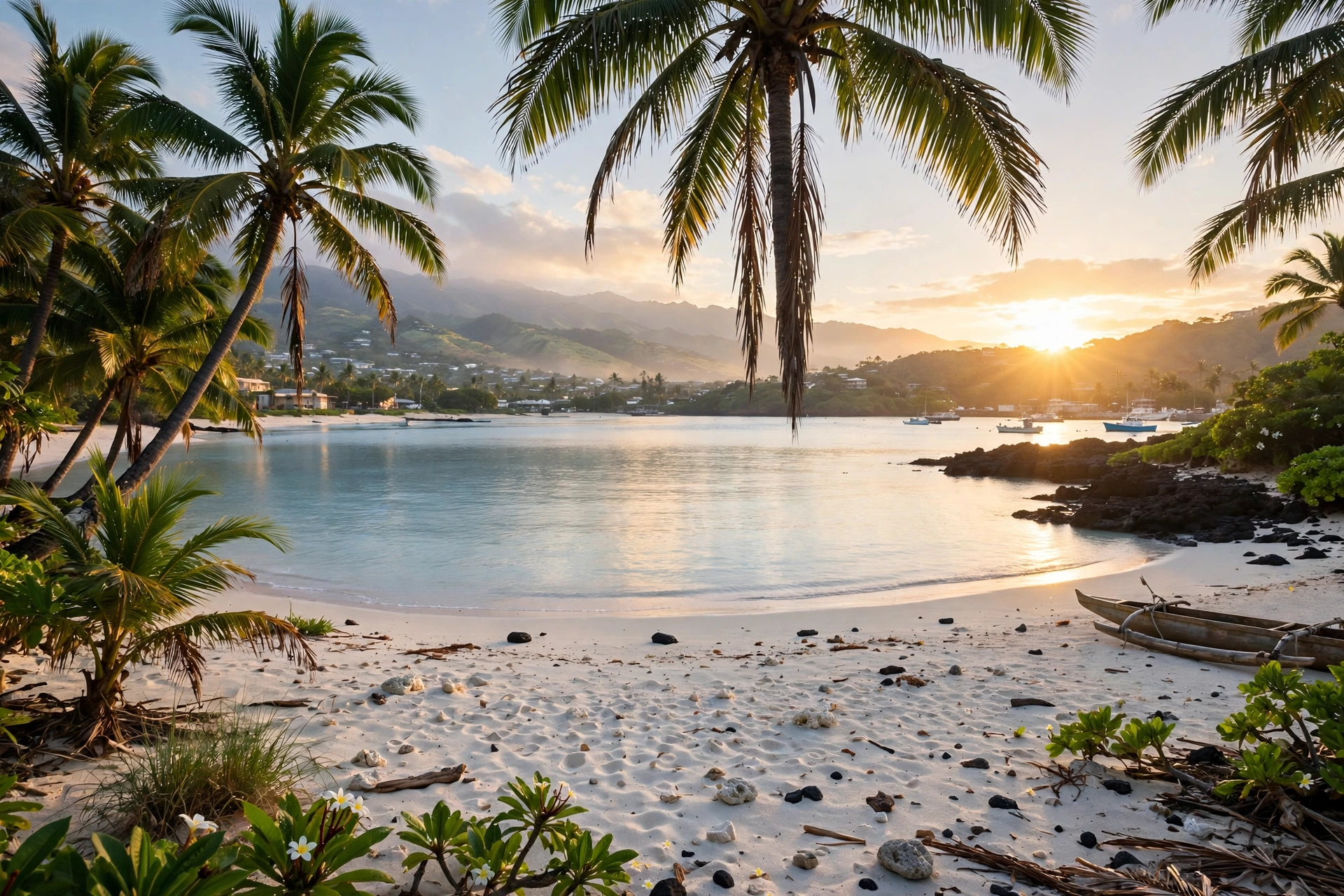
Big Island Weather at a Glance
The Big Island, officially the Island of Hawaiʻi, is larger than all the other Hawaiian islands combined at just over 4,000 square miles. That size, combined with extreme elevation, is what creates its famous climate diversity. The island rises from sea level to 13,803 feet at the summit of Mauna Kea, and temperature drops roughly 3.5 degrees Fahrenheit for every 1,000 feet of elevation gained. Drive from a Kailua-Kona beach at 84 degrees to the Mauna Kea summit in under two hours and you can easily lose 40 degrees along the way.
The northeast trade winds shape the island’s basic pattern, just as they do across Hawaiʻi. Moist ocean air rides the trades into the island’s eastern slopes, where the volcanic massifs of Mauna Kea, Mauna Loa, and Kohala force it upward. The air cools as it rises, its moisture condenses, and it falls as rain on the windward east side. By the time the air descends the western slopes, it has wrung out most of its moisture, leaving the leeward Kona and Kohala coasts in a warm rain shadow. The result is one of the sharpest wet-to-dry transitions on Earth: Hilo, on the windward coast, receives roughly 125 to 130 inches of rain a year, while Waikōloa, barely 70 miles away on the leeward coast, receives about 10.
At sea level, temperatures are as stable as anywhere in Hawaiʻi. Daytime highs on the coasts run from the high 70s in winter to the mid 80s in late summer, and nighttime lows rarely leave the 60s and low 70s. Humidity is moderate on the coasts, lower on the dry leeward side and higher in Hilo and Puna. What varies enormously is rain, cloud cover, and wind exposure, and those three variables are almost entirely a function of where you are on the island and how high you climb.
The practical takeaway for visitors is that “Big Island weather” is not one thing. A forecast for Kailua-Kona tells you almost nothing about conditions in Hilo, at Hawaiʻi Volcanoes National Park, or on the Mauna Kea summit. The National Weather Service Honolulu office issues separate zone forecasts for each region, and experienced travelers check the zone for wherever they are headed that day rather than relying on a single island-wide number. Pack for at least two climates on any Big Island trip, and three if the summit is on your itinerary.
Weather by Season
Winter: November Through March
Winter is the Big Island’s coolest, wettest, and most variable season. Coastal highs average 78 to 81 degrees and lows dip into the mid 60s, which feels cool to most visitors after the warmth of summer. This is when the trade winds weaken most often, allowing cold fronts from the northwest and Kona storms from the south to reach the island. Kona winds, which blow from the south or southwest opposite the usual trades, bring warm, humid, still air and can carry vog from Kīlauea up the Kona coast. These episodes typically last a few days before the trades return and clear the air.
Winter is also snow season on the summits. Storm systems dropping south from the North Pacific can blanket Mauna Kea and occasionally Mauna Loa in snow from roughly October through April, with the heaviest snowfalls in midwinter. The summit access road sometimes closes during storms, and temperatures at the 13,803-foot summit stay near or below freezing day and night. On the coasts, winter brings the year’s biggest surf to west and northwest facing shores, while the Kona coast’s famous morning calm often persists even in winter, making it the most reliably swimmable leeward coast in the state during these months. Humpback whale season peaks from January through March, and the calm Kona waters are one of the best places in Hawaiʻi to hear whales singing while snorkeling.
Spring: April and May
Spring is a gentle transition and one of the most pleasant windows on the island. Rainfall eases on the windward side, temperatures climb back into the low 80s on the coasts, and the trade winds settle into their steady summer rhythm. North Pacific swells fade, calming the west-facing beaches, while the water warms toward its summer peak. Waterfalls on the Hāmākua Coast and around Hilo still run full from winter rains, making spring excellent for waterfall viewing. Visitor numbers sit between the winter peak and the summer rush, and late April through May combines comfortable weather with relatively moderate crowds and prices.
Summer: June Through September
Summer brings the year’s warmest and, on the leeward side, driest weather. Coastal highs reach 84 to 87 degrees, with Kailua-Kona and the Kohala resorts at their sunniest. The trades blow steadily, keeping humidity tolerable on the coasts, though Hilo and Puna stay lush and showery year-round. Afternoon cloud build-up over the island’s interior slopes is a daily summer feature: mornings dawn clear on the Kona coast, clouds gather over Hualālai and Mauna Loa by early afternoon, and brief upland showers may fall while the beaches stay sunny.
This is also hurricane season, which runs June through November, though direct strikes on the Big Island are rare. South swells generated by Southern Hemisphere storms arrive from June through September, bringing surf to south-facing shores like Punaluʻu while the Kona coast stays comparatively calm. Ocean temperatures peak around 82 degrees in late summer, the warmest water of the year. Late summer can feel hot and still during trade-wind lulls, especially in Kailua-Kona, where temperatures occasionally push toward 90 degrees.
Fall: October and November
Fall is a short transitional season. October often feels like an extension of summer, with warm temperatures, warm water, and settled weather, while November brings the first real winter storms and a noticeable uptick in rainfall on the windward side. Early fall offers some of the year’s best value, with summer crowds gone and the ocean still at its warmest. By late November, the rainy season takes hold in Hilo and the summits begin to see their first snows. Travelers visiting in fall should watch forecasts a bit more closely than summer visitors, particularly for upland and summit plans.
Trade winds vs. Kona winds: The northeast trade winds are the Big Island’s default weather, bringing cooling breezes, passing windward showers, and clear leeward skies. Kona winds reverse the pattern, blowing warm, humid air from the south. On the Big Island, Kona winds matter more than anywhere else in the state because they can carry volcanic smog, or vog, from Kīlauea up the western coast. When locals say “Kona winds today,” expect still, hazy air in Kona and possible rain island-wide.
Weather by Region
Kona and the Kohala Coast: The Sunny West
The Kona coast, stretching from Kailua-Kona north through Waikōloa to the Kohala resorts, is the Big Island’s sun belt and its most popular visitor base for good reason. Sheltered in the rain shadow of Hualālai and the Kohala Mountains, Kailua-Kona receives roughly 20 inches of rain a year, and Waikōloa about half of that. Sunshine is the norm: the coast averages well over 250 sunny days a year. A signature daily rhythm shapes life here. Mornings dawn calm and glassy, famously still enough that the ocean looks like a lake, which is why Kona’s morning snorkeling and diving conditions are legendary. By early afternoon, heating over the upland slopes draws in the sea breeze, clouds build over Hualālai, and brief mountain showers may fall while the beaches stay dry.
Temperatures are the warmest on the island at sea level, with summer highs in the mid to upper 80s and winter highs near 80. The trade-off for the sunshine is heat on still afternoons and the occasional vog episode when Kona winds blow. The Kohala coast north of the airport is even drier and can feel desert-like, with golden grasslands running down to the sea. For travelers who want the highest odds of beach weather, especially in winter, the Kona and Kohala coasts are the safest bet on the island.
Hilo and the Hāmākua Coast: The Lush East
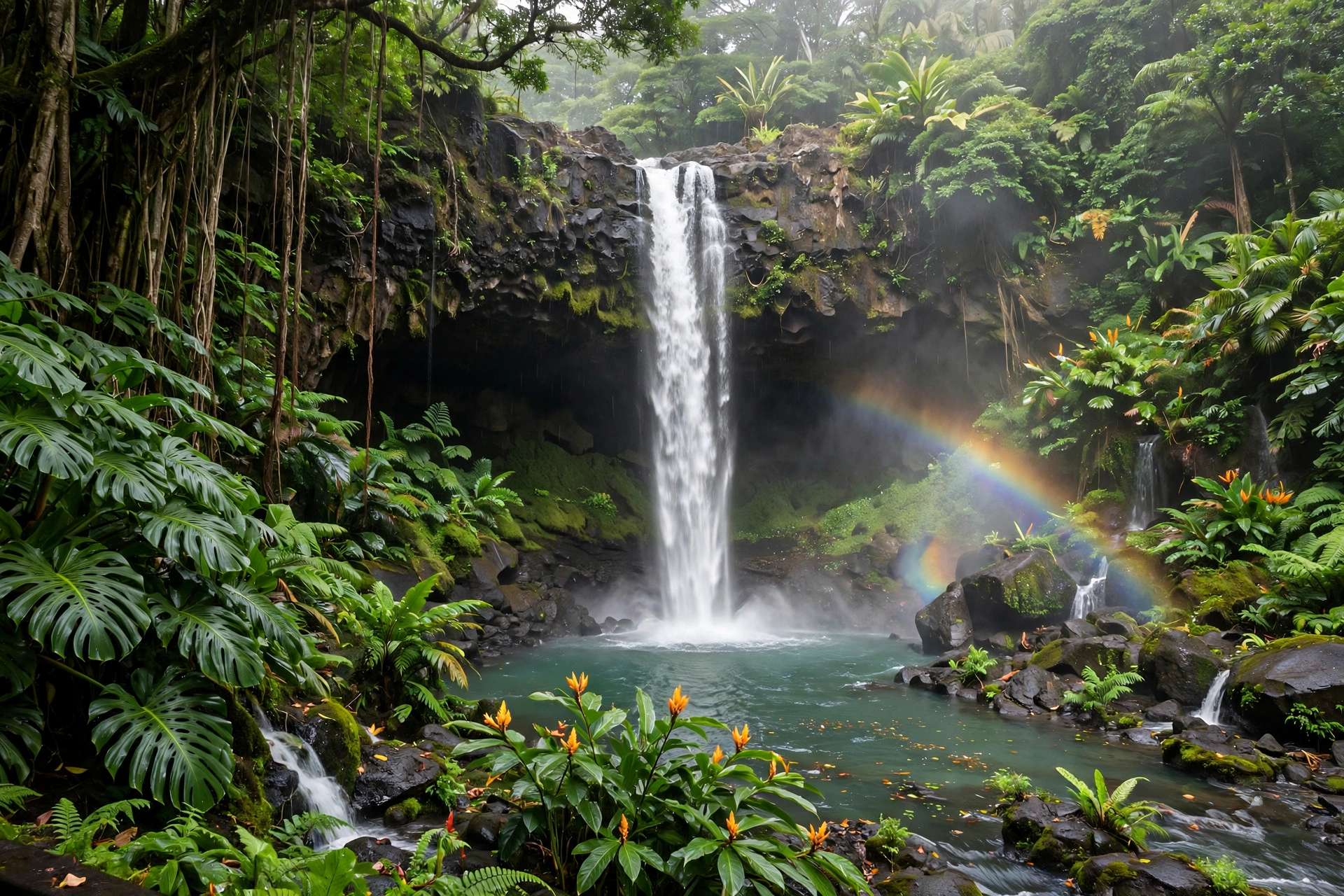
Hilo is famously one of the wettest cities in the United States, averaging roughly 125 to 130 inches of rain a year. The rain arrives mostly as brief, intense trade-wind showers, many falling overnight or in the early morning, with afternoons that often turn partly sunny. Locals joke that you can set your watch by the morning rainbow, and Hilo’s rain is the reason the entire windward side is so green: this is waterfall country, orchid country, and rainforest country, all fed by the same moisture visitors sometimes grumble about.
Temperatures run a few degrees cooler than Kona, with highs from the upper 70s in winter to the mid 80s in summer, and the humidity is noticeably higher. The Hāmākua Coast north of Hilo shares the wet, lush pattern, with dramatic sea cliffs and valleys carved by abundant runoff. Travelers headed to Akaka Falls, the Hawaiʻi Tropical Bioreserve Garden, or the scenic drives of the northeast coast should simply expect rain as part of the experience and pack accordingly. Mornings are statistically the driest part of the day, so plan outdoor sightseeing early.
Kaʻū: The Dry Volcanic South
Kaʻū, the island’s southern district, is a land of extremes. The coastal strip around Punaluʻu and Nāʻālehu is dry and sunny, receiving roughly 25 to 35 inches of rain a year, while the upland slopes of Mauna Loa above catch far more. This is Hawaiʻi’s volcanic frontier: vast black lava fields, the black sand beach at Punaluʻu, and the green sand beach at Papakōlea, all set against an arid, windswept landscape. Waiʻōhinu, in the district’s uplands, is the southernmost town in the United States.
Kaʻū’s weather note that matters most is vog. When Kīlauea is actively degassing, the district sits directly downwind of the summit vents, and volcanic smog can be thickest here. During Kona wind episodes the vog drifts north toward Kona instead, giving Kaʻū temporary relief. Temperatures are warm at the coast and cool quickly with elevation; the road to Hawaiʻi Volcanoes National Park climbs through several climate zones in a few miles.
The Summits: Mauna Kea and Mauna Loa
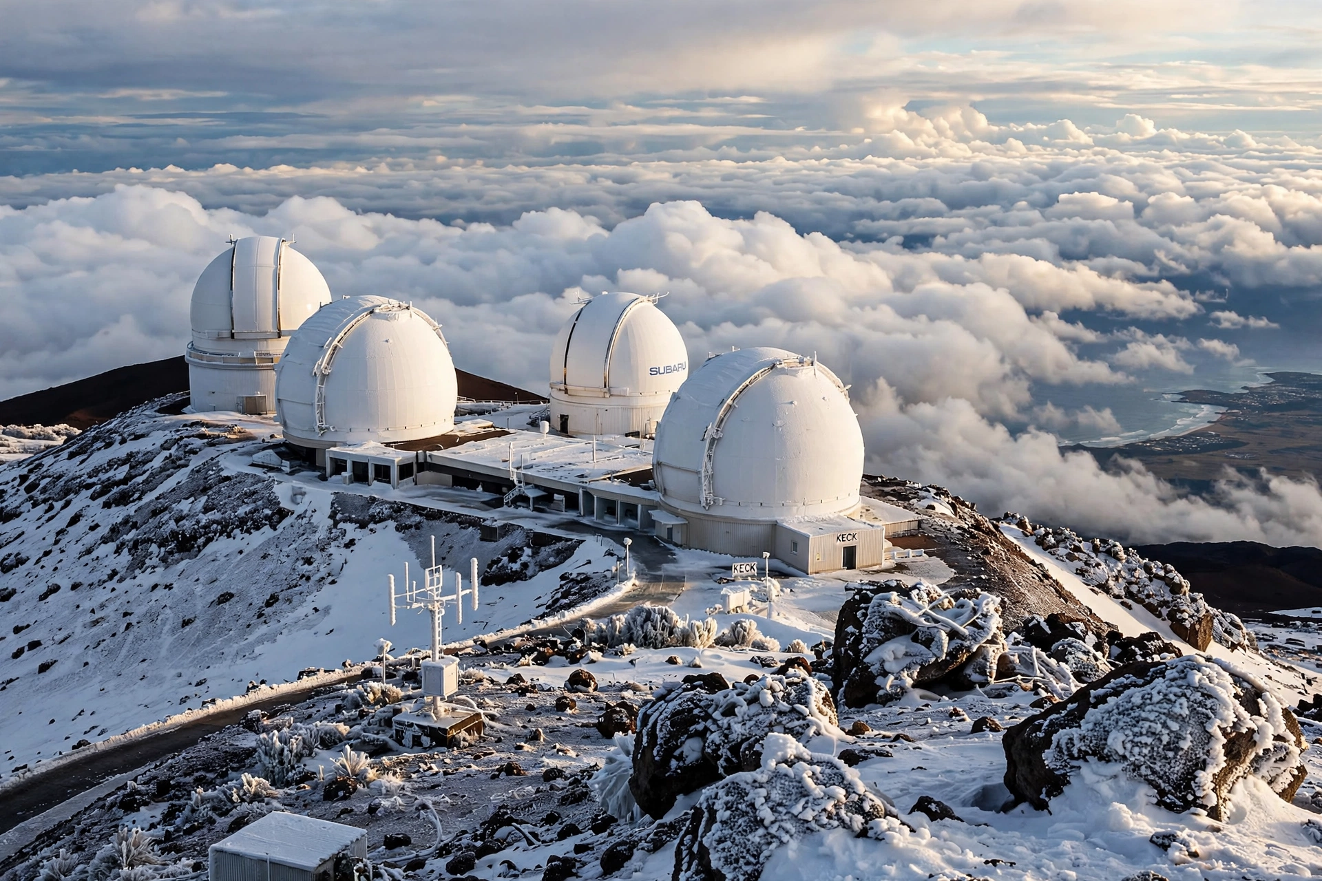
The island’s two great summits create their own alpine world. Mauna Kea, at 13,803 feet, is the tallest mountain in the world measured from its ocean base, and its summit climate resembles the high Arctic more than the tropics. Daytime highs at the summit hover in the 30s and 40s Fahrenheit year-round, nighttime lows drop into the 20s, and winter storms bring snow from roughly October through April. The air holds about 60 percent of the oxygen available at sea level, so altitude sickness is a real concern: visitors are advised to stop at the 9,200-foot visitor station for at least 30 minutes to acclimatize, and children under 13, pregnant visitors, and anyone with heart or respiratory conditions are advised against going to the summit.
The summit access road is steep, unpaved for its upper section, and requires a 4WD vehicle; standard rental cars are not permitted past the visitor station by most rental agreements. Mauna Loa, at 13,679 feet, is similarly cold and far more remote, accessible only by a strenuous multi-day hike. Both summits can experience snow, ice, high winds, and whiteout conditions with little warning, and conditions change fast. Always check the Mauna Kea weather forecast and road status before driving up, and bring true winter clothing no matter what the beach forecast says.
Saddle Road and Waimea: The Uplands
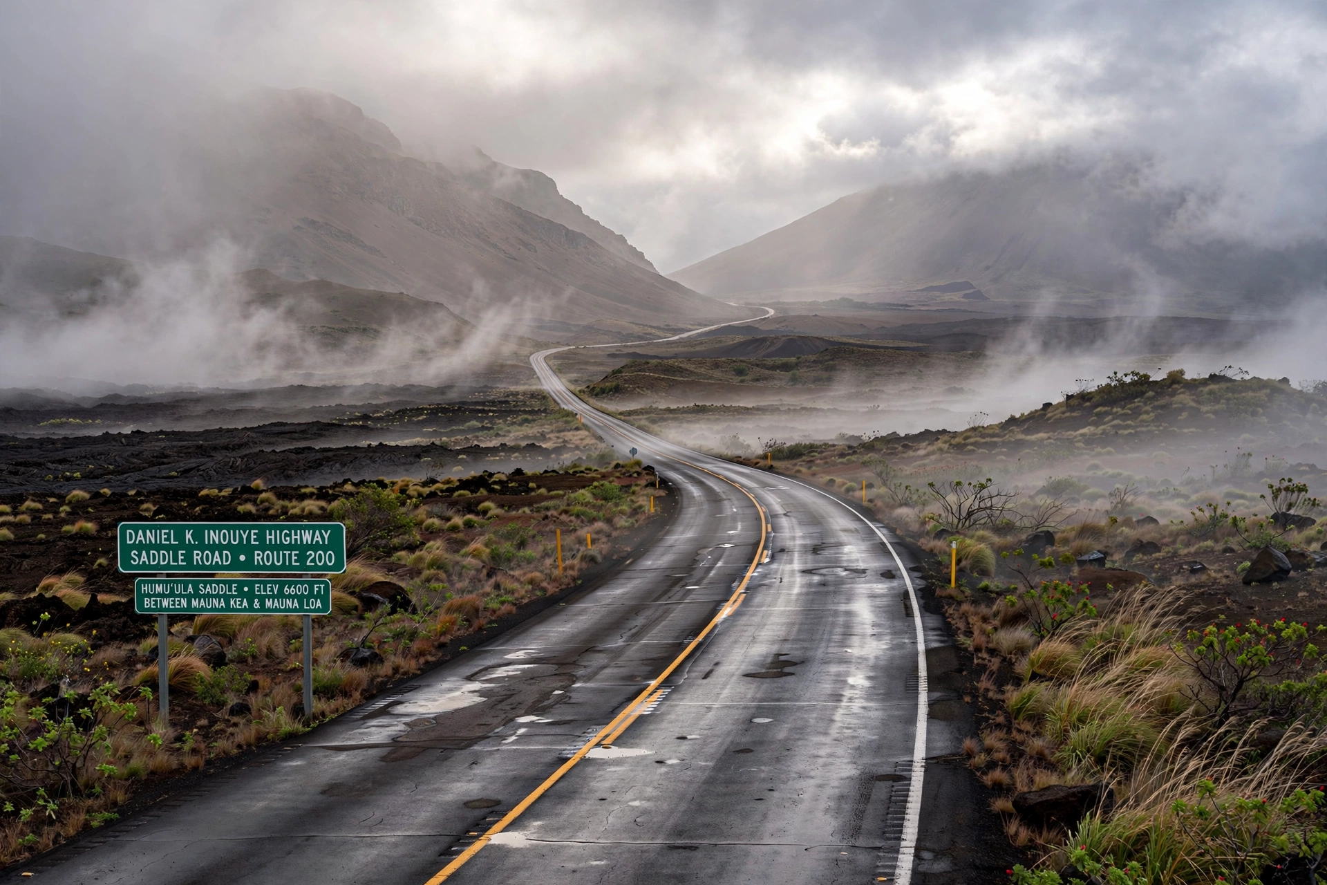
The Daniel K. Inouye Highway, still widely called Saddle Road, crosses the high plateau between Mauna Kea and Mauna Loa at elevations up to about 6,600 feet, and its weather can change completely in a few miles. Fog, rain, and low clouds are common, especially on the Hilo side of the saddle, while the Kona side often breaks clear. Temperatures along the highway run 15 to 25 degrees cooler than the coasts, and nighttime lows can approach freezing in winter. Drivers should use headlights in fog, watch for sudden rain, and never stop in the travel lanes to look at the summits.
Waimea, also known as Kamuela, sits at about 2,700 feet in the island’s northern uplands and is the center of paniolo (Hawaiian cowboy) country. Its weather surprises first-time visitors: highs run only in the 70s even in summer, winter nights can dip into the 40s, and misty drizzle is frequent, particularly in the late afternoon. The rolling green pastures look more like Ireland than the Hawaiʻi of postcards, and a jacket is standard attire year-round. The contrast between Waimea’s sweater weather and the beach heat of the Kohala coast 30 minutes away is one of the island’s great climate parables.
Temperatures and Rainfall
The tables below show long-term average highs, lows, and rainfall for three representative locations: Kailua-Kona on the dry leeward coast, Hilo on the wet windward coast, and Waimea in the cool uplands. Figures are rounded from National Weather Service and Western Regional Climate Center normals and illustrate how dramatically conditions vary across the island.
Average Temperatures (Fahrenheit)
| Month | Kailua-Kona High | Kailua-Kona Low | Hilo High | Hilo Low | Waimea High | Waimea Low |
|---|---|---|---|---|---|---|
| January | 80 | 64 | 78 | 63 | 70 | 50 |
| February | 80 | 64 | 78 | 63 | 70 | 50 |
| March | 81 | 65 | 79 | 64 | 71 | 51 |
| April | 82 | 67 | 80 | 65 | 72 | 53 |
| May | 83 | 69 | 81 | 67 | 74 | 55 |
| June | 84 | 71 | 82 | 68 | 76 | 57 |
| July | 85 | 72 | 83 | 69 | 77 | 58 |
| August | 86 | 73 | 84 | 70 | 78 | 58 |
| September | 86 | 72 | 84 | 69 | 78 | 57 |
| October | 85 | 71 | 83 | 68 | 76 | 56 |
| November | 83 | 68 | 81 | 66 | 73 | 54 |
| December | 81 | 65 | 79 | 64 | 71 | 51 |
Average Rainfall (Inches)
| Month | Kailua-Kona | Hilo | Waikōloa | Volcano Village |
|---|---|---|---|---|
| January | 2.5 | 9.7 | 1.2 | 9.0 |
| February | 2.0 | 10.9 | 1.0 | 8.5 |
| March | 2.2 | 12.8 | 0.9 | 10.0 |
| April | 1.2 | 12.0 | 0.5 | 9.5 |
| May | 0.8 | 9.8 | 0.4 | 8.0 |
| June | 0.6 | 7.4 | 0.3 | 6.5 |
| July | 0.7 | 9.4 | 0.4 | 7.5 |
| August | 0.8 | 10.9 | 0.4 | 8.5 |
| September | 1.0 | 9.9 | 0.5 | 8.0 |
| October | 1.8 | 10.9 | 0.9 | 8.5 |
| November | 2.8 | 12.8 | 1.2 | 10.0 |
| December | 3.0 | 10.5 | 1.4 | 9.5 |
| Annual | 19 | 127 | 10 | 104 |
The rainfall table tells the Big Island’s climate story in one glance. Hilo receives more than six times the rain of Kailua-Kona and nearly thirteen times the rain of Waikōloa. Volcano Village, at 4,000 feet on the windward slope of Kīlauea, is wet in every month, which surprises visitors who associate volcanoes with barren lava. The seasonal swing is gentlest on the leeward coast, which is exactly why Kona and Kohala are the safest bets for winter sun.
Vog: Volcanic Smog
Vog is the Big Island’s unique weather phenomenon, and it deserves its own section because no other Hawaiian island experiences it the same way. Vog forms when sulfur dioxide gas released by Kīlauea reacts with moisture and oxygen in the atmosphere to create a hazy mix of sulfate aerosols. It looks like a thin gray or bluish haze, smells faintly of sulfur when concentrated, and can dim the famously sharp island views and sunsets.
Where vog goes depends on the wind. Under normal trade winds, emissions drift southwest over Kaʻū and out to sea, and the Kona coast stays clear. When Kona (southerly) winds set in, the plume curls northward up the western coast, and Kailua-Kona can wake up to hazy skies and a sulfur tang in the air. These episodes usually last a few days until the trades return. Vog levels also rise and fall with volcanic activity: during active eruptive phases, emissions and vog increase significantly, while quiet periods bring clearer air island-wide.
For most healthy visitors, vog is a minor nuisance, causing itchy eyes or a scratchy throat on the haziest days. People with asthma, respiratory conditions, heart conditions, pregnant visitors, and young children are more sensitive and should limit outdoor exertion when vog is heavy. The Hawaiʻi Department of Health issues vog advisories during significant episodes, and a dedicated vog forecast is available through the National Weather Service and the University of Hawaiʻi. If you are sensitive to air quality, check the vog forecast alongside the weather forecast when Kīlauea is active, and favor the Hāmākua Coast or Kohala, which sit upwind of the plume under normal trades.
Ocean Conditions
The Big Island’s ocean has a split personality that follows its coasts. The Kona coast is famous for its calm mornings: the offshore flow and the island’s sheltering massif keep the water glassy until the afternoon sea breeze arrives, creating some of the clearest and calmest snorkeling and diving conditions in Hawaiʻi. Mornings are the golden window for ocean activities on the entire leeward coast, and experienced visitors plan boat trips, snorkeling, and diving before noon as a matter of habit.
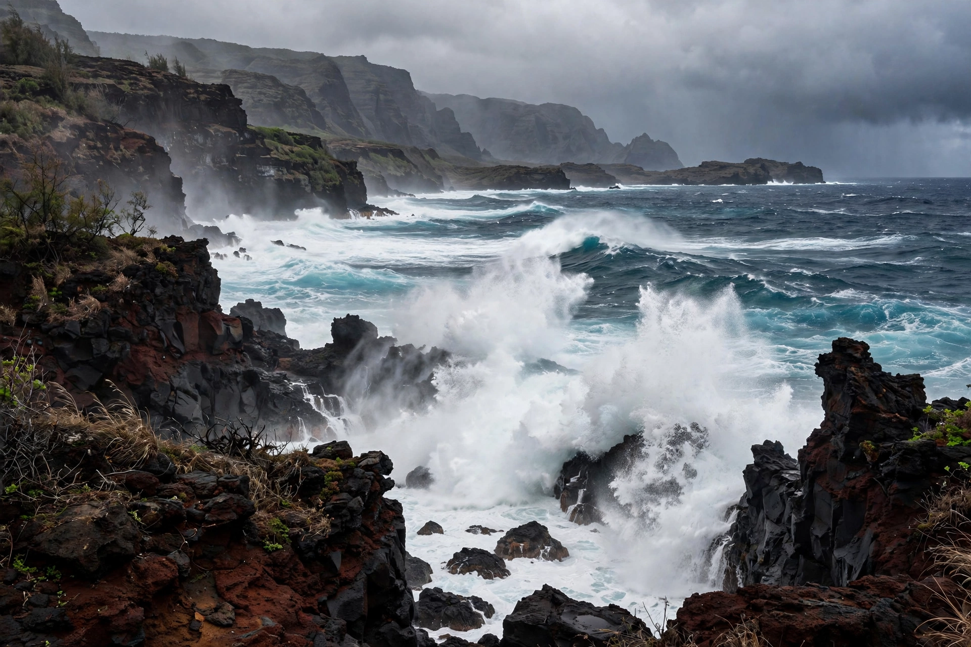
Winter, from roughly October through March, brings North Pacific swells to west and northwest facing shores. The Kohala coast and exposed Kona spots can see large surf during the biggest swells, and shorebreak at beaches like Hāpuna demands respect in winter. Summer reverses the pattern: south swells arrive from Southern Hemisphere storms, giving south-facing shores around Kaʻū their surf season while Kona stays comparatively calm. The Hilo and Puna coasts face the open trade-wind ocean and are rough much of the year, which is why the island’s best swimming beaches are concentrated on the leeward side; Richardson and Carlsmith in Hilo are the main exceptions, sheltered by rock barriers.
Water temperature runs from about 75 degrees in late winter to about 82 degrees in late summer, comfortable for swimming year-round without a wetsuit, though a rash guard helps with sun protection during long snorkel sessions. Box jellyfish and Portuguese man o’ war occasionally drift in on the winds, most often on windward shores; lifeguard stations post warnings when they are present. As everywhere in Hawaiʻi, never turn your back on the ocean, check the National Weather Service surf forecast before swimming, and favor lifeguarded beaches.
Hurricanes and Storms
The central Pacific hurricane season runs from June through November, with peak activity typically in August and September. Direct hurricane strikes on the Big Island are rare, thanks to the island’s size, its sheltering position, and the way its massive volcanoes disrupt storm circulation. But “rare” is not “never,” and the island’s storm history carries real lessons for travelers.
In August 2014, Tropical Storm Iselle made landfall in the Puna district, the first tropical cyclone to hit the Big Island in recorded history, toppling thousands of trees, cutting power to tens of thousands of residents, and damaging homes and farms across lower Puna. In August 2018, Hurricane Lane weakened before reaching the islands but stalled nearby and dumped catastrophic rain on the windward Big Island: Mountain View recorded more than 50 inches of rain in a few days, among the highest tropical cyclone rainfall totals ever measured in the United States, triggering landslides and severe flooding. These events show that the island’s main tropical threat is water, not wind: even a storm that never makes landfall can be dangerous through rainfall.
For travelers, the practical risk to any single trip is low. Modern forecasting provides several days of warning before any tropical cyclone threat, and the National Weather Service Honolulu office issues watches and warnings with wide margins. If a storm approaches during your visit, follow official guidance, stay away from the ocean, streams, and flood-prone roads, and expect flight disruptions. Travel insurance covering weather interruptions is worth considering for late-summer and fall trips. Much more common than tropical cyclones are winter Kona storms, which bring heavy rain and gusty winds, occasionally closing the summit road and flooding low-lying areas.
What to Pack by Season and Region
Year-Round Essentials
- Light rain jacket or shell: Essential for Hilo, Volcano, the Hāmākua Coast, and the uplands in every season.
- Reef-safe sunscreen: Hawaiʻi law bans sunscreens containing oxybenzone and octinoxate. Mineral formulas with zinc oxide are the safe choice, and the Kona sun is intense.
- Swimwear and rash guard: The leeward ocean is swimmable year-round; a rash guard adds sun protection for long snorkel sessions.
- Sturdy walking shoes plus reef-safe sandals: For lava-rock shorelines, waterfall trails, and the uneven ground at the national park.
- Layers: A fleece or light sweater for Waimea, Volcano Village evenings, and air-conditioned spaces.
The Summit Kit (Any Season)
This deserves its own list because visitors are caught out so often. For Mauna Kea, pack as if for a winter mountain trip: an insulated winter jacket, warm hat, gloves, long pants, and closed sturdy shoes. Daytime summit temperatures sit in the 30s and 40s with wind that makes it feel colder, and snow is possible from fall through spring. Sunglasses and sunscreen are critical at 13,803 feet, where ultraviolet exposure is extreme. Bring more water than you think you need; the thin, dry air dehydrates quickly.
Winter Additions (November to March)
- A warmer rain shell for the windward side, where winter rain is steadier.
- Long pants and closed shoes for muddy waterfall trails.
- A compact umbrella for Hilo town days.
- Flexibility: plan Kona-coast alternatives for stormy windward days.
Summer Additions (June to September)
- Extra sun protection: wide-brim hat, UV shirts, and more sunscreen than you think you need, especially in Kona and Kohala.
- Light, breathable clothing for hot leeward afternoons.
- Insect repellent for Hilo, Puna, and valley evenings.
- Hurricane-season awareness: keep an eye on forecasts for late-summer and fall trips.
Best Time to Visit the Big Island
There is no bad month on the Big Island, only trade-offs, and the island’s climate diversity means the “best” time depends heavily on what you want to do. For the best combination of weather, crowds, and value across the island, many experienced visitors point to the shoulder seasons: mid-April through May and September through mid-October. In these windows, leeward sunshine is reliable, windward rain is moderate, the ocean is warm, and accommodation prices sit below peak-season levels.
Winter, from mid-December through March, offers the warmest escape from mainland cold, peak humpback whale season from January through March, and the island’s best odds of seeing snow on Mauna Kea. The costs are higher prices, bigger crowds, the wettest windward weather of the year, and the largest surf on west-facing shores. Winter visitors who base on the Kona or Kohala coast and plan summit and Hilo days around forecasts do best.
Summer, from June through August, delivers the most reliable leeward weather of the year, the calmest Kona mornings, and ideal conditions for snorkeling, diving, and manta ray night snorkeling. It also brings peak family-travel crowds, the highest accommodation rates, the hottest leeward afternoons, and hurricane season, though direct threats remain unlikely. Booking lodging and rental cars well ahead is essential for summer trips.
If a specific activity drives your trip, let it choose your season. Whale watching means winter. The calmest snorkeling and diving favor summer mornings on the Kona coast. Waterfall viewing is best in late winter and spring, when Hilo-side flows run fullest. Stargazing at the Mauna Kea summit is excellent year-round but coldest and stormiest in midwinter. And if you simply want sunshine with the fewest fellow travelers, late April, May, and October are hard to beat.
Big Island Weather FAQ
Does it snow in Hawaiʻi?
Yes, on the Big Island. Mauna Kea, at 13,803 feet, receives snow most winters, typically from October through April, and Mauna Loa is occasionally dusted as well. Summit temperatures stay near or below freezing, and the access road sometimes closes during storms. It is one of the only places on Earth where you can watch sunrise above the clouds in a winter jacket and swim in the ocean the same afternoon.
Which side of the Big Island has the best weather?
The leeward Kona and Kohala coasts have the sunniest, driest weather year-round, with Kailua-Kona averaging about 20 inches of rain a year and Waikōloa about 10. They are the safest choice for beach weather, especially in winter. The windward Hilo side is far wetter but lusher, with the island’s waterfalls and rainforests.
Why is Hilo so rainy?
Hilo sits on the windward coast directly in the path of the northeast trade winds. Moist ocean air hits the massive slopes of Mauna Kea and Mauna Loa, rises, cools, and drops its moisture as rain. The city averages roughly 125 to 130 inches a year, making it one of the wettest cities in the United States, and the rain is what keeps the entire east side so green.
What is vog and should I worry about it?
Vog is volcanic smog formed when sulfur dioxide from Kīlauea reacts with air and moisture. It looks like a thin haze and is worst in Kaʻū and, during Kona winds, along the Kona coast. Most healthy visitors notice little more than hazy views, but people with respiratory or heart conditions, pregnant visitors, and young children should limit exertion on heavy vog days and check the vog forecast when Kīlauea is active.
How cold is the Mauna Kea summit?
Very cold by Hawaiʻi standards. Daytime highs at the 13,803-foot summit run in the 30s and 40s Fahrenheit year-round, nighttime lows drop into the 20s, and wind chill makes it feel colder. Snow falls in winter. Bring a true winter jacket, hat, gloves, and long pants, and give yourself at least 30 minutes at the 9,200-foot visitor station to acclimatize to the thin air.
When is hurricane season on the Big Island?
The central Pacific hurricane season runs June through November, peaking in August and September. Direct strikes are rare, but tropical systems can still bring dangerous rainfall, as Hurricane Lane demonstrated in 2018. The risk to any single trip is low, forecasts give days of warning, and travel insurance is worth considering for late-summer and fall visits.
Can you swim in the ocean year-round on the Big Island?
Yes, on the leeward coast. The Kona and Kohala coasts are swimmable in every month, with the calmest conditions on winter and spring mornings. Water temperatures range from about 75 degrees in late winter to 82 degrees in late summer. West-facing beaches can get large surf during winter swells, so check the surf forecast and favor lifeguarded beaches.
Where can I get an accurate Big Island weather forecast?
The National Weather Service Honolulu office (weather.gov/hawaii) is the authoritative source, with separate zone forecasts for Kona, Kohala, Hilo, Puna, Kaʻū, and the summits, plus surf, wind, flood, and vog products. It is far more useful than a single island-wide number, because a forecast for Kailua-Kona says almost nothing about conditions in Hilo or on Mauna Kea.
Related Big Island Guides
- Big Island Map : island orientation, regions, and driving routes
- Kona Hawaiʻi Map : the sunny leeward coast in detail
- Big Island Hawaiʻi Beaches : seasonal beach picks for every coast
- Big Island Hawaiʻi Snorkeling : when and where the water is calmest
- Hawaiʻi Beaches: Complete Guide : statewide beach safety and seasonal picks
- Hawaiʻi Snorkeling: Complete Guide : statewide snorkeling seasons and safety
- Hawaiʻi Hikes: Complete Guide : trails across the islands, with seasonal advice
- Hawaiʻi Map: Complete Guide : the full island chain at a glance
A Final Note
Big Island weather is not a single forecast to check but a landscape to read. The same trade winds that soak Hilo keep Kona sunny, the same volcanoes that generate vog also built the island’s black sand beaches, and the same elevation that chills the Mauna Kea summit makes it one of the finest stargazing sites on the planet. Travelers who learn the island’s regions, respect its elevation, and check the zone forecast for wherever the day takes them will find that the Big Island’s wild climate variety is not an obstacle to the trip but one of its greatest attractions.