
Oʻahu is often called the Gathering Place, and the name fits. It is home to Honolulu, the state capital, to the famous shores of Waikīkī, to the surf towns of the North Shore, and to dozens of smaller communities spread around the island’s coasts and central plateau. No other Hawaiian island has as many distinct towns packed into so small an area, and each one has its own character shaped by geography, history, and the people who live there. Understanding where these towns sit on the map and what each offers is one of the most useful steps in planning an Oʻahu trip, because where you base yourself shapes every day of your visit.
This guide covers every major town on Oʻahu, from the urban core of Honolulu to the plantation-era streets of Haleʻiwa and the quiet windward villages of the east coast. You will find practical orientation for each community, what each area is known for, and how the towns connect to one another by road.
On This Page
Oʻahu Towns at a Glance
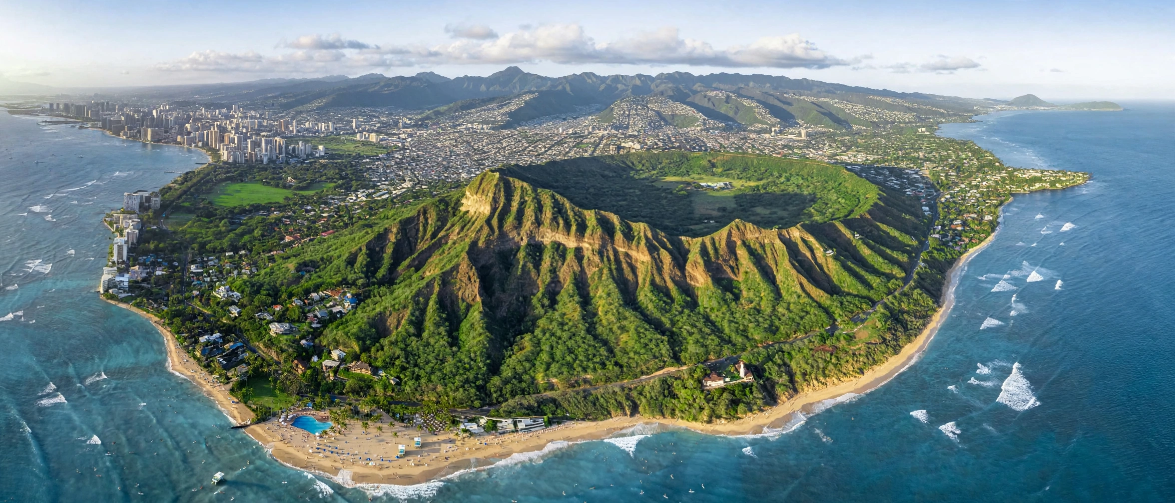
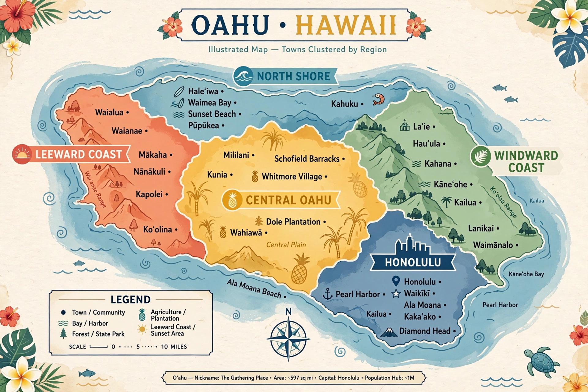
Oʻahu is the third largest island in the Hawaiian chain, covering about 597 square miles, but it holds roughly two thirds of the state’s population. Its geography shapes its towns in clear ways. The island formed from two shield volcanoes whose eroded remnants are now the Waiʻanae Range on the west and the Koʻolau Range on the east. Between them lies the central plateau, a broad plain that became the island’s agricultural heartland. Honolulu sits on the sheltered southeastern shore, and the island’s highway system radiates outward from the city: the H-1 freeway runs west along the southern shore and east toward the southeast coast, the H-2 runs north into Central Oʻahu, and the H-3 crosses beneath the Koʻolau Range to the windward side.
The island’s towns fall into several natural regions. Honolulu is the urban core: the state capital, the financial center, and home to the island’s largest neighborhoods, including Waikīkī, the famous beach district just east of downtown. The Windward Coast on the east side holds Kailua, Kāneʻohe, and Waimānalo, green residential towns facing the trade winds. The North Shore is the legendary surf coast, anchored by the historic plantation town of Haleʻiwa and smaller communities like Kahuku and Lāʻie. The Leeward Coast on the dry west side includes the fast-growing city of Kapolei, the Ko Olina resort area, and older beach towns like Waiʻanae and Nānākuli. Central Oʻahu holds Wahiawā, Mililani, and Pearl City on the plateau between the two mountain ranges.
Weather varies noticeably between these regions. The windward side catches the moisture from the northeast trade winds, which is why Kailua, Kāneʻohe, and the North Shore are noticeably greener and rainier than the leeward coast. Honolulu and the Leeward Coast sit in the rain shadow of the Koʻolau and Waiʻanae ranges, making them the driest and sunniest parts of the island. Central Oʻahu tends to be warm and breezy, with the mountains on both sides funneling the trades. These patterns matter for trip planning: a rainy morning in Kāneʻohe can coincide with bright sunshine in Waikīkī, and the North Shore’s enormous winter surf gives way to calm summer water. See our Oʻahu map guide for a fuller picture of these regions.
Each town also carries a different history. Honolulu grew from a small harbor settlement into the capital of the Hawaiian Kingdom and eventually the modern state capital, with ʻIolani Palace, the only royal palace in the United States, standing in its downtown. Kailua and Kāneʻohe were once quiet beach towns that grew into residential communities. Haleʻiwa preserves its sugar plantation character with low-slung wooden storefronts. Waiʻanae and Nānākuli have deep Native Hawaiian roots that predate the plantation era. Kapolei is the newest major town, deliberately planned in recent decades as a second urban center for the island. Knowing a little of this background makes the towns far more interesting to explore.
Honolulu and Waikīkī
Honolulu is the political, economic, and cultural center of Hawaiʻi, and the vast majority of Oʻahu visitors spend at least part of their trip here. The city stretches along the southeastern shore from Pearl Harbor to the slopes of Diamond Head, and it contains distinct neighborhoods that feel like towns in their own right. Waikīkī is the most famous of them, but downtown Honolulu, the Ala Moana district, and the residential neighborhoods of Mānoa, Mōʻiliʻili, and Hawaiʻi Kai each have their own character.
Downtown Honolulu
Downtown Honolulu is the historic and civic heart of the island. This is where the Hawaiian monarchy built its capital, and the neighborhood still holds ʻIolani Palace, the official residence of the Hawaiian monarchs until the overthrow of the Kingdom in 1893. The palace offers guided tours and stands as the most important historical site in the state. Nearby are the Hawaiʻi State Capitol, the King Kamehameha statue in front of the historic Aliʻiōlani Hale, and the Kawaiahaʻo Church, sometimes called the Westminster Abbey of Hawaiʻi.
The downtown waterfront along the harbor has been revitalized with the Aloha Tower Marketplace area, and the nearby Chinatown district is one of the island’s most atmospheric neighborhoods, with its produce markets, lei shops, art galleries, and restaurants. Downtown is best explored on foot during weekday business hours, when the streets are lively and most historic sites are open. Parking can be limited, so many visitors combine a downtown day with TheBus, the city’s public transit system, or a rideshare.
Waikīkī
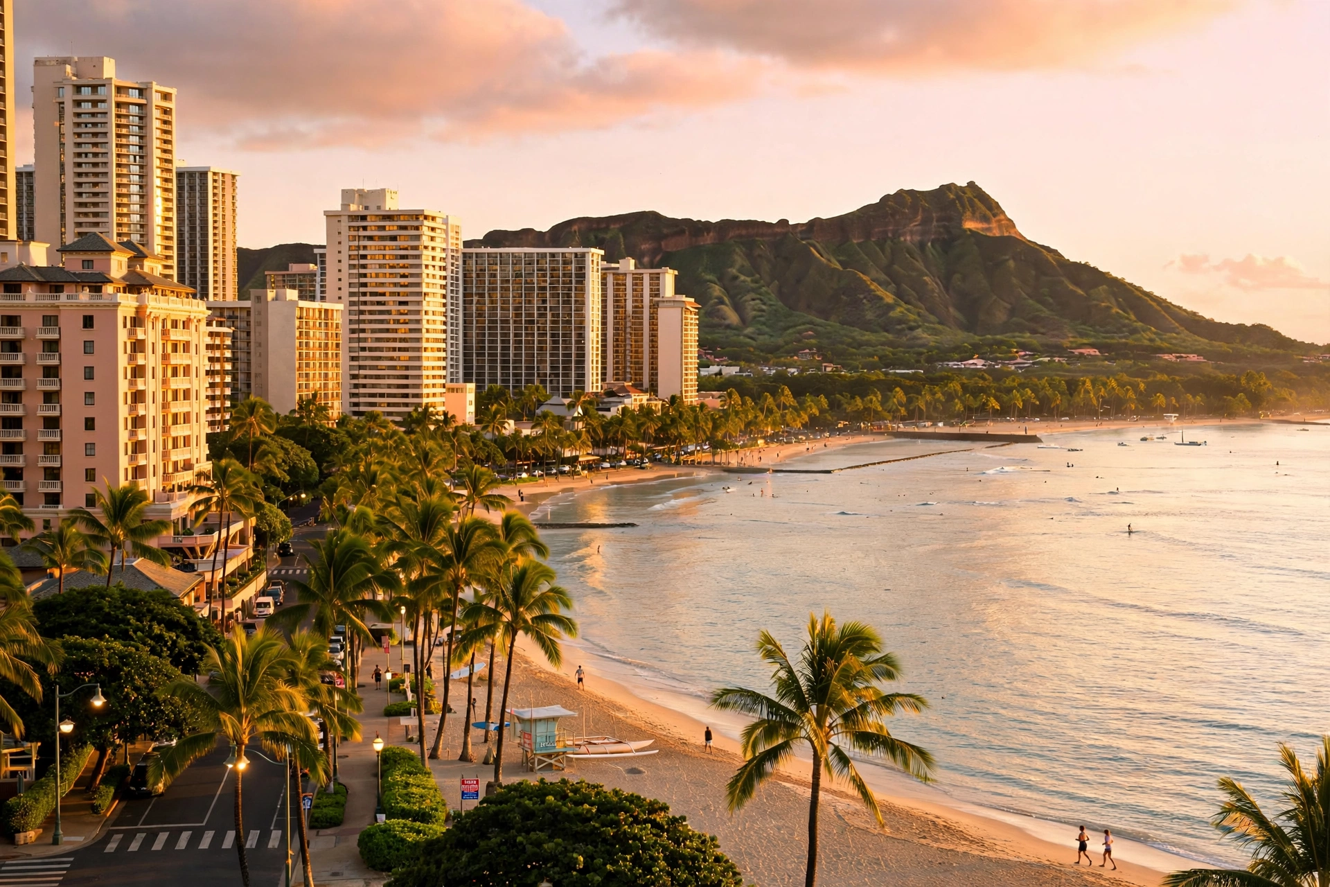
Waikīkī is the beach district that made Hawaiʻi famous, and it remains the island’s most concentrated visitor area. The neighborhood runs about two miles along the shore from the Ala Wai Canal to Diamond Head, centered on the famous crescent of Waikīkī Beach. Three main streets run through it: Kalākaua Avenue along the beach, Kūhiō Avenue one block inland, and Ala Wai Boulevard beside the canal. Cross streets like Lewers Street and Royal Hawaiian Avenue connect them, and the whole district is flat and easy to walk.
Waikīkī’s history stretches back centuries: it was once a retreat for Hawaiian royalty, with fishponds and taro fields where the hotels now stand. The first hotel, the Moana, opened in 1901, and the district grew through the twentieth century into the high-rise beachfront it is today. The Royal Hawaiian Hotel, known as the Pink Palace, opened in 1927 and remains a landmark. The Duke Kahanamoku statue on Kalākaua Avenue honors the father of modern surfing, and the beach sections in front of the Royal Hawaiian and Moana are still among the best places on the island to learn to surf.
For walkers, Waikīkī is the most pedestrian-friendly district on Oʻahu. The beachfront path runs the length of the beach, Kalākaua Avenue is closed to cars on some evenings for street festivals, and Kapiʻolani Park at the eastern end offers open lawns, banyan trees, and the Honolulu Zoo. See our Waikīkī walking map guide for detailed routes.
Ala Moana and Mōʻiliʻili
Just west of Waikīkī, the Ala Moana district centers on Ala Moana Center, one of the largest open-air shopping centers in the world, and Ala Moana Beach Park, a beloved local beach park with calm water and Magic Island’s sheltered lagoon. The area has grown into a dense residential neighborhood of high-rises, and it is a practical base for visitors who want to be near Waikīkī without staying in the middle of it. The Mōʻiliʻili neighborhood inland is a local favorite for food, with long-standing restaurants along South King Street and the University of Hawaiʻi at Mānoa just up the road.
Mānoa Valley
Mānoa Valley sits just inland of Honolulu, a lush residential valley that feels far removed from the city’s bustle. It is home to the University of Hawaiʻi’s main campus and the trailhead for Mānoa Falls, one of the island’s most popular waterfall hikes. The valley’s old wooden houses, giant monkeypod trees, and frequent rainbow sightings give it a distinctly old-Hawaiʻi atmosphere. See our Oʻahu waterfalls guide for details on the falls trail.
Hawaiʻi Kai
Hawaiʻi Kai is the easternmost residential community of Honolulu, built around the Koko Marina and the slopes of Koko Crater. It is a suburban, largely residential area popular with families, and it serves as the gateway to the southeast coast’s attractions: Hanauma Bay, the Halona Blowhole, Sandy Beach, and Makapuʻu Point. Visitors rarely base themselves here, but it is a useful reference point when driving the southeastern coast.
Windward Towns
The windward side of Oʻahu faces the northeast trade winds, and the moisture they carry makes this the greenest part of the island. The Koʻolau mountains rise dramatically behind the coastal towns, their fluted green cliffs streaked with waterfalls after rain. The windward towns are primarily residential communities, quieter and more local in feel than Honolulu, with some of the island’s most beautiful beaches. The H-3 freeway and the Pali Highway connect the windward side to Honolulu, making it an easy day trip or an alternative base for visitors who prefer a calmer setting.
Kailua
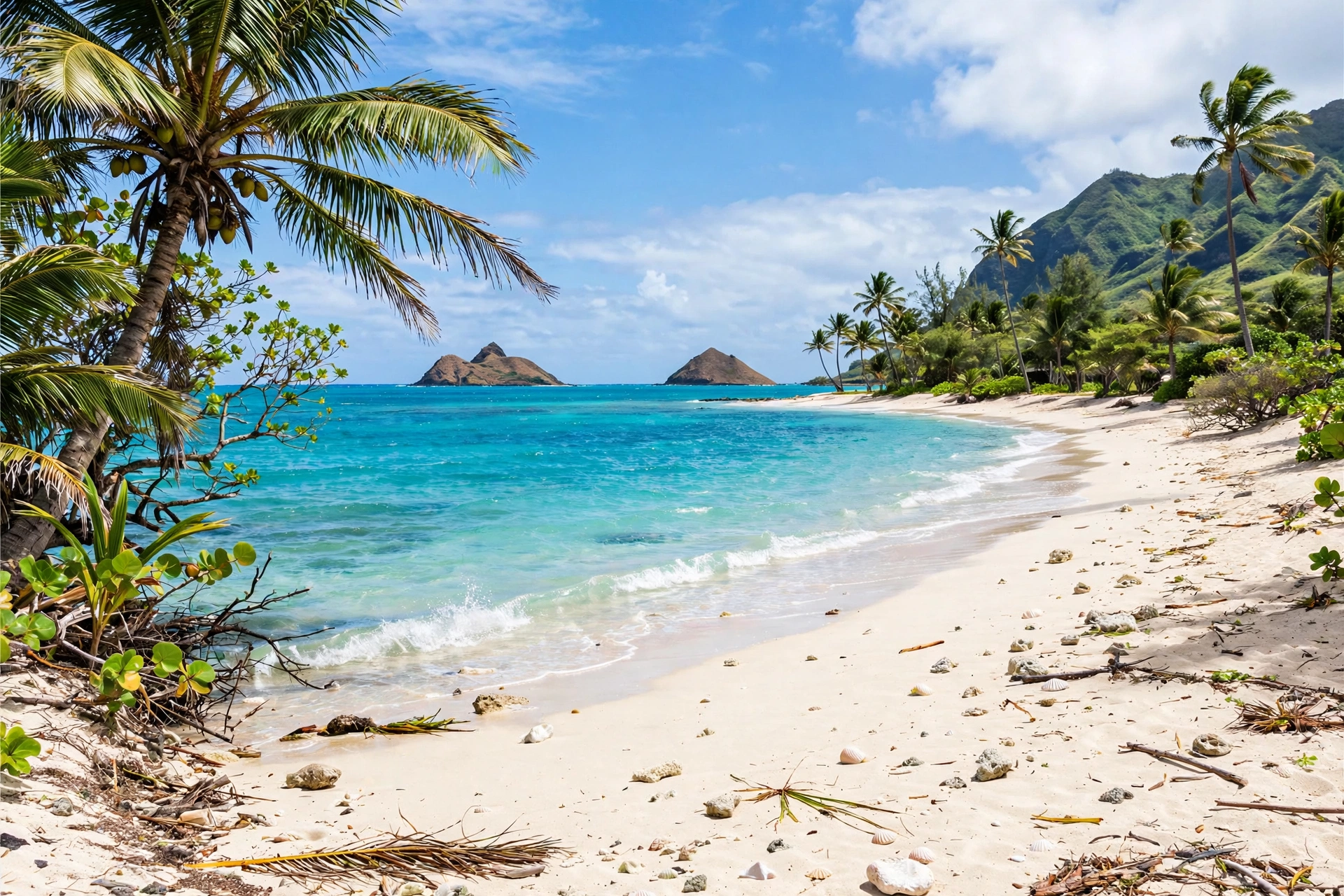
Kailua is the largest windward town and one of the most appealing places to stay on Oʻahu for visitors who want beach access without the Waikīkī crowds. The town sits on the shore of Kailua Bay, home to Kailua Beach Park and Lanikai Beach, two of the most photographed beaches in the state. Lanikai’s powdery sand, turquoise water, and views of the Mokulua Islands are iconic, though the beach itself has limited parking and no facilities, so most visitors go through Kailua Beach Park.
Kailua’s town center along Kailua Road and Hahani Street has a lively mix of shops, cafes, and restaurants, and the Thursday farmers market at the town center is a local institution. The Lanikai Pillbox hike, a short ridge trail above Lanikai with panoramic views of the windward coast, is one of the island’s most popular sunrise hikes. See our Oʻahu hikes guide for details. Kailua is about a 25 to 30 minute drive from Waikīkī via the Pali Highway in normal traffic.
Kāneʻohe
Kāneʻohe sits at the head of Kāneʻohe Bay, the largest sheltered bay in the main Hawaiian Islands, and it is the windward side’s other major town. The town is more residential and less visitor-oriented than Kailua, but it holds several important attractions. The Hoʻomaluhia Botanical Garden, a 400-acre garden at the base of the Koʻolau cliffs, is free to visit and one of the most scenic spots on the island. The Valley of the Temples is home to the Byodo-In Temple, a striking replica of a Japanese temple set against the mountains.
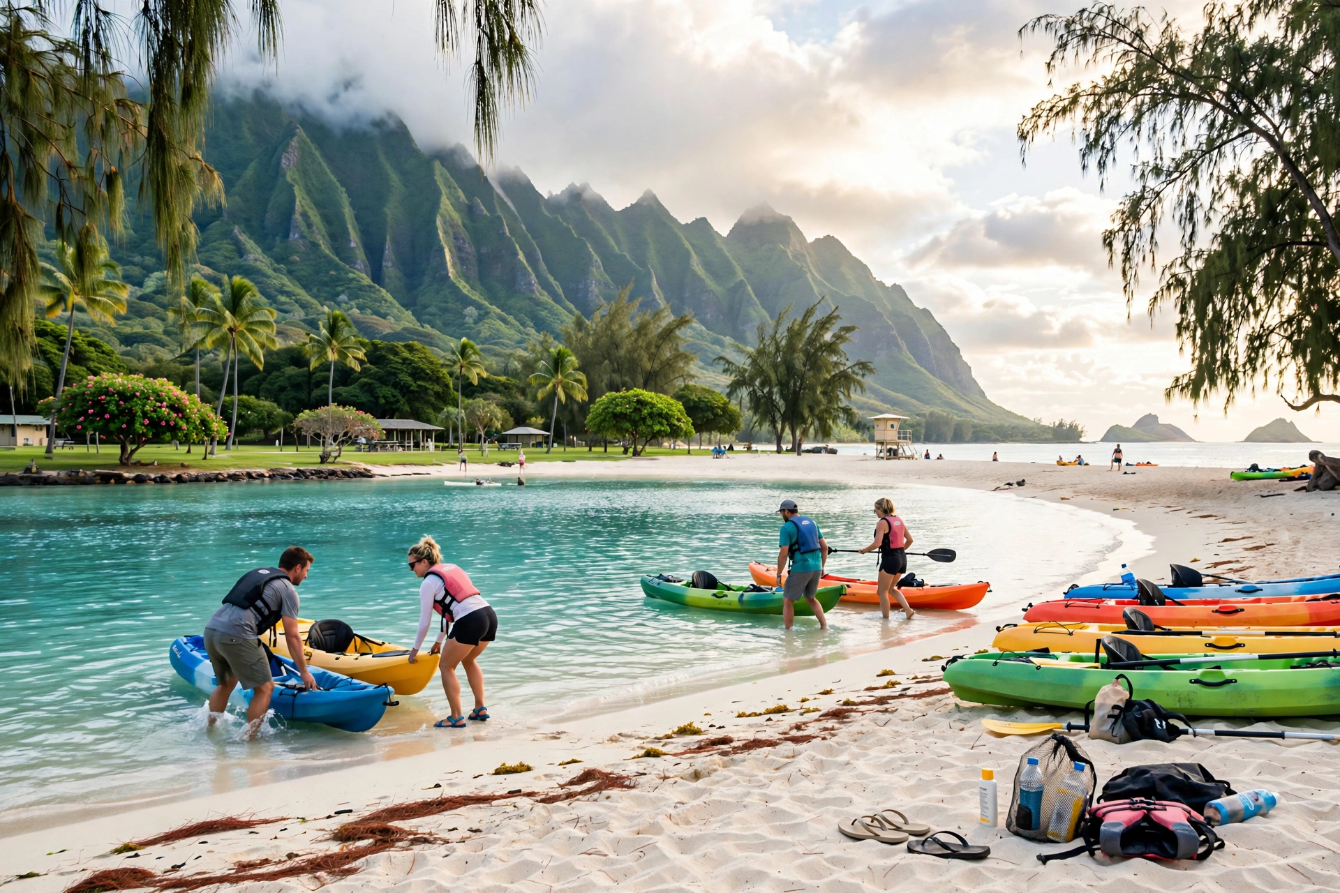
Kāneʻohe Bay itself is famous for its sandbar, a long shallow stretch of sand that emerges at low tide and is one of the island’s best snorkeling and kayaking destinations. The bay’s calm, protected water also makes it popular for sailing and outrigger canoe paddling. Windward Mall and the town’s shopping centers serve the local population, and the town has a growing food scene. The H-3 freeway connects Kāneʻohe to Honolulu in about 20 minutes.
Waimānalo
Waimānalo is the quietest of the windward beach towns, a small community with deep agricultural roots stretching along the coast south of Kailua. Waimānalo Beach Park is a long, uncrowded stretch of white sand that locals consider one of the island’s best-kept secrets. The town is known for its farms: the Waimānalo area grows much of the island’s sweet corn, and the roadside stands along Kalanianaʻole Highway sell fresh produce. The drive from Waimānalo around Makapuʻu Point to Hawaiʻi Kai is one of the most scenic coastal drives on Oʻahu.
North Shore Towns
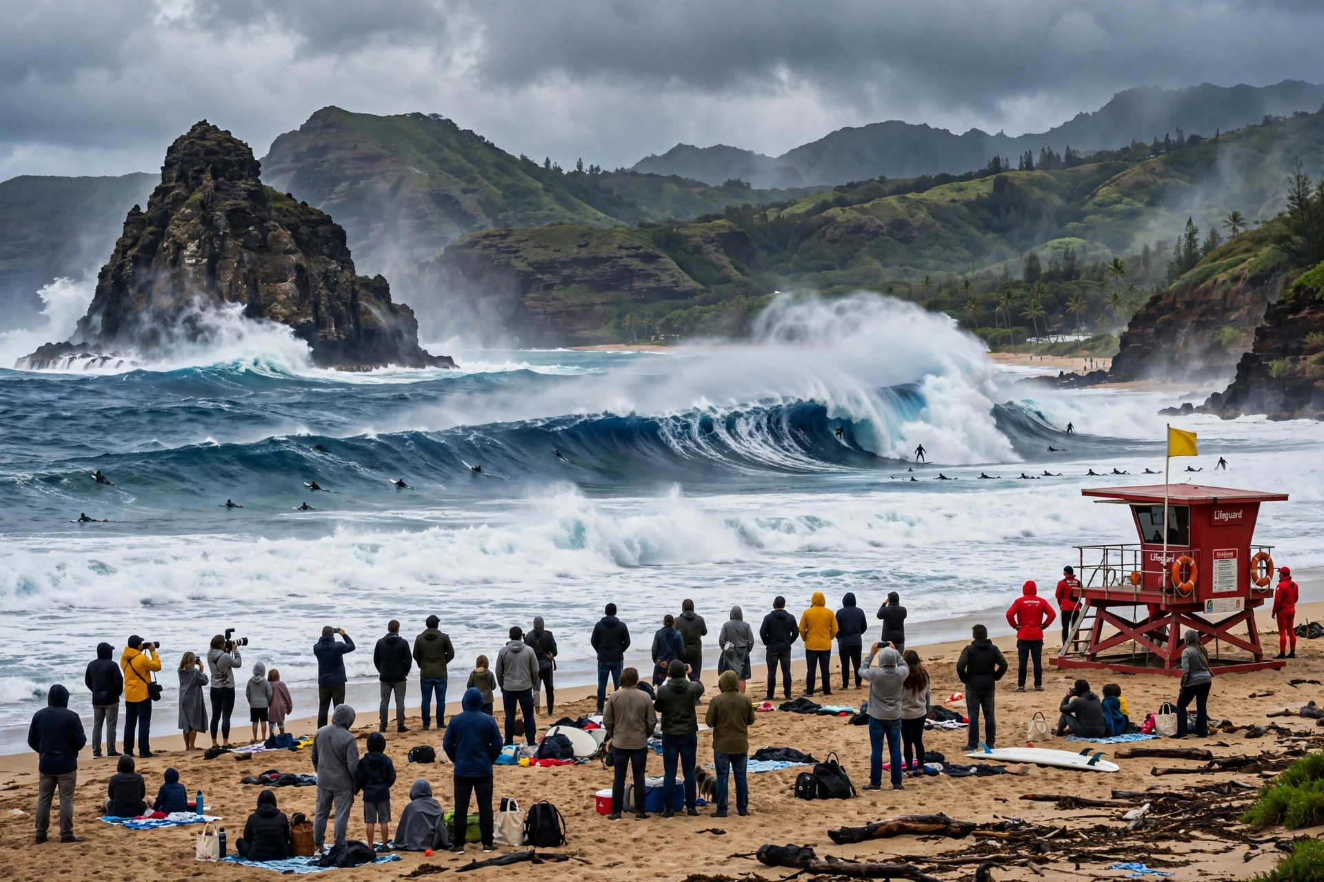
Oʻahu’s North Shore is legendary in the surfing world, home to the massive winter waves of Waimea Bay, Pipeline, and Sunset Beach. The towns here are small, rural, and fiercely protective of their laid-back character. The North Shore runs along Kamehameha Highway (Route 83) from Kaʻena Point in the west to Kahuku in the east, and the whole coast transforms dramatically between the huge winter surf season and the calm summer months. Traffic on the two-lane highway can be heavy on winter weekends and during major surf competitions, so plan drives accordingly.
Haleʻiwa
Haleʻiwa is the North Shore’s main town and its historic heart. Founded as a sugar plantation community, the town preserves its character in a row of low wooden storefronts along Kamehameha Highway, many of them listed on the National Register of Historic Places. The town’s shops, shave ice stands, art galleries, and restaurants make it the natural base for exploring the North Shore. Haleʻiwa Aliʻi Beach Park on the west side of town is a popular summer swimming and surfing spot, and the harbor is the departure point for sport fishing and dive boats.
Haleʻiwa’s food scene punches well above its size, with the town’s shrimp trucks, plate lunch spots, and shave ice stands drawing visitors from all over the island. The town hosts the start of the famous North Shore surf season each winter, and its streets fill with surf fans during major competitions at nearby breaks. From Haleʻiwa, the surf beaches of the Seven Mile Miracle stretch east along the coast.
Waimea and Waimea Valley
Just east of Haleʻiwa, the Waimea area centers on Waimea Bay, one of the most famous big-wave surf spots in the world in winter and a calm, idyllic swimming beach in summer. The bay’s huge rock, a landmark lava formation at the water’s edge, is a popular jumping spot when the ocean is calm. Waimea Valley, the lush valley behind the bay, is a botanical garden and cultural site with a paved path leading to Waimea Falls, where visitors can swim in the pool beneath the falls. See our Oʻahu waterfalls guide for more on the falls.
Kahuku
Kahuku sits at the northeastern corner of the island, a former sugar plantation town now best known as the home of the North Shore’s famous shrimp trucks. The town’s roadside shrimp stands along Kamehameha Highway are a required stop for many visitors. Kahuku is also the gateway to the Turtle Bay area and the Kahuku Point coastline. The town has a rural, working-community feel that contrasts with the resort development further west.
Lāʻie
Lāʻie is a small town with an outsized cultural footprint. It is home to Brigham Young University-Hawaiʻi and the Polynesian Cultural Center, the island’s most comprehensive showcase of Polynesian cultures, with villages representing Hawaiʻi, Samoa, Tonga, Fiji, Tahiti, and Aotearoa. The town is also home to the Laie Hawaii Temple of the Church of Jesus Christ of Latter-day Saints, whose grounds are open to visitors. Lāʻie’s coastline includes the sheltered waters of the area’s small bays, and the town maintains a quiet, community-centered atmosphere.
Leeward Towns
The leeward or west side of Oʻahu sits in the rain shadow of the Waiʻanae Range, making it the driest and sunniest part of the island. The leeward coast runs from Pearl Harbor west and north to Kaʻena Point, and its towns range from the fast-growing second city of Kapolei to older beach communities with deep Native Hawaiian roots. The leeward side gets fewer visitors than the rest of the island, but its sunny weather, uncrowded beaches, and growing amenities make it worth exploring.
Kapolei
Kapolei is Oʻahu’s second urban center, a planned city that has grown rapidly since the 1990s to relieve pressure on Honolulu. The city holds major shopping centers, government offices, the University of Hawaiʻi’s West Oʻahu campus, and a growing residential population. For visitors, Kapolei is mainly useful as a shopping and services stop on the way to the leeward beaches, and its central location makes it a practical base for exploring the west side. The city’s wide streets, modern infrastructure, and ample parking contrast sharply with Honolulu’s density.
Ko Olina
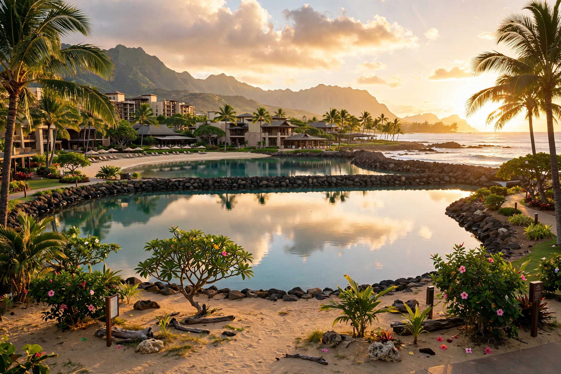
Ko Olina is the leeward coast’s resort area, a planned development centered on four man-made lagoons with calm, swimmable water. The lagoons are connected by a seaside walking path and fronted by resort hotels and vacation condominiums. Ko Olina’s sheltered lagoons make it one of the most reliable swimming spots on the island, and the area’s sunsets over the Waiʻanae coast are spectacular. The development also includes a marina, a golf course, and the Disney Aulani resort. Public parking at the lagoons is limited, so arrive early.
Waiʻanae
Waiʻanae is the largest town on the leeward coast and one of the oldest continuously inhabited areas on Oʻahu, with Native Hawaiian settlements dating back centuries. The town has a strong Native Hawaiian community and cultural identity, and it is home to important cultural sites including the Waiʻanae area’s ancient fishponds and heiau. Waiʻanae’s coastline includes Pōkaʻī Bay Beach Park, a sheltered beach popular with local families, and the harbor is a departure point for dolphin-watching and sport fishing boats. The town’s Mākaha side is famous in surfing history: Mākaha Beach hosted some of the earliest big-wave surfing competitions.
Nānākuli
Nānākuli sits just south of Waiʻanae along the Farrington Highway, a residential community with a strong local character. The town’s coastline includes Nānākuli Beach Park, and the area is known for its dramatic sunsets and views across the channel to the Waiʻanae mountains. Like Waiʻanae, Nānākuli has deep Native Hawaiian roots and a close-knit community. Visitors passing through will find local food spots and a genuine neighborhood atmosphere far removed from the resort corridors.
Central Oʻahu Towns
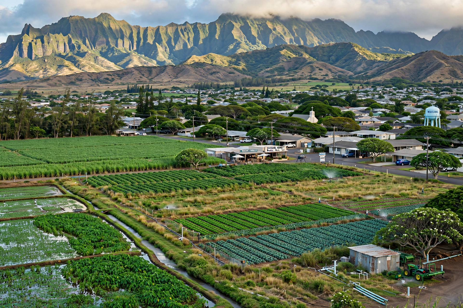
Central Oʻahu occupies the plateau between the Waiʻanae and Koʻolau ranges, a broad plain that was once the heart of the island’s sugar and pineapple industries. The towns here are primarily residential communities serving Honolulu’s workforce, and most visitors pass through on the H-2 freeway without stopping. But Central Oʻahu holds a few attractions worth a detour, and understanding the area helps make sense of the island’s layout.
Wahiawā
Wahiawā sits at the northern end of the central plateau, surrounded by former plantation lands. The town is home to the Wahiawā Botanical Garden, a quiet 27-acre garden in a cool upland setting, and it serves as the gateway to the North Shore via the Kamehameha Highway. The town’s plantation-era buildings and local food spots give it an old-Hawaiʻi feel. Nearby Lake Wilson (Wahiawā Reservoir) is a freshwater fishing spot unusual in the islands.
Mililani
Mililani is one of Hawaiʻi’s first master-planned communities, built in the 1960s and 1970s on former pineapple land. The town is almost entirely residential, with parks, schools, and shopping centers serving its population. Visitors rarely stop in Mililani, but it is a useful landmark on the H-2 freeway between Honolulu and the North Shore, and its central location makes it a convenient meeting point for island-wide drives.
Pearl City and ʻAiea
Pearl City and ʻAiea sit on the southern edge of the central plateau above Pearl Harbor. The area is primarily residential and commercial, with Pearlridge Center, one of the island’s largest shopping malls. The Pearl Harbor National Memorial lies just below these towns on the harbor’s shore; see our Pearl Harbor location guide for visiting details. The area’s hillside neighborhoods offer sweeping views over the harbor and the southern coast.
Where to Base Yourself
Choosing where to stay on Oʻahu depends on what kind of trip you want. The island is small enough that day trips are possible from almost anywhere, but traffic can be heavy during rush hours, so your base still shapes your days. Here is how the main options compare for different travel styles. This is general orientation only; for specific lodging, consult current listings and reviews.
First-Time Visitors
Waikīkī is the natural choice for first-time visitors. It puts the beach, restaurants, shopping, and tour departures within walking distance, and the public bus system makes it easy to reach Honolulu’s attractions without a car. The trade-off is crowds and higher prices, but for a first trip the convenience is hard to beat. The Ala Moana area just west of Waikīkī offers a slightly quieter alternative with easy access to the same attractions.
Beach Lovers Seeking Calm
Kailua is the best base for travelers who want a beautiful beach without the Waikīkī scene. Kailua Beach and Lanikai are superb, the town has good restaurants and shops, and the windward setting feels more local. Ko Olina on the leeward coast is the other calm-beach option, with its sheltered lagoons and resort amenities. Both are further from Honolulu’s attractions, so plan for longer drives to Pearl Harbor or downtown.
Surfers and North Shore Fans
Haleʻiwa is the obvious base for surf-focused trips, putting the North Shore’s breaks, the town’s food scene, and Waimea Valley within easy reach. In winter, staying on the North Shore means living with the surf culture at its peak; in summer, the same coast offers calm swimming and snorkeling. Note that the North Shore is about an hour from Honolulu in normal traffic, so it works best for travelers who plan to spend most of their time on that coast.
Budget-Conscious Travelers
The areas around the airport, Pearl City, and Kapolei tend to offer lower lodging prices than Waikīkī or the resort coasts. These are practical bases if you plan to rent a car and explore the whole island, though they lack the beachfront atmosphere of the visitor districts. The Kūhiō Avenue side of Waikīkī, one block from the beach, also tends to be more affordable than the beachfront blocks.
Splitting Your Stay
Many experienced Oʻahu visitors split their trip between two bases: a few nights in Waikīkī or Honolulu for the city attractions, Pearl Harbor, and dining, then a few nights in Kailua or on the North Shore for beaches and a slower pace. This avoids long cross-island drives and lets you experience two very different sides of the island. If you split your stay, plan the transfer for midday to avoid rush-hour traffic.
Getting Between Towns
Oʻahu’s highway system makes it possible to reach any town from any other within about an hour, but traffic patterns matter enormously. The H-1 freeway through Honolulu is heavily congested during weekday rush hours, roughly 6 to 9 in the morning heading into town and 3 to 7 in the evening heading out. Plan cross-island drives outside these windows when possible.
The main routes are straightforward. The H-1 freeway runs from Kapolei in the west through Honolulu to the southeast coast. The H-2 freeway runs north from Pearl City through Mililani to Wahiawā, where it becomes the Kamehameha Highway to the North Shore. The H-3 freeway crosses beneath the Koʻolau Range from Halawa to Kāneʻohe, one of the most scenic freeway drives in the state. The Pali Highway (Route 61) and the Likelike Highway (Route 63) are the older cross-island routes, winding over the Koʻolau with the Nuʻuanu Pali lookout as a worthwhile stop. Kamehameha Highway (Route 83) rings the windward and northern coasts, and Farrington Highway (Route 93) serves the leeward coast.
Typical drive times in normal traffic: Waikīkī to Pearl Harbor, 25 minutes. Waikīkī to Kailua, 25 to 30 minutes. Waikīkī to Haleʻiwa, 50 to 60 minutes. Waikīkī to Ko Olina, 35 to 45 minutes. Honolulu to Kāneʻohe via the H-3, 20 minutes. Add 30 minutes or more during rush hours. TheBus, the island’s public transit system, serves all major towns with affordable fares, though cross-island bus trips can take two to three times as long as driving. Rideshares are readily available in Honolulu and Waikīkī but thinner on the North Shore and leeward coast.
Frequently Asked Questions
What is the best town to stay in on Oʻahu?
There is no single best town; it depends on your priorities. Waikīkī suits first-time visitors who want walkability and convenience. Kailua suits beach lovers who prefer a quieter, more local setting. Haleʻiwa suits surf fans and North Shore explorers. Ko Olina suits travelers who want guaranteed calm swimming water. Consider splitting your stay between two areas to experience more of the island.
How many towns are on Oʻahu?
Oʻahu has dozens of named communities, but the island’s towns are generally grouped into five regions: Honolulu (including Waikīkī), the Windward Coast, the North Shore, the Leeward Coast, and Central Oʻahu. The major towns covered in this guide are Honolulu, Waikīkī, Kailua, Kāneʻohe, Waimānalo, Haleʻiwa, Kahuku, Lāʻie, Kapolei, Ko Olina, Waiʻanae, Nānākuli, Wahiawā, Mililani, and Pearl City.
Is it better to stay in Waikīkī or Kailua?
Waikīkī offers walkability, nightlife, dining variety, and easy access to tours and public transit, but it is crowded and more expensive. Kailua offers superb beaches, a relaxed local atmosphere, and generally lower lodging prices, but it is further from Honolulu’s attractions and Pearl Harbor, and you will want a rental car. Many visitors find that a split stay gives them the best of both.
What is the North Shore of Oʻahu known for?
The North Shore is world famous for its winter surf, with legendary breaks like Pipeline, Waimea Bay, and Sunset Beach producing some of the largest rideable waves on the planet from roughly November through February. In summer the same coast is calm and excellent for swimming and snorkeling. The historic plantation town of Haleʻiwa is the area’s hub, and the coast’s shrimp trucks, shave ice stands, and laid-back culture are attractions in their own right.
Can you visit all of Oʻahu’s towns in one day?
You can drive a full loop of the island in a day, roughly 120 miles, but you would only be passing through most towns. A proper visit to even half the towns in this guide needs several days. If your time is short, prioritize one region per day: Honolulu and Waikīkī one day, the Windward Coast another, and the North Shore a third.
What is the second city of Oʻahu?
Kapolei is Oʻahu’s planned second urban center, developed since the 1990s on the leeward side to balance Honolulu’s dominance. It holds major shopping, government offices, the University of Hawaiʻi West Oʻahu campus, and a growing residential population. It is more of a practical services hub than a visitor destination, but it anchors the fast-growing leeward region.
Are Oʻahu’s leeward towns worth visiting?
Yes, particularly for travelers who have already seen the main sights. The leeward coast is the sunniest part of the island, Ko Olina’s lagoons offer reliably calm swimming, and the Waiʻanae coast has deep cultural roots and dramatic scenery. The area sees fewer tourists, so it offers a more local perspective on the island. Go with respect for the residential communities and their character.
How do I get around Oʻahu without a car?
TheBus, Oʻahu’s public transit system, reaches all major towns with low fares, and Waikīkī itself is highly walkable. However, bus trips between regions can be slow, and service is less frequent on the North Shore and leeward coast. For a trip focused on Honolulu, Waikīkī, and Pearl Harbor, going car-free is feasible. For exploring the Windward Coast, North Shore, and leeward beaches, a rental car makes the trip far more practical.
Related Guides
- Oʻahu Map: Complete Reference Map and Area Guide: the island-wide map companion to this towns guide.
- Oʻahu Beaches: the island’s best beaches by coast.
- Oʻahu Hikes: trails across the island, from Diamond Head to the Koʻolau ridges.
- Oʻahu Waterfalls: waterfall hikes and safety.
- Waikīkī Walking Map: detailed walking routes through Waikīkī.
- Where Is Pearl Harbor on a Map: locating the memorial and planning a visit.
- Hawaii Map: Complete Reference: the statewide map hub.
- Maui Towns: the companion towns guide for Maui.
Reading Oʻahu Through Its Towns
Oʻahu rewards travelers who look past the postcard and into the towns. The island’s communities tell the story of Hawaiʻi itself: the royal history of downtown Honolulu, the plantation past of Haleʻiwa and Wahiawā, the surf culture of the North Shore, the suburban present of Kapolei and Mililani, and the enduring Native Hawaiian presence in Waiʻanae and Nānākuli. Each town adds a layer to the island, and the more of them you understand, the richer every beach, hike, and meal becomes.
The practical lesson is simple. Pick a base that matches your travel style, plan your drives around the island’s traffic rhythms, and leave room in your itinerary for at least one town you had not planned to visit. Oʻahu’s towns are close together on the map but far apart in character, and that variety is the island’s greatest strength.