
Oʻahu Hikes
O‘ahu packs an extraordinary variety of hiking into a single island. In one weekend you can watch the sunrise from the rim of a volcanic crater, walk through a bamboo forest to a 150-foot waterfall, and stand on the highest peak in the Wai‘anae Range looking down at both coasts. The island’s two mountain ranges, the Ko‘olau and the Wai‘anae, create dozens of ridge trails, valley walks, and summit climbs within an hour’s drive of Waikīkī.
This guide covers more than 20 of the island’s best trails, organized by difficulty so you can find the right hike whether you are traveling with kids, training for a bigger objective, or chasing the most dramatic views on the island. Every trail includes distance, elevation gain, trailhead details, and an honest assessment of what to expect. Trail conditions in Hawai‘i change with the weather, so always check the Hawai‘i DLNR Na Ala Hele trail system website for current closures before you go.

Table of Contents
- Quick Comparison: 22 O‘ahu Trails
- Easy Hikes
- Moderate Hikes
- Challenging Hikes
- O‘ahu Hikes by Region
- What to Pack for Hiking O‘ahu
- Trail Safety and Etiquette
- Best Time to Hike O‘ahu
- Frequently Asked Questions
- Related Guides
Quick Comparison: 22 O‘ahu Trails
Use this table to compare every trail in this guide at a glance. Distances are round trip. Elevation figures are approximate gain from the trailhead. Difficulty ratings reflect a reasonably fit hiker in dry conditions; rain can move any O‘ahu trail up a full difficulty grade because of mud and slippery rock.
| Trail | Distance (RT) | Elevation Gain | Difficulty | Best For |
|---|---|---|---|---|
| Diamond Head Summit | 1.6 miles | 560 ft | Easy | Sunrise, first-time visitors |
| Mānoa Falls | 1.6 miles | 800 ft | Easy | Waterfall, rainforest |
| Makapu‘u Point Lighthouse | 2.0 miles | 500 ft | Easy | Whale watching, paved path |
| Ka‘ena Point | 5.0 miles | Minimal | Easy | Seabirds, coastal walk |
| Waimea Valley Falls | 1.5 miles | Minimal | Easy | Families, swimming |
| Likeke Falls (Old Pali Road) | 1.0 mile | 200 ft | Easy | Quick waterfall stop |
| Judd Trail | 1.0 mile | 150 ft | Easy | Shaded forest loop |
| Lanikai Pillbox (Kaiwa Ridge) | 1.8 miles | 600 ft | Moderate | Sunrise, ocean views |
| Kuli‘ou‘ou Ridge | 5.0 miles | 1,800 ft | Moderate | Ridge views, workout |
| ‘Aiea Loop | 4.8 miles | 900 ft | Moderate | Forest loop, history |
| Wiliwilinui Ridge | 5.0 miles | 1,600 ft | Moderate | Summit views, ridge walking |
| Maunawili Falls | 3.0 miles | 600 ft | Moderate | Waterfall swimming |
| Hawai‘i Loa Ridge | 7.0 miles | 1,900 ft | Moderate | Long ridge, solitude |
| Mariner’s Ridge | 4.2 miles | 1,200 ft | Moderate | Koko Head views |
| Koko Head Stairs | 1.8 miles | 1,200 ft | Challenging | Workout, city views |
| Ka‘ala (Wai‘anae) | 7.0 miles | 3,600 ft | Challenging | Highest point on O‘ahu |
| Olomana Three Peaks | 4.5 miles | 1,800 ft | Challenging | Experienced scramblers only |
| Ka‘au Crater | 5.5 miles | 1,600 ft | Challenging | Crater loop, waterfall |
| Pali Puka and Notches | 1.0 mile | 400 ft | Challenging | Views, exposure |
| Mt. Olympus (Awaawaloa) | 4.4 miles | 1,700 ft | Challenging | Honolulu views |
| Kalihi Saddle | 5.0 miles | 2,000 ft | Challenging | Ko‘olau summit remoteness |
| Pu‘u ‘Ōhi‘a (Tantalus) | 2.0 miles | 700 ft | Easy-Moderate | Forest, city views |
Easy O‘ahu Hikes
These trails are suitable for most fitness levels, including families with children and travelers who do not hike regularly. They have clear paths, modest elevation gain, and big payoffs. Start here if you are new to hiking in Hawai‘i.
Diamond Head Summit Trail
Distance: 1.6 miles round trip | Elevation gain: 560 feet | Time: 1.5 to 2 hours | Fee: Yes, reservation required
Hawai‘i’s most famous hike climbs the interior of a 300,000-year-old volcanic crater to a historic military lookout with sweeping views of Waikīkī, Honolulu, and the Pacific. The well-maintained trail passes through a tunnel, up two sets of steep stairs, and along the crater rim. It is crowded by mid-morning, so book the earliest entry slot you can and arrive at the 6 AM opening for sunrise. All out-of-state visitors must reserve entry online in advance through the Hawai‘i State Parks system; walk-ins are not accepted. Bring more water than you think you need. There is no shade and no water on the trail.
Trailhead: Diamond Head State Monument parking lot, accessible from Diamond Head Road. Facilities: Restrooms and drinking water at the trailhead only.
Mānoa Falls Trail
Distance: 1.6 miles round trip | Elevation gain: 800 feet | Time: 1 to 2 hours | Fee: Paid parking at trailhead
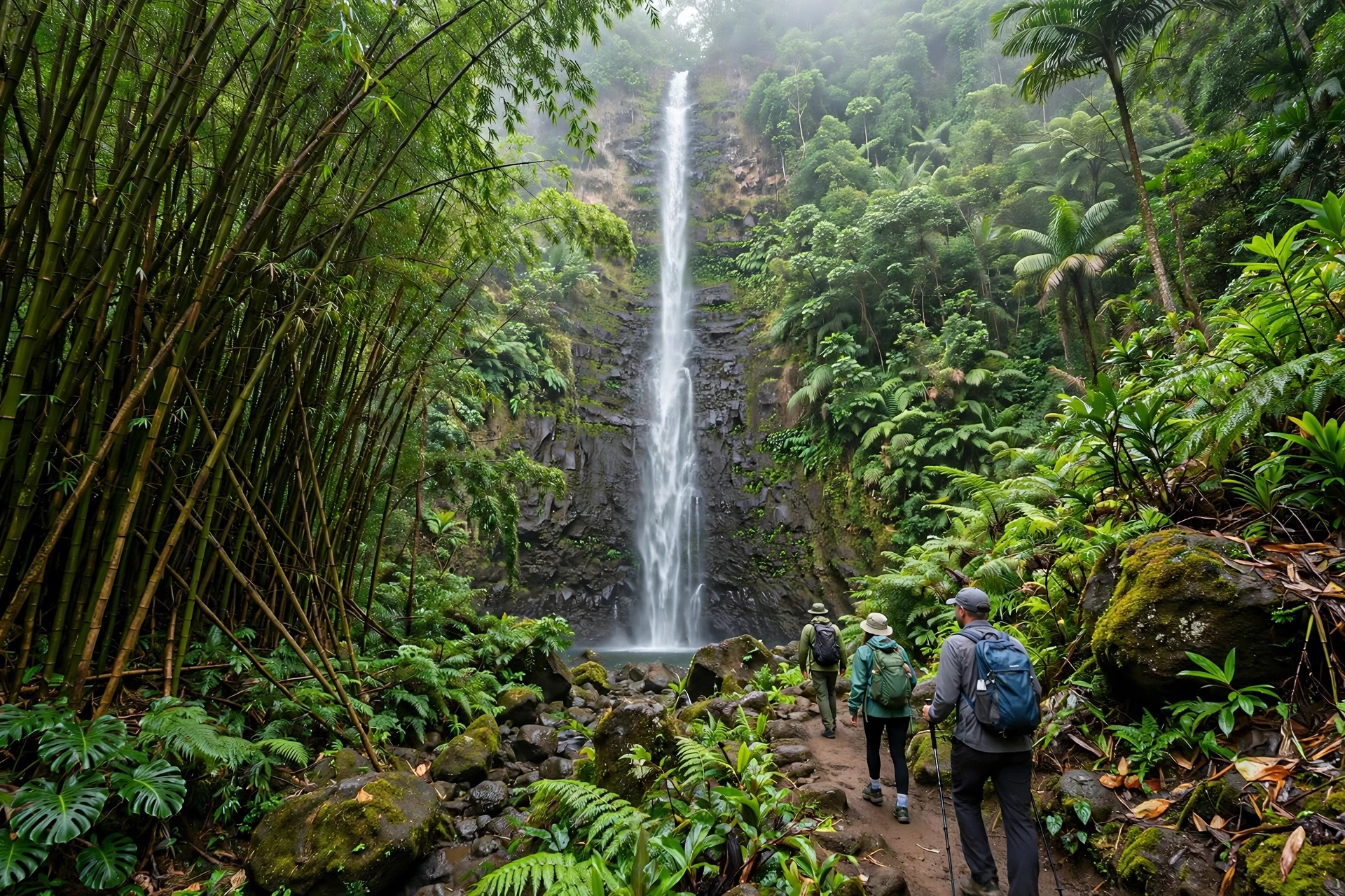
This lush rainforest walk ends at a 150-foot waterfall in the back of Mānoa Valley, one of the wettest and greenest places on O‘ahu. The trail winds through bamboo groves, banyan trees, and native forest that has appeared in films and television shows. The falls are most dramatic after rain, but the trail becomes genuinely muddy, so wear shoes with real tread and expect to get dirty. Swimming at the base of the falls is discouraged because of rockfall danger and water quality. Go early to enjoy the forest before the tour groups arrive, and keep an eye out for native birds like the ‘apapane in the canopy.
Trailhead: End of Mānoa Road, past the Hawai‘i Trail and Mountain Club area near Lyon Arboretum. Facilities: Portable restrooms near the parking area.
Makapu‘u Point Lighthouse Trail
Distance: 2 miles round trip | Elevation gain: 500 feet | Time: 1 to 1.5 hours | Fee: None
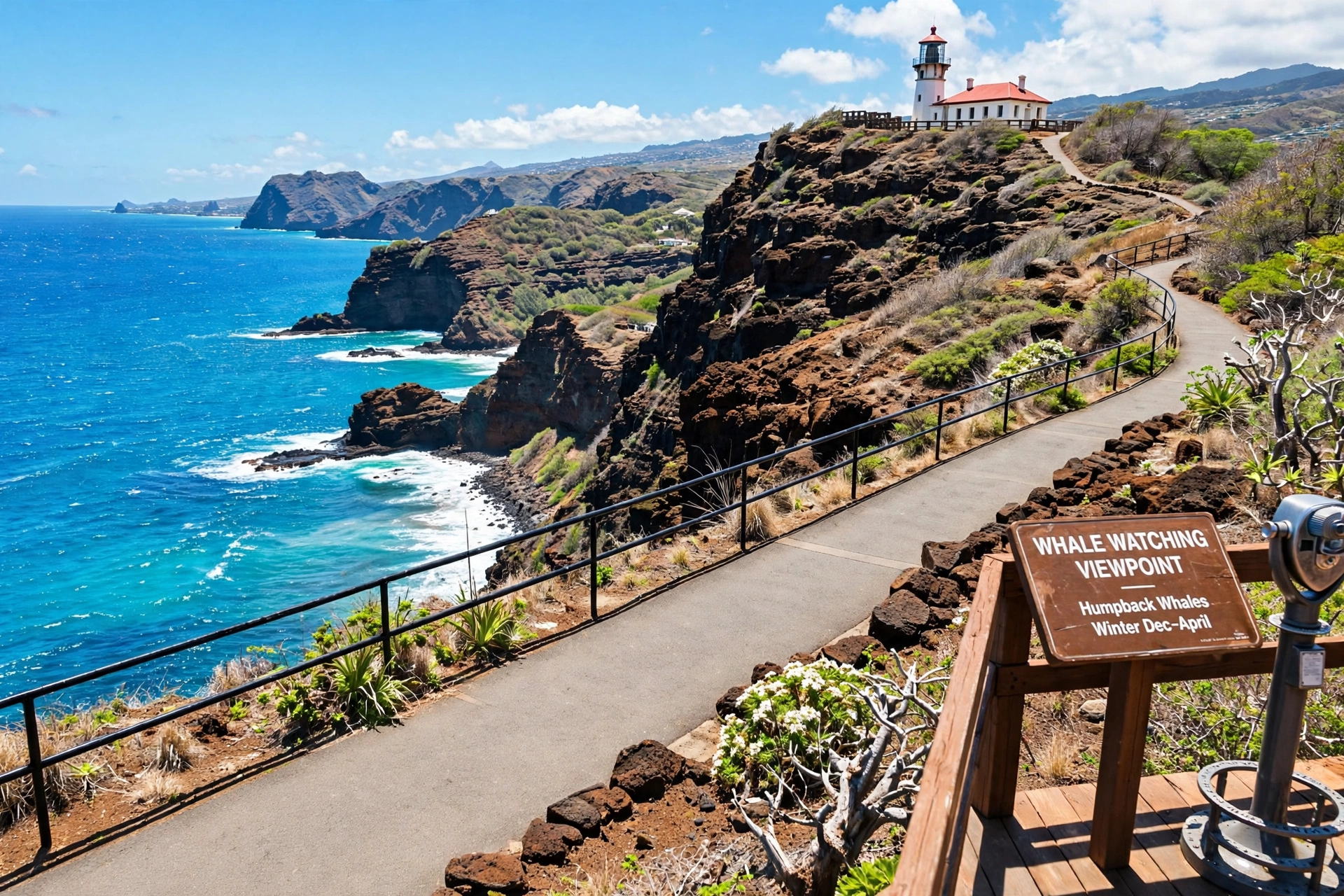
A wide paved path climbs the southeastern tip of O‘ahu to an overlook above the historic Makapu‘u Lighthouse, with views stretching to Rabbit Island, the Ka‘iwi coastline, and on clear days the neighboring islands of Moloka‘i and Lāna‘i. From December through May this is one of the island’s best land-based whale watching spots; bring binoculars and scan for spouts and breaches offshore. The trail is exposed with no shade, so mornings are far more pleasant than midday. It is stroller and wheelchair friendly, making it one of the most accessible scenic hikes on the island.
Trailhead: Makapu‘u Point parking lot on Kalaniana‘ole Highway. Facilities: Restrooms at the trailhead.

Ka‘ena Point
Distance: 5 miles round trip | Elevation gain: Minimal | Time: 2 to 3 hours | Fee: None
Ka‘ena Point is the westernmost tip of O‘ahu, reached by a flat coastal walk through a State Natural Area Reserve. A predator-proof fence protects one of the island’s most important seabird nesting colonies, and from November through spring you can see Laysan albatross (mōlī) nesting just feet from the trail. Hawaiian monk seals frequently haul out on the beaches. There is no shade and no water, so this is strictly a morning hike. Walk in from either the Keawa‘ula (Yokohama Bay) side or the Mokulē‘ia side; both are about 2.5 miles each way along an old dirt road.
Trailhead: End of Farrington Highway at Keawa‘ula Beach (west side) or end of the road at Mokulē‘ia (north side). Facilities: None. Bring everything you need.
Waimea Valley Falls
Distance: 1.5 miles round trip | Elevation gain: Minimal | Time: 1 to 2 hours | Fee: Paid admission to Waimea Valley
A paved, garden-lined path leads three-quarters of a mile through one of the most significant cultural sites on O‘ahu’s North Shore to a 45-foot waterfall with a swimming pool at its base. Lifeguards are on duty when swimming is permitted, and life jackets are required. The valley holds dozens of archaeological sites and a remarkable botanical collection, so the walk itself is as interesting as the destination. This is the easiest waterfall experience on the island and an excellent choice for families, older travelers, and anyone with limited mobility.
Trailhead: Waimea Valley visitor area on Kamehameha Highway, Hale‘iwa. Facilities: Full facilities including restrooms, food, and cultural demonstrations.
Likeke Falls via Old Pali Road
Distance: 1 mile round trip | Elevation gain: 200 feet | Time: Under 1 hour | Fee: None
A short, shaded stroll along the historic Old Pali Road leads to a delicate waterfall tucked into the Ko‘olau cliffs. The trail follows the route travelers used before the modern Pali Highway tunnels were built, and interpretive signs explain the road’s history. The falls are modest compared to Mānoa, but the combination of history, shade, and minimal effort makes this a perfect add-on stop when driving between Honolulu and the Windward side. The trailhead parking is limited, so visit on weekday mornings.
Trailhead: Small pullout on the Old Pali Road, accessible from the Pali Highway. Facilities: None.
Judd Trail
Distance: 1 mile loop | Elevation gain: 150 feet | Time: Under 1 hour | Fee: None
This gentle loop through the Nu‘uanu Valley forest follows a stream past swimming holes and through groves of introduced and native trees. It is one of the quietest easy hikes near Honolulu, popular with local families and trail runners. The stream crossings are easy in dry weather but can become impassable after heavy rain, so skip it during storms. Combine it with a stop at the nearby Nu‘uanu Pali Lookout for a half-day Windward side outing.
Trailhead: End of Judd Street in Nu‘uanu Valley. Facilities: None.
Moderate O‘ahu Hikes
These trails require a reasonable fitness level and proper footwear. Expect steeper grades, some mud, and sections where you will use your hands for balance. The rewards are proportionally bigger: ridgeline views, quieter trails, and a real sense of the island’s interior.
Lanikai Pillbox Trail (Kaiwa Ridge)
Distance: 1.8 miles round trip | Elevation gain: 600 feet | Time: 1.5 to 2.5 hours | Fee: None
The most photographed sunrise hike on O‘ahu climbs Kaiwa Ridge to two World War II-era concrete pillboxes overlooking Lanikai Beach, the Mokulua Islands, and the Windward coast. The trail is short but steep and can be slick after rain. Arrive well before dawn with a headlamp to claim a spot for sunrise; the view of the sun rising between the Mokuluas is worth the early alarm. Parking in the Lanikai neighborhood is extremely limited and strictly enforced, so consider rideshare or the nearby Kailua Beach Park lot. Stay on the main trail to protect the fragile ridge vegetation.
Trailhead: Ka‘elepulu Drive in Lanikai, Kailua. Look for the trail entrance between houses. Facilities: None at the trailhead.
Kuli‘ou‘ou Ridge Trail
Distance: 5 miles round trip | Elevation gain: 1,800 feet | Time: 3 to 5 hours | Fee: None
A steady climb through introduced forest and native koa stands leads to a narrow ridge with views down into Waimānalo and across to the Ko‘olau summit. The trail passes through a state forest reserve, and the upper sections traverse an open ridge that feels wonderfully remote for being minutes from Hawai‘i Kai. The final push to the summit shelter is the steepest part. Start early, carry at least two liters of water, and be prepared for mud on the forested switchbacks even in dry season.
Trailhead: End of Kala‘au Place in Hawai‘i Kai. Facilities: None.
‘Aiea Loop Trail
Distance: 4.8 mile loop | Elevation gain: 900 feet | Time: 3 to 4 hours | Fee: None
This classic loop through the Keaīwa Heiau State Recreation Area combines forest hiking with Hawaiian history. The trail passes the site of a pre-contact heiau (temple) and the wreckage of a B-24 bomber that crashed in 1944, marked by an interpretive sign. The loop is mostly shaded, with occasional viewpoints over Pearl Harbor and the Wai‘anae Range. Hike it clockwise for a gentler grade on the descent. The recreation area also has picnic facilities, making it a good full-morning outing.
Trailhead: Keaīwa Heiau State Recreation Area, ‘Aiea Heights Drive. Facilities: Restrooms and picnic areas at the park.
Wiliwilinui Ridge Trail
Distance: 5 miles round trip | Elevation gain: 1,600 feet | Time: 3 to 5 hours | Fee: None (access through gated community, sign in at guard)
One of the finest ridge hikes on the island, Wiliwilinui follows a narrow spine through native forest to a summit with panoramic views of Honolulu, the Wai‘anae Range, and the Ko‘olau summit. The trailhead sits inside a gated community; you must stop at the guard station, show ID, and sign in. The upper ridge is exposed with steep drop-offs on both sides, so this is not a hike for anyone uncomfortable with heights. In clear weather the views rival anything on O‘ahu.
Trailhead: End of Laukahi Street, inside the Wiliwilinui Ridge community. Sign in at the guard station. Facilities: None.
Maunawili Falls Trail
Distance: 3 miles round trip | Elevation gain: 600 feet | Time: 2 to 3 hours | Fee: None
A muddy, root-tangled trail through guava forest leads to a two-tiered waterfall with a deep swimming pool that locals have enjoyed for generations. This is the classic O‘ahu waterfall swim, and on weekends the pool gets lively. Access to this trail has changed over the years because portions cross private land, so verify current legal access and any permit requirements on the Na Ala Hele website before you go. Do not swim after heavy rain when flash flooding is possible, and never dive from the rocks. Wear shoes you do not mind destroying; the mud here is legendary.
Trailhead: Maunawili neighborhood, Kailua. Check current access information before visiting. Facilities: None.

Hawai‘i Loa Ridge Trail
Distance: 7 miles round trip | Elevation gain: 1,900 feet | Time: 4 to 6 hours | Fee: None
A long, quiet ridge hike above Honolulu that sees a fraction of the traffic of the island’s famous trails. The route climbs steadily through forest before breaking onto an open ridge with views of the city, Diamond Head, and the Ko‘olau crest. Because of its length, this is a genuine half-day commitment; bring ample water and food. The solitude is the point here. On a weekday you may have the entire ridge to yourself, a rare experience on O‘ahu.
Trailhead: End of Hawai‘i Loa Ridge Road, ‘Āina Haina. Facilities: None.
Mariner’s Ridge Trail
Distance: 4.2 miles round trip | Elevation gain: 1,200 feet | Time: 2.5 to 4 hours | Fee: None
Climbing above Hawai‘i Kai, Mariner’s Ridge offers some of the best views of Koko Head and Koko Crater on the island, plus sweeping looks at Maunalua Bay. The trail follows an old jeep road before narrowing to singletrack along the ridge. It is exposed and hot, so start early and carry sun protection. The summit area has views in every direction, from the Ko‘olau summit to the southeastern coastline. This is a favorite training hike for locals preparing for harder objectives.
Trailhead: End of Kalama Valley subdivision roads, near Sandy Beach area. Facilities: None.
Pu‘u ‘Ōhi‘a (Mount Tantalus)
Distance: 2 miles round trip | Elevation gain: 700 feet | Time: 1.5 to 2.5 hours | Fee: None
Just minutes above downtown Honolulu, the Pu‘u ‘Ōhi‘a Trail climbs through some of the island’s most beautiful native forest, including one of the largest remaining stands of native koa on O‘ahu. The trail connects to the broader Tantalus trail system, so you can extend your hike to the Manoa Cliffs or the Pauoa Flats for a longer outing. The forest here is a birdwatcher’s delight; listen for the songs of ‘apapane and ‘amakihi. It rains often on Tantalus, which keeps the forest lush and the trail muddy.
Trailhead: Tantalus Drive, near the Hawai‘i Nature Center. Facilities: Limited parking; no restrooms at the trailhead.
Challenging O‘ahu Hikes
These trails demand strong fitness, good judgment, and experience on exposed terrain. Several involve scrambling, steep drop-offs, or route-finding. People are injured and killed on O‘ahu’s difficult trails every year, almost always because they underestimated the route or the weather. If you are not sure you are ready, hike one of the moderate trails first.
Koko Head Stairs (Koko Crater Railway Trail)
Distance: 1.8 miles round trip | Elevation gain: 1,200 feet | Time: 1.5 to 3 hours | Fee: None
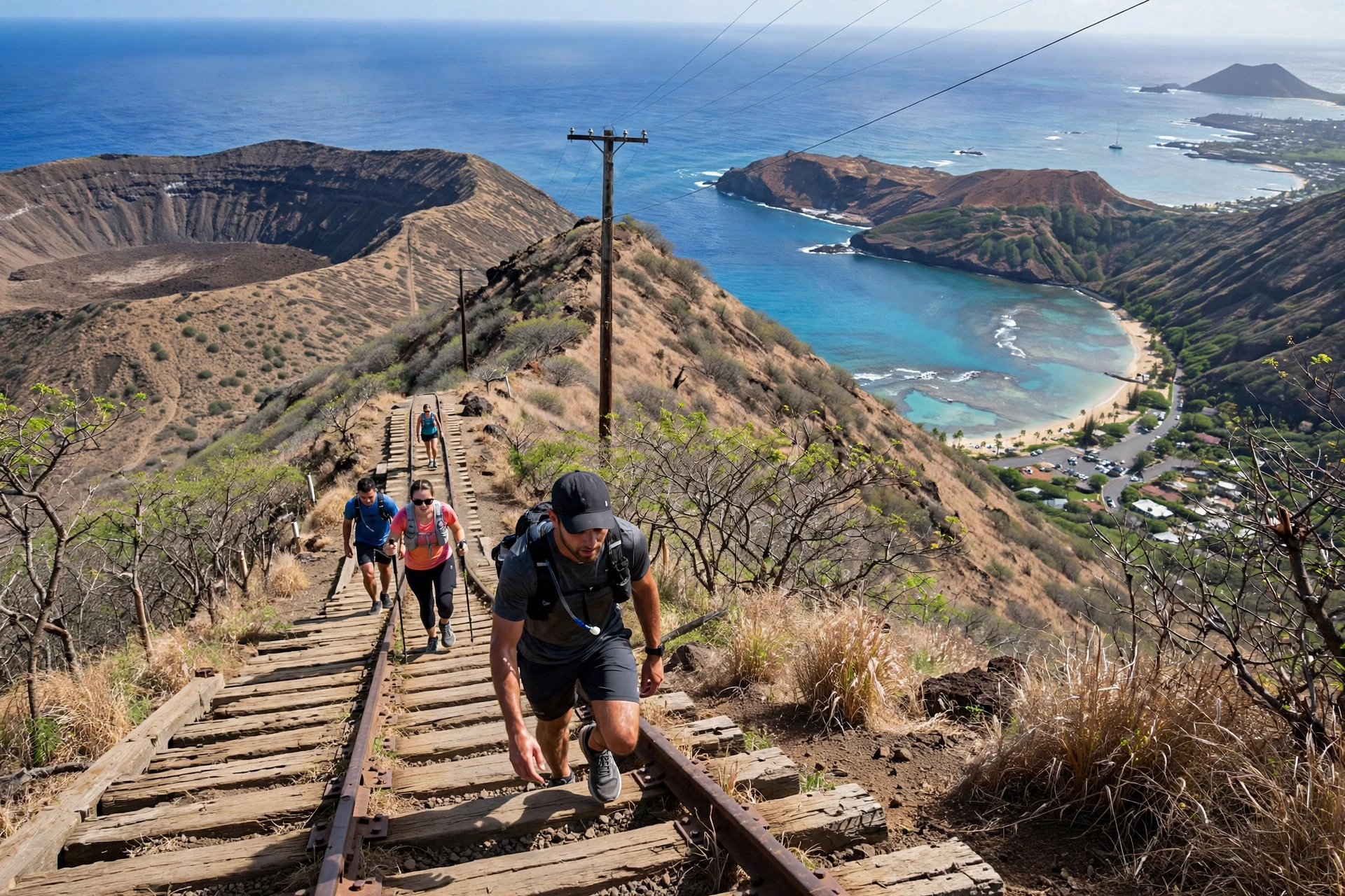
More than a thousand abandoned WWII-era railroad ties climb straight up the side of Koko Crater in one of Hawai‘i’s most brutal workouts. There are no switchbacks and no shade; it is a pure grind from the first step to the old military bunkers at the top. Locals use it as a fitness benchmark, and you will share the trail with everyone from elite athletes to first-timers questioning their life choices. The reward is a stunning panorama of Hanauma Bay, the southeastern coastline, and Honolulu. Go at sunrise to beat the heat, bring at least a liter of water, and take the bridge section seriously; the drop beneath the trestle is real.
Trailhead: Koko Head District Park parking lot, Hawai‘i Kai. Facilities: Restrooms and water at the park.
Ka‘ala via Wai‘anae (Highest Point on O‘ahu)
Distance: 7 miles round trip | Elevation gain: 3,600 feet | Time: 5 to 7 hours | Fee: None
At 4,025 feet, Ka‘ala is the highest peak on O‘ahu, and the trail to reach it is a serious undertaking. The route climbs through dry forest, up a steep ridge, and finally along an elevated boardwalk through a misty native cloud forest that feels like another world. On clear days the summit offers views of the entire island, from the Wai‘anae coast to Pearl Harbor to the Ko‘olau Range. Clear days are the exception; Ka‘ala is often wrapped in clouds, and the boardwalk can be extremely slippery. This is a full-day hike. Start early, carry 3 liters of water, and be prepared for rapidly changing weather.
Trailhead: End of Waianae Valley Road, past the forest reserve gate. Facilities: None.
Olomana Three Peaks
Distance: 4.5 miles round trip (full traverse) | Elevation gain: 1,800 feet | Time: 4 to 6 hours | Fee: None
Olomana’s three jagged peaks are the most technically demanding hike on this list and one of the most dangerous on O‘ahu. The first peak is a steep but manageable climb popular for sunrise. The traverse to the second and third peaks involves exposed rock scrambling with serious fall exposure, and multiple fatalities have occurred here. Do not attempt the full traverse unless you are an experienced scrambler comfortable with exposure, and never attempt it in wet or windy conditions. Even the first peak requires care on the descent. This trail commands respect.
Trailhead: End of Maunawili Road / Olomana Golf Course area, Kailua side. Facilities: None.
Ka‘au Crater Loop
Distance: 5.5 mile loop | Elevation gain: 1,600 feet | Time: 4 to 6 hours | Fee: None
This demanding loop climbs to the rim of Ka‘au Crater, circles it, and descends past a waterfall, combining ridge walking, a crater interior, and waterfall scenery in a single hike. The climb to the rim involves steep, muddy sections with ropes in places. The crater itself is a serene, boggy bowl that feels prehistoric. Most hikers go clockwise, tackling the steepest climbing early. The descent includes a waterfall section that can be treacherous when wet. Like all Ko‘olau hikes, skip it during or after heavy rain.
Trailhead: End of ‘Aina Koa Avenue, Pālolo Valley. Facilities: None.
Pali Puka and the Pali Notches
Distance: 1 mile round trip | Elevation gain: 400 feet | Time: 1 to 2 hours | Fee: None
Short in distance but serious in exposure, this route starts at the famous Nu‘uanu Pali Lookout and follows a narrow, crumbling path along the cliff edge to a natural stone arch (the puka) and a series of notches in the cliff with dizzying views of the Windward coast. The trail is unmaintained, the drop-offs are sheer, and the rock can be loose. This is not a hike to attempt in wind, rain, or with children. Experienced hikers only, and even they should treat every step with care. The views of Kāne‘ohe Bay from the notches are among the most dramatic accessible on foot on O‘ahu.
Trailhead: Nu‘uanu Pali Lookout parking lot on the Pali Highway. Facilities: Restrooms at the lookout.
Mt. Olympus (Awaawaloa) via Wa‘ahila Ridge
Distance: 4.4 miles round trip | Elevation gain: 1,700 feet | Time: 3 to 5 hours | Fee: None
Rising directly above Mānoa Valley, Mt. Olympus offers one of the finest Honolulu panoramas on the island, with the city spread below and the Ko‘olau summit stretching in both directions. The Wa‘ahila Ridge trail climbs steadily through forest before emerging onto the open ridge. The final section to the summit is steep and can be muddy. On clear winter mornings the air is crystalline and the views extend to Moloka‘i. The trailhead at Wa‘ahila Ridge State Recreation Area also offers picnic facilities.
Trailhead: Wa‘ahila Ridge State Recreation Area, St. Louis Heights. Facilities: Restrooms and picnic areas at the park.
Kalihi Saddle
Distance: 5 miles round trip | Elevation gain: 2,000 feet | Time: 4 to 6 hours | Fee: None
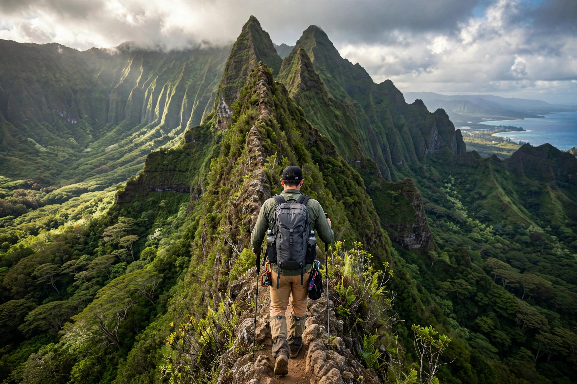
For hikers who want the remoteness of the Ko‘olau summit without the crowds, the Kalihi Saddle route climbs from Kalihi Valley to a saddle on the crest with views down both the Honolulu and Windward sides. The trail is rough, often overgrown, and requires route-finding skills in places. This is a hike for experienced island hikers who are comfortable being far from help. The payoff is a genuine wilderness experience minutes from the city, in cloud forest that few visitors ever see.
Trailhead: End of Kalihi Valley roads; research current access before going. Facilities: None.
O‘ahu Hikes by Region
Grouping trails by region helps you plan efficient days. O‘ahu is small, but traffic can turn a 20-mile drive into an hour, so clustering hikes geographically saves real time.
Honolulu and Diamond Head Area
The island’s most accessible hiking sits within 20 minutes of Waikīkī. Diamond Head, Koko Head Stairs, Makapu‘u Lighthouse, Mariner’s Ridge, and Kuli‘ou‘ou Ridge all lie along the southeastern corridor. You can easily combine Diamond Head at sunrise with Makapu‘u later in the morning, or pair Koko Head with a swim at nearby Hanauma Bay (reservations required for the bay). The Tantalus trail system, including Pu‘u ‘Ōhi‘a, sits just above downtown and makes an excellent rainy-day option since the forest canopy provides cover.
Windward (East) O‘ahu
The lush Windward side holds Lanikai Pillbox, Maunawili Falls, Olomana, Ka‘au Crater, Judd Trail, and Likeke Falls. Kailua makes the ideal base for this cluster, with its excellent beaches for post-hike recovery. The Ko‘olau mountains trap moisture here, so Windward trails are the muddiest on the island; plan accordingly and consider hiking them after a few dry days.
North Shore and Central O‘ahu
The famous surf towns are not primarily a hiking destination, but Ka‘ena Point’s western trailhead, Waimea Valley, and the ‘Aiea Loop are all within easy reach. The North Shore’s best contribution to hikers is recovery: nothing restores tired legs like an afternoon at Waimea Bay or a shave ice in Hale‘iwa. Central O‘ahu’s trails, including the Wai‘anae-side routes, see the fewest visitors.

Leeward (West) O‘ahu
The dry Wai‘anae coast offers Ka‘ala, the island’s highest peak, and the Ka‘ena Point western approach. This is the hottest, driest part of the island, so Leeward hikes are best in winter or early morning. The sunsets from the Wai‘anae Range are spectacular, but do not plan to descend unfamiliar trails in the dark.
What to Pack for Hiking O‘ahu
O‘ahu’s trails punish the unprepared and reward the well-equipped. The combination of tropical sun, sudden rain, and famously slick mud means your packing list matters more here than on most mainland day hikes.
- Footwear with real tread. Trail runners or hiking shoes with aggressive lugs are essential. The mud on ridges like Kuli‘ou‘ou and the rocks on Olomana are treacherous in smooth-soled shoes. Many local hikers wear tabis (reef shoes) or dedicated mud shoes they do not mind destroying.
- Water, more than you think. Carry at least one liter for every two hours of hiking, and double that for exposed routes like Koko Head or Ka‘ena Point. There is no potable water on any trail in this guide except at a few trailhead parks.
- Sun protection. Hawai‘i’s sun is intense year-round. Use reef-safe sunscreen (Hawai‘i law bans sunscreens containing oxybenzone and octinoxate), a hat, and sunglasses. Ridgeline trails offer zero shade.
- Rain gear. A lightweight rain shell weighs almost nothing and can save a hike when the inevitable afternoon shower arrives. A dry bag or ziplock for your phone is equally wise.
- Headlamp. Even for day hikes. If you are delayed, descending a muddy ridge in the dark without light is genuinely dangerous. Sunrise hikers need one for the ascent.
- First aid basics. Blister treatment, antiseptic wipes, and bandages. Cuts in tropical environments can become infected quickly, so clean and cover any wound promptly.
- Snacks and electrolytes. The humidity accelerates dehydration. Salty snacks and electrolyte drinks help on longer hikes like Ka‘ala.
For a complete trip packing checklist beyond hiking gear, see our Hawai‘i Packing List Generator tool.
Trail Safety and Etiquette
Safety
- Check conditions before you go. The Hawai‘i DLNR Na Ala Hele website lists official trail closures and alerts. After heavy rain, assume all valley and ridge trails are hazardous until they dry.
- Never cross flooded streams. Flash floods kill hikers in Hawai‘i. If water is rising or the sky is dark upstream, turn back immediately. Most drownings happen when hikers try to cross or are caught in narrow valleys.
- Stay on marked trails. Social trails and shortcuts cause erosion, damage native plants, and lead hikers onto dangerous terrain. The “Stairway to Heaven” (Ha‘ikū Stairs) is illegal to access and the state actively fines trespassers; do not attempt it.
- Tell someone your plan. Leave your intended trail and return time with someone reliable. Cell service is unreliable on many ridges and valleys.
- Do not drink stream water. Leptospirosis, a bacterial disease carried in the urine of wild animals, is present in Hawai‘i’s freshwater. Cover open cuts and avoid swallowing stream or waterfall water.
- Respect kapu areas. Some trails pass near sacred sites marked with signs. Do not enter, stack rocks, or remove anything.
Etiquette
- Leave No Trace. Pack out everything, including food scraps and tissues. O‘ahu’s trails see heavy use; your care keeps them enjoyable.
- Yield appropriately. Uphill hikers have the right of way. Step aside for trail runners only where it is safe to do so.
- Keep noise down. Many of these trails pass through residential neighborhoods at their trailheads. Keep voices low in the early morning, park legally, and never block driveways. Residents near popular trailheads like Lanikai and Kuli‘ou‘ou deal with hiker traffic daily; be a good guest.
- Do not feed wildlife or leave food. This includes the feral chickens you will meet everywhere. They do not need your help.
Best Time to Hike O‘ahu
O‘ahu is hikeable year-round, but conditions vary meaningfully by season. The dry season (April through October) brings more reliable weather, firmer trails, and calmer conditions on exposed ridges. Mornings are almost always the best time to hike: trade winds are lighter, temperatures are cooler, and the island’s famous cloud buildup over the mountains typically arrives after noon.
The wet season (November through March) makes waterfall hikes like Mānoa Falls and Maunawili Falls more dramatic, but it also makes every trail muddier and increases flash flood risk in valleys. Winter brings the biggest surf to the North Shore, which does not affect hiking directly but does make post-hike beach stops more hazardous for swimming.
Whale season (December through May) adds a bonus to coastal hikes like Makapu‘u Lighthouse and Ka‘ena Point. Sunrise hikes are spectacular year-round; in summer the sun rises around 5:50 AM, in winter around 7:00 AM, so plan your alarm accordingly.

Frequently Asked Questions About O‘ahu Hikes
What is the best hike on O‘ahu for beginners?
Diamond Head is the classic first hike: short, well-maintained, and spectacular. For a quieter introduction, try Makapu‘u Point Lighthouse (paved, whale watching in winter) or the Mānoa Falls rainforest walk. All three deliver big scenery for modest effort.
Do I need a permit or reservation to hike on O‘ahu?
Most trails require no permit. The major exception is Diamond Head State Monument, where out-of-state visitors must book entry online in advance; walk-ins are not accepted. Waimea Valley requires paid admission. Always verify current requirements on the Hawai‘i DLNR Na Ala Hele website before your trip, as rules change.
What is the hardest hike on O‘ahu?
The Olomana Three Peaks traverse is widely considered the most technically demanding, with exposed scrambling between peaks. For pure physical difficulty, the Ka‘ala summit hike (7 miles, 3,600 feet of gain) and the Koko Head Stairs (1,200 feet straight up) are the toughest workouts.
Are O‘ahu hiking trails safe?
The trails in the easy and moderate sections of this guide are safe for prepared hikers who check weather, carry water, and stay on marked paths. The challenging trails carry real risk: falls, flash floods, and heat illness injure hikers every year. Match the trail to your experience, never hike alone on remote routes, and turn back when conditions deteriorate.
Can you hike the Stairway to Heaven (Ha‘ikū Stairs)?
No. Accessing the Ha‘ikū Stairs is illegal, and the state enforces trespassing fines. The stairs are being removed. Do not attempt to access them through neighborhood routes; it disrespects residents and risks serious legal consequences.
What should I do if I get lost on a trail?
Stop moving, stay on the trail, and call 911. Honolulu Fire Department handles trail rescues on O‘ahu. Conserve your phone battery, make yourself visible, and do not attempt cross-country shortcuts, which is how lost hikers become injured hikers.
Are there snakes or dangerous animals on O‘ahu trails?
Hawai‘i has no native snakes and no large predators. The realistic animal concerns are feral pigs (give them space), centipedes (watch where you put your hands), and mosquitoes in wet valleys. The ocean, not the forest, holds the island’s dangerous wildlife.
Can I bring my dog hiking on O‘ahu?
Dogs are allowed on many Na Ala Hele trails but must be leashed. They are not permitted in State Natural Area Reserves like Ka‘ena Point, which protect nesting seabirds. Always check the specific trail’s rules, carry water for your dog, and be aware that some ridges are too hot and exposed for dogs.
How muddy are O‘ahu trails really?
Extremely, especially on the Windward side and after rain. Trails like Maunawili Falls, Kuli‘ou‘ou, and ‘Aiea Loop can be slick for days after a storm. Wear shoes with aggressive tread, accept that you will get dirty, and consider gaiters for longer hikes. If you dislike mud, stick to paved routes like Makapu‘u or hike during the dry season.
What is the best sunrise hike on O‘ahu?
Lanikai Pillbox is the favorite: a short climb rewarded with the sun rising between the Mokulua Islands. Diamond Head at the 6 AM opening is the classic alternative. For experienced hikers, the Olomana first peak sunrise is unforgettable. Bring a headlamp for any pre-dawn ascent.
How long does the Koko Head Stairs hike take?
Fit hikers finish the round trip in about 1.5 hours; most visitors take 2 to 3 hours including rest stops and time at the top. There is no shame in a slow time. The stairs do not care about your pace, only that you keep moving and stay hydrated.
Is hiking free on O‘ahu?
Nearly all trails are free. You will pay for Diamond Head entry and parking (non-residents), Waimea Valley admission, and Mānoa Falls trailhead parking. Everything else in this guide costs nothing but effort.
Related Guides
Continue planning your island adventures with these related guides:
- Maui Hikes: Complete Guide: the Valley Isle’s best trails, from Haleakalā to the West Maui Mountains
- Big Island Hikes: Complete Guide: volcano trails, Waipi‘o Valley, and high-altitude routes
- Hawai‘i Waterfalls: Complete Guide: the islands’ most spectacular falls, island by island
- Hawai‘i Map: Complete Reference: trailhead locations, driving distances, and regional maps
- Maui Beaches: Complete Guide: recover from your hikes on the Valley Isle’s best sand
- Hawai‘i Packing List Generator: build a custom packing list for your trip, including hiking gear
Planning Your O‘ahu Hiking Days
O‘ahu rewards hikers who match the trail to the day. Start exposed ridges and grinds like Koko Head at dawn before the heat builds. Save waterfall walks like Mānoa Falls for afternoons when the forest canopy provides shade. After a heavy rain, skip the muddy Windward valleys and head for paved Makapu‘u or the dry ridges above Hawai‘i Kai. Cluster your hikes by region to spend less time in traffic and more time on trail, and always leave one flexible day in your itinerary: the hike you will remember most is often the one you choose based on that morning’s sky.