
Maui is often called the Valley Isle, but it could just as easily be called the island of many towns. Each of its communities has a distinct personality shaped by geography, history, and the people who live there. The sunny resort corridors of the west and south feel like a different world from the misty farm towns of Upcountry or the remote quiet of Hāna on the far east coast. Understanding where each town sits on the map and what it offers is one of the most useful steps in planning a Maui trip, because where you base yourself shapes every day of your visit.
This guide covers every major town on Maui, from the historic streets of Lahaina to the plantation-era storefronts of Pāʻia. You will find practical orientation for each community, what each area is known for, and how the towns connect to one another by road.
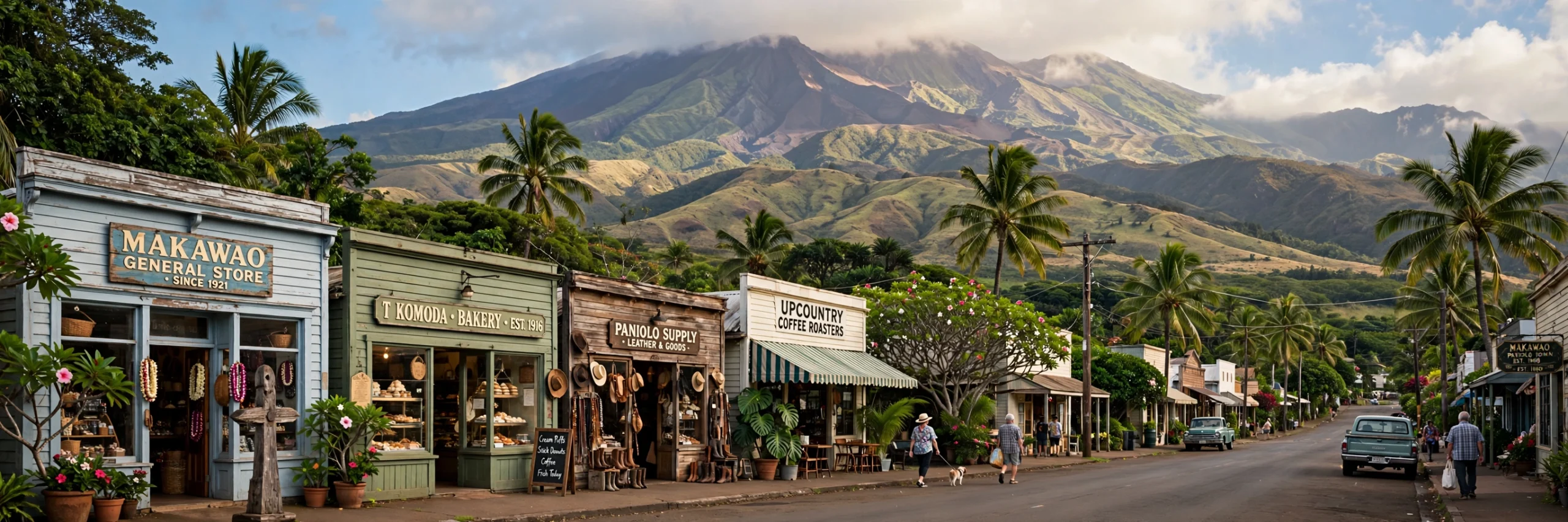
On This Page
Maui Towns at a Glance
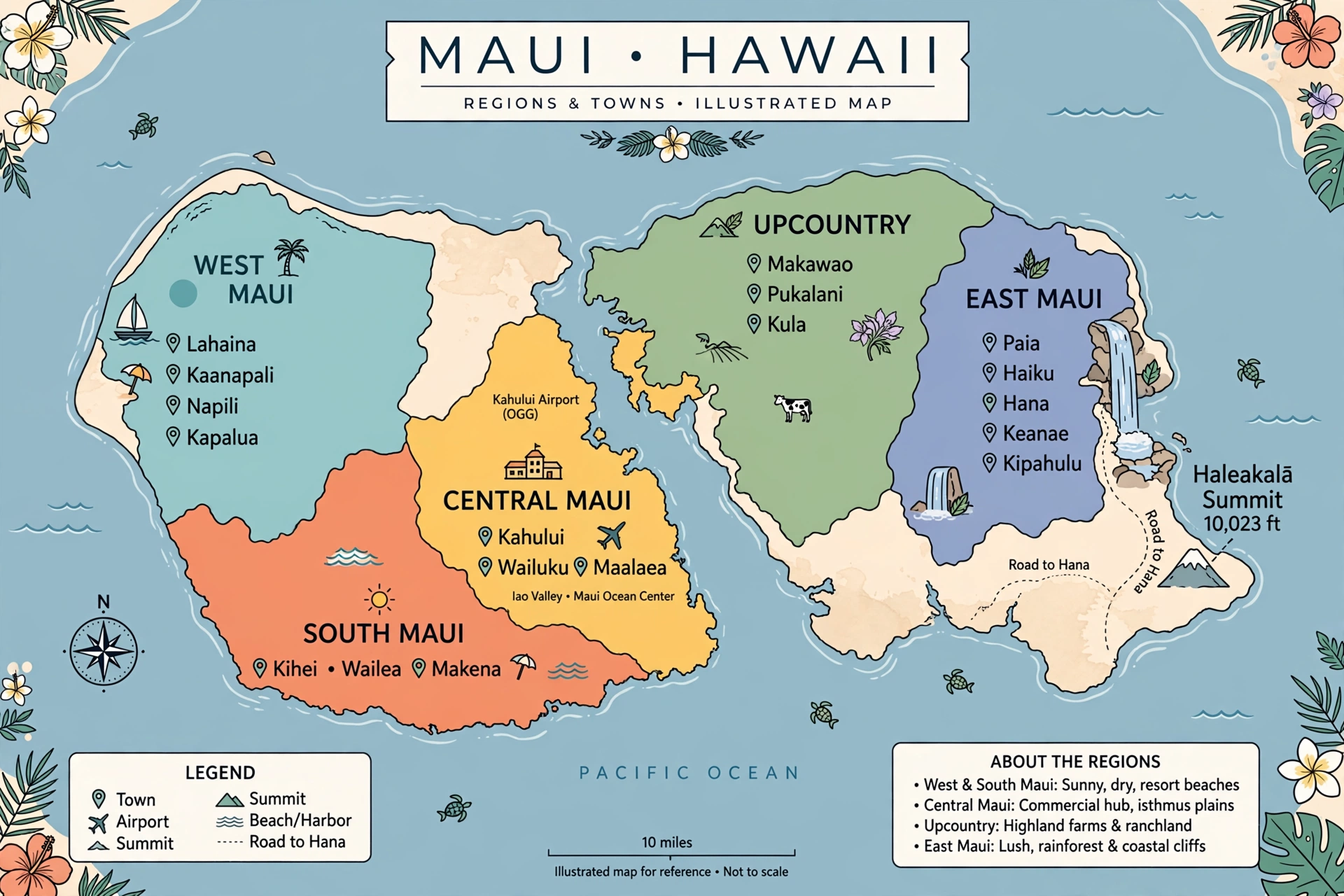
Maui is the second largest island in the Hawaiian chain, covering about 727 square miles. Its shape is often described as two volcanic masses joined by a low isthmus: the older West Maui Mountains on the west side and the massive shield of Haleakalā on the east. The towns grew up around the island’s coasts and fertile slopes, and their character still reflects the landscapes around them.
The island’s communities fall into several natural clusters. West Maui holds the historic town of Lahaina and the resort corridor that runs north through Kāʻanapali, Nāpili, and Kapalua. South Maui includes Kīhei, Wailea, and Mākena, strung along some of the island’s sunniest coastline. Central Maui is the island’s working heart, with Kahului’s harbor and airport, Wailuku’s county offices and historic streets, and the lush ʻĪao Valley just inland. Upcountry Maui sits on the western slopes of Haleakalā, where Makawao, Kula, Pukalani, and Pāʻia enjoy cooler air and farm-country scenery. East Maui is the remote windward side, anchored by the small town of Hāna at the end of the famous coastal highway.
Weather varies sharply between these clusters. West and South Maui sit in the rain shadow of the West Maui Mountains and Haleakalā, which is why they are the island’s sunniest and driest areas. Central Maui’s isthmus can be breezy, especially in the afternoons. Upcountry runs noticeably cooler, with Kula sitting around 3,000 feet above sea level. East Maui and the windward slopes catch the trade-wind rain that keeps Hāna and the Road to Hana corridor famously green. For a fuller picture of these patterns, see our Maui weather guide.
Each town also carries a different history. Lahaina was once the capital of the Hawaiian Kingdom and later a rough whaling port. Wailuku grew as the seat of county government and the commercial center of the sugar era. Pāʻia and Makawao are former plantation and ranch towns that reinvented themselves. Kahului is the modern face of the island, with the main harbor, the airport, and the island’s largest shopping center. Knowing a little of this background makes the towns far more interesting to explore.
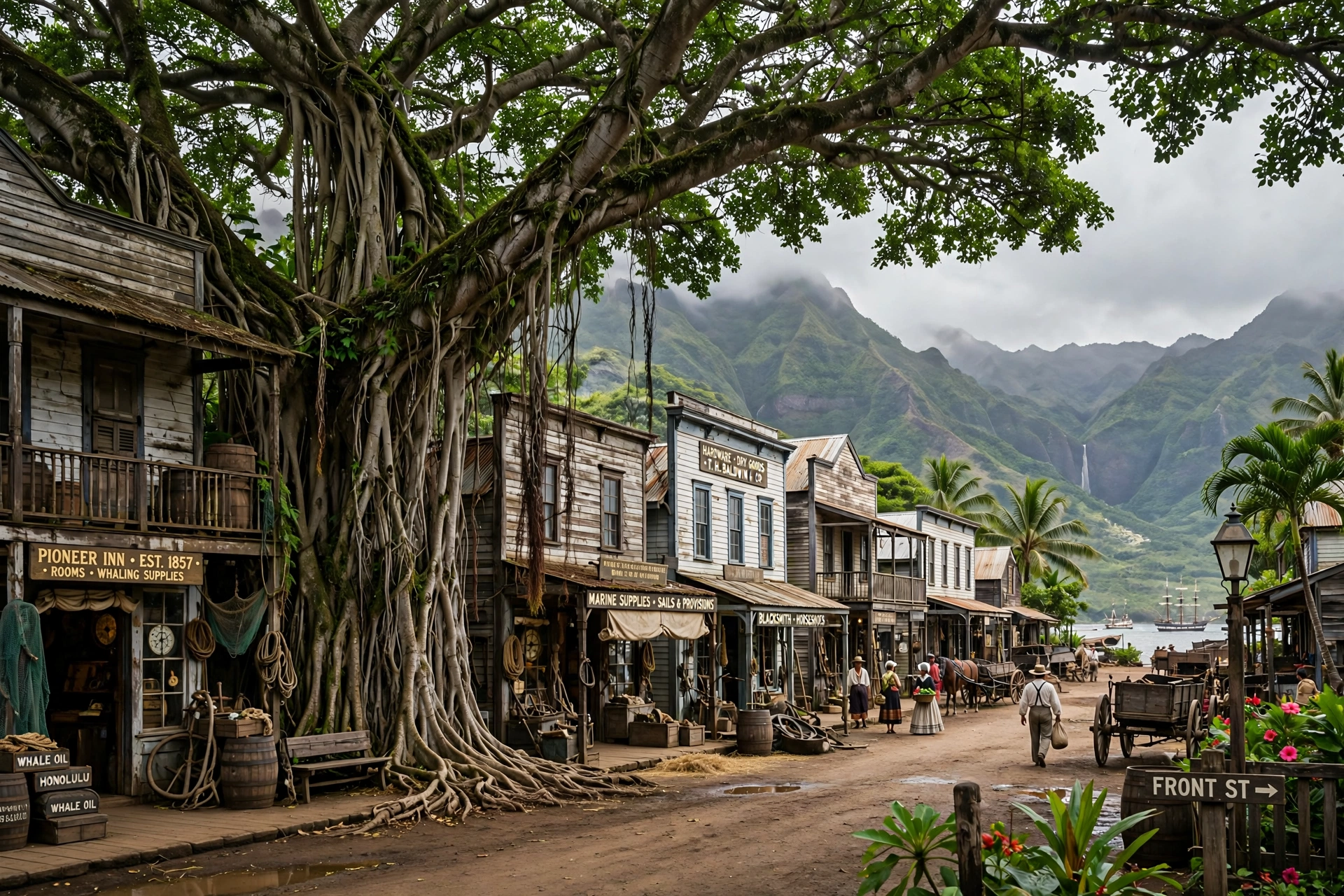
West Maui Towns
West Maui is the island’s most visited region, and for good reason. It combines historic character, long sandy beaches, and the calmest ocean conditions on the island for much of the year. The towns here run along Honoapiʻilani Highway (Route 30) from south to north, with the West Maui Mountains rising steeply on the inland side.
Lahaina
Lahaina is one of the most historically significant towns in all of Hawaiʻi. It served as the capital of the Hawaiian Kingdom from 1820 to 1845, when the seat of government moved to Honolulu. In the mid-1800s it became a booming whaling port, and its Front Street waterfront grew into a lively district of shops, inns, and gathering places. The famous banyan tree in the town square, planted in 1873, grew into one of the largest banyan trees in the United States, shading nearly an entire city block.
On August 8, 2023, a catastrophic wildfire swept through Lahaina, destroying much of the historic town and taking more than 100 lives. It was one of the deadliest wildfires in modern American history, and its impact on the community is still deeply felt. Recovery and rebuilding have been underway since, with residents, cultural leaders, and officials working to restore the town while honoring what was lost. Visitors should approach Lahaina with respect and awareness: some areas remain closed or under reconstruction, while other parts of West Maui are fully open and welcoming. Before visiting, check current conditions through official Maui County sources.
Even amid recovery, Lahaina’s historical importance endures. The Baldwin Home, the oldest standing house on Maui, and the Wo Hing Temple Museum speak to the town’s layered past. When the town fully reopens, its art galleries, waterfront setting, and deep history will again make it a natural stop on any West Maui itinerary.
Kāʻanapali
Just north of Lahaina, Kāʻanapali was developed in the 1960s as Hawaiʻi’s first master-planned resort community, and it set the template for resort development across the islands. Its three miles of golden sand were once named the best beach in America, and the beach remains one of Maui’s most reliable places for swimming, sunbathing, and beginner-friendly ocean conditions.
The northern end of the beach is marked by Puʻu Kekaʻa, known as Black Rock, a lava point where a nightly cliff-diving ceremony honors the legend of Kahekili, a Maui chief who leapt from the rock. The reef around Black Rock is one of West Maui’s most popular snorkeling spots. A paved beachwalk runs the length of the resort area, lined with hotels, shops, and restaurants, making Kāʻanapali one of the most walkable resort districts on the island. For a detailed look at the beach itself, see our Kāʻanapali Beach map guide.
Honokōwai, Kahana, and Nāpili
Continuing north along the coast, the smaller communities of Honokōwai, Kahana, and Nāpili offer a quieter version of West Maui. These are primarily residential and condominium areas with a local, low-key feel. Nāpili Bay is the standout here: a picture-perfect crescent of white sand with calm water that is excellent for swimming and snorkeling when conditions are calm. The pace in these towns is slower, the beaches less crowded, and the sunsets just as spectacular.
Kapalua
At the northern end of the resort corridor, Kapalua sits where the coastline turns rugged and dramatic. The Kapalua Coastal Trail is one of Maui’s best easy walks, tracing lava-rock shoreline past tide pools and ocean overlooks. Nearby, the strange lava formations at Dragon’s Teeth and the clear waters of Honolua Bay, a marine reserve popular with snorkelers and surfers, show a wilder side of West Maui. Kapalua feels more secluded than Kāʻanapali, with luxury resorts set among rolling green fairways and ironwood forests.
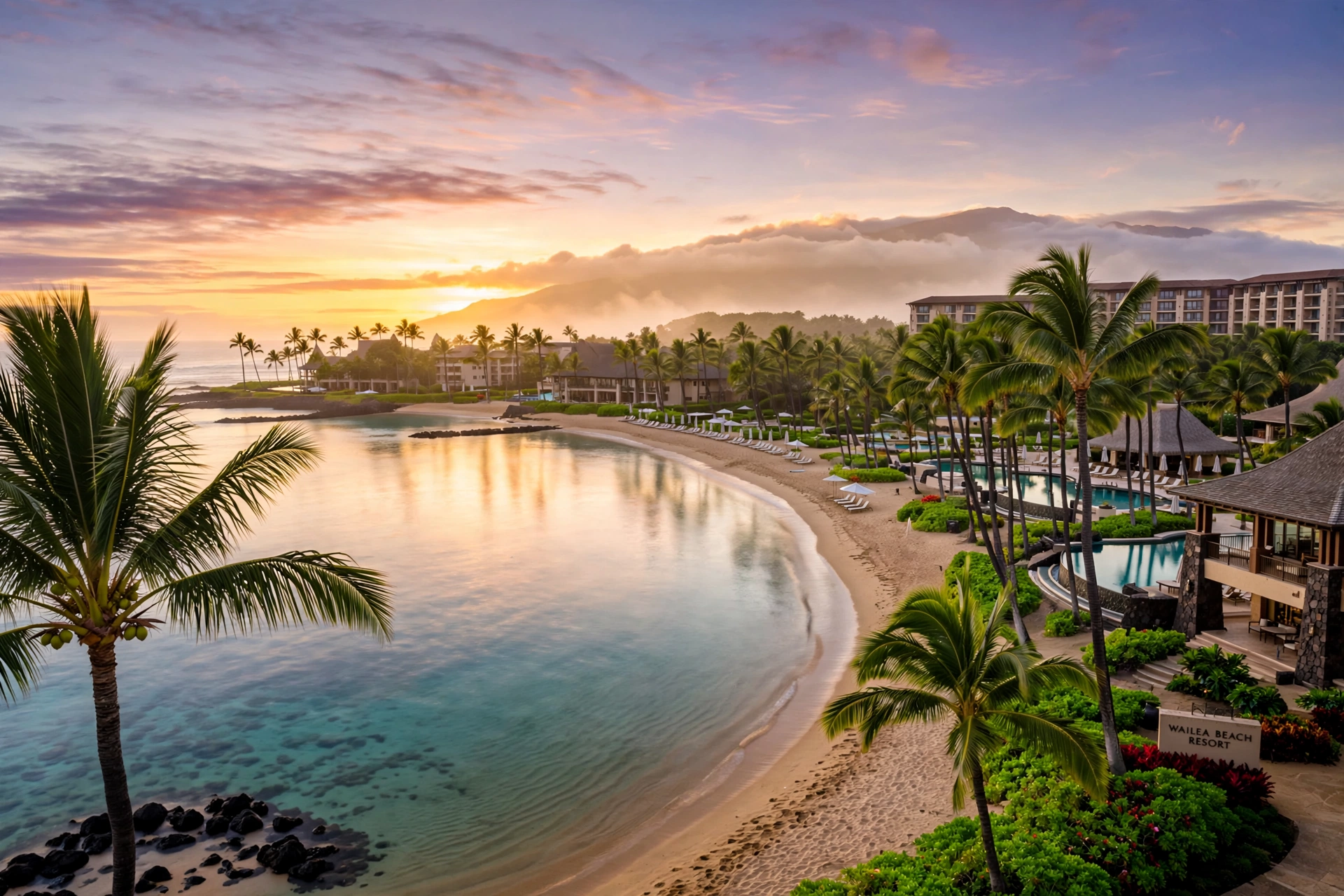
South Maui Towns
South Maui faces the sun. Sheltered by Haleakalā from the trade winds, this coast gets some of the most reliable sunshine on the island, with calm mornings and breezy afternoons. The towns here run along South Kīhei Road and Piʻilani Highway (Route 31) from north to south.
Kīhei
Kīhei is South Maui’s main town and its most down-to-earth community. It stretches for about six miles along the coast, lined with the Kamaole Beach Parks (known locally as Kam I, Kam II, and Kam III), which are among the island’s most popular family beaches. Unlike the planned resort areas to the south, Kīhei grew organically, and it shows in the best way: a long strip of casual restaurants, shave ice stands, farmers markets, and local shops along South Kīhei Road.
Kīhei is also one of the most practical bases on the island. It has grocery stores, affordable dining, and easy access to both the Wailea resort area and the road up to Haleakalā. The town has a strong local community, and its beaches fill with residents on weekends. Snorkeling is good at several spots along the coast, and the sunsets over the offshore islands of Kahoʻolawe and Lānaʻi are a nightly event.
Wailea
South of Kīhei, Wailea is Maui’s upscale resort district, a carefully landscaped enclave of luxury hotels, high-end shops, and championship golf courses. The Wailea Beach Path is a highlight: a scenic oceanfront walkway connecting the area’s beaches, including Wailea Beach and Ulua Beach, both known for calm water and excellent snorkeling.
Wailea feels polished and serene, with manicured grounds, fine dining, and some of the island’s most photographed sunsets. It is a popular choice for travelers who want a refined, quiet base with top-tier beaches steps away. The Shops at Wailea provide the area’s main retail and dining hub.
Mākena
Past Wailea, the development thins out and the landscape turns wilder. Mākena is home to Mākena State Park, where Big Beach (Oneloa Beach) stretches for two-thirds of a mile of deep golden sand backed by the cinder cone of Puʻu Olaʻi. It is one of the most dramatic beaches on Maui, though its powerful shorebreak means swimming requires caution and respect for ocean conditions.
The road ends at La Perouse Bay, where the last lava flow on Maui reached the sea in the late 1700s. A coastal trail leads from here into the ʻĀhihi-Kīnaʻu Natural Area Reserve, a stark and beautiful lava landscape. Mākena has a remote, end-of-the-road feeling that contrasts sharply with the resort polish just a few miles north.
Central Maui Towns
The low isthmus between the West Maui Mountains and Haleakalā is the island’s working center. This is where most of Maui’s residents live and work, and while it gets less attention from visitors, it holds some of the island’s most interesting history and scenery.
Kahului
Kahului is Maui’s largest town and its commercial hub. The island’s main airport (OGG) sits here, along with the deep-draft harbor at Kahului Bay, the island’s largest shopping center (Queen Kaʻahumanu Center), and big-box stores that make it the practical stop for supplies. Most visitors pass through Kahului at the start and end of their trips without stopping, but it is worth a look for its local food scene and everyday island life. Our Maui airport guide covers the OGG area in detail.
Wailuku
Just west of Kahului, Wailuku is the county seat and one of Maui’s most characterful towns. Its historic Market Street district has a small-town main street feel, with local shops, cafes, and historic buildings dating to the plantation era. Wailuku was the center of political power in old Maui, and the area around it saw the pivotal Battle of Kepaniwai in 1790, when Kamehameha the Great defeated the Maui chiefs.
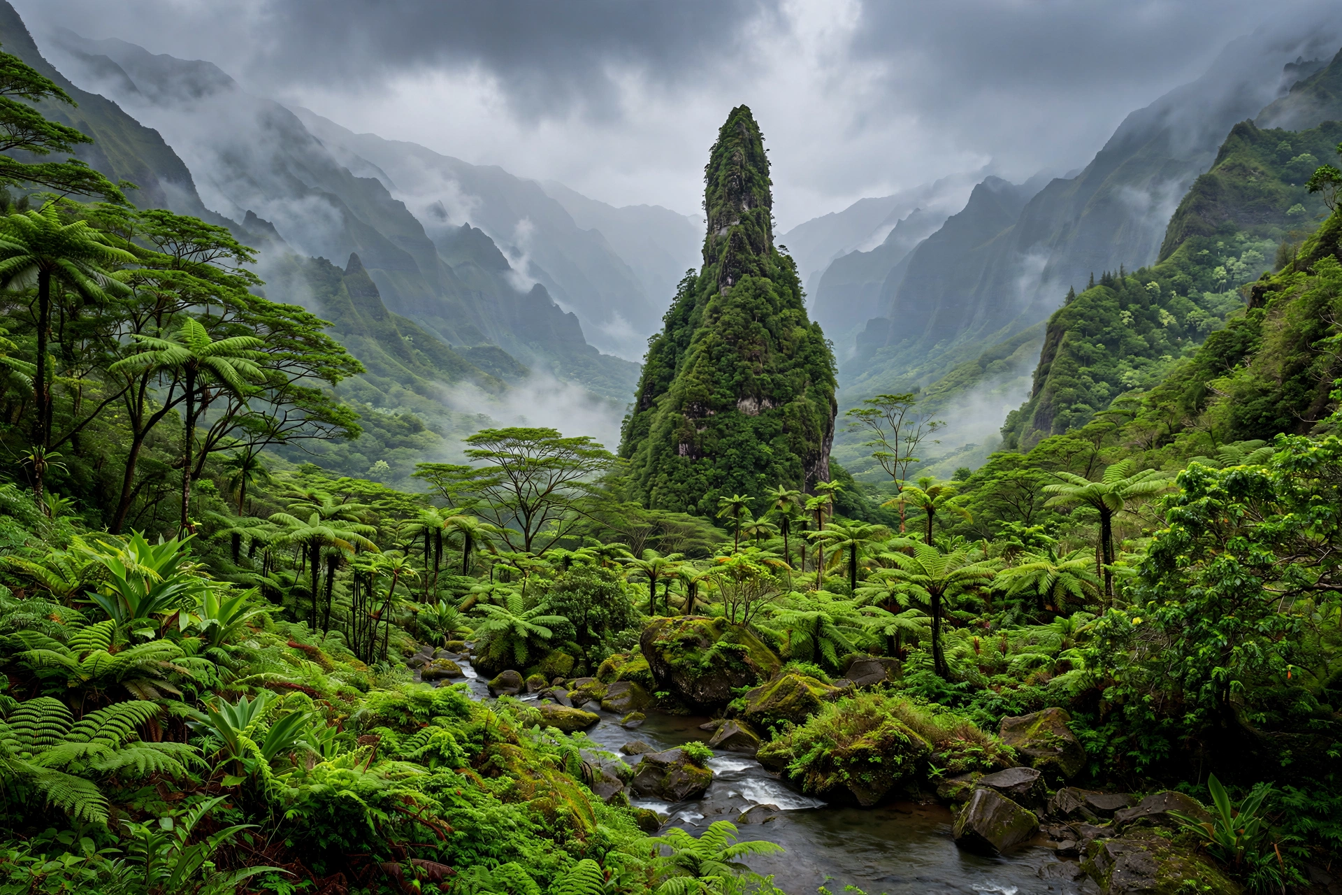
Wailuku is also the gateway to ʻĪao Valley State Monument, one of Maui’s most beautiful and culturally significant places. The emerald ʻĪao Needle, a 1,200-foot lava remnant draped in green, rises above a valley that was sacred to Hawaiian royalty. The valley is an easy drive from town and makes a rewarding half-day trip.
ʻĪao Valley
Technically a valley rather than a town, ʻĪao deserves mention because it anchors Central Maui’s identity. The state monument includes short paved trails with views of the Needle, a small botanical garden, and interpretive signs about the valley’s history. It is one of the wettest places on the island, so the landscape is lush year-round, and rain showers are common even on sunny days elsewhere.
Upcountry Maui Towns
Upcountry Maui occupies the western slopes of Haleakalā, from about 1,000 to over 3,000 feet in elevation. The air is cooler, the pace is slower, and the landscape looks more like farm country than tropical beach. This is ranching and farming territory, with a strong paniolo (Hawaiian cowboy) heritage, and its towns have a distinctive rural charm.
Makawao
Makawao is the heart of paniolo country. This former ranch town keeps its Old West character in its wooden storefronts and boardwalks, but today it is better known as an arts community, with galleries, boutiques, and studios lining Baldwin Avenue. The Makawao Rodeo, held each Fourth of July weekend, is one of the island’s biggest local events. The town is a good stop for lunch or browsing on the way up or down the mountain.
Kula
Kula spreads across the upper slopes in a patchwork of farms, flower fields, and country estates. At around 3,000 feet, it can be 10 to 15 degrees cooler than the beaches below, and on clear days the views stretch across the isthmus to the West Maui Mountains. The Kula Botanical Garden and local farm stands selling fresh produce, flowers, and Maui onions make it a pleasant area to explore. Kula is also the starting point for the road up to Haleakalā’s summit.
Pukalani and Hāliʻimaile
Pukalani is a quiet residential community that serves as Upcountry’s practical center, with a supermarket, schools, and everyday services. Nearby Hāliʻimaile grew around the old pineapple plantation and is now known for its distillery and a well-regarded restaurant set in a historic plantation building. Both towns give a glimpse of the residential, working side of Upcountry life.
Pāʻia
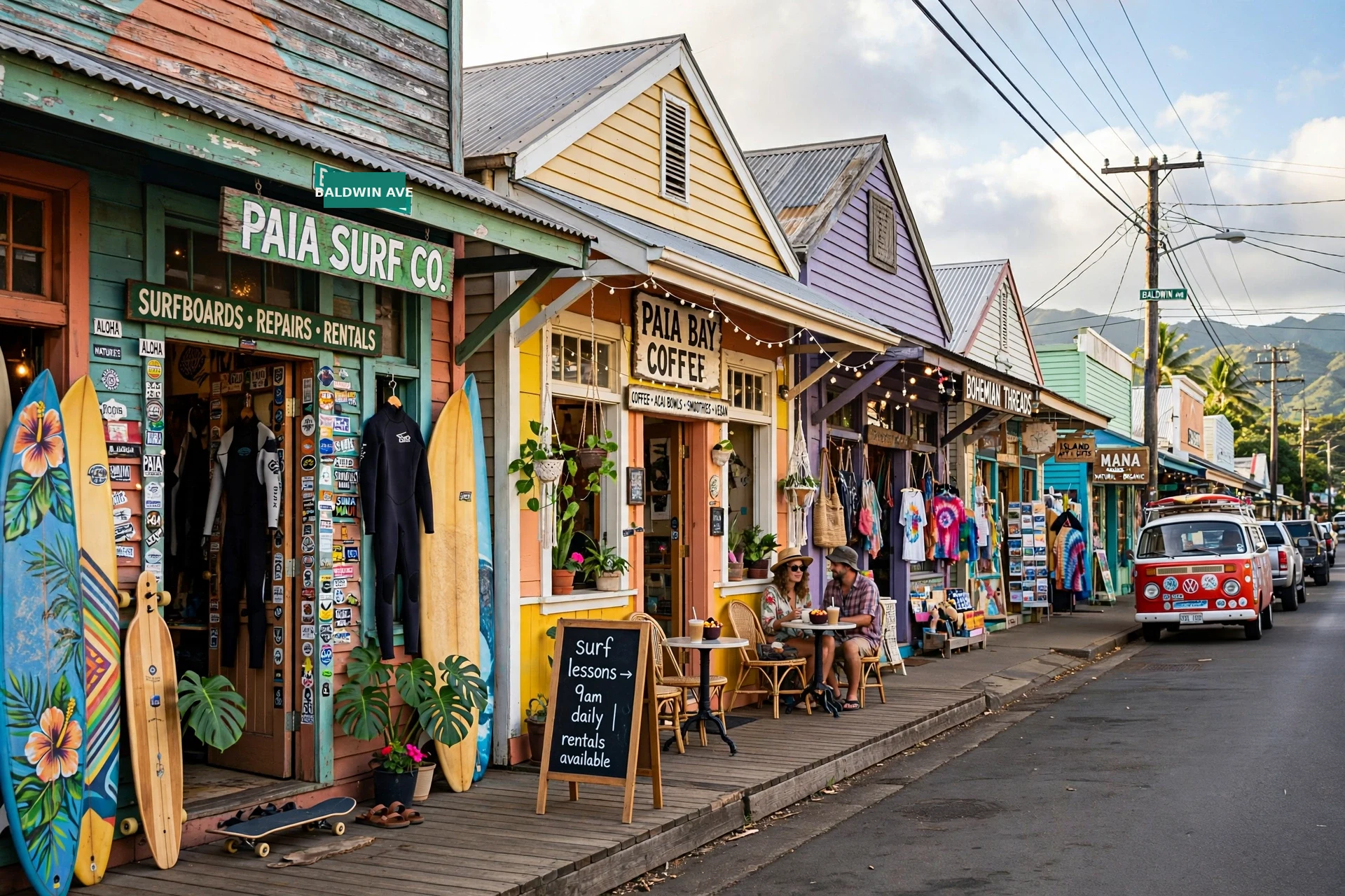
On the North Shore at the start of the Road to Hana, Pāʻia is a former sugar plantation town turned bohemian surf hub. Its colorful storefronts house surf shops, organic cafes, boutiques, and art galleries, and the town has a lively, youthful energy. Just east of town, Hoʻokipa Beach Park is one of the world’s most famous windsurfing spots and a reliable place to see Hawaiian green sea turtles resting on the sand. Pāʻia is the last real town before the Hāna Highway narrows into its winding coastal journey, so it is the natural place to fuel up, grab food, and check conditions before heading east.
East Maui Towns
East Maui is the island’s remote windward side, reached by the winding Hāna Highway. This is the wettest, greenest part of Maui, with rainforest, waterfalls, and small communities that feel far removed from the resort coasts.
Haʻikū
Haʻikū sits in the rolling country between Pāʻia and the start of the truly winding section of the Hāna Highway. It is a spread-out community of farms, country homes, and rural subdivisions rather than a compact town center, but it has a growing food scene and a laid-back, alternative character. Nearby, the famous big-wave surf break at Peʻahi, known as Jaws, draws elite surfers when winter swells arrive.
Hāna
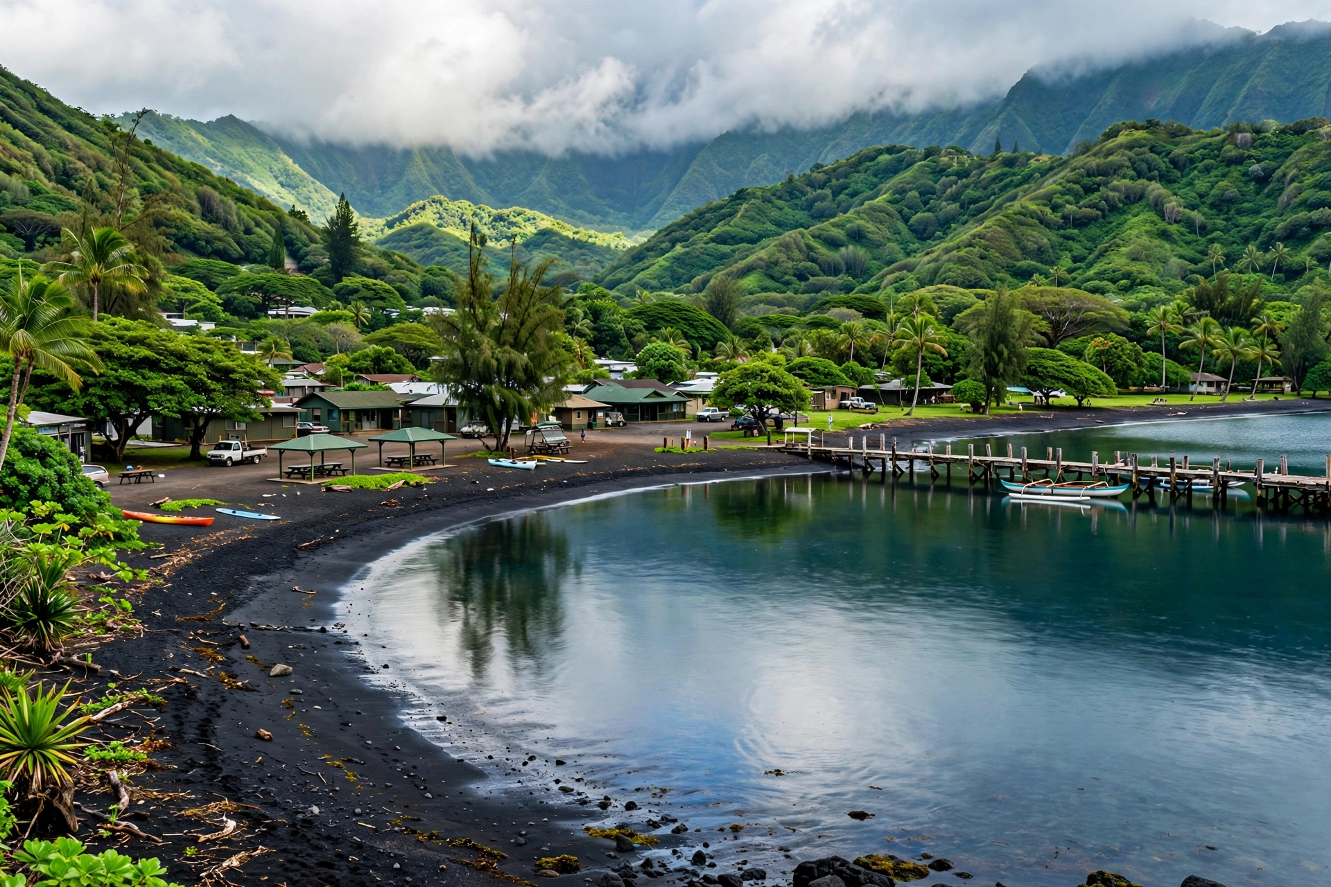
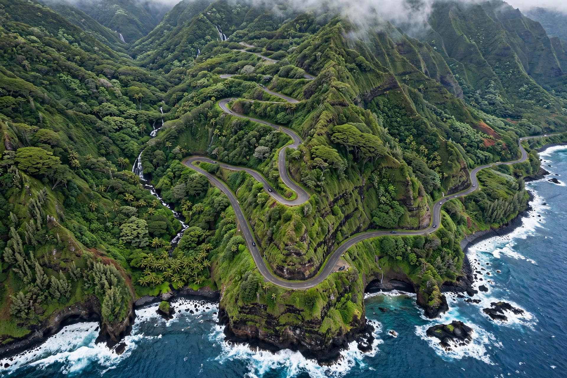
Hāna is one of the most isolated towns in Hawaiʻi, sitting near the eastern tip of Maui at the end of the Road to Hana. The journey there is famously slow: the highway narrows to a winding two-lane road with more than 600 curves and dozens of one-lane bridges. The reward is a quiet town surrounded by some of the island’s most beautiful scenery, including Hāna Bay’s black-sand beach, the red-sand beach at Kaihalulu, and the waterfalls and pools of the Kīpahulu district in Haleakalā National Park.
Hāna has a small year-round community with deep roots, and visitors should be mindful that this is a real hometown, not a resort outpost. Services are limited, so arrive with a full tank of gas and supplies. Many travelers visit as a long day trip, but staying overnight lets you experience the town’s peaceful mornings and evenings after the day-trippers leave. For the full journey, see our Road to Hana map guide.
Smaller Communities Worth Knowing
Beyond the main towns, several smaller communities dot the island and are worth knowing for navigation and day trips. Māʻalaea sits at the junction of the West Maui and South Maui highways, a small harbor village known for the Maui Ocean Center aquarium and as the departure point for whale watching and snorkeling boats to Molokini. Olowalu, just north of Māʻalaea on the west side, is a quiet stretch with a general store, a popular snorkeling reef, and some of the island’s oldest cultural sites.
On the North Shore between Pāʻia and Haʻikū, Spreckelsville is a former plantation village turned upscale beachfront neighborhood, while Kuau is a tiny surf community with a beloved local beach park. Upcountry, Keokea and ʻUlupalakua sit at the southern end of the Kula area, where the rural landscape gives way to ranch land and the historic ʻUlupalakua Ranch. These small places rarely make the guidebooks, but they are part of what makes driving around Maui feel like a journey through real communities rather than a tour of attractions.
Where to Base Yourself
Where you stay on Maui shapes your trip, so it is worth matching your base to your travel style. There is no single best answer, only the best fit for what you want to do.
First-time visitors who want beaches and convenience usually do best in West or South Maui. Kāʻanapali and Wailea offer the classic resort experience with top beaches, dining, and activities close at hand. Kīhei gives you similar beach access with a more casual, affordable, and local feel, plus a central location for day trips.
Travelers seeking quiet and local character might prefer Nāpili or Kapalua in West Maui, where the pace is slower and the scenery wilder. Upcountry towns like Makawao or Kula suit those who want cool air, farm-country views, and a rural base, though you will drive more to reach beaches.
Hikers and nature lovers should consider what they want to do most. Haleakalā’s summit and crater trails are easiest from Upcountry or Central Maui. The Road to Hana’s waterfalls and the Pipiwai Trail reward an overnight in Hāna. West Maui’s coastal and ridge trails pair well with a Lahaina or Kāʻanapali base. Our Maui hikes guide can help you plan around the trails.
Budget-conscious travelers will find the most options in Kahului, Wailuku, and Kīhei, where vacation rentals and smaller hotels cost less than the resort corridors. Staying in Central Maui also puts you within reasonable driving distance of nearly everything, at the cost of not being walking distance to a beach.
Many visitors split their stay between two areas, for example a few nights in West Maui and a few in Hāna or Upcountry, to experience more of the island’s variety without long daily drives.
Getting Between Towns
A rental car is the practical way to explore Maui’s towns. Public bus service exists but is limited, and the island’s spread-out geography makes a car nearly essential for most itineraries.
The main highways form a rough loop. Honoapiʻilani Highway (Route 30) runs along the west coast from Māʻalaea through Lahaina to Kapalua. Piʻilani Highway (Route 31) serves South Maui from Kīhei to Wailea and continues past Mākena toward the island’s remote south shore. Hāna Highway (Routes 36 and 360) winds along the north and east coasts from Pāʻia to Hāna. Haleakalā Highway (Routes 37 and 377) climbs from Kahului through Pukalani and Kula to the national park summit.
Drive times are longer than distances suggest. Kahului to Lahaina takes about 45 minutes in normal traffic. Kahului to Hāna takes around two and a half to three hours without stops, and most people stop many times. The climb from Kahului to Haleakalā’s summit takes about two hours. Build buffer time into your plans, fill up on gas before heading to remote areas like Hāna or the south shore past Mākena, and never leave valuables visible in a parked car at trailheads or beaches.
Frequently Asked Questions
What is the main town on Maui?
Kahului is the largest town and the island’s commercial center, with the main airport, harbor, and shopping. Wailuku, right next door, is the county seat. For visitors, though, the towns that matter most are usually Lahaina, Kāʻanapali, Kīhei, and Wailea, which hold most of the island’s beach resorts and visitor services.
Is Lahaina open to visitors?
Parts of West Maui, including Kāʻanapali, Nāpili, and Kapalua, are fully open. Lahaina town itself was devastated by the August 2023 wildfire and rebuilding is ongoing. Some areas remain closed while others have reopened. Check current conditions through official Maui County sources before planning a visit, and approach the town with respect for the community’s recovery.
Which side of Maui is best to stay on?
West Maui (Lahaina to Kapalua) and South Maui (Kīhei to Mākena) are the most popular because they are the sunniest and have the calmest beaches. West Maui has more historic character and dramatic scenery, while South Maui tends to be slightly calmer in winter. Central Maui is the most affordable and central for driving, and Upcountry suits those who prefer cool air and rural scenery.
What is the prettiest town on Maui?
That depends on taste. Pāʻia charms with its colorful plantation-era storefronts and surf-town energy. Makawao has authentic paniolo character. Hāna is stunning in its remote, lush isolation. Hanalei-style beauty is not on Maui, but Nāpili and Kapalua offer the island’s prettiest coastal village scenery. Each town photographs differently because each sits in a different landscape.
How long does it take to drive around Maui?
A full loop using the Hāna Highway and the south shore road is not recommended as a single drive, since parts of the southern route are rough and rental agreements often restrict them. The practical “big day” is Kahului to Hāna and back, which takes 10 to 12 hours with stops. Most visitors explore the island in sections over several days rather than attempting a full circle.
What is Upcountry Maui known for?
Upcountry is known for its cool climate, farms, ranches, and views. It is home to Maui’s paniolo (cowboy) heritage in Makawao, the agricultural community of Kula, the arts and food scene around Pāʻia, and the road up to Haleakalā’s summit. It feels like a different island from the beach resorts, which is exactly why many visitors make the drive up.
Can you visit Hāna as a day trip?
Yes, most visitors do Hāna as a day trip from Central, South, or West Maui, but it makes for a very long day of 10 to 12 hours including stops. Staying overnight in Hāna lets you enjoy the town after the day-trippers leave and explore the Kīpahulu area of Haleakalā National Park at a relaxed pace. If you go for the day, start early.
Do I need a car to get between Maui towns?
For most itineraries, yes. Maui’s towns are spread out, public transit is limited, and the island’s best scenery is along the roads between towns. A rental car gives you the freedom to explore at your own pace, reach trailheads and remote beaches, and adjust plans around weather. Book early, as rental demand is high in peak seasons.
Related Guides
- Maui Map: Complete Reference Map & Area Guide
- Maui Beaches: The Complete Guide
- Maui Weather: Complete Guide
- Maui Hikes: The Complete Guide
- Maui Airport Map: Complete Guide
- Kāʻanapali Beach Map: Complete Reference Map & Area Guide
- Road to Hana Map: Complete Reference Map & Area Guide
- Hawaii Map: The Complete Guide
Reading Maui Through Its Towns
Maui rewards travelers who look beyond the beach. The island’s towns each tell part of its story: the kingdom-era capital at Lahaina, the whaling and plantation history in Wailuku and Pāʻia, the ranching heritage of Makawao, the quiet isolation of Hāna. Drive the highways between them with the windows down, stop in the small towns for food and browsing, and let each community add its own chapter to your understanding of the island. The beaches may be what bring most visitors to Maui, but the towns are what make it memorable.