
Big Island Map
The Island of Hawaiʻi, better known as the Big Island, is the largest and youngest island in the Hawaiian chain, and reading a Big Island map for the first time can feel like studying a small continent. Roughly the size of Connecticut, the island holds five volcanoes, eight of the world’s thirteen major climate zones, 266 miles of coastline, and landscapes that shift from tropical rainforest to alpine desert within a single drive. This Big Island map guide gives you the geographic orientation you need before you travel: the island’s six main regions, its nine official districts, the key towns, the major driving routes with distances, the waterfall map, the beaches by coast, the airports, and answers to the most common map and navigation questions. Everything here is written as a reference, with facts grounded in official sources such as the U.S. Geological Survey, the National Park Service, and Hawaiʻi County planning documents.
In This Guide
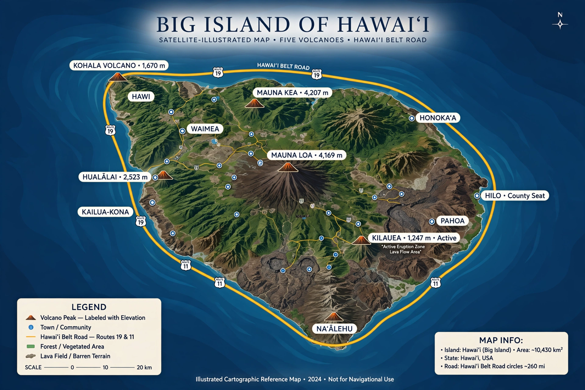
Big Island Overview: Size, Volcanoes, and Climate
Start with the big picture, because the Big Island’s nickname is literal. The island covers about 4,028 square miles, which is larger than all the other Hawaiian islands combined and roughly 63 percent of the state’s total land area. It stretches about 93 miles from north to south and 76 miles from east to west. Driving around the entire island on the Hawaiʻi Belt Road is a journey of roughly 300 miles, which is why most travelers treat the Big Island as a multi-day road trip rather than a single base with day trips.
Geologically, the island is the youngest in the chain and the only one still growing. It was built by five shield volcanoes that erupted sequentially, each overlapping the last. From oldest to youngest, they are Kohala (extinct), Mauna Kea (dormant), Hualālai (active, last erupted in 1800-1801), Mauna Loa (active, and the largest active volcano on Earth), and Kīlauea (active, and among the world’s most frequently active volcanoes). Mauna Kea’s summit reaches 13,803 feet above sea level, and Mauna Loa reaches 13,678 feet. Because the island sits over a volcanic hot spot, new land is still being created whenever lava reaches the ocean, so the Big Island map is, in a very real sense, unfinished.
The island’s size and volcanic height produce one of the most concentrated climate gradients on Earth. Under the widely used Köppen classification, the Big Island contains eight of the world’s thirteen major climate zones, more than any other Hawaiian island. You can stand on a hot desert beach along the Kohala coast in the morning, drive through cool temperate pastureland in Waimea at midday, and watch snow fall on the summit of Mauna Kea in winter. Annual rainfall ranges from under 10 inches in the leeward rain shadow to more than 200 inches on the windward slopes of the Hāmākua coast. This is why orientation matters so much on the Big Island: the words “windward” (wet, eastern side) and “leeward” (dry, western side) describe completely different vacations, and the drive between them can take two hours.
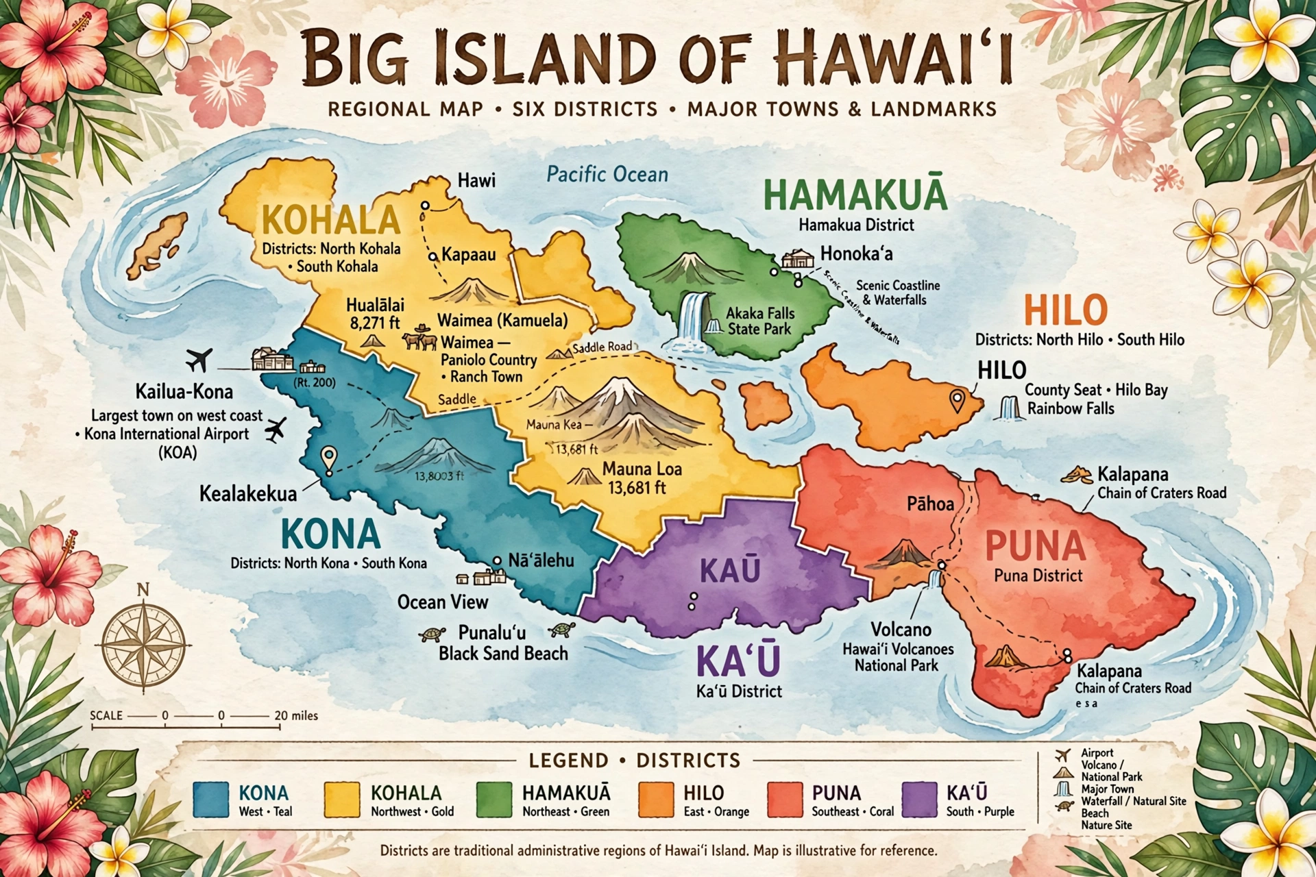
Hawaiʻi County, which is coextensive with the island (the island and the county share the same boundaries), is divided into nine districts: North Kona, South Kona, North Kohala, South Kohala, Hāmākua, North Hilo, South Hilo, Puna, and Kaʻū. The county seat is Hilo. For most travelers, though, a simpler six-region mental map works better, and that is what the next section covers.
Big Island Regions and Districts Map
Think of the Big Island as six regions arranged roughly clockwise from the west coast. Each region has its own character, weather, and reason to visit.
Kona (North and South Kona districts)
The Kona region runs along the island’s sunny western coast, from Kailua-Kona town south through Kealakekua Bay toward the coffee country around Captain Cook and Hōnaunau. Kona sits in the rain shadow of Hualālai volcano, so it is dry, sunny, and warm nearly year-round, which is why most of the island’s beach resorts cluster here. This is the region of Kona coffee farms, calm morning ocean conditions, world-class snorkeling, and the famous Ironman World Championship finish line on Aliʻi Drive. The Kona coast is where most first-time visitors base themselves.
Kohala (North and South Kohala districts)
Kohala occupies the island’s northwest corner, built on the slopes of the oldest volcano, Kohala. South Kohala holds the luxury resort coast of Waikōloa and Mauna Lani, plus some of the island’s best white sand beaches. North Kohala is ranch country and history country: the birthplace of Kamehameha the Great near Hāwī, the dramatic Pololū Valley lookout at the end of Highway 270, and the town of Waimea (officially Kamuela for postal purposes) with its paniolo cowboy culture, farmers markets, and cool upland weather.
Hāmākua (Hāmākua district)
The Hāmākua coast runs along the island’s northeast, a lush, waterfall-lined stretch between Waimea and Hilo. This is the Big Island’s plantation heritage coast, where sugarcane once dominated and small towns like Honokaʻa and Paʻauilo now cater to travelers on the scenic drive. The Hāmākua coast holds the island’s most accessible major waterfalls, the Waipiʻo Valley lookout, and some of the wettest, greenest landscapes in the state. Highway 19 along this coast is one of the most scenic drives in Hawaiʻi.
Hilo (North and South Hilo districts)
Hilo, on the island’s east coast, is the county seat and the island’s largest town, with a population of about 45,000. It is the wettest major town in the United States, which is exactly why it is so green: the Hilo side holds Rainbow Falls, the Hawaiʻi Tropical Bioreserve Garden, the Lyman Museum, and the island’s best farmers market. Hilo is the gateway to Hawaiʻi Volcanoes National Park for east-side visitors and the natural base for waterfall and rainforest exploring. Expect rain, often in brief tropical bursts, and plan accordingly.
Puna (Puna district)
Puna stretches southeast of Hilo and is the island’s most geologically active district, sitting on the lower East Rift Zone of Kīlauea. The 2018 eruption reshaped parts of lower Puna dramatically, destroying hundreds of homes and creating new land. Today Puna offers black sand beaches like Kehena, the Ahalanui thermal pool (a naturally heated ocean-fed pool), the town of Pāhoa with its bohemian character, and a raw, volcanic landscape unlike anywhere else on the island. Check current conditions before visiting, as volcanic and road conditions in Puna can change.
Kaʻū (Kaʻū district)
Kaʻū is the island’s vast southern district, the largest by area and the least developed. It holds Ka Lae, better known as South Point, the southernmost point in the fifty states. Kaʻū is home to the famous Punaluʻu Black Sand Beach (a favorite haul-out spot for honu, Hawaiian green sea turtles), the Papakōlea Green Sand Beach near South Point (reached by a 2.5-mile hike each way), and the southern portion of Hawaiʻi Volcanoes National Park. The Kaʻū Desert, along the park’s southwestern edge, shows what a volcanic rain shadow looks like at its most extreme.
Big Island Waterfalls Map
If you searched for a big island waterfalls map, this is the section you need. Big Island waterfalls cluster overwhelmingly on the windward side, along the Hāmākua coast and around Hilo, because that is where the trade winds dump their moisture. The leeward Kona and Kohala coasts have almost no waterfalls at all. Here is the waterfall map in words, from north to south.
Waipiʻo Valley and Hiʻilawe Falls. At the head of sacred Waipiʻo Valley, Hiʻilawe Falls drops nearly 1,450 feet in a series of cascades, making it one of the tallest waterfalls in the United States. It is best viewed from the Waipiʻo Valley lookout at the end of Highway 240. Note that the steep valley road is now restricted: only Hawaiʻi County residents with four-wheel-drive vehicles may drive it, and non-residents may enter the valley floor only on permitted tours or on foot. Check current county rules before planning a valley visit.
ʻAkaka Falls State Park. The island’s most visited waterfall, ʻAkaka Falls plunges 442 feet into a gorge draped in tropical vegetation. A short, paved 0.4-mile loop trail leads past ʻAkaka Falls and the 100-foot Kahūnā Falls. The park sits about 11 miles northwest of Hilo off Highway 220 and is an easy half-day trip. Go early in the morning for the best light and smallest crowds.
Hilo area waterfalls. Rainbow Falls (Waiānuenue) drops 80 feet on the Wailuku River just minutes from downtown Hilo, and on sunny mornings rainbows form in its mist, hence the name. Just upstream, the Boiling Pots (Peʻepeʻe Falls) are a series of pools that churn during high water. Both are free and easy to reach, making Hilo the best base for waterfall viewing.
Umauma Falls and the Hāmākua coast. Between Hilo and Honokaʻa, the Umauma River feeds a series of falls on private land that can be viewed from the Umauma Experience area. Numerous smaller cascades line the Hāmākua coast after heavy rain, and the drive itself, with ocean views on one side and green cliffs on the other, is half the experience.
A word of caution that belongs on any waterfall map: never swim at the base of a waterfall during or after rain. Flash floods are the leading cause of hiking fatalities in Hawaiʻi, and streams on the windward side can rise from a trickle to a torrent in minutes. Check the National Weather Service Honolulu forecast before any waterfall trip, and turn back if water looks brown or is rising.
Key Towns and Areas
Five towns anchor the Big Island map, and where you stay among them shapes your trip more than almost any other decision.
Kailua-Kona
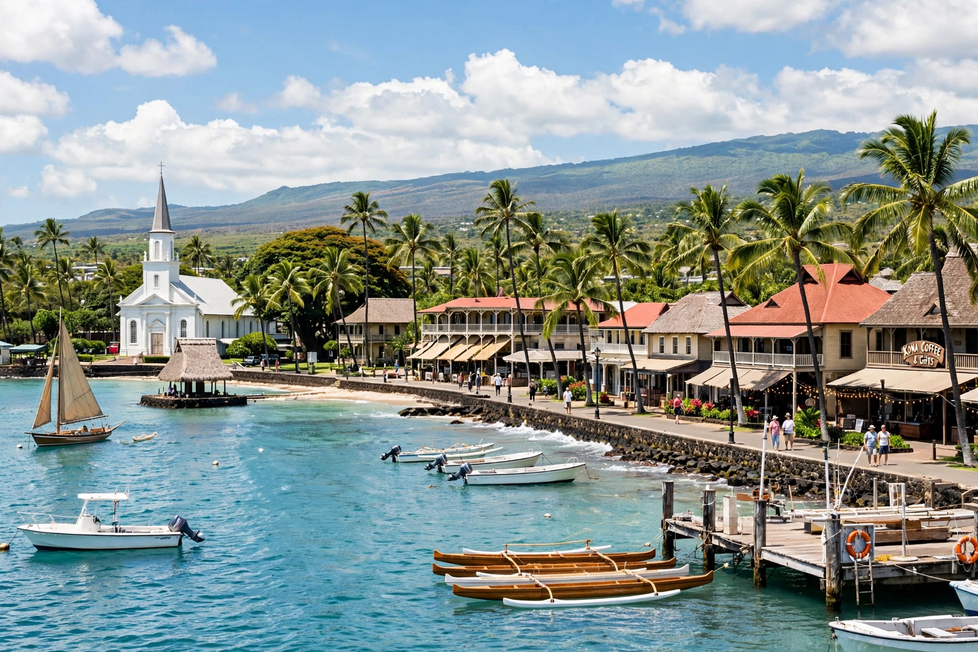
Kailua-Kona, usually just called Kona, is the island’s main visitor town on the sunny west coast. Aliʻi Drive runs along the waterfront past historic Huliheʻe Palace, the Ahuʻena Heiau, shops, and restaurants, all facing the calm waters of Kailua Bay. Kona is the base for snorkeling trips, manta ray night snorkeling, deep-sea fishing, and coffee farm tours in the hills above town. Kona International Airport (KOA) is about 10 miles north. Expect the most sun, the most visitors, and the highest concentration of ocean activities here.
Waikōloa
About 18 miles north of the airport, Waikōloa is the island’s purpose-built resort coast, with large hotels, vacation rentals, golf courses, and the Kings’ Shops and Queens’ Marketplace shopping centers. The nearby beaches, including ʻAnaehoʻomalu Bay (A-Bay) and Hāpuna Beach State Recreation Area a few miles north, are among the island’s finest. Waikōloa is the pick for travelers who want a polished resort experience with reliable sunshine.
Hilo
Hilo is the island’s working town and cultural heart, with a historic downtown, the Hilo Farmers Market, the Pacific Tsunami Museum, and the Lyman Museum. It rains often, sometimes daily, but usually in passing showers, and the reward is waterfalls, botanical gardens, and lush scenery within minutes of town. Hilo is the closest major town to Hawaiʻi Volcanoes National Park (about 30 miles) and the natural base for the island’s east side.
Volcano Village
Volcano Village sits just outside the entrance to Hawaiʻi Volcanoes National Park at about 4,000 feet elevation, surrounded by native ʻōhiʻa rainforest. It is cool, misty, and quiet, with bed-and-breakfasts, art galleries, and restaurants like the long-running Kīlauea Lodge. Stay here if the volcano is your priority: you will be minutes from the park entrance for sunrise or after-dark crater viewing, when conditions and park alerts allow.
Waimea (Kamuela)
Waimea, at about 2,700 feet elevation in the island’s interior saddle country, is paniolo (Hawaiian cowboy) country, home to Parker Ranch, one of the largest cattle ranches in the United States. The town has a thriving food scene, weekend farmers markets, and cool weather that can feel like a different state entirely. Waimea sits at the junction of the routes to Kona, Kohala, and Hāmākua, making it a strategic midpoint, and it is worth a stop even if you do not stay overnight.
Driving Routes and Distances
The Big Island rewards drivers but punishes poor planning. Distances look short on the map and take longer than expected because of winding roads, elevation changes, and small-town speed limits. Always allow more time than the table suggests, and never plan a cross-island drive after dark if you can avoid it, since rural roads are poorly lit and rain can arrive suddenly.
The three cross-island routes. There are three ways to drive between the Kona (west) and Hilo (east) sides. The Saddle Road, officially the Daniel K. Inouye Highway (Route 200), cuts directly across the island’s interior between Mauna Kea and Mauna Loa. It is the fastest Kona to Hilo route at about 78 miles and roughly 1 hour 45 minutes of driving. Once notorious, it has been rebuilt to modern highway standards in phases and is now a good road, though it climbs above 6,600 feet, where fog, rain, and altitude can affect drivers. Note that some rental car agreements historically restricted Saddle Road use; check your contract, though most major companies now permit it.
The northern Belt Road route (Highways 19 and 190 via Waimea and the Hāmākua coast) is longer at roughly 126 miles and about 2 hours 45 minutes, but far more scenic, passing Waimea, the Waipiʻo Valley lookout turnoff, and waterfall country. The southern route (Highway 11 through South Kona, Kaʻū, and Volcano) is the longest at roughly 125 miles and 3 hours or more, but it connects Kona to the national park and South Point. Many travelers drive one route over and a different route back to see the whole island.
The Belt Road loop. The Hawaiʻi Belt Road (Māmalahoa Highway) circles the island, combining Highway 19 on the north and east with Highway 11 on the south and west. A full circumnavigation is about 300 miles. It is a magnificent two-day drive with stops, or a very long single day for the determined.
| Route | Approx. Distance | Approx. Drive Time (no stops) |
|---|---|---|
| Kailua-Kona to Hilo (Saddle Road) | 78 miles | 1 hr 45 min |
| Kailua-Kona to Hilo (via Waimea, Hāmākua) | 126 miles | 2 hr 45 min |
| Kailua-Kona to Hawaiʻi Volcanoes National Park | 96 miles | 2 hr 15 min |
| Hilo to Hawaiʻi Volcanoes National Park | 30 miles | 45 min |
| Kona Airport (KOA) to Kailua-Kona | 10 miles | 20 min |
| Kona Airport (KOA) to Waikōloa | 18 miles | 25 min |
| Kailua-Kona to Waimea | 40 miles | 1 hr |
| Waimea to Hilo | 55 miles | 1 hr 30 min |
| Kailua-Kona to Ka Lae (South Point) | 65 miles | 1 hr 45 min |
| Hilo to ʻAkaka Falls State Park | 11 miles | 25 min |
Distances are approximate and drive times assume clear conditions with no stops. Add time for viewpoints, food, and the island’s famously slow stretches through small towns.
Volcanoes and Hawaiʻi Volcanoes National Park
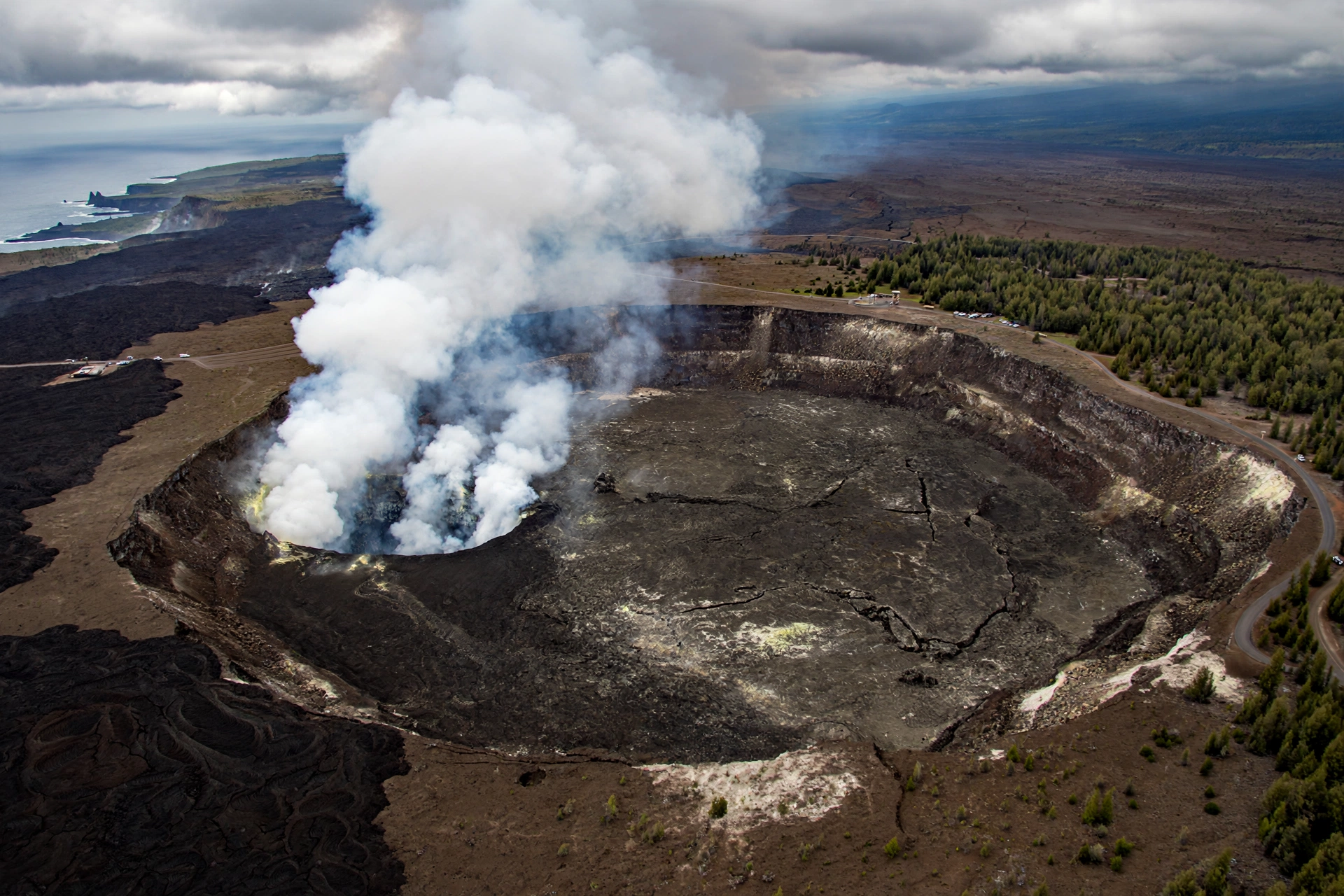
Hawaiʻi Volcanoes National Park protects the summits and rift zones of Kīlauea and Mauna Loa on the island’s southeast side. It is the single most visited attraction on the Big Island, and understanding its layout is essential map knowledge.
Kīlauea, whose summit caldera holds the Halemaʻumaʻu crater, is one of the most active volcanoes on Earth and the legendary home of Pele, the Hawaiian goddess of fire. Mauna Loa, rising 13,678 feet, is the largest active volcano on the planet by volume. Eruption activity varies enormously from year to year: some years bring spectacular lava fountains visible from overlooks, while in other years the volcanoes rest. Always check the current eruption status on the National Park Service and U.S. Geological Survey Hawaiian Volcano Observatory websites before visiting, and never expect guaranteed lava viewing.
The park’s two main roads are Crater Rim Drive, which circles the Kīlauea caldera past overlooks, the Kīlauea Visitor Center, and trailheads, and the Chain of Craters Road, which descends 19 miles from the summit to the sea, crossing old lava flows with pullouts at craters, sea arches, and the Hōlei Sea Arch. Top experiences include the Kīlauea Iki Trail, a 3.3-mile loop that descends through rainforest onto the floor of a steaming crater, and the Thurston Lava Tube (Nāhuku), a 600-foot-long cave formed by flowing lava. The park charges an entrance fee per vehicle, valid for seven days. Because the park sits between 2,000 and 4,000 feet elevation, bring a jacket even on sunny Kona days, and carry water, since there are no services along Chain of Craters Road.
Beaches by Coast
The Big Island has about 266 miles of coastline but fewer classic sandy beaches than visitors expect, because much of the shore is young black lava rock. The beaches it does have are spectacularly varied, and their character follows the island’s geology coast by coast.
Kona and Kohala coasts (west). This is the island’s best beach coast: sunny, calm, and sandy. Hāpuna Beach State Recreation Area, consistently ranked among the best beaches in the United States, offers a half-mile of white sand. Nearby Mauna Kea Beach (Kaunaʻoa Bay) is famously beautiful, though public parking is limited and fills early. ʻAnaehoʻomalu Bay in Waikōloa is ideal for families, with calm water and shade. In Kona proper, Magic Sands (White Sands) Beach and the small coves along Aliʻi Drive serve town visitors.
Hāmākua and Hilo coasts (northeast and east). Few sandy beaches here, but the ones that exist are dramatic. Kolekole Beach Park near Hilo has a small sandy cove beneath cliffs. Richardson Ocean Park in Hilo offers the town’s best swimming and snorkeling. Most of this coast is rocky shoreline with crashing surf, better for sightseeing than swimming.
Puna coast (southeast). Volcanic black sand defines Puna’s beaches. Kehena Black Sand Beach is a local favorite (note: clothing-optional), while the 2018 eruption created the new black sand beach at Pohoiki. The Ahalanui thermal pool offers warm, spring-fed swimming in a protected ocean-fed pond.
Kaʻū coast (south). Punaluʻu Black Sand Beach is the island’s most famous black sand beach and a reliable spot to see basking honu (Hawaiian green sea turtles). Keep the legally required distance from turtles and never touch them. Nearby, the Papakōlea Green Sand Beach, colored by olivine crystals, is one of only a handful of green sand beaches in the world. Reaching it requires a 2.5-mile hike each way across hot, shadeless terrain, so bring abundant water and sun protection.
Airports and Getting Around
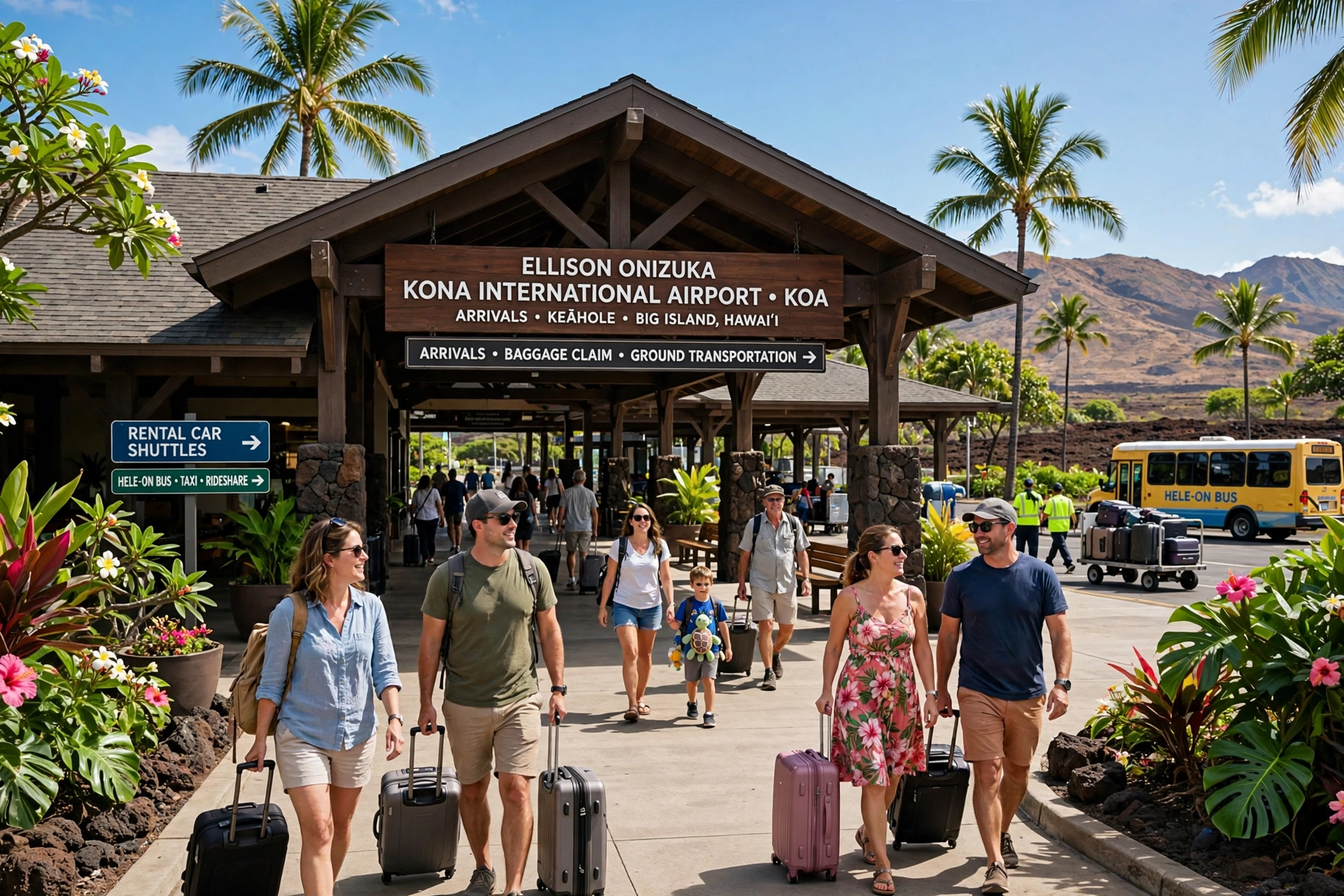
The Big Island has two commercial airports, and choosing the right one is one of the most useful map decisions you will make. The Ellison Onizuka Kona International Airport at Keāhole (KOA), about 10 miles north of Kailua-Kona, serves the west side and handles most visitor arrivals, with direct flights from the U.S. mainland, Canada, and inter-island connections. Hilo International Airport (ITO), on the island’s east side, mainly serves inter-island flights and is the right choice if your trip centers on Volcanoes National Park, Hilo, and the Hāmākua coast. Some travelers fly into one and out of the other to avoid backtracking.
A rental car is close to essential on the Big Island. Public transportation exists in the form of the county’s Hele-On bus system, but routes are limited and schedules are built around residents, not sightseeing. Book rental cars well in advance, especially for holidays and winter, since island inventory is finite. Gas up before long cross-island drives, as stations are sparse along the Saddle Road and in Kaʻū. If you plan to drive to the Mauna Kea summit, only four-wheel-drive vehicles are permitted above the visitor station, and the summit road is steep, unpaved in sections, and subject to altitude effects.
Frequently Asked Questions
Where is the Big Island on the map?
The Big Island, officially the Island of Hawaiʻi, is the southeasternmost and largest island in the Hawaiian archipelago, in the central North Pacific Ocean. It sits about 2,400 miles from California and is the southernmost major island in the chain, which is why it is still growing over the volcanic hot spot while the older northwestern islands erode.
How big is the Big Island?
The Big Island covers about 4,028 square miles, roughly the size of Connecticut. It is larger than all the other Hawaiian islands combined and accounts for about 63 percent of the state’s total land area. It measures roughly 93 miles from north to south and 76 miles from east to west.
How many volcanoes does the Big Island have?
Five volcanoes rise above sea level on the Big Island: Kohala (extinct), Mauna Kea (dormant), Hualālai (active), Mauna Loa (active), and Kīlauea (active). Mauna Loa is the largest active volcano on Earth, and Kīlauea is among the world’s most frequently active volcanoes. Both are protected within Hawaiʻi Volcanoes National Park.
Can you drive around the Big Island in one day?
Technically yes, but it is not recommended. The Belt Road loop is about 300 miles, and driving it without stops takes roughly 6 to 8 hours. With viewpoints, meals, and the island’s winding roads, most travelers need two days to circle the island comfortably. A single day works only for a focused route, such as Kona to Hilo and back via the Saddle Road.
Which airport should I fly into, Kona or Hilo?
Fly into Kona (KOA) if your trip centers on beaches, snorkeling, coffee country, and the west side resorts. Fly into Hilo (ITO) if your focus is Hawaiʻi Volcanoes National Park, waterfalls, and the east side. Many visitors fly into one and out of the other. Kona handles most mainland direct flights; Hilo is primarily inter-island.
How long does it take to drive from Kona to Hilo?
Via the Saddle Road (Daniel K. Inouye Highway), the drive is about 78 miles and takes roughly 1 hour 45 minutes without stops. Via the northern Belt Road through Waimea and the Hāmākua coast, it is about 126 miles and 2 hours 45 minutes. The southern route through Kaʻū and Volcano is about 125 miles and takes 3 hours or more.
What is the best side of the Big Island to stay on?
The Kona/Kohala west side offers sunshine, calm beaches, and most resorts, making it the best choice for a classic beach vacation. The Hilo east side offers waterfalls, rainforest, and quick access to the volcano, making it better for nature-focused trips. Many experienced visitors split their stay, spending part of the trip on each side to avoid long daily drives.
Is the Saddle Road safe to drive?
Yes. The Saddle Road, officially the Daniel K. Inouye Highway, has been rebuilt to modern standards and is a good two-lane highway. It climbs above 6,600 feet, so expect possible fog, rain, and cooler temperatures, and take it slowly in poor visibility. Check your rental agreement, as a few companies still note restrictions, though most now permit it.
Where are the waterfalls on the Big Island?
Nearly all the major waterfalls are on the windward side: ʻAkaka Falls and Kahūnā Falls on the Hāmākua coast, Rainbow Falls and the Boiling Pots in Hilo, Hiʻilawe Falls in Waipiʻo Valley, and Umauma Falls between them. The dry Kona and Kohala coasts have essentially no waterfalls. See the waterfalls map section above for details and access notes.
What is the southernmost point on the Big Island map?
Ka Lae, known as South Point, in the Kaʻū district is the southernmost point in the fifty United States. It is a windswept, dramatic cliff area about 65 miles south of Kailua-Kona. Nearby, the Papakōlea Green Sand Beach is reached by a 2.5-mile hike from the South Point area.
Related Guides
- Kona Hawaii Map: Complete Reference Map & Area Guide
- Hawaii Map: Complete Reference Map & Island Guide
- Hawaii Beaches
- Hawaii Hikes
- Hawaii Snorkeling: Complete Guide
- Maui Map: Complete Reference Map & Area Guide
Reading the Big Island Like a Local
The most useful thing a Big Island map can teach you is that the island is not one destination but several, each with its own weather, geology, and rhythm. The west side gives you sun and sea, the east side gives you waterfalls and rainforest, the south gives you raw volcanic coastline, and the center gives you mountains that touch the edge of the atmosphere. Travelers who try to see it all from a single base spend their vacation in the car; travelers who read the map, split their stay, and give each region its due come home understanding why this island, more than any other in Hawaiʻi, feels like a world unto itself.