
Kona Hawaiʻi Map

The Kona coast on the western side of the Island of Hawaiʻi is one of the most visited regions in the state, and a good Kona Hawaii map is the key to navigating it well. Kona is not a single town but a district stretching roughly 60 miles along the leeward coast, from the airport at Keāhole in the north to the fishing village of Miloliʻi in the south. Within that span sit the historic waterfront of Kailua-Kona, world-class snorkeling bays, sacred Hawaiian cultural sites, and the upland slopes where Kona coffee grows. This guide maps the region in detail: where each area sits, what is there, how far apart things are, and how to use the geography to plan your days.
On This Page
1. Kona Region Overview on the Map

On any Big Island map, the Kona district occupies the western flank of the island, wrapping around the slopes of Hualālai volcano. The name Kona refers to the leeward side in traditional Hawaiian directional terms, and the district lives up to it: shielded from the northeast trade winds by the island’s massive volcanic peaks, Kona sits in a rain shadow that delivers reliably sunny weather and calm morning seas for most of the year. The district is formally divided into North Kona and South Kona, with the boundary running roughly through the town of Kailua-Kona itself.
Geographically, Kona is long and narrow. The coastline runs north to south, while the land rises steeply eastward from sea level to the 8,271-foot summit of Hualālai within just a few miles. This compression means dramatic variety over short distances. At the shore: black lava rock, small pocket beaches, and clear snorkeling water. A ten-minute drive uphill: coffee farms, macadamia orchards, and cool misty air. The two main highways reflect this layout. Highway 19 (Queen Kaʻahumanu Highway) runs along the coast through the northern half, while Highway 11 (Mamalahoa Highway) winds through the uplands and continues south around the island. The lower coastal road, Aliʻi Drive, serves the Kailua-Kona waterfront.
Understanding Kona’s position on the island matters for trip planning. Kona International Airport (KOA) at Keāhole sits about 7 miles north of Kailua-Kona town and is the arrival point for most Kona visitors. The Kohala resort coast (Waikoloa, Mauna Lani) lies 20 to 30 miles north. Hawaiʻi Volcanoes National Park is roughly 100 miles southeast, a serious day trip. Hilo on the windward east side is about 90 miles across the island via Saddle Road. Kona works best as a home base for the western half of the Big Island; the eastern sights deserve either long day trips or a split stay.
The Kona coast’s underwater geography is as important as what is on land. The shoreline drops off quickly into deep water, which is why the ocean here is so clear and why large marine life comes close to shore. Manta rays feed on plankton drawn to lights off the Kona coast nightly. Spinner dolphins rest in the sandy-bottomed bays of South Kona during the day. The deep offshore waters make Kona one of the world’s premier sportfishing destinations, with the famous marlin season running through summer. A Kona map that only shows roads misses half the story; the ocean is the district’s second landscape.
2. Kailua-Kona Town Map
Kailua-Kona, usually shortened to Kona by visitors (though locals distinguish the town from the district), sits on Kailua Bay roughly midway along the district’s coast. On the map it is compact: the historic waterfront core stretches about a mile along Aliʻi Drive, and most of what a visitor needs is within walking distance of the bay. The town was once the seat of Hawaiian royalty; King Kamehameha I spent his final years here, and the waterfront still holds the stonework and structures of that era.
Aliʻi Drive is the town’s main street, a one-way waterfront road lined with shops, restaurants, and historic sites. Starting from the north end near the King Kamehameha’s Kona Beach Hotel and walking south, the key landmarks come in order. The Kailua Pier extends into the bay and serves as the departure point for snorkeling cruises, manta ray night tours, and sportfishing charters. Just inland from the pier stands the Huliheʻe Palace, the former vacation residence of Hawaiian royalty, now a museum operated by the Daughters of Hawaiʻi. Admission is modest, and the palace grounds offer one of the best oceanfront picnic spots in town.
Next door to the palace is Mokuaikaua Church, built in 1820 of lava rock and coral mortar. It is the oldest Christian church in the Hawaiian Islands and still an active congregation; the architecture alone makes it worth a stop. Continuing south on Aliʻi Drive, the road passes through the main shopping and dining blocks, then reaches the Old Kona Airport State Recreation Area at the southern end of the walkable core. This beach park occupies the site of the town’s former airport and offers a long sandy beach popular with local families, with far fewer visitors than the resort beaches to the north.
Inland from Aliʻi Drive, the town climbs the lower slopes of Hualālai. The Kona Commons and Keauhou Shopping Center areas hold supermarkets, pharmacies, and practical services visitors need. The Kona Farmers Market on Aliʻi Drive (open daily) and the larger Kona farmers markets in the uplands are the places to buy tropical fruit, Kona coffee, and macadamia nuts directly from growers. Parking in the waterfront core is limited; the public lots on Likana Lane and behind the shops fill by midday, and many visitors find it easier to walk from their hotel or use the free trolley that runs along Aliʻi Drive.
South of town, Aliʻi Drive continues past residential neighborhoods and small beach parks to Keauhou Bay, about 6 miles from the town center. Keauhou was historically a royal center and remains a quieter alternative base, with a sheltered bay used for kayaking and stand-up paddleboarding, plus the departure point for some manta ray tours. The drive from Kailua-Kona to Keauhou takes about 15 minutes and passes several worthwhile stops, including the Keauhou Holua Slide (a National Historic Landmark, an ancient stone ramp once used for chiefly sledding) and small snorkeling coves.
3. North Kona & Airport Area
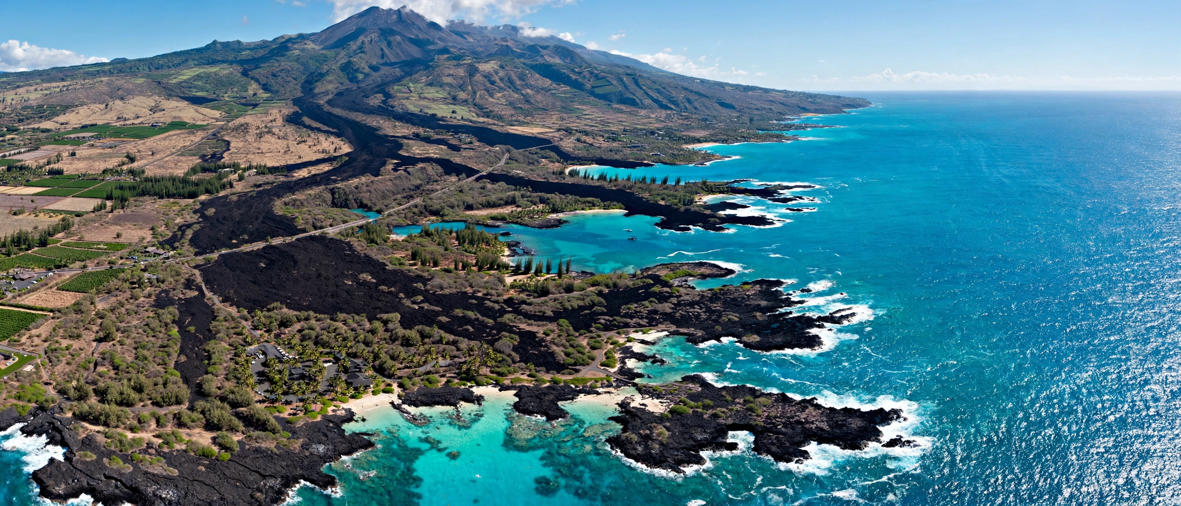
North of Kailua-Kona, the landscape opens into wide black lava fields that look almost lunar from the highway. This is the youngest terrain on the island, formed by Hualālai’s eruptions, most recently in 1801. The Kona International Airport at Keāhole (KOA) sits in these lava fields about 7 miles north of town. Unlike most mainland airports, KOA is largely open-air, with covered walkways connecting small terminals; arriving passengers step almost directly into the warm Hawaiian air. Rental car facilities are on site, and the drive into Kailua-Kona takes 15 to 20 minutes via Highway 19.
The airport area holds several attractions worth marking on the map. The Kaloko-Honokōhau National Historical Park, just south of the airport, preserves an ancient Hawaiian coastal settlement with fishponds, petroglyphs, and a sacred heiau. The park’s Honokōhau Beach is one of the most reliable places on the island to see Hawaiian green sea turtles (honu) resting on the sand; the park asks visitors to stay at least 10 feet away. The Ala Kahakai National Historic Trail runs through the park along the coast. North of the airport, the Kona Salt Farm and the Natural Energy Laboratory area host aquaculture operations, including seahorse and abalone farms that offer tours.
Continuing north on Highway 19, the lava fields give way to the resort developments of South Kohala around Waikoloa, about 20 miles from Kailua-Kona. While technically outside the Kona district, these resorts function as part of the greater Kona visitor region, and many travelers split time between Kailua-Kona town and the Waikoloa beach resorts. The highway between them passes the Waikoloa Petroglyph Preserve and the Kings’ Shops area. Driving time from Kailua-Kona to Waikoloa is about 30 minutes in normal traffic.
4. South Kona: Kealakekua Bay to Hōnaunau

South of Kailua-Kona, Highway 11 climbs into the uplands while a lower coastal road (Napōʻopoʻo Road) descends to the shoreline communities. This stretch of coast, roughly 12 to 20 miles south of town, holds the Kona district’s most significant cultural sites and its best snorkeling. The road is winding and narrow in places, and the drive from Kailua-Kona to Kealakekua Bay takes about 30 minutes; to Puʻuhonua o Hōnaunau, about 45 minutes.
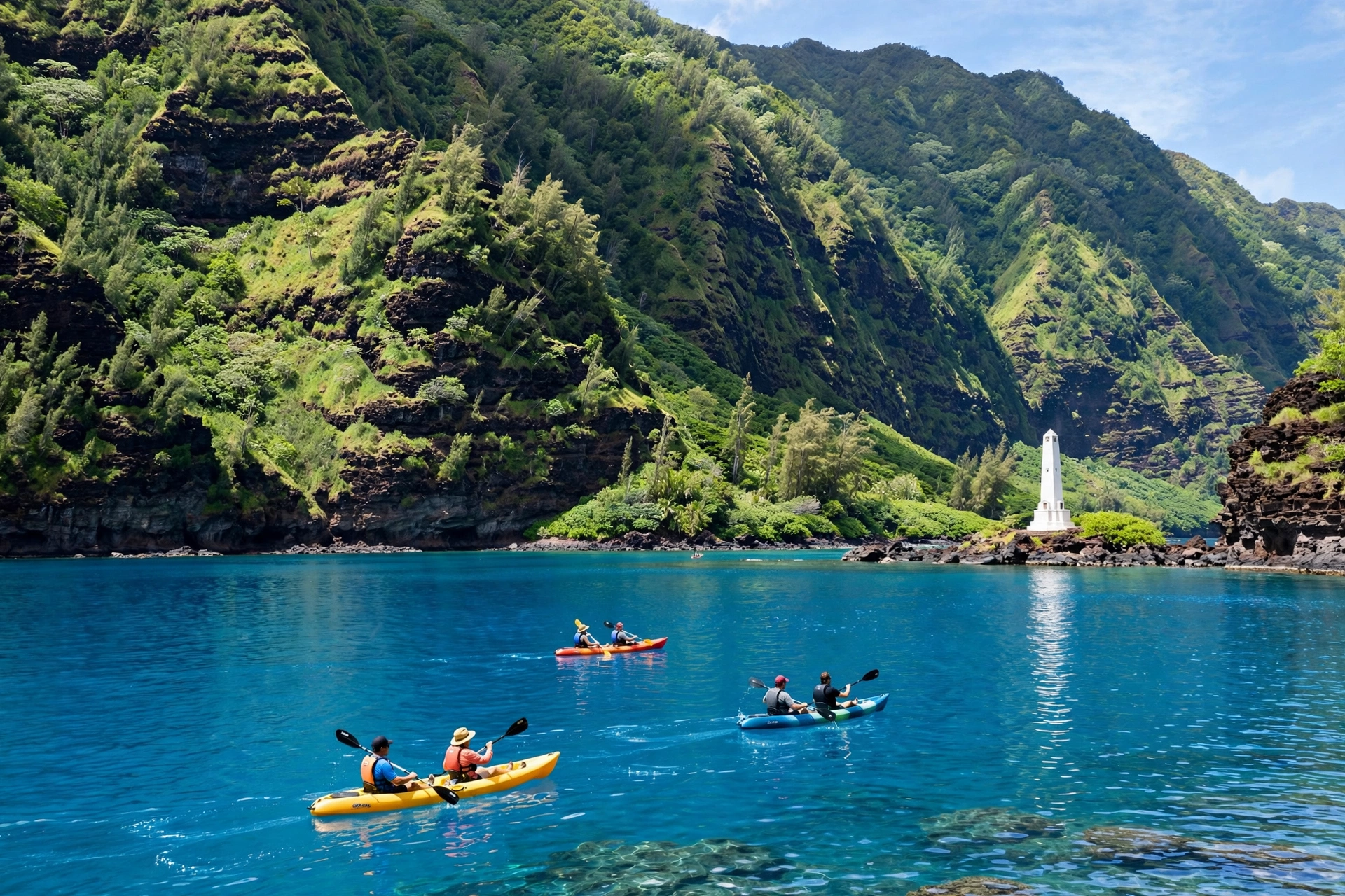
Kealakekua Bay is a marine life conservation district and one of the finest snorkeling spots in Hawaiʻi. The bay’s deep, sheltered water stays exceptionally clear, and the coral gardens along its cliffs teem with reef fish. The Captain Cook Monument stands on the bay’s north shore at Kaʻawaloa, marking the approximate site where Captain James Cook was killed in 1779. The monument is reachable only by hiking the Kaʻawaloa trail (a steep 2-mile round trip), by kayak, or by boat tour; there is no road access. Kayak landings at the monument require a state permit, available through the Division of Boating and Ocean Recreation. Most visitors experience the bay on a morning snorkeling cruise from Keauhou Bay, when the water is calmest. Also worth a look: Captain Cook Hawaiʻi Map.
Just south of Kealakekua Bay, the village of Hōnaunau is home to Puʻuhonua o Hōnaunau National Historical Park, the Place of Refuge. In ancient Hawaiʻi, those who broke kapu (sacred law) could escape punishment by reaching a puʻuhonua; once inside, priests performed ceremonies of absolution. The park preserves the great wall, royal fishponds, and reconstructed temples of this sacred site, set against a stunning oceanfront of black lava and swaying palms. The adjacent Two Step Beach (Hōnaunau Bay) is named for the natural rock steps that provide easy water entry, and its protected reef offers excellent snorkeling. The park charges a per-vehicle entrance fee; the beach access area is free.
South of Hōnaunau, the coast becomes increasingly rural. The village of Miloliʻi, about 35 miles from Kailua-Kona, is one of the last traditional Hawaiian fishing villages, with a small beach park and a working harbor. The road beyond Miloliʻi narrows and the landscape turns to open lava and pasture. Most visitor itineraries turn around at Hōnaunau, but the drive to Miloliʻi rewards those interested in seeing the Kona coast as it existed before tourism.
5. Kona Coffee Country Map

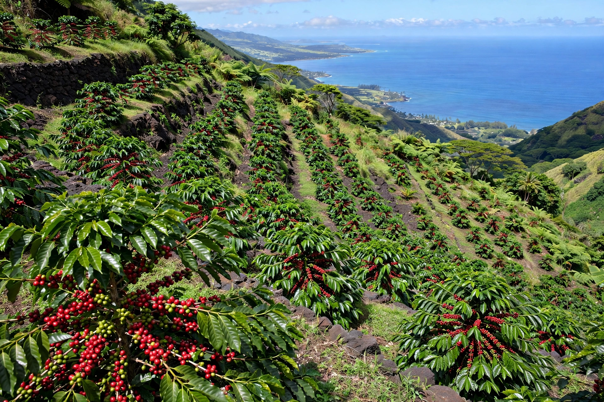
Above the coastal highway, between roughly 800 and 2,500 feet of elevation, the western slopes of Hualālai and Mauna Loa hold Kona coffee country. The combination of morning sun, afternoon cloud cover, rich volcanic soil, and well-drained slopes creates one of the world’s most distinctive coffee growing regions. The coffee belt runs in a band roughly 30 miles long and 2 miles wide, paralleling the coast from Kaloko in the north to Kealakekua in the south. Highway 11 (Mamalahoa Highway) and the upper Napōʻopoʻo Road provide access; the winding Painted Church Road climbs through the heart of farm country.
Over 600 independent coffee farms operate in the Kona district, most of them small family holdings of under 10 acres. Dozens offer farm tours, which typically include a walk through the orchards, an explanation of the growing and roasting process, and a tasting. Well-known stops include farms along Mamalahoa Highway near Holualoa and Kealakekua. The Holualoa village itself, about 10 minutes uphill from Kailua-Kona, is worth a visit for its art galleries and coffeehouses; the St. Benedict’s Painted Church in Hōnaunau, decorated with biblical murals by Father John Velghe in 1899, sits in the midst of coffee country and is open to visitors.
When buying Kona coffee, the map matters. Only coffee grown within the legally defined Kona district and meeting Hawaiʻi Department of Agriculture standards may be labeled “100% Kona Coffee.” Blends labeled “Kona Blend” may contain as little as 10 percent Kona coffee. Farm-direct purchases at the source offer the freshest beans and the best prices; the Kona Coffee Cultural Festival, held each November, is the harvest season celebration with farm tours, tastings, and cultural events.
6. Driving Distances from Kona

Kona’s central-west position makes it a practical base, but Big Island distances are deceptive. Plan by drive time, not mileage; winding coastal roads and the Saddle Road’s elevation changes slow every route.
| Route | Distance | Drive Time |
|---|---|---|
| Kailua-Kona → Kona Airport (KOA) | 7 miles | 15 to 20 min |
| Kailua-Kona → Waikoloa resort area | 20 miles | 30 min |
| Kailua-Kona → Hāpuna Beach | 30 miles | 40 min |
| Kailua-Kona → Waimea (Kamuela) | 40 miles | 55 min |
| Kailua-Kona → Kealakekua Bay | 18 miles | 30 min |
| Kailua-Kona → Puʻuhonua o Hōnaunau | 20 miles | 45 min |
| Kailua-Kona → Hilo (via Saddle Road) | 90 miles | 2 hr |
| Kailua-Kona → Hawaiʻi Volcanoes NP | 100 miles | 2.5 hr |
| Kailua-Kona → Mauna Kea Visitor Station | 65 miles | 1.5 hr |
| Kailua-Kona → Hāwī (North Kohala) | 55 miles | 1.5 hr |
The Saddle Road (Highway 200) between Kona and Hilo deserves special mention. It crosses the high saddle between Mauna Kea and Mauna Loa, climbing to 6,600 feet, and for years rental car companies prohibited its use. The road has since been rebuilt to modern standards, and most major rental agencies now allow it, but check your specific rental agreement. Weather on the Saddle Road can change fast: fog, rain, and near-freezing temperatures are possible even when the coast is sunny. Fill the gas tank before crossing; there are no services for most of the route.
7. Kona Beaches on the Map

The Kona coast’s beaches differ from the wide sandy stretches of Maui or Oʻahu. Here the shoreline is mostly black lava rock punctuated by pocket beaches of white or golden sand. The snorkeling is superb; the long sandy swimming beaches are fewer and require knowing where to look.
North of Kailua-Kona: Hāpuna Beach State Recreation Area, about 30 miles north in South Kohala, is the region’s best swimming beach: a half-mile of white sand with lifeguards, restrooms, and shaded picnic areas. Mauna Kea Beach (Kaunaʻoa Bay), fronting the Mauna Kea Beach Hotel, offers excellent swimming and snorkeling but limits public parking to a small number of passes issued daily. Anaehoʻomalu Bay at Waikoloa is a long, calm beach ideal for paddleboarding and sunset walks.
In and around Kailua-Kona: Kamakahonu Beach, the small cove fronting the King Kamehameha hotel, is the most convenient swimming spot in town. Old Kona Airport State Recreation Area at the south end of Aliʻi Drive has the longest sandy beach in the immediate town area. Honl’s Beach near the harbor is a locals’ surf spot.
South Kona: Two Step (Hōnaunau Bay) is the snorkeling standout, with easy rock-step entry and a protected reef. Kealakekua Bay offers the clearest water but no beach; access is by boat or kayak. Maniniʻōwali Beach (Kua Bay), about 12 miles north of town off Highway 19, is a stunning white-sand cove popular for bodyboarding, though shorebreak can be strong.
8. Using This Map for Trip Planning
Kona rewards travelers who organize days by geography rather than by activity list. The district’s north-south layout and the single coastal highway mean backtracking is the enemy; grouping nearby stops turns driving time into beach time.
- Base in Kailua-Kona town for walkable dining, the historic waterfront, and central access to both north and south. Base in Waikoloa for resort beaches and the Kohala coast. Base in Keauhou for a quieter bay setting with manta ray tour departures.
- Do South Kona as one full day: Kealakekua Bay snorkeling in the morning (calmest water), Puʻuhonua o Hōnaunau and Two Step after lunch, coffee farm on the drive back via the upland road.
- Do the Kohala coast as another day: Hāpuna Beach in the morning, Waimea town for lunch (a paniolo ranching town with good food), Pololū Valley lookout or Hāwī in the afternoon.
- Volcanoes National Park needs its own day at minimum, with a very early start from Kona. Many visitors prefer an overnight in Volcano village to avoid 5 hours of round-trip driving in one day.
- Mornings are for the ocean. Kona’s famous calm conditions are a morning phenomenon; trade-wind chop typically builds after noon. Schedule snorkeling, diving, and boat tours before lunch.
9. Frequently Asked Questions
Where is Kona on the Big Island map?
Kona is the western (leeward) district of the Island of Hawaiʻi, stretching about 60 miles along the coast from Keāhole (north) to Miloliʻi (south). Kailua-Kona town sits roughly in the middle of the district on Kailua Bay.
What is the difference between Kona and Kailua-Kona?
Kona is the district; Kailua-Kona is the town. Visitors often say “Kona” when they mean the town, but the district includes the airport area, Keauhou, Kealakekua, Hōnaunau, and the coffee-growing uplands.
How far is Kona from the airport?
Kona International Airport (KOA) at Keāhole is about 7 miles north of Kailua-Kona town, a 15 to 20 minute drive via Highway 19.
Can you swim at Kealakekua Bay?
Yes, the bay’s water is excellent for swimming and snorkeling, but there is no beach; entry is from boats, kayaks, or the rocky shoreline near the monument trail. Most visitors arrive by morning snorkeling cruise.
Is the drive from Kona to Volcanoes National Park doable in a day?
Yes, but it is long: about 100 miles and 2.5 hours each way. Leave before 7 AM, and consider the southern route (Highway 11) for scenery or the Saddle Road for speed. An overnight in Volcano village makes for a much more relaxed trip.
Where can I buy real 100% Kona coffee?
Directly from farms in the Kona coffee belt along Mamalahoa Highway. Look for the “100% Kona Coffee” label certified under Hawaiʻi state standards; “Kona Blend” may contain as little as 10 percent Kona beans.
What is the best beach near Kailua-Kona for swimming?
For calm swimming close to town: Kamakahonu Beach or the Old Kona Airport beach. For the region’s best swimming beach overall, drive 30 miles north to Hāpuna Beach State Recreation Area in South Kohala.
Do I need a car in Kona?
Yes, effectively. The district’s attractions are spread along 60 miles of coast with limited public transit. Kailua-Kona town itself is walkable, but reaching Kealakekua Bay, the coffee farms, Hāpuna Beach, or the volcano requires a car.
10. Related Guides

Once the Kona map is clear, these guides go deeper:
- Big Island map: the full island: Hilo, Kohala, Kaʻū, and Puna districts
- Maui map: West Maui, South Maui, Upcountry, and the Road to Hāna
- Hawaii map: the complete island chain overview and inter-island distances
- Kohala Hawaii map: the coast directly north of Kona, from Kawaihae to the Pololū Valley lookout
- Big Island Hawaii hikes: trails across the island including Kona-area walks
- Hawaii snorkeling guide: Kealakekua Bay, Two Step, and top snorkel spots statewide
- Hawaii beaches guide: Hāpuna, Mauna Kea Beach, and the island’s best sand
- Hawaii trip cost calculator: estimate the budget for a Kona-based itinerary
- Hawaii packing list generator: build a custom list for the Big Island’s climate zones
Reading the Kona Coast
Kona’s geography tells you how to spend your time before you ever arrive. The calm leeward water says mornings belong to the ocean. The long north-south highway says group your days by direction, not by whim. The volcano rising behind town says the uplands hold a second Kona of coffee farms and cool air that most beach-focused itineraries miss entirely. And the distances on the map, deceptively short to the eye, say to respect drive times and resist the urge to cram the whole island into a Kona-based week. Travelers who read the map first tend to come home with the particular contentment of a trip that flowed the way the land wanted it to, rather than one spent fighting the island’s shape.
For more on this, see Haleʻiwa Hawaiʻi Map.