
Where Is Big Island in Hawaiʻi
On This Page
The Quick Answer
The Big Island is the common name for Hawaiʻi Island, the southeasternmost and largest island in the Hawaiian chain. It sits in the North Pacific Ocean about 2,400 miles southwest of California and roughly 200 miles southeast of Oʻahu. The island covers about 4,028 square miles, which makes it larger than all the other Hawaiian Islands combined. It is also the youngest island in the chain and the only one still growing, thanks to its two active volcanoes, Kīlauea and Mauna Loa.
The name “Big Island” exists to avoid confusion. The island’s official name is Hawaiʻi, which is also the name of the state, so residents and visitors use “Big Island” in everyday speech. When you see “Hawaiʻi Island” in official documents, it means the same place.
Travelers reach the island by air. There are no passenger ferries between the Big Island and any other island, so every visitor arrives at one of two airports: Kona International Airport (KOA) on the dry west coast or Hilo International Airport (ITO) on the lush east side. Inter-island flights connect both airports with Honolulu, Maui, and Kauaʻi, and Kona also receives direct flights from several mainland cities.
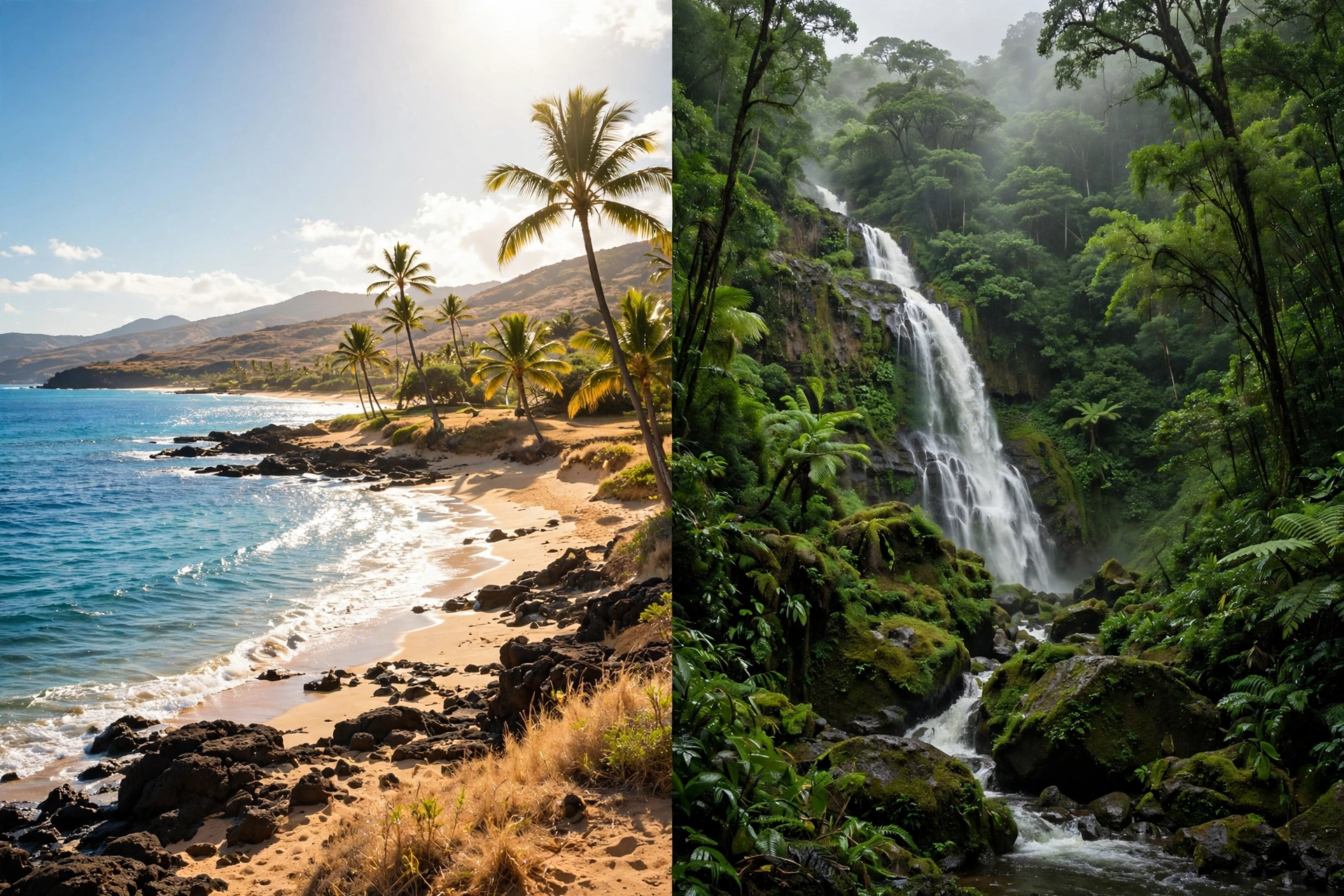
Because of its size, the Big Island contains dramatic variety within a single island. Snow sometimes caps Mauna Kea in winter while swimmers enjoy 80-degree water at Kona beaches on the same day. Lush rainforest near Hilo, stark black lava fields in Puna, rolling ranch country in Waimea, and desert-like coastline in Kaʻū all share one island. Understanding where the Big Island sits in the chain, and how its regions relate to each other, is the key to planning a trip that fits its scale.
The Big Island in the Island Chain
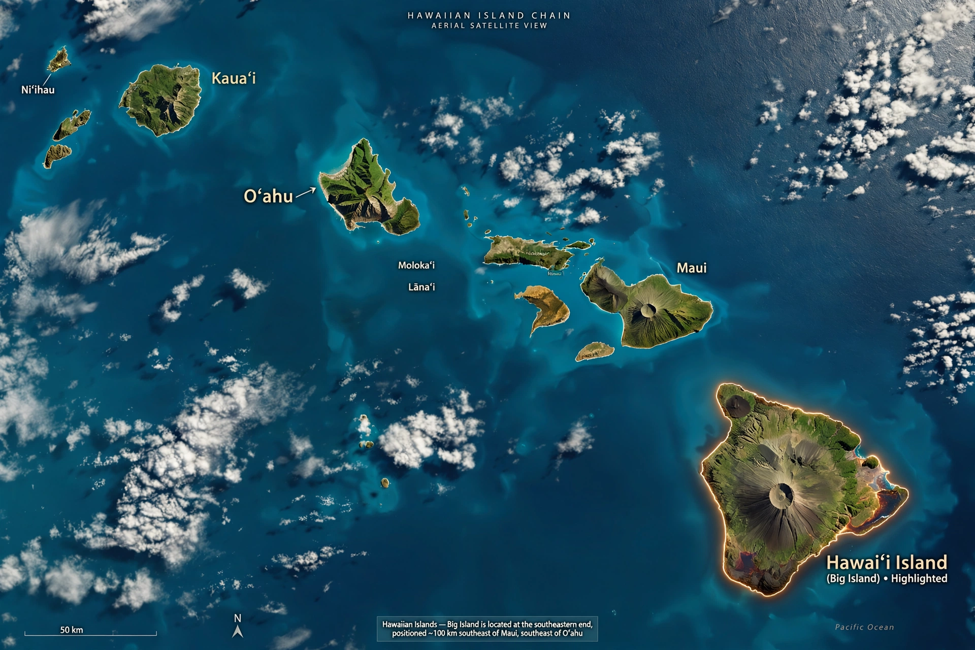
The Hawaiian Islands formed as the Pacific tectonic plate drifted northwest over a stationary hotspot of magma deep in the earth. The result is a chain of islands arranged by age: the oldest islands sit at the northwestern end and the youngest at the southeastern end. The Big Island occupies the southeastern tip of the main island chain, directly over the hotspot, which is why it is the youngest island and the only one with active volcanism.
To picture its position, start at Oʻahu, home to Honolulu and about two-thirds of the state’s population. Travel roughly 200 miles southeast across open ocean and you reach Maui. Continue another 30 miles southeast across the ʻAlenuihāhā Channel and you arrive at the Big Island. Kauaʻi lies about 300 miles northwest of the Big Island, at the far end of the main chain. Molokaʻi and Lānaʻi sit between Oʻahu and Maui, tucked into the middle of the group.
This southeastern position shapes the island’s character in practical ways. The Big Island is the first island to intercept weather systems moving up from the south, and its enormous volcanic mountains wring moisture from the trade winds more dramatically than any other island. The result is one of the sharpest wet-to-dry contrasts in the state: Hilo on the east side averages well over 100 inches of rain a year, while parts of the Kona coast on the west side receive fewer than 20 inches.
The island’s neighbors are visible from its shores on clear days. From the Kohala coast on the northwest side, Maui’s Haleakalā volcano rises across the channel, its 10,023-foot summit often visible above a layer of clouds. From South Point (Ka Lae), the southernmost tip of the island and of the entire United States, there is nothing but open Pacific all the way to Antarctica. That sense of standing at the edge of the map is part of what makes the Big Island’s position feel different from the more centrally located islands.
Size is the other defining fact of the Big Island’s place in the chain. At about 4,028 square miles, it holds roughly 63 percent of the state’s total land area. Maui, the second largest island, is about 727 square miles by comparison. This scale means the Big Island functions less like a single destination and more like a small region: driving from Kona to Hilo takes about two hours across the island’s interior, and a full loop of the island is a genuine day-long undertaking rather than a casual afternoon drive.
Coordinates and Geography
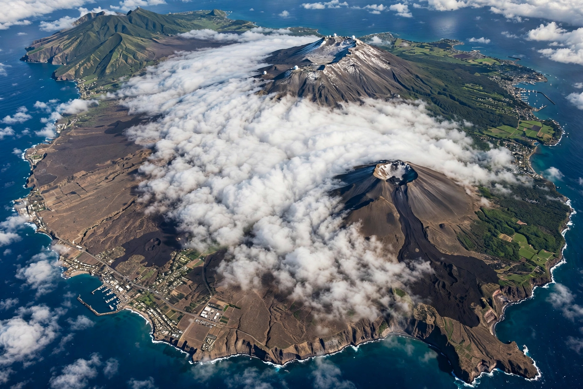
The Big Island sits between approximately 18.9 and 20.3 degrees north latitude and 154.8 and 156.0 degrees west longitude. In practical terms, it lies just south of the Tropic of Cancer, which gives it a warm tropical climate moderated by surrounding ocean and by elevation. For comparison, it sits at roughly the same latitude as central Mexico and southern Cuba.
Five volcanoes built the island, and their outlines still define its geography. Kohala, the oldest, forms the island’s northern tip with its deeply eroded valleys and sea cliffs. Mauna Kea, the tallest, rises 13,803 feet above sea level and is the highest point in the state. Measured from its base on the ocean floor, Mauna Kea stands over 33,000 feet tall, which makes it the tallest mountain on earth by that measure. Hualālai rises behind Kailua-Kona on the west side. Mauna Loa, the largest subaerial volcano on the planet, dominates the island’s center and south. Kīlauea, the youngest and most active, occupies the southeastern flank of Mauna Loa.
Elevation drives the island’s famous climate variety. Temperatures drop about 3 to 4 degrees Fahrenheit for every 1,000 feet of elevation gain, so the summit of Mauna Kea can sit near freezing while sea-level Kona basks in the 80s. The island’s windward east side catches the moisture-laden trade winds, feeding rainforests, waterfalls, and the lush Hāmākua Coast. The leeward west side sits in the mountains’ rain shadow, which is why the Kona and Kohala coasts are sunny and dry.
| Quick Fact | Detail |
|---|---|
| Official name | Hawaiʻi Island (commonly called the Big Island) |
| Position in chain | Southeasternmost of the main Hawaiian Islands |
| Land area | About 4,028 square miles, larger than all other islands combined |
| Highest point | Mauna Kea, 13,803 feet above sea level |
| Active volcanoes | Kīlauea and Mauna Loa |
| Southernmost point | Ka Lae (South Point), the southernmost point in the United States |
| Distance from Oʻahu | About 200 miles southeast |
| Main airports | Kona International (KOA), Hilo International (ITO) |
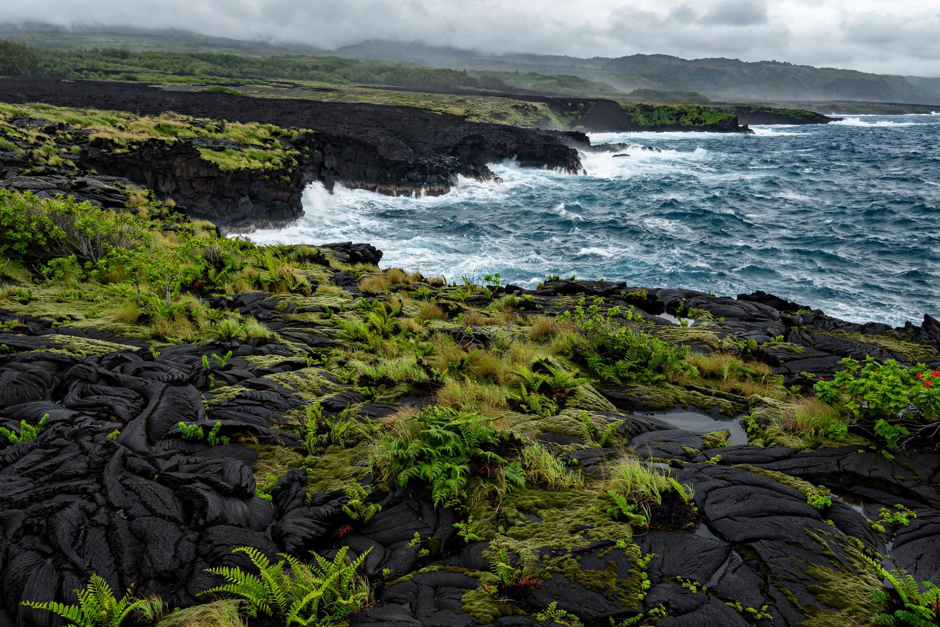
The island’s coastline runs about 270 miles and includes nearly every coastal landscape Hawaiʻi offers: white-sand beaches at Hāpuna, black-sand beaches at Punaluʻu, green-sand at Papakōlea near South Point, sea cliffs along the Hāmākua Coast, and fresh black lava shorelines in Puna where recent flows met the sea. No other Hawaiian island packs this much geographic range into one place, and that range is a direct product of the island’s size and its position over the hotspot.
Getting to the Big Island
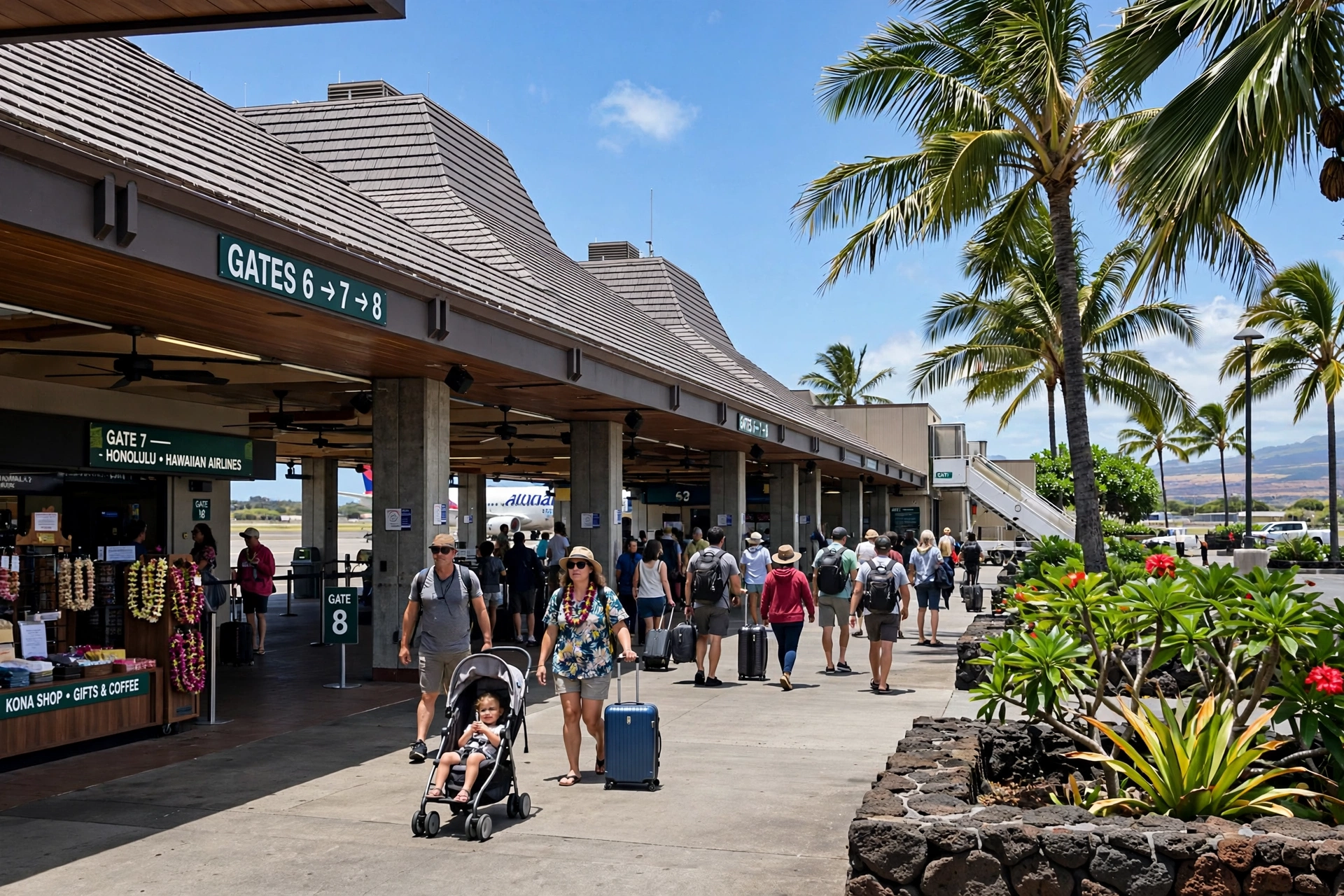
Every visitor arrives by air. There are no ferries, bridges, or any other scheduled passenger connection between the Big Island and another island, so choosing flights is the first real planning decision. The island’s two airports serve different sides of the island, and picking the right one can save hours of driving.
Kona International Airport (KOA) sits on the west side of the island, about 7 miles north of Kailua-Kona along the sunny Kona coast. It is the island’s busier airport and the main gateway for visitors heading to the Kona and Kohala resort areas. Kona receives direct flights from several West Coast mainland cities as well as inter-island flights from Honolulu, Kahului on Maui, and Līhuʻe on Kauaʻi. The airport is open-air, with covered walkways between terminals, which gives first-time visitors an immediate taste of the island’s climate.
Hilo International Airport (ITO) serves the east side of the island from the town of Hilo. It handles inter-island flights from Honolulu and Kahului and a smaller number of mainland connections. Travelers basing themselves in Hilo, Volcano Village, or the Puna district will find Hilo far more convenient than Kona: the drive between the two airports crosses the island’s interior via the Saddle Road and takes about an hour and a half in good conditions.
Many visitors fly into one airport and out of the other, which works well for a one-way tour of the island. A common pattern is to land in Kona, explore the west side, drive across to Volcanoes National Park and Hilo, and depart from Hilo. Rental cars are available at both airports, and a car is effectively essential on the Big Island. Public transit exists but does not reach most visitor destinations, and the island’s sheer size makes taxis and rideshares impractical for touring.
Inter-island travel follows the same pattern as the rest of the state. Hawaiian Airlines and Southwest Airlines operate frequent short flights between the Big Island and Oʻahu, Maui, and Kauaʻi, with typical flight times of 30 to 50 minutes. Travelers combining islands usually route through Honolulu, which has the most connections, though direct flights between Kona and Kahului make Maui and Big Island pairings easy.
Regions of the Big Island
The Big Island’s regions differ so much in weather, landscape, and pace that choosing where to base a trip matters more here than on any other Hawaiian island. Each region below sits in a distinct part of the island, and together they explain why the island rewards travelers who plan around geography rather than trying to see everything from one spot.
Kona (West)
The Kona coast runs along the island’s dry, sunny west side, sheltered from the trade winds by Mauna Loa and Hualālai. This is the island’s main visitor corridor, home to Kailua-Kona town, Keauhou, and the resort areas stretching north toward the Kohala Coast. Kona is famous for calm morning ocean conditions, excellent snorkeling and diving, manta ray night viewing, and world-renowned coffee grown on the slopes of Hualālai. Afternoon clouds often build over the mountains while the coast stays sunny, a classic leeward weather pattern.
Kohala (North)
North Kohala holds the island’s oldest landscapes and some of its most dramatic scenery. The towns of Hāwī and Kapaʻau preserve plantation-era storefronts, and the region is the birthplace of Kamehameha the Great. Pololū Valley’s lookout offers sweeping views of fluted sea cliffs dropping to a black-sand beach. The Kohala Coast to the west, around Waikoloa, is the island’s luxury resort zone with championship golf and some of the state’s best beaches, including Hāpuna Beach State Recreation Area.
Hāmākua (Northeast)
The Hāmākua Coast runs northeast from Waimea toward Hilo along cliffs draped in rainforest. This former sugar plantation region is dotted with waterfalls, including 442-foot ʻAkaka Falls in ʻAkaka Falls State Park, one of the island’s most visited natural attractions. The coast road passes through small plantation towns like Honokaʻa, and the views from its overlooks stretch across deep green valleys to the ocean. Waimea (Kamuela) sits inland at about 2,700 feet elevation, a genuine ranching town with paniolo (Hawaiian cowboy) culture, cooler temperatures, and rolling pastureland.
Hilo (East)
Hilo, the island’s largest town with about 44,000 residents, anchors the wet, lush east side. It receives abundant rainfall, which feeds its rainforests, waterfalls, and gardens, including the Hawaiʻi Tropical Bioreserve Garden and Rainbow Falls near town. Hilo hosts the annual Merrie Monarch Festival, the world’s premier hula competition. The town has a relaxed, local character distinct from Kona’s visitor focus, with a historic bayfront, farmers market, and museums. It is also the gateway to Hawaiʻi Volcanoes National Park via the road south through Volcano Village.
Puna (Southeast)
Puna is the island’s youngest landscape, built by recent lava flows from Kīlauea. Its terrain ranges from black lava fields to pockets of lush rainforest, and its coastline includes new black-sand beaches formed where lava met the sea. The district has a famously offbeat, alternative community centered on towns like Pāhoa. Lava Tree State Monument preserves a forest of lava molds formed when a 1790 flow swept through. Visitors should note that parts of Puna were reshaped by the 2018 Kīlauea eruption, and conditions and access in the lower Puna area can change with volcanic activity.
Kaʻū (South)
Kaʻū, the island’s southernmost district, is remote, rural, and strikingly beautiful. Punaluʻu Black Sand Beach is its best-known attraction, a reliable spot to see basking honu (green sea turtles). Nearby, the Papakōlea green-sand beach sits at the end of a rugged hike near South Point. Ka Lae itself, the southernmost point in the United States, offers windswept cliffs and ocean views with nothing but open Pacific beyond. The district’s small towns, including Nāʻālehu, move at a pace far removed from the resort coasts.
Why Its Location Matters
The Big Island’s position at the southeastern end of the chain, directly over the hotspot, makes it the only Hawaiian island where visitors can watch the islands being built in real time. Kīlauea and Mauna Loa are among the most studied volcanoes on earth, and Hawaiʻi Volcanoes National Park protects their landscapes for public access. When eruptions occur, the glow from Halemaʻumaʻu crater can be visible for miles. Because volcanic activity changes over time, visitors should always check current conditions with the U.S. Geological Survey’s Hawaiian Volcano Observatory and the National Park Service before planning around an eruption.
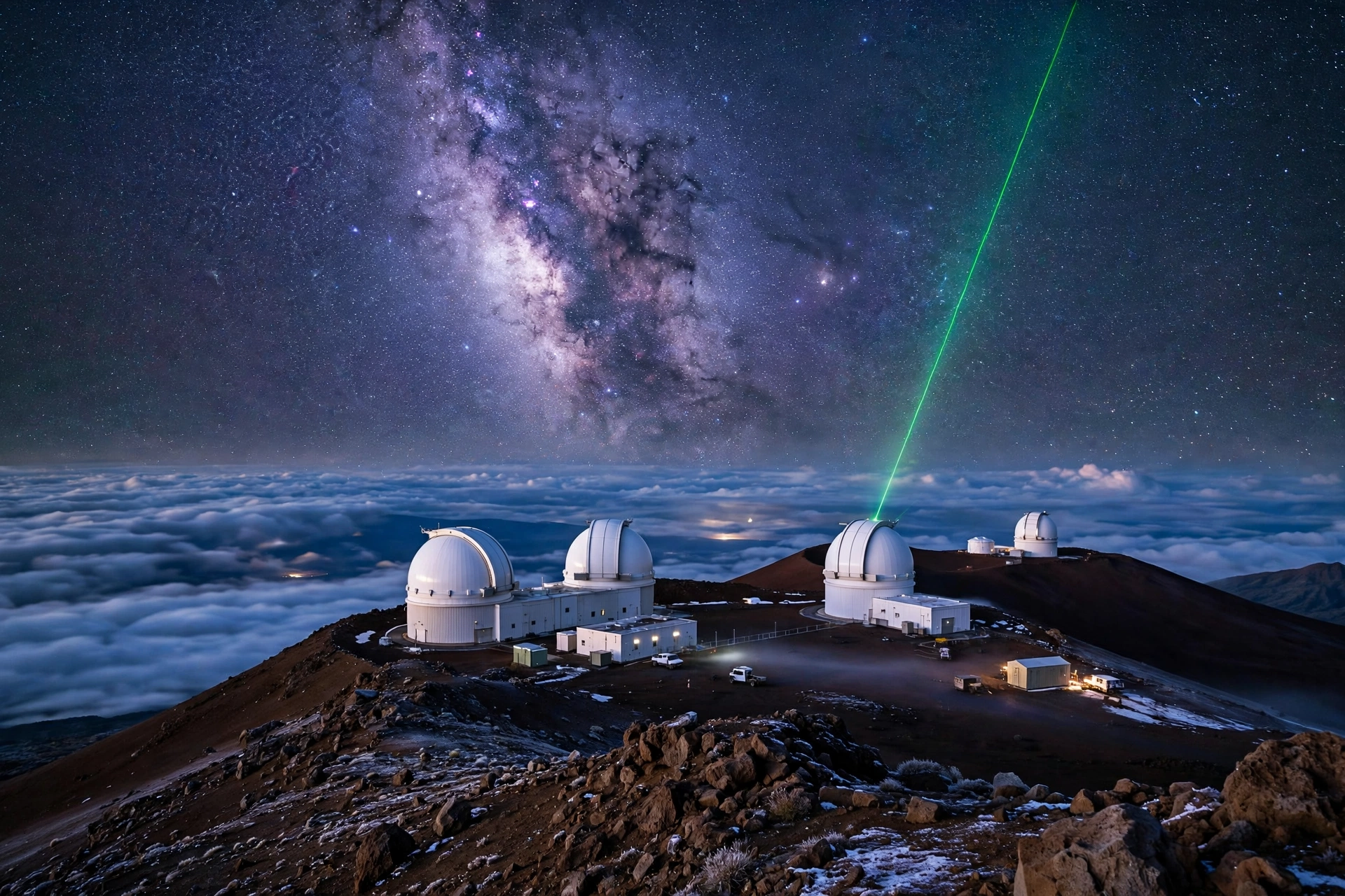
The island’s size and latitude also make it one of the world’s premier astronomy sites. Mauna Kea’s 13,803-foot summit rises above most of the atmosphere’s water vapor, with clear, dark skies that drew a cluster of international observatories to its peak. The summit holds deep cultural significance for Native Hawaiians, and access and conduct there are subjects of ongoing community discussion that visitors should respect. Even without visiting the summit, the island’s southern latitude and dark rural skies make for exceptional stargazing.
Historically, the island’s location made it the center of the Hawaiian Kingdom’s founding. Kamehameha the Great was born in North Kohala and launched his unification campaign from the island’s shores. Puʻukoholā Heiau National Historic Site near Kawaihae preserves the temple he built to fulfill a prophecy before completing the unification. The island’s position as the largest landmass in the archipelago gave its chiefs resources and manpower that shaped Hawaiian history for generations.
For modern travelers, the island’s location at the southeastern end of the chain has one more practical meaning: it is the farthest main island from Honolulu and the continental United States, which keeps visitor numbers lower than Oʻahu and Maui despite its size. The reward for the extra travel is an island that still feels spacious, where a single day can include desert, rainforest, beach, ranchland, and volcanic crater, all within the boundaries of one remarkable place.
Frequently Asked Questions
Where exactly is the Big Island in Hawaiʻi?
The Big Island (Hawaiʻi Island) is the southeasternmost of the main Hawaiian Islands, sitting in the North Pacific about 2,400 miles southwest of California and roughly 200 miles southeast of Oʻahu. It lies just south of the Tropic of Cancer, between about 18.9 and 20.3 degrees north latitude.
Is the Big Island the biggest Hawaiian island?
Yes, by a wide margin. At about 4,028 square miles, the Big Island is larger than all the other Hawaiian Islands combined and holds roughly 63 percent of the state’s total land area. Maui, the second largest island, is about 727 square miles.
Which island is closest to the Big Island?
Maui is the closest neighbor, lying about 30 miles northwest across the ʻAlenuihāhā Channel. On clear days, Maui’s Haleakalā volcano is visible from the Big Island’s Kohala coast.
Can you see other islands from the Big Island?
Yes. Maui is regularly visible from the Kohala and Kona coasts on clear days. Molokaʻi and Lānaʻi can sometimes be spotted from high elevations. From South Point, there is only open ocean to the south.
Which airport should I fly into?
Fly into Kona (KOA) for the west side resort areas, Kona coast beaches, and Kohala. Fly into Hilo (ITO) for Hilo town, Volcanoes National Park, and the east side. Many visitors fly into one and out of the other for a one-way island tour.
How do you travel between the Big Island and other islands?
By air only. There are no passenger ferries between the Big Island and any other island. Inter-island flights connect Kona and Hilo with Honolulu, Maui, and Kauaʻi in 30 to 50 minutes.
Why is it called the Big Island instead of Hawaiʻi?
The island’s official name is Hawaiʻi, which is also the state’s name. “Big Island” is the everyday nickname used to avoid confusion between the island and the state. You will see both names used interchangeably.
What is the southernmost point in the United States?
Ka Lae, also called South Point, on the Big Island’s Kaʻū coast. It sits at about 18.9 degrees north latitude and is marked by windswept cliffs overlooking open Pacific.
Related Guides
- Big Island Weather: seasons, microclimates, and regional forecasts for Hawaiʻi Island.
- Hawaiʻi Map: the full island chain with positions, distances, and orientation.
- Where Is Oʻahu Located in Hawaiʻi: the companion location guide for Oʻahu.
- Hawaiʻi Volcanoes: Kīlauea, Mauna Loa, and the hotspot geology behind the island.
- Best Time to Visit Hawaiʻi: month-by-month guidance for timing a Big Island trip.
- Hawaiʻi Transportation: inter-island flights, rental cars, and getting around.
A Final Note
The Big Island’s location at the southeastern end of the Hawaiian chain explains nearly everything about it: its size, its youth, its active volcanoes, and its staggering variety. No other island in the archipelago combines this scale with this much geological and cultural history in one place. It is the island where the archipelago is still being built, where the southernmost point in the nation meets the tallest mountain in the Pacific, and where a single day’s drive can cross desert, rainforest, ranchland, and fresh lava rock. Knowing where it sits on the map is the first step; the rest is best learned with a full tank of gas and an unhurried schedule.