
Hawaiʻi Volcanoes
On This Page
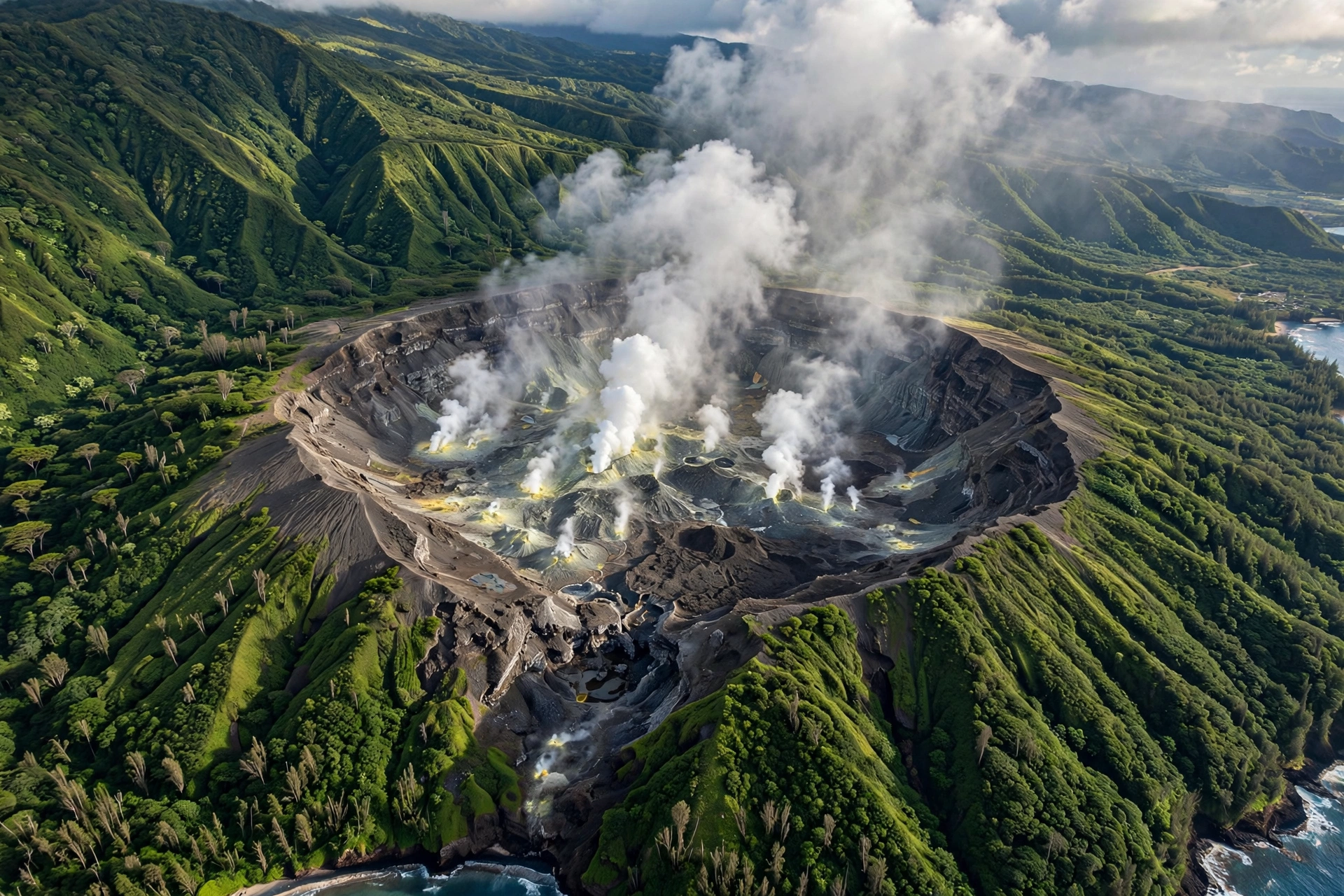
The Hawaiian Islands exist because of volcanoes. Every island in the chain, from the oldest to the youngest, is the exposed summit of a massive shield volcano built up from the seafloor by countless lava flows over millions of years. On the Island of Hawaiʻi, that process is still underway: Kīlauea and Mauna Loa remain among the most active volcanoes on Earth, and the island continues to grow with each eruption. Understanding Hawaiʻi’s volcanoes is understanding Hawaiʻi itself, from its geology and landscapes to its culture and daily weather.
Hawaiʻi’s Volcanoes: An Overview
The Hawaiian Islands were formed by a geologic hotspot, a plume of unusually hot rock rising from deep within Earth’s mantle. As the Pacific Plate drifts slowly northwest over this stationary plume, magma punches through the ocean floor and builds volcanoes one after another. The result is a chain of islands arranged by age: Kauaʻi in the northwest is roughly five million years old and deeply eroded, while the Island of Hawaiʻi in the southeast is less than a million years old and still growing. Farther northwest, the older islands have already sunk beneath the waves, surviving only as atolls and seamounts stretching toward Midway.
Hawaiian volcanoes are shield volcanoes, named for their broad, gently sloping profile that resembles a warrior’s shield lying on the ground. Their lava is basaltic, low in silica and highly fluid, so it flows easily and builds wide domes rather than steep cones. This is why Hawaiian eruptions are typically effusive, with rivers and fountains of lava, rather than explosive like the volcanoes of the Pacific Rim. The trade winds, the black sand beaches, the sea cliffs of the Nā Pali Coast, and the red dirt of Lānaʻi all trace back to this volcanic foundation.
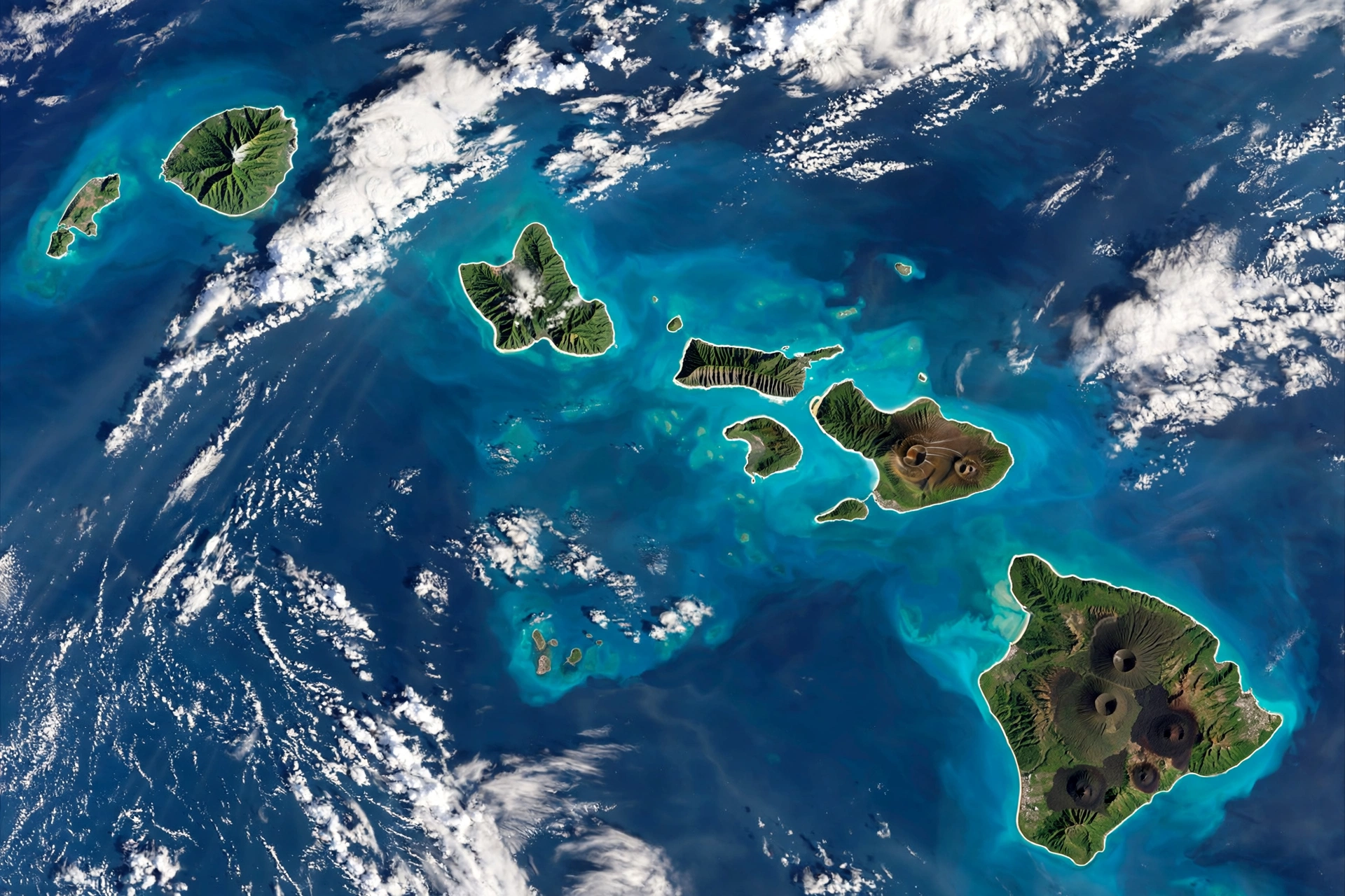
That age progression is visible in the landscape. Kauaʻi’s five million years of rainfall have carved Waimea Canyon, often called the Grand Canyon of the Pacific, and the fluted sea cliffs of the Nā Pali Coast. Oʻahu’s older volcanoes have softened into the Koʻolau and Waiʻanae ranges. Maui sits in the middle, with the dormant Haleakalā still holding its broad shield shape while West Maui has eroded into sharp ridges. The Island of Hawaiʻi, at less than a million years old, still shows fresh lava surfaces beside its older, forested slopes. Each island is a different chapter of the same volcanic story.
Scientists classify Hawaiian volcanoes by their life stage. An active volcano has erupted in recorded history or shows signs it could erupt again. Kīlauea and Mauna Loa are active. Hualālai is considered active but has been quiet for over two centuries. A dormant volcano has not erupted in a long time but could in the future; Haleakalā and Mauna Kea fall into this category. An extinct volcano is not expected to erupt again, which describes Kohala, the West Maui Volcano, and the deeply eroded shields of Oʻahu and Kauaʻi.
One more volcano deserves mention: Loʻihi, recently given the Hawaiian name Kamaʻehuakanaloa, is an active submarine volcano growing on the seafloor about 22 miles southeast of the Island of Hawaiʻi. Its summit is still roughly 3,000 feet below the ocean surface, but it is steadily building toward the day, tens of thousands of years from now, when it will break the surface as Hawaiʻi’s newest island.
Because volcanic activity changes, always check current conditions before planning a volcano visit. The U.S. Geological Survey’s Hawaiian Volcano Observatory publishes activity updates and alert levels, and the National Park Service posts closures and hazards for Hawaiʻi Volcanoes National Park. An eruption that is front-page news one month may be quiet the next, so treat any specific activity described here as a snapshot, not a promise.
The Major Volcanoes
Kīlauea
Kīlauea is the youngest and most active volcano in Hawaiʻi, and one of the most active in the world. Its summit caldera sits inside Hawaiʻi Volcanoes National Park, and its East Rift Zone stretches toward the Puna district, where the 2018 eruption destroyed more than 700 homes in Leilani Estates and reshaped the coastline with entirely new land. Kīlauea erupts frequently from its summit and rift zones, producing lava fountains, flows, and, during summit activity, a glowing lava lake inside Halemaʻumaʻu crater that has become one of the most photographed sights in the islands.
Note: Trail and viewing-area closures change frequently with volcanic activity. As of October 2026, Halemaʻumaʻu Trail, part of Byron Ledge Trail, and Keanakākoʻi-side viewing areas are temporarily closed. Check the NPS Hawaiʻi Volcanoes National Park alerts page before your visit.
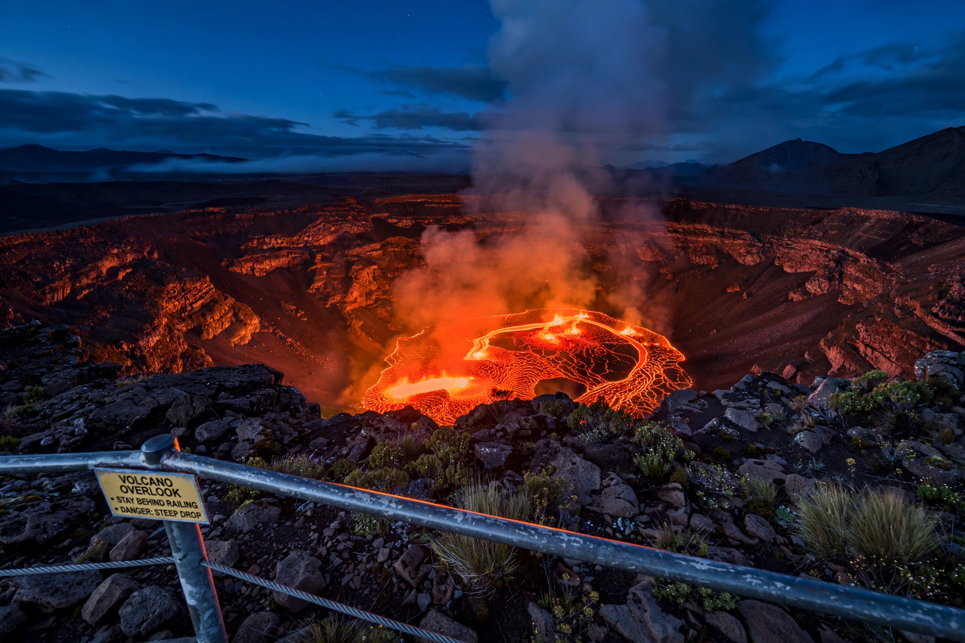
For visitors, Kīlauea is the centerpiece of the national park. Its activity level varies, and the park adjusts viewpoints, trail closures, and ranger programs accordingly. Even when the volcano is quiet, the landscape tells the story: the steaming vents along Crater Rim Drive, the solidified lava lake surface of Kīlauea Iki, and the long, black flows of Chain of Craters Road record decades of eruptions.
Mauna Loa
Mauna Loa is the largest subaerial volcano on Earth by volume, rising more than 30,000 feet from the ocean floor to its summit at 13,679 feet above sea level. Its broad dome covers roughly half the Island of Hawaiʻi. Despite its size, Mauna Loa erupts less often than Kīlauea; its most recent eruption began in late 2022, the first since 1984, sending lava fountains and flows down its Northeast Rift Zone and briefly closing the Saddle Road area. Like Kīlauea, it is monitored around the clock by the Hawaiian Volcano Observatory.
Most visitors experience Mauna Loa from a distance, watching its massive profile dominate the horizon from Kona or Hilo. The summit is reachable by a long, strenuous backcountry hike for experienced and well-prepared hikers, but it demands respect for altitude, weather, and remoteness.
Mauna Kea
Mauna Kea is a dormant shield volcano and, measured from its base on the ocean floor, the tallest mountain in the world at over 33,000 feet. Its summit reaches 13,803 feet above sea level, high enough for winter snow and for the thin, dry air prized by astronomers. The summit hosts world-class observatories, and the drive to the top passes through climate zones from tropical to alpine in under two hours.
Mauna Kea last erupted several thousand years ago and is considered dormant rather than extinct. The summit area is culturally significant, and visitors should treat it with respect: stay on designated paths, keep the area clean, and be aware that access rules and cultural protocols apply. Altitude affects everyone, so ascend slowly, stay hydrated, and skip the summit if you feel unwell.
Hualālai
Hualālai rises behind Kailua-Kona on the west side of the Island of Hawaiʻi and last erupted in 1800 and 1801, sending flows to the coast near what is now the Kona airport area. It is classified as active, and because the Kona coast is now densely developed, scientists monitor it closely. For visitors, Hualālai is mostly a scenic backdrop, visible as the long ridge behind town, with a few trails and viewpoints on its upper slopes.
Kohala
Kohala is the oldest volcano on the Island of Hawaiʻi, at roughly one million years old, and is considered extinct. Its deeply eroded valleys and sea cliffs form the dramatic Kohala coast, including the waterfall-draped valleys of Waipiʻo and Waimanu. The Pololū Valley lookout offers one of the easiest views of what a million years of erosion does to a Hawaiian shield.
Haleakalā
Haleakalā, the “house of the sun,” forms the bulk of East Maui. Its summit rises to 10,023 feet, and the massive erosional crater at the top, seven miles across, holds cinder cones in striking red, brown, and gray. Haleakalā is a dormant shield volcano; its most recent eruptions occurred a few hundred years ago, with the youngest flows near La Pérouse Bay dated to around 1790.
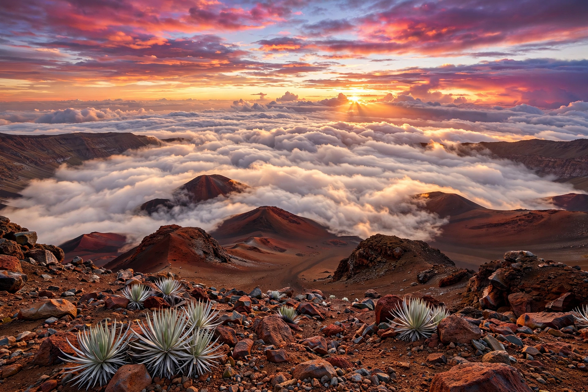
Sunrise at the Haleakalā summit is one of Maui’s most famous experiences and requires an advance reservation for the pre-dawn hours. The summit’s high elevation means temperatures can be near freezing at dawn even when the beaches below are warm, so layered clothing is essential. The Sliding Sands and Halemauʻu trails descend into the crater for day hikes through an otherworldly volcanic landscape.
The Older Islands: West Maui, Oʻahu, and Kauaʻi
The West Maui Volcano, which built the mountains around Lahaina and the northwest coast, is extinct at about 1.3 million years old. On Oʻahu, the Waiʻanae and Koʻolau volcanoes are long extinct, though the island’s famous landmarks, Diamond Head, Hanauma Bay, and Koko Head, are tuff cones from much younger, short-lived eruptions that occurred long after the main shields went quiet. Kauaʻi’s single great shield, now five million years old, has eroded into Waimea Canyon and the Nā Pali sea cliffs, among the most dramatic landscapes in the Pacific.
Hawaiʻi Volcanoes National Park
Hawaiʻi Volcanoes National Park, established in 1916 and designated a UNESCO World Heritage Site, protects more than 335,000 acres of volcanic landscape on the Island of Hawaiʻi, including the summits of Kīlauea and Mauna Loa. It is the essential destination for anyone who wants to understand Hawaiian volcanism up close, and it rewards at least a full day, ideally two.
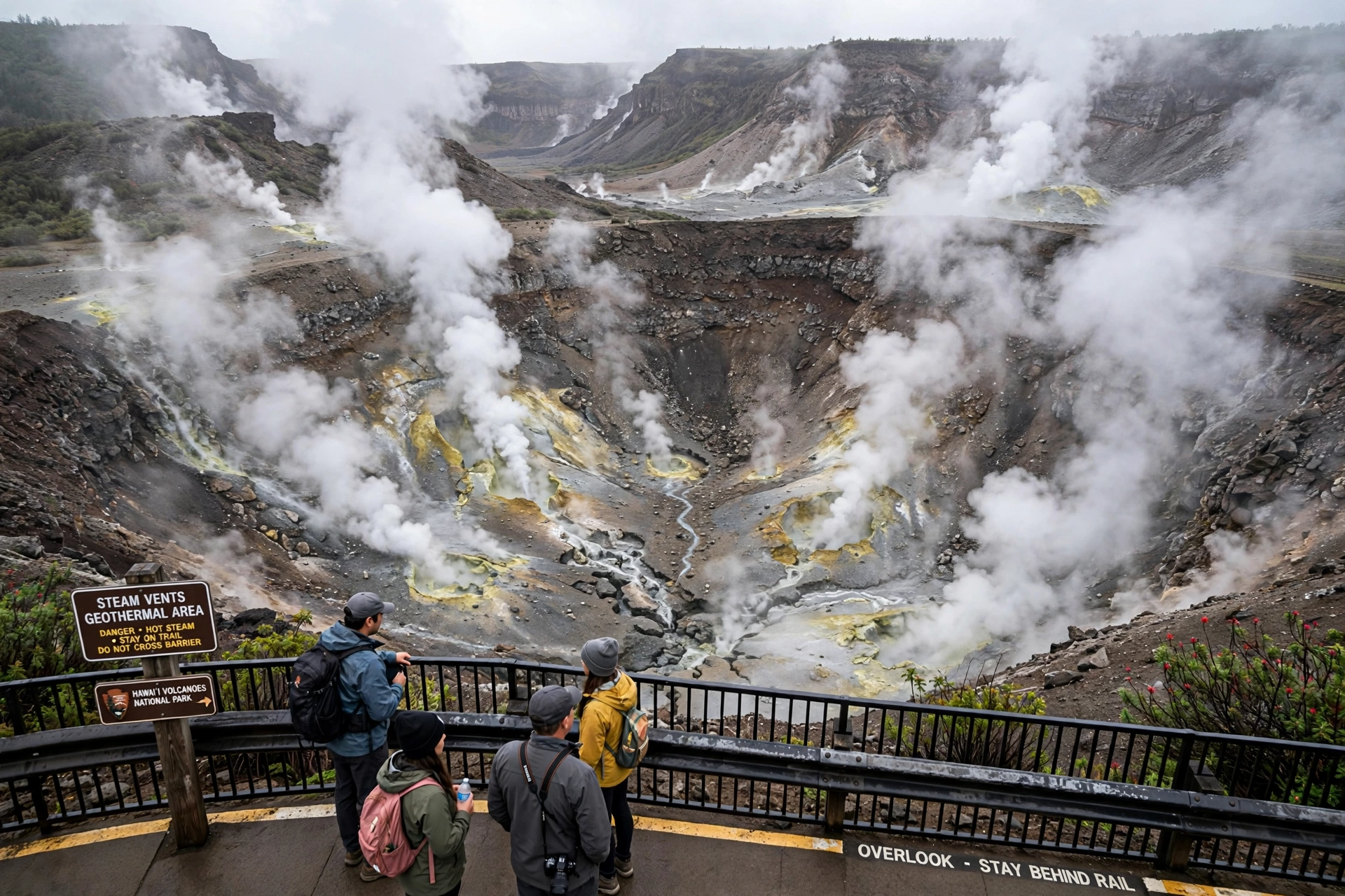
Start at the Kīlauea Visitor Center near the park entrance for exhibits, the park film, and current conditions from rangers. From there, Crater Rim Drive loops past the summit caldera overlooks, the Steam Vents, and the Steaming Bluff, where groundwater heated by magma rises through cracks in the earth. The Kīlauea Iki Overlook is the trailhead for the park’s signature hike, a three-mile loop that descends through rainforest into a solidified lava lake, crosses its cracked floor past the still-steaming vent, and climbs back out the far side.
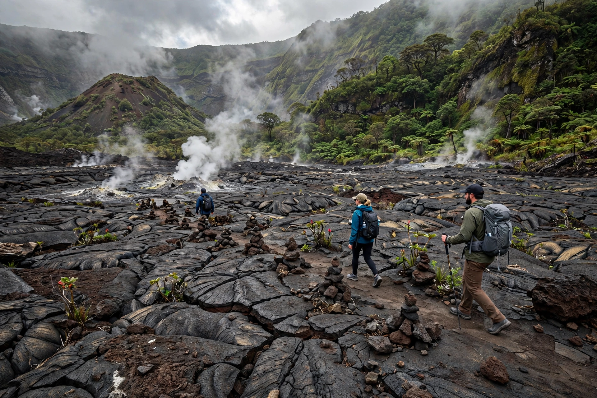
Chain of Craters Road descends 20 miles from the summit to the sea, passing pit craters, old lava flows, and the turnoff for the Nāhuku lava tube, a short walk through a cave formed when the surface of a lava flow cooled while molten rock continued flowing beneath. At the coast, the road ends at the Hōlei Sea Arch, where the ocean has carved an arch through a lava cliff. Where the road has been buried by past flows, the turnaround point itself is a reminder that this landscape is still being built.
Practical notes: the park sits at around 4,000 feet elevation, so it is cooler and rainier than the Kona or Hilo coasts; bring a rain jacket and warm layer. There is no food or gas inside the park, so arrive prepared. Entrance fees apply per vehicle. Beyond the main Kīlauea summit area, the park’s Kahuku unit on the southwestern slopes of Mauna Loa offers additional trails through lava fields, pit craters, and native forest with far fewer visitors. Backcountry hiking and camping are available by permit for experienced hikers. Check the National Park Service website for current alerts, closures, and whether any eruption viewing is available, since conditions change frequently.
Volcano Safety
Volcanic landscapes demand respect. The rules below apply whether you are in the national park or anywhere near volcanic terrain.
Check current conditions first. Before any volcano visit, review the USGS Hawaiian Volcano Observatory alert levels and the National Park Service alerts page. Areas close without warning when activity changes, and conditions that were safe yesterday may not be safe today.
Respect closures and barriers. Closed areas are closed for reasons that are not always visible, including unstable ground, toxic gas, and ballistic hazards. Entering a closed area endangers you and the rescuers who would have to come after you.
Stay on marked trails. Lava rock is sharp, thin crusts can collapse over voids, and new flows may hide hot spots. The signed trail is the safe route; shortcuts across lava fields are how injuries happen.
Take vog seriously. Volcanic smog, a mix of sulfur dioxide and fine particles, can irritate eyes and airways, especially for children, older adults, and anyone with asthma or heart conditions. When vog is heavy or you are sensitive, limit exertion outdoors and consider skipping summit areas downwind of active vents.
Never approach ocean lava entries. Where lava meets the sea, the new land is unstable, the water is scalding, and explosive reactions can hurl debris without warning. Observe from designated viewpoints only.
Prepare for the environment. Volcano areas combine sun, wind, rain, and altitude in a single day. Carry water, sun protection, a warm layer, sturdy closed-toe shoes, and a flashlight if you will be out near dusk. Cell service is unreliable in much of the park.
Pele and Cultural Significance
In Hawaiian tradition, the volcanoes are the domain of Pele, the goddess of fire, lightning, wind, and volcanoes. Her home is said to be Halemaʻumaʻu crater at the summit of Kīlauea, and her stories, of journeys between islands, rivalries, and creation, are among the richest in Hawaiian mythology. Her sister Hiʻiaka, goddess of hula and healing, figures alongside her in the epic traditions still performed in hula today.
Visitors encounter Pele’s presence in practical ways. You may see offerings left at crater overlooks, traditionally items like ʻōhelo berries. Leave offerings undisturbed, and do not add your own unless you understand the protocol; the park asks visitors not to leave food, coins, or other items. The well-known legend that taking lava rocks brings bad luck is widely respected, and removing rocks, sand, or other natural features from the national park is also illegal under federal law, so the rule and the respect point the same way.
Many places associated with the volcanoes are wahi pana, storied and sacred places. Treat heiau, burial sites, and cultural features with quiet respect: do not climb on stone structures, move rocks, or enter areas marked kapu. If a ranger or cultural practitioner offers guidance, follow it. An informed, respectful visit honors both the geology and the living culture.
Best Ways to Experience the Volcanoes
Overlooks at dawn or dusk. The Kīlauea summit overlooks along Crater Rim Drive are at their best in the soft light of morning or evening, and after dark during active periods the glow from the caldera is visible from several viewpoints. Check park guidance for which overlooks are open.
The Kīlauea Iki hike. This three-mile loop remains the classic volcano hike: rainforest descent, a walk across a solidified lava lake, and a climb past the vent that once fountained lava hundreds of feet high. Allow two to three hours and carry water.
Haleakalā sunrise or sunset. Reserve the pre-dawn entry in advance for sunrise, or come for sunset when no reservation is needed. Either way, dress for near-freezing wind at 10,000 feet, then descend to the Kīpahulu side or the crater trails for the rest of the day.
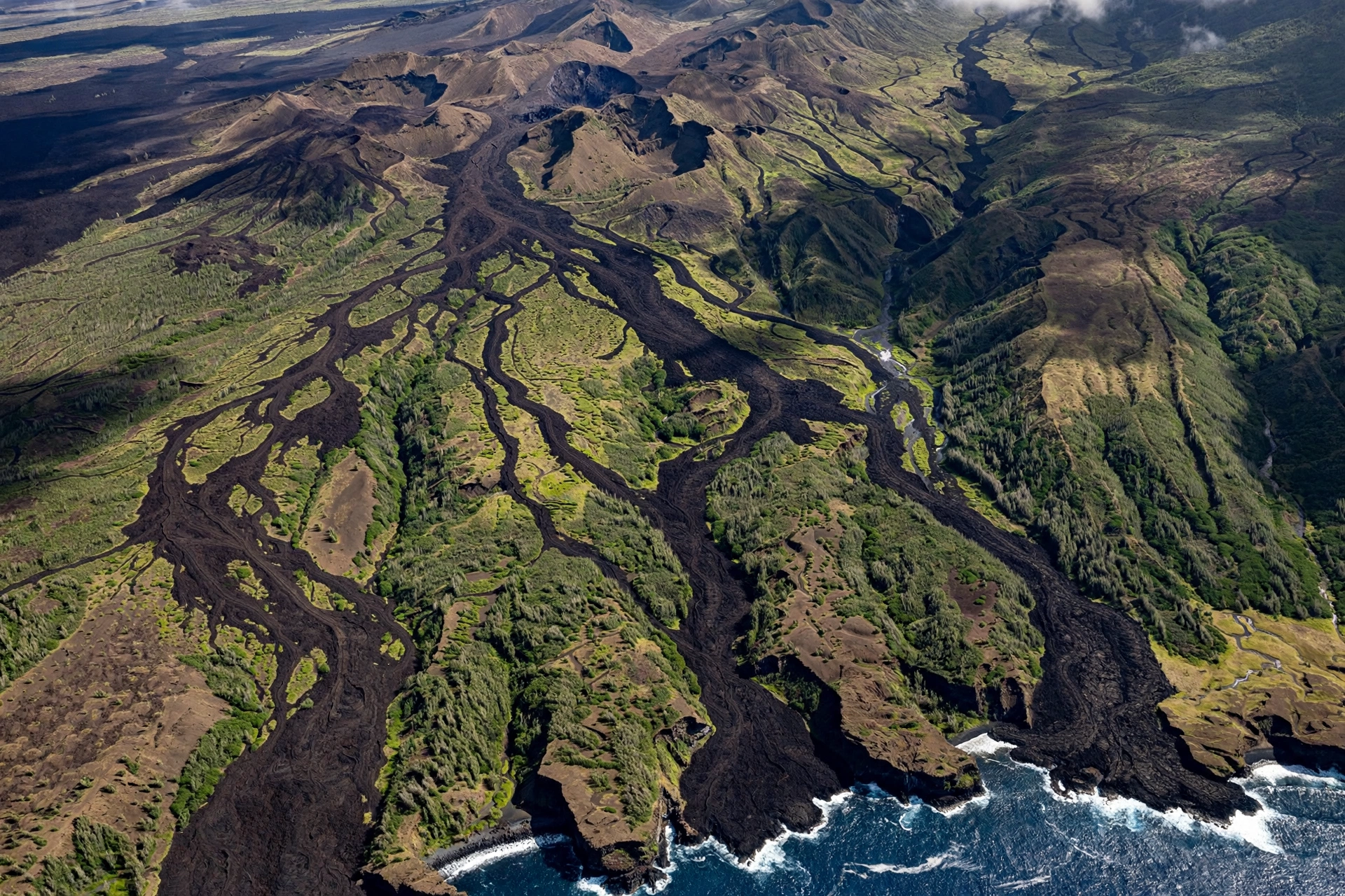
Scenic flights. Helicopter tours operate over the active volcanoes from Hilo and Kona-side bases, offering a perspective on rift zones, craters, and coastlines that is impossible from the ground. These are commercial sightseeing flights; compare operators on safety records and choose established companies, and remember that flight paths and lava viewing depend on current activity and weather.
Museums and geology stops. The park’s visitor center exhibits, the Jaggar Museum area displays, and roadside geology markers along Chain of Craters Road add depth to what you see outdoors. On Maui, the Haleakalā Visitor Centers at the summit and at headquarters cover the volcano’s natural and cultural history.
Frequently Asked Questions
Are Hawaiʻi’s volcanoes erupting right now?
Activity changes frequently. Kīlauea erupts episodically and Mauna Loa erupts far less often, so the only reliable answer comes from the USGS Hawaiian Volcano Observatory, which publishes current alert levels and updates. Check before your trip and again the morning of your visit.
Which island is best for seeing volcanoes?
The Island of Hawaiʻi, home to Hawaiʻi Volcanoes National Park, Kīlauea, Mauna Loa, and Mauna Kea. Maui’s Haleakalā is the other essential volcano destination, with its summit crater and sunrise views.
Is it safe to visit an active volcano?
Yes, when you follow official guidance. Stay in open areas, obey closures, remain on marked trails, and check USGS and National Park Service alerts before you go. The park is designed for safe viewing, and rangers adjust access as conditions change.
Can you see lava?
Sometimes. During summit eruptions, the glow from Halemaʻumaʻu is visible from overlooks, especially after dark. Surface flows and ocean entries occur only during certain eruptions. There is no permanent, guaranteed lava viewing, so check current activity rather than expecting it.
What is vog?
Volcanic smog, formed when sulfur dioxide from active vents reacts with sunlight, oxygen, and moisture. It can irritate eyes and airways and reduces visibility. People with respiratory or heart conditions should limit outdoor exertion when vog is heavy, particularly downwind of vents.
Can you walk on lava fields?
On old, cooled flows along marked trails, yes. On recent flows or near active areas, no. Even old lava is sharp and uneven, so wear sturdy closed-toe shoes, watch your footing, and never leave the signed route.
Is it really bad luck to take lava rocks?
The legend of Pele’s curse is widely known and respected in the islands. Beyond the legend, removing rocks, sand, or plants from a national park is illegal. Enjoy them, photograph them, and leave them where they are.
How much time do you need at Hawaiʻi Volcanoes National Park?
Plan at least one full day for the Kīlauea summit area, the Kīlauea Iki hike, and the drive down Chain of Craters Road. Two days lets you add the Kahuku unit, longer hikes, and ranger programs without rushing.
Related Guides
- Hawaiʻi Weather: seasons, vog, and microclimates that shape every volcano visit.
- Best Time to Visit Hawaiʻi: month-by-month planning for the islands.
- Hawaiʻi Beaches: black sand beaches formed by volcanic activity.
- Maui Travel Guide: Haleakalā planning alongside the rest of the island.
- Big Island Weather: summit cold, coastal heat, and vog patterns.
- Hawaiʻi Map: orienting the volcanoes across the island chain.
A Final Note
Hawaiʻi’s volcanoes are both a geologic engine and a cultural heart. They built every beach, valley, and cliff in the islands, and they continue to build today on the Island of Hawaiʻi. Visit with preparation, follow official guidance, respect the cultural significance of these places, and you will come away with a deeper understanding of how the islands came to be and why they inspire such devotion in the people who call them home.