
Molokaʻi History
On This Page
Molokaʻi’s history is unlike that of any other Hawaiian island. It is the story of an island that fed ancient chiefdoms with the largest fishponds in Hawaiʻi, sheltered some of the earliest Polynesian settlements in the archipelago, and then became known to the world through Kalaupapa, the remote peninsula settlement for people with Hansen’s disease. Ranchers and pineapple companies reshaped its dry west end, while its people repeatedly said no to the kind of development that transformed the other islands. The result is an island often called the most Hawaiian place in Hawaiʻi, where history is not behind glass but part of daily life. This guide walks through Molokaʻi’s past in chronological order, from the first voyagers to the present day.
Molokaʻi History at a Glance
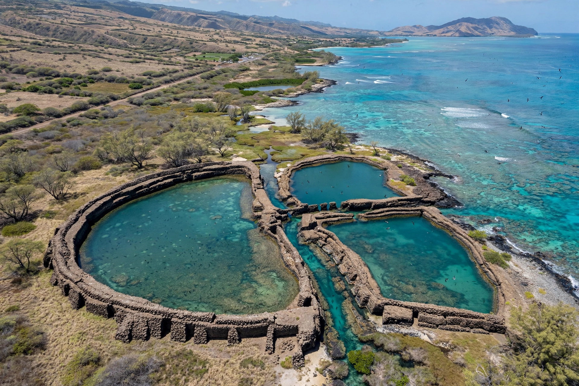
Molokaʻi is the fifth largest of the Hawaiian Islands, a long, narrow island of about 260 square miles. Two volcanoes built it: the older West Molokaʻi Volcano, worn into a dry, rolling landscape, and the younger East Molokaʻi Volcano, whose collapsed northern flank created the tallest sea cliffs in the world, rising over 3,000 feet above the Pacific. Between them sits the central Hoʻolehua plain. The island’s geography dictated its history: the calm south shore hosted vast fishponds, the wet east end valleys sheltered early settlements, the dry west end suited cattle, and the isolated Kalaupapa Peninsula, cut off by cliffs on one side and ocean on the other, became a place of exile.
Archaeologists consider Molokaʻi one of the earliest settled islands in the archipelago. Hālawa Valley on the east end contains evidence of human habitation stretching back more than a thousand years, and its taro terraces were still cultivated into modern times. The island’s south shore holds the greatest concentration of ancient Hawaiian fishponds anywhere in the islands, walled enclosures built in the shallows where fish were raised and harvested. These engineering works fed dense populations and supplied the chiefs of other islands.
In 1866 the Hawaiian Kingdom established the Kalaupapa settlement on the island’s north shore peninsula for people suffering from Hansen’s disease, known at the time as leprosy. The settlement’s story, and the lives of Father Damien and Mother Marianne who served there, brought Molokaʻi international attention. The nineteenth and twentieth centuries added cattle ranching and pineapple to the island’s economy, industries that rose and fell and left their marks on the landscape. Through it all, Molokaʻi’s Native Hawaiian community maintained a strong cultural identity and repeatedly resisted large-scale resort development, most recently in the battles over the island’s future after the Molokaʻi Ranch closed in 2008.
To understand Molokaʻi is to understand an island that has always gone its own way. The sections below follow that history from the earliest settlements to the present, with attention to the places where the past can still be seen and respectfully visited today.
Ancient Molokaʻi: Fishponds, Heiau, and Valleys
Long before written records, Molokaʻi was organized under the traditional Hawaiian system of land division. The island was split into large districts called moku, further divided into wedge-shaped ahupuaʻa running from the mountains to the sea. Society was structured around the aliʻi, the chiefly class, supported by kahuna, priests and skilled experts, and the makaʻāinana, the common people who farmed and fished. The kapu system of sacred laws regulated daily life, and religion centered on the great gods honored at heiau, stone temple platforms.
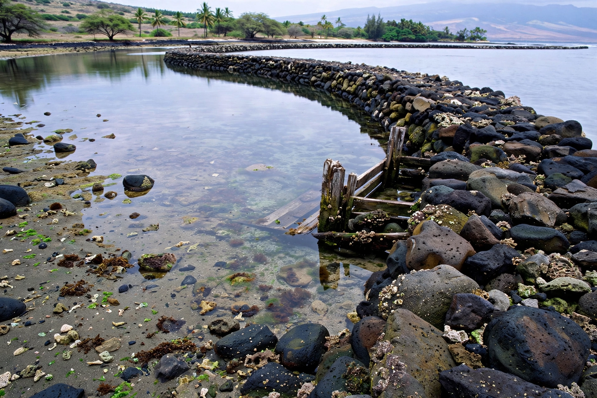
Molokaʻi’s most distinctive ancient achievement was its fishponds. The calm, shallow south shore, protected by one of the longest fringing reefs in the Hawaiian Islands, was ideal for loko iʻa, walled fishponds built of stacked rock in the shallows. More than fifty fishponds once lined the south shore, and several of the largest in all of Hawaiʻi are found here. ʻUalapuʻe Fishpond, near the east end of the south shore, is among the most significant, its long rock walls still visible at low tide. Keawanui and the Aliʻi Fishpond near Kaunakakai are other notable examples. These ponds were sophisticated aquaculture systems: gates called mākāhā allowed small fish to enter and kept larger fish inside, and the ponds were managed to produce a steady harvest for the chiefs and the community.
The fishponds made Molokaʻi a breadbasket of the ancient islands. Dried and salted fish from Molokaʻi’s ponds were traded to Oʻahu and other islands, and control of the ponds was a source of chiefly wealth and power. Oral traditions record that the great chief ʻUmi-a-Līloa of the island of Hawaiʻi, who lived in the sixteenth century, had connections to Molokaʻi, and the island’s chiefs intermarried with the ruling lines of Maui and Oʻahu. Building and maintaining the ponds required organized labor on a massive scale, and their construction over generations speaks to a prosperous, well-ordered society.
Hālawa Valley, at the far east end of the island, is one of the most important archaeological sites in Hawaiʻi. The valley’s broad floor was terraced for taro cultivation, and its streams watered one of the densest agricultural systems in the islands. Excavations have found evidence of continuous habitation stretching back to the earliest period of Polynesian settlement. The valley was home to a large population, and its residents maintained the terraces, fishponds at the valley mouth, and religious sites. Two waterfalls, Moʻoula and Hipuapua, drop from the valley walls. Access to the valley today is limited, and visitors should respect the privacy of the families who still live and farm there.
Molokaʻi also holds significant heiau. Iliʻiliʻōpae Heiau at Mapulehu, on the southeast coast, is one of the largest and most important temple platforms in the Hawaiian Islands. Tradition holds that it was built in a single night by the menehune, the legendary small people of Hawaiian stories, who passed stones hand to hand from the mountains to the sea. The heiau’s massive scale and its association with human sacrifice in later periods made it one of the most feared and respected religious sites in the islands. It remains a sacred place, and visitors should treat it with the utmost respect: stay on established paths, do not move or stack stones, and keep voices low.
The north shore’s towering sea cliffs, the tallest in the world, shaped the island’s ancient geography in another way. The valleys cut into the cliffs, including Wailau, Pelekunu, and Waikolu, sheltered small communities that were accessible mainly by sea or by steep trails. These remote valleys preserved traditional ways of life long after change came to the more accessible parts of the island, and their inaccessibility is part of why Kalaupapa, on the peninsula below the cliffs, was chosen for the settlement described in the next section.
Kalaupapa: The Settlement and Its Saints
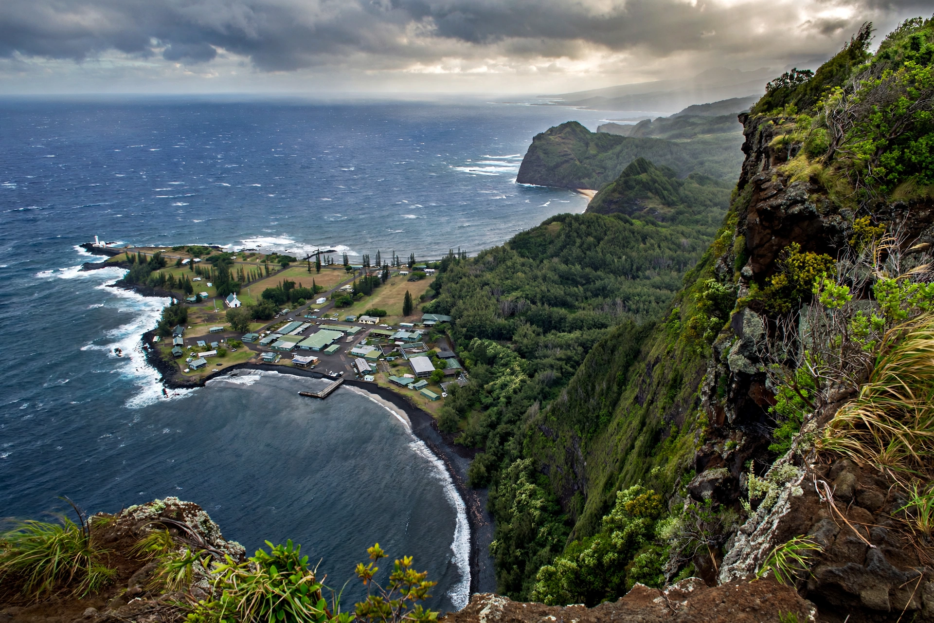
In the mid-nineteenth century, Hansen’s disease, then called leprosy, spread through the Hawaiian Islands with devastating effect. Native Hawaiians had no immunity to the introduced disease, and by the 1860s the kingdom’s government faced a public health crisis. In 1865 the legislature passed “An Act to Prevent the Spread of Leprosy,” which authorized the isolation of people with the disease. The following year, the government established a settlement on the Kalaupapa Peninsula, a flat shelf of land on Molokaʻi’s north shore, cut off from the rest of the island by the tallest sea cliffs in the world and bounded by ocean on the other three sides. The first group of patients arrived at Kalawao, on the peninsula’s windward side, in January 1866.
The early years at Kalawao were harsh. The settlement was remote, supplies were irregular, and the first patients lived in rough shelters with little medical care or support. Over time, the settlement developed into a community with homes, churches, and farms, and many patients built full lives there, marrying and raising families. The population grew as more people were sent to the peninsula, reaching its peak in the late nineteenth century. The settlement was later moved in part to the leeward side at Kalaupapa village, which offered a calmer landing and better conditions.
The settlement’s story is inseparable from two figures who gave their lives to its people. Father Damien, born Joseph de Veuster in Belgium, was a Catholic priest of the Congregation of the Sacred Hearts who arrived at Kalaupapa in 1873. He found a community in desperate need: the sick were often left without care, the dead without proper burial. Damien built houses, churches, and coffins, organized water systems, and ministered to the patients with a devotion that became known around the world. He contracted Hansen’s disease himself and died at Kalaupapa in 1889. The Catholic Church canonized him as Saint Damien of Molokaʻi in 2009.
Mother Marianne, born Barbara Koob in Germany and raised in New York, was a Franciscan sister who answered the Hawaiian Kingdom’s call for help in 1883. She led a group of Sisters of St. Francis to the islands and eventually took charge of the Bishop Home for girls at Kalaupapa, caring for the settlement’s most vulnerable residents with discipline and tenderness. She never contracted the disease despite decades of close contact with patients, a fact she attributed to careful hygiene. She died at Kalaupapa in 1918. The Catholic Church canonized her as Saint Marianne Cope in 2012.
The settlement’s later history reflects the changing science of the disease. Sulfone drugs developed in the 1940s made Hansen’s disease curable, and in 1969 the state ended the policy of mandatory isolation. Patients were free to leave, and many did, but a number chose to remain in the community they had built. Kalaupapa National Historical Park was established in 1980 to preserve the settlement and tell its story. The park is managed in cooperation with the State of Hawaiʻi Department of Health, which continues to care for the remaining patient-residents.
Today Kalaupapa is home to a small number of elderly former patients who chose to spend their lives there, and the settlement is both a national park and their home. Visitors are welcome but access is strictly controlled out of respect for the residents: the settlement can only be visited with an authorized tour, and visitors must be at least 16 years old. The famous sea cliff trail, once the main route down to the peninsula, has been closed, and current access is by small aircraft or by permitted tour. Anyone planning a visit should check the National Park Service’s current guidance well in advance, approach the settlement with quiet respect, and understand that this is a place of suffering, courage, and community, not a conventional tourist attraction.
Ranching and the Plantation Era
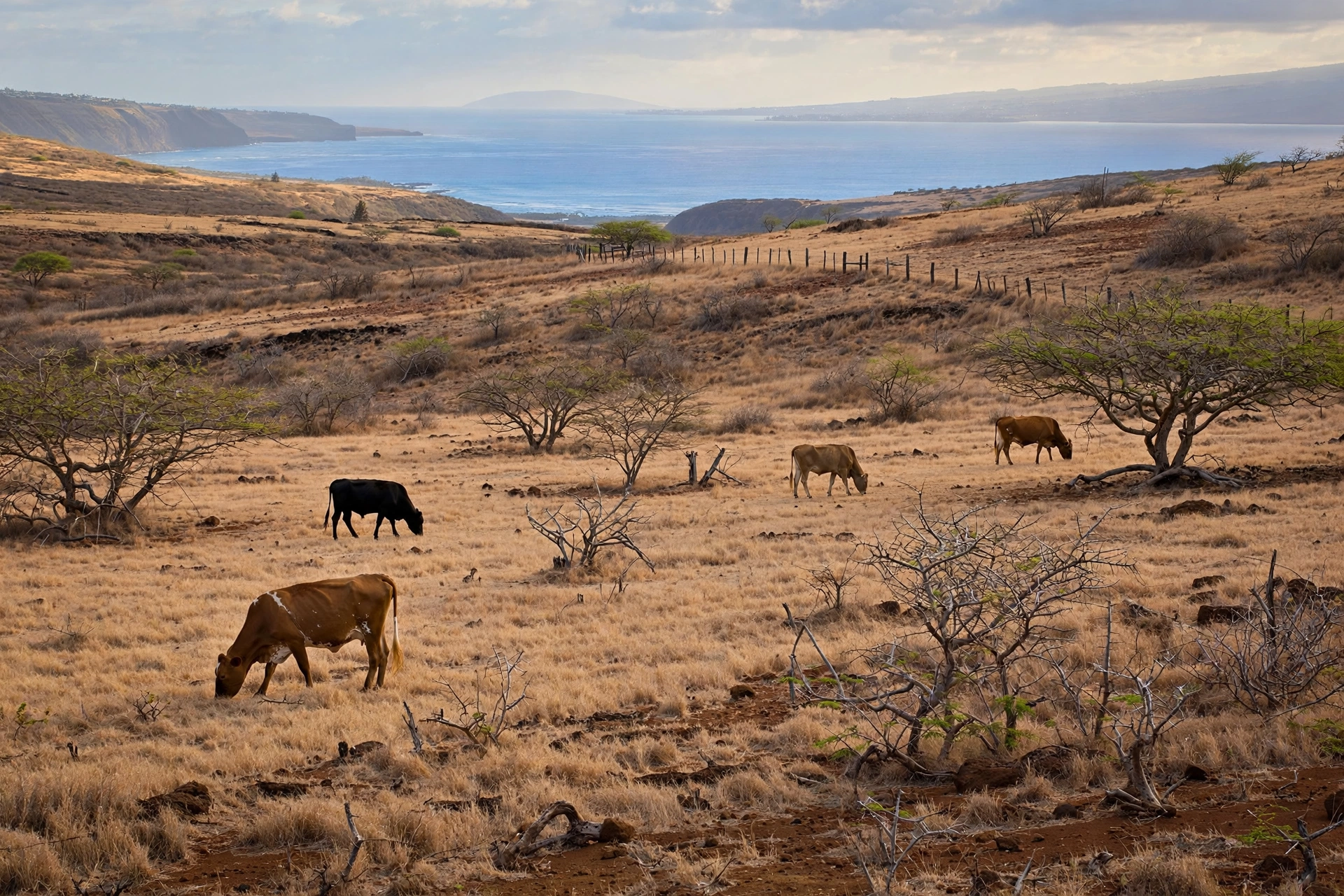
While Kalaupapa occupied the north shore, the rest of Molokaʻi was being reshaped by ranching and plantation agriculture. Cattle arrived in the Hawaiian Islands in the 1790s as a gift to Kamehameha, and ranching spread to Molokaʻi in the nineteenth century. The dry west end, with its rolling grasslands, proved well suited to cattle, and large ranches came to dominate the island’s western half. The Molokaʻi Ranch, established in the late nineteenth century, grew into one of the island’s largest landholders, running thousands of head of cattle across tens of thousands of acres.
Pineapple followed cattle as the island’s second great agricultural industry. The Dole Food Company and later Del Monte operated pineapple plantations on Molokaʻi’s central plain, where the red soils and sunny climate produced excellent fruit. At its height, the pineapple industry employed hundreds of Molokaʻi residents and shaped the economy of towns like Kualapuʻu, which grew up as a plantation village. The industry declined in the late twentieth century as global competition drove production overseas, and Del Monte ended its Molokaʻi operations in the 1970s. The closure cost the island hundreds of jobs and marked the beginning of a long economic transition.
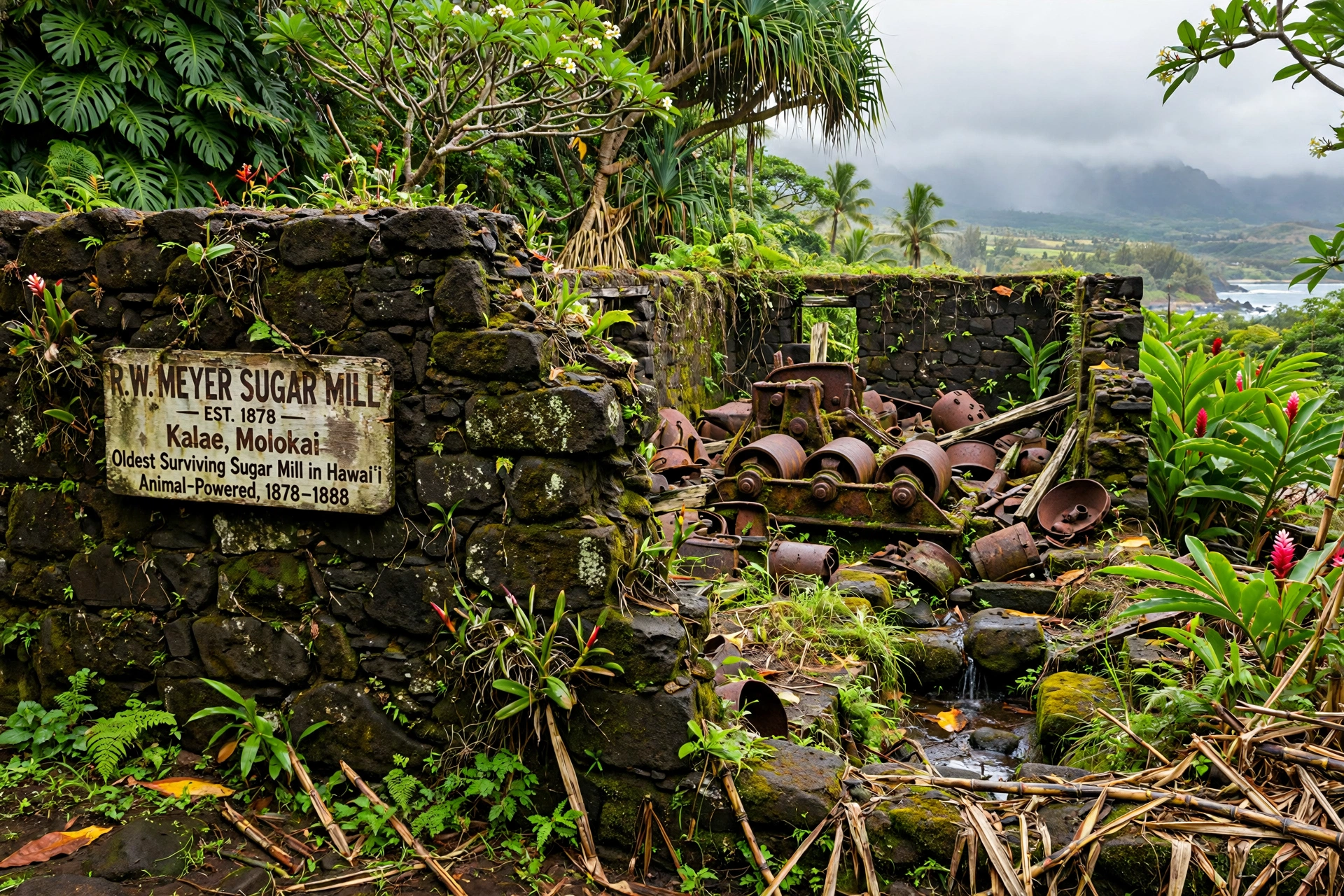
Sugar had a smaller but notable presence. The R. W. Meyer Sugar Mill at Kalaʻe, built in 1878, is the oldest surviving sugar mill in Hawaiʻi. Rudolf Wilhelm Meyer, a German immigrant who married into a prominent Hawaiian family, operated the mill to process cane grown on the island’s wetter slopes. The mill’s stone walls and iron machinery still stand, and the site offers a rare glimpse of the small-scale sugar operations that preceded the great plantations of the other islands. Molokaʻi never developed the vast plantation system of Maui or the island of Hawaiʻi, which is one reason its landscape and communities retained a different character.
The ranching era left lasting marks beyond the pastures. The Molokaʻi Ranch built the island’s early infrastructure, including roads and the harbor facilities at Kaunakakai, and its paniolo, Hawaiian cowboys, became part of the island’s cultural fabric. Hunting, particularly for axis deer, which were introduced to the island and multiplied across the west end, became both a subsistence tradition and a visitor activity. Coffee later found a home on the former plantation lands around Kualapuʻu, where Coffees of Hawaii established one of the state’s larger coffee farms.
The end of the plantation era forced hard choices. When the Molokaʻi Ranch shut down its operations in 2008, laying off more than a hundred workers, the island lost its largest private employer and landowner. The closure sparked an intense community debate about the island’s future, including a controversial proposal to develop luxury homes at Laʻau Point on the southwest coast. Community opposition, organized under the banner of keeping Molokaʻi rural and Hawaiian, ultimately helped stop the development. The episode confirmed a pattern: Molokaʻi’s people have consistently chosen preservation over large-scale development, a choice that defines the modern island.
Modern Molokaʻi: Preservation and Community
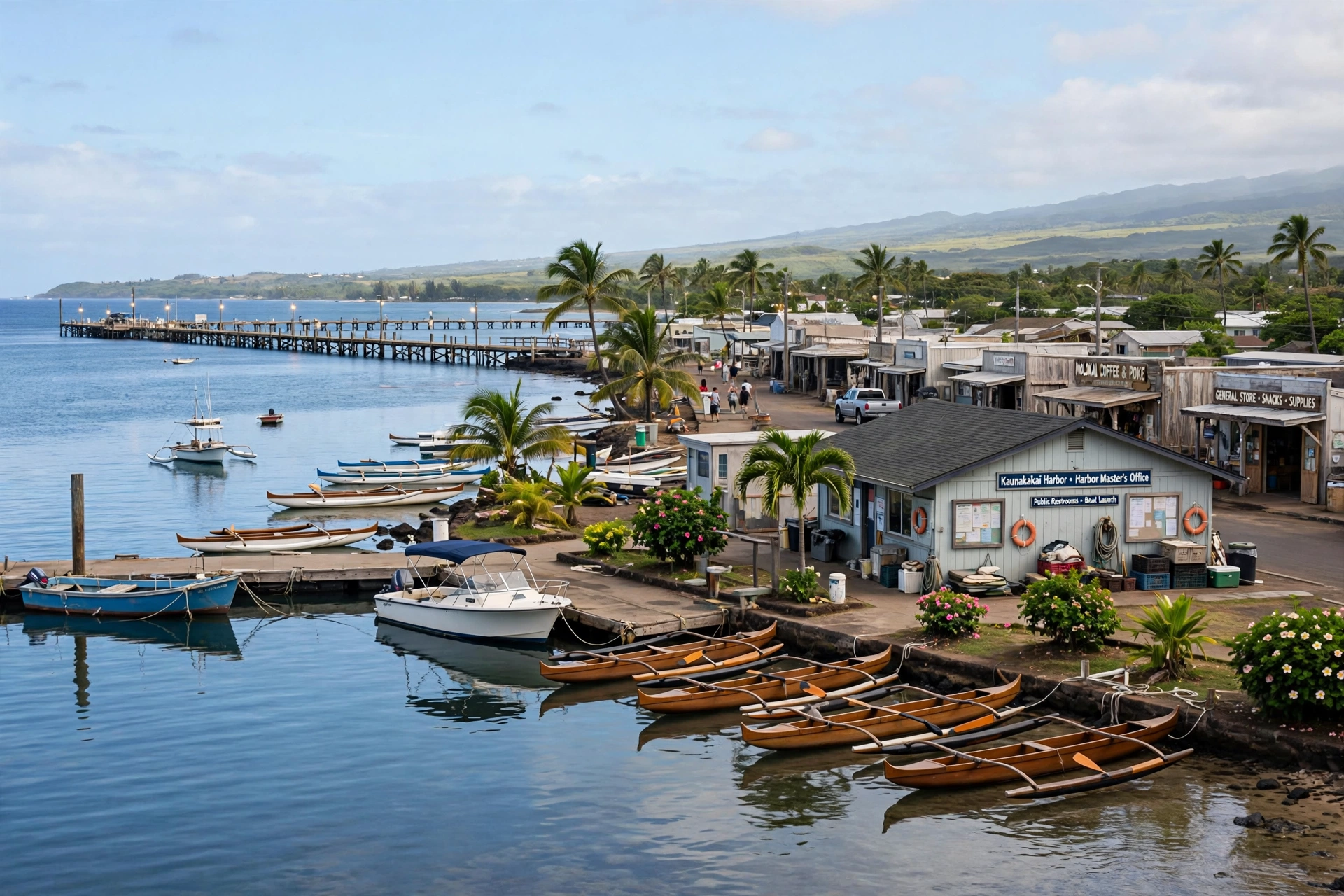
Modern Molokaʻi is defined less by what was built than by what was refused. While the other main islands developed resort coastlines, Molokaʻi has no large resort hotels, no traffic lights, and a year-round population of roughly 7,000 people. The island’s Native Hawaiian community, which makes up a large share of the population, has been the driving force behind this resistance to development, arguing that large-scale tourism would destroy the culture, environment, and way of life that make Molokaʻi special.
The battles over development form a central thread of recent history. In the 1970s and beyond, proposals for destination resorts on the west end met sustained community opposition. The Laʻau Point controversy of the 2000s, in which the Molokaʻi Ranch sought community approval for a luxury development in exchange for land donations, ended with the community voting no and the ranch closing its doors. The episode is still discussed on the island as a defining moment, proof that the community’s voice could prevail over powerful interests.
This stance has economic costs, and Molokaʻi’s residents are frank about them. Jobs are scarce, young people often leave for school or work on other islands, and the cost of living is high, with nearly everything shipped in by barge. The island’s economy rests on small businesses, government employment, subsistence fishing and hunting, small-scale agriculture, and a modest visitor industry built around the island’s natural and cultural attractions. Community organizations have worked to build local food systems, restore fishponds, and create livelihoods that fit the island’s values rather than fighting them.
Cultural preservation is the other pillar of modern Molokaʻi. The island is a stronghold of the Hawaiian language, traditional hula, and subsistence practices. Fishpond restoration projects have brought community volunteers back to the ancient walls of the south shore, rebuilding rock by rock using traditional methods. Hālawa Valley’s taro farmers continue cultivation methods passed down through generations. The annual Molokaʻi Ka Hula Piko festival celebrates the island’s claim as the birthplace of the hula, drawing practitioners from across the islands.
Molokaʻi’s relationship with visitors reflects this history. The island welcomes travelers who come with respect, an interest in Hawaiian culture, and realistic expectations: there are no luaus on the beach or resort concierges here. What visitors find instead is an island where Hawaiian culture is lived rather than performed, where the past is present in the fishponds, the valley terraces, and the stories people tell. Understanding the history of resistance and preservation helps visitors appreciate why Molokaʻi looks and feels the way it does, and why its residents are protective of it.
Historic Sites to Visit
Molokaʻi’s history can be encountered in its places. The following sites offer the most rewarding connections to the island’s past. Access and conditions can change, so confirm current status before visiting, and treat every cultural site with respect.
Kalaupapa National Historical Park
The settlement on the isolated north shore peninsula, accessible only by authorized tour with visitors aged 16 and older. The park preserves the churches, homes, and graves of the Hansen’s disease settlement, including St. Philomena Church at Kalawao, built under Father Damien’s direction, and the grave sites of Saint Damien and Saint Marianne. Check the National Park Service’s current access guidance well in advance, as the cliff trail is closed and tour arrangements are required.
Iliʻiliʻōpae Heiau
At Mapulehu on the southeast coast, one of the largest heiau in the Hawaiian Islands, traditionally said to have been built in a single night by the menehune. This is a sacred site of great cultural sensitivity. Stay on established paths, do not touch or move stones, and visit quietly.
ʻUalapuʻe Fishpond
One of the largest and most significant ancient fishponds in Hawaiʻi, on the south shore near the east end. Its long rock walls are visible at low tide. Community restoration work continues here, and the pond is best appreciated as a living cultural site rather than a photo stop.
R. W. Meyer Sugar Mill
At Kalaʻe, the oldest surviving sugar mill in Hawaiʻi, built in 1878. The stone structure and iron machinery illustrate the small-scale sugar era that preceded the great plantations. The site is on private land with limited access; view respectfully from public areas.
St. Joseph Church, Kamalo
Built in 1876 under Father Damien’s supervision, this small stone church on the south shore predates his move to Kalaupapa. It is one of several churches Damien built on Molokaʻi and offers a quiet connection to his early years on the island.
Hālawa Valley Overlook
The valley itself has limited access, but the overlook at the end of Highway 450 offers views into one of Hawaiʻi’s most important archaeological landscapes. Remember that families live and farm in the valley below; the overlook is for viewing, not for entering.
Kaunakakai Town
Molokaʻi’s main town retains its mid-twentieth century character, with false-front storefronts along Ala Malama Street that recall the plantation and ranching era. The town’s small harbor, churches, and community buildings tell the story of an island that grew slowly and on its own terms.
Frequently Asked Questions
Who were the first settlers of Molokaʻi?
Polynesian voyagers settled Molokaʻi more than a thousand years ago, and the island is considered one of the earliest settled in the archipelago. Hālawa Valley on the east end contains evidence of continuous habitation stretching back to this early period, with extensive taro terraces that were farmed for centuries.
What was Kalaupapa?
Kalaupapa was a settlement established by the Hawaiian Kingdom in 1866 on Molokaʻi’s isolated north shore peninsula for people with Hansen’s disease, then called leprosy. At its peak it housed over a thousand residents. Mandatory isolation ended in 1969, and today it is a national historical park and home to a small number of elderly former patients.
Who were Father Damien and Mother Marianne?
Father Damien, born Joseph de Veuster, was a Belgian Catholic priest who served the Kalaupapa patients from 1873 until his death from the disease in 1889. Mother Marianne Cope was a Franciscan sister who led care for the settlement’s residents from 1883 until her death in 1918. Both were canonized as saints, Damien in 2009 and Marianne in 2012.
Can visitors go to Kalaupapa?
Yes, but access is strictly controlled. Visitors must be at least 16 years old and can only enter with an authorized tour. The historic cliff trail is closed, so current access is by small aircraft or permitted tour operators. Check the National Park Service’s guidance well in advance and approach the settlement with respect for its residents.
What is special about Molokaʻi’s fishponds?
Molokaʻi’s south shore holds the greatest concentration of ancient Hawaiian fishponds in the islands, including several of the largest ever built. These walled aquaculture systems, such as ʻUalapuʻe Fishpond, were sophisticated food production works that fed dense populations and supplied other islands through trade.
Why is Molokaʻi called the most Hawaiian island?
Molokaʻi has the highest proportion of Native Hawaiian residents of any island, a living Hawaiian language and cultural tradition, and a long history of resisting the large-scale resort development that transformed the other islands. Its people have repeatedly chosen cultural and environmental preservation over mass tourism.
What happened to the pineapple industry on Molokaʻi?
Pineapple was a major employer on Molokaʻi through the mid-twentieth century, centered on the central plain around Kualapuʻu. Global competition drove production overseas, and the island’s pineapple operations closed in the 1970s, costing hundreds of jobs and beginning a long economic transition toward smaller-scale agriculture and local enterprise.
What is the oldest historic building on Molokaʻi?
Among the oldest surviving structures is the R. W. Meyer Sugar Mill at Kalaʻe, built in 1878, the oldest sugar mill still standing in Hawaiʻi. St. Joseph Church at Kamalo, built in 1876 under Father Damien’s direction, is another important nineteenth century building.
Related Guides
- Molokai Travel Guide: the island overview, regions, and trip planning
- Molokai Map: Complete Reference Map & Area Guide: the island’s regions, towns, and driving routes
- Molokai Towns: Kaunakakai, Kualapuʻu, Maunaloa, and the island’s communities
- Molokai Hikes: trails including the Hālawa Valley area
- Maui History: the neighboring island’s past, from chiefdoms to the present
- Oahu History: the kingdom era and Honolulu’s rise
- Kauai History: the oldest island’s distinct past
- Hawaii Map: Complete Reference Map & Area Guide: the full island chain in geographic context
A Final Note
Molokaʻi’s history resists the simple story of paradise found and developed. It is an island that fed ancient chiefdoms with engineering marvels of stone and seawater, that became known to the world through a settlement built on suffering and redeemed by extraordinary compassion, and that has repeatedly chosen its culture and community over the easy money of mass development. The fishpond walls still stand in the shallows, the taro still grows in Hālawa Valley, and the people of Molokaʻi still decide their island’s future for themselves. Visitors who learn this history will understand why Molokaʻi guards its past so carefully: it is not a museum piece but the foundation of a living community.