
Molokaʻi Hikes
On This Page
Molokaʻi is not a hiking destination in the way Maui or Kauaʻi are, and that is precisely what makes walking here special. The island has no national park trail system, no crowded trailhead parking lots, and no network of maintained state hiking trails. What it has instead is a handful of remarkable routes through landscapes you will find nowhere else: a lush valley that ends at a 250-foot waterfall, a mountaintop bog crossed by a boardwalk through cloud forest, and coastal paths along an ancient fishpond shoreline. Every one of them comes with conditions, and respecting those conditions is part of the experience.
Hiking on Molokaʻi: An Overview
Hiking on Molokaʻi works differently than hiking anywhere else in Hawaiʻi. Much of the island is private land, and access to the most celebrated trails depends on the permission of the people who own or steward the land. The Hālawa Valley waterfall hike crosses family land and can only be done with a local cultural guide. The Pepeʻopae Trail in the Kamakou Preserve sits inside a Nature Conservancy reserve and requires an advance permit. The famous Kalaupapa switchback trail, once descended by mule riders, is closed to hikers. These are not suggestions. They are the terms on which the island shares its trails, and visitors who honor them are welcomed.
The island’s geography shapes the hiking as well. Molokaʻi is the fifth largest Hawaiian island, roughly 38 miles long and 10 miles wide, formed by two shield volcanoes. The dry west end rises gently to low hills. The central plateau around Hoʻolehua is ranch country. The east end climbs through the Kamakou uplands to the island’s high point near 4,961 feet, then drops into the deeply carved valleys of the north shore, where sea cliffs rise to 3,000 feet, among the tallest in the world. The south shore is a long, calm coastline lined with ancient Hawaiian fishponds. Trails are concentrated in the east end and the uplands. There is no circle road around the island and no trail that traverses it.
Distances on Molokaʻi are short but the logistics are real. Kaunakakai, the main town, sits on the central south shore. The Hālawa Valley trailhead is at the end of Route 450, roughly 30 miles and an hour’s drive east. The Kamakou Preserve trailhead is reached by a rough unpaved road that requires a high-clearance vehicle, and many rental agreements restrict where you can drive. Plan your hiking days around these drives, carry everything you need, and tell someone your plans. Cell service is unreliable or nonexistent in the valleys and the uplands.
What surprises most visitors is how much the island reveals to those who slow down. A morning on the Pepeʻopae boardwalk, with mist moving through the ʻōhiʻa and the calls of native birds overhead, feels like stepping into a Hawaiʻi that existed long before resorts and rental cars. An afternoon in Hālawa Valley, walking behind a guide whose family has lived there for generations, connects you to the island’s living culture in a way no viewpoint ever could. Molokaʻi’s trails are few, and that scarcity is the point. Each one is earned, whether by planning, by permission, or simply by the willingness to drive to the end of the road.

The Best Hikes on Molokaʻi
The trails below are the island’s established routes, described honestly with their access requirements. A few other informal paths exist along the east end coast and in the west end hills, but they cross private land and are not appropriate for visitors to attempt without local guidance. When in doubt, ask locally and respect posted signs.
Hālawa Valley Trail to Moʻoula Falls
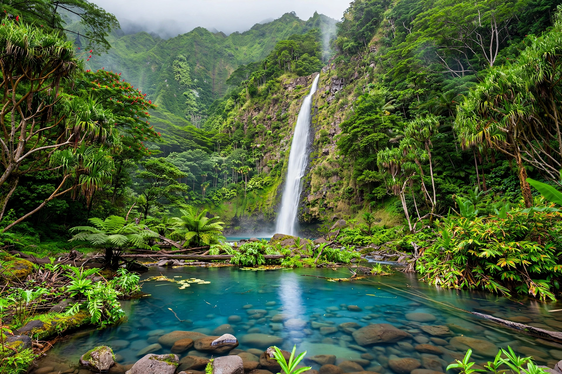
The signature hike on Molokaʻi follows an ancient Hawaiian valley to one of the island’s great waterfalls. Hālawa Valley, at the eastern tip of the island where Route 450 ends, was settled centuries before European contact and remains a place of deep cultural significance, with taro loʻi, stone terraces, and heiau still present in the valley floor. Moʻoula Falls drops roughly 250 feet in a narrow cascade into a clear pool, framed by towering green walls.
The hike is about 2 miles each way and follows a sometimes muddy trail along the stream, crossing it several times on stepping stones. It is not technically difficult, but it is not a casual walk either. The trail crosses private family land, and access requires going with an authorized local cultural guide from one of the Hālawa families. This is a firm requirement, not a recommendation. The guided hike typically takes a full morning, and your guide will share the valley’s history, its plants, and its protocols as you walk. Book ahead, as guide availability is limited and groups are small.
Swimming at the falls is sometimes possible depending on conditions and your guide’s judgment. Do not jump from rocks, and never enter the pool during or after heavy rain, when the stream can rise with frightening speed. The valley is sacred ground. Stay on the trail, do not pick plants or move stones, and follow your guide’s instructions about where you may and may not go.
Pepeʻopae Trail, Kamakou Preserve
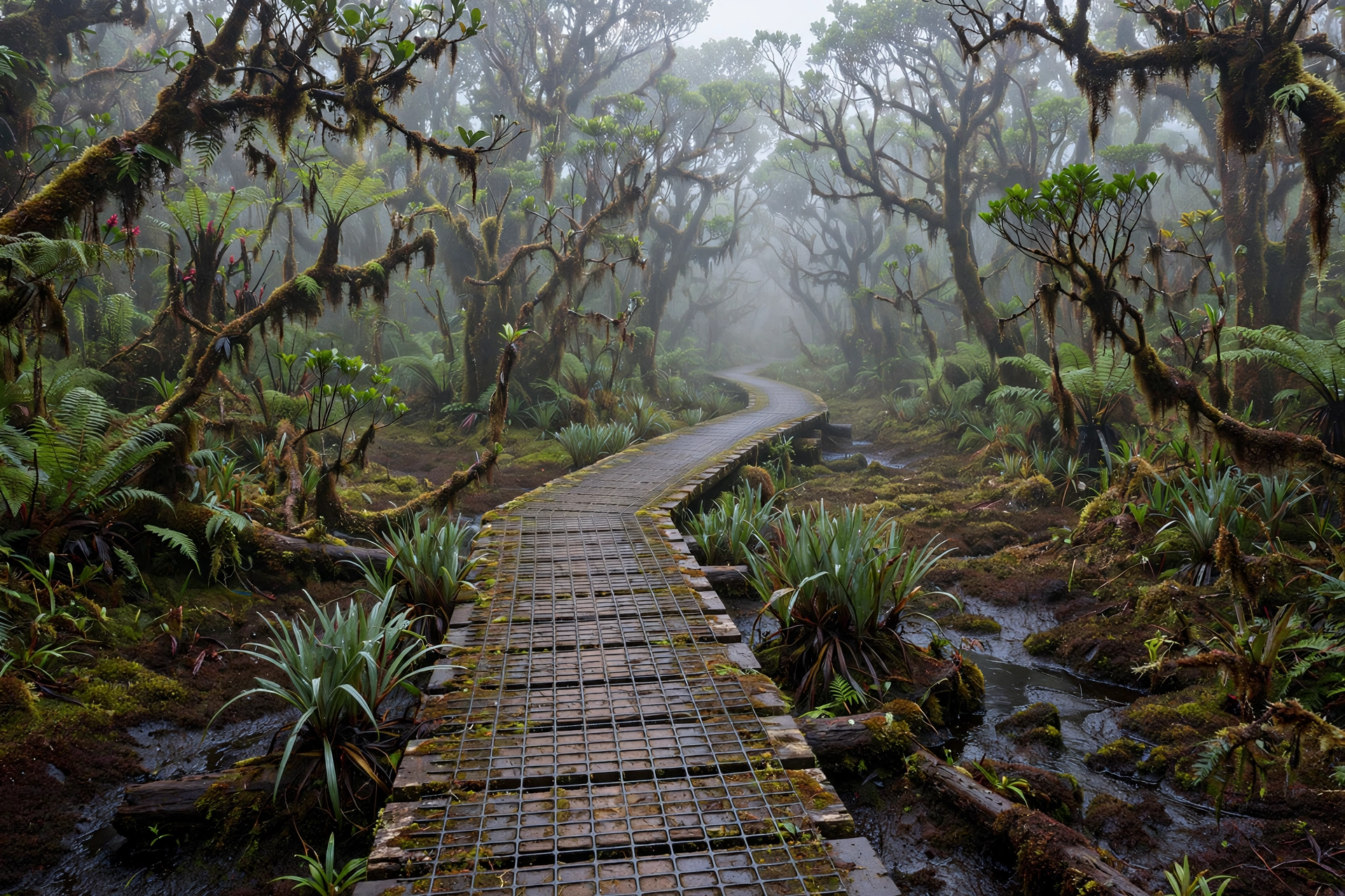
The most unusual hike on Molokaʻi crosses a mountaintop bog that feels nothing like the Hawaiʻi of postcards. The Kamakou Preserve, managed by The Nature Conservancy, protects native montane rainforest and bog on the slopes below the island’s summit. The Pepeʻopae Trail is a roughly 2-mile boardwalk loop through cloud forest and open bog, where stunted ʻōhiʻa trees, sedges, and mosses grow in a landscape shaped by constant mist and rain.
The bog is home to native birds found only in these high forests, and on a clear morning you may hear them calling through the mist. The boardwalk protects the fragile bog vegetation, which can take decades to recover from a single footprint off the path. Stay on the boardwalk at all times.
Access requires an advance permit from The Nature Conservancy, and the preserve is open to permitted visitors only on designated days. Reaching the trailhead means driving a rough, unpaved road up from the east end that demands a high-clearance vehicle, preferably four-wheel drive, and dry conditions. Check the weather before you commit to the drive. This is the most logistically demanding hike on the island, and it is worth every bit of the effort for walkers who want to see Hawaiʻi’s native forest as it was before people arrived.
Palaʻau State Park Trails
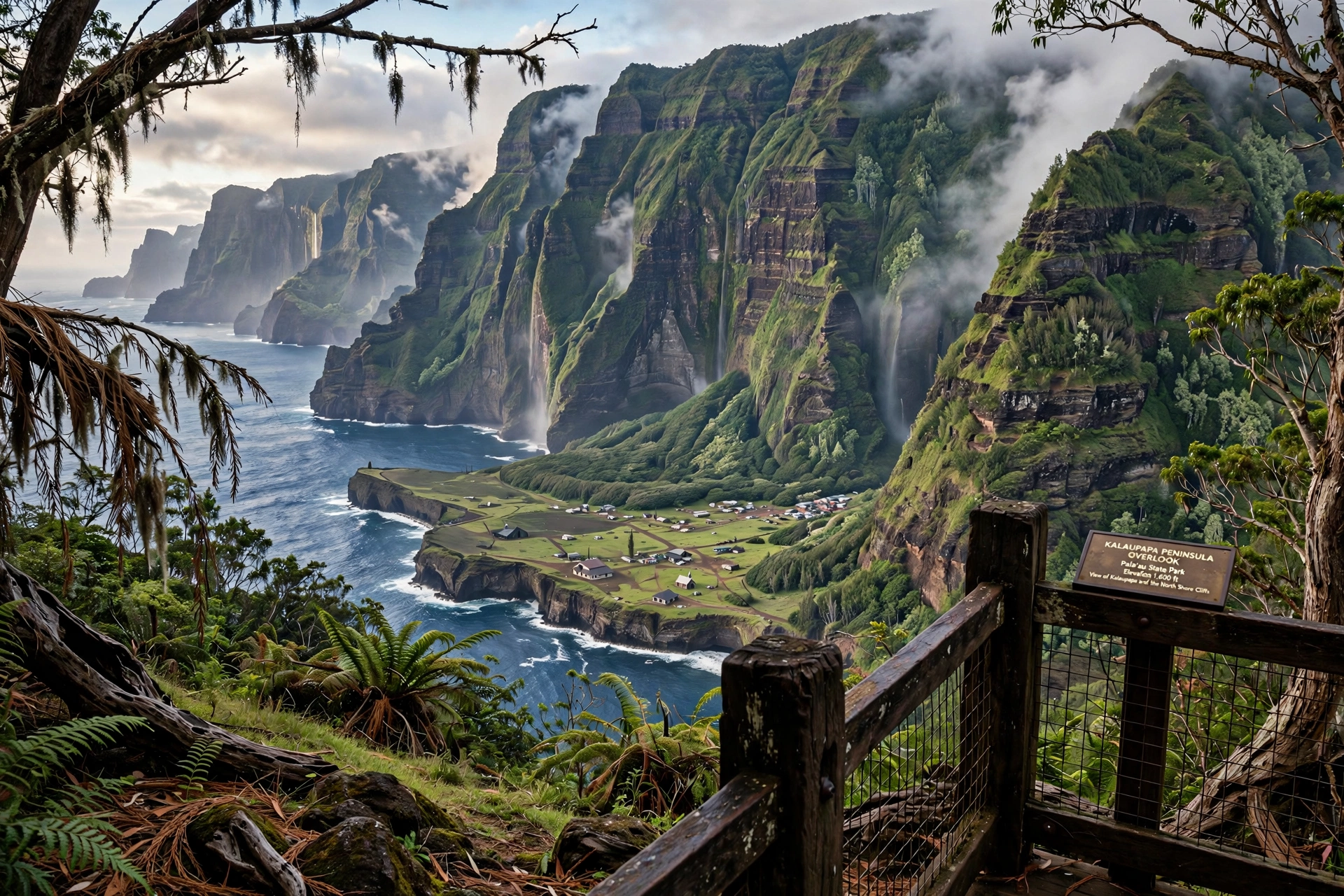
Palaʻau State Park, on the central north side of the island, is the easiest and most accessible place to walk on Molokaʻi. The park’s main attraction is the Kalaupapa overlook, reached by a short, easy path from the parking area, with a sweeping view down the 1,600-foot cliffs to the Kalaupapa peninsula and the Pacific beyond. Interpretive signs explain the history of the settlement below.
A second short trail leads through ironwood forest to Kaule o Nānāhoa, known as Phallic Rock, a natural stone formation with cultural significance. The walk is gentle and shaded, suitable for most fitness levels. The park has picnic tables, restrooms, and some of the island’s finest views. It is an ideal first stop for visitors finding their feet, and it pairs naturally with a drive up the Kalae Highway.
The Kalaupapa Trail: Closed to Hikers
The trail that descends the cliffs to Kalaupapa deserves a mention precisely because you cannot hike it. The switchback path drops about 1,600 feet over 3.5 miles, with 26 numbered turns carved into the cliff face. For decades it was famous for its mule rides, which ended in 2018. The trail is currently closed to public hiking, and there is no legal way to walk down to the peninsula.
Kalaupapa itself, now Kalaupapa National Historical Park, is accessible only by small aircraft or by boat, and visits require a permit arranged in advance. The settlement remains home to a small number of remaining Hansen’s disease patients, and it is a place of profound history that deserves quiet respect. View it from the Palaʻau overlook, learn its story from the National Park Service, and do not attempt the closed trail.
Wailau Valley Views
Wailau Valley, east of Kalaupapa on the north shore, is one of the great hidden valleys of Hawaiʻi, a vast amphitheater with waterfalls threading down its walls. There is no maintained trail into Wailau for visitors, and the old route from the summit is overgrown and unsafe. The valley is best appreciated from the air on a helicopter tour or from the sea, where its scale becomes apparent. Include it in your mental map of the island’s north shore valleys, alongside Hālawa and Pelekunu, as places to admire rather than enter.
East End Coastal Walks
The most relaxed walking on Molokaʻi is along the south shore east of Kaunakakai, where Route 450 runs close to the water past ancient fishponds. There is no single named trail here, but the shoreline offers informal walking where public access exists. Park respectfully, stay on the shore side of the road, and do not cross private property to reach the water. The fishponds, walled arcs of stone in the shallows, are centuries-old Hawaiian aquaculture and are still being restored by community groups. Admire them, do not walk on the walls, and keep your distance from any restoration work in progress.
Permits and Permissions
On Molokaʻi, the question is rarely whether a trail is difficult. It is whether you are allowed on it. The island’s hiking access rests on three different systems, and understanding them before you arrive will save you disappointment.
Cultural guides in Hālawa Valley. The waterfall hike requires a guide from an authorized local family. Book before your trip, as same-week availability is not guaranteed. The fee supports the family and the valley’s stewardship. Treat the hike as a cultural visit, not a workout, and follow every instruction your guide gives.
The Nature Conservancy permit for Kamakou. The Pepeʻopae Trail requires an advance permit, and the preserve limits visitor days. Contact The Nature Conservancy’s Molokaʻi program well ahead of your visit to check availability and current access rules. Do not drive up without a confirmed permit.
State parks. Palaʻau State Park requires no permit and no reservation for day visits. Standard Hawaiʻi state park rules apply: stay on trails, pack out everything you bring, and observe quiet hours if camping nearby.
Beyond these, the general rule for the island is simple. If a path crosses land that is not clearly public, you need permission. Posted signs, gates, and fences mean what they say. Trespassing is taken seriously on Molokaʻi, and the community’s protectiveness of its land is well earned. When a local tells you a trail is closed or off limits, accept it graciously. There is always another way to experience the island.
Hiking Safety on Molokaʻi
Molokaʻi’s trails are remote by Hawaiian standards, and the island’s rescue resources are limited. The precautions below are not boilerplate. They reflect how the island actually works.
Remoteness. You may be the only group on the trail. In Hālawa Valley and the Kamakou uplands, cell service is unreliable or absent. Tell someone your plan, your expected return time, and what to do if you do not check in. Guided and permitted hikes build this safety net in automatically, which is another reason the access rules exist.
Flash floods. Valley streams can rise dangerously fast during rain. If it is raining heavily in the mountains above you, even under a blue sky where you stand, stay out of stream beds and narrow valley floors. Your Hālawa guide will make the call on whether the falls hike is safe on a given day. Respect it.
Cliffs and ocean. The north shore cliffs are sheer and unforgiving. Stay well back from edges at overlooks, and never approach cliff rims in wet or windy conditions. On coastal walks, the ocean on the north and east shores can be rough, with no lifeguards anywhere on the island. Never turn your back on the water.
Heat and sun. The west end and the south shore are dry and exposed. Carry more water than you think you need, wear sun protection, and hike in the morning. The uplands are the opposite problem: Kamakou is cool, wet, and misty, and hypothermia is a real risk if you are soaked and the wind picks up. Dress in layers and bring rain gear regardless of the forecast.
Private land and hunting areas. Parts of the island are active hunting areas. If you are walking anywhere near forested or upland areas outside the established trails, wear bright colors. Never wander off established routes onto land you have not confirmed is open to you.
What to Bring
Molokaʻi has limited shopping, so assemble your hiking kit before you leave Kaunakakai, or better yet before you leave Honolulu. The island’s one full-service grocery and a handful of small stores stock basics, but specialized gear is not available.
- Water: At least 2 liters per person for a half-day hike, more for Kamakou or any full-day outing. There is no potable water at trailheads.
- Footwear: Sturdy shoes with good grip. Valley trails are muddy and stream crossings are slippery. The Kamakou boardwalk is easy underfoot but the access road is not.
- Rain gear: A light rain jacket year round. The east end and uplands can rain on any day.
- Sun protection: Hat, sunscreen, and sunglasses for the dry west end and south shore.
- Layers: Kamakou mornings can be in the 50s Fahrenheit. Bring a warm layer even if Kaunakakai is 80 degrees.
- Food: Trail snacks and lunch. There are no food vendors near any trailhead.
- First aid: A basic kit including blister care, plus any personal medications.
- Navigation: Downloaded offline maps. Do not rely on live cell data.
- Dry bag: For stream crossings and sudden rain in the valleys.
- Cash: Guide fees and small purchases in Hālawa and east end communities may be cash only.
Best Time to Hike
Molokaʻi is hikeable year round, but the seasons matter. The wetter months, roughly November through March, bring the heaviest rain to the east end and the uplands. Waterfalls are at their most dramatic, but valley trails are muddiest and flash flood risk is highest, and your Hālawa guide may cancel. The drier months, April through October, offer more reliable trail conditions, though the west end and south shore can be hot.
Morning is the best time to start any hike on the island. Trade winds typically build through the day, and afternoon showers are common in the east end even in the dry season. An early start also gives you a buffer for the long drives back to Kaunakakai. Winter brings large surf to the north and east shores, which affects coastal walks but not the valley and upland trails.
Molokaʻi Hiking FAQ
Do I really need a guide for the Hālawa Valley waterfall hike?
Yes. The trail crosses private family land, and access is only granted through authorized local guides. This is a firm requirement. The guided hike is also a far richer experience, as your guide shares the valley’s history, culture, and ecology along the way.
Can I hike down to Kalaupapa?
No. The Kalaupapa switchback trail is closed to public hiking. Kalaupapa National Historical Park is reached by small aircraft or boat, and visits require an advance permit. View the peninsula from the Palaʻau State Park overlook.
How do I get a permit for the Kamakou Preserve?
Contact The Nature Conservancy’s Molokaʻi program in advance. Permits are required, visitor days are limited, and you should confirm access before driving up. The access road requires a high-clearance vehicle.
Are there any easy hikes on Molokaʻi?
Palaʻau State Park offers short, easy walks to the Kalaupapa overlook and through the forest to Kaule o Nānāhoa. The south shore coastal areas near Kaunakakai allow gentle informal walking where public access exists.
Is Molokaʻi hiking dangerous?
The established trails are safe for prepared hikers who follow the rules. The risks come from remoteness, flash floods, cliffs, and ocean exposure, not from the trails themselves. Go with guides where required, check conditions, and carry the ten essentials.
Can I hike in Hālawa Valley on my own if I stay on the trail?
No. There is no public right of way through the valley, and hiking without a guide is trespassing on private land. The community enforces this, and visitors should respect it without exception.
What should I wear for the Kamakou Preserve?
Layers and rain gear. The preserve sits above 3,000 feet in cloud forest, and temperatures can be 20 degrees cooler than Kaunakakai. Expect mist, mud on the access road, and cool wind on the boardwalk.
Are dogs allowed on Molokaʻi trails?
Dogs are not appropriate for the guided Hālawa hike or the Kamakou Preserve, where native wildlife is sensitive to disturbance. State park rules apply at Palaʻau. In general, leave pets behind when hiking on Molokaʻi.
Related Guides
Plan the rest of your Molokaʻi visit with these guides:
- Molokaʻi Travel Guide: the complete island overview
- Molokaʻi Map: regions, towns, roads, and distances
- Hawaiʻi Hikes: hiking across all the islands
- Molokaʻi Wildlife: the island’s native and introduced animals, and how to watch them responsibly
- Maui Hikes: trails on the neighboring island
- Hawaiʻi Map: the full island chain
Walking on Molokaʻi asks something of you that hiking elsewhere rarely does. It asks you to accept that the best trail on the island is not yours to walk alone, that a mountaintop bog opens only to those who plan ahead, and that a famous cliff trail stays closed because the place below it matters more than the view. Visitors who meet these terms find something increasingly rare in Hawaiʻi: trails that feel discovered rather than consumed, valleys that still belong to the families who have cared for them for generations, and forests that predate every human footprint. Hike gently, ask permission, and leave the island quieter than you found it.