
On This Page
Maui’s history reaches back more than a thousand years, from the first Polynesian voyagers who settled its valleys to the whaling ships that crowded Lahaina’s harbor, the sugar plantations that reshaped its landscape, and the modern resort communities that line its shores. The island once held the seat of the Hawaiian Kingdom, witnessed some of the most decisive battles in the islands’ unification, and in August 2023 endured one of the deadliest wildfires in American history. This guide walks through Maui’s past in chronological order, so you can understand the island not just as a destination but as a place with deep roots, living traditions, and a community still recovering from tragedy.
Maui History at a Glance
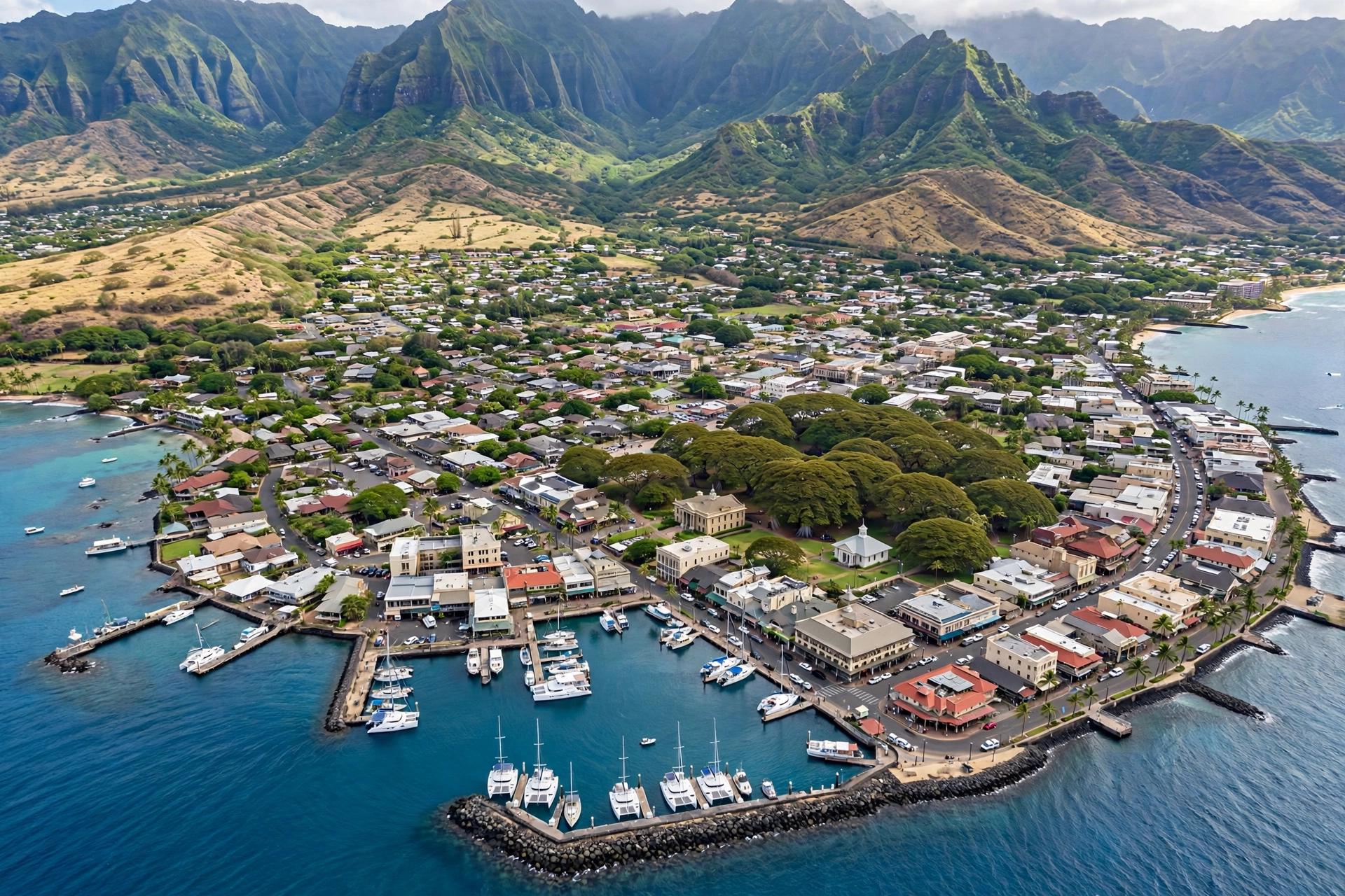
Maui is the second largest of the Hawaiian Islands, formed by two volcanoes joined at the neck by a flat central isthmus. The older West Maui Mountains, worn down over millions of years into sharp ridges and deep valleys, shelter the leeward towns of Lahaina and Kāʻanapali. The younger Haleakalā, a massive shield volcano rising to 10,023 feet, anchors the island’s east side and looms over Upcountry farms and the remote Hāna coast. This geography shaped everything that followed: where people settled, where rain fell, where ports were built, and where battles were fought.
Archaeological evidence places the first Polynesian settlers in the Hawaiian archipelago roughly a thousand years ago, with Maui’s fertile windward valleys and protected leeward bays among the earliest and most productive settlement areas. By the time Europeans arrived in the late eighteenth century, Maui was a powerful independent chiefdom, often at war with the island of Hawaiʻi and Oʻahu. The island’s rulers controlled rich agricultural lands and commanded formidable warriors.
The nineteenth century brought whalers, missionaries, sugar barons, and immigrant laborers in rapid succession, each wave rewriting the island’s economy and culture. Lahaina served as the capital of the Hawaiian Kingdom from 1820 to 1845, making Maui the political heart of the islands during a pivotal era. The twentieth century layered on military significance, the rise of plantation agriculture on an industrial scale, and eventually tourism, which made Maui one of the world’s most recognized island destinations.
Understanding this layered past enriches any visit. The plantation-era storefronts of Pāʻia, the missionary-era stone buildings of Lahaina, the vast former cane fields of the central valley, and the quiet heiau platforms of Hāna all carry stories. The sections below follow that history from the earliest settlements to the present day.
Ancient Maui and the Chiefdoms
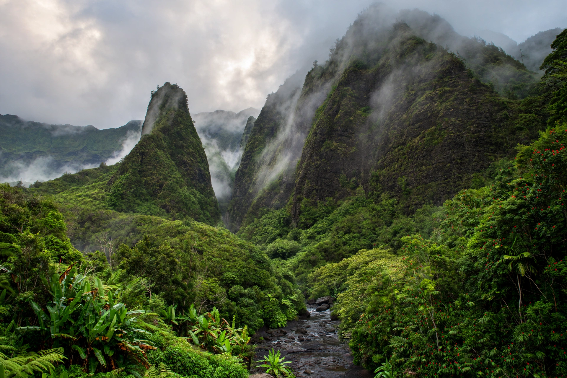
Long before written records, Maui was organized under the traditional Hawaiian system of land division and governance. The island was split into large districts called moku, which were further divided into wedge-shaped ahupuaʻa running from the mountains to the sea. Each ahupuaʻa contained the full range of resources a community needed: upland forests for timber and birds, agricultural terraces for taro and sweet potato, and coastal fisheries. This self-sufficient design sustained dense populations in places like Wailuku, Hāna, and the valleys of the West Maui Mountains. The same ahupuaʻa pattern remains visible on Oʻahu at Kahana Bay’s historic coastal valley, where a traditional fishpond still marks the shoreline.
Society was structured around the aliʻi, the chiefly class, supported by kahuna, priests and skilled experts, and the makaʻāinana, the common people who farmed and fished. The kapu system of sacred laws regulated daily life, from what could be eaten to where one could walk. Religion centered on the great gods Kū, Kāne, Lono, and Kanaloa, honored at heiau, stone temple platforms that still dot the island. One of the largest and best preserved heiau in all of Hawaiʻi, Piʻilanihale Heiau near Hāna, stands as a monumental reminder of this era, its massive stone terraces built in stages over generations.
Maui’s most celebrated ancient ruler was Piʻilani, who lived in the sixteenth century and unified the island’s districts under his rule. His name survives in the Piʻilani Highway and in the Hoapili Trail, often called the King’s Trail or the Great Piʻilani Trail, a coastal footpath along Maui’s rugged south shore built during his reign. Piʻilani is remembered as a wise and capable ruler, and his lineage produced some of the most important chiefs in Hawaiian history, including his son Kiha-a-Piʻilani.
Hāna, on Maui’s remote east coast, developed in relative isolation behind the bulk of Haleakalā. Its chiefs maintained close ties with the rulers of the island of Hawaiʻi across the ʻAlenuihāhā Channel, and the district’s warriors were prized as allies. The Kīpahulu district below Hāna supported dense taro cultivation in its valley floors. Control of Hāna was strategically vital: whoever held the east coast controlled the channel crossing, and Maui’s wars with Hawaiʻi island often turned on campaigns fought in these valleys.
Maui’s chiefdoms were frequently at war with neighboring islands. Control of Maui meant control of the ʻAlenuihāhā Channel and rich agricultural lands, and the island’s warriors were renowned. These rivalries would reach their climax in the late eighteenth century, when Kamehameha of the island of Hawaiʻi set his sights on bringing all the islands under one rule.
Kamehameha and Unification
By the 1780s, Kamehameha, a powerful chief of the island of Hawaiʻi, had begun his campaign to unite the archipelago. Maui stood directly in his path. The island’s ruler, Kahekili, was one of the most formidable chiefs of his generation, and Maui’s warriors had a fearsome reputation. The struggle between the two would be decided in a series of battles, the most famous of which took place on Maui itself.
In 1790, Kamehameha launched an invasion of Maui. The decisive engagement came at the Battle of Kepaniwai, fought in the narrow ʻĪao Valley near present-day Wailuku. Kamehameha’s forces, equipped with Western firearms and cannon obtained through trade, faced the Maui warriors under Kahekili’s son Kalanikūpule. The fighting was fierce, and the valley’s confined geography amplified the effectiveness of Kamehameha’s guns. The Maui forces were driven back, and the battle ended in a decisive victory for Kamehameha. The name Kepaniwai translates roughly as “the damming of the waters,” a reference to the tradition that the stream ran red and was choked with the fallen.
The victory at Kepaniwai broke Maui’s independence. Kamehameha went on to conquer Oʻahu at the Battle of Nuʻuanu in 1795, and Kauaʻi’s ruler Kaumualiʻi ceded his island peacefully in 1810, completing the unification of the Hawaiian Islands. Maui thus became part of the new Hawaiian Kingdom at its founding, and the island would remain central to the kingdom’s affairs throughout the nineteenth century.
Today, ʻĪao Valley State Monument preserves the site of the battle within a lush, sacred valley. The ʻĪao Needle, a 1,200-foot lava remnant draped in greenery, rises above the valley floor near where the fighting took place. Visitors can walk the paved paths, read the interpretive signs, and reflect on how this quiet, beautiful place once decided the fate of an island. The valley remains culturally significant to Native Hawaiians, and respectful behavior is expected.
The Kingdom Era: Lahaina as Capital
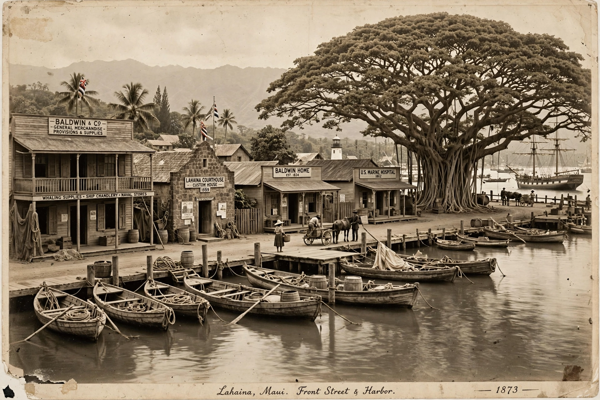
In 1820, Kamehameha II moved the capital of the Hawaiian Kingdom from Honolulu to Lahaina, and the small west Maui town became the political center of the islands for the next twenty-five years. The choice made practical sense. Lahaina’s roadstead offered one of the best anchorages in the islands, and the town was already growing as a provisioning stop for ships. During its years as capital, Lahaina hosted the kingdom’s government, foreign diplomats, and a parade of visitors that included missionaries, merchants, and whaling captains.
The whaling era transformed Lahaina into a booming port. In the 1840s and 1850s, hundreds of whaling ships anchored off Lahaina each season, and the town’s population swelled with sailors on shore leave. Taverns, boarding houses, and shops lined Front Street. The whalers brought money and rowdiness in equal measure, and the missionaries who had settled in Lahaina worked hard to temper the sailors’ behavior, building churches and schools and pressing the kingdom’s government for moral reforms. The tension between the whalers’ appetites and the missionaries’ rules defined Lahaina’s character for decades.
The missionaries left a lasting mark on Maui. The first American Protestant missionaries arrived in 1820, and Lahaina became one of their key stations. They established Lahainaluna in 1831, originally a mission school that later became Hawaiʻi’s first high school and the site of the islands’ first printing press. The Hawaiian-language newspaper Ka Lama Hawaiʻi was printed there, and the school trained generations of Hawaiian scholars, teachers, and government officials. The Baldwin Home Museum and the Wo Hing Museum in Lahaina preserve artifacts and stories from this period.
Kamehameha III, who reigned from 1825 to 1854, spent much of his youth in Lahaina and promulgated the kingdom’s first constitution there in 1840. The Declaration of Rights of 1839 and the Constitution of 1840, both issued during the Lahaina capital years, transformed Hawaiʻi from an absolute monarchy into a constitutional one. The king’s summer residence in Lahaina and the government buildings of the period made the town, for a generation, the place where the kingdom’s future was decided.
The capital moved back to Honolulu in 1845, but Lahaina remained an important town. The Māhele of 1848, the great land division that converted traditional land tenure into private property, reshaped Maui’s countryside as it did across the islands. Much of the best agricultural land passed into the hands of foreign businessmen and the new planter class, setting the stage for the sugar era that would dominate the island’s economy for the next century.
Sugar Plantations and Plantation Towns
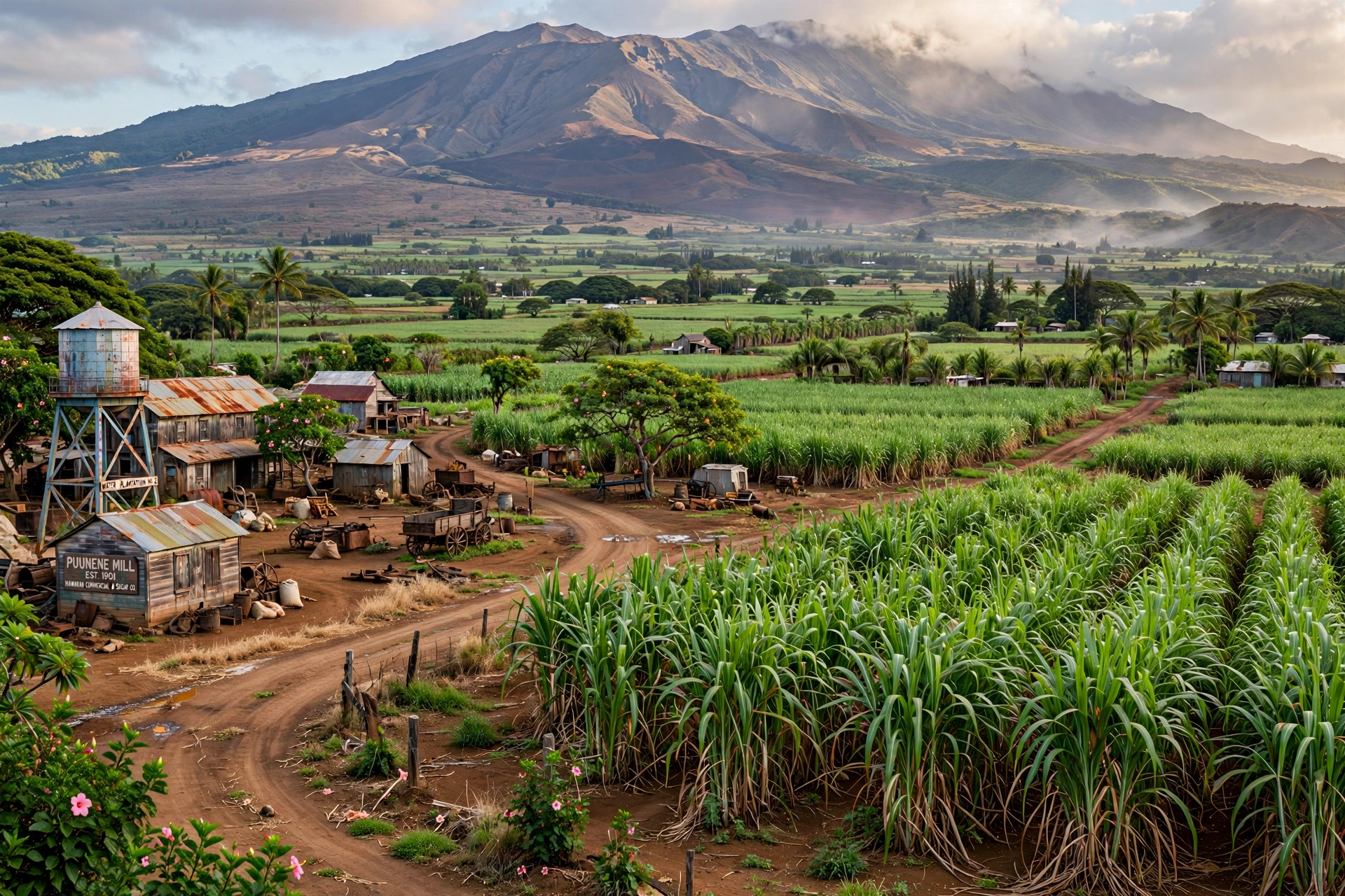
Sugar cane had been grown in Hawaiʻi for centuries, but it was the 1875 Reciprocity Treaty with the United States, which allowed Hawaiian sugar to enter American markets duty free, that turned sugar into the islands’ dominant industry. On Maui, the flat central valley between the West Maui Mountains and Haleakalā proved ideal for large-scale cane cultivation, and plantations soon covered tens of thousands of acres.
The most powerful of Maui’s sugar companies was Hawaiian Commercial & Sugar Company, known as HC&S, which became part of the Alexander & Baldwin empire. A&B itself had roots in a Maui partnership formed in 1870 by Samuel Thomas Alexander and Henry Perrine Baldwin, sons of missionaries. The company built the Hāmākua Ditch and other irrigation systems that carried water from the wet windward slopes of Haleakalā across the dry central plain, an engineering feat that made large-scale sugar possible. At its peak, HC&S operated the largest sugar plantation in Hawaiʻi.
The plantations needed labor, and the labor came from around the world. Chinese workers arrived first, followed by Portuguese, Japanese, Korean, Filipino, and Puerto Rican immigrants. Each group brought its own food, festivals, and traditions, and the plantation camps where they lived became the crucible of modern Hawaiʻi’s multicultural society. Towns like Pāʻia, Puʻunēnē, and Spreckelsville grew up around the mills and camps. Pāʻia, once a rough plantation town, retains its early twentieth century storefronts along Baldwin Avenue. Puʻunēnē was a classic company town, built and run by the plantation.
Plantation life was hard. Field workers labored long hours in the cane for modest wages, and the companies controlled housing, stores, and much of daily life. Over the decades, workers organized, struck, and gradually won better conditions. The 1946 sugar strike, which shut down plantations across the islands, was a turning point for labor power in Hawaiʻi and helped reshape the territory’s politics.
Maui’s plantations were part of the network of companies known as the Big Five, the interlocking firms that dominated Hawaiʻi’s economy and politics for a century. Alexander & Baldwin, headquartered in Honolulu but rooted in Maui soil, was among the most powerful. The company’s influence extended far beyond cane: it developed shipping, invested in the island’s first resort at Kāʻanapali, and shaped land use decisions across the island well into the twentieth century.
The Alexander & Baldwin Sugar Museum in Puʻunēnē, housed in the former plantation superintendent’s home, tells this story through photographs, equipment, and oral histories. It stands near the site of the last operating sugar mill in Hawaiʻi. HC&S harvested its final crop in 2016, ending 147 years of commercial sugar production on Maui. The former cane lands are now being converted to diversified agriculture, including coffee, citrus, and cattle grazing.
Maui in the Twentieth Century
The twentieth century brought war, then tourists, to Maui’s shores. During World War II, the island hosted tens of thousands of American servicemen. Training areas were established in the central valley and Upcountry, and the Fourth Marine Division prepared for the battles of the Pacific at camps on Maui. The war years strained the island’s infrastructure but also poured federal money into roads and facilities.
After the war, air travel changed everything. Jet service to Hawaiʻi began in 1959, the same year Hawaiʻi achieved statehood, and Maui’s visitor industry took off. The decisive moment came in the early 1960s, when Alexander & Baldwin began developing Kāʻanapali on Maui’s west coast as a planned resort destination. The Sheraton Maui opened there in 1963, followed by a wave of hotels along Kāʻanapali Beach. The resort’s design, with its beachfront hotels, golf courses, and the famous cliff diving ceremony at Puʻu Kekaʻa, or Black Rock, became a template for Hawaiian resort development.
South Maui followed. Kihei’s long coastline filled with condominiums in the 1970s and 1980s, and Wailea was developed as an upscale resort community with championship golf courses. The Road to Hāna, once a rough plantation track, became one of the world’s most famous scenic drives. Upcountry towns like Makawao and Kula kept their ranching character even as tourism grew around them.
The 1970s brought the Hawaiian Renaissance, a cultural revival that touched Maui deeply. Interest in traditional navigation led to the construction and voyaging of the Hōkūleʻa, the double-hulled canoe that proved ancient Polynesians could have navigated to Hawaiʻi intentionally. On Maui, the renaissance fueled renewed attention to hula, Hawaiian language, and the protection of sacred sites. It also gave momentum to the movement that eventually led to the return of Kahoʻolawe, the island off Maui’s southwest coast used as a military bombing range, to the state in 1994.
By the early twenty-first century, Maui welcomed roughly three million visitors a year, and tourism had become the island’s economic engine. The growth brought prosperity but also strain: high housing costs, traffic congestion, water disputes, and debates over how much development the island could absorb. These tensions were part of daily life on Maui long before the fires of 2023 made the island’s fragility impossible to ignore.
The August 2023 Wildfires
On August 8, 2023, driven by strong winds from a high pressure system north of the islands combined with a passing hurricane to the south, wildfires broke out across Maui. The most destructive fire swept through Lahaina, moving with terrifying speed through the historic town. The fire killed 102 people, making it the deadliest wildfire in the United States in more than a century, and destroyed more than 2,200 structures, including much of historic Front Street, homes, businesses, churches, and cultural landmarks. Thousands of residents were displaced.
The disaster struck at the heart of Maui’s history. Lahaina was not just a tourist town. It was the former capital of the Hawaiian Kingdom, a place of deep cultural significance to Native Hawaiians, and home to generations of local families. The 150-year-old banyan tree in Banyan Court Park, one of the town’s most beloved landmarks, was badly burned but survived and has since shown signs of recovery. The Baldwin Home Museum, the Wo Hing Museum, and other historic buildings were lost or damaged.
In the aftermath, the community’s response was extraordinary. Residents, many of whom had lost everything, organized supply distribution, sheltered neighbors, and began the long work of recovery. Questions about emergency warning systems, water access for firefighting, land management, and the role of invasive grasses in fueling the fire prompted official investigations and public debate. The recovery has involved complex decisions about rebuilding, with strong community insistence that Lahaina’s future be shaped by its residents, particularly Native Hawaiian voices.
As of 2026, recovery continues. Some areas of Lahaina remain closed to the public as cleanup and rebuilding proceed. Visitors to Maui should check current guidance from Maui County before planning time in Lahaina, respect all posted closures and restrictions, and approach the town with sensitivity. Supporting local businesses in the open areas of West Maui is one concrete way visitors can help. The fire is now part of Maui’s history, and any honest account of the island must include it, but the story is still being written by the people who call Lahaina home.
Historic Sites to Visit
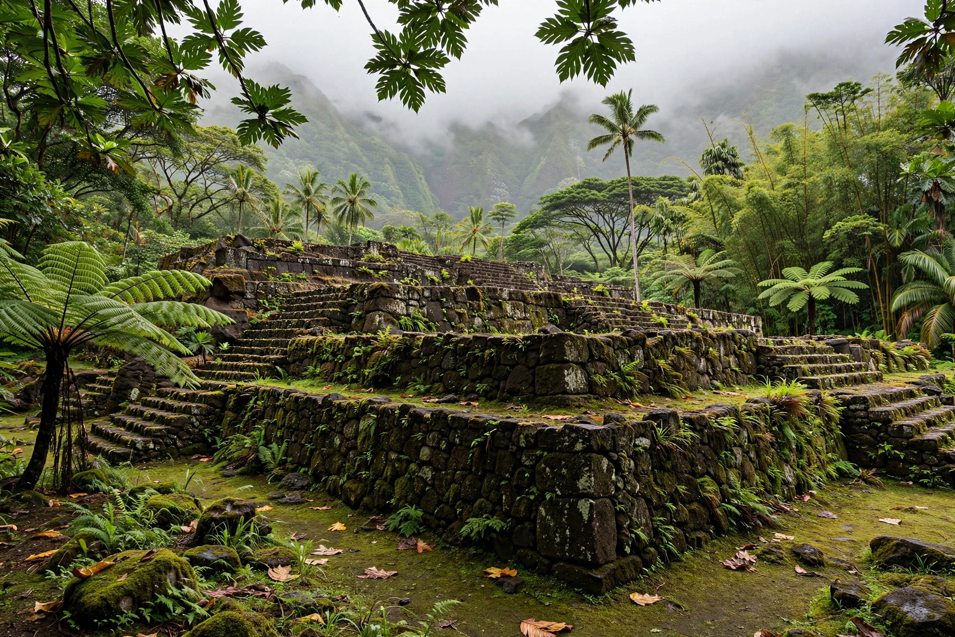
Maui’s history can be read in its places. The following sites offer the most rewarding encounters with the island’s past. Conditions and access can change, especially in Lahaina, so confirm current status before visiting.
Lahaina Town
Even with much of Front Street lost to the 2023 fire, Lahaina’s history endures in what survived and in what the community is rebuilding. The banyan tree in Banyan Court Park, planted in 1873, still stands. The Lahaina Jodo Mission and other surviving landmarks remain. Visit with respect, follow all posted guidance, and understand that for residents this is a place of grief as well as heritage. West Maui’s open businesses welcome visitors whose spending supports recovery.
ʻĪao Valley State Monument
The site of the 1790 Battle of Kepaniwai, set in a sacred valley of extraordinary beauty. The paved walkways, the ʻĪao Needle, and the interpretive signs make this one of Maui’s most accessible history experiences. Note that the monument uses a reservation system for non-residents, so book ahead.
Bailey House Museum
Located in Wailuku, this 1833 missionary-era stone house now operates as a museum of Hawaiian history and culture. Its collection includes pre-contact artifacts, missionary-period furnishings, and works by the artist Edward Bailey. The grounds include gardens of native Hawaiian plants.
Alexander & Baldwin Sugar Museum
Housed in Puʻunēnē in the former plantation superintendent’s residence, this museum documents the sugar era through photographs, machinery, and the stories of the immigrant workers who built the industry. It sits near the site of Hawaiʻi’s last operating sugar mill.
Piʻilanihale Heiau
Near Hāna, this massive stone temple platform is among the largest heiau in the Hawaiian Islands. It is reached via the Kahanu Garden, a National Tropical Botanical Garden site. The scale of the stonework is humbling, and the garden setting includes one of the world’s largest collections of breadfruit cultivars.
Haleakalā National Park Historic District
The park’s summit and Kīpahulu districts contain structures built by the Civilian Conservation Corps in the 1930s, including the visitor centers and stone cabins. The park also protects cultural landscapes of deep significance to Native Hawaiians, and the Kīpahulu area preserves the remnants of traditional agricultural systems in the valley below the famous pools.
Lahainaluna and Hale Paʻi
On the hillside above Lahaina, Lahainaluna High School occupies the site of the 1831 mission seminary. Hale Paʻi, the original printing house, still stands and houses a small museum with one of the original presses. Check visiting arrangements in advance, as this is an active school campus.
Frequently Asked Questions
Why was Lahaina the capital of the Hawaiian Kingdom?
Kamehameha II moved the capital from Honolulu to Lahaina in 1820. The town offered an excellent anchorage for the growing number of foreign ships visiting the islands, and it was already developing as a provisioning port. Lahaina remained the capital until 1845, when the government returned to Honolulu.
What happened at the Battle of Kepaniwai?
In 1790, Kamehameha’s forces invaded Maui and defeated the island’s warriors under Kalanikūpule in the narrow ʻĪao Valley. Kamehameha’s Western firearms proved decisive in the confined valley. The victory ended Maui’s independence and was a major step toward the unification of the Hawaiian Islands.
When did sugar plantations operate on Maui?
Commercial sugar production on Maui ran from the late nineteenth century until 2016, when Hawaiian Commercial & Sugar Company harvested its final crop. At its height, the plantation covered tens of thousands of acres in the central valley. The Alexander & Baldwin Sugar Museum in Puʻunēnē documents the era.
Can visitors go to Lahaina after the 2023 fire?
Parts of West Maui, including areas of Lahaina, have reopened to visitors, but some zones remain restricted as recovery continues. Check current guidance from Maui County before visiting, respect all closures, and approach the town with sensitivity. Supporting open local businesses helps the recovery.
What is the oldest historic site on Maui?
Among the most significant ancient sites is Piʻilanihale Heiau near Hāna, one of the largest stone temple platforms in Hawaiʻi, built in stages over generations. The Hoapili Trail along the south shore also dates to the reign of Piʻilani in the sixteenth century.
Who were the first immigrants to work on Maui’s plantations?
Chinese laborers were the first large group recruited for plantation work, followed by Portuguese, Japanese, Korean, Filipino, and Puerto Rican workers. Their descendants form the core of modern Hawaiʻi’s multicultural population.
What role did Maui play in World War II?
Maui hosted major training camps, including facilities where the Fourth Marine Division prepared for Pacific battles. Tens of thousands of servicemen passed through the island, and the war years brought significant federal investment in the island’s infrastructure.
Where can I learn more about Native Hawaiian history on Maui?
The Bailey House Museum in Wailuku, the ʻĪao Valley State Monument, and Piʻilanihale Heiau near Hāna all offer deep encounters with Native Hawaiian history. The Kahanu Garden surrounding Piʻilanihale Heiau is managed by the National Tropical Botanical Garden and includes cultural interpretation.
Related Guides
- Maui Map: Complete Reference Map & Area Guide: the island’s regions, towns, and driving routes
- Maui Towns: Lahaina, Pāʻia, Makawao, Hāna, and more by region
- Road to Hana Map: Complete Reference Map & Area Guide: the famous drive and its historic stops
- Maui Hikes: trails including ʻĪao Valley and the Pīpīwai Trail
- Maui Waterfalls: Waimoku Falls, Wailua Falls, and the island’s cascades
- Where Is the Airport on Maui: Kahului Airport location and arrival tips
- Maui Beaches: the island’s best stretches of sand, from Kaʻanapali to Makena
- Hawaii Map: Complete Reference Map & Area Guide: the full island chain in geographic context
A Final Note
Maui’s history is not a closed book. The island’s past lives on in the taro fields of Hāna, the plantation storefronts of Pāʻia, the missionary stones of Lahaina, and the quiet heiau platforms that have watched over the island for centuries. It also lives on in the community rebuilding Lahaina after the 2023 fires, a recovery that will shape the town’s next chapter. Visitors who take time to learn this history will find that Maui rewards attention: the deeper you look, the more the island reveals.