
Lumahaʻi Beach Kauaʻi Map
Table of Contents
- Lumahaʻi Beach at a Glance
- Map: Beach Layout, River Mouth, and Access Points
- The Beach Experience: Scenery, Photography, and Why It Is Famous
- Swimming and Safety: Read This Before You Enter the Water
- Getting There: From Hanalei, Parking, and the Access Trail
- Nearby Beaches: Tunnels, Hāʻena, and Keʻe
- Best Time to Visit Lumahaʻi Beach
- Lumahaʻi Beach FAQ
- Related Guides
Lumahaʻi Beach at a Glance
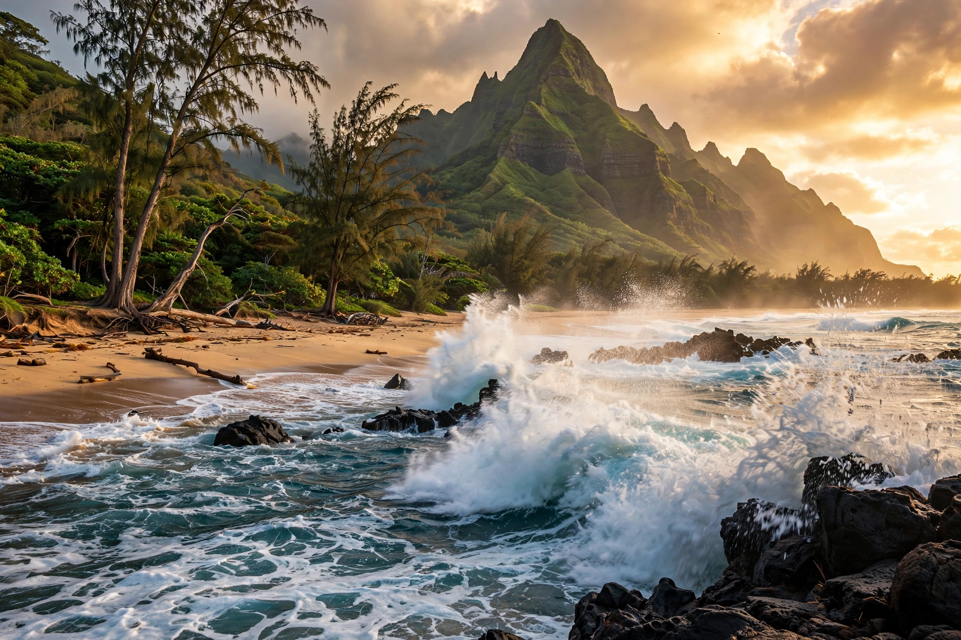
Lumahaʻi Beach is the wild heart of Kauaʻi’s north shore. Located just west of Hanalei, on the stretch of Kūhiō Highway that runs toward Hāʻena and the Nāpali Coast, Lumahaʻi is a beach that visitors photograph from the roadside long before they ever set foot on its sand. Emerald cliffs drop toward a curve of golden beach, ironwood trees lean in the trade winds, and behind it all rises Mount Makana, the sheer, pyramid-shaped peak that the world knows as Bali Hai from the film South Pacific. On paper it sounds like paradise. In person, it looks like paradise. And that is exactly why a detailed map and an honest guide matter so much, because Lumahaʻi’s beauty hides some of the most dangerous water on the island.
The beach sits roughly 4 miles west of Hanalei town, between mile markers 4 and 5 on Kūhiō Highway (Route 560). It is not a single simple crescent. Lumahaʻi is better understood as two beach sections divided by the Lumahaʻi River mouth, plus a rocky shoreline that extends west toward Wainiha. The main beach, the wide golden stretch most people see in photographs, runs east from the river. A smaller, more secluded section sits to the west. Together with the river estuary and the rocky points at either end, the area forms a small coastal system that rewards visitors who understand its layout and punishes those who do not.
Lumahaʻi’s fame comes from two sources. The first is cinematic. When the 1958 film South Pacific needed a stand-in for a mythical island paradise, location scouts chose this stretch of Kauaʻi’s north shore. The beach scenes were filmed here, and Mount Makana became the visual anchor for Bali Hai. Decades later, the film’s legacy still draws visitors who want to stand on the sand they once saw on screen. The second source of fame is more recent and more somber: Lumahaʻi’s reputation as one of the most dangerous beaches in Hawaiʻi. Powerful shorebreak, strong rip currents, and a steep beach face have made this a beach for looking, not swimming, for most of the year. Both reputations are deserved, and this guide covers both honestly.
There are no lifeguards at Lumahaʻi Beach. There are no restrooms, no showers, no concessions, and no rentals. What exists is a small roadside parking area, an access path through the ironwoods, and a beach that the Hawaiʻi Department of Land and Natural Resources and the County of Kauaʻi treat with clear respect. Warning signs at the beach are direct. This page is designed to give you the complete reference picture: the map, the layout, the access points, the safety picture, and how Lumahaʻi fits into a north shore day alongside its calmer neighbors.
Map: Beach Layout, River Mouth, and Access Points
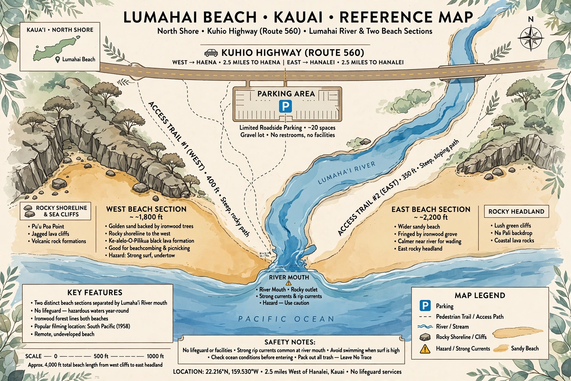
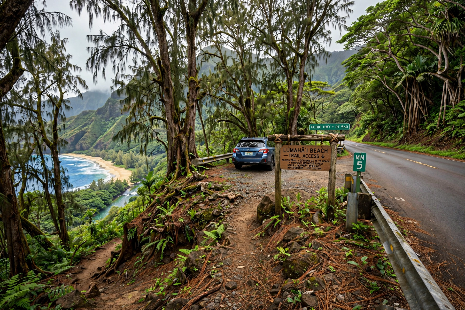
Reading Lumahaʻi correctly starts with the geography. Kūhiō Highway runs along the coast here, and the beach is visible from the road in several places between Hanalei and Wainiha. The main access is a small signed parking pullout on the ocean side of the highway. From the parking area, a short trail descends through ironwood trees to the sand. The path is unpaved and can be slippery after rain, so wear footwear with grip rather than flip flops.
The Two Beach Sections
The Lumahaʻi River divides the beach into two distinct sections. The eastern section, the one most visitors reach first, is the wide golden strand that appears in photographs. It is the longest continuous stretch of sand, and it is where most people spread a towel, take photographs, and watch the surf. The beach face here is steep, which is part of what makes the shorebreak so powerful. The sand drops quickly into deep water, so waves that look moderate from the road arrive at the shoreline with full force.
West of the river mouth, the second section is smaller and more tucked away. It sits beneath steeper cliffs and feels more enclosed. The river mouth itself shifts with the seasons and with rainfall. After heavy rain in the mountains, the Lumahaʻi River runs high and brown, pushing sediment across the beach and into the nearshore water. The estuary is worth observing from a distance, especially for birds, but the mixing zone where river meets ocean is not a swimming spot. Currents around river mouths are unpredictable even on calm days.
The Rocky Shoreline and Western End
West of the second beach section, the coastline turns rocky toward Wainiha. Tide pools form in the lava rock at lower tides, and the shoreline walk in this direction offers some of the best views back toward Mount Makana. Stay on stable rock, watch for waves, and never turn your back on the ocean here. Sneaker waves and sudden surges are a real hazard on rocky Hawaiian coastlines, and this stretch has no easy exit points if you get into trouble.
Key Landmarks for Orientation
Mount Makana is your compass. The distinctive flat-topped, sheer-sided peak rises directly behind the beach and is visible from nearly every point on the sand. When photographers frame Lumahaʻi, Makana is almost always in the shot. To the east, the coastline curves toward Hanalei Bay. To the west, the green wall of the Nāpali Coast begins to build. The Lumahaʻi River mouth is the central landmark on the beach itself. If you walk the sand, note where the river meets the ocean, because conditions on either side of it can differ, and the river mouth area deserves extra caution.
The Beach Experience: Scenery, Photography, and Why It Is Famous
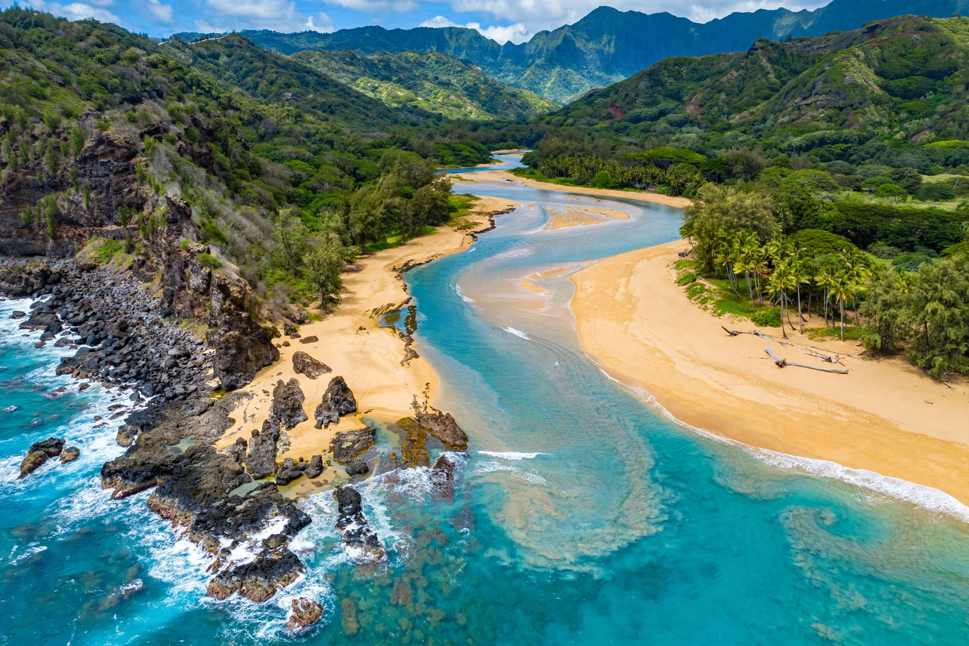
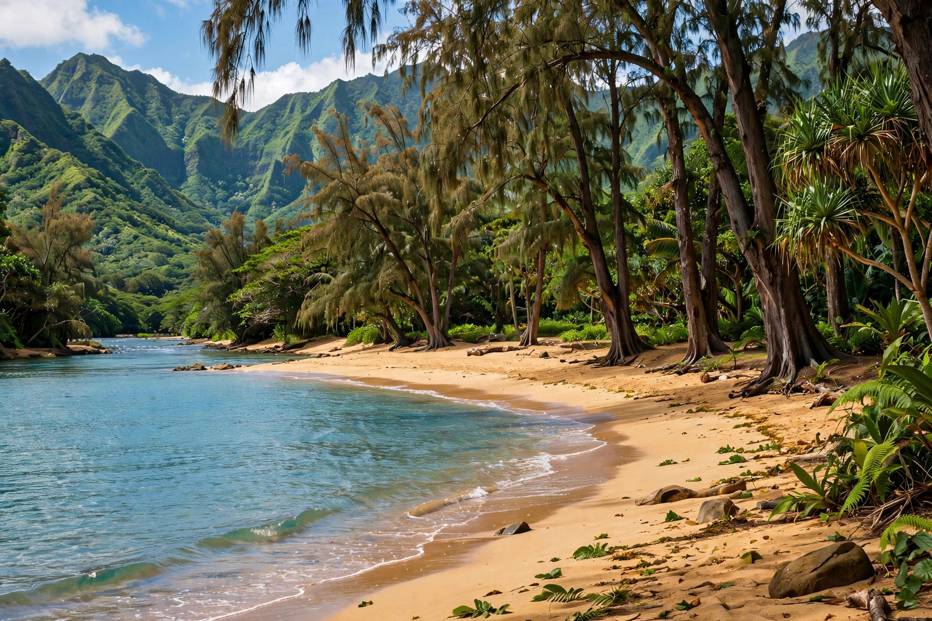
Lumahaʻi is, without qualification, one of the most beautiful beaches in Hawaiʻi. That statement needs the safety context that follows, but the beauty itself deserves its own section. The beach faces roughly north, which means the light changes dramatically through the day. Mornings bring soft light on the cliffs and long shadows across the sand. Midday, the water shows its full turquoise range over the reef and sand. Late afternoon and the golden hour before sunset are when Lumahaʻi becomes almost unreal: the cliffs glow, the surf turns silver and gold, and Mount Makana stands in silhouette. Photographers plan entire north shore days around the light at Lumahaʻi.
Why the Film Connection Still Matters
The South Pacific connection is more than trivia. The 1958 film, adapted from the Rodgers and Hammerstein musical, used Kauaʻi’s north shore as its visual definition of paradise, and Lumahaʻi was the beach. Mount Makana became Bali Hai, the mysterious island on the horizon. For many visitors, especially those who grew up with the film or the stage musical, standing on Lumahaʻi is a small pilgrimage. The landscape has changed remarkably little since the cameras rolled. The beach is still undeveloped, the cliffs are still green, and Makana still dominates the view. That continuity is rare and worth appreciating.
Photography Tips
The classic Lumahaʻi photograph is taken from the beach looking west or southwest, with the surf in the foreground and Mount Makana in the background. A wide-angle lens captures the full sweep of beach, cliffs, and peak. For a different composition, walk to the western section and shoot back east along the beach toward the river mouth. Sunrise shoots are quieter and the beach is often empty. Sunset shoots have the best light but draw more visitors to the roadside pullouts. Drones are subject to Hawaiʻi state park and wildlife regulations in nearby areas, and the Nāpali Coast region has specific restrictions, so check current rules before flying. Never fly a drone over other beachgoers.
What the Beach Feels Like
Because there are no facilities and no commercial activity, Lumahaʻi feels wilder than the beaches to its east and west. The sound of the surf is constant and loud. The ironwood trees hiss in the wind. The beach is rarely crowded, even in high season, because most visitors stop for photographs and move on, and because the swimming warnings keep casual beachgoers away. If you want a beach for sitting, reading, picnicking, and watching the ocean, Lumahaʻi delivers. If you want a beach for swimming, keep driving to one of the safer options covered later in this guide.
Swimming and Safety: Read This Before You Enter the Water
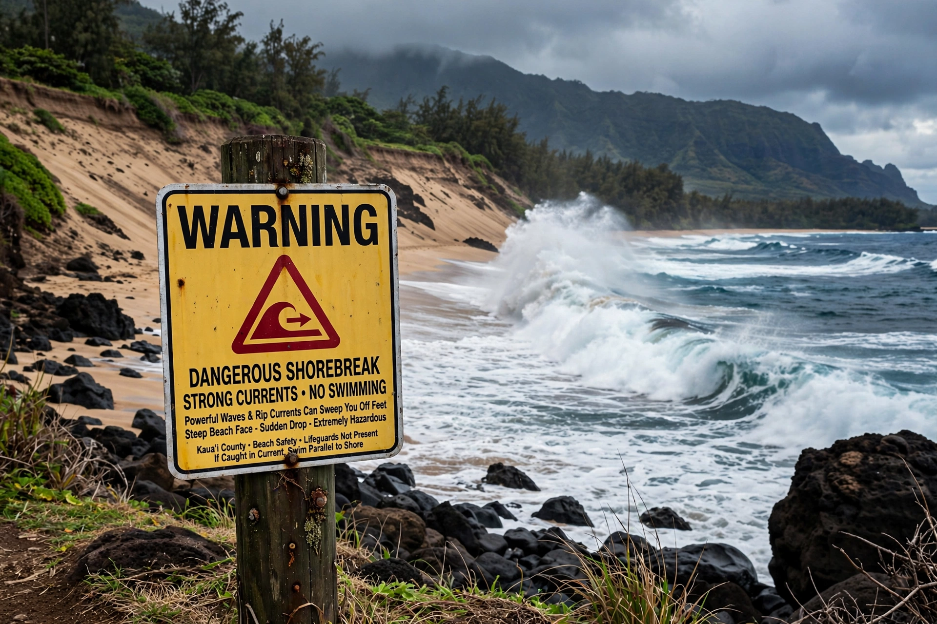
This is the most important section on this page. Lumahaʻi Beach has a well-earned reputation as one of the most dangerous beaches in Hawaiʻi for swimming. The combination of a steep beach face, powerful shorebreak, strong rip currents, and an exposed north-facing orientation creates conditions that have led to serious injuries and drownings. The State of Hawaiʻi and the County of Kauaʻi post warning signs at the beach, and those signs should be treated as instructions, not suggestions.
Why the Water Is So Dangerous
Several factors combine at Lumahaʻi. First, the beach face is steep, which means waves do not lose energy gradually across a shallow shelf. They arrive at the shoreline at full power and break directly onto the sand as shorebreak. Shorebreak can slam a swimmer into the sand with enough force to cause spinal injuries, broken bones, and drownings. Second, the north shore of Kauaʻi receives powerful winter swells generated by North Pacific storms. From roughly October through April, surf at Lumahaʻi can be enormous, and even experienced surfers treat the beach with caution. Third, rip currents form along the beach, especially near the river mouth and the rocky points. These currents can pull even strong swimmers away from shore faster than they can swim back.
When, If Ever, to Enter the Water
The honest answer is that most visitors should not swim at Lumahaʻi at all. On the calmest summer days, typically June through August, the ocean can look inviting, and some experienced ocean swimmers do enter the water close to shore. Even then, conditions can change within an hour as a new swell arrives. There are no lifeguards to read the water for you. If you do choose to enter the water on a calm summer day, stay in shallow water where you can stand, never go in alone, never turn your back on the waves, and get out at the first sign of increasing surf. Children should not swim at Lumahaʻi under any conditions. Bodysurfing and bodyboarding the shorebreak here have caused severe injuries; this is not a beach for playing in the waves.
Reading the Warning Signs and the Ocean
Check the surf forecast before you go. The National Weather Service Honolulu office issues surf forecasts for Kauaʻi’s north shore, and high surf advisories or warnings are common in winter. If an advisory is in effect, stay well back from the water’s edge. Even on the sand, large waves can wash far up the beach face. Watch the ocean for at least 15 to 20 minutes before approaching the water anywhere on Kauaʻi’s north shore. Look for sets of larger waves, which arrive in groups, and note how far up the beach the water reaches. If in doubt, stay out. The beaches a few minutes east and west offer far safer swimming, and there is no reason to take risks at Lumahaʻi when alternatives are close.
Flash Floods and the River
The Lumahaʻi River and the streams in the cliffs behind the beach are subject to flash flooding. Kauaʻi’s north shore mountains are among the wettest places on earth, and heavy rain in the mountains can send a wall of water down the river with little warning at the beach, even when it is sunny on the sand. Never camp or linger in the riverbed or estuary, and be alert to changes in water color or debris in the river, which signal flooding upstream. After major storms, the beach itself can be reshaped, with new channels cut through the sand.
Getting There: From Hanalei, Parking, and the Access Trail
Lumahaʻi Beach is on Kūhiō Highway (Route 560) west of Hanalei, roughly a 10-minute drive from Hanalei town. From Līhuʻe Airport, the drive takes about 55 to 70 minutes depending on traffic, following Kūhiō Highway north through Kapaʻa and Princeville, then west past Hanalei. The highway beyond Hanalei is narrower and more winding, with several one-lane bridges. Drive with patience, yield to oncoming traffic at the bridges, and pull over only in designated areas.
Parking
The parking area for Lumahaʻi is a small roadside pullout on the ocean side of the highway. It fills quickly on nice days, especially in the morning when photographers arrive for the light. If the pullout is full, do not park on the highway shoulder in a way that blocks traffic or damages vegetation. Continue to another beach and return later, or visit during off-peak hours. Illegal parking on Kauaʻi’s north shore is ticketed, and tow trucks patrol the area. The limited parking is actually part of what keeps Lumahaʻi from becoming overcrowded, so plan accordingly.
The Access Trail
From the parking pullout, a short trail leads through ironwood trees down to the sand. The trail is unpaved, uneven in places, and slippery when wet. Wear sturdy footwear. The descent is brief, only a few minutes, but it is steep enough to be awkward with beach gear. There are no facilities at the trailhead or on the beach, so bring everything you need: water, sun protection, snacks, and a bag for your trash. Pack out everything you pack in. There are no trash cans on the beach.
Public Transportation
The Kauaʻi Bus serves the north shore, but service beyond Hanalei is limited. Most visitors reach Lumahaʻi by rental car. If you are relying on the bus, check the current schedule carefully, because missing the last return bus would leave you far from your lodging with no services nearby. For most travelers, a rental car is the practical way to visit Lumahaʻi and the surrounding north shore beaches.
Nearby Beaches: Tunnels, Hāʻena, and Keʻe
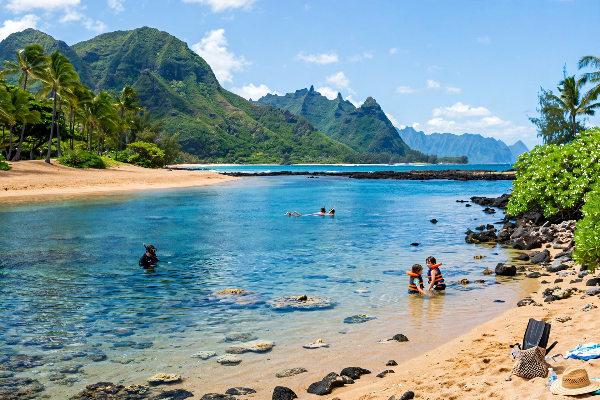
One of the best things about Lumahaʻi’s location is that safer and equally beautiful beaches are minutes away in both directions. If you arrive, read the surf, and decide the water is not for you, which will be the right call most days, you do not have to give up on the beach day. The north shore’s best swimming beaches are close.
Tunnels Beach (Mākua Beach)
About 10 minutes west of Lumahaʻi, Tunnels Beach offers what Lumahaʻi does not: a protected reef lagoon with calm summer swimming and excellent snorkeling. The horseshoe-shaped reef creates a sheltered inner lagoon that is ideal for families when the surf is down. Like Lumahaʻi, Tunnels is dangerous in winter, but in summer it is one of the north shore’s premier beach days. See our Where Is Tunnel Beach guide for the full map, access details, and snorkeling information.
Hāʻena Beach Park
Between Lumahaʻi and Tunnels, Hāʻena Beach Park offers restrooms, showers, and a more sheltered swimming area in summer. It is a county beach park, so it has the facilities that Lumahaʻi lacks. The park is a good base for a north shore beach day, with shade, picnic tables, and a calmer section of water when conditions allow.
Keʻe Beach
At the end of the road, Keʻe Beach sits where the highway meets the Nāpali Coast. The reef-protected lagoon is one of the best snorkeling spots on the north shore in summer, and the beach marks the start of the Kalalau Trail. Access to Hāʻena State Park, which includes Keʻe, requires advance reservations for entry or parking through the state system. Plan ahead, because same-day availability is rare. The sunset views from Keʻe, with the Nāpali cliffs turning gold, are among the finest on Kauaʻi.
Hanalei Bay
To the east, Hanalei Bay offers two miles of beach with generally calmer summer swimming, lifeguarded sections, and the full services of Hanalei town nearby. Our Hanalei Bay Map guide covers the bay’s four beach sections, surf breaks, parking, and town in detail.
Best Time to Visit Lumahaʻi Beach
Lumahaʻi is a year-round photography destination, but the experience changes completely with the seasons. Understanding the seasonal pattern helps you plan the right kind of visit.
Summer: May Through September
Summer is the calm season on Kauaʻi’s north shore. The North Pacific storm track moves north, winter swells fade, and the ocean at Lumahaʻi can be strikingly calm. This is when the beach looks most like the paradise of the photographs: turquoise water, gentle waves, and safe-feeling conditions on the sand. Even in summer, the shorebreak deserves respect, and the no-swimming guidance still applies to children and casual swimmers. But summer is the season for long beach walks, picnics, photography, and careful wading at the water’s edge. Mornings are calmest, with trade winds typically picking up in the afternoon.
Winter: October Through April
Winter is the dramatic season. North Pacific storms send powerful swells to Kauaʻi’s north shore, and Lumahaʻi becomes a spectacle of raw ocean power. Waves can reach heights that close the beach to any water entry whatsoever. This is the season for watching, not swimming. The surf is thrilling to observe from a safe distance on the sand, and storm light can be extraordinary for photography. It is also the season when the beach is most dangerous, and when most of the serious incidents occur. Check the surf forecast every winter day, heed all advisories, and keep a generous distance from the waterline.
Whale Season and Shoulder Months
Humpback whales visit Hawaiian waters from roughly December through April, and they can sometimes be spotted from north shore beaches, including Lumahaʻi. Bring binoculars on winter visits and scan the horizon between sets. The shoulder months of May and September often combine the best of both seasons: fading or not-yet-arrived winter swells, warm water, and fewer visitors than the summer peak.
Lumahaʻi Beach FAQ
Where is Lumahaʻi Beach on the map?
Lumahaʻi Beach is on Kauaʻi’s north shore, on Kūhiō Highway (Route 560) about 4 miles west of Hanalei town and east of Wainiha. It sits between Hanalei Bay to the east and Tunnels Beach to the west, with Mount Makana rising directly behind it.
Can you swim at Lumahaʻi Beach?
Swimming at Lumahaʻi is dangerous and generally not recommended. The beach has a steep face, powerful shorebreak, and strong rip currents, with no lifeguards. On the calmest summer days, experienced ocean swimmers sometimes wade in shallow water, but most visitors should enjoy the beach from the sand and swim at nearby Tunnels Beach or Hāʻena Beach Park instead.
Why is Lumahaʻi Beach famous?
Lumahaʻi is famous as a filming location for the 1958 movie South Pacific, where it represented a tropical paradise and Mount Makana became the Bali Hai peak. It is also known, more somberly, as one of the most dangerous beaches in Hawaiʻi for swimming.
Is there parking at Lumahaʻi Beach?
There is a small roadside parking pullout on the ocean side of Kūhiō Highway. It fills quickly on nice days. Do not park illegally on the shoulder. If the lot is full, continue to another beach and return later.
Are there lifeguards at Lumahaʻi Beach?
No. There are no lifeguards at Lumahaʻi Beach, and there are no restrooms, showers, or concessions. Bring everything you need and pack out all trash.
What is the best time of day to visit?
Morning offers the calmest conditions and soft light for photography. Late afternoon brings the famous golden-hour light on the cliffs and Mount Makana. Midday trade winds can make the beach breezy.
How is Lumahaʻi different from Tunnels Beach?
Lumahaʻi is an exposed, steep-faced beach with dangerous shorebreak and no reef protection. Tunnels Beach, about 10 minutes west, has a horseshoe reef that creates a calm lagoon for summer swimming and snorkeling. Visitors often see both in one day: Lumahaʻi for the scenery, Tunnels for the water.
Can you see Bali Hai from Lumahaʻi Beach?
Yes. Mount Makana, the peak that portrayed Bali Hai in South Pacific, rises directly behind Lumahaʻi Beach and dominates the view. It is one of the most photographed mountain-to-beach compositions in Hawaiʻi.
Related Guides
- Where Is Tunnel Beach : map, snorkeling, and access for the reef-protected neighbor to the west
- Hanalei Bay Map: Complete Reference Map & Area Guide : the two-mile bay, surf breaks, and Hanalei town to the east
- Hanalei Map: Complete Reference Map & Area Guide : the historic north shore town and valley
- Hawaii Beaches : the statewide beaches hub, with safety and seasonal guidance
- Hawaii Snorkeling: Complete Guide : where to snorkel safely around the islands
- Līhuʻe Map: Complete Reference Map & Area Guide : the airport gateway and driving routes to the north shore
Reading Lumahaʻi With Clear Eyes
Lumahaʻi Beach rewards the visitor who arrives with the right expectations. It is not a swimming beach, and it was never meant to be one. It is a beach for standing on the sand with the surf thundering in front of you, for watching light move across Mount Makana, for understanding why filmmakers chose this exact stretch of coast to represent paradise on screen. The map on this page shows you where everything is: the two sections, the river mouth, the access trail, the parking pullout, and the safer beaches waiting a few minutes in either direction. Use it to plan a north shore day that pairs Lumahaʻi’s scenery with Tunnels’ lagoon or Hanalei Bay’s calm water. The most beautiful beach on Kauaʻi’s north shore is also one of its most serious. Give it the respect it deserves, keep a safe distance from the water, and it will give you one of the great coastal views in all of Hawaiʻi.