
Hanalei Map
Hanalei at a Glance
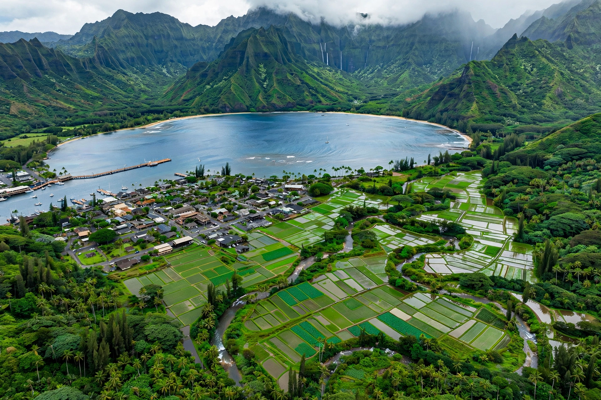
Hanalei is the historic heart of Kauaʻi’s north shore, a small plantation-era town set between one of the world’s most beautiful bays and one of Hawaiʻi’s most productive agricultural valleys. Located on Kauaʻi’s north shore, Hanalei sits roughly 55 miles north of Līhuʻe via Kūhiō Highway (Route 560), the only road in. The town itself is compact: a short strip of plantation-style storefronts along the highway, home to art galleries, food trucks, shave ice stands, and surf shops.
Hanalei’s history runs deep. The bay was a provisioning stop for whaling ships in the 1800s, and the town grew around sugar cane plantations in the late 19th century. The Waiʻoli Huiʻia Church, founded by American missionaries in 1834, still stands in town with its green shutters and coral-limestone construction. The Hanalei Pier, built in 1912 and listed on the National Register of Historic Places, once served rice and sugar plantations and now serves swimmers, anglers, and sunset watchers.
Today Hanalei is the gateway to the Nāpali Coast. The Kalalau Trail begins at Keʻe Beach, about 8 miles west of town at the literal end of the road. Hanalei is also the launching point for boat tours that view the Nāpali Coast from the ocean, and it fronts the Hanalei Valley, where taro has been cultivated in irrigated loʻi for more than a thousand years. The Hanalei National Wildlife Refuge protects 917 acres of valley wetlands that are critical habitat for endangered Hawaiian waterbirds.
Understanding Hanalei’s layout matters because everything funnels through one two-lane road. Parking in town is limited, the single-lane bridges on the approach require courtesy, and flood closures can cut the road entirely during heavy rain events. This guide maps the town, the valley, the bay, and the surrounding beaches so you can plan accordingly.
Hanalei Town and Area Layout
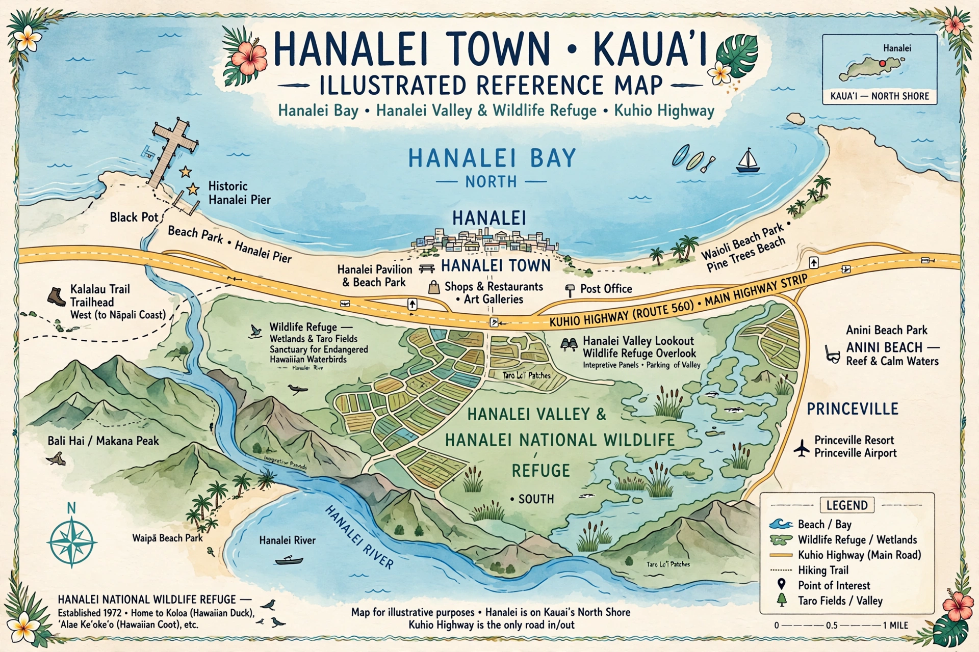
Hanalei occupies a narrow coastal plain between Hanalei Bay to the north and the Hanalei Valley to the south and east. Kūhiō Highway runs through the middle of it all. Coming from the east (Princeville), you cross the one-lane Hanalei Bridge over the Hanalei River, then arrive at the town strip, which runs roughly from the Ching Young Village shopping center on the east end to the Waiʻoli Huiʻia Church and Hanalei Taro and Juice Company area on the west.
The town strip is walkable but there are no sidewalks in the conventional sense along much of it, so visitors typically park once and stroll. Key landmarks from east to west: Ching Young Village (grocery, coffee, shops), the historic Hanalei School, the main commercial cluster with restaurants and galleries, the Waiʻoli Huiʻia Church and Waiʻoli Mission House museums on the south side of the highway, and the turnoff north to Weke Road, which leads down to Black Pot Beach Park and the Hanalei Pier.
South of the highway lies the Hanalei Valley. The Hanalei Valley Lookout, a roadside pullout on the highway just east of town, offers the classic postcard view of the valley’s patchwork of taro loʻi backed by waterfalls streaming down the emerald cliffs. The valley floor is largely agricultural and refuge land, not open to casual wandering, but the lookout and a few roadside pullouts give excellent views.
North of the highway is Hanalei Bay itself, covered in detail on our companion page, Hanalei Bay Map. The bay’s two-mile crescent runs from the Hanalei River mouth on the east to Puʻu Poa Point on the west. West of town, the road continues past beach access points at Hideaways and the St. Regis Princeville area toward Lumahaʻi Beach, Wainiha, and eventually Hāʻena State Park and Keʻe Beach at the end of the road.
Table of Contents
In This Guide
Hanalei Town Guide
Hanalei’s town center is small enough to explore on foot in an hour, but rich enough to reward a full morning. The architecture is plantation vernacular: low wooden buildings with corrugated roofs, wide lānai, and tropical landscaping. Most businesses close by early evening, and the town retains a distinctly local rhythm despite its fame.
Waiʻoli Huiʻia Church and Mission House
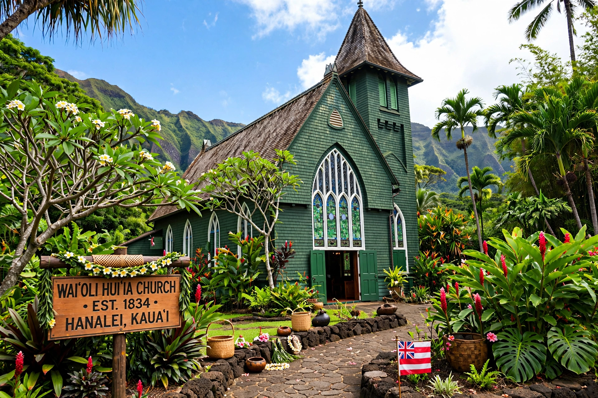
The green-shuttered Waiʻoli Huiʻia Church, founded in 1834, is one of the oldest church buildings on Kauaʻi. The current structure dates to 1912, but the congregation’s history stretches back to the first missionaries. The adjacent Waiʻoli Mission House, built in 1837, is a small museum furnished in period style. Both are open to visitors at limited hours and offer a genuine window into 19th-century missionary-era Kauaʻi.
Shopping and Galleries
Hanalei’s shops lean toward Hawaiian art, locally made crafts, surf gear, and clothing. The main commercial cluster along the highway includes galleries featuring island artists, bookstores, and boutiques. Ching Young Village on the east end of town houses a grocery store, coffee shop, and several eateries in a plantation-style complex. Prices reflect the remote location, so stock up on basics before you arrive.
Food and Shave Ice
Hanalei’s food scene punches above its weight for a town of a few thousand people. Food trucks near the center of town serve plate lunches, fish tacos, and açaí bowls. Several sit-down restaurants offer Hawaiian regional cuisine with valley and ocean views. The town’s shave ice stands are justifiably famous: order it with ice cream on the bottom and a snow cap of sweetened condensed milk for the full experience. Fresh poke from the grocery delis is a local staple and an excellent beach picnic option.
Farmers Markets and Local Produce
The Hanalei Farmers Market, held on Saturday mornings at the Hanalei Neighborhood Center, is one of the best on Kauaʻi. Valley farmers sell just-harvested taro, tropical fruit, honey, and cut flowers, and food vendors offer breakfast plates and fresh juice. Arrive before 10 a.m. for the best selection. Smaller pop-up markets appear during the week near the town center in high season.
Art and Culture
Hanalei’s galleries showcase work by island artists: koa wood sculpture, seascapes, jewelry made from local shells and sea glass, and photography of the Nāpali Coast. Several galleries host artist receptions on weekend evenings. The town’s small public library branch, in a plantation cottage near the school, carries an excellent Hawaiiana collection and offers free community programs.
Hanalei Pier
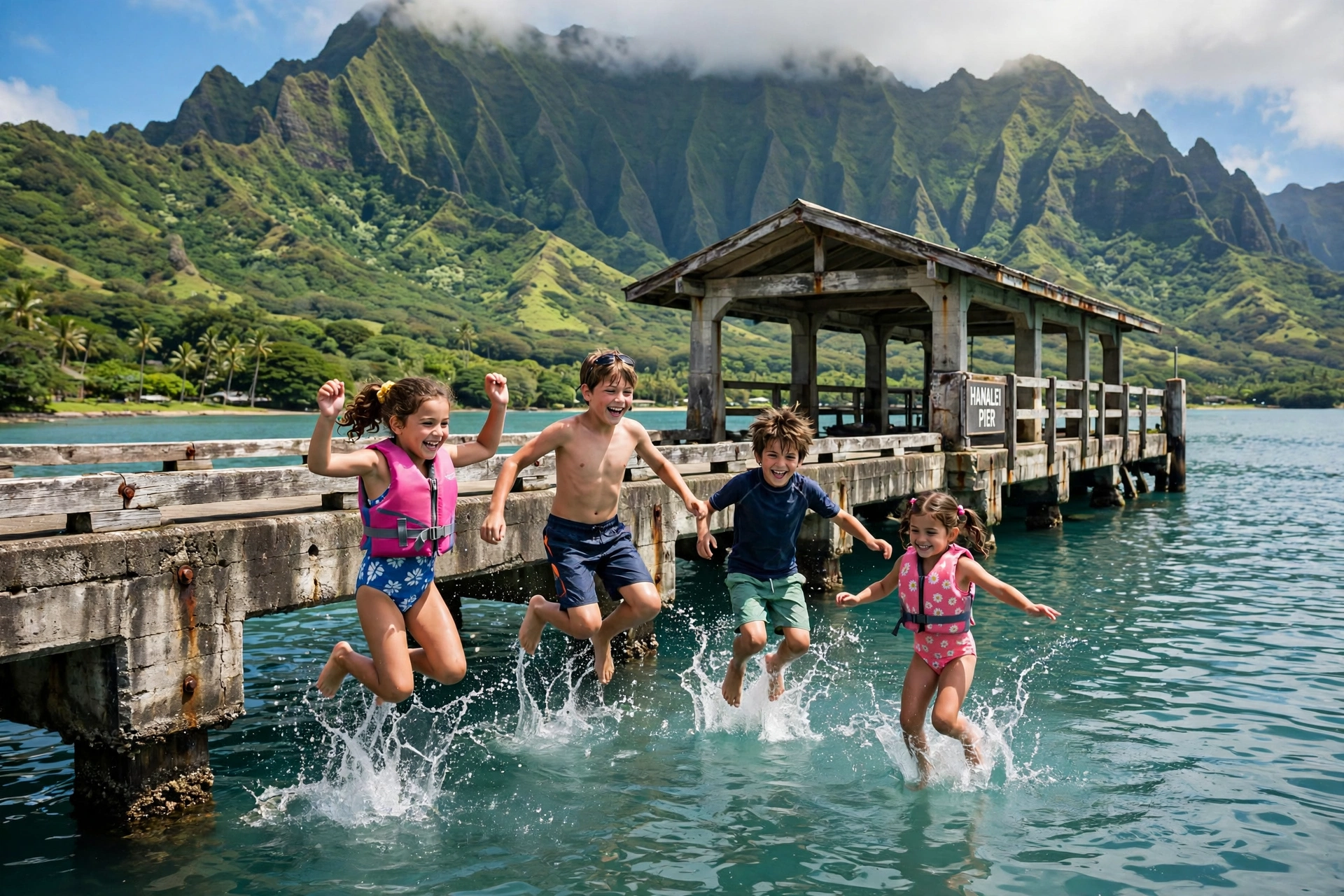
The Hanalei Pier extends into the bay from Black Pot Beach Park at the end of Weke Road. Built in 1912 for the rice and sugar trade and listed on the National Register of Historic Places, the pier is now a beloved public gathering place. Kids jump off it in summer when the surf is calm, anglers fish from it year round, and everyone gathers on it for sunset. The pier area has restrooms, showers, and picnic tables.
Hanalei Valley and Taro Fields
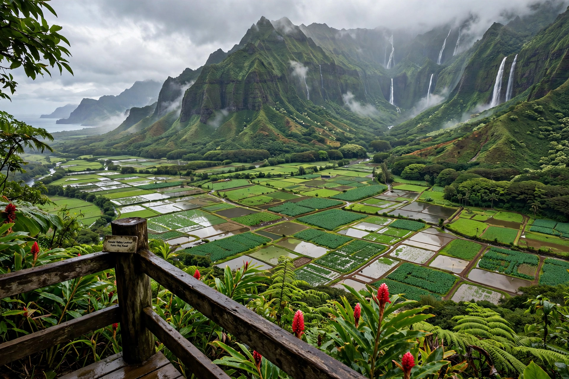
The Hanalei Valley is one of the most culturally significant landscapes in Hawaiʻi. Its floor is a patchwork of irrigated taro loʻi, some of which have been in continuous cultivation for over a thousand years. The valley produces the majority of Hawaiʻi’s taro, the staple crop at the center of Native Hawaiian culture and cuisine.
The Hanalei Valley Lookout, a signed roadside pullout on Kūhiō Highway just east of the one-lane bridge, provides the classic view: flooded taro paddies reflecting the sky, backed by waterfalls threading down the sheer green cliffs of the valley’s head. Early morning light is best for photography, and the valley is often clearest before the afternoon clouds build.
The Hanalei National Wildlife Refuge, established in 1972 and managed by the U.S. Fish and Wildlife Service, protects 917 acres of the valley’s wetlands. The refuge is critical habitat for four endangered Hawaiian waterbirds: the Hawaiian stilt (aeʻo), Hawaiian coot (ʻalae keʻokeʻo), Hawaiian moorhen (ʻalae ʻula), and Hawaiian duck (koloa maoli). The refuge is not generally open to the public except through occasional guided tours, but the birds are easily visible from the lookout and the highway with binoculars.
Respect the valley’s working character. The loʻi are private farms. Do not enter them, fly drones over them, or park on plantation roads. View from the public lookouts and appreciate that you are looking at a living agricultural landscape, not a park.
Surrounding Beaches
Hanalei sits at the center of one of the finest beach coastlines in Hawaiʻi. The bay itself is covered in full detail on our Hanalei Bay Map page, which maps the pier, the four beach sections, surf breaks, parking, and access points. The highlights beyond the bay:
- Lumahaʻi Beach: About 4 miles west of Hanalei, the beach made famous by the film South Pacific. Stunning and dangerous in equal measure, with powerful shorebreak and currents. Best admired from the sand in summer, never swum in winter.
- Wainiha and Hāʻena beaches: Continuing west, a string of pocket beaches and reef-protected swimming spots fronts the road to the end. Tunnels Beach (Makua) offers excellent summer snorkeling.
- Keʻe Beach: At the literal end of the road, Keʻe is the trailhead for the Kalalau Trail and a beautiful reef-protected beach in its own right. Entry requires a reservation through the state park system.
- East of Hanalei: Toward Princeville, Hideaways Beach (Pali Ke Kua) rewards a steep trail descent with excellent summer snorkeling. Anini Beach, further east, is one of Kauaʻi’s safest swimming beaches behind its fringing reef.
For the full bay breakdown, including the surf breaks at Pine Trees and the Bowl, parking at Black Pot, and seasonal safety guidance, see Hanalei Bay Map.
Nāpali Coast Gateway
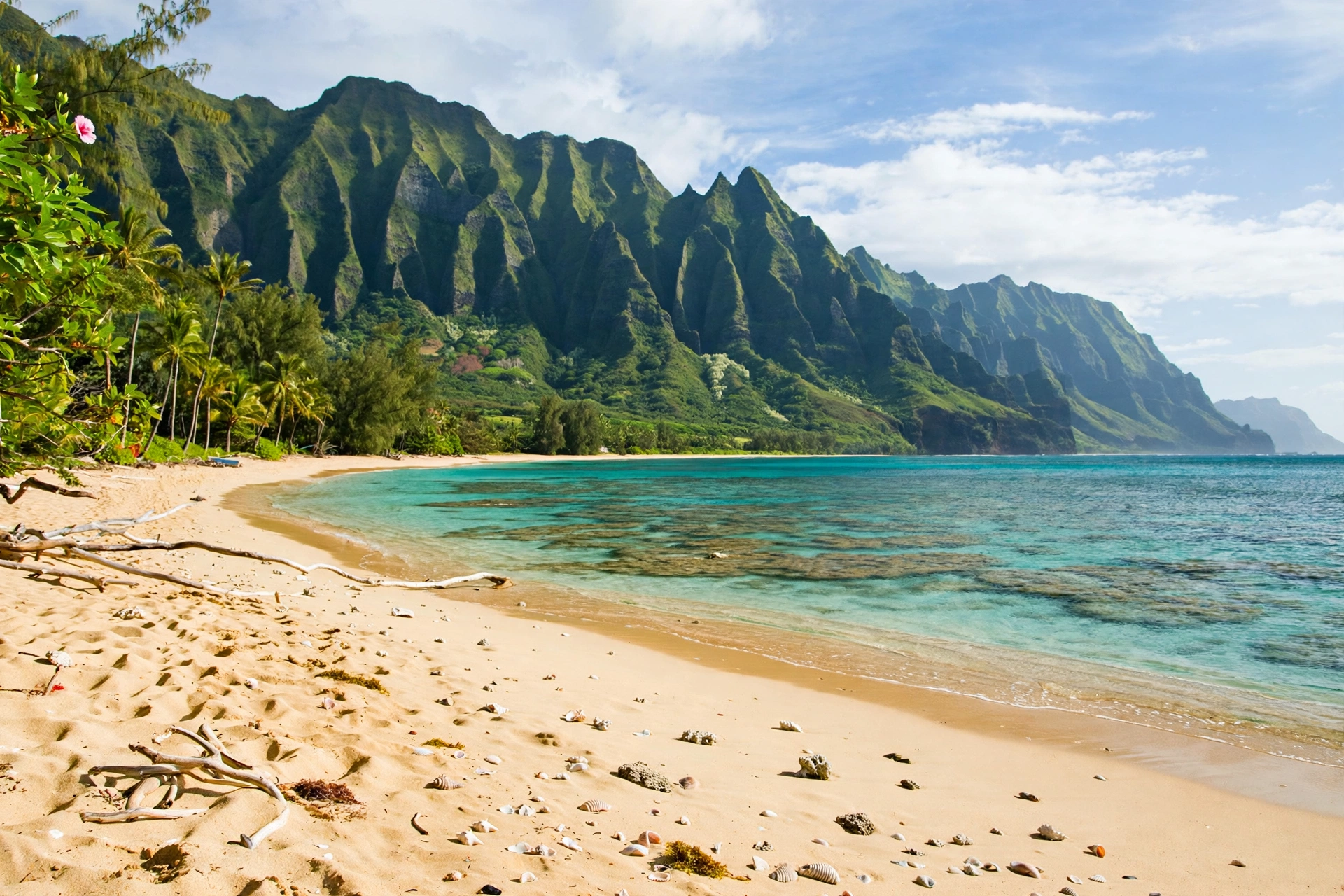
Hanalei is the practical gateway to the Nāpali Coast, the 17-mile stretch of fluted sea cliffs that defines Kauaʻi’s northwest shore and is inaccessible by road. There are three ways to experience it, all launching from the Hanalei area.
Kalalau Trail
The 11-mile Kalalau Trail begins at Keʻe Beach and traverses the coast to Kalalau Beach. Day hiking to Hanakāpīʻai Beach (4 miles round trip) requires a day-use reservation for Hāʻena State Park. Continuing past Hanakāpīʻai requires a camping permit, available only through the state system and often booked months ahead. The trail is strenuous, exposed, and dangerous in rain. Do not attempt it casually.
Boat Tours
Boat tours departing from Hanalei Bay and nearby harbors cruise along the Nāpali Coast, viewing the cliffs, sea caves, waterfalls, and dolphins from the water. Most operate seasonally, with winter swells sometimes forcing cancellations. These are sightseeing cruises, and this site does not promote or book specific operators.
Helicopter Views
Helicopter flights from Līhuʻe offer aerial views of the Nāpali Coast’s interior valleys and waterfalls that are invisible from the trail or the water. Weather cancellations are common on the north shore, so book early in your trip to allow rebooking.
Planning Tips for the Nāpali Coast
Whichever way you choose to experience the coast, plan around the weather. Winter swells cancel boat tours and make the Kalalau Trail’s stream crossings dangerous. Summer offers the calmest ocean and the driest trail, but also the heaviest demand for permits and reservations. Book Hāʻena State Park reservations the moment your dates open, carry rain gear even on sunny days, and build a buffer day into your itinerary so a weather cancellation does not cost you the experience.
Driving and Parking
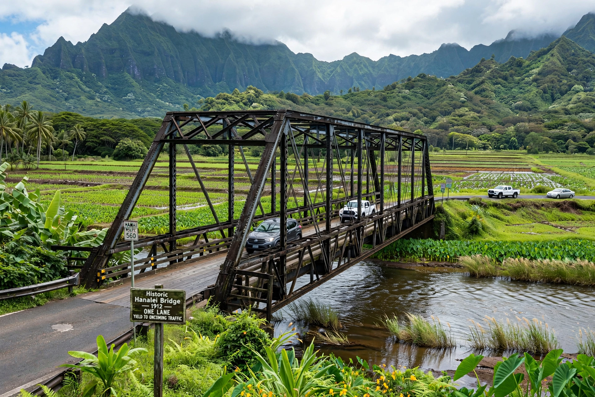
Hanalei is reached via Kūhiō Highway (Route 560) from Līhuʻe, a drive of about 45 to 70 minutes depending on traffic and the single-lane bridges. The highway narrows to one lane in several places west of Hanalei, with yield signs indicating priority. The protocol is simple: whoever arrives first or is indicated by the sign goes, and locals appreciate a friendly wave.
Parking in Hanalei town is limited to small lots and street parking along the highway. The lots at Ching Young Village and the main commercial area fill by mid-morning. For the bay, Black Pot Beach Park at the end of Weke Road has the main public lot, and it fills early on weekends and holidays. Do not park on private property or block driveways; towing is actively enforced.
Flood closures are a real planning factor. The Hanalei Bridge and the highway west of town close during heavy rain events, sometimes for hours and occasionally for days, as happened during the record April 2018 floods. Check weather and road conditions before driving to the north shore, keep your fuel tank above half, and carry water and snacks in case of delays.
Hanalei’s History
Hanalei’s written history begins with the bay. In the early 1800s, New England whaling ships anchored in Hanalei Bay to reprovision, trading with Hawaiian farmers for sweet potatoes, taro, and fresh water. The town that grew around the bay took its name from the valley: Hana-lei, often translated as “lei making” or “crescent bay,” a reference to the bay’s perfect crescent shape.
The missionary era left the town’s most visible landmarks. The Waiʻoli Mission, established in 1834, brought the church and school that anchor the west end of town. The missionaries’ descendants became prominent in Kauaʻi’s sugar industry, and Hanalei’s plantation era shaped the town’s architecture: the wooden storefronts, the manager’s houses, and the small worker cottages that still line the side streets.
Rice replaced sugar as the valley’s cash crop in the late 1800s, and the Hanalei Pier was built in 1912 to ship rice to Honolulu. Chinese and Japanese immigrant farmers worked the valley’s paddies, and their legacy persists in the valley’s irrigation systems and in the multicultural food traditions of the north shore. When rice collapsed after World War I, taro reclaimed the valley floor, and Hanalei settled into the quiet agricultural rhythm it keeps today.
Hanalei entered popular culture through the 1958 film South Pacific, shot at nearby Lumahaʻi Beach, and through Peter Paul and Mary’s 1960s ballad “Puff, the Magic Dragon,” whose lyric “Hanalei” introduced the town’s name to a generation. The town has grown as a visitor destination since, but county zoning and community activism have kept large-scale resort development out of Hanalei itself, preserving the small-town character visitors come to see.
Best Time to Visit Hanalei
Hanalei has two distinct seasons, and choosing between them shapes your trip. Summer, roughly May through September, brings calmer seas, warmer water, and the best beach and snorkeling conditions on the north shore. This is the classic Hanalei postcard season: glassy mornings on the bay, swimmable beaches from Keʻe to Anini, and long warm evenings. It is also the busiest season, with higher accommodation prices and fuller parking lots.
Winter, roughly October through April, brings the big north swells that make the bay a world-class surf destination and a dangerous swimming one. Winter visitors come for the surf watching, the dramatic ocean, whale season from December through March, and the lush green landscape at its most vivid after the rains. Rain is more frequent in winter, and flood-related road closures are most likely from November through February.
The shoulder months of April, May, September, and October often offer the best balance: manageable crowds, reasonable weather, and swimmable seas. Whenever you visit, start beach days early. North shore trade-wind weather typically delivers clear mornings with clouds building by afternoon, and the bay is calmest before the afternoon breeze arrives.
Frequently Asked Questions
Where is Hanalei on the map?
Hanalei is on the north shore of Kauaʻi, about 55 miles north of Līhuʻe via Kūhiō Highway. It sits between Hanalei Bay to the north and the Hanalei Valley to the south, roughly 8 miles east of the end of the road at Keʻe Beach.
What is the difference between Hanalei and Hanalei Bay?
Hanalei is the town; Hanalei Bay is the two-mile crescent beach and bay fronting it. Our Hanalei Bay Map page covers the beach, surf breaks, and bay access in detail, while this page covers the town, valley, and surrounding area.
How far is Hanalei from the airport?
Hanalei is about 32 miles from Līhuʻe Airport, a drive of 45 to 70 minutes depending on traffic and the single-lane bridges along Kūhiō Highway.
Can you swim at Hanalei Bay in winter?
Winter surf can make the bay dangerous, especially at the western breaks. Summer is the calm swimming season. Always check conditions, swim near lifeguards at the Pavilion, and respect warning signs.
Do I need reservations for Hāʻena State Park?
Yes. Hāʻena State Park, including Keʻe Beach and the Kalalau Trail trailhead, requires advance reservations for entry or parking through the state system. Book as early as the release window allows.
What is the Hanalei Valley Lookout?
A roadside pullout on Kūhiō Highway just east of the Hanalei Bridge, offering the classic view over the taro loʻi patchwork of the Hanalei Valley with waterfalls on the cliffs behind. Best in early morning light.
Is Hanalei prone to flooding?
Yes. The north shore receives heavy rainfall, and the highway can close at the Hanalei Bridge and west of town during major rain events. Check conditions before driving out and keep supplies in the car.
Where can I see the Nāpali Coast from Hanalei?
The Kalalau Trail from Keʻe Beach, boat tours viewing the coast from the ocean, and helicopter flights from Līhuʻe. Each requires advance planning and is weather dependent.
Related Guides
- Hanalei Bay Map: the complete reference map for the bay itself, with beach sections, surf breaks, and access points
- Līhuʻe Map: the gateway town and airport on Kauaʻi’s east side
- Hawaii Beaches: the statewide beaches hub
- Hawaii Hikes: the statewide hiking hub, including the Kalalau Trail
- Hawaii Map: the statewide map hub
Reading Hanalei Like a Local
Hanalei rewards travelers who slow down to its pace. Park the car, walk the town strip, talk story with shopkeepers, eat shave ice by the pier, and watch the light change on the valley from the lookout at dawn. The bay, the valley, and the road to the Nāpali Coast are three facets of one place: a small town holding the line between a working agricultural landscape and one of the most visited coastlines in the Pacific. Treat the valley’s farms, the refuge’s birds, and the ocean’s moods with respect, check the weather before you drive the single-lane highway, and Hanalei will give you the version of Kauaʻi that keeps people coming back for decades.