Kaneohe Pillbox Hike: Pu’u Ma’eli’eli Trail Guide

The Kaneohe pillbox hike, officially the Pu’u Ma’eli’eli Trail, is Oahu’s friendliest pillbox hike: a short, rewarding climb through windward forest to World War II bunkers with sweeping views over Kaneohe Bay. At about 2.5 miles round trip and 606 feet of elevation gain, most hikers finish in one to one and a half hours, and the payoff at the top rivals hikes twice as long.
This is the single complete guide to the Kaneohe pillbox hike. It covers trail stats, how to find the trailhead and where to park legally, what to expect on the climb, the history of the pillboxes, the views from the top, safety and etiquette, what to bring, nearby things to do in Kaneohe, and answers to common questions. Everything about this hike is answered on this one page.
Kaneohe Pillbox Hike at a Glance
| Trail briefing: Puʻu Maʻeliʻeli | Details | On the trail |
|---|---|---|
| Official name | Puʻu Maʻeliʻeli Trail (also called Digging Hill) | Locals say Digging Hill |
| Distance | About 2.5 miles round trip, out and back | Short enough for a morning |
| Elevation gain | About 606 feet | Steep in bursts, not gradual |
| Time | 1 to 1.5 hours for most hikers | Add time if it has rained |
| Difficulty | Moderate; steep and muddy sections after rain | Trail shoes beat sneakers here |
| Location | Kaneohe, windward Oahu | Windward means wetter: expect mud |
| Parking | No designated lot; park legally and respect the neighborhood | Arrive early; street parking fills |
| Dogs | Allowed on leash | Bring water for them too |
| Best for | Beginner to intermediate hikers, families with older kids, sunrise seekers | Start before dawn for the sunrise payoff |
Where the Trail Is
Pu’u Ma’eli’eli sits above the town of Kaneohe on Oahu’s windward coast, roughly a 30 to 40 minute drive from Waikiki without traffic. The trailhead is tucked into a residential neighborhood off Kamehameha Highway, which is the single most important thing to know before you go. This is a quiet community, not a trailhead parking lot, and how hikers behave here determines whether the trail stays welcoming.
There is no designated parking area. Park only where it is clearly legal: never block driveways, mailboxes, or fire hydrants, never park on private lawns, and obey all posted signs. Hikers have been fined and towed for parking in the neighborhood, so take the warnings seriously. Keep noise down, especially for sunrise hikes when residents are still asleep. Carpooling helps: fewer cars means less impact on the street.
What to Expect on the Climb
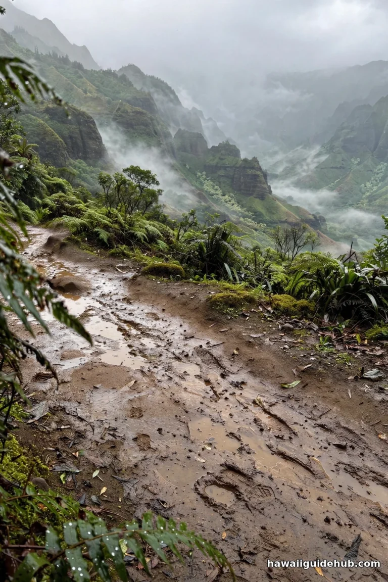
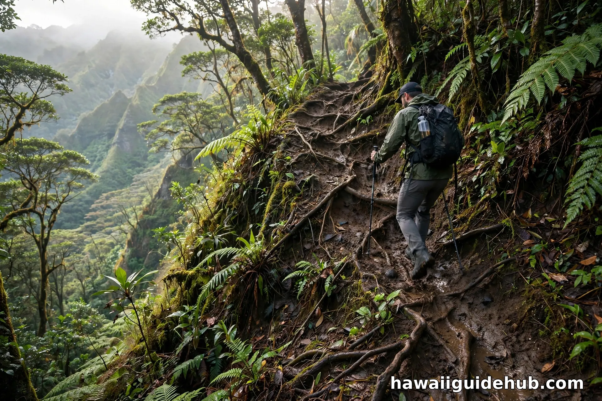
The trail starts in shady windward forest and climbs a ridge toward the summit at about 700 feet. The path mixes easy stretches with steep, rooty pitches, and installed ropes help on the slickest spots after rain. This is one of the muddier hikes on Oahu: after a good rain, expect slippery red clay that will coat your shoes and legs. Wear footwear you do not mind getting dirty, and check the ropes before trusting your weight to them.
The trail borders private property in places, so stay on the marked path and respect all posted signage. The route is straightforward to follow: it is an out-and-back, so you return the way you came. Dogs are welcome on leash. Carry at least a liter of water per person; there is no water on the trail, and the windward humidity makes you sweat more than you expect.
The Pillboxes and Their History
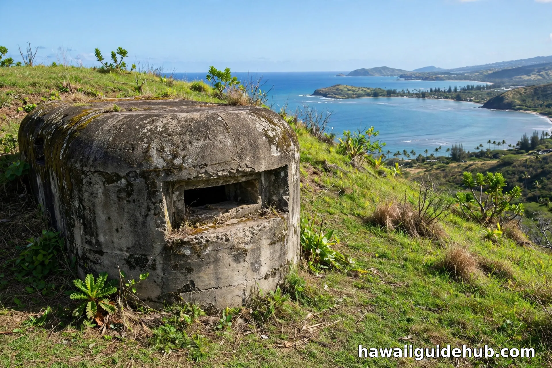
The concrete pillboxes at the top are World War II military bunkers, built as part of Oahu’s coastal defense network after the attack on Pearl Harbor. Similar bunkers dot ridgelines across the island: this is one of four main pillbox hikes on Oahu, along with the Lanikai (Kaiwa), Maili, and Ehukai pillbox trails. The bunkers here are open and explorable, and they make natural rest stops and photo spots on the way up.
Treat the pillboxes with respect. They are historic structures, and graffiti and vandalism have damaged bunkers on other Oahu trails. Do not add to it. Pack out everything you bring in, including food wrappers and water bottles.
Best Time of Day and Best Season
There is no bad season for this hike: the trail is open year round and Kaneohe looks beautiful in every month. Winter brings slightly cooler temperatures and a greener landscape, while summer offers drier trail conditions and calmer, clearer bay water below. Rain is the real variable, and it can arrive in any season on the windward side. Check the forecast the morning of your hike and skip it if heavy rain is expected.
For time of day, sunrise is the signature experience. The east-facing summit catches the first light over the bay, temperatures are at their coolest, and you will share the top with only a handful of other early risers. Mid-morning is the next best window: the light is still good for photos and the neighborhood is awake, so your arrival is less disruptive. Midday brings heat on the exposed ridge and the biggest crowds. Late afternoon offers golden light, but start your descent with plenty of daylight to spare.
The View From the Top
The summit delivers one of the great windward views on Oahu: the full sweep of Kaneohe Bay in its turquoise shades, the famous sandbar (Ahu o Laka) visible on calm days, Mokoli’i island (Chinaman’s Hat) offshore, and the Ko’olau mountains rising behind you. On clear mornings the water glows in layered blues and greens that photographs barely capture.
Sunrise is the classic time for this hike. The trail faces east over the bay, so the sun comes up directly over the water, and going early means cooler temperatures and fewer people. Bring a headlamp for the pre-dawn climb and give yourself enough time to reach the top before first light. Sunset works too, but you will be descending in fading light, so bring a light either way.
What You Are Looking At: The Bay, the Sandbar, and Mokoli’i
The panorama from the summit deserves a proper introduction. Kaneohe Bay is the largest sheltered body of water in the Hawaiian Islands, a maze of turquoise shallows, patch reefs, and deeper channels. On calm days you can spot the Kaneohe sandbar, a long stripe of shallow sand in the middle of the bay that emerges at low tide and draws boats and kayakers on weekends. Its Hawaiian name is Ahu o Laka.
Offshore to the north rises Mokoli’i, the small steep island everyone calls Chinaman’s Hat for its distinctive shape. It is part of Kualoa Regional Park’s viewshed and a familiar landmark in countless photos of the windward coast. Behind you, the Ko’olau mountains run in their sheer green wall, often with clouds snagged on the ridge. Take a few minutes at the top to simply look: this is one of the few easily accessible viewpoints that frames the whole windward seascape at once.
Photography Tips
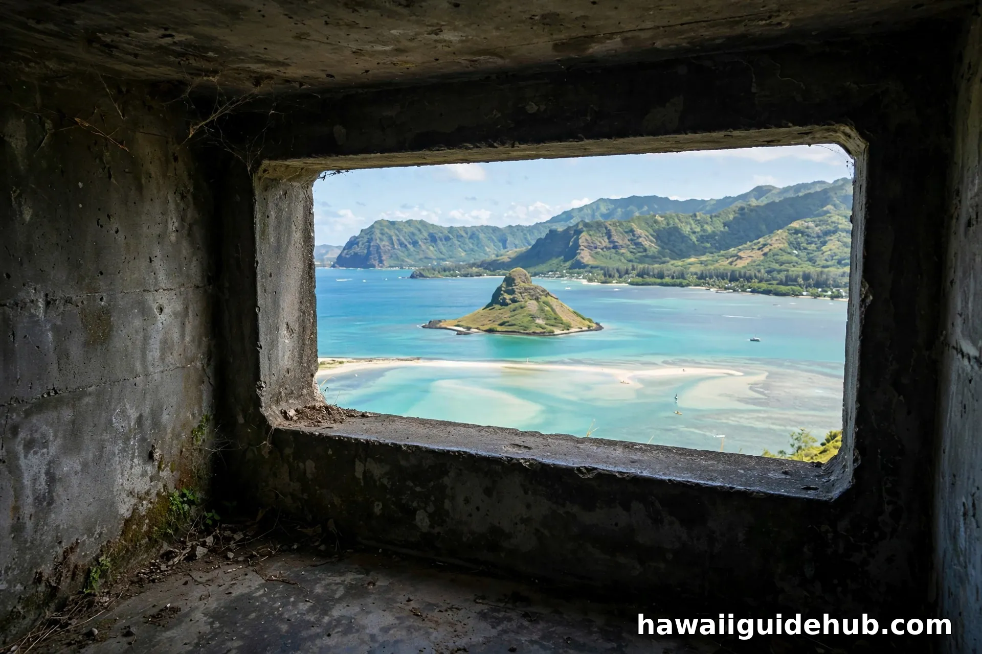
This hike is a photographer’s dream, and a few tricks help. Shoot the bay through the pillbox openings for a natural frame that tells the whole story in one image. Morning light is kindest: the sun rises over the bay, so the water glows and the Ko’olau mountains behind you stay softly lit. A polarizing filter cuts glare off the water and deepens the turquoise. For sunrise shots, bring a small tripod or brace your phone on the concrete; the low light needs a steady hand. And take the classic summit panorama, but also turn around: the view back toward the mountains with clouds snagged on the ridge is just as dramatic.
Safety and Etiquette
Respect the neighborhood. Keep voices down, park legally, and leave no trace. The trail’s future depends on hiker behavior. Watch the mud. The trail gets genuinely slippery after rain; turn back if a section feels unsafe rather than risking a fall. Bring water and sun protection. The exposed ridge sections bake in the midday sun. Stay on the trail. Private property borders the route, and shortcuts cause erosion and conflict. Check conditions. If heavy rain is forecast, pick another day: flash flooding and landslides are real risks on windward trails.
What to Bring
Trail shoes or hiking sandals with grip (not flip-flops), at least one liter of water per person, reef-safe sunscreen and a hat, insect repellent, snacks, a small first-aid kit, and your phone for photos and navigation. A headlamp is essential for sunrise or sunset hikes. A change of shoes for the car is wise: your hiking shoes will be muddy. Leave valuables at your lodging, since trailhead-area car break-ins happen on Oahu.
How It Compares to Other Oahu Pillbox Hikes
Oahu has four main pillbox hikes, and Pu’u Ma’eli’eli is widely considered the easiest of the four, with the least elevation gain and a manageable distance that suits beginners and families with older kids. The Lanikai Pillbox (Kaiwa Ridge) is the most famous, with postcard views of the Mokulua Islands but bigger crowds and a steeper start. The Maili Pillbox on the west side, known as the pink pillbox, offers the best sunset views. The Ehukai Pillbox on the North Shore is distinguished by its painted peace sign. If you only do one pillbox hike, Lanikai wins on fame, but Kaneohe wins on the ratio of effort to reward and on crowd levels. For more island trails, see our ultimate guide to outdoor adventures in Hawaii.
Things to Do Nearby in Kaneohe
Pair the hike with the windward side’s other draws. Ho’omaluhia Botanical Garden, a few minutes away, is a free 400-acre garden with lake views and picnic areas that kids love. Kaneohe Bay itself offers kayak rentals and sandbar tours on calm days. Kailua town, about 15 minutes south, has great beaches and lunch spots for the post-hike refuel. For another classic Oahu waterfall hike on a future trip, see our guide to Manoa Falls. If you are continuing around the island, the North Shore’s surf towns are an easy drive north. Our guide to the windward side of Oahu covers more of what makes this coast special.
Watch: Pu’u Ma’eli’eli Pillbox Hike
Frequently Asked Questions
How long is the Kaneohe pillbox hike?
About 2.5 miles round trip with roughly 606 feet of elevation gain. Most hikers finish in 1 to 1.5 hours.
Where do you park for the Kaneohe pillbox hike?
There is no designated lot. Park only where legal on nearby public streets, never blocking driveways or parking on private property. Illegal parkers have been fined and towed.
Is the Kaneohe pillbox hike good for beginners?
Yes, it is considered the easiest of Oahu’s four main pillbox hikes. Expect some steep, muddy sections, so wear proper footwear and bring water.
Can you do the Kaneohe pillbox hike at sunrise?
Yes, and it is one of the best sunrise hikes on Oahu since the trail faces east over Kaneohe Bay. Bring a headlamp and keep noise down in the neighborhood.
Are there bathrooms on the trail?
No. There are no facilities at the trailhead or on the trail, so plan accordingly before you arrive.
Is the trail dog-friendly?
Yes, dogs are welcome but must stay on leash. Bring water for them too, and be ready for muddy paws.
How does it compare to the Lanikai Pillbox hike?
The Kaneohe hike is easier, shorter, and far less crowded than Lanikai. Lanikai has the more famous view of the Mokulua Islands, but Kaneohe’s bay panorama is just as beautiful and you will share it with fewer people.
Is the hike free?
Yes. There are no fees, permits, or reservations required for the Pu’u Ma’eli’eli Trail. Just show up, park legally, and hike.
Is there cell service on the trail?
Generally yes, since the trail is close to town. But do not rely on it: download an offline map before you go, as coverage can drop in the dips of the ridge.
The Kaneohe pillbox hike is proof that the best Oahu experiences are not always the most famous ones. A short climb, a little mud, some World War II history, and a view over Kaneohe Bay that you will think about for years. Park legally, respect the neighborhood, start early, and enjoy one of the windward side’s finest mornings.