Hiking the Pihea Trail: Kalalau Valley Views and the Highest Swamp on Earth

There is a moment on the Pihea Trail when you realize you have walked into one of the strangest and most beautiful places in Hawaii. You start at a lookout where the green cliffs of the Nāpali Coast drop away into the Pacific, the kind of view that fills camera rolls and magazine covers. Then you turn away from the ocean, walk into a dripping native forest, and end up in a swamp. Not just any swamp. A swamp sitting more than 4,000 feet above sea level, believed to be the highest elevation swamp on Earth. Few hikes anywhere pack this much contrast into a single day.
The Pihea Trail runs along the back rim of Kalalau Valley in Kōkeʻe State Park on Kauaʻi. It is the gateway to the Alakaʻi Swamp, the montane wet forest that surrounds nearby Mount Waiʻaleʻale, one of the wettest spots on the planet. Hikers use the Pihea Trail to reach the Alakaʻi Swamp Trail, which ends at Kilohana Lookout with its sweeping view of Hanalei Bay. Together they form one of Kauaʻi’s signature mountain hikes, and also one of its muddiest. Come prepared for that, and the trail rewards you with scenery you cannot find anywhere else.
Getting to the Trailhead
The Pihea Trail begins at the Puʻu o Kila Lookout, at the very end of Highway 550 in Kōkeʻe State Park. The drive itself is part of the experience. From the town of Waimea on Kauaʻi’s west side, Highway 550 climbs through Waimea Canyon and into the high plateau of Kōkeʻe, gaining around 4,000 feet of elevation. Stop at the Kōkeʻe Natural History Museum near mile marker 15 on the way up. The staff there know the trails intimately and can tell you how the Pihea Trail is looking that day, which matters more than you might think.
Kōkeʻe State Park covers 4,345 acres of mountainous terrain on a plateau ranging from about 3,200 to 4,200 feet above sea level. Much of the park is montane mesic forest dominated by koa and ʻōhiʻa lehua trees, and it holds roughly 45 miles of the finest hiking trails in Hawaii. The park gets around 70 inches of rain per year, mostly from October to May, and temperatures range from the mid-40s in winter to the high 60s in summer. That temperature drop surprises a lot of visitors. You left a sunny beach an hour ago, and now you are shivering in mist at the trailhead. Bring a layer.
Puʻu o Kila Lookout sits at the end of the road with a parking area. Arrive early, because the lot fills on clear weekends. Take a moment at the lookout before you start hiking. On a clear morning you get a commanding view of Kalalau Valley stretching out to the sea, the towering cliffs of the Nāpali Coast rising on either side. The Pihea Trail starts right here, skirting along the back of that valley you are looking at. For more ideas on building your island itinerary around days like this, see the ultimate guide to things to do on Kauai.
The Trail in Sections
The Kalalau Valley Rim
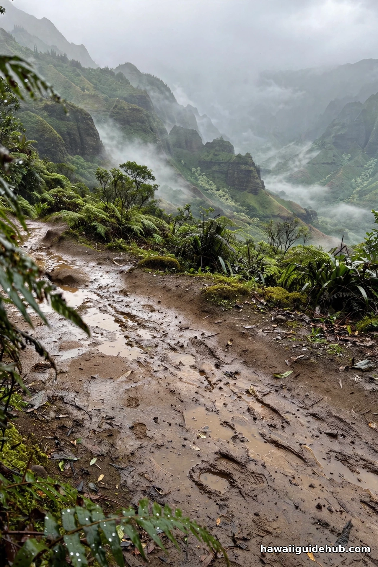
The first stretch of the Pihea Trail is the scenic highlight for many hikers. The trail curves along the back of Kalalau Valley, threading through native forest of ʻōhiʻa trees, ferns, and koa. Gaps in the vegetation open to views down into the valley and along the Nāpali Coast’s fluted cliffs. Cloud mists blow through at this elevation, and the light changes constantly. One minute the cliffs stand out in sharp relief, the next they dissolve into white. Photographers should keep the camera accessible for the entire first mile.
This is also prime birdwatching territory. Kōkeʻe’s forests shelter colorful endemic Hawaiian forest birds including the ʻapapane, the ʻiwi, and the Kauaʻi ʻamakihi. Listen for their calls in the canopy. The ʻapapane’s song is a series of whistled phrases that carries surprisingly far in the mist. If you are interested in Hawaii’s native wildlife, read up on the birds you might spot before you go, because most of these species exist nowhere else on Earth.
The Pihea Vista Side Trail
About a mile in, a short but extremely steep side trail climbs to the Pihea Vista. This is the highest rim point of Kalalau Valley on the trail, and on a clear day the panorama is extraordinary. The climb is short and sharp, and it can be brutally slippery after rain. Some hikers skip it to save their legs for the long haul ahead. Others consider it the single best viewpoint of the day. The honest advice is this: if the clouds are socked in and you can barely see twenty feet, save your energy. If the valley is open and glowing, the scramble is worth every muddy step. Use extreme caution near the edge. The cliffs here are real, and the soil can be loose.
Into the Mud
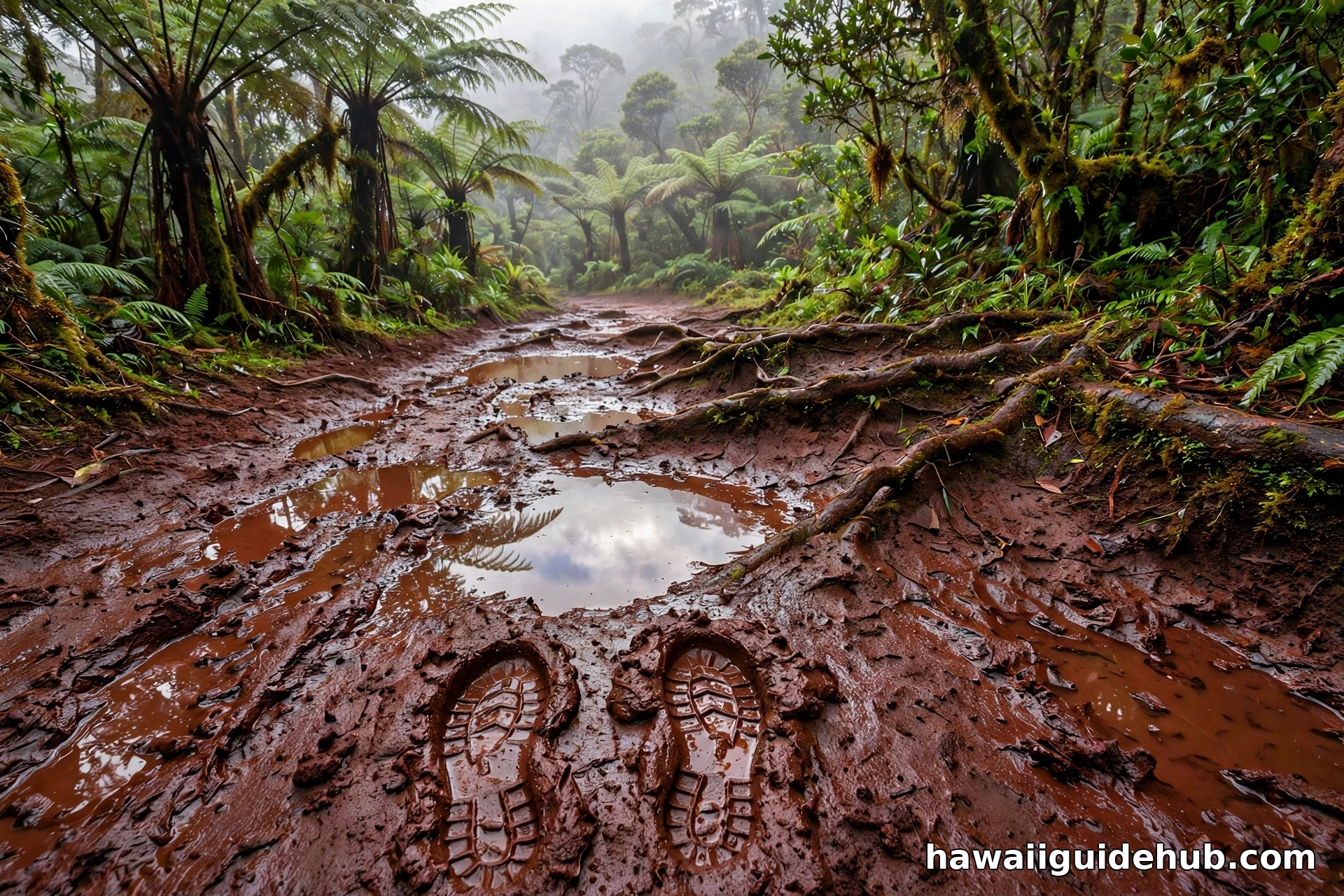
Past the Pihea Vista junction, the character of the hike changes. The trail dips and the famous Kauaʻi mud takes over. The Pihea Trail is notorious for its slick red mud, especially in the low spots along the ridgeline. This is the wettest corner of one of the wettest islands on Earth, so treat mud as a certainty rather than a possibility. Waterproof hiking boots with aggressive tread and ankle support are essential. Gaiters keep the worst of it out of your socks. Trekking poles help enormously on the slippery descents. And whatever you do, do not wear your favorite white sneakers. They will not survive, and neither will your mood.
The Alakaʻi Swamp Junction
At roughly 1.75 miles, the Pihea Trail meets the Alakaʻi Swamp Trail. This junction is the decision point of the hike. Going straight continues on the Pihea Trail toward Kawaikoi Camp, a longer backcountry route. Turning left takes you onto the Alakaʻi Swamp Trail toward Kilohana Lookout, which is the route almost every hiker is here for. The junction can be confusing in the mist, so watch for the trail markers and commit to your turn.
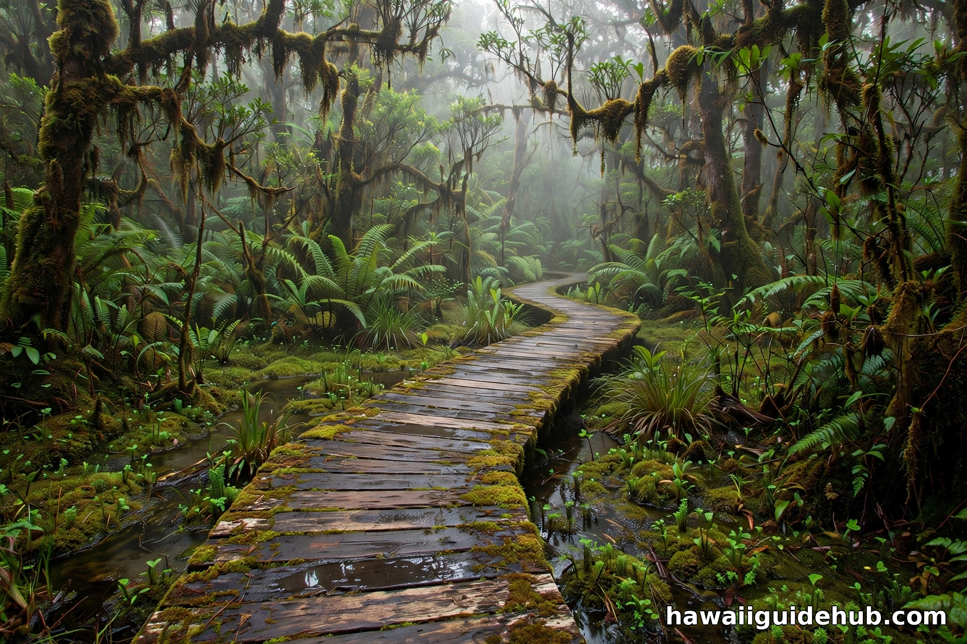
From here the trail becomes a wooden boardwalk with stairs, descending and then climbing through the high mountain swamp. The boardwalk exists for two reasons: to keep your feet out of the bog, and to protect the fragile swamp ecosystem from your feet. Stay on it. The Alakaʻi bog has swallowed hikers’ boots, walking sticks, and worse. Some sections of the boardwalk are weathered and aging, with planks that have softened or rotted through, so test your footing before committing your weight. The chicken wire or mesh stapled to some sections helps with grip when wet, but it is not everywhere.
The Swamp Itself
Walking the boardwalk through the Alakaʻi Swamp feels like stepping into another world. The forest here is stunted and strange, shaped by constant wind, mist, and saturated ground. Moss drapes everything. Dwarf ʻōhiʻa trees twist out of the bog. The air smells of wet earth and vegetation. You are walking across a plateau near Mount Waiʻaleʻale at over 4,000 feet, through a wetland that exists because impermeable volcanic rock traps the immense rainfall. The Alakaʻi Wilderness Preserve spans about 9,000 acres and was established in 1981. It harbors endangered endemic species found only in this montane wet ecosystem, which is why staying on the boardwalk matters beyond your own safety.
The swamp is quiet in a way that is hard to describe. The mist muffles sound, and the bird calls seem to come from everywhere and nowhere. Hikers often say this section feels the most remote, even though the trail is well marked. Take your time here. The boardwalk winds for a good stretch, and rushing it means missing the details: the tiny orchids, the moss gardens, the way the light filters through the stunted canopy.
Kilohana Lookout
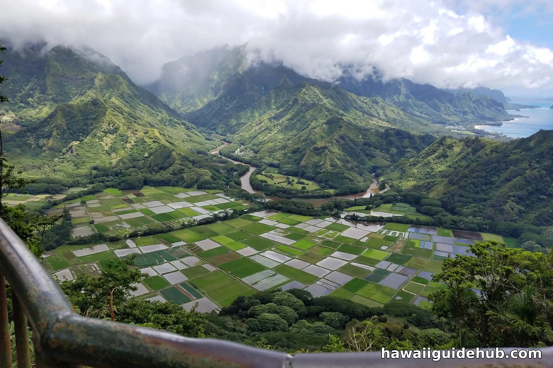
The boardwalk ends at Kilohana Lookout, and the payoff is enormous. The forest opens and suddenly you are looking out over Hanalei Bay, the crescent of turquoise water curving below with the Wainiha Pali rising behind it. On a clear day you can see the patchwork of taro fields in Hanalei Valley and waterfalls threading down the cliffs. The clouds appear and disappear quickly at the lookout, so if you arrive socked in, wait. Fifteen or twenty minutes of patience is often rewarded when the mist tears open. This is one of the great viewpoints on Kauaʻi, and you earned it through mud and mist. After soaking it in, learn more about what awaits at sea level with this guide to the best things to do in Hanalei.
Difficulty and Fitness
How hard is the Pihea Trail? It depends on how far you go and what the weather has been doing. The full out-and-back from Puʻu o Kila to Kilohana Lookout via the Alakaʻi Swamp Trail runs about 8.1 miles with roughly 1,683 feet of elevation gain, taking most hikers four to five hours. The mud is the great equalizer. In dry conditions it is a moderate hike with some strenuous sections. After rain it becomes a genuine challenge, with slippery descents that demand full attention and add significant time.
The first mile along the valley rim is the most accessible part and makes a fine shorter outing on its own. The Pihea Vista side trail adds a steep scramble. The swamp boardwalk section is less about fitness and more about careful footing and patience. Hikers with knee issues should know the return trip involves a fair amount of climbing back up what you descended. There is no water on the trail and no facilities past the trailhead, so this is a self-sufficient hike.
When to Go
The trail is open year-round, and Kauaʻi’s uplands are beautiful in any season. That said, timing matters. Start early in the morning. The clouds typically build through the day, and the valley views that make the first mile magical are far more likely before midday. Early starts also mean cooler temperatures for the climbing and a better shot at the Kilohana Lookout being clear.
Kauaʻi’s drier months, roughly May through September, generally bring more manageable trail conditions. But this is the Alakaʻi, next to one of the wettest places on Earth, so “dry” is relative. Rain can arrive any day of the year. The one hard rule: do not hike the Pihea Trail during or right after heavy rain. The mud becomes treacherous, stream crossings swell, and the views vanish entirely. Check conditions at the Kōkeʻe Museum before you commit, and be willing to pick another day. The trail will still be there.
What to Bring
Pack like you mean it. The elevation, the weather swings, and the remoteness punish the underprepared.
Waterproof hiking boots with ankle support are non-negotiable. Bring at least two liters of water per person, because there is none on the trail. Pack a rain jacket no matter what the sky looks like at the trailhead. Add a warm layer for the wind at the lookouts. Bring food or substantial snacks for the full route. Trekking poles are strongly recommended for the muddy sections. A basic first aid kit, sun protection for the exposed rim sections, and a fully charged phone round out the kit. A dry bag or waterproof case for your camera and phone is smart insurance in a place where the mist can turn to rain in minutes.
Wear clothes you do not mind staining. The red dirt of Kōkeʻe does not wash out of everything, and the mud on the Pihea Trail has ended the careers of many light-colored hiking pants.
Safety Essentials
A few safety points deserve emphasis. Stay back from cliff edges at the lookouts and along the rim, especially when the ground is wet. The soil near the drops can be undercut and unstable. Stay on the boardwalk through the swamp, without exception. Tell someone your plans and expected return time. Cell service is unreliable in the mountains. If you are hiking in the afternoon, carry a headlamp in case the mud slows you more than expected. And respect any posted warnings or closures in the park. Trail conditions change, and the park staff post warnings for good reasons.
One more consideration: the drive up Highway 550 climbs fast. If you have been scuba diving, wait at least 24 hours before heading up to these elevations, the same guidance that applies to the island’s other high-altitude areas.
Planning Your Kōkeʻe Day
The Pihea Trail pairs naturally with the rest of Kōkeʻe State Park. After your hike, the Kalalau Lookout a short drive back down the road offers another angle on the valley. The Kōkeʻe Museum’s exhibits on the park’s weather, vegetation, and birdlife will mean more after you have walked through all three. If you want to make a full day of the island’s wild side, browse these outdoor adventures in Hawaii for ideas on what to pair with your mountain day.
For swimmers in your group who would rather be at sea level, Hanalei Bay waits at the end of the view from Kilohana Lookout. This complete guide to Hanalei Beach covers what to know before you go.
A Hike Like Nowhere Else
The Pihea Trail is not the easiest hike on Kauaʻi, and it is certainly not the cleanest. You will get muddy. You may get rained on. The clouds may hide the very views you came for, at least for a while. But few trails anywhere offer this particular journey: a cliffside rim walk above one of the Pacific’s great valleys, a boardwalk through the highest swamp on Earth, and a final lookout over a bay that looks exactly like the Hawaii of postcards. Hike it prepared, hike it early, and give the mist time to lift. The Alakaʻi has a way of rewarding patience.