South Point Hawaii: The Complete Guide to Ka Lae

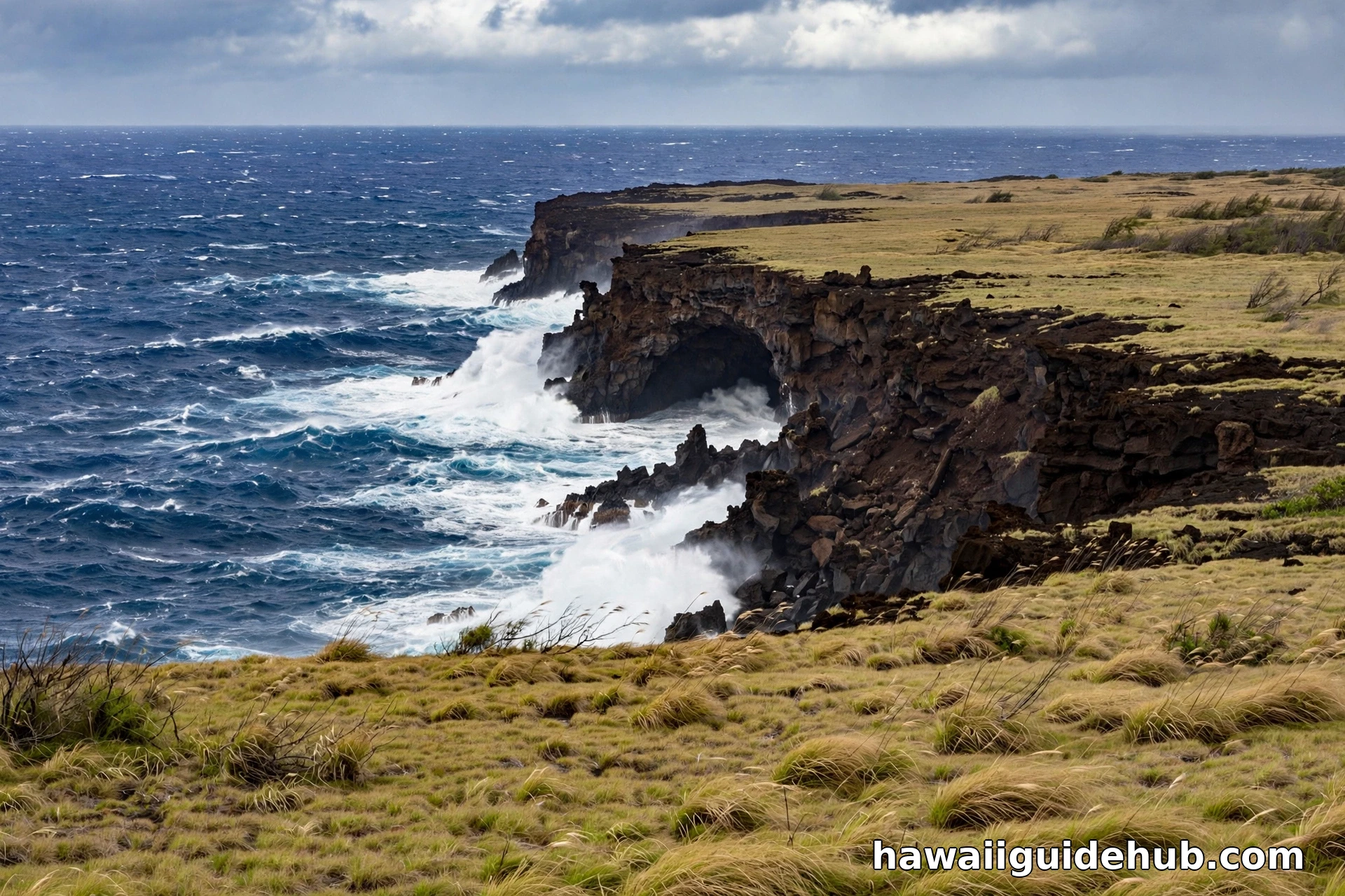
South Point, known in Hawaiian as Ka Lae, is the southernmost point of the Big Island and of the entire United States. Stand at its cliffs and there is no other land between you and Antarctica, 7,500 miles of open Pacific. It is a windswept, raw, beautiful place: 40 foot lava cliffs, fishermen lowering boats on wooden hoists, ancient heiau ruins, and some of the strongest ocean currents in Hawaii. This is the single complete guide to visiting South Point, Hawaii.
This page covers what Ka Lae is, how to get there, what to see and do, the cultural history, the famous cliff jumping and why it is dangerous, how to combine it with Papakolea Green Sand Beach, safety essentials, and FAQs. Everything about the southern edge of America is here on this one page.
What Is South Point (Ka Lae)?
Ka Lae means “the point” in Hawaiian, and it is exactly that: the tapered southern tip of the island of Hawaii. The entire area is a National Historic Landmark District called the South Point Complex, one of the most archaeologically significant places in the state. Historians believe the first Polynesian voyagers to reach Hawaii made landfall here sometime between 400 and 800 AD, which would make Ka Lae the site of the first Hawaiian settlement.
The evidence is written on the rocks. Ruins of heiau (temples) and fishing shrines dot the point, and ancient Hawaiians drilled mooring holes into the cliff ledges to tie off their canoes with long ropes, holes you can still see today. They fished these waters for centuries because the convergence of currents makes them extraordinarily rich: ulua, mahi mahi, marlin, and red snapper all run here.
The History: Where Hawaii Began
The South Point Complex was designated a National Historic Landmark because it may be the single most important archaeological zone in Hawaii. Excavations have found evidence of human activity dating back to the earliest settlement period, and the density of sites is unmatched: habitation caves, temple platforms, fishing shrines, canoe sheds, and burial sites are scattered across the point. The Kalalea Heiau near the beacon is one of the visible remnants, a low rock wall that once formed part of a temple complex.
Why here? The first voyagers were master navigators who read birds, currents, and stars. Ka Lae juts south into the open Pacific, making it the natural first landfall for canoes sailing north from Tahiti and the Marquesas. The rich fishing grounds meant a crew could eat immediately upon arrival. Standing at the point, you are plausibly standing where Hawaiian civilization first touched these islands, which gives the wind and the waves a weight that no interpretive sign could add.
Fishing Culture: Then and Now
The ancient Hawaiians engineered this coastline for fishing. They drilled the mooring holes, built the shrines where the first catch was offered, and learned which currents carried which fish in which season. Modern fishermen inherited the knowledge and added their own inventions: the wooden boat hoists that lower small skiffs down the cliffs, the long ladders, and even toy boats used to carry baited lines far offshore beyond casting range.
Night is the prime time. Fishermen arrive in the evening, set up powerful lights, and work the cliffs through the dark for ulua (giant trevally), some weighing over 100 pounds. If you visit at dusk you may see the setup beginning. Again: this is work, not entertainment. Watch from a distance, keep noise down, and never handle anyone’s gear.
What to Bring
There is no store, no water fountain, and no shade at Ka Lae, so your trunk is your supply depot. The non negotiables: at least a liter of water per person (double it if you are hiking to Green Sand Beach), sun protection including a hat that will stay on in strong wind, sturdy closed toe shoes for the sharp lava rock, and snacks or a packed lunch. A light windbreaker earns its place even on warm days. Bring a trash bag and pack everything out: there are no bins worth relying on.
Getting There
South Point is remote. From Kona it is about a 90 minute drive; from Hilo about two hours. Take Highway 11 to Naalehu, the southernmost town in the US, then turn onto South Point Road, a long straight road across grassy ranchland that ends at the cliffs. The last stretch is rough and unpaved in places, so drive slowly. There is no entrance fee, no visitor center, and no real facilities beyond a few porta potties near the parking area. Bring water, food, sun protection, and a full tank of gas: there is nothing once you turn onto South Point Road.
At the fork near the 10 mile marker, the left fork leads to the trailhead for Papakolea Green Sand Beach; the right fork continues to Ka Lae itself. Most visitors do both. Plan about 30 minutes at the point itself, or a half day if you add the Green Sand Beach hike.
Go in the morning. The wind builds through the day, the light is best before 11 AM, and you will finish the Green Sand Beach hike before the midday heat. Sunset at Ka Lae is spectacular but means driving the rough road back in the dark, so only stay late if you are comfortable with that. Photographers: the cliffs face south and west, so late afternoon gives dramatic side light on the rock, while morning gives the bluest water.
One hidden feature most visitors miss: the Lua Palahemo, a brackish water pond in a collapsed lava tube near the point, sometimes called a bottomless pond. It is on private land, so view it respectfully from the road area and do not trespass. It is a reminder that Ka Lae’s geology is as alive as its history.
What to See at Ka Lae
The southernmost tip
Walk past the parking area to the black and white light beacon, then follow the low ancient rock wall, the Kalalea Heiau, toward the cliff edge. The wall is a sacred site: look, photograph, but do not touch or sit on it. The actual southernmost point is just beyond the beacon, where the ocean surges against the lava rock.
The fishing cliffs
The most fascinating sight at Ka Lae is the working fishing culture. Local fishermen still fish from the cliff edge, and you will see the large wooden boat hoists they use to lower small boats into the sea, plus the long ladders hanging down the 40 foot cliffs. The ancient canoe mooring holes are visible in the rock below the hoists. Watch quietly and keep your distance from anyone working: this is their livelihood, not a show.
The wind
Ka Lae is one of the windiest places in Hawaii. The wind is so consistent that some trees grow almost horizontally, branches all streaming in one direction. Wind farms on the approach road harvest the same gusts. Hold onto hats, secure car doors, and expect the wind to be the dominant sensory memory of your visit.

Cliff Jumping: The Honest Warning
People do jump from the South Point cliffs. The drop is about 40 feet, roughly five stories, into clear water with ladders to climb back up. It looks thrilling, and on calm days locals do it routinely. Here is the honest warning: the Halaea Current runs along the shore and can sweep a swimmer straight out to sea, and it is named for a Hawaiian chief who was carried off to his death here. Conditions change fast, and there are no lifeguards, no rescue services, and no cell signal you can count on.
If you are determined to jump, go only on a calm day, watch locals first, never jump alone, and never jump if you cannot see the current clearly. For most visitors, the right call is to watch, photograph, and keep your feet on the rock. The view is the experience; the jump is optional and genuinely risky.
Building Your South Point Half Day: What to Pair It With
Ka Lae alone is a 30 minute stop, which is why everyone pairs it with something. Here is how to build the day.
| Stop | Time needed | Why it pairs well | Watch out for |
| Ka Lae cliffs | 30 to 45 minutes | The southernmost point itself; fishing culture and heiau | Extreme wind; stay back from cliff edges |
| Papakolea Green Sand Beach | 2 to 3 hours with hike | One of four green sand beaches in the world, same road | 2.5 mile hike each way in full sun; bring lots of water |
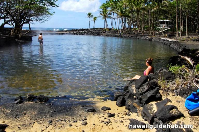
| Punaluʻu Black Sand Beach | 1 hour | Black sand and basking turtles on the drive back east | Hot sand; do not touch the turtles |
| Naalehu town | 30 minutes | Southernmost town in the US; bakery and supplies stop | Small; plan it as a supply stop, not a destination |
The classic loop from Kona: depart by 8 AM, stop in Naalehu for supplies, reach Ka Lae by 10, hike to Green Sand Beach by 11, back by 2, Punaluʻu on the return, home by dinner. From Hilo, pair Ka Lae with Hawaii Volcanoes National Park for the ultimate south island day, though that is a long one.
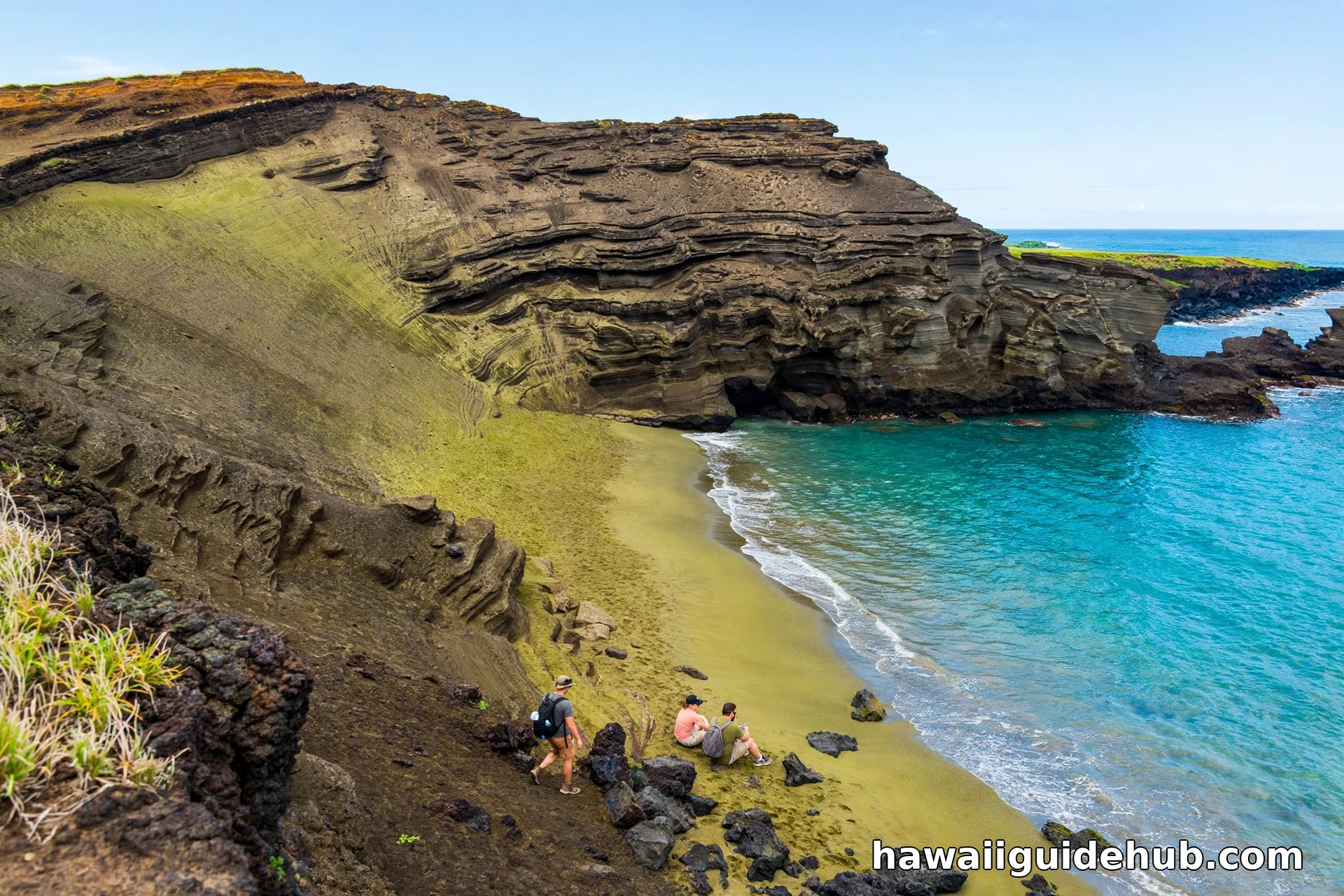
Papakolea Green Sand Beach
The green sand comes from olivine crystals eroding out of the surrounding cinder cone, and on a sunny day the beach glows an unmistakable olive green. The hike is about 2.5 miles each way along an exposed coastal trail with no shade and no water, so go early, carry more water than you think you need, and wear a hat. Locals offer truck rides to the beach for a fee, but the hike is the experience. Swimming is possible but the surf can be rough; most visitors wade and photograph.
Safety Essentials
South Point is unmanaged wilderness with real hazards. Stay well back from cliff edges, which can be undercut. Do not swim except in calm conditions and never alone; the currents are the main danger. There is no drinking water, no food, no shade, and limited cell service. Tell someone your plans. Leave the heiau walls and archaeological sites exactly as you find them: removing rocks or artifacts is illegal and deeply disrespectful.
For the broader Big Island context, see the best things to do on the Big Island of Hawaii and the best things to do in Kona.
Video: Exploring South Point at Ka Lae
A video exploration of Ka Lae: the cliffs, the fishing culture, and the history of Hawaii’s southern tip.
Frequently Asked Questions
Where is South Point Hawaii?
At the southern tip of the Big Island, reached via South Point Road from Naalehu. It is the southernmost point of the United States.
Is South Point free to visit?
Yes. There is no entrance fee, no reservation, and no set hours, though daytime visits are recommended for safety.
Can you swim at South Point?
It is not recommended. Strong, unpredictable currents including the Halaea Current make swimming dangerous. Only very calm conditions and never alone.
How long is the hike to Green Sand Beach?
About 2.5 miles each way along an exposed coastal trail, roughly 45 to 60 minutes each direction. Bring plenty of water; there is no shade.
What is the southernmost town in the US?
Naalehu, on the Big Island of Hawaii, the last town before the South Point Road turnoff.
Can you cliff jump at South Point?
People do, from about 40 feet, but it is genuinely dangerous due to currents. There are no lifeguards. Most visitors should watch rather than jump.
South Point is Hawaii without the filter: no ticket booth, no railings, no gift shop, just wind, cliffs, and 7,500 miles of ocean. It demands respect and a little preparation, and it pays back with one of the most memorable hours on the Big Island. Pair it with the Green Sand Beach, pack more water than seems reasonable, and stand at the edge of America for a while.