
Where Is Hualālai in Hawaiʻi
Quick Answer: Where Is Hualālai?
Hualālai (pronounced approximately hoo-ah-LAH-lay) is a shield volcano on the west side of the Island of Hawaiʻi. It rises directly behind Kailua-Kona and the Kona coast, reaching a summit elevation of 8,278 feet. If you have ever stood in downtown Kailua-Kona and looked inland, the long green ridge filling the horizon is Hualālai. The Ellison Onizuka Kona International Airport at Keāhole sits on the volcano’s lower northwest flank, which means many visitors literally land on Hualālai before they even realize it is there.
Geographically, Hualālai occupies the west-central portion of the Big Island. The Kona coast towns of Kailua-Kona, Keauhou, and the resort areas of North Kona all sit on its slopes. The volcano’s north side merges toward the Waikoloa and Puakō coastline, while its southern flank drops toward the Kealakekua region. Inland, the saddle between Hualālai and Mauna Loa leads toward Waimea and the island’s central plateau.
Hualālai is one of the Big Island’s five volcanoes, and it is the third youngest of the five. The others are Kohala (the oldest), Mauna Kea, Mauna Loa, and Kīlauea (the youngest). Unlike its more famous neighbors, Hualālai erupts only every few centuries. Its last eruption occurred around 1800-1801, which is within written historical time. Because of that, the U.S. Geological Survey classifies Hualālai as an active volcano, and it monitors the volcano around the clock from the Hawaiian Volcano Observatory.
The most important thing for visitors to understand is that Hualālai is a populated volcano. Tens of thousands of people live on its slopes, and its lava flows from the 1800-1801 eruption underlie entire neighborhoods, resorts, and the international airport itself. The volcano is not a distant wilderness sight. It is the ground beneath the Kona coast’s homes, shops, coffee farms, and beaches. That closeness is exactly why this guide exists: to explain where Hualālai is, what it is, and how to appreciate it safely.
The Volcano: Geology and Eruption History
A Shield Volcano in the Making
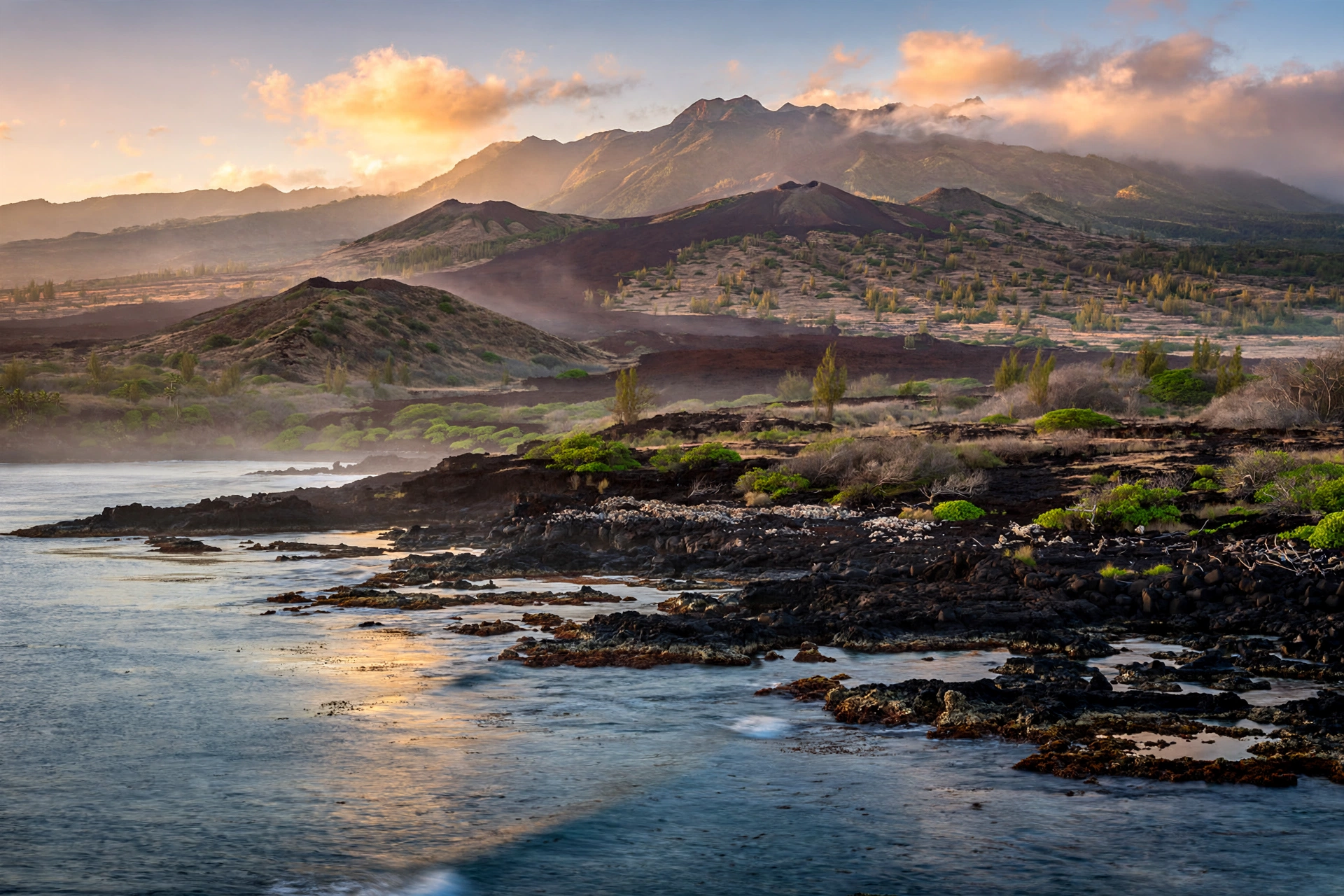
Hualālai is a classic Hawaiian shield volcano: a broad, gently sloping mountain built entirely from thousands of fluid lava flows. It began forming more than 300,000 years ago as magma rose from the same hot spot that built the rest of the island chain. Its summit stands at 8,278 feet above sea level, modest next to Mauna Loa and Mauna Kea but high enough that its upper slopes catch clouds and support native forest.
The volcano’s surface tells its history. The lower slopes facing the ocean are covered with dark, young-looking lava flows, many of them from the last few thousand years. Higher up, erosion has softened the landscape into rolling pastureland and forest. Over one hundred cinder and spatter cones dot the rift zones, giving the summit area a bumpy, textured skyline that looks nothing like the smooth profile of a simple cone.
Three Rift Zones
Hualālai has three rift zones along which eruptions can occur. One strikes north from the summit toward Puʻu Waʻawaʻa. A second runs south-southeast toward Puʻu Lehua. The third, outlined by cinder cones, extends from the summit northwest toward Makalawena and continues about 40 miles offshore along the seafloor. Eruptions may break out along any of these rift zones or from the summit area itself, which is why hazard assessments consider the entire mountain.
This rift geometry explains the shape of the historic lava flows. The 1800-1801 eruptions came from the northwest rift zone, and their flows ran downhill toward the sea, crossing what is now the airport, the resort coast, and Kiholo Bay. Future eruptions, whenever they come, would likely follow the same rift pathways, which is one reason USGS scientists study the old flow channels so carefully.
The 1800-1801 Eruption
The most recent eruptions of Hualālai took place around 1800-1801, well within the written record of early European visitors to Hawaiʻi. Two lava flow fields are named from this period: the Kaʻūpūlehu flow and the Huʻehuʻe flow. The Kaʻūpūlehu flow issued from a long fissure vent on the northwestern flank between roughly 5,500 and 6,000 feet elevation, and its lava rivers flowed seaward to form the broad dark flow visible today between Kona Village Resort and Kiholo Bay. The flow is famous among geologists for its abundant xenoliths, chunks of deep green dunite carried up from the mantle, which look like green stones dipped in black lava.
The Huʻehuʻe flow, whose eruption ended in 1801, underlies almost the entire Ellison Onizuka Kona International Airport at Keāhole. Detailed USGS field studies found that the eruption built its flow field over weeks to months, moving through lava tubes across great distances. Some geologic work suggests the Kaʻūpūlehu flow may have been emplaced a few decades before 1800, so the exact chronology has some uncertainty, but the USGS consistently describes both as the products of the volcano’s last historic activity.
The Wahapele Eruption and Older Activity
Before 1800, the most recent large eruption of Hualālai was the Wahapele eruption, which likely occurred sometime between 1200 and 1400 AD. Its source was Wahapele crater, a vent on the south flank at about 5,053 feet elevation. The eruption began by building a spatter cone roughly 765 yards across, then produced short flows of both ʻaʻā and pāhoehoe lava. The eruption probably lasted weeks to months, a typical duration for this kind of activity.
The pattern is clear: Hualālai erupts much less often than Kīlauea or Mauna Loa, with centuries rather than years or decades separating eruptions. In the 200th anniversary year of the last eruption, USGS scientists noted that this infrequent rhythm is no comfort. Eruptions are inevitable on geologic time scales, and future eruptions from Hualālai may pose a direct threat to Kailua-Kona and the surrounding communities.
The 1929 Earthquake Swarm
The last notable unrest at Hualālai was an earthquake swarm in 1929. From September 19 to mid-December, earthquakes rocked the Kona region, and two of the tremors were large enough to be felt on Oʻahu. Based on the pattern of energy release, USGS scientists concluded the swarm was probably related to magma pushing upward into the volcano rather than ordinary tectonic faulting. No earthquake swarms have been detected at Hualālai since 1929, and current monitoring shows no magma movement. USGS scientists note that a similar swarm of earthquakes should precede the next eruption, giving authorities time to act.
How Hualālai Is Monitored
The U.S. Geological Survey’s Hawaiian Volcano Observatory monitors Hualālai continuously. A seismic network capable of locating very small earthquakes watches for the swarms that precede eruptions. GPS stations and tiltmeters measure whether the mountain is swelling with rising magma. Laser-ranging measurements across the volcano have run since 1971, and a sensitive strainmeter installed in the saddle between Mauna Loa and Hualālai can detect stresses from magma movement. All of these instruments currently show no change. For visitors, the practical takeaway is simple: Hualālai is quiet now, it is watched closely, and any unrest would be detected well before an eruption began.
What to See on Hualālai
Reading the Volcano From the Coast
Most visitors experience Hualālai without ever leaving sea level, and that is entirely appropriate. The volcano reveals itself in layers as you look inland from the Kona coast. From Aliʻi Drive in Kailua-Kona, the lower slopes are hidden behind hotels and homes, but the mid-slopes rise in a green band of coffee farms and pasture, and on clear mornings the summit ridge stands above the clouds. The classic view comes at sunrise, when the light catches the cinder cones along the northwest rift and the mountain glows against the pale sky.
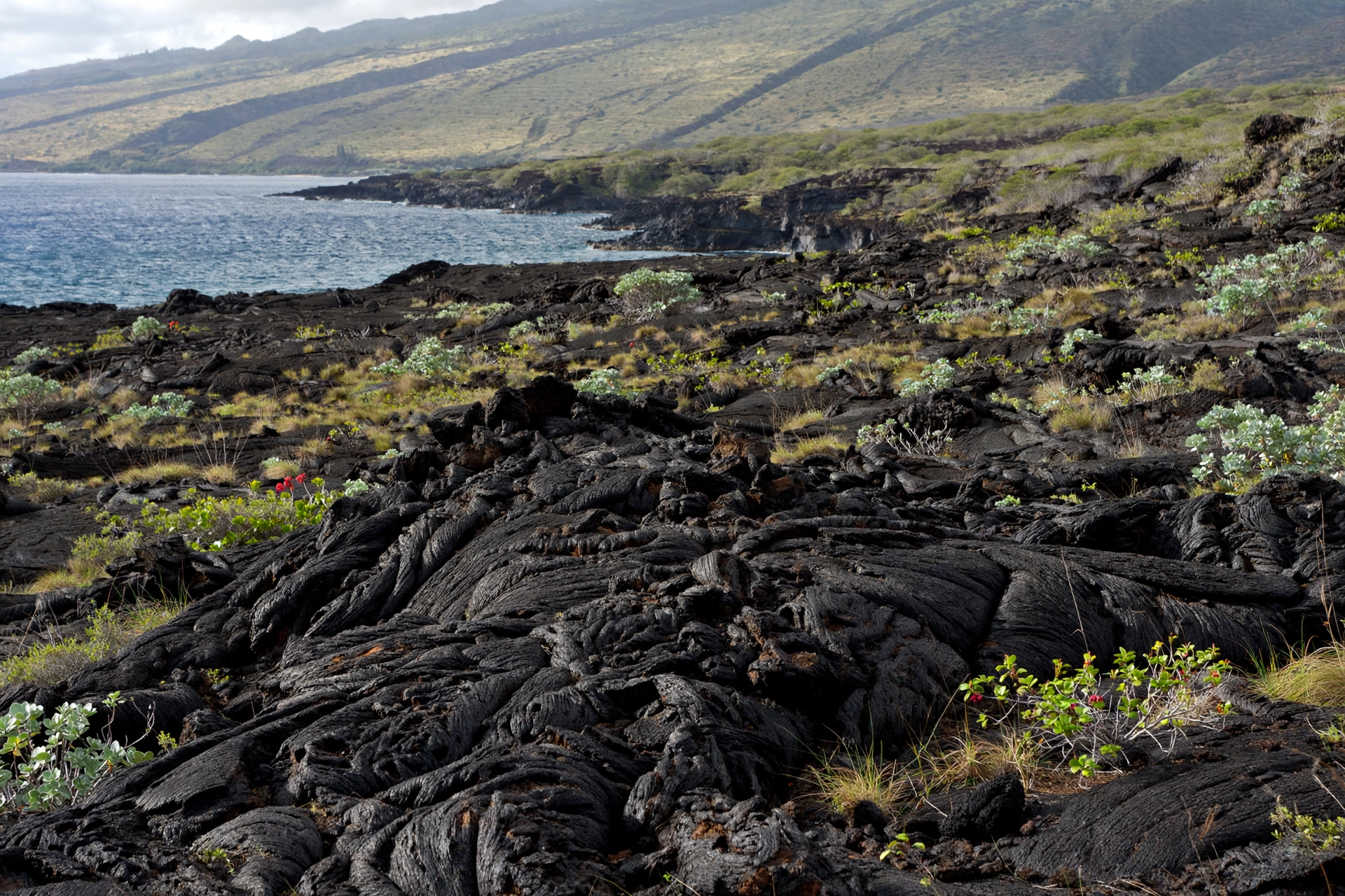
One of the best roadside encounters with the volcano is the drive along Queen Kaʻahumanu Highway between the airport and Kailua-Kona. The road crosses the stark Huʻehuʻe lava flow, one of the youngest landscapes in Hawaiʻi. Pull over safely at designated areas and look at the flow surface: it is ʻaʻā lava, rough and clinkery, with almost no soil. Sparse vegetation is slowly colonizing it, and you can see exactly how a 19th-century lava flow looks more than two centuries later. It is a striking reminder that the airport runway sits on ground younger than the United States as an independent nation.
Cinder Cones and the Summit Country
The upper part of Hualālai is scattered with more than a hundred cinder and spatter cones, each marking a past eruption vent. From a distance, they give the summit a knobby silhouette. Up close, the cones range from small bumps to sizable hills. Much of the upper mountain is private ranch land with no public access, so the summit itself is not a hiking destination for visitors. There is no public trail to the top, and trespassing on ranch land is both illegal and unsafe.
Visitors who want to experience high-elevation Hualālai can look toward the slopes above Holualoa, the arts village perched on the mountain’s west flank. The road to Holualoa climbs through the transition from dry coastal scrub to the cooler, wetter elevations where coffee grows. The air cools noticeably, the vegetation shifts, and the views across the Kona coast widen with every switchback. This short drive is the easiest way to feel the mountain’s vertical scale.
Puʻu Waʻawaʻa and the North Rift
At the northern end of Hualālai’s north rift zone stands Puʻu Waʻawaʻa, a prominent cone visible from the Mamalahoa Highway. The surrounding area includes the Puʻu Waʻawaʻa Forest Reserve, where native dry forest is being restored. Access is limited, and visitors should check current regulations with the state before planning any visit. Even viewed from the road, the cone is a useful landmark for understanding the north rift’s orientation.
Holualoa: The Village on the Slope
The small village of Holualoa sits on Hualālai’s west flank at roughly 1,400 feet elevation. Originally a coffee and Kona town, it is now known for its galleries, historic storefronts, and cool mountain air. A stop in Holualoa puts you literally on the volcano’s side, and the gallery-lined main street makes a pleasant break from the heat of the coast below. The village is a good example of how communities have adapted to life on an active volcano’s flank, farming its weathered upper slopes for generations.
Coffee Country on the Slopes
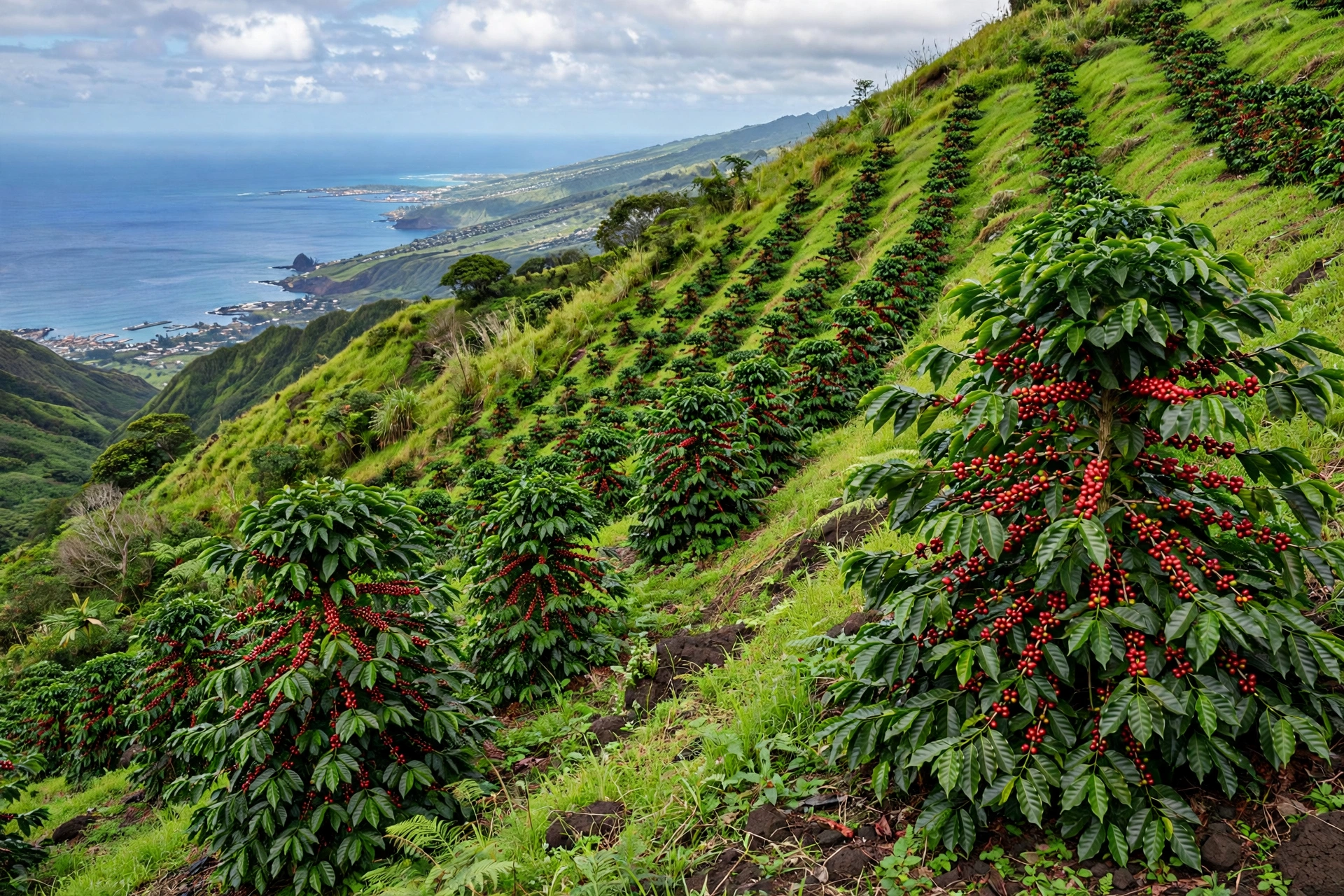
The most delicious way to experience Hualālai is through its coffee. The Kona coffee belt occupies the mountain’s west-facing slopes at elevations roughly between 800 and 2,500 feet, where afternoon cloud cover, morning sun, and rich volcanic soil create ideal growing conditions. The slopes of Hualālai, along with those of neighboring Mauna Loa, produce the coffee sold as Kona coffee, one of the most famous coffee names in the world.
Why the Volcano Makes Great Coffee
The connection between Hualālai and the coffee cup is direct. Volcanic soil drains well and is rich in minerals, which the coffee trees need. The mountain’s height creates a daily weather cycle: sunny mornings warm the trees, and afternoon clouds shade them and deliver gentle moisture. Elevation moderates the tropical heat, slowing the ripening of the coffee cherries and developing more complex flavors. Farmers often describe the slopes as a staircase of microclimates, with each farm’s coffee tasting slightly different depending on its exact position on the mountain.
Visiting Coffee Farms
Dozens of coffee farms operate on Hualālai’s slopes, particularly around Holualoa, Kealakekua, and Captain Cook. Many offer guided walks through the orchards and roasting demonstrations, where visitors can learn how cherries are picked, dried, hulled, and roasted. Tours vary in length and format, so check ahead for schedules and whether reservations are required. Tasting the coffee at the farm where it grew, with the slopes of the volcano visible through the trees, connects the landscape to the cup in a way no store-bought bag can match.
When you visit, remember that these are working farms on steep ground. Wear closed shoes, bring sun protection, and stay on designated paths. The farms are businesses, not parks, so follow each farm’s visitor rules. Buying coffee directly from the farm supports the small growers who maintain the Kona coffee tradition.
The Coffee Belt Towns
The communities strung along the coffee belt each have their own character. Holualoa is the arts village. Kealakekua is a small town with historic roots and farm stands. Captain Cook is a working agricultural community named for the bay just downhill. Hōlualoa, Kealakekua, and Captain Cook all sit on Hualālai’s flank, and driving the Mamalahoa Highway through them is effectively a drive across the volcano’s midsection. Farm stands along the road sell coffee, fruit, and macadamia nuts grown in the same volcanic soil.
Nearby Attractions
Kaloko-Honokōhau National Historical Park
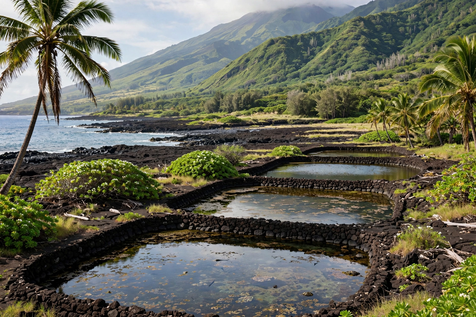
At the base of Hualālai’s northwest flank, where the 1800-1801 lava meets the sea, lies Kaloko-Honokōhau National Historical Park. The park preserves ancient Hawaiian fishponds, petroglyphs, and coastal settlement sites on some of the island’s youngest land. The contrast is remarkable: stone fishpond walls built centuries ago, sitting on lava that flowed after the ponds were already old. It is one of the best places to see how Hawaiians adapted to the volcano’s newest coastline. The park also offers good chances to see Hawaiian green sea turtles resting on the sand.
Kiholo Bay
South of the airport, Kiholo Bay sits where the Kaʻūpūlehu flow reached the ocean. The bay’s black sand beach and calm blue water are framed by dark lava, making it one of the most scenic examples of the 1800-1801 eruption’s legacy. A short walk leads from the highway to the bay. The area is popular for swimming and snorkeling on calm days, but ocean conditions change, so check the surf before entering the water and never turn your back on the ocean.
Keāhole Point and the Kona Coast
Keāhole Point, at the western tip of the Huʻehuʻe flow, is the closest point in Hawaiʻi to the equator and the site of the natural energy laboratory and the airport. The point’s stark lava landscape is a textbook example of a young flow field. Offshore, the deep water near Keāhole is famous for manta ray night viewing and pelagic fishing, activities that take place over the submerged extension of the volcano.
Kailua-Kona and Keauhou
Kailua-Kona sits squarely on Hualālai’s lower flank, and its historic sites are inseparable from the volcano. Huliheʻe Palace and Mokuʻaikaua Church were built on the mountain’s slopes by Hawaiians who lived with its eruptions in living memory. Keauhou, south of town, is another community built on the volcano’s side, with shopping, beaches, and historic sites along the shore. Exploring these towns is, in a real sense, exploring Hualālai.
Puʻuhonua o Hōnaunau and the South Flank
Farther south, on the slopes between Hualālai and Mauna Loa, Puʻuhonua o Hōnaunau National Historical Park preserves a place of refuge from ancient Hawaiʻi. While the park sits on older flows, the drive there crosses Hualālai’s southern rift country, where cinder cones rise from pastureland. The Kealakekua Bay overlook along the way offers one of the finest views of the Kona coast with the volcano rising behind it.
Safety
Hualālai is currently quiet, and USGS monitoring shows no signs of unrest. Still, visiting an active volcano calls for a few common-sense precautions. First, respect private land. Much of the mountain above the coffee belt is ranch land with no public access. Do not cross fences or gates, and do not assume a dirt road is open to the public. Trespassing on ranch land can be dangerous as well as illegal.
Second, be prepared for elevation. The drive from Kailua-Kona at sea level to Holualoa at 1,400 feet is easy, but the upper slopes are much higher and cooler. If you venture to higher elevations on the island, temperatures drop and weather changes fast. Carry water, sun protection, and a light layer even on warm coastal days.
Third, treat all volcanic terrain with respect. ʻAʻā lava is sharp enough to shred shoes and skin, so wear sturdy footwear on any lava walk. Lava tubes and cracks can be unstable. Stay on marked paths, and never approach steam vents or cracks closely. The gases they release can be harmful in concentrated amounts.
Finally, stay informed. The USGS Hawaiian Volcano Observatory publishes current status updates for all Hawaiian volcanoes. If you want to check Hualālai’s status before or during your visit, look for the observatory’s official updates. In the extremely unlikely event of unrest, follow instructions from Hawaiʻi County Civil Defense.
Getting There
Reaching Hualālai is straightforward because you are probably already on it. The Ellison Onizuka Kona International Airport at Keāhole sits on the volcano’s northwest flank, about 11 miles north of Kailua-Kona along Queen Kaʻahumanu Highway. Most visitors arrive by air and drive south into Kailua-Kona, crossing the 1800-1801 lava flows within minutes of leaving the terminal.
From Kailua-Kona, the Mamalahoa Highway (Highway 180/190) climbs the volcano’s west flank through Holualoa and into the coffee country. The drive is well paved and takes about 20 minutes from downtown Kona to Holualoa. For the north side of the volcano, the Mamalahoa Highway continues toward Waimea and the Kohala resorts, passing Puʻu Waʻawaʻa country along the way.
A rental car is the practical way to explore the volcano’s slopes, since the sights are spread along the highway system and public transit is limited. Parking in Kailua-Kona and at popular stops like Kaloko-Honokōhau fills up during the day, so arrive early. Fuel up before heading into the uplands, and download offline maps, as cell coverage can be spotty on the mountain’s back roads.
Frequently Asked Questions
Where exactly is Hualālai located?
Hualālai is on the west side of the Island of Hawaiʻi, rising directly behind Kailua-Kona and the Kona coast. Its summit is at 8,278 feet elevation, roughly inland from downtown Kailua-Kona. The Kona International Airport sits on its lower northwest flank.
Is Hualālai an active volcano?
Yes. The U.S. Geological Survey classifies Hualālai as active because it erupted in historic time, most recently around 1800-1801. It is monitored continuously by the Hawaiian Volcano Observatory, which currently reports no signs of unrest.
When did Hualālai last erupt?
The last eruptions occurred around 1800-1801 from the northwest rift zone, producing the Kaʻūpūlehu and Huʻehuʻe lava flows. An earlier large eruption, the Wahapele eruption, took place between roughly 1200 and 1400 AD.
Can you hike to the summit of Hualālai?
There is no public trail to the summit. Much of the upper mountain is private ranch land with no public access. Visitors can experience the volcano’s slopes through the coffee belt roads, Holualoa village, and coastal parks at its base.
What is the difference between Hualālai and Mauna Loa?
Hualālai is the third youngest of the Big Island’s five volcanoes, while Mauna Loa is the fourth, younger and far larger. Hualālai sits on Mauna Loa’s west flank. Mauna Loa erupts every few years or decades; Hualālai erupts every few centuries.
Is Kailua-Kona on Hualālai?
Yes. Kailua-Kona, Keauhou, and the surrounding Kona coast communities are built on Hualālai’s lower west flank. The town’s historic buildings, beaches, and hotels all sit on the volcano’s slopes and lava flows.
Is the Kona airport really on a lava flow?
Yes. The Ellison Onizuka Kona International Airport at Keāhole sits almost entirely on the Huʻehuʻe lava flow from the eruption that ended in 1801. The dark ʻaʻā lava visible around the runways is about 225 years old.
Could Hualālai erupt again?
Geologists consider future eruptions inevitable on geologic time scales, and the USGS notes that future eruptions could directly threaten Kailua-Kona and nearby communities. However, there are currently no signs of unrest, and monitoring systems are designed to detect magma movement long before an eruption begins.
The Mountain Beneath the Town
Hualālai is easy to overlook precisely because it is everywhere in Kona. It is the ridge behind the hotels, the slope beneath the coffee farms, the lava under the airport runway, and the dark shore at Kiholo Bay. Unlike Kīlauea, it does not demand attention with glowing vents and daily headlines. It sits quietly, watched by instruments, its last eruption old enough to predate photography but recent enough to count as historic. Understanding where Hualālai is means seeing the Kona coast differently: not as a beach destination that happens to have a mountain behind it, but as a community built on the flank of a living volcano. That perspective turns an ordinary drive to the airport into a crossing of two-century-old lava, and a morning cup of Kona coffee into a taste of the mountain itself.