
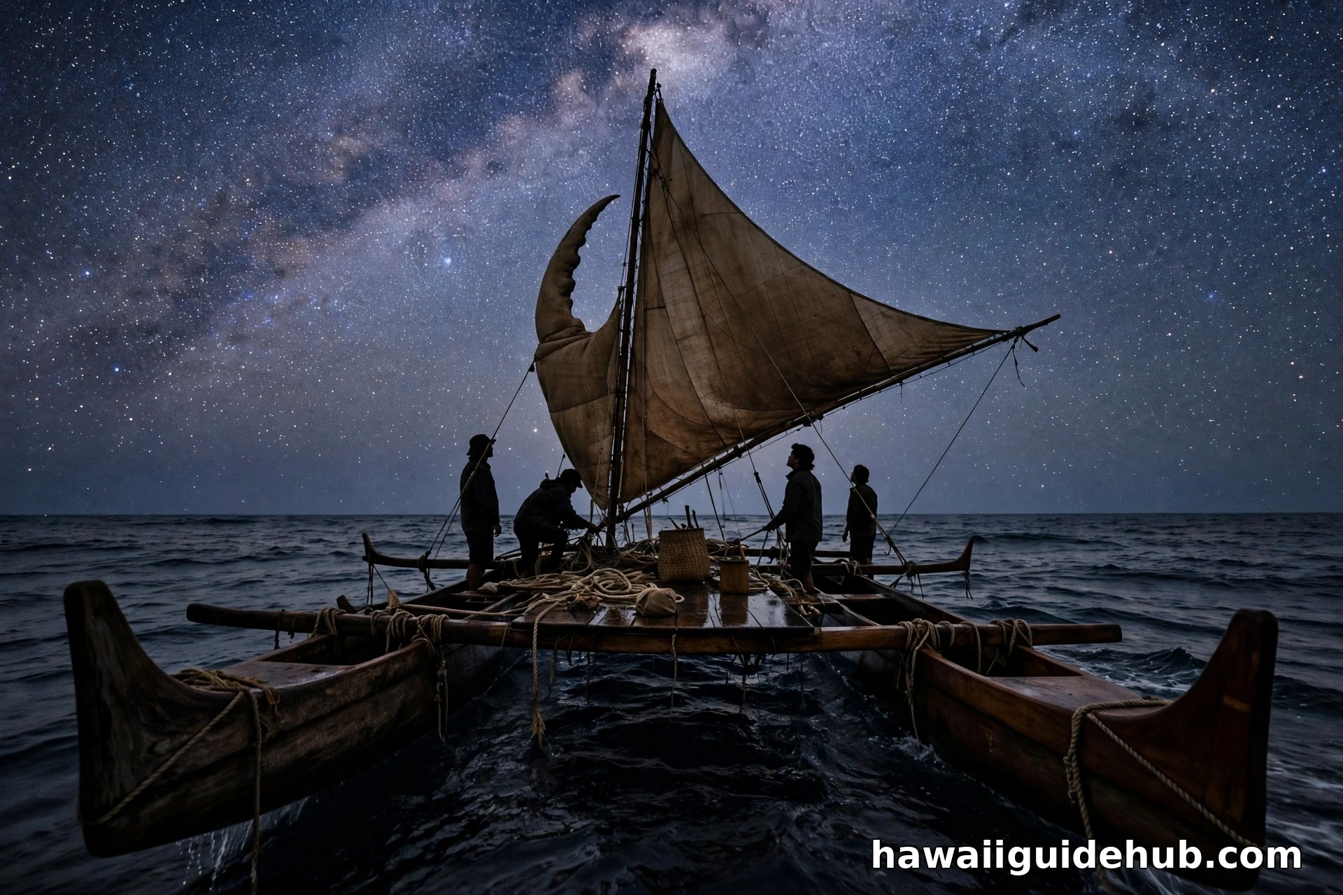
Hawaiian Star Navigation: How Wayfinders Crossed the Pacific by the Stars

Long before charts, compasses, or satellites reached the Pacific, Hawaiian navigators crossed thousands of miles of open ocean using only the sky, the sea, and memory. Hawaiian star navigation is the heart of that system. It is a disciplined way of reading where stars rise and set on the horizon, how high they climb, and how the ocean moves beneath the canoe. With those signs, a trained navigator could leave Hawaiʻi, sail for weeks out of sight of land, and still find a small island waiting over the horizon.
This guide explains how Hawaiian star navigation works, where it came from, and why it matters today. It covers the Hawaiian star compass, the key stars and their Hawaiian names, the other natural signs navigators combine with the stars, the revival led by the Polynesian Voyaging Society and the canoe Hōkūleʻa, and what visitors can respectfully learn from this living tradition.
What Hawaiian Star Navigation Is
Hawaiian star navigation is a form of wayfinding, the broader Pacific art of traveling by natural signs without instruments. The stars are the backbone of the system because they are the most reliable direction markers on the open ocean. Every star rises at a fixed point on the eastern horizon and sets at a fixed point on the western horizon, night after night, season after season. A navigator who has memorized those rising and setting points owns a compass written across the whole sky.
The system is not a single trick. It is a complete mental framework that combines star paths, the sun and moon, ocean swells, winds, clouds, and the flight of seabirds. The navigator holds the canoe’s course, speed, and position in memory at all times, updating the picture with every new sign. As master navigator Nainoa Thompson of the Polynesian Voyaging Society has often explained, you cannot simply look up at the stars and be told where you are. The knowledge has to live in your head, organized and ready before the canoe ever leaves shore.
The Hawaiian Star Compass
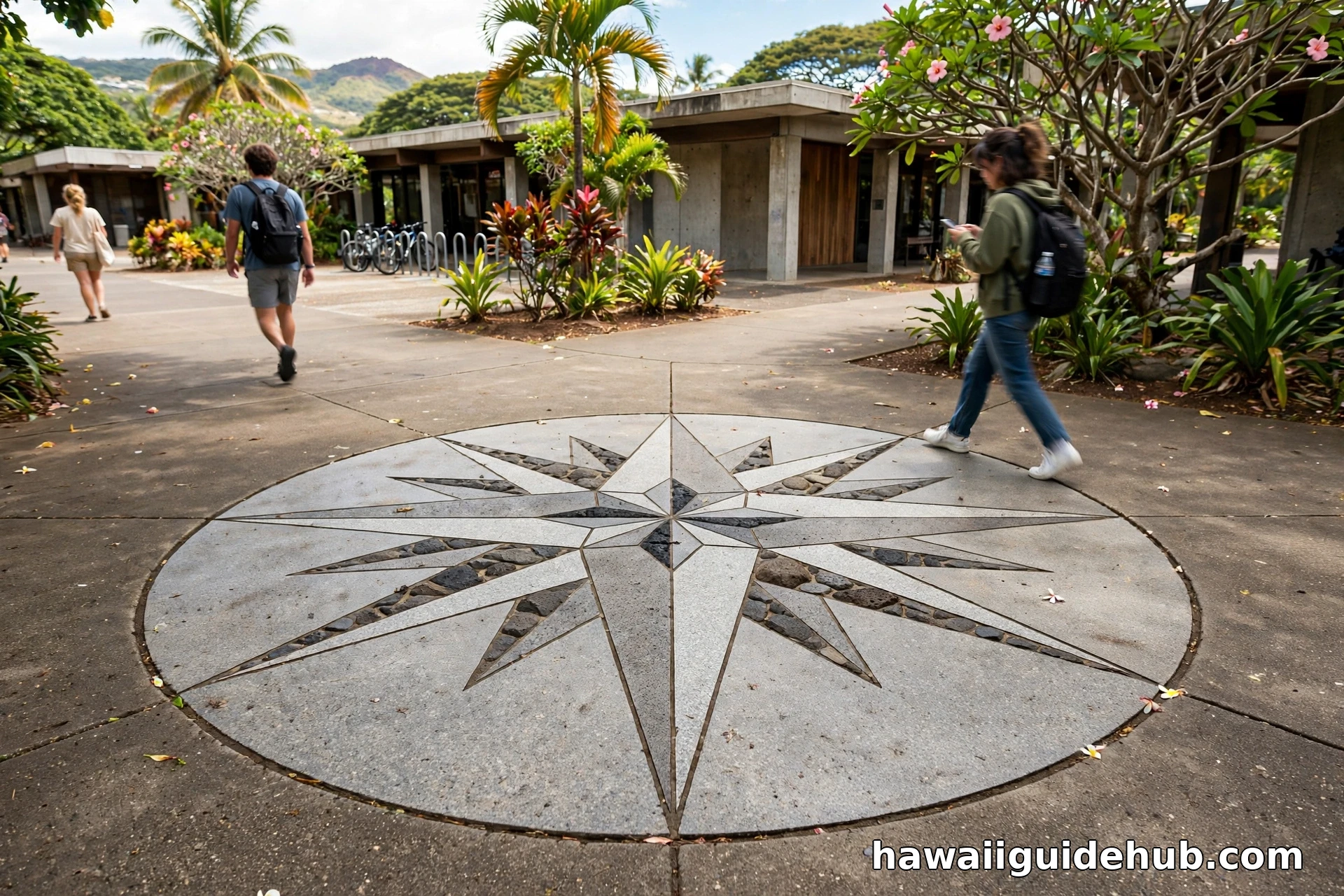
The teaching tool at the center of modern Hawaiian wayfinding is the Hawaiian star compass, developed by Nainoa Thompson and based on the Micronesian star compass taught by his teacher, master navigator Mau Piailug of Satawal. The compass is not a physical instrument you carry. It is a mental map of the horizon divided into 32 houses, the places where stars come out of the ocean and go back into it.
The horizon circle is organized around the four cardinal directions, which carry Hawaiian names: ʻĀkau for north, Hikina for east, Komohana for west, and Hema for south. Between those points, the compass is divided into quadrants, and each quadrant holds named houses where particular stars rise and set. When a navigator says a canoe is steering toward a certain house, the whole crew knows the direction meant, because the rising point of a familiar star defines it more precisely than any spoken angle.
| Compass element | What it means in practice |
| 32 houses | Named sections of the horizon where stars rise and set, used as steering marks |
| ʻĀkau, Hikina, Hema, Komohana | Hawaiian names for north, east, south, and west on the compass |
| Star pairs | Stars that rise or set at nearly the same horizon point, extending a steering mark through the night |
| Zenith stars | Stars that pass directly overhead at a known latitude, signaling how far north or south the canoe has traveled |
| The canoe as compass | Points marked along the canoe itself line up with the horizon houses, turning the vessel into the dial of the compass |
Because stars keep rising all night, no single star can guide a canoe from dusk to dawn. Navigators therefore steer by a sequence of stars, handing the course from one rising star to the next as each climbs too high to judge its horizon point accurately. Pairs and groups of stars that share nearly the same rising or setting point make that handoff smooth. The compass also reads more than stars. The flight lines of birds and the direction of ocean swells are plotted on the same mental circle, so every natural sign speaks the same directional language.
Key Stars and Hawaiian Star Names
Certain stars carry special weight in Hawaiian navigation. Hōkūleʻa, the Hawaiian name for Arcturus, is among the most loved. Arcturus is a zenith star for Hawaiʻi, which means it passes directly overhead in Hawaiian skies. For a canoe sailing north toward home, watching Hōkūleʻa climb higher night after night was a sign that the islands were drawing near. Its name is often translated as Star of Gladness, a reflection of the joy navigators felt when it guided them back to family. The famous voyaging canoe Hōkūleʻa carries this star’s name.
Hōkūpaʻa, the North Star, anchors the northern sky. It stays in the north while other stars wheel around it, and its height above the horizon tells a navigator latitude at a glance: the higher Hōkūpaʻa stands, the farther north the canoe has sailed. In the south, the Southern Cross, called Hānaiakamalama, helps fix direction when northern markers are low. Other bright guides include Sirius, known as ʻAʻā, and the stars of the Big Dipper and Scorpius. Scorpius appears in Hawaiian tradition as the great fishhook of Māui, a shape every crew member could recognize instantly. The Pleiades, Makaliʻi, also mattered far beyond navigation, marking the rhythm of seasons and the Makahiki period in the Hawaiian calendar.
Zenith Stars and Latitude
Stars can tell a navigator direction, but finding an island also requires knowing how far north or south the canoe has come. That is latitude, and zenith stars are the key. Every island sits at a specific latitude, and certain stars pass straight overhead only at that latitude. When the star that passes over your destination begins passing over your canoe at night, you know you have reached the right band of ocean. The navigator then turns and runs along that latitude line, watching for birds, clouds, and other land signs. It is an elegant solution to the hardest problem in ocean navigation, worked out entirely from patient observation of the sky.
More Than Stars: Swells, Wind, Birds, and Clouds
Stars vanish behind clouds, and they disappear entirely in daylight. A complete navigator therefore reads the ocean itself. Deep ocean swells travel for hundreds of miles in steady directions, shaped by distant winds, and they keep rolling under the canoe day and night. By feeling how several swell trains lift and drop the hull, a navigator can hold a course through a cloudy night or a bright noon when no star is visible. Mau Piailug taught that if you can read the ocean, you will never be lost, and modern crews still train their bodies to feel swell direction while they steer.
The sun is the main guide by day when it rides low in the morning and late afternoon, since its rising and setting points shift along the horizon through the year in a pattern navigators memorize. Wind matters too, because steady trade winds give the canoe a reference direction that can be felt on the face and skin. Near land, the signs multiply. Land based seabirds fly out to fish in the morning and return home at evening, so their flight lines point toward an island still hidden below the horizon. Clouds gather and linger over high islands, and the color of the sky and sea can change above a lagoon or reef. Reading all of these signs together is what turns a good star student into a true wayfinder. For a wider sense of the islands these voyages connected, see our Oʻahu travel guide and the stories gathered in Hawaii facts.
Where This Knowledge Came From
Hawaiian star navigation descends from one of the great achievements of the ancient world. Polynesian ancestors spread across the largest ocean on Earth in deliberate, planned voyages, settling island after island inside the vast Polynesian Triangle bounded by Hawaiʻi, Rapa Nui, and Aotearoa New Zealand. These were not accidental drifts. Voyagers carried plants, animals, and everything a new community needed, which only makes sense on intentional return voyages guided by skilled navigators.
In Hawaiʻi, navigation knowledge was held by specialists and passed down through generations of training, chant, and practice. After Western contact, the deep ocean voyaging tradition faded in the islands, and for generations no Hawaiian canoe sailed the long routes to Tahiti. The star knowledge survived more completely in a few places in Micronesia, where navigators like Mau Piailug still learned the old system as living practice. That survival made the Hawaiian revival possible.
Hōkūleʻa and the Revival of Hawaiian Wayfinding
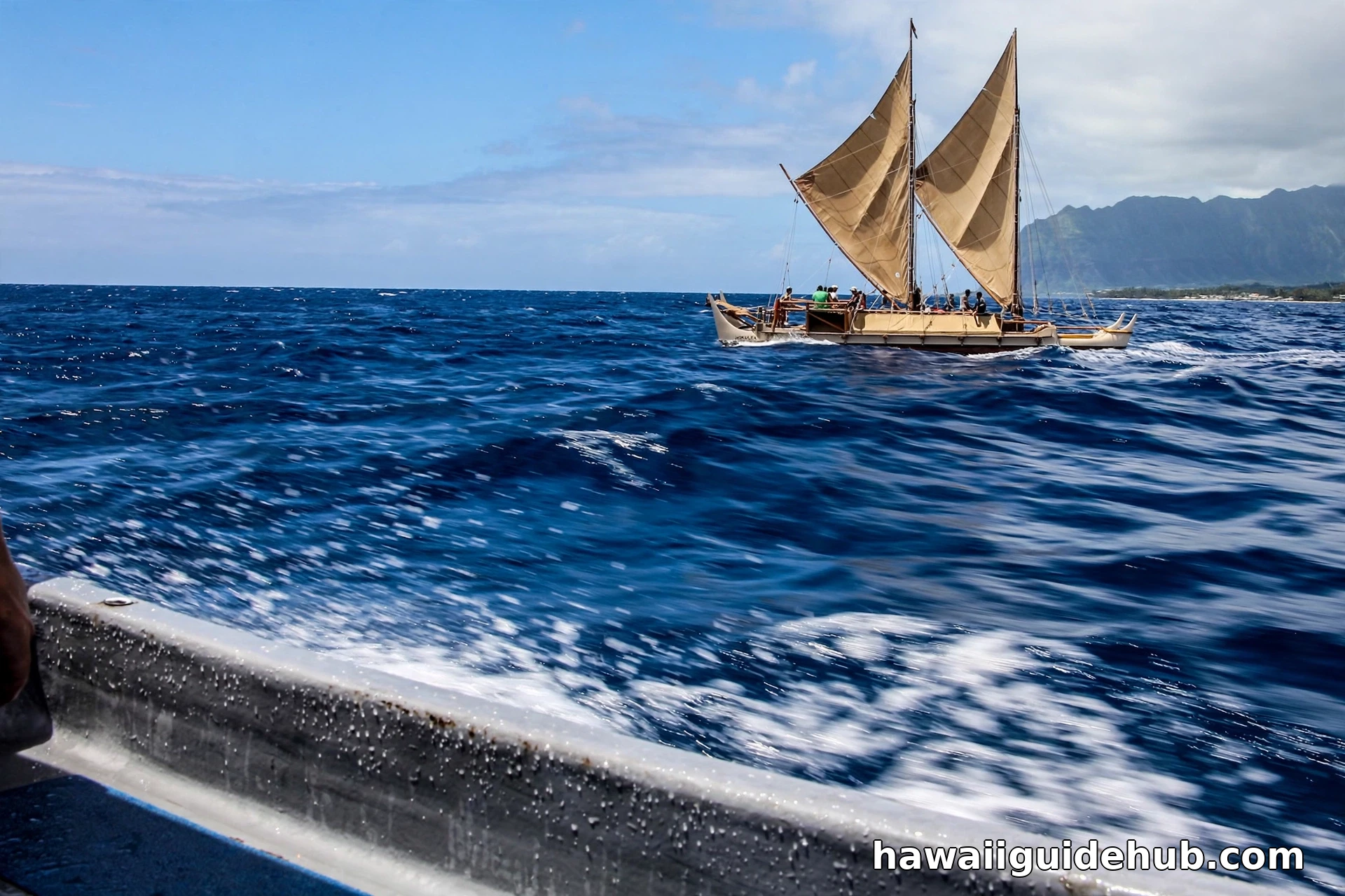
The modern story begins with the Polynesian Voyaging Society, founded to test whether a traditional double hulled canoe could still sail the ancient routes using only traditional navigation. Their canoe Hōkūleʻa launched on March 8, 1975, in Honolulu. In 1976 she sailed from Hawaiʻi to Tahiti with Mau Piailug navigating, completing the first deep sea Polynesian voyage of its kind in centuries and proving the old system worked exactly as the chants described.
Mau then taught Nainoa Thompson, who adapted what he learned into the Hawaiian star compass and, in 1980, navigated Hōkūleʻa to Tahiti and back himself, the first Hawaiian to navigate a long open ocean voyage in the traditional way in the modern era. Voyages multiplied from there: to Aotearoa, Rapa Nui, the Marquesas, and eventually, on the Mālama Honua Worldwide Voyage from 2014 to 2017, around the world. Sister canoe Hikianalia now sails alongside Hōkūleʻa, and new generations of navigators, including the first women to captain and navigate long distance legs, have earned their place through years of training. The thread of that story, from kingdom era Hawaiʻi to today, runs through Hawaiʻi’s history before statehood.
Common Misconceptions
One common myth is that ancient Polynesians drifted to Hawaiʻi by accident, blown off course on fishing trips. The deliberate settlement cargo, the return voyages recorded in tradition, and the demonstrated accuracy of traditional navigation all argue against it. Another misconception is that star navigation is guesswork or intuition. It is the opposite: a structured system with named stars, memorized horizon points, and constant mental position keeping, closer in spirit to mathematics than to luck. A third myth is that the knowledge died out completely. It faded in Hawaiʻi, but it lived on in Micronesia, and the Hawaiian revival reconnected the two branches of the tradition.
Learning About Star Navigation Respectfully
Visitors can engage with this tradition in ways that honor it. The Polynesian Voyaging Society shares star compass lessons, talks, and canoe tours when Hōkūleʻa and Hikianalia are in port, and community colleges across Hawaiʻi teach voyaging in partnership with the society. A stone star compass is set into the walkway at Kapiʻolani Community College for anyone to study. When you attend, listen more than you speak, use Hawaiian star names carefully and correctly, and remember that this knowledge belongs to a living culture. It is taught generously, but it is earned through study, not collected as a souvenir. If you are planning time on several islands, our Hawaii itinerary guide can help you leave room for experiences like these.
Video: A Star Lesson With Nainoa Thompson
Navigator Nainoa Thompson explains how the star compass works and how a crew can steer thousands of miles by the rising and setting of stars.
Frequently Asked Questions
What is the Hawaiian star compass?
The Hawaiian star compass is a mental map of the horizon divided into 32 named houses where stars rise and set. Developed by Nainoa Thompson from the Micronesian compass of Mau Piailug, it lets a navigator steer by star paths, and also organizes swell, wind, and bird directions into one framework.
Which star is Hōkūleʻa?
Hōkūleʻa is the Hawaiian name for Arcturus, one of the brightest stars in the sky. It passes directly overhead in Hawaiʻi, making it a zenith star for the islands, and its name is often translated as Star of Gladness. The voyaging canoe Hōkūleʻa is named for it.
How did Hawaiian navigators find islands without instruments?
They combined star compass steering with zenith stars for latitude, ocean swell patterns for direction under clouds, the sun by day, and land signs such as seabird flight lines and clouds over islands. The navigator kept a running mental picture of the canoe’s position the entire voyage.
Who taught Nainoa Thompson to navigate?
Thompson was taught by Mau Piailug, a master navigator from Satawal in Micronesia, who navigated Hōkūleʻa to Tahiti in 1976 and then shared his star compass system with Thompson, who adapted it with Hawaiian star names and taught it to new generations.
Can visitors see Hōkūleʻa?
When she is not voyaging, Hōkūleʻa is based in Honolulu, and the Polynesian Voyaging Society periodically offers public tours and educational events. Schedules change with voyage plans, so check the society’s current announcements before you go.
Hawaiian star navigation is both a science and an inheritance. It carried the first Hawaiians across the greatest ocean on Earth, it fell quiet for generations, and through the patience of teachers like Mau Piailug and students like Nainoa Thompson, it sails again. Every star name memorized by a young navigator today is a line of that old map redrawn, proof that careful attention to the sky and sea can still guide a canoe, and a community, home.