
Lānaʻi Waterfalls
In This Guide
Lānaʻi is not a waterfall island, and any honest guide has to say that first. The island is the driest of the publicly accessible Hawaiian Islands, and it has no named, permanently flowing waterfalls like the famous falls of Kauaʻi, Maui, or the Big Island. What Lānaʻi does have is a small number of seasonal, rain-fed flows that appear in its gulches after heavy winter rains, plus a collection of genuinely beautiful water features, from the tide pools of Hulopoʻe to the fog-draped summit of Lānaʻihale, that reward visitors who come with the right expectations.
The Honest Truth About Lānaʻi Waterfalls
Most Hawaiian islands earn their waterfall reputations from the same recipe: tall volcanic mountains, heavy trade-wind rainfall, and deep valleys that funnel water over cliff edges. Lānaʻi breaks that recipe in almost every way. The island is small, roughly 140 square miles, and its highest point, Lānaʻihale, rises to only about 3,370 feet. That elevation is not enough to wring the kind of rainfall out of the trade winds that feeds the great falls of neighboring islands. Lānaʻi City, sitting on the central plateau, averages roughly 35 to 40 inches of rain per year, while the west end of the island can receive fewer than 10 inches in a dry year. For comparison, parts of Kauaʻi’s Mount Waiʻaleʻale receive more than 400 inches annually.
Geology adds a second obstacle. Lānaʻi is an old, deeply eroded shield volcano, and much of its rainfall soaks quickly into porous volcanic rock rather than running off the surface in streams. The island has no perennial streams of any size. Its gulches, including Maunalei Gulch on the east side and the drainages that cut the island’s flanks, carry water only after significant rain. Without reliable surface flow, permanent waterfalls simply cannot form.
This matters because travel content about Hawaiʻi sometimes implies that every island has a waterfall worth chasing. On Lānaʻi, that implication would be misleading. Visitors who arrive expecting a Road to Hāna style waterfall drive will be disappointed. Visitors who arrive knowing the island’s water story, its seasonal flows, its tide pools, its fog-catching forests, and the ocean that shapes everything here, tend to leave impressed by a quieter kind of beauty.
There is also a practical consequence to the island’s dryness. Because surface water is scarce, Lānaʻi’s communities depend on groundwater pumped from wells that tap the high-level aquifer beneath the central highlands. That aquifer is recharged largely by fog drip, moisture that condenses on the vegetation of the Lānaʻihale summit forests and seeps into the ground. Understanding this helps visitors appreciate why water is treated as precious on Lānaʻi, and why wandering off trail in search of waterfalls in dry gulches is both fruitless and disrespectful to the island’s fragile watershed.
The island’s water history reinforces the point. During the pineapple plantation era, Lānaʻi’s engineers became experts at capturing and conserving every drop, building an extensive system of wells, tunnels, and pipelines to move groundwater from the highlands to the fields and the company town. That infrastructure still underpins the island’s water supply today. Modern conservation efforts focus on protecting the summit watershed, because the native forest that catches the fog is the island’s most important water infrastructure. When visitors learn that a single misty ridge keeps an entire island’s taps running, the absence of waterfalls starts to feel less like a missing attraction and more like the central fact of the place.
What Actually Exists: Seasonal Falls
With the honest framing established, here is what a visitor can realistically encounter. After heavy rains, typically during the November through March wet season, water does move across Lānaʻi’s landscape, and in a few places it drops over rock ledges in ways that qualify as waterfalls, however briefly.
Seasonal Flows in the Eastern Gulches
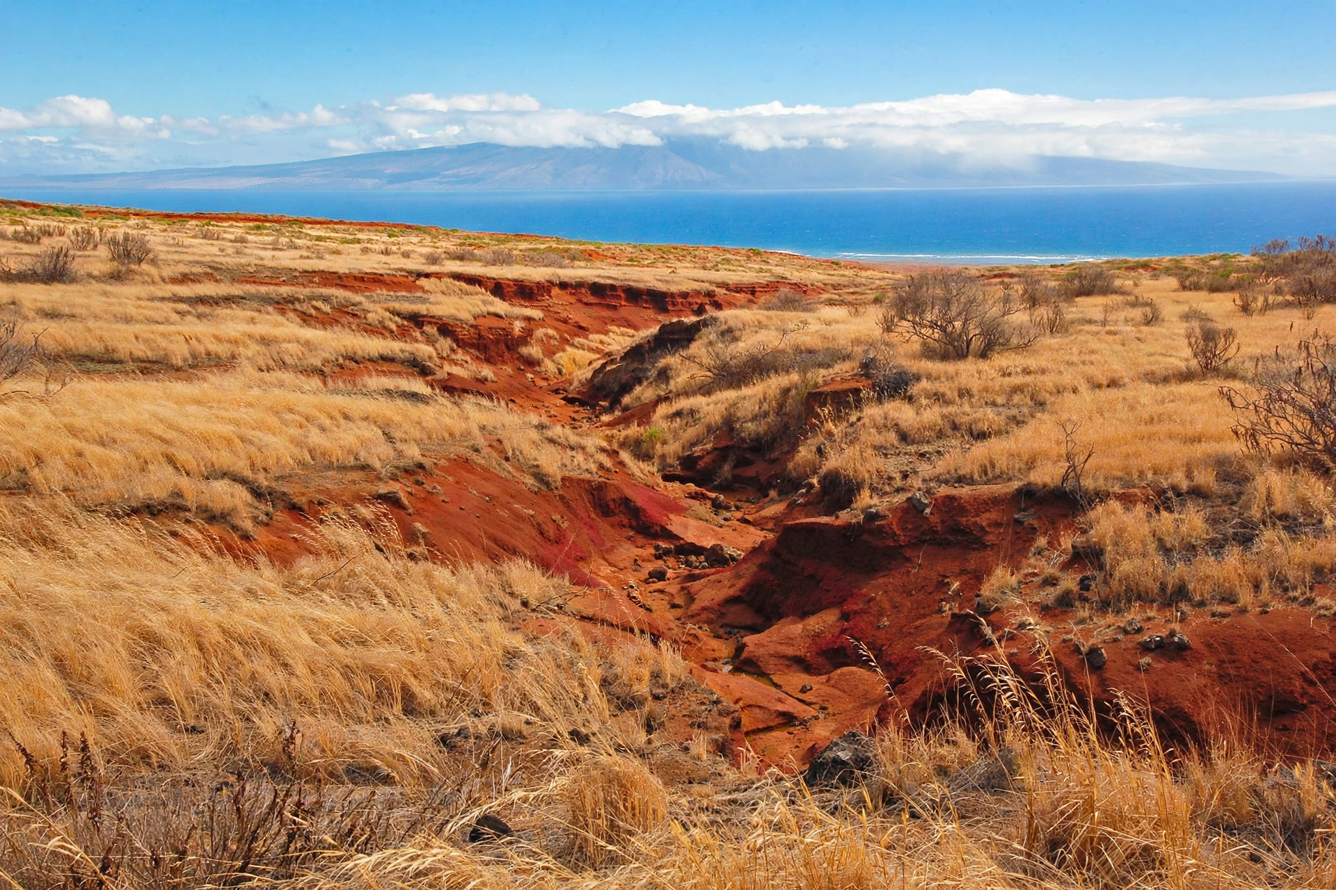
The east side of Lānaʻi catches more rain than the rest of the island, and its gulches are the most likely places to see temporary falls. Maunalei Gulch, the largest drainage on the island’s windward flank, can carry impressive flows after Kona storms or extended wet periods. Water pours off the plateau, threads through the gulch’s upper reaches, and in places drops over basalt ledges in short cascades. These flows are unnamed, unmarked, and unreachable by any maintained trail. They are visible mainly from a distance, as white threads against dark gulch walls, and they vanish within days of the rain stopping.
Smaller drainages along the island’s flanks behave the same way. A strong storm can turn a dozen dry gullies into temporary cascades overnight. Local residents notice them; visitors rarely do, because the flows are short-lived and the viewpoints are limited. There is no trailhead, no parking area, and no safe vantage point marketed for any of them, which is itself a useful signal about their significance as attractions.
Why There Are No Named Falls
On islands with permanent waterfalls, falls earn names because they persist: they become landmarks, meeting places, and waypoints in oral tradition. Lānaʻi’s flows do not persist, so they never acquired that status. A guide that invents names for Lānaʻi waterfalls, or that lists specific falls with directions and height estimates, is fabricating information. Travelers should treat any such list with skepticism, because the underlying geography does not support it.
The absence of named falls is not a gap in the island’s story. It is the story. Lānaʻi’s relationship with water is defined by scarcity, by fog drip and groundwater rather than rivers and cascades, and by an ocean that provides what the land cannot. That relationship shaped where people settled, how they farmed, and how the island is managed today.
Reading the Landscape After Rain
For visitors lucky enough to be on Lānaʻi during or just after a major storm, the island offers a rare show. Dark streaks appear on gulch walls where water is running, silver threads catch the light in the eastern drainages, and the normally dusty roads develop temporary streams along their edges. The upper Munro Trail can turn into a corridor of dripping vegetation, with water running in rivulets along the track. These moments are fleeting, often lasting only a day or two, but they reveal the hidden plumbing of the island. The best way to witness them is simply to look toward the eastern gulches from the central plateau roads after a storm, or to walk the upper trail while the forest is still dripping. No special destination is required, only timing and attention.
The Summit Fog Drip
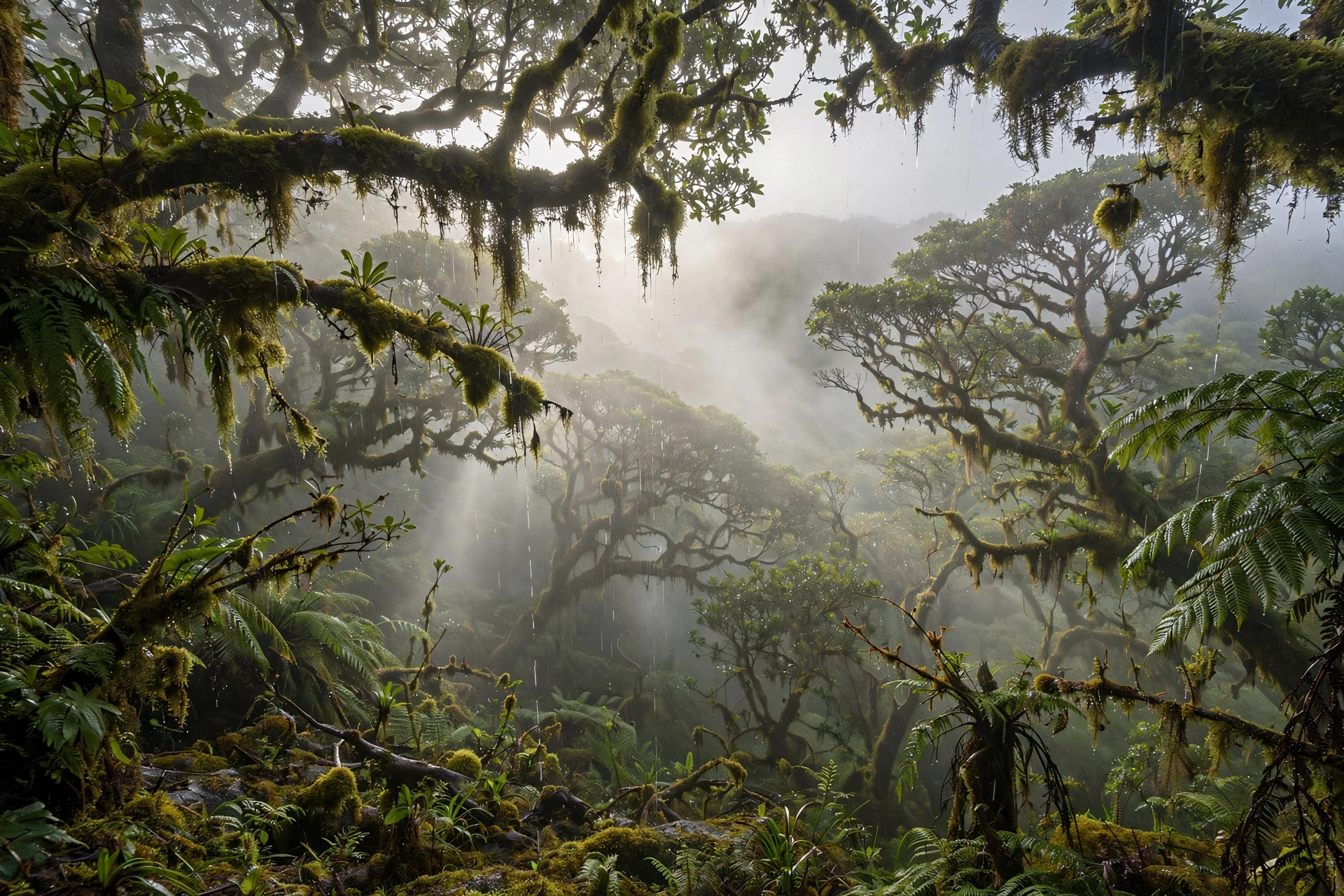
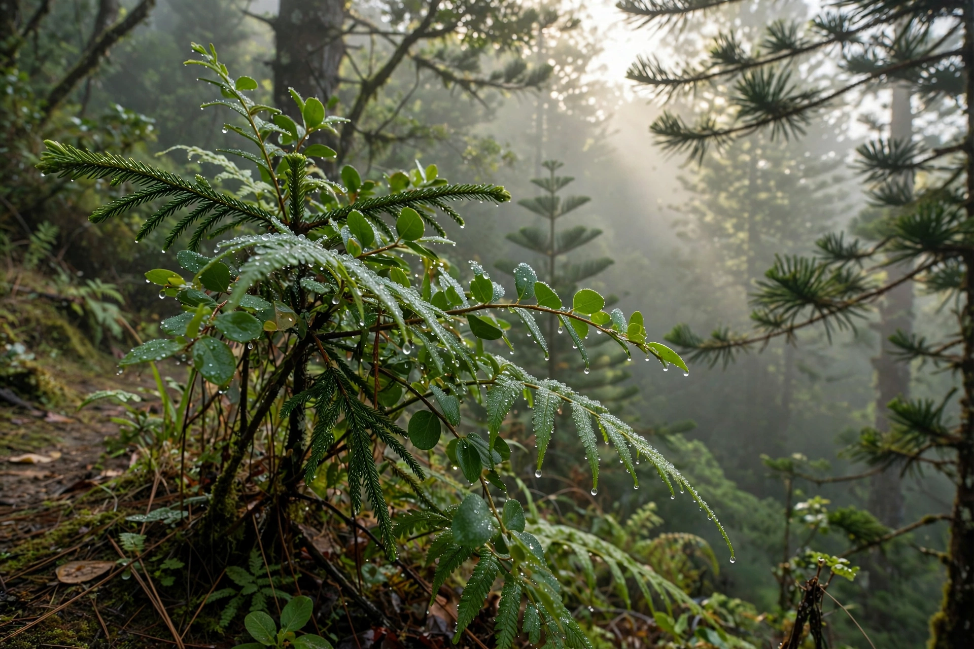
If Lānaʻi has a waterfall equivalent, it is invisible: the fog drip of the Lānaʻihale summit. Moist air pushed up the island’s slopes condenses on the leaves of the summit forest, and droplets fall continuously to the forest floor, feeding the aquifer below. On a misty morning along the upper Munro Trail, you can stand in this process, with water beading on every leaf and dripping steadily around you. It is not photogenic in the way a waterfall is, but it is the most important water phenomenon on the island, and experiencing it gives visitors a genuine understanding of how Lānaʻi survives on so little rain.
Water Features Worth Seeing Instead
Visitors drawn to Lānaʻi by an interest in water will find more to love in the island’s coastal and ocean features than in its gulches. These are the places where water puts on its real show.
Hulopoʻe Tide Pools
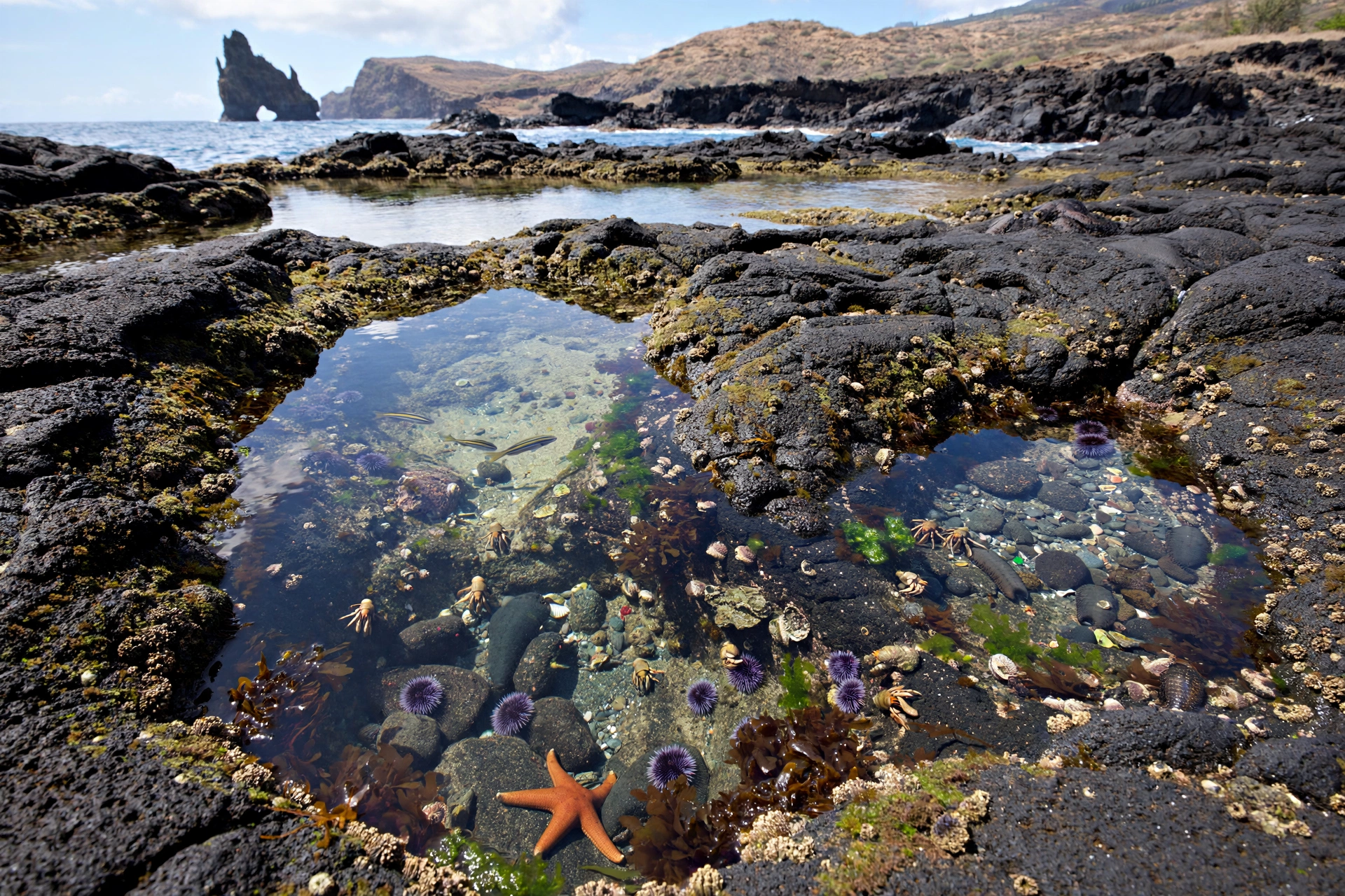
At the western end of Hulopoʻe Beach, lava rock formations create a series of natural tide pools that are among the finest easily accessible pools in Hawaiʻi. At low tide, the pools reveal a concentrated world of marine life: small fish, crabs, sea urchins, limpets, and algae in vivid colors. The pools are beautiful at any tide, but they are safest and most rewarding near low water, when the ocean’s surge is at its weakest. Visitors should wear reef shoes, watch the surf carefully, never turn their backs on the ocean, and avoid the pools entirely during high surf. The pools sit within walking distance of the beach park’s facilities, making them the most visitor-friendly water feature on the island.
Hulopoʻe Bay and Mānele Bay
Lānaʻi’s best swimming and snorkeling water is found at Hulopoʻe Bay, a Marine Life Conservation District where the reef is protected and the water is famously clear. Just offshore rises Puʻupehe, also called Sweetheart Rock, a sea stack that turns the bay into one of the most photographed coastal scenes in the islands. Neighboring Mānele Bay offers a smaller, quieter pocket of calm water. Neither is a waterfall, but both deliver the turquoise-water experience many waterfall chasers are actually seeking.
Shipwreck Beach and the North Shore
Kaiolohia, known as Shipwreck Beach, shows water in a wilder mood. The rusting hull of the YOGN-42 sits offshore where trade winds and currents run strong, and driftwood lines the sand. The north shore is not safe for swimming, but it is powerful to witness, and it illustrates the ocean forces that shape an island with so little fresh water. Reaching it requires a four-wheel-drive vehicle and respect for the rough road.
Keahiakawelo and the Island’s Dry Heart
Keahiakawelo, the Garden of the Gods, is a water feature in reverse: a landscape defined by water’s absence. Wind-sculpted rock formations in reds, oranges, and purples spread across a barren plain, carved by centuries of wind erosion in one of the driest spots in the state. Visiting helps travelers understand the full spectrum of Lānaʻi’s relationship with water, from the fog-fed summit to the desert-like north.
Ocean Lookouts
Several roadside pullouts along the island’s roads offer sweeping views of the ʻAuʻau Channel and neighboring islands, with whales visible in winter. The overlook above Mānele and the viewpoints along the road to the Garden of the Gods are the most accessible. In December through April, humpback whales breach and spout in the channel, a water display no waterfall can match.
The Island’s Hidden Springs
Lānaʻi’s freshwater story includes a few modest natural springs, though none are developed as visitor attractions. Historically, small seeps in the highlands provided water for early Hawaiian settlement sites, and the island’s first ranching operations depended on locating reliable springs. Today these sources are part of the managed watershed rather than destinations, and most sit on private or protected land. They are worth knowing about because they complete the picture: on Lānaʻi, fresh water hides underground and in the clouds rather than running visibly across the land. Visitors interested in the island’s water heritage can learn more at local cultural sites in Lānaʻi City, where the story of the island’s water development is part of the broader plantation-era history.
Safety Around Water on Lānaʻi
Water safety on Lānaʻi deserves serious attention, precisely because the island’s water features are informal and unguarded. There are no lifeguards at any beach or tide pool on the island, and emergency services are limited.
At the tide pools, the primary danger is the ocean itself. Waves can surge into pools with little warning, especially at high tide or during south swells. Visitors should check ocean conditions before going, stay on the inland side of the pools, keep children within arm’s reach, and leave immediately if waves begin washing over the rocks. Wet lava rock is extremely slippery, and falls onto sharp rock or into urchin-covered pools cause real injuries every year across Hawaiʻi.
In the island’s interior, the main risk is flash flooding. Lānaʻi’s gulches are dry most of the year, which makes them tempting to explore, but a rainstorm miles away can send a wall of water down a dry gulch with almost no warning. Never enter a narrow gulch if rain is falling or forecast anywhere on the island, and never camp in a dry streambed. The same storms that create the island’s brief seasonal waterfalls create its most dangerous conditions.
More broadly, Lānaʻi’s backcountry has no cell service in many areas, high daytime heat, and limited shade. Anyone venturing beyond the beach parks should carry more water than seems necessary, tell someone their plans, and stay on established routes. The island rewards self-sufficiency and punishes improvisation.
Heat and dehydration deserve their own warning. Lānaʻi’s dry west and central areas can be deceptively hot, especially for visitors hiking in the middle of the day. The air feels dry, sweat evaporates quickly, and it is easy to become dehydrated without realizing it. Carry at least a liter of water per person for short walks and more for longer hikes, wear a hat and sunscreen, and plan strenuous activity for the cooler morning hours. There are no water fountains or stores once you leave Lānaʻi City and Mānele, so what you bring is what you have.
Best Time to See Flowing Water
Timing matters more on Lānaʻi than on wetter islands, because the window for seeing flowing water is narrow. The island’s rainy season runs roughly from November through March, when Kona storms and cold fronts bring the heaviest precipitation. A strong storm during these months is the only reliable trigger for seasonal flows in the eastern gulches, and even then the flows last days, not weeks.
The summit forests around Lānaʻihale are at their most atmospheric during the same period, when clouds stack against the highlands and fog drip is at its peak. Morning visits along the upper Munro Trail in winter offer the best chance to experience the misty, dripping forest at its most vivid.
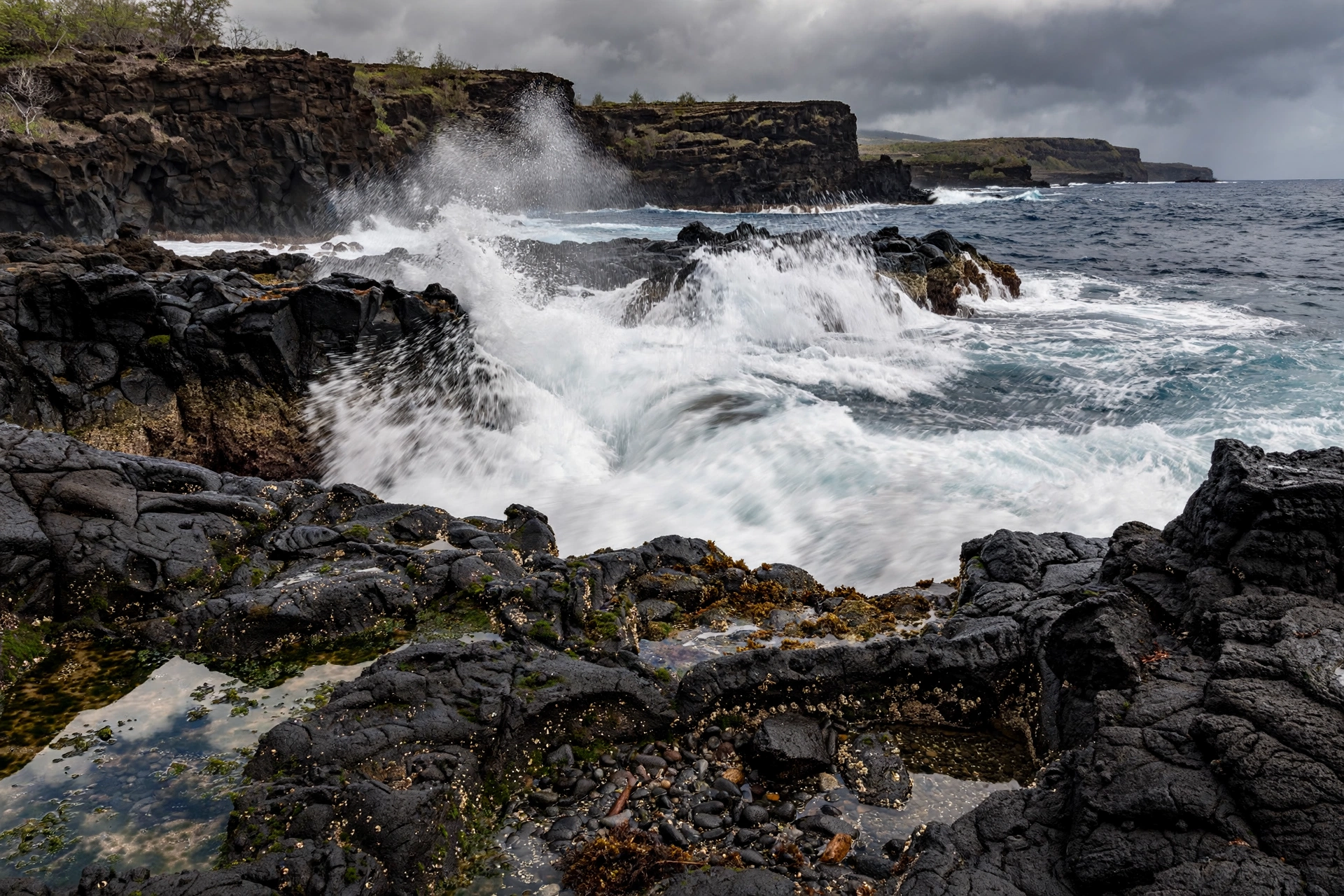
For the coastal water features, the calculus flips. The tide pools at Hulopoʻe are best at low tide on calm days, which occur most reliably during the April through October dry season, when south swells are smaller and trade winds are steadier. Winter brings larger surf to south-facing shores and can make the pools unsafe. Whale season, December through April, overlaps with the rainy months, so winter visitors get the best chance of combining a misty summit morning with an afternoon of whale watching from the shore.
There is no month in which Lānaʻi offers anything resembling a permanent waterfall. Visitors who plan a trip around a specific flow will almost certainly be disappointed. The better approach is to visit for the island’s overall quiet beauty and treat any flowing water as a bonus.
One more timing note: the shoulder months of April, May, October, and November can offer the best of both worlds. Early winter storms sometimes arrive in November, bringing the first gulch flows of the season, while the ocean is often still calm enough for comfortable tide pooling. Late spring can deliver a similar combination in reverse. These are also the island’s quietest months for visitors, which suits Lānaʻi’s unhurried character.
Photography Tips
Photographing Lānaʻi’s water features calls for a different approach than waterfall photography on wetter islands. Long-exposure silky-water shots are rarely possible, since the flows are brief and access is limited. Instead, focus on what the island does well.
At the tide pools, shoot at low tide in the soft light of early morning, when the water is calmest and the colors are most saturated. A polarizing filter cuts glare on the water surface and reveals the life below. Get low to emphasize the textures of the lava rock, but keep a safe distance from the surf line.
For the seasonal gulch flows, which are viewed from a distance, a telephoto lens compresses the scene and makes distant white water read clearly against dark rock. Overcast light after a storm is ideal, reducing harsh contrast. Never leave the road or trail to get closer to a flowing gulch; the ground near flash-flood drainages is unstable.
The summit fog makes its own subject. Mist simplifies compositions, softens backgrounds, and beads beautifully on leaves and spiderwebs. A macro lens or a phone’s close-focus mode captures the droplets that are, in a real sense, Lānaʻi’s most important waterfall.
Frequently Asked Questions
Are there any waterfalls on Lānaʻi?
There are no named, permanently flowing waterfalls on Lānaʻi. After heavy rains, usually in the November to March wet season, temporary cascades can appear in gulches such as Maunalei Gulch on the island’s east side, but they are unnamed, unmarked, and vanish within days.
What is the tallest waterfall on Lānaʻi?
This question has no meaningful answer, because Lānaʻi has no permanent waterfalls to measure. Any height claimed for a Lānaʻi waterfall refers to a temporary rain-fed flow, not a lasting feature.
Can you swim in waterfalls on Lānaʻi?
No. There are no waterfall pools suitable for swimming on the island. Visitors seeking freshwater swimming will not find it on Lānaʻi; the island’s swimming happens in the ocean at protected spots like Hulopoʻe Bay.
Where are the tide pools on Lānaʻi?
The best-known tide pools are at the western end of Hulopoʻe Beach, near Puʻupehe. They are accessible on foot from the beach park and are best visited at low tide on calm days. There are no lifeguards, so ocean conditions must be checked first.
Is it safe to hike into Lānaʻi’s gulches after rain?
It is not recommended. Dry gulches can flash flood with little warning when rain falls anywhere on the island, and there are no maintained trails into the gulch systems. Enjoy seasonal flows from established viewpoints and roadsides only.
Why is Lānaʻi so dry compared to other islands?
Lānaʻi’s highest point, Lānaʻihale, reaches only about 3,370 feet, which is too low to squeeze heavy rainfall from the trade winds the way taller islands do. Its porous volcanic rock also absorbs much of the rain that does fall, leaving few surface streams.
What is fog drip and where can I experience it?
Fog drip is moisture that condenses on vegetation in the summit forests and falls to the ground, recharging the island’s aquifer. It can be experienced along the upper Munro Trail near Lānaʻihale on misty mornings, particularly in the winter months.
Should I skip Lānaʻi if I love waterfalls?
Not necessarily, but adjust expectations. Lānaʻi will not satisfy a waterfall-focused itinerary. It rewards travelers interested in quiet beaches, tide pools, native forests, stargazing, and the island’s distinctive dry-landscapes, rather than cascades.
Related Lānaʻi Guides
- Lānaʻi Travel Guide: the complete island overview
- Lānaʻi Beaches: Hulopoʻe, Shipwreck Beach, and Polihua
- Lānaʻi Hikes: Munro Trail, Koloiki Ridge, and coastal walks
- Lānaʻi Snorkeling: Hulopoʻe Bay and the Marine Life Conservation District
- Lānaʻi Map: island orientation and driving routes
- Molokaʻi Waterfalls: nearby island cascades including Hālawa Valley
- Maui Waterfalls: the closest major waterfall destination
A Final Note
Lānaʻi’s waterfall story is really a story about honesty in travel. The island does not have the cascades its neighbors are famous for, and pretending otherwise would do a disservice to the travelers who plan around such claims. What Lānaʻi offers instead is rarer: a Hawaiian island where water is visibly precious, where a misty morning on the summit explains the wells below, where tide pools concentrate the ocean’s life into a few square feet of rock, and where the absence of waterfalls becomes its own kind of lesson in how these islands work. Come for the quiet, respect the water you find, and let the island be what it is.