
Molokaʻi Waterfalls
Molokaʻi holds the most remote and least visited waterfalls in Hawaiʻi. The island’s north shore sea cliffs, the tallest in the world, shed dozens of slender falls into the ocean, most of them impossible to reach on foot. On the east end, Hālawa Valley guards the one great waterfall you can walk to, while the vast Kamakou uplands hide others behind permits and private land. This guide is honest about access: some falls you hike to with a cultural guide, some you see only from a boat or a plane, and some you simply admire from an overlook. Knowing which is which keeps your trip safe, legal, and respectful of the island’s communities.
On This Page
Molokaʻi Waterfalls at a Glance
Molokaʻi’s waterfalls are unlike those on any other Hawaiian island. The island’s north shore rises straight from the Pacific in a wall of green cliffs more than 3,000 feet high, the tallest sea cliffs on earth. Every stream that reaches this edge ends as a waterfall, and during winter storms the cliffs wear dozens of white ribbons at once. Almost none of them can be reached by trail. There is no road along the north shore, the valleys below are private and rugged, and the falls themselves drop into deep ocean.
The island’s accessible waterfalls live on the east end, where Hālawa Valley opens to the sea. Moʻoula Falls is the star: a tall cascade reached on a guided hike through private family land, the only major Molokaʻi waterfall with regular visitor access. Everything else with a trail either requires a permit from The Nature Conservancy, a cultural guide with family ties to the valley, or simply cannot be done legally at all.
This matters because Molokaʻi is the island most protective of its land and culture. Trespassing to reach a waterfall is not a gray area here. Valleys like Waimanu, Wailau, and Pelekunu are private, remote, and extremely dangerous, and the island’s rescue resources are limited. The good news is that the waterfalls you can see legally are spectacular, and the ones you cannot reach on foot are often best seen from the air, where the scale of the north shore cliffs becomes clear in a way no trail could show.
Below you will find every named waterfall on the island organized by how you can actually experience it: hike with a guide, view from an overlook, or see from a boat or plane. Distances, permit requirements, and seasonal notes are included so you can plan realistically.
The honest truth: Molokaʻi is not a waterfall-chasing island like Kauaʻi. If waterfalls are the center of your trip, pair Molokaʻi with another island. If you are visiting Molokaʻi anyway, the falls you do see will be wilder and emptier than anywhere else in Hawaiʻi.
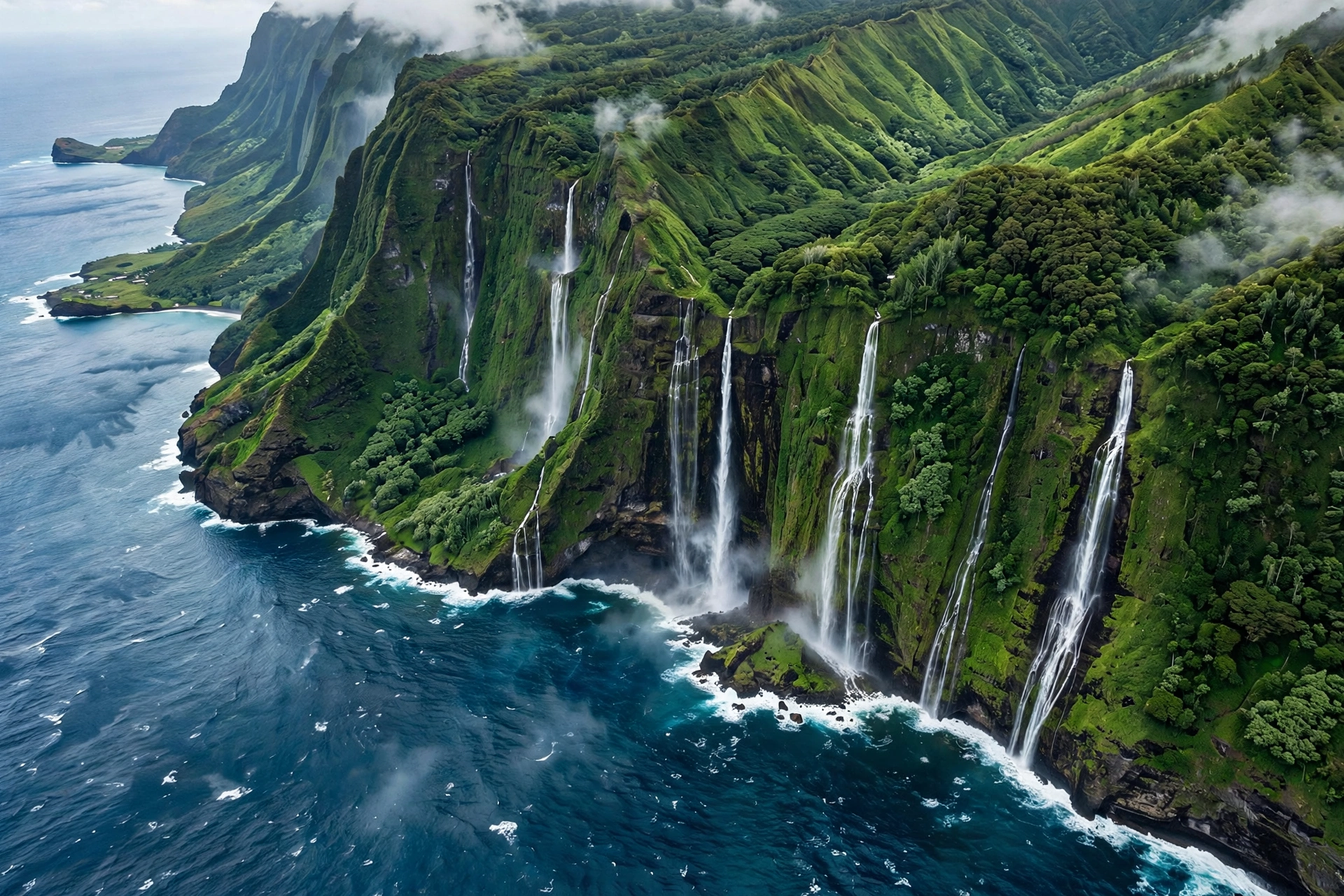
The Waterfalls of Molokaʻi
Moʻoula Falls (Hālawa Valley) : Guided Hike Required
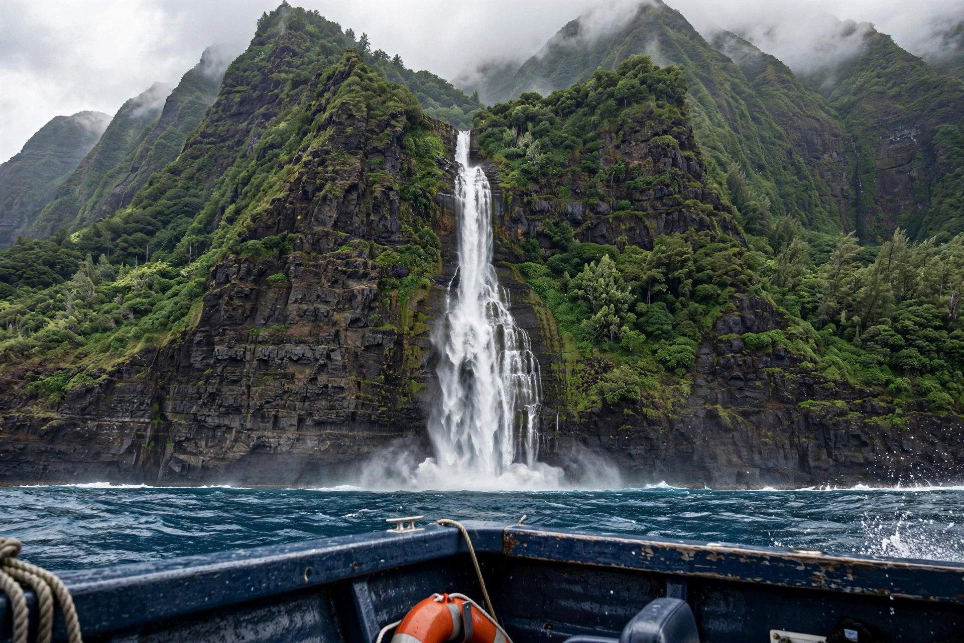
Moʻoula Falls is the one great waterfall on Molokaʻi that visitors can actually stand beneath, and the only way to do it is with a cultural guide from Hālawa Valley. The valley is private family land, and the Solatorio family has led guided hikes here for generations. The trail runs about two miles each way through the valley floor, crossing taro loʻi and streams, and ends at a falls that drops roughly 250 feet into a clear pool where swimming is allowed.
The hike is moderate rather than easy. Stream crossings can be slippery, the valley floor is humid, and the trail involves mud, roots, and a few short climbs. Guides set the pace and the schedule, and the cultural portion of the walk is as much the point as the waterfall: Hālawa is one of the oldest continuously settled valleys in Hawaiʻi, and the hike includes stories, plant knowledge, and respect protocols that make the experience meaningful rather than transactional.
Book ahead. The guided hikes run on set days, group sizes are limited, and walk-ins are not accepted. Bring swimwear, water shoes or sandals with straps for the crossings, and cash or a card per the guide’s payment instructions. Do not attempt the valley without a guide. Side trails, taro fields, and the upper falls areas are all kapu to unguided visitors, and the community enforces this.
Access: Guided hike only, Hālawa Valley, east end. About 2 miles each way. Reserve in advance.
Kahiwa Falls (North Shore Sea Cliffs) : Boat or Plane View Only
Kahiwa Falls holds the distinction of being one of the tallest waterfalls in the world, plunging some 1,750 feet down the north shore sea cliffs between Wailau and Waikolu valleys. Like nearly every fall on this stretch of coast, it has no trail and no land access. It exists to be seen from offshore.
On calm days, boat tours along the north shore pass beneath these cliff falls, and the scale is impossible to grasp from a photo: a mile of vertical green wall with water falling straight from cloud level into the sea. Kahiwa flows strongest in winter when the windward uplands are wet, and can thin to a trickle or dry entirely in late summer. Helicopter tours of the north shore give the most reliable views, weather permitting.
Access: Boat or helicopter viewing only. No land access.
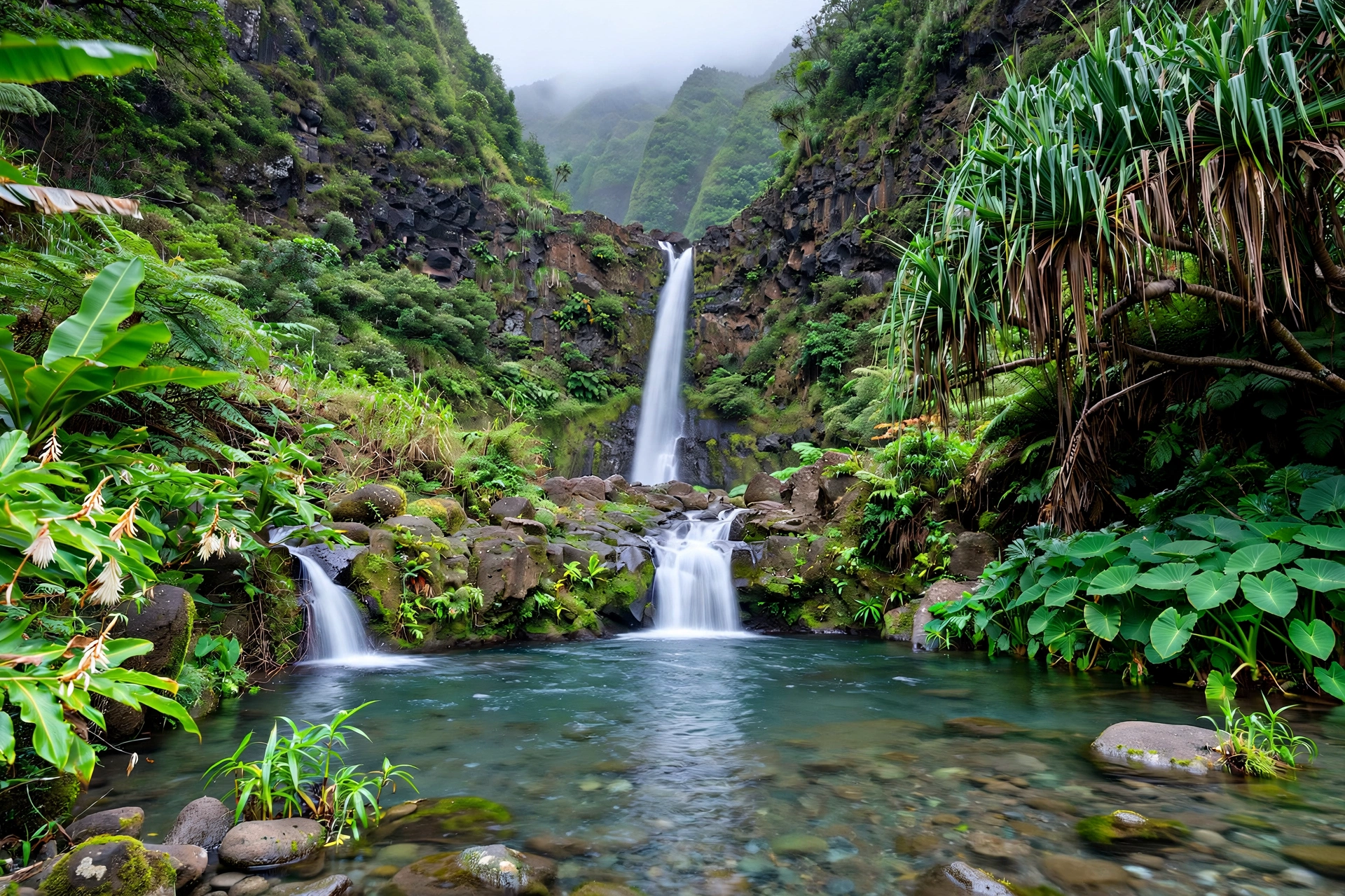
Papalaua Falls : Limited Access
Papalaua Falls sits in the upper reaches of the island’s central plateau country, in one of the wettest pockets of the Kamakou uplands. It is not a destination waterfall in the usual sense: there is no maintained trail, no parking area, and no viewpoint. Hikers with a Nature Conservancy permit for the Kamakou Preserve area may encounter it or its tributaries on the Pepeʻopae Trail network, but the falls themselves are not a signed stop and the terrain off-trail is fragile bog and native forest that should not be entered.
Treat Papalaua as a bonus for serious preserve hikers rather than a target. The Pepeʻopae boardwalk trail is worth the trip on its own for the misty montane bog and native birds, and any waterfall glimpses are a reward for the effort, not the plan.
Access: Kamakou Preserve permit holders only, via Pepeʻopae Trail area. No maintained viewpoint.
Waikolu Falls : View from Kalaupapa Area Only
Waikolu Falls drains the high valleys between Wailau and Kalaupapa, dropping from the plateau toward the sea in a series of cascades. It is visible from parts of the Kalaupapa peninsula and from the air, but there is no trail to it and the valleys it drains are closed to the public. Like the other north shore falls, it is a view-only waterfall, best appreciated as part of the larger spectacle of the sea cliffs.
If you are visiting the Kalaupapa overlook at Palaʻau State Park, bring binoculars. On wet days you can pick out multiple falls along the cliff wall to the east, Waikolu among them, and the sight puts the island’s hydrology into perspective: every one of those white threads is a valley you will never walk, feeding an ocean you can barely reach.
Access: Distant views from Kalaupapa area overlooks, or from air and sea.
East End Roadside Falls : Seasonal and Unmarked
The Kamehameha V Highway as it runs east from Kaunakakai passes through the wettest lowland country on the island, and after heavy rain, thin falls appear on the mauka side of the road in several spots between mile markers 15 and 25. These are unnamed, unsigned, and entirely seasonal: they flow for hours or days after a storm and vanish in dry weather.
There is no safe parking for most of them, and stopping on the narrow highway is dangerous. If you catch one flowing while driving the east end road, note the spot, continue to a safe pullout, and walk back along the shoulder with care. Never climb toward a roadside fall: the slopes are steep, the rock is loose, and flash flood water can arrive with no warning even when the sky above you is blue.
Access: Visible from the road after heavy rain only. No trails, no parking areas.
Waterfall Safety on Molokaʻi
Waterfall safety on Molokaʻi starts with a rule that sounds obvious and gets ignored constantly: never enter a valley without permission. The island’s valleys are private, the trails are unmaintained or nonexistent, and the terrain punishes mistakes. Hālawa Valley is the only waterfall valley with a legal visitor system, and it runs through the family guides. Everywhere else with a waterfall is either permit-only preserve land or flat-out closed.
Flash floods are the specific danger. Molokaʻi’s east end valleys drain steep, narrow watersheds, and a storm on the summit can send a wall of water down a valley that looks calm at the coast. This is why the guided Hālawa hike can be canceled on short notice, and why you should never swim at the base of a fall if the water is brown, rising, or carrying debris. The rule used across Hawaiʻi applies double here: if the water looks wrong, stay out of it.
Leptospirosis is present in Hawaiʻi’s fresh water, and Molokaʻi’s valley streams are no exception. Avoid swallowing stream water, and keep cuts and open wounds out of the water. The Moʻoula Falls pool is generally considered safe for swimming on guided hikes, and guides will tell you directly if conditions say otherwise. Follow their call without argument.
Cliff-edge falls on the north shore are a different category of danger: they are not approached at all. The sea cliff edges on the plateau above are unfenced, the ground can be undercut, and the wind is strong enough to unbalance you. Enjoy the north shore falls from the overlooks, the boats, and the air, and keep a respectful distance from every edge.
Finally, respect the kapu. When a guide, a sign, or a local tells you an area is closed, it is closed. This is not a suggestion and not a challenge. Molokaʻi’s communities have kept their valleys intact by controlling access, and visitors who honor that are welcomed back. Those who do not are not.
Emergency note: Cell coverage is unreliable in east end valleys and nonexistent on the north shore. Tell someone your plan, carry more water than you think you need, and remember that helicopter rescue in these valleys is weather-dependent and not guaranteed.
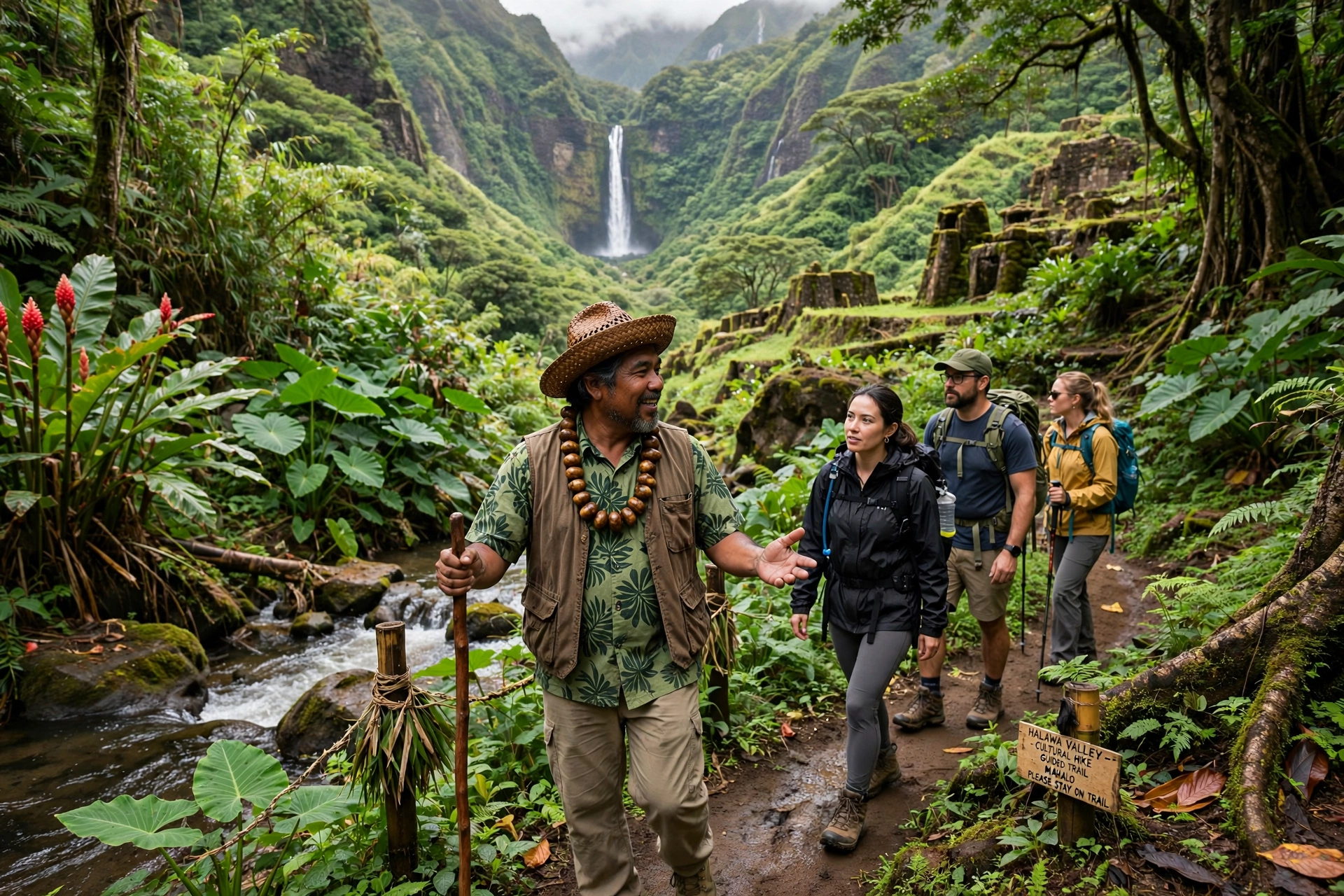
Viewing from Air and Sea
For most of Molokaʻi’s waterfalls, the honest recommendation is to see them from the air or the sea. This is not a consolation prize. The north shore sea cliffs are one of the great landscapes on earth, and the only way to grasp them is from offshore, where the full 3,000-foot wall rises above you with waterfalls threading down it.
Helicopter tours departing from Maui or Oʻahu routinely include the Molokaʻi north shore, weather permitting, and this is the single best waterfall viewing on the island. From the air you can see Hiʻilawe, Kahiwa, and a dozen unnamed falls in one pass, plus the sea cliff amphitheaters of Waimanu, Wailau, and Pelekunu valleys. Book the earliest flight of the day for the clearest air, and understand that tours can be rerouted or canceled when the cliffs are socked in.
Boat tours along the north shore run from Maui harbors and from Kaunakakai on select schedules. The water-level view is slower and more intimate: you watch individual falls grow as the boat approaches, hear them before you see them around headlands, and feel the scale of the cliffs in a way the air does not give. Winter and spring bring the strongest flows. Summer seas are calmer but the falls are thinner.
A third option costs nothing: the Palaʻau State Park overlook above Kalaupapa. On a clear wet-season morning, you can count waterfalls on the eastern cliff wall with binoculars. It is distant, but it is free, legal, and open to everyone, and the peninsula view itself is worth the drive.
Best Time to See the Falls
Molokaʻi’s waterfalls run on the island’s rainfall calendar. The wet season, roughly November through March, brings the strongest flows to every fall on the island: the north shore cliff falls are at their most dramatic, the east end roadside falls appear after storms, and Moʻoula Falls runs full and loud. This is also when the north shore is cloudiest, so air tours face the most weather cancellations. It is a tradeoff: more water, less visibility.
The shoulder months, April through June and September through November, often give the best balance. Rainfall is still enough to keep Moʻoula Falls flowing well, the north shore cliffs clear more often, and both boat and helicopter tours run with fewer weather interruptions. Summer, July and August, is the driest period: Moʻoula still flows, but the cliff falls can thin dramatically and some vanish entirely.
For the guided Hālawa Valley hike specifically, there is no bad season, only wet days and dry days. Guides run the hike year-round when conditions allow, and the valley is beautiful in every month. Book the hike first and plan the rest of your island time around it, rather than the reverse.
What to Bring
Waterfall days on Molokaʻi are simple to pack for because the list is short and non-negotiable. For the guided Hālawa hike: swimwear, water shoes or sandals with heel straps for the stream crossings, a full water bottle, reef-safe sunscreen, a light rain layer, and a dry bag or zip-top bag for your phone and keys. The guides handle navigation, cultural protocol, and safety calls; your job is to show up prepared and listen.
For overlook and roadside viewing: binoculars make an enormous difference at Palaʻau and along the east end road, a camera with a zoom lens earns its weight, and a windbreaker is useful at the exposed overlooks. Bring more water than the drive seems to require. The east end has no services past a certain point, and the overlook parking areas have no water.
For boat and helicopter viewing: motion sickness prevention if you need it, a secure strap for hats and sunglasses, and layers for the wind. Cameras are welcome on both, but keep gear secured; the wind at the open doors of a helicopter and the spray on a boat deck have ended many trips for unsecured electronics.
Waterfall FAQs
Can you hike to waterfalls on Molokaʻi without a guide?
Effectively no. The only waterfall valley with regular visitor access is Hālawa Valley, and it requires a cultural guide from the valley’s families. The Kamakou Preserve trails require a Nature Conservancy permit. Every other waterfall valley is private and closed. Unguided hiking to waterfalls on Molokaʻi is trespassing.
What is the tallest waterfall on Molokaʻi?
Kahiwa Falls, at roughly 1,750 feet down the north shore sea cliffs, is the tallest named fall and one of the tallest waterfalls in the world. Hiʻilawe Falls in Waimanu Valley, at about 1,450 feet, is the tallest that drops into a valley rather than the ocean. Neither is accessible on foot.
Is Moʻoula Falls worth the guided hike?
Yes. It is the only major waterfall on the island you can stand beneath, the valley is one of the most beautiful and culturally rich places in Hawaiʻi, and the guided format means you learn the valley’s story rather than just photographing a cascade. Book ahead; the hikes fill up.
Can you swim at Molokaʻi waterfalls?
Swimming is allowed at the Moʻoula Falls pool on guided hikes when conditions are safe, and the guides make that call. Swimming at any other waterfall is either illegal (private land), impossible (cliff falls into the ocean), or unsafe. Never swim in brown or rising water anywhere on the island.
Why are so many Molokaʻi waterfalls inaccessible?
Geography and ownership. The great falls drop down sea cliffs with no trail system and no road, and the valleys behind them are private land, much of it held by families and ranches for generations. Molokaʻi’s community has chosen to keep it this way, and the island’s limited rescue resources make backcountry access genuinely dangerous.
When do the north shore waterfalls flow strongest?
November through March, the island’s wet season. Winter storms can put dozens of falls on the cliffs at once. By late summer many thin to trickles or dry up. Helicopter and boat tours give the best views in the strong-flow months, though weather cancellations are more common then.
Is the Kalaupapa Trail hike still possible?
No. The Kalaupapa Trail, the famous switchback descent to the peninsula, is closed to hikers. Access to Kalaupapa National Historical Park is by guided tour and permit only. Do not attempt the trail; it is closed and the descent is extremely dangerous.
Are there waterfalls near Kaunakakai?
No. The central and west end of Molokaʻi are dry, and there are no waterfalls near town. The island’s falls are on the wet east end and the north shore. Plan a full day for the east end, and treat waterfall viewing as an east end or north shore activity, not a Kaunakakai one.
Related Guides
Waterfalls are one part of Molokaʻi’s wild side. Continue planning with these guides:
- Molokaʻi Travel Guide : the complete island overview
- Molokaʻi Map : regions, towns, roads, and distances
- Molokaʻi Hikes : trails, permits, and the Hālawa Valley guide system
- Hawaiʻi Waterfalls : waterfall guides for every island
- Maui Waterfalls : Road to Hāna falls and more
- Kauaʻi Waterfalls : the island with the most accessible falls
A Final Note
Molokaʻi’s waterfalls ask something of you that the falls on other islands do not: acceptance. You will not tick off a list of cascades here. You will hire a guide, walk a valley with people who belong to it, and stand under one great fall that feels earned. You will watch others fall from cliffs you cannot climb, and that distance is part of the experience, not a flaw in it. The island keeps its waterfalls the way it keeps everything else: on its own terms. Meet it there, and what you see will stay with you longer than any checklist.