
Lānaʻi Map
On This Page
Lānaʻi is the smallest publicly accessible inhabited island in Hawaiʻi, and it rewards travelers who take time to understand its layout before they arrive. The island has one town, a handful of paved roads, and vast stretches of open country where dirt tracks lead to sea cliffs, ancient villages, and some of the most unusual landscapes in the state. A good mental map of Lānaʻi turns a confusing island into a simple one: everything radiates from Lānaʻi City, the single town on the central plateau.
Lānaʻi on the Map: Position, Size, and Shape
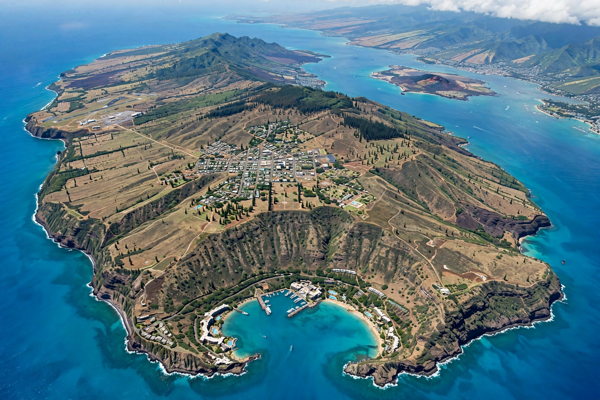
Lānaʻi sits off the west coast of Maui, separated from its larger neighbor by the ʻAuʻau Channel, which narrows to about 9 miles at its slimmest point. On a clear day the West Maui Mountains are plainly visible from Lānaʻi’s east side, and Haleakalā looms to the southeast. To the north, across the Kalohi Channel, lies Molokaʻi, roughly 15 miles away at the closest approach. Oʻahu sits about 70 miles to the northwest, well beyond the horizon.
The island covers about 141 square miles, making it the sixth largest of the main Hawaiian Islands. It measures roughly 18 miles long from east to west and about 13 miles wide from north to south. For comparison, it is slightly larger than the island of Manhattan multiplied many times over, yet its entire population would barely fill a single city block in Honolulu: roughly 3,300 residents, most of them in one town.
Geologically, Lānaʻi is a single eroded shield volcano, the eroded remnant of a once much larger volcanic mass. Its highest point is Lānaʻihale, a forested summit rising to 3,366 feet near the island’s center. The island’s shape is roughly like a comma or a curved comma: a broad central dome that slopes down to a dry, rugged coastline on most sides, with the calmest and most developed coast facing south toward Mānele Bay.
Because the island is small and its interior is high, Lānaʻi has distinct climate zones packed into a short drive. The central plateau around Lānaʻi City sits near 1,700 feet and stays noticeably cooler and greener than the coasts, with tall Cook pines planted during the ranching era lining the town streets. The southern and western coasts are dry and sunny, while the summit ridge catches clouds and mist. The north shore faces the open ocean and the trade winds, which is why it is wild, windswept, and mostly undeveloped.
The Regions of the Island
Think of Lānaʻi as six regions arranged around its central dome. Each has a different character, a different landscape, and a different reason to visit.
Lānaʻi City and the Central Plateau
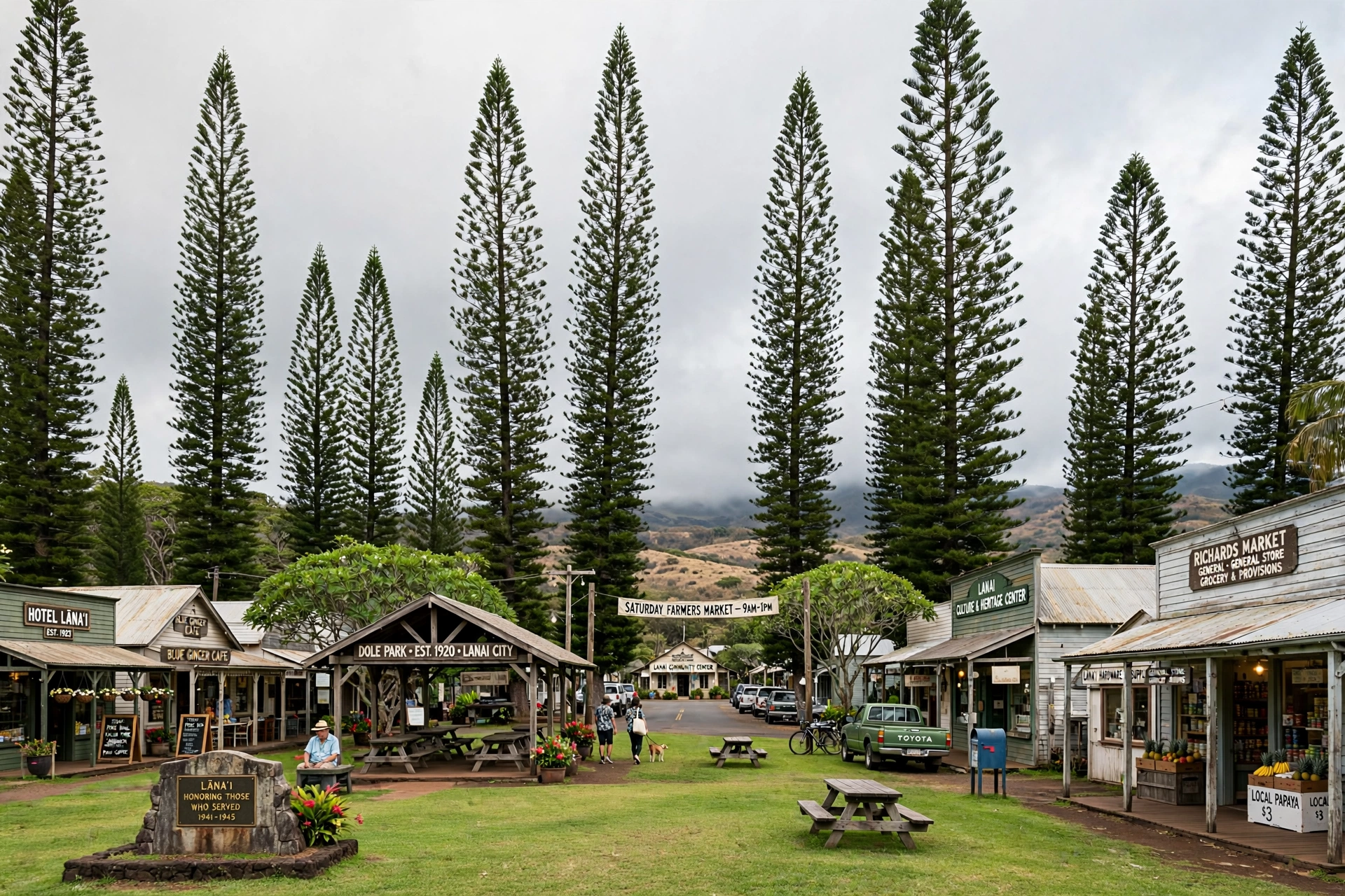
Lānaʻi City sits at the geographic and practical center of the island, on a plateau about 1,700 feet above sea level. This is where the island’s only town, its airport, its hospital, its schools, and nearly all of its shops and restaurants are located. The town was built as a plantation village in the 1920s, and its grid of streets around Dole Park still reads like a company town: small plantation cottages, a few commercial blocks, and Cook pines towering overhead.
The plateau around the town was once covered in pineapple fields. After the last pineapple harvest in 1992, much of that land reverted to pasture and open country. Today the plateau is a mix of ranch land, fallow fields, and residential lots. For visitors, the central plateau is the base of operations: every road trip on Lānaʻi starts and ends here.
Mānele and the South Coast
The south coast is Lānaʻi’s developed shoreline. Mānele Bay holds the island’s small boat harbor, the ferry dock for boats arriving from Maui, a resort, and Hulopoʻe Beach, the island’s best swimming beach. The coastline here is calm and sheltered, facing away from the trade winds, which is why it became the island’s visitor hub.
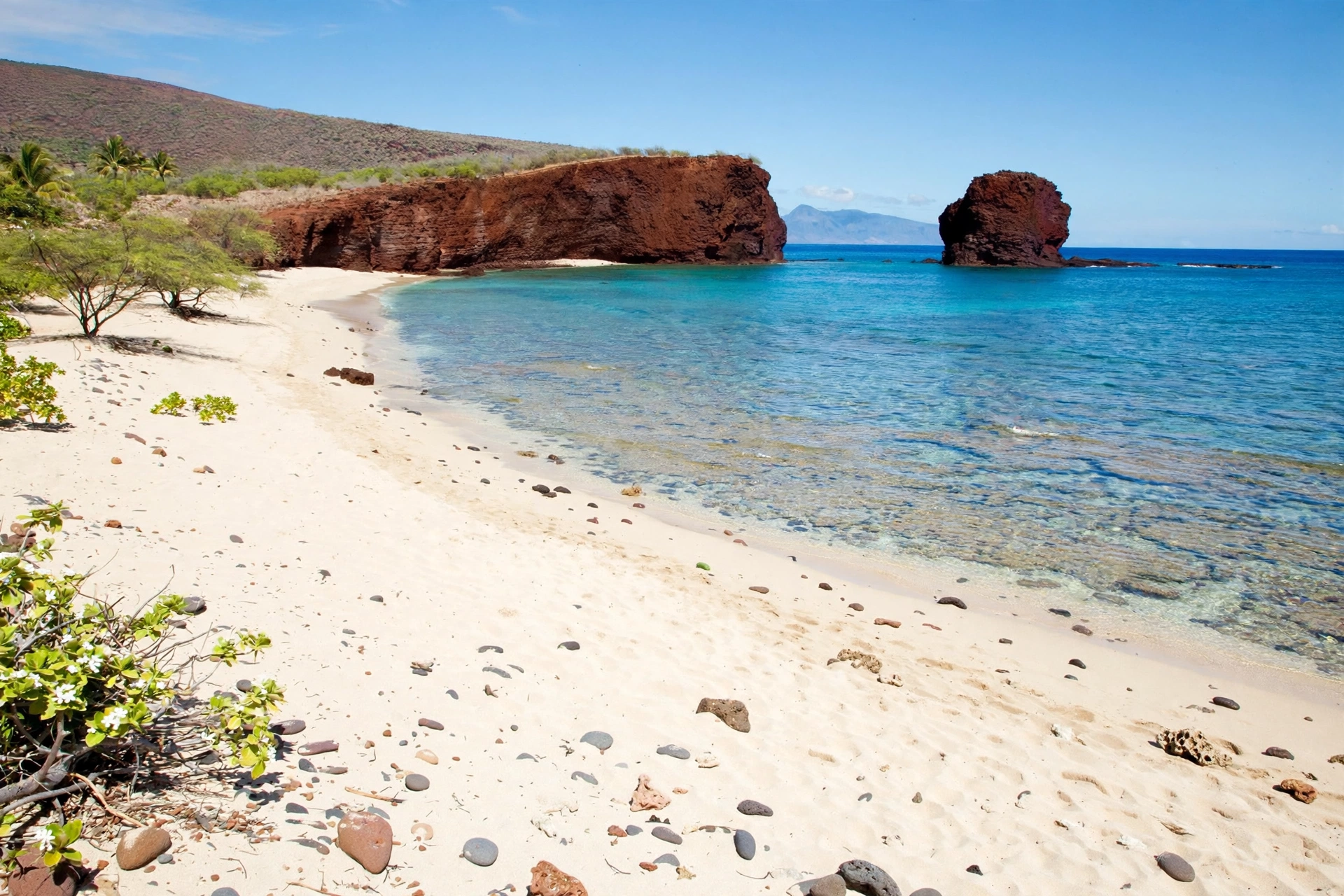
South of Lānaʻi City, the Mānele Road descends from the cool plateau to the dry, sunny coast in about 9 miles. The landscape changes quickly along the way: green pasture gives way to dry scrub, and the ocean appears as a band of turquoise. Offshore from Hulopoʻe sits Puʻupehe, the sea stack known as Sweetheart Rock. The south coast also holds the trailhead for the walk to Puʻupehe and tide pools along the rocky shore.
The North Shore
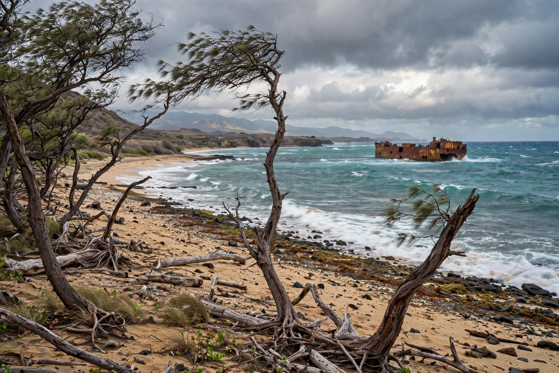
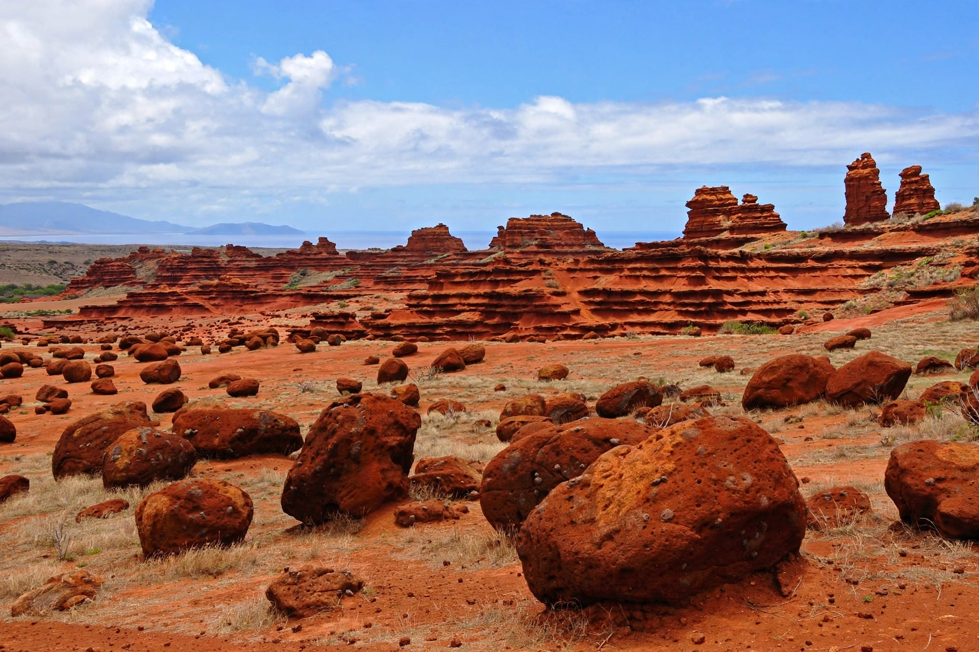
Lānaʻi’s north shore is the island’s wild side. It faces the open Pacific and the full force of the trade winds, and it has no towns, no services, and no paved roads. Two of the island’s most striking landmarks sit here: Kaiolohia, better known as Shipwreck Beach, where a rusting shipwreck rests offshore, and Keahiakawelo, the Garden of the Gods, an otherworldly field of rust red boulders and rock towers in the island’s north-central interior.
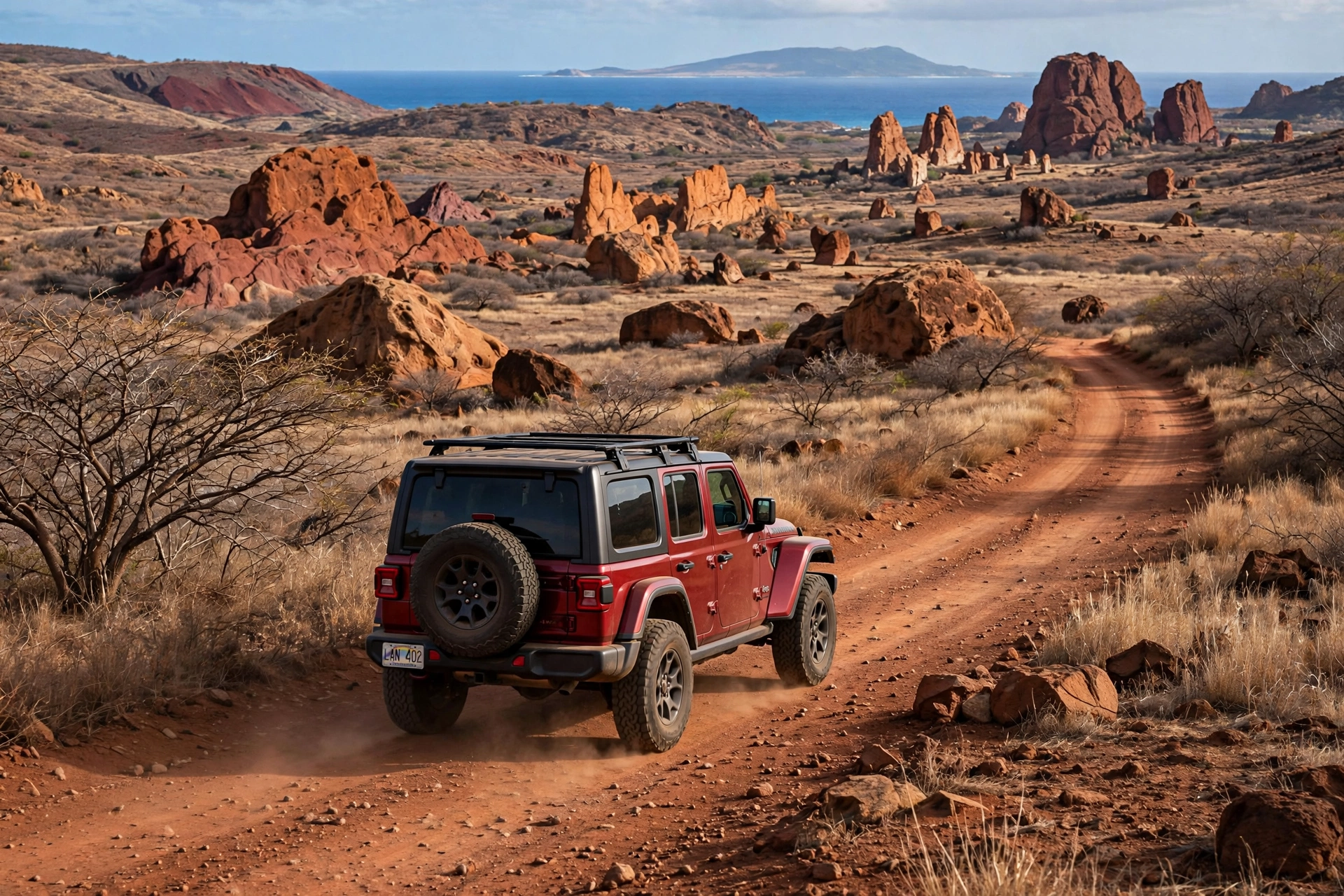
The north shore is reached only by dirt roads that require a four wheel drive vehicle and dry conditions. There is no swimming here: the shore is rocky, the surf is rough, and the currents are strong. Visitors come for the scenery, the shipwreck, the Garden of the Gods, and the sense of standing at the edge of an undeveloped coast.
The East Side
The east side of Lānaʻi faces Maui across the ʻAuʻau Channel and holds some of the island’s quietest country. The dirt Keōmuku Highway runs along this coast, passing the site of Keōmuku, a former plantation-era village that is now abandoned. The east side has no towns and no services, but it offers empty beaches, ironwood-lined shores, and views across the channel to Haleakalā.
This is the least visited part of the island, and it rewards travelers who enjoy solitude. The road is unpaved and best suited to a four wheel drive vehicle. There are no lifeguards, no facilities, and no cell service along much of the route.
The West Side
The west side of Lānaʻi faces the open ocean toward Oʻahu and holds Kaumālapaʻu Harbor, the island’s small commercial harbor. This is a working waterfront rather than a visitor destination: barges and supply boats use it, and there are no beaches or attractions aimed at tourists. The west side’s coastline is dry and rugged, with sea cliffs and rocky shores.
The Kaumālapaʻu Highway connects the harbor to Lānaʻi City. Beyond the harbor, the coast is largely inaccessible by road, and the few tracks that exist are rough and unsigned.
The Summit: Lānaʻihale
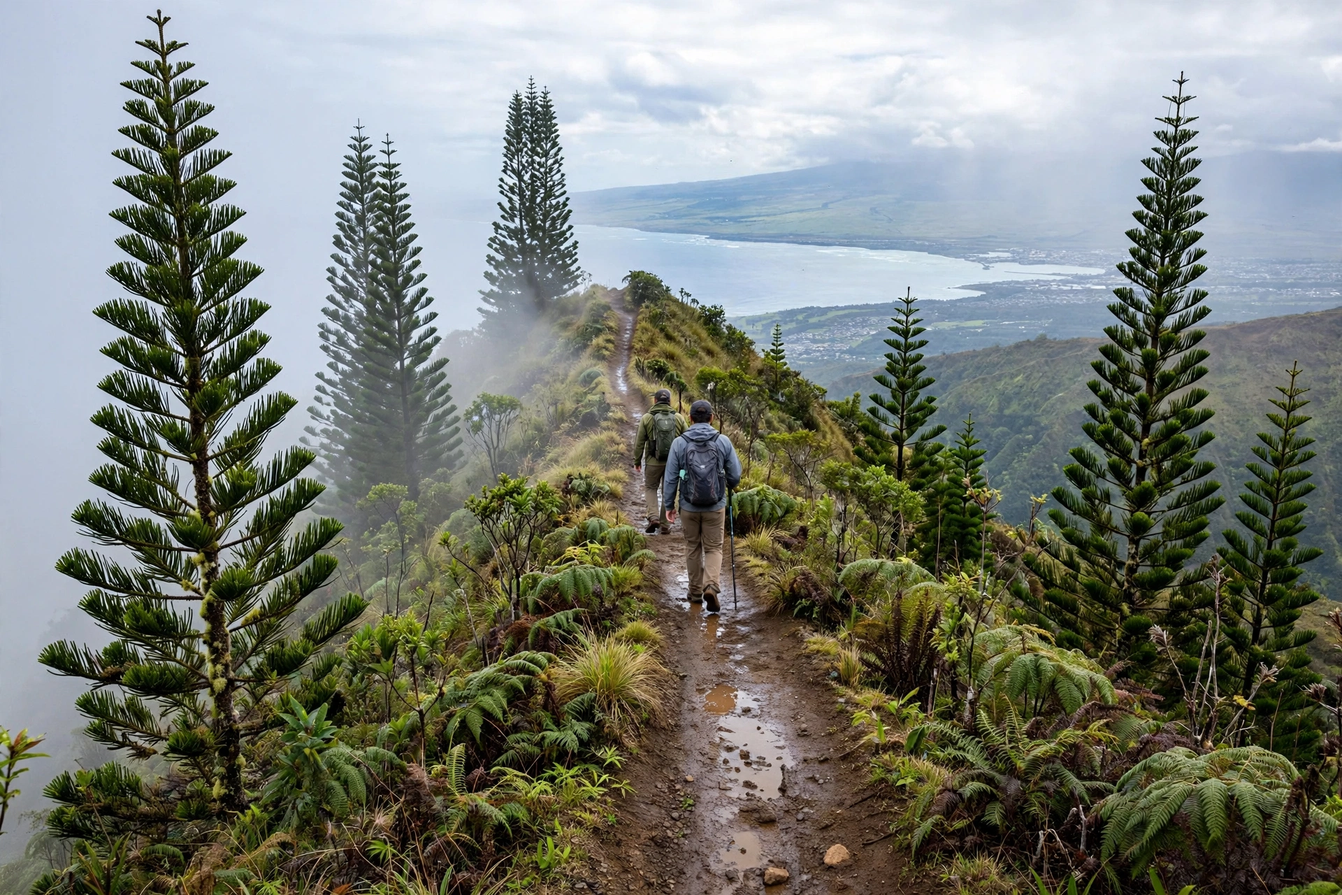
The island’s summit region is a forested ridge running along the island’s spine, with Lānaʻihale at 3,366 feet as its high point. The Munro Trail follows this ridge for about 13 miles, passing through native forest and Cook pine plantings, with views on clear mornings stretching from Maui to Molokaʻi. Near the summit sits the Kānepuʻu Preserve, a 590 acre native dry forest managed by The Nature Conservancy and accessible only on guided visits.
The summit is the wettest part of the island, catching clouds that miss the lower slopes. It can be misty, muddy, and cool, a sharp contrast to the dry coasts below. The Munro Trail is a dirt road and hiking route; the upper sections require a four wheel drive vehicle or a long hike.
Towns and Communities
Lānaʻi has one town. Understanding that single fact clarifies the entire island.
Lānaʻi City: The Only Town
Lānaʻi City is home to nearly all of the island’s roughly 3,300 residents. Built by the Hawaiian Pineapple Company in the 1920s as a plantation town, it centers on Dole Park, a grassy square ringed by small shops, restaurants, and the island’s only grocery store of any size. The streets are laid out in a simple grid, the houses are modest plantation cottages, and towering Cook pines give the town a look unlike anywhere else in Hawaiʻi.
Everything a visitor needs is here: the airport is 3 miles west, the island’s medical clinic is in town, the gas station is in town, and nearly all dining and shopping is in town. If you are staying on Lānaʻi, you will pass through Lānaʻi City constantly. It is quiet in the evenings, and many businesses close early or on Sundays, so plan provisioning accordingly.
Mānele: The Resort and Harbor Area
Mānele is not a town but a destination: a small harbor, a ferry dock, a resort, and Hulopoʻe Beach clustered around Mānele Bay on the south coast. The ferry from Māʻalaea on Maui arrives here, making Mānele the island’s front door for day visitors. There are no grocery stores or gas stations at Mānele, and no residential neighborhoods; it exists to serve the harbor, the resort, and the beach.
Smaller Settlements and Historic Sites
Beyond Lānaʻi City and Mānele, the island’s communities are tiny or historic. Kaumālapaʻu on the west coast is a small harbor settlement with a handful of residents and working waterfront facilities. Keōmuku on the east side is a former plantation village, now abandoned, with a historic church marking the site. Kōʻele, in the uplands near the summit, was the site of a historic lodge and remains a place name on the map rather than a community.
There are no suburbs, no strip malls, and no second town waiting around the next bend. When the map shows open country, it is open country.
Roads and Getting Around the Map
Lānaʻi’s road map is simple to describe and important to respect. A small number of paved roads connect the town, the airport, the harbor, and the south coast. Everything else is dirt, and much of it requires a four wheel drive vehicle.
Paved Roads
The island’s paved network is short. The Kaumālapaʻu Highway (Route 440) runs from Kaumālapaʻu Harbor on the west coast east through Lānaʻi City and on to the airport area. The Mānele Road (Route 460) runs south from Lānaʻi City about 9 miles to Mānele Bay, Hulopoʻe Beach, and the ferry dock. Within Lānaʻi City, the town streets are paved. That is essentially the entire paved system.
These roads are two lane, well maintained, and easy to drive. The Mānele Road is the scenic route on the island, descending from the cool pines of the plateau to the dry coast with expanding ocean views.
Dirt Roads and Four Wheel Drive Routes
Beyond the pavement, Lānaʻi is a network of dirt roads, and this is where the map gets interesting. The Keahiakawelo Access Road leads north from the town area to the Garden of the Gods; it is rough, rocky, and requires a four wheel drive vehicle. The road to Kaiolohia (Shipwreck Beach) branches off toward the north shore and is similarly rough. The Munro Trail along the summit ridge is a dirt road that becomes muddy and rutted after rain. The Keōmuku Highway along the east side is unpaved. The track to Kaunolū on the southwest coast is one of the roughest on the island.
Rental car companies on Lānaʻi rent four wheel drive vehicles specifically because so much of the island requires them, and the island’s small rental fleet sells out well in advance. Standard sedans are fine for Lānaʻi City, the airport, and Mānele, but they cannot safely reach the north shore landmarks, the summit, or the east side. Never take a two wheel drive vehicle onto the dirt roads, and never drive the dirt roads in or right after heavy rain.
What the Map Does Not Show
There is no road that circles the island. The north shore has no through road, the west coast beyond Kaumālapaʻu Harbor has no road, and large parts of the coastline are reachable only on foot, by boat, or not at all. Do not assume that two points on the map connect by road just because they look close. The standard visitor circuit is Lānaʻi City to Mānele and back; everything else is an expedition that requires planning, a proper vehicle, and daylight.
Key Landmarks by Region
Here are the island’s major landmarks organized by where they sit on the map, so you can group them into efficient routes.
South Coast: Hulopoʻe Beach and Puʻupehe
Hulopoʻe Beach sits at Mānele Bay, a white sand beach with clear water, tide pools at its eastern end, and a marine life conservation district offshore. It is the island’s only reliable swimming beach. Just offshore rises Puʻupehe, the sea stack called Sweetheart Rock, reached by a short coastal trail. The landmark sits within easy walking distance of the Mānele ferry dock and harbor.
North Shore: Kaiolohia (Shipwreck Beach)
Kaiolohia, known to visitors as Shipwreck Beach, stretches along the north shore with the rusting hulk of a shipwreck visible offshore. The beach itself is windswept and rocky, with strong currents and no safe swimming. It is reached by dirt road from the central part of the island and is best visited in the morning before the trade winds strengthen.
North-Central: Keahiakawelo (Garden of the Gods)
Keahiakawelo, the Garden of the Gods, is a barren landscape of rust red boulders, rock towers, and eroded formations in the island’s north-central interior. Hawaiian tradition holds the area as sacred, and visitors should stay on the paths and never stack or move rocks. It is reached by the rough Keahiakawelo Access Road and is often combined with Shipwreck Beach in a single north shore outing.
Summit: Munro Trail and Lānaʻihale
The Munro Trail runs about 13 miles along the summit ridge, passing through Cook pine forest and native vegetation to the island’s high point at Lānaʻihale (3,366 feet). On clear mornings the views extend across the ʻAuʻau Channel to Maui and north to Molokaʻi. The Kānepuʻu Preserve, a remnant native dry forest near the summit, is open only through guided visits arranged with The Nature Conservancy.
Southwest: Kaunolū Village
Kaunolū on the southwest coast was once a thriving ancient Hawaiian fishing village and the favorite residence of Kamehameha the Great on Lānaʻi. The site includes house platforms, the Halulu Heiau, and the cliff known as Kahekili’s Leap. It is reached by a very rough dirt track and should be visited with respect: it is a cultural site, not a photo stop. Stay on established paths and do not disturb stone structures.
Central: Lānaʻi Culture and Heritage Center and Dole Park
In Lānaʻi City, the Lānaʻi Culture and Heritage Center documents the island’s history from ancient settlement through the ranching and pineapple eras. Dole Park, the town square, is the social center of the island. Both sit within the town’s compact grid and are easy to visit on foot.
East Side: Keōmuku
Keōmuku on the east coast marks the site of a former plantation village, with a historic church standing as its most visible remnant. The surrounding coast is quiet and undeveloped, with ironwood-lined shores facing Maui across the channel.
Distances and Drive Times
Distances on Lānaʻi are short, but drive times on dirt roads are long. Use this table to plan realistic routes. All distances are approximate and measured from Lānaʻi City.
| Route | Distance | Drive Time | Road Type |
|---|---|---|---|
| Lānaʻi City to Lānaʻi Airport (LNY) | 3 miles | 10 minutes | Paved |
| Lānaʻi City to Mānele Bay / Hulopoʻe | 9 miles | 20 minutes | Paved |
| Lānaʻi City to Mānele ferry dock | 9 miles | 20 minutes | Paved |
| Lānaʻi City to Keahiakawelo (Garden of the Gods) | 7 miles | 45 minutes | Dirt, 4WD |
| Lānaʻi City to Kaiolohia (Shipwreck Beach) | 8 miles | 45 minutes | Dirt, 4WD |
| Lānaʻi City to Kaunolū Village | 8 miles | 60 minutes | Rough dirt, 4WD |
| Lānaʻi City to Munro Trail summit area | 6 miles | 40 minutes | Dirt, 4WD |
| Lānaʻi City to Keōmuku (east side) | 10 miles | 60 minutes | Dirt, 4WD |
| Mānele Bay to Hulopoʻe Beach | 0.5 miles | 5 minutes | Walking path |
The pattern is clear: everything on pavement is minutes away, and everything on dirt takes the better part of an hour each way. Plan north shore outings (Garden of the Gods plus Shipwreck Beach) as a single half day trip, and start early.
How to Read the Map
A few orientation rules make the Lānaʻi map click. First, Lānaʻi City is the hub: every route starts there, and the town sits high enough that you can orient by elevation. Downhill south leads to Mānele and the ferry; downhill west leads to the airport and Kaumālapaʻu Harbor; the rough roads north lead to the Garden of the Gods and Shipwreck Beach.
Second, the island’s services thin out fast. Gas, groceries, restaurants, and medical care exist only in Lānaʻi City. Mānele has limited food and no fuel. Everywhere else has nothing. Fill the tank and pack water and snacks before leaving town.
Third, cell service is unreliable outside Lānaʻi City and Mānele. Download offline maps before driving the dirt roads, and let someone know your planned route and return time. The dirt roads have no signs, no mile markers, and no passing traffic to ask for directions.
Fourth, read the coastline by exposure. The south coast is calm and swimmable at Hulopoʻe; every other coast is rough, rocky, or exposed to surf. If a beach on the map is not Hulopoʻe, assume it is a look-but-don’t-swim beach until you confirm otherwise.
Frequently Asked Questions
Where is Lānaʻi on the map?
Lānaʻi sits off the west coast of Maui, across the ʻAuʻau Channel, about 9 miles from Maui at the narrowest crossing. It is the smallest publicly accessible inhabited island in Hawaiʻi, roughly 141 square miles, with Molokaʻi to the north and Oʻahu about 70 miles to the northwest.
How big is Lānaʻi compared to the other islands?
At about 141 square miles, Lānaʻi is the sixth largest of the main Hawaiian Islands and far smaller than Maui or the Big Island. It measures roughly 18 miles long and 13 miles wide, and its entire population of about 3,300 people lives mostly in one town.
What is the only town on Lānaʻi?
Lānaʻi City is the island’s only town. It sits on the central plateau at about 1,700 feet elevation and holds nearly all of the island’s residents, shops, restaurants, the hospital, the schools, and the gas station. Mānele on the south coast is a harbor and resort area, not a town.
Can you drive around the entire island?
No. There is no road that circles Lānaʻi. The paved roads connect Lānaʻi City with the airport, Kaumālapaʻu Harbor, and Mānele Bay. The rest of the island is reached by dirt roads, and large stretches of coastline have no road access at all.
Which roads on Lānaʻi are paved?
The Kaumālapaʻu Highway (Route 440) from the west coast through Lānaʻi City to the airport, the Mānele Road (Route 460) from Lānaʻi City south to Mānele Bay, and the streets within Lānaʻi City. Every other road on the island is unpaved dirt.
How far is it from Lānaʻi City to Mānele Bay?
About 9 miles, or roughly 20 minutes by car on the paved Mānele Road. The road descends from the cool central plateau to the dry south coast, and it is the easiest and most scenic drive on the island.
Where is the airport on Lānaʻi?
Lānaʻi Airport (LNY) sits about 3 miles west of Lānaʻi City on the Kaumālapaʻu Highway, roughly a 10 minute drive from town. Commuter flights connect it with Honolulu and Kahului on Maui.
What island is closest to Lānaʻi?
Maui is the closest island, about 9 miles away across the ʻAuʻau Channel at the narrowest point. Most visitors reach Lānaʻi by ferry from Māʻalaea on Maui or by commuter flight, and the West Maui Mountains are visible from Lānaʻi’s east side on clear days.
Related Guides
- Lānaʻi Travel Guide: the complete planning guide for the island, with things to do, where to stay, and practical tips.
- Hawaii Map: the full state overview showing where Lānaʻi sits among the main islands.
- Maui Map: the neighboring island across the ʻAuʻau Channel, and the usual gateway to Lānaʻi.
- Molokaʻi Travel Guide: the other small, quiet island, for travelers comparing the two.
- Molokaʻi Map: the geographic companion page for the island to the north.
A Final Note
Lānaʻi’s map is small enough to memorize and wild enough to deserve respect. Learn the six regions, remember that every road begins in Lānaʻi City, and treat the dirt roads as the expeditions they are. Travelers who arrive with the island’s geography in mind spend less time lost and more time standing in the places that make Lānaʻi unlike anywhere else in Hawaiʻi: the red dust of Keahiakawelo, the quiet of Hulopoʻe at sunrise, and the view from the Munro Trail with three islands on the horizon.