Honopū Ridge Trail: Kauaʻi’s Wildest Hike With the Nā Pali’s Best View

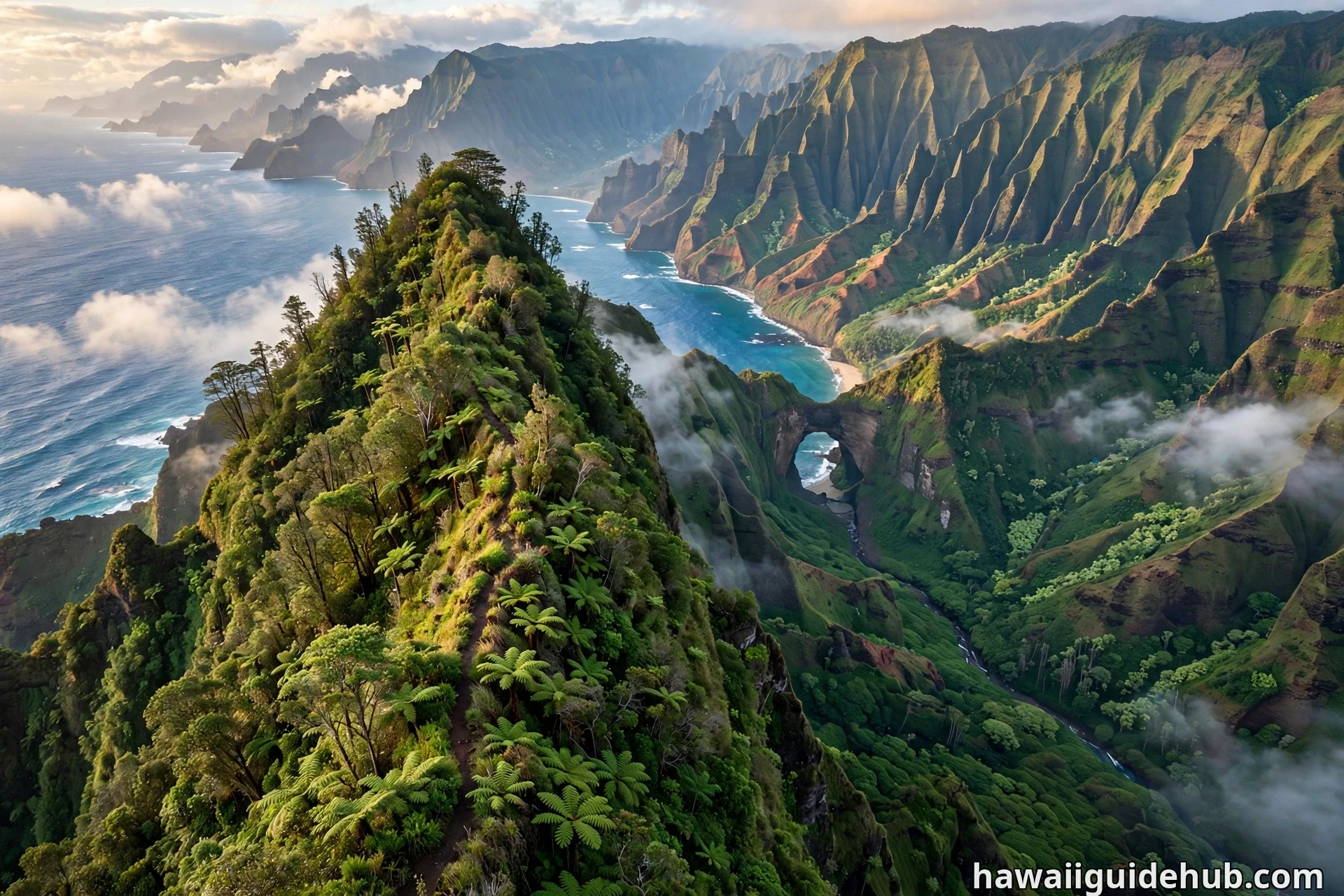
Some trails on Kauaʻi hand you the views. Honopū Ridge Trail makes you earn them, step by slippery step, through a tunnel of ferns taller than you are, down a ridge that narrows until the world falls away on both sides. Then, all at once, the forest opens and you are staring straight into Honopū Valley, one of the most hidden and storied places on the entire Nā Pali Coast.
This is the hike for travelers who find the busy overlooks a little too easy. There is no sign at the trailhead, no maintained path, and no crowd. What there is: a rough, unmaintained route through Kōkeʻe State Park that delivers one of the only land-based views of the Honopū Valley arch and a sweeping panorama of fluted Nā Pali cliffs plunging into the Pacific. If that sounds like your kind of adventure, this guide covers everything you need to know before you go.
What Makes Honopū Ridge Trail Special
Honopū Valley is exceptionally isolated. The valley floor is reachable only by boat or by swimming in from Kalalau, and even then landings are dangerous and often illegal without permission. For almost everyone, the ridge trail is the only way to see it from land.
The name Honopū means “conch shell” in Hawaiian, a reference to the strong north winds that funnel through a natural rock arch at the mouth of the valley and make a whistling sound. The valley also carries deep cultural weight. Hawaiian legends describe Honopū as a burial place for ancient chiefs, whose bones were so sacred that anyone who found their hidden resting place could use their mystical powers. Those who hid the chiefs’ remains were reportedly executed to keep the secret safe.
What makes the trail itself special is the contrast between effort and reward. The first part of the hike is pure jungle work: mud, fallen trees, and dense stands of uluhe ferns that close over the path like a green ceiling. The last part is pure exposure: an open ridgeline with the Nā Pali Coast spreading out below you. Hikers consistently call it one of the roughest and most rewarding hikes on Kauaʻi, and unlike the famous Awaʻawapuhi and Nualolo trails nearby, Honopū gives you the complete, unobstructed Nā Pali panorama.
Honopū Ridge Trail at a Glance
Here are the key facts to know before lacing up your boots.
Getting to the Trailhead
Finding the trailhead is famously the hardest part of the hike. Honopū Ridge is not an official, maintained trail, so you will not find it on most park maps and there is no sign marking the start.
From Waimea town, take Highway 50 (Kaumualiʻi Highway) to Waimea Canyon Drive, which becomes Highway 550, also called Kōkeʻe Road. Drive up the winding mountain road for about 17 miles. The trailhead is just past mile marker 17, between the Awaʻawapuhi trailhead and the Kalalau Lookout at the end of the road. Look for a small dirt pullout on the left side of the road with room for about four cars, roughly 100 feet past a telephone pole on a curve. If you reach the Kalalau Lookout parking area, you have gone too far.
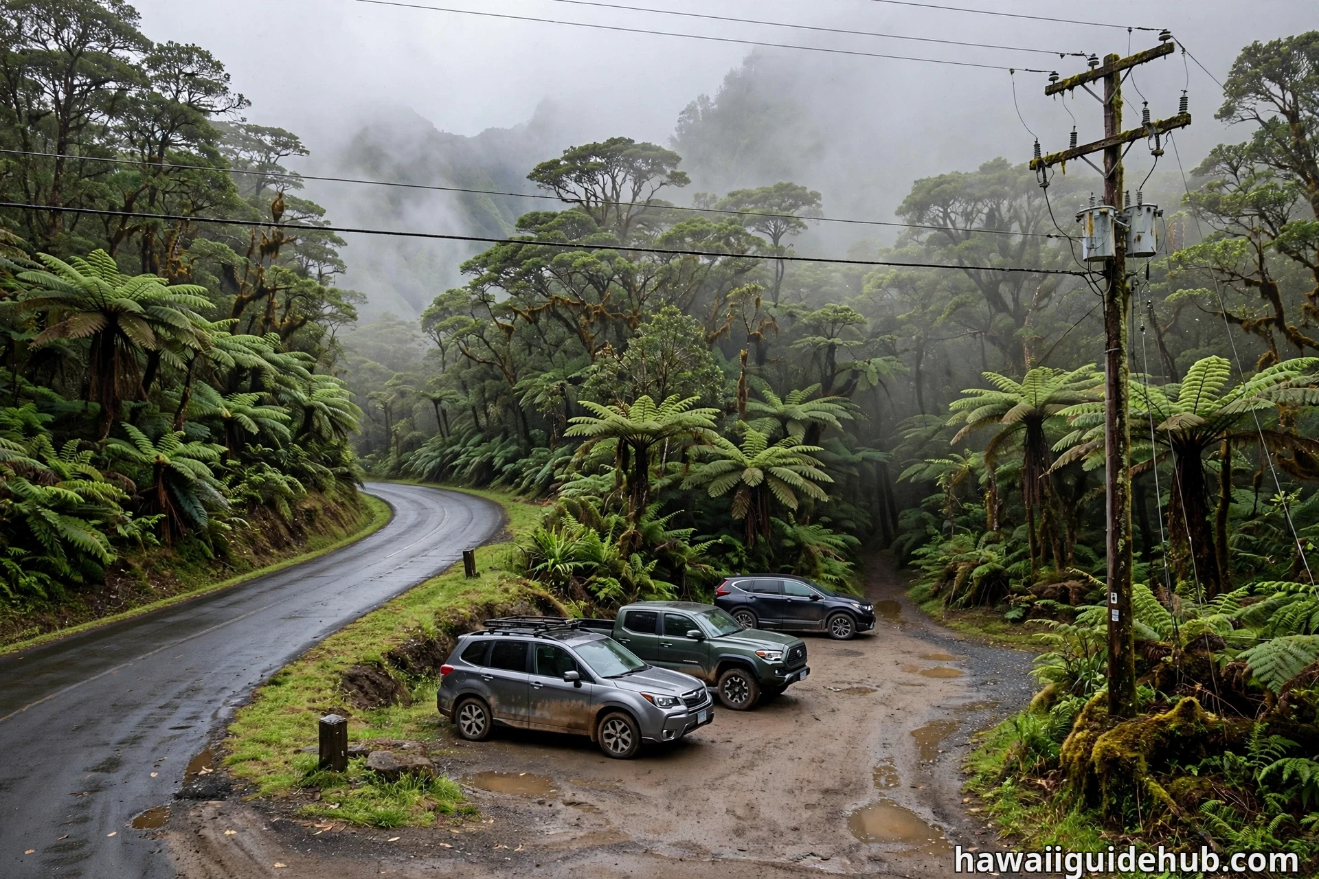
Parking is extremely limited. Arrive early, especially on weekends, and park fully off the road. There are no restrooms at the trailhead, but the Kōkeʻe Lodge grounds you pass on the way up do have public restrooms, so plan a stop there. Fill up your water bottles at the lodge too, because there is no water on the trail.
One more practical note: there is almost no cell service in the park. Download an offline map of the trail before you leave Waimea or Kōkeʻe Lodge, because you will not be able to pull one up at the trailhead. The drive from Waimea to the trailhead takes about 45 minutes to an hour along the winding road, so give yourself plenty of time.
How Difficult Is Honopū Ridge Trail?
Honopū Ridge is rated difficult, and the rating comes less from distance than from conditions. The round trip runs about 4.4 to 5 miles, and most hikers finish in 3 to 5 hours depending on fitness, mud, and how long they linger at the viewpoints. The elevation change is roughly 1,400 to 1,900 feet from the trailhead down to the end of the ridge.
Here is what makes it hard. The trail has not been officially maintained by the park since hurricane damage decades ago, so the path is rough throughout. The first challenge is navigation: several small side trails, many of them pig hunting paths, branch off near the start and can mislead you. Hikers mark the correct route with orange and pink ribbons tied to trees, and sticks or branches are often laid across the wrong paths. Follow the ribbons, and when in doubt take the most well-trodden route.
The second challenge is the vegetation. About 1.2 miles in, the trail enters long stretches of uluhe ferns that grow 8 to 10 feet tall and close over the path. You will be pushing through them, getting wet, and possibly getting scratched. This is why every experienced hiker repeats the same advice: wear long pants and long sleeves, or at least long pants. The fern section covers nearly half a mile of up and down hiking.
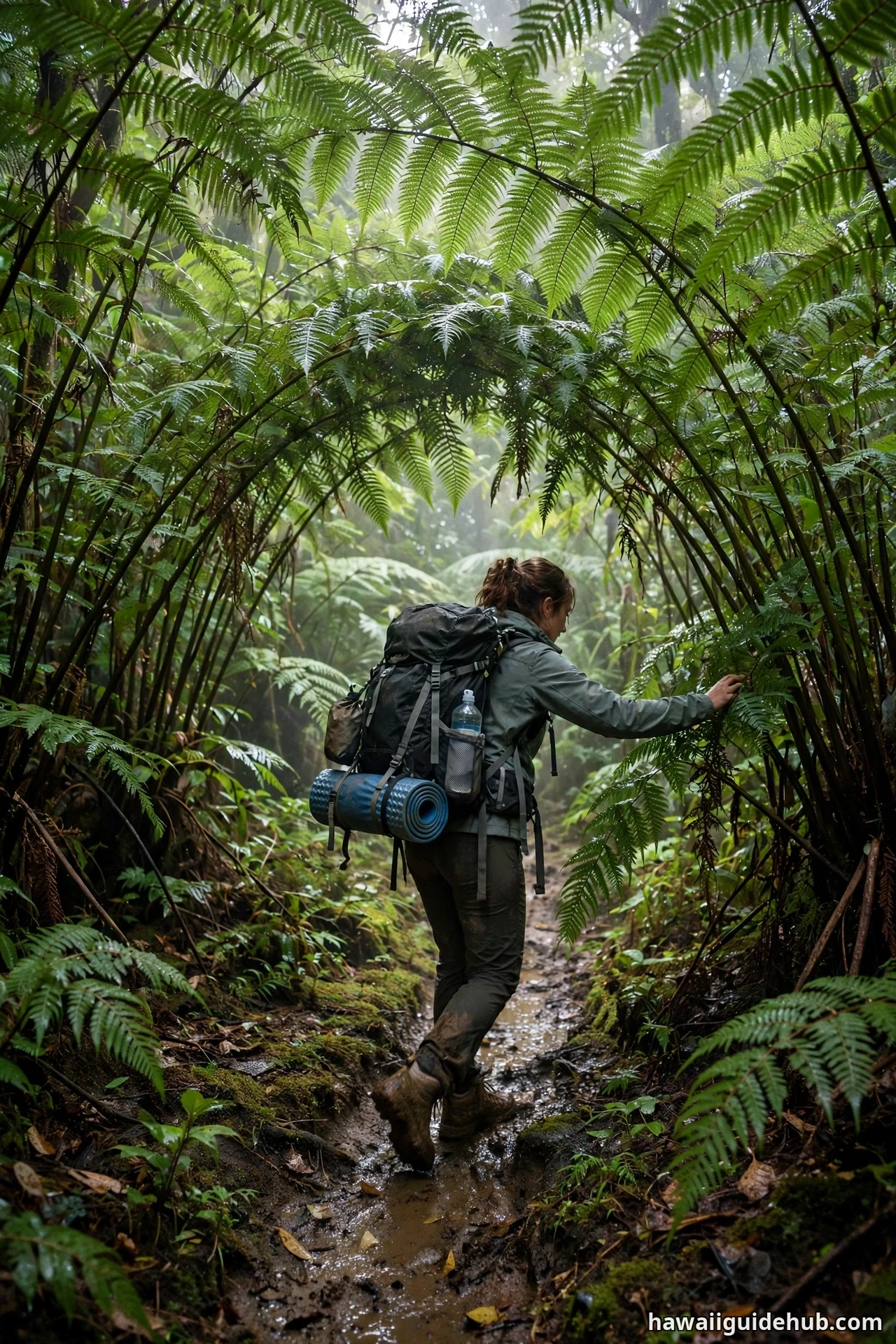
The third challenge is the mud. The trailbed is moist most of the year no matter the season, and the steep descents get genuinely slippery. A hiking stick or trekking poles make a real difference, and shoes with aggressive tread are far better than sneakers.
Finally, remember the profile of the hike. You descend on the way out, which means the return trip is all uphill on tired legs. The climb back up the ridge is steep and humid. Save water and energy for the ascent, and start early enough that you are not climbing out in the heat of the afternoon or fading light.
What You Will See Along the Way
The hike breaks naturally into three acts, and each one looks completely different.
The Forest and the Fern Tunnels
The trail begins in dense native forest, sheltered and shady, with the path narrowing quickly into bushy stretches. After the first confusing junctions near the trailhead, the route settles into a rhythm of descending through old-growth trees, moss-covered ʻōhiʻa, and tangled vines. Then the uluhe ferns take over. These towering ferns form tunnels over the trail, and the hiking slows to a push-and-duck pace. It is sweaty, scratchy work, but there is something deeply satisfying about a trail that refuses to be tamed.
The Open Ridgeline
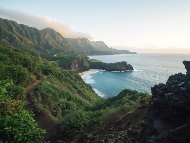
Past the fern sections, the forest gives way to open ridgeline, and the hike changes character completely. The path becomes a narrow dirt spine with steep slopes falling away on both sides, marked by the colorful ribbons of hikers who came before you. This is the most exposed part of the trail, and also the most beautiful stretch of walking on the route.
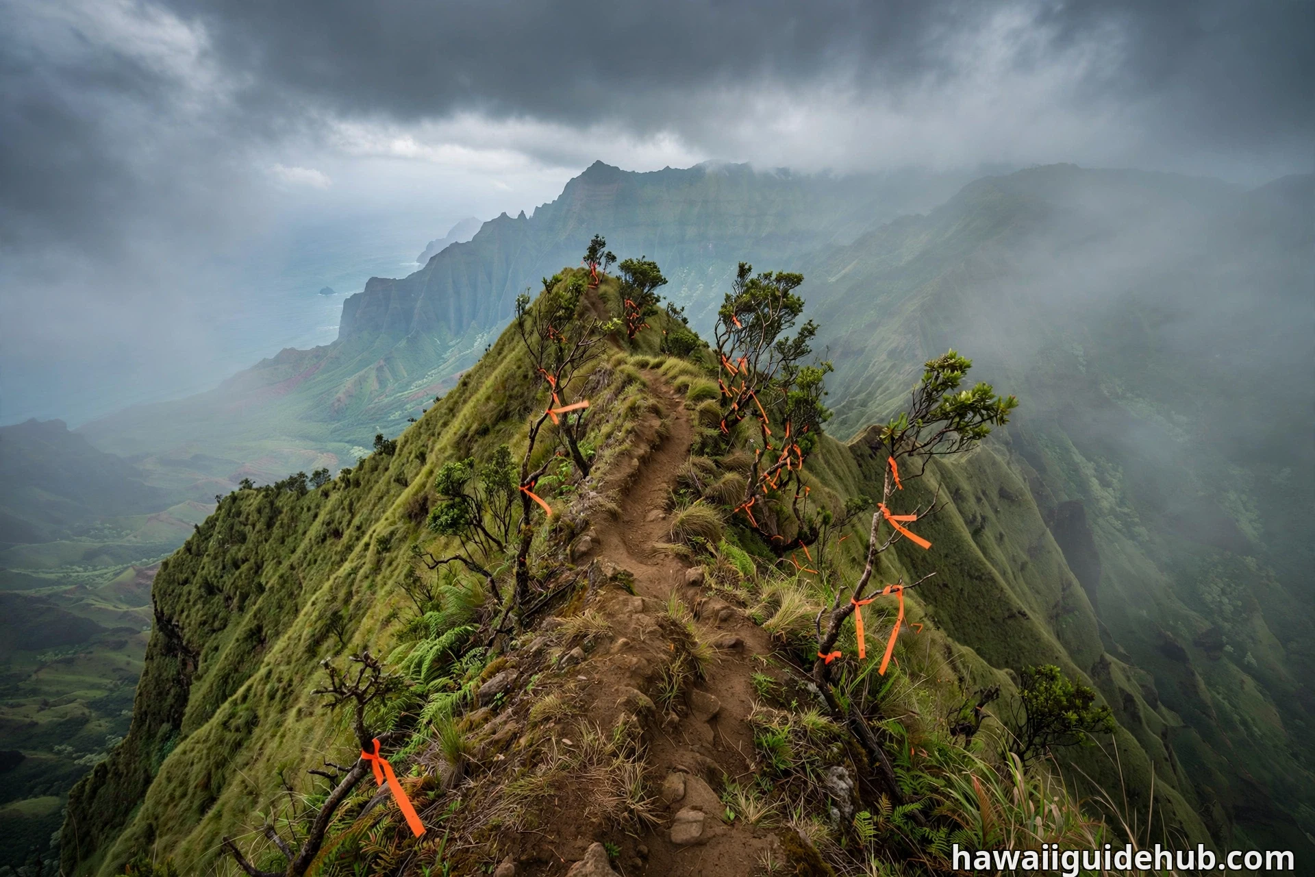
The first real viewpoint arrives about 1.6 miles in, after a descent of roughly 725 feet. From here, the first glimpse of Honopū Valley appears, and the Nā Pali ridges start to show themselves. Keep going and the views keep widening with every step: the fluted green cliffs, the blue Pacific, and on clear days the forbidden island of Niʻihau sitting on the horizon.
Honopū Valley and the Arch
The main event is the overlook into Honopū Valley itself. From the end of the ridge, you look thousands of feet down into an emerald valley that almost no one ever sets foot in, with the famous natural arch framing the ocean at its mouth. Turn your gaze along the coast and the panorama extends up the Nā Pali shoreline toward Kalalau, and sharp-eyed hikers can pick out Kalalau Beach in the far distance.
Hikers consistently say the final stretch is where the trail earns its reputation. The footing gets steeper and more eroded near the end of the ridge, and many people choose a sensible stopping point where the views are already spectacular rather than pushing to the absolute tip. There is no shame in that. The panorama from the first full overlook is the same coastline, and it is unforgettable.
Permits, Fees and Park Rules
You do not need a special hiking permit to walk Honopū Ridge Trail as a day hike. However, the trail sits inside Kōkeʻe State Park, which charges an entry and parking fee for non-residents. Check the Hawaii DLNR Kōkeʻe State Park page for current rates before you go, since fees can change.
Status alert (October 2026): Kōkeʻe State Park is currently closed after Hurricane Lowell, with no reopening date announced by the Division of State Parks, so the trailhead is not reachable right now. Because Honopū Ridge is unofficial and unmaintained, its status can change even when the park reopens. Some trail databases currently list the trail as closed, so verify the current official status with Hawaii DLNR before making the drive. Respect any posted closures or advisories. If the trail is posted closed when you arrive, choose one of the maintained ridge trails nearby instead.
Standard park rules apply: pack out everything you pack in, stay on the main path, and do not disturb wildlife or hunting areas. You may encounter pig hunters on the trail, as parts of the area are used for hunting. Give them space and keep noise reasonable.
Safety on the Trail
This is not a trail to underestimate, and most of the risk comes from the combination of mud, exposure, and remoteness. Take these precautions seriously.
First, the mud. The trailbed stays wet nearly year round, and the steep descents are slippery even in dry-looking weather. Wear footwear with real tread, use a hiking stick or poles, and take the downhills slowly. Ankle injuries on a remote, unmaintained trail are a serious problem because help is far away and there is no cell service to call for it.
Second, the exposure. The open ridgeline near the end of the trail has steep drop-offs on both sides, and the footing near the tip is eroded and unstable. Stay well back from crumbling edges, do not climb out onto narrow points for photos, and turn back the moment the footing feels unsafe. The views from the first overlook are already world class.
Third, the weather. Clouds build over the Nā Pali ridges by midday and can swallow the views entirely, and rain can arrive fast. Start early on a clear morning, watch the sky, and be willing to turn around if conditions deteriorate. A trail this remote is no place to get caught in a downpour with fading light.
Fourth, navigation. With no signs and multiple false trails near the start, it is genuinely possible to wander off route. Follow the ribbon markers, download an offline map, and tell someone your plan and expected return time before you set out. Hiking with a partner is strongly recommended on this trail.
Finally, water and heat. There is no water source on the trail, and the humid climb out is harder than it looks. Carry at least two liters per person plus snacks, and drink before you feel thirsty. If you are pairing this hike with hiking in Waimea Canyon on the same trip, note that Honopū is the rougher, less forgiving of the two, so save it for a day when you are fresh.
Tips for Visiting Honopū Ridge Trail
A few more practical tips from hikers who know the trail well. Wear long pants without exception; the ferns and thorny lantana will shred bare legs. Bring a small first aid kit with blister care, because wet feet and steep descents are a blister factory. A lightweight rain jacket is worth carrying even on sunny mornings, since the ridge makes its own weather.
Photographers should know that morning light is the kindest to the valley. The arch and the fluted cliffs photograph best before the midday clouds roll in, which is another reason to start at first light. And if the clouds do win, remember that Kōkeʻe has plenty of consolation prizes: the Kalalau Lookout is minutes away by car, and the drive back down Waimea Canyon Road is one of the great scenic drives in Hawaiʻi.
If you want to see the coastline from a completely different angle after your hike, seeing the Nā Pali Coast by boat shows you the same cliffs and valleys from sea level, including sea caves the trail can never reveal. For more ideas in the same spirit, our guide to off-the-beaten-path outdoor adventures across the islands is a good next read. And if you are basing your Kauaʻi trip on the sunnier south shore, our complete guide to Poipu covers where to stay, eat, and unwind after the hike.
Best Time to Hike Honopū Ridge Trail
The trail is hikeable year round, but conditions and views vary with the weather. The single biggest factor is cloud cover. The Nā Pali ridges generate their own clouds, and by midday the viewpoints can be completely socked in. Morning is almost always better than afternoon, in every season.
Summer, roughly April through September, tends to bring drier and more stable conditions to Kōkeʻe, with better odds of clear mornings. Winter brings more rain, which makes an already muddy trail muddier and the descents slicker, though the island is at its greenest and the waterfalls along the coast run fuller.
Whale season, roughly December through April, adds a bonus: from the high ridge viewpoints you can sometimes spot humpback whales spouting far below in the Pacific. Whenever you go, check the forecast the night before and the morning of, and pick the clearest morning of your trip for this hike.
Honopū Ridge Trail is not the easiest hike on Kauaʻi, and that is exactly the point. It asks for muddy boots, scratched shins, and a willingness to navigate by ribbons instead of signs, and it pays you back with one of the great views in all of Hawaiʻi: a hidden valley, a stone arch, and the full sweep of the Nā Pali Coast from a ridge almost no one walks. Go prepared, go early, and give the mountain the respect it deserves.