
Big Island Hawaiʻi Beaches Map
The Big Island of Hawaiʻi has more coastline than all the other Hawaiian islands combined, yet its beaches are scattered unevenly around the island. If you are trying to make sense of where to find white, black, and green sand, where the calmest swimming is, and how far apart everything really is, a map view is the fastest way to get oriented. This guide lays out the Island of Hawaiʻi beach by beach, region by region, so you can read the coastline the way locals do: by district, by sand color, and by ocean conditions.
This page is the map-level companion to our detailed beach guides. For deeper coverage of individual beaches, see Big Island Hawaiʻi Beaches, and for regional map detail, see Kohala Hawaiʻi Map, Waikōloa Hawaiʻi Map, and Captain Cook Hawaiʻi Map. For the island’s overall position, start with Where Is Big Island Hawaiʻi and the Hawaiʻi Map.
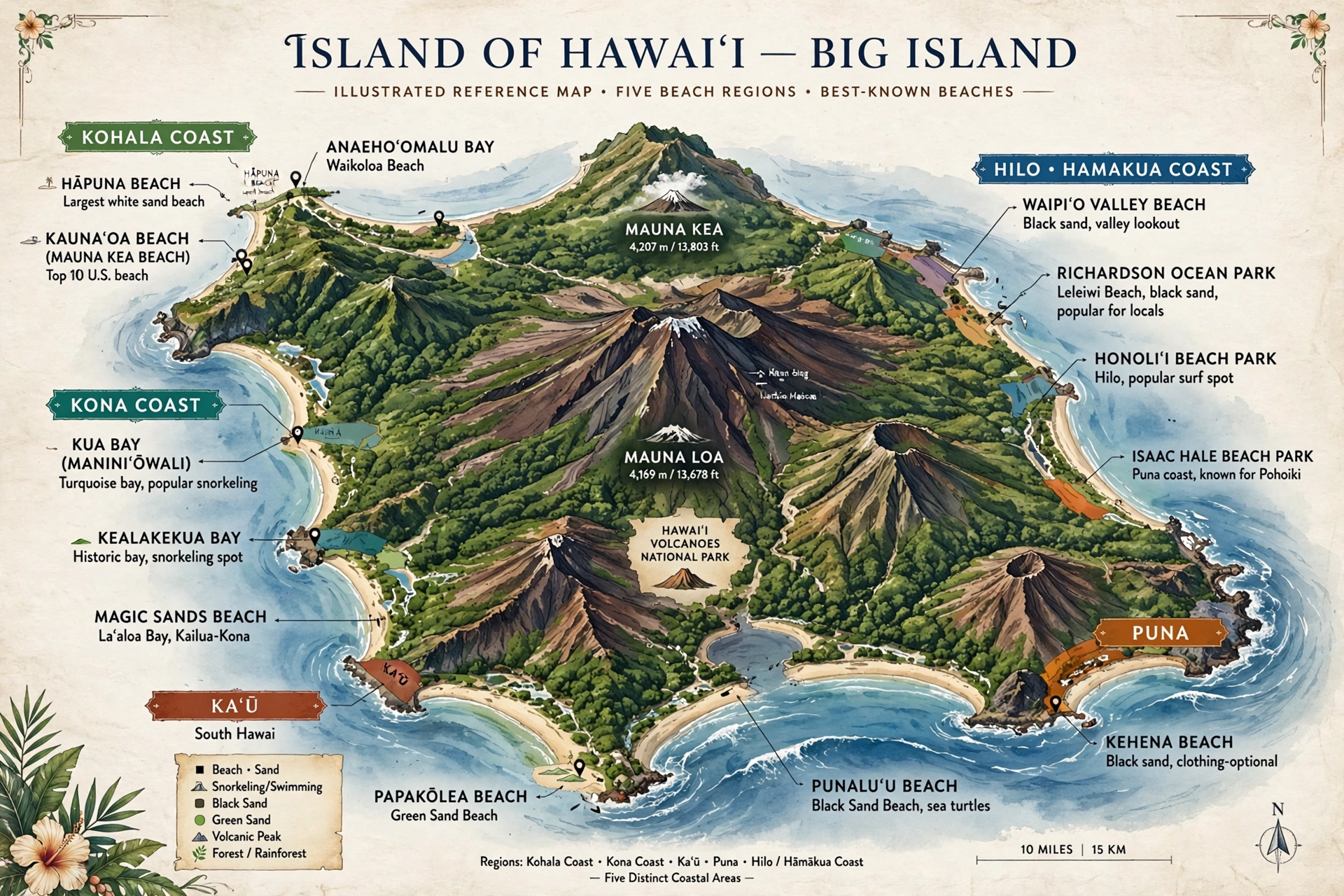
The Island’s Coasts on the Map
The Island of Hawaiʻi is the youngest and largest island in the chain, formed by five volcanoes that merged into a single landmass of about 4,028 square miles. That scale is the first thing the map teaches you. Driving from the Kohala Coast in the northwest to Puna in the southeast can take well over two hours, and beaches that look close together on a phone screen are often separated by long stretches of lava field, ranch land, or cliff-lined coast with no road at all.
The island’s weather pattern splits the coastline into two broad halves. The leeward west side, covering the Kohala Coast and the Kona Coast, sits in the rain shadow of the island’s volcanoes. This is the dry, sunny side where most of the famous swimming beaches sit. Trade winds blow from the northeast most of the year, but the high volcanoes block them from the west side, leaving calm mornings and gentle afternoon sea breezes. The windward east side, covering Hilo, Hāmākua, and Puna, faces the trades directly. It is wetter, greener, and its beaches are fewer, smaller, and more rugged, though they have their own appeal.
That divide shapes the whole beach map. The classic postcard beaches, the long white crescents and the calm snorkeling coves, cluster along the leeward west coast from North Kohala down through South Kona. The south and east coasts are dominated by black sand beaches formed from basalt, many of them young in geological terms and backed by dramatic cliffs. The island’s single green sand beach sits at the remote southern tip. Once you see this pattern, the map starts to read like a story about wind, lava, and time.
There is one more thing the map makes clear: the Big Island’s shoreline is mostly rocky. Between the named beaches lie long stretches of lava rock coastline with no sand at all. Swimming access is concentrated at specific spots, and the island has far fewer swimmable beaches per mile of coast than Oʻahu or Maui. That scarcity is exactly why the beaches that do exist are worth knowing individually.
Beaches by Region
Reading the beach map region by region is the most practical approach. Each of the island’s five coastal regions has a distinct character, and knowing which region a beach belongs to tells you a lot about what to expect: sand color, swimming conditions, drive time, and crowds.
The Kohala Coast
The Kohala Coast runs along the northwest side of the island through South Kohala and into North Kohala. This is the Big Island’s premier beach region, home to the longest stretches of white sand on the island and the calmest swimming. The coast sits fully in the rain shadow, so sunshine is nearly guaranteed, and the offshore waters stay relatively calm for much of the year, with the exception of winter north swells.
Hāpuna Beach State Recreation Area is the standout. Its half-mile crescent of white sand is consistently ranked among the best beaches in Hawaiʻi, and it has the facilities to match: lifeguards, restrooms, showers, picnic pavilions, and a parking area. Because it is a state recreation area, it is open to everyone and easy to find, which also makes it one of the busiest beaches on the island. Arriving early is the standard advice.
Just north, Kaunaʻoa Bay fronts the Mauna Kea resort area and is widely considered one of the most beautiful beaches in the state. Public access is guaranteed by law, but parking is limited to a small number of passes issued on a first-come basis, so this is a beach that rewards an early start. To the south, ʻAnaehoʻomalu Bay at Waikōloa offers calm water, historic royal fishponds along the shore, and a long coastal walkway. These three beaches anchor the Kohala Coast map, with smaller coves and shoreline parks scattered between them. See the Kohala Hawaiʻi Map and Waikōloa Hawaiʻi Map for the regional detail.
The Kona Coast
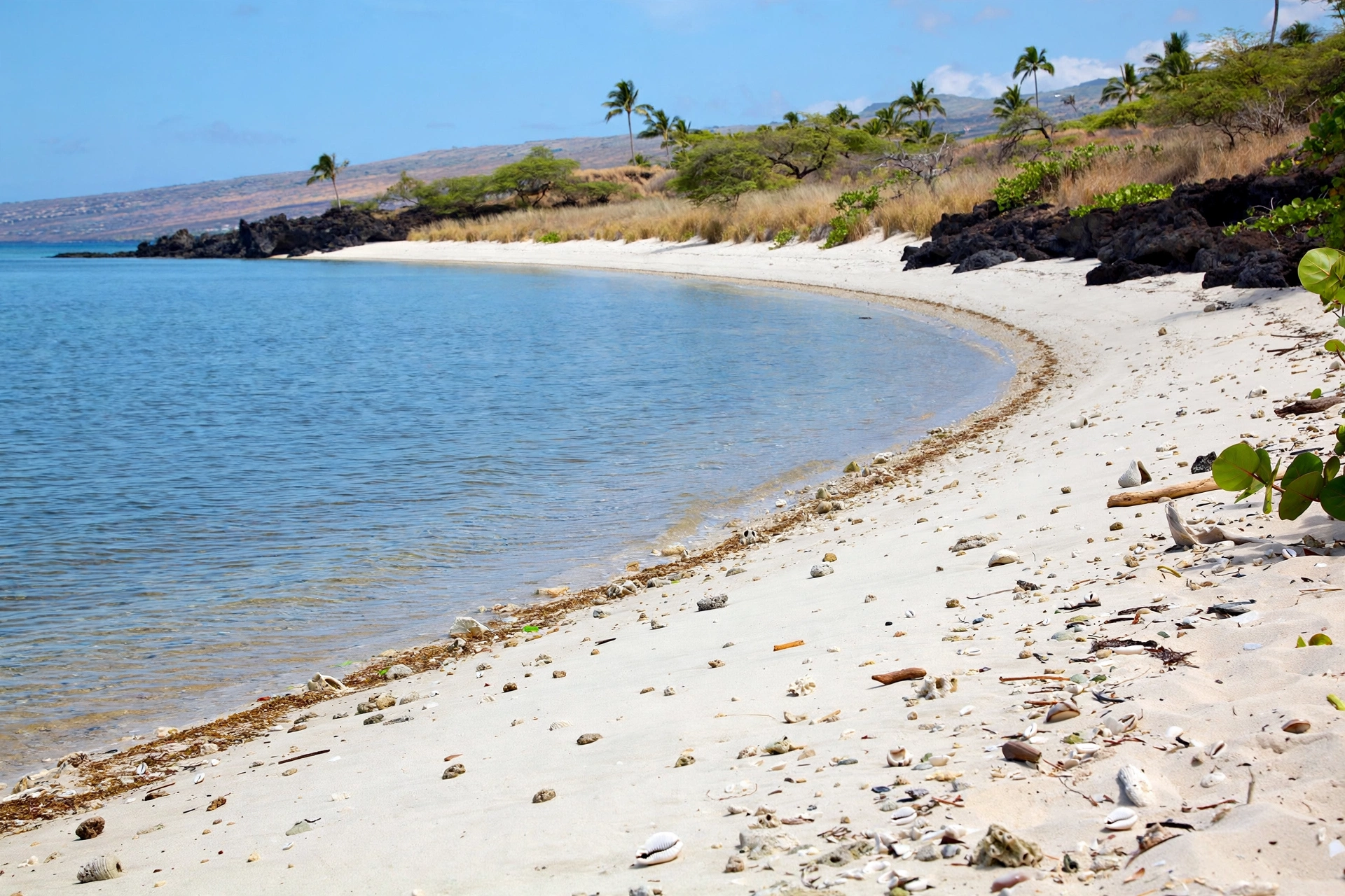
South of the Kohala Coast, the Kona Coast runs from Kawaihae down past Kailua-Kona to Kealakekua Bay. The beaches here are smaller and more pocket-like than the long Kohala crescents, tucked between lava points and often fronting calm, clear water that makes for excellent snorkeling. The Kona side is also where the island’s main visitor town, Kailua-Kona, sits, so these beaches see the steadiest year-round use.
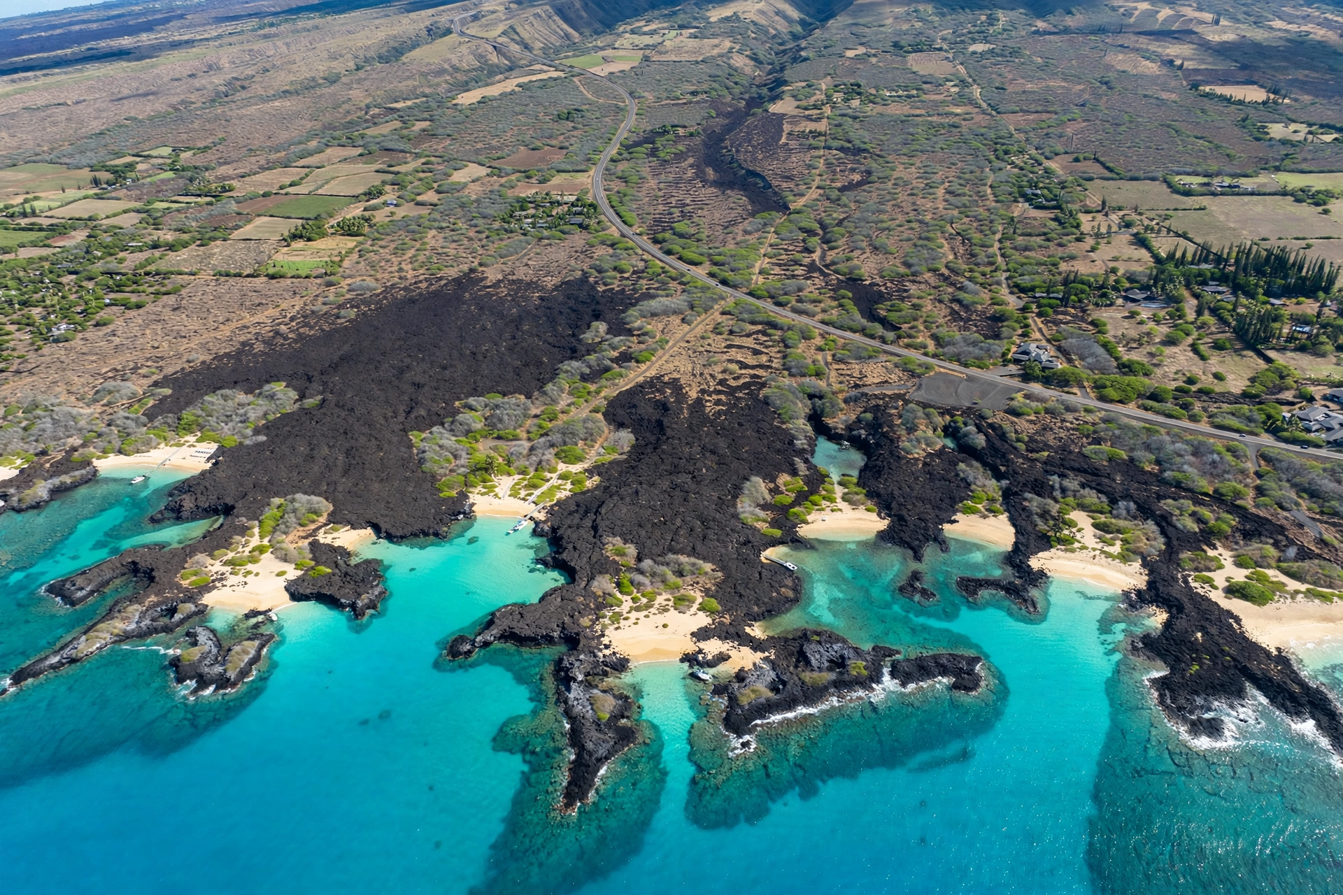
Kua Bay, officially Maniniʻōwali Beach, is a local favorite in North Kona with bright white sand and typically calm water, though winter swells can bring strong shorebreak. Makalawena, a little farther north, is one of the island’s most photographed beaches, but it requires a rough four-wheel-drive road and a hike over lava, which keeps it quieter. Near Kailua-Kona itself, Magic Sands (White Sands) Beach lives up to its name by appearing and disappearing with the surf, while Kahaluʻu Beach Park just south of town is the island’s most accessible snorkeling spot, with a protected reef full of sea turtles. Kealakekua Bay at the southern end of the Kona Coast is a marine preserve with extraordinary snorkeling, though it has no real beach; access is by kayak, boat, or a steep hike. See the Captain Cook Hawaiʻi Map for this area’s geography.
Kaʻū
The Kaʻū district covers the island’s remote southern coast, a landscape of black lava, sea cliffs, and vast open ranch land. This is the least developed beach region on the island and, for many visitors, the most memorable. The drive alone, along Highway 11 past macadamia orchards and cattle country, feels like a different Hawaiʻi.
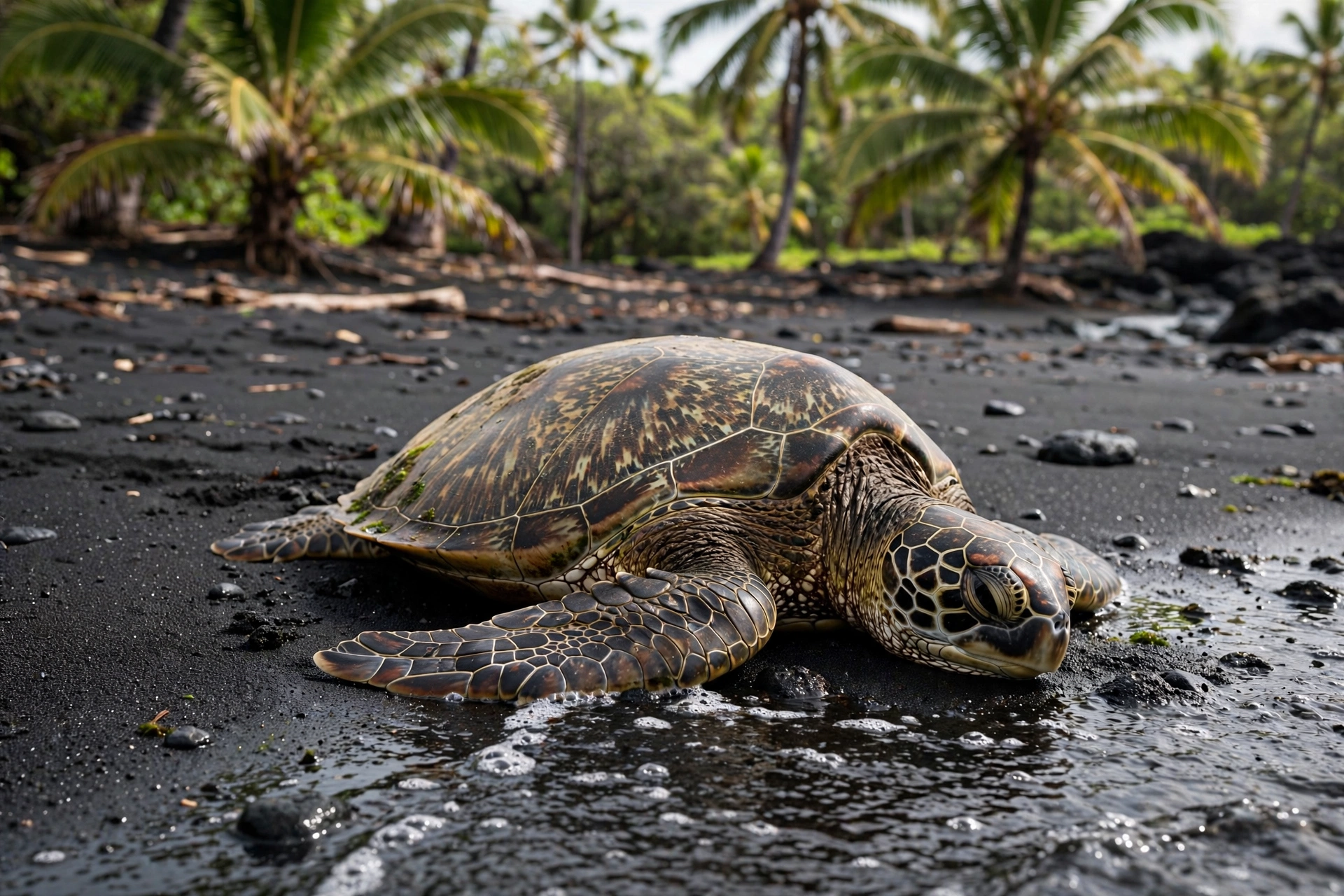
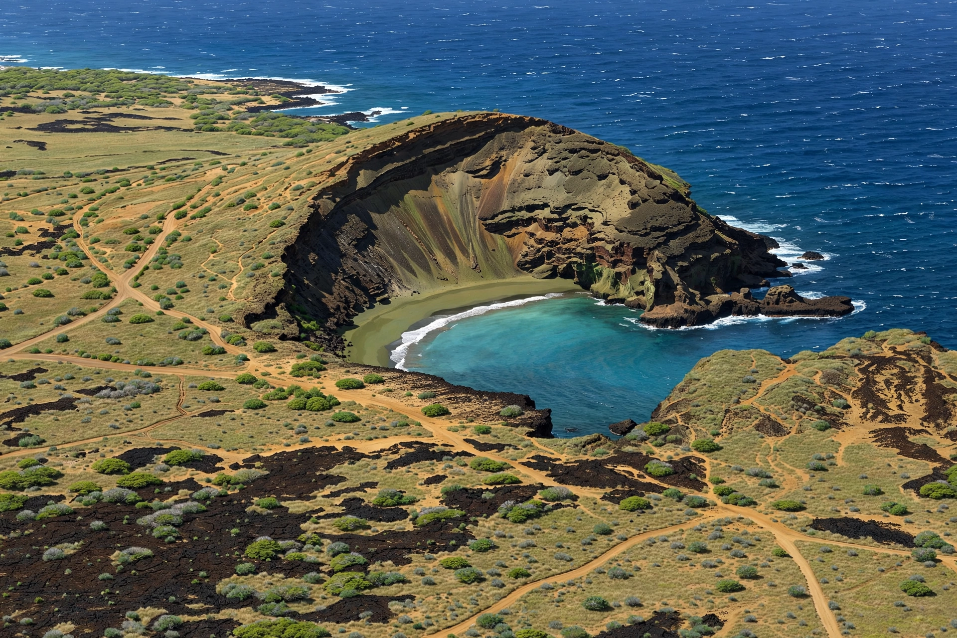
Punaluʻu Black Sand Beach is the region’s famous stop: a striking black sand beach where sea turtles haul out to rest on the warm sand, backed by coconut palms. The water here is often rough, and swimming is for strong swimmers only on calm days, but the beach is worth the trip for the setting alone. Farther west, near South Point (Ka Lae, the southernmost point in the United States), sits Pāpākōlea Beach, one of only a handful of green sand beaches in the world. The green color comes from olivine crystals eroding out of an ancient cinder cone. Reaching it requires a hike of about two and a half miles each way across a windswept landscape, and the beach itself sits at the base of a steep cinder cone. It is a serious half-day outing, not a casual stop.
Puna
Puna occupies the island’s eastern tip, a region reshaped dramatically by the 2018 lower East Rift Zone eruption. Lava flows buried entire neighborhoods and several beloved beaches, then created new coastline in places. The beach map of Puna is the newest on the island, and it is still evolving.
Pohoiki is the most remarkable result: where the 2018 lava flow met the ocean, a brand-new black sand beach formed almost overnight, now one of the island’s most popular surfing and swimming spots. Kehena Beach, a clothing-optional black sand beach at the base of a steep cliff, survived the eruption and remains one of Puna’s most distinctive swimming spots, though the access trail is steep and the surf can be rough. Puna’s beaches are young, wild, and less developed than the west-side beaches, which is precisely their draw.
Hilo and Hāmākua
The Hilo and Hāmākua coasts on the windward northeast side have the fewest beaches on the island, and almost none fit the white-sand postcard mold. What they offer instead is lush, dramatic shoreline with a local feel and far fewer visitors.
Near Hilo, Richardson Ocean Park is the area’s best swimming beach, with a mix of black sand and rocky tide pools, plus lifeguards. Carlsmith Beach Park and Onekahakaha Beach Park offer calm, shallow lagoons that are popular with families. Along the Hāmākua Coast, Kolekole Beach Park sits at the mouth of a stream beneath towering cliffs, a classic windward setting. Waipiʻo Valley’s famous black sand beach is one of the most beautiful on the island, but the road down into the valley is extremely steep and currently restricted, so most visitors see it only from the lookout above. The Hilo side rewards travelers who value scenery and solitude over swimming.
Sand Colors on the Map
The Big Island is the only Hawaiian island where you can find white, black, and green sand beaches all on the same island, and their distribution on the map tells the island’s geological story.
White sand beaches are concentrated on the leeward Kohala and Kona coasts. This sand is made of ground coral and shells, and it accumulates where reefs and calm water allow it to settle. Hāpuna, Kaunaʻoa, Kua Bay, and Makalawena are the great examples. White sand is the rarest color on the Big Island because the island is so young; there has been less time for coral sand to build up than on the older islands.
Black sand beaches ring the island’s younger volcanic coasts, especially in Kaʻū, Puna, and Hāmākua. Black sand forms when hot lava meets the ocean and shatters into glassy fragments, which the surf then grinds into sand. Punaluʻu, Kehena, Pohoiki, and Waipiʻo are the signature black sand beaches. New black sand is still being created today wherever lava reaches the sea, which is why Puna’s coastline changed so dramatically in 2018.
Green sand appears at just one beach: Pāpākōlea in Kaʻū. Its olivine-rich sand comes from the erosion of Puʻu Mahana, an ancient cinder cone. There are only a few green sand beaches on Earth, which makes Pāpākōlea one of the island’s genuine natural wonders, even though reaching it takes real effort.
One practical note: black sand gets extremely hot in the midday sun, much hotter than white sand. Footwear is not optional on black sand beaches.
Beach Access and Safety
Understanding access is as important as knowing locations. Hawaiʻi law guarantees public access to all beaches, but reaching some of them requires effort, and a few of the island’s most famous beaches sit behind limited parking or rough roads.
Kaunaʻoa Bay is the classic example: the beach is public, but the number of public parking passes is small and they are gone early most days. Makalawena requires a rough unpaved road and a cross-country hike over sharp lava; a high-clearance vehicle and sturdy shoes are the minimum. Pāpākōlea demands a long exposed hike with no water or shade along the way. These are not reasons to skip these beaches, but they are reasons to plan ahead, bring more water than you think you need, and start early.
Ocean safety deserves its own emphasis because the Big Island’s beaches can be deceptive. A beach that is calm in the morning can turn rough by afternoon when the trade winds pick up, and winter swells from the north can transform even sheltered west-side beaches. Shorebreak, the powerful wave that breaks directly on the sand, is the most common hazard at beaches like Kua Bay and Magic Sands, and it injures visitors every year. Rip currents occur at several beaches, particularly where streams meet the ocean.
The standard precautions apply everywhere: swim at beaches with lifeguards when possible, never turn your back on the ocean, check surf and weather reports before you go, and stay out of the water when in doubt. Snorkeling is superb at Kahaluʻu, Kealakekua Bay, and the calm Kohala coves, but even experienced snorkelers should respect changing conditions. Flash flooding can affect stream-mouth beaches on the windward side after heavy rain. And at beaches where sea turtles rest, like Punaluʻu, keep a respectful distance; they are protected by state and federal law.
Reading the map for safety: as a rule of thumb, west-side beaches are calmest in the morning before the trades build, winter brings the biggest surf to north and west facing shores, and the island’s south and east shores are roughest overall. When a beach has no lifeguard and no other swimmers, treat the water with extra caution.
Navigating the Island’s Beaches
Distances on the Big Island surprise first-time visitors, so it helps to think in terms of beach days by region rather than trying to see everything at once.
The Kohala Coast beaches cluster within about a twenty-minute drive of each other along and near Highway 19, making them easy to combine. Hāpuna, Kaunaʻoa, and ʻAnaehoʻomalu can all be visited from a single base in Waikōloa or Mauna Kea. The Kona Coast beaches stretch along a longer corridor; Kua Bay and Makalawena are about thirty to forty-five minutes north of Kailua-Kona, while Kahaluʻu and Magic Sands are minutes from town. Kealakekua Bay is about forty-five minutes south of Kailua-Kona via Highway 11.
Kaʻū is a full-day commitment from the west side. Punaluʻu is roughly an hour and a half from Kailua-Kona, and Pāpākōlea adds several more hours with the hike. Puna and Hilo are best paired with an east-side base; Pohoiki and Kehena are about forty-five minutes to an hour from Hilo. The classic two-base strategy, a few days on the west side and a few days on the east side, is how most experienced visitors divide the island, and it applies to beaches as much as to anything else.
A rental car is effectively essential for beach exploring on the Big Island. Public transit reaches some beaches but not the remote ones, and the distances involved make ride services impractical for a full beach day. Bring reef-safe sunscreen, more water than seems necessary, and footwear you can wear on hot sand and sharp lava alike. Many of the island’s best beaches have limited or no shade, so sun protection is not optional. It also helps to download offline maps before you leave your hotel, since cell coverage drops out along several remote stretches of coast.
Frequently Asked Questions
Where are the best beaches on the Big Island?
The most celebrated beaches cluster on the leeward Kohala and Kona coasts: Hāpuna, Kaunaʻoa, ʻAnaehoʻomalu, Kua Bay, and Makalawena for white sand and swimming; Punaluʻu and Pāpākōlea in Kaʻū for black and green sand scenery. The “best” beach depends on what you want: calm swimming, snorkeling, scenery, or solitude.
Does the Big Island have white sand beaches?
Yes, though fewer than the older islands. The best white sand beaches are on the Kohala Coast (Hāpuna, Kaunaʻoa) and in North Kona (Kua Bay, Makalawena). The island’s youth means less coral sand has accumulated than on Oʻahu or Maui.
Where is the green sand beach on the Big Island?
Pāpākōlea Beach in Kaʻū, near South Point. It is one of only a few green sand beaches in the world. Reaching it requires a hike of about two and a half miles each way with no shade or water along the route.
Are Big Island beaches free to access?
All beaches in Hawaiʻi are public by law. Some have parking fees, particularly state parks, and a few (like Kaunaʻoa Bay) limit the number of public parking passes. The beaches themselves are always free.
Which side of the Big Island has the calmest water?
The leeward west side, the Kohala and Kona coasts, generally has the calmest water, especially in the morning. The windward east side and the south coast are rougher overall. Winter north swells can bring big surf to west and north facing beaches.
How far apart are the Big Island’s beaches?
Farther than the map suggests. The Kohala Coast beaches are close together, but driving from the Kohala Coast to Kaʻū takes about two hours, and reaching Puna from Kona takes a similar amount of time. Plan beach days by region.
Can you swim at black sand beaches?
It depends on the beach and the day. Punaluʻu and Pohoiki can be swimmable when calm, but black sand beaches often have rougher water than the sheltered white sand coves. Check conditions, and note that black sand gets extremely hot underfoot at midday.
Do I need a car to visit Big Island beaches?
Effectively, yes. The island is large, the best beaches are spread across distant regions, and public transit does not reach the remote ones. A rental car is the standard way to explore the island’s coastline.
Related Guides
- Big Island Hawaiʻi Beaches: detailed coverage of the island’s individual beaches.
- Kohala Hawaiʻi Map: the Kohala region in detail, including Hāpuna and Kaunaʻoa.
- Waikōloa Hawaiʻi Map: the Waikōloa resort area and ʻAnaehoʻomalu Bay.
- Captain Cook Hawaiʻi Map: South Kona, Kealakekua Bay, and the monument.
- Where Is Big Island Hawaiʻi: the island’s overall location and geography.
- Hawaiʻi Map: the full island chain at a glance.
Reading the Island by Its Shores
The Big Island’s beach map is really a map of the island itself: young lava in the south and east, older coral sand in the west, and a coastline still being written by eruptions, surf, and time. Once you can read the regions, the sand colors, and the distances between them, the island stops feeling overwhelming and starts feeling navigable. Pick a region, pick a color of sand, and let the map do the rest.