
Kohala on the Map: The Overview
Kohala is the northwestern region of Hawaiʻi Island, the island most visitors call the Big Island. If you look at a map of the island, Kohala forms the northwestern shoulder: the landmass that juts toward the island’s northern tip and curves down the leeward (western) side. The region is built on the slopes of the Kohala volcano, the oldest of the Big Island’s five volcanoes, which rose from the ocean roughly a million years ago and has been extinct for about 120,000 years. Its long, rounded profile is what gives this corner of the island its distinctive shape on a map: a broad, gently sloping dome on the north side and a drier, lava-field shoreline on the west.
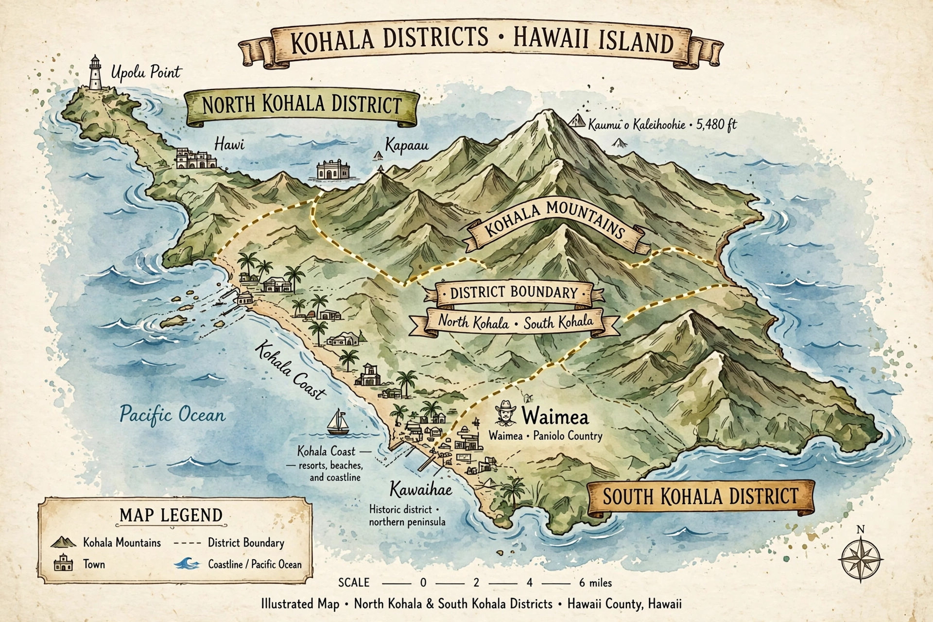
On most maps, Kohala appears as two districts: North Kohala and South Kohala. These are two of the island’s nine traditional districts, and together they cover the entire northwestern quadrant. North Kohala is the smaller, greener, more rural half, centered on the historic towns of Hāwī and Kapaʻau near the island’s northern tip. South Kohala is the larger half, stretching from the Kohala Mountains east of Waimea down to the sun-drenched Kohala Coast, where resort areas, white-sand beaches, and black lava fields line the shoreline from Kawaihae south toward the Kona district boundary.
For orientation purposes, three things define Kohala’s position on the island map. First, it is the island’s oldest volcanic terrain, which means the deep valleys, sea cliffs, and rolling pastureland of the north look very different from the young lava fields further south. Second, it is almost entirely on the leeward side of the island, sheltered from the trade winds by the Kohala Mountains and Mauna Kea, so much of South Kohala is among the driest places in the state. Third, it is the island’s northwest anchor: the point from which distances to Hilo (east, roughly 60 miles), Kailua-Kona (south, roughly 35 miles from Waimea), and the Hāmākua Coast (southeast) are most usefully measured.
This page is a map reference for the Kohala region: how the districts fit together, which roads connect what, and where the towns and landmarks sit relative to one another. If you are looking for the broader “where is Kohala” answer, including its history and what to see, our guide to where Kohala is in Hawaiʻi covers that ground. For the resort area in detail, see our Waikōloa map guide, and for the island as a whole, the Hawaiʻi map.
District Boundaries: North and South Kohala
Understanding the boundary between North Kohala and South Kohala is the single most useful thing a map reader can do, because the two districts feel like different places. The dividing line runs roughly east-west across the Kohala peninsula, and while the exact legal boundary follows old land divisions, the practical split on a traveler’s map is easy to learn.
North Kohala: the northern tip
North Kohala occupies the northern end of the island, a roughly triangular wedge of green country bounded by the ocean on three sides: the windward (northeastern) coast, the northern tip itself, and the leeward coast down to about Kawaihae. Its southern boundary runs inland across the Kohala Mountains, roughly along the ridge line that separates the wet, green north-facing slopes from the drier ranchlands to the south. On a road map, the district is defined by Highway 270 (the Ākohōkohō Highway, also signed as Akoni Pule Highway), which traces the northern coastline from Kawaihae up through Hāwī and Kapaʻau to the Pololū Valley lookout at the road’s end, and by Highway 250 (the Kohala Mountain Road), which crosses the interior from Waimea to Hāwī.
North Kohala is compact. From Kawaihae at its southwestern corner to the Pololū Valley lookout at its eastern end is roughly 25 miles by road. The district’s interior is dominated by the Kohala Mountains, whose forested slopes rise to about 5,500 feet and catch the moisture that keeps the north side green. The northern coastline is rugged: high sea cliffs, deep valleys like Pololū and Honokāne, and small pocket beaches reachable only on foot. This is ranching and farming country, dotted with historic sites connected to Kamehameha the Great, who was born in the district at Kokoiki.
The population centers of North Kohala cluster in the northwest: Hāwī and Kapaʻau, two small plantation-era towns about two miles apart on Highway 270, and the scattered communities of Halaʻula, Hāwī, and the upland homesteads along Highway 250. There are no traffic lights in the district and only a handful of gas stations, so map readers should note fuel stops before heading to the far ends of Highway 270.
South Kohala: Waimea and the Kohala Coast
South Kohala is the larger district, wrapping around the southern and eastern flanks of the Kohala Mountains. Its boundaries are broader and more varied. To the north it meets North Kohala along the mountain ridge. To the east it borders the Hāmākua district, with the boundary running through ranch country near Waimea toward the windward side. To the south it borders the Kona districts, with the line falling roughly between the resort areas of the Kohala Coast and the lava fields approaching Kona International Airport at Keāhole. To the west is the Pacific.
South Kohala contains two very different landscapes, and a map shows the split clearly. The upland interior around Waimea (also known by its postal name, Kamuela) sits at about 2,700 feet elevation on the rolling pastures of Parker Ranch, one of the largest cattle ranches in the United States. This is green, cool, often misty country. Drop westward down the slopes toward the ocean and you cross one of the sharpest climate gradients on the island: within about 15 miles, annual rainfall falls from over 40 inches to under 10, and the landscape shifts from pasture to the black lava fields and white-sand beaches of the Kohala Coast.
The Kohala Coast is the district’s western shoreline, running roughly from Kawaihae in the north to the Kona district line south of the Mauna Lani resort area. On the map it reads as a nearly straight north-south coastline of lava rock punctuated by pocket beaches: Spencer Beach Park and Hāpuna Beach State Recreation Area in the north, the Mauna Kea Beach area, then Waikōloa Beach, ʻAnaehoʻomalu Bay, and the Puakō and Mauna Lani areas to the south. Inland from this shoreline, the Queen Kaʻahumanu Highway (Highway 19) is the district’s main north-south artery, and the resort communities sit between it and the sea.
One boundary worth noting precisely: Waikōloa sits entirely within South Kohala, and our Waikōloa map guide covers its internal layout, beaches, and roads in detail rather than repeating them here.
Key Roads of Kohala
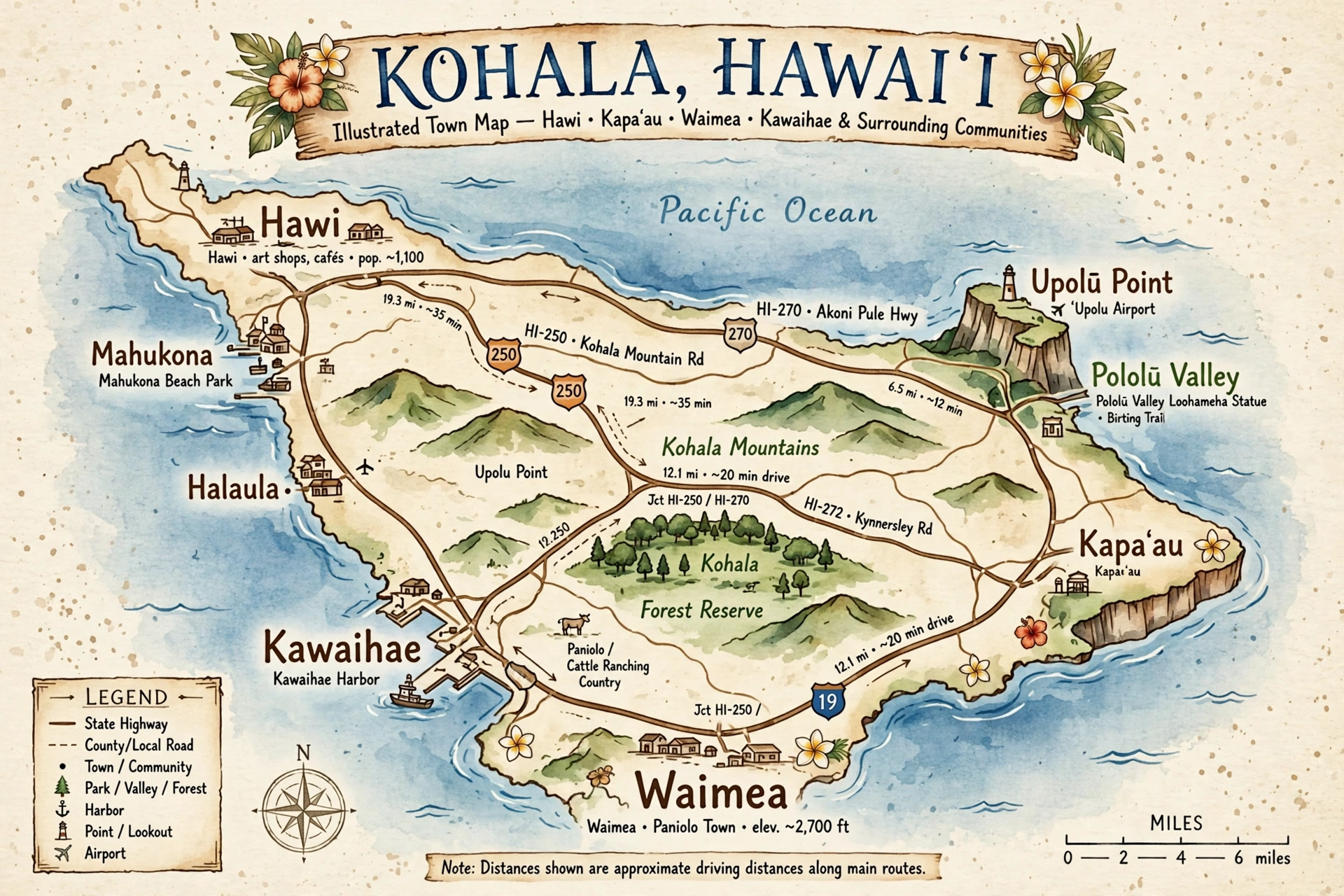
Four numbered highways define how people move through Kohala, and learning them is the fastest way to read any map of the region. Each has a distinct character, and together they form a loop with a few important spurs.
Highway 270: the northern coastal road (Akoni Pule Highway)
Highway 270 begins at Kawaihae, at its junction with Highway 19, and runs north and then east along the North Kohala coastline for about 25 miles to its terminus at the Pololū Valley lookout. The road is officially named the Akoni Pule Highway. From Kawaihae it climbs through dry coastal country past the turnoffs for Lapakahi State Historical Park and Māhukona, then enters the greener belt around Hāwī and Kapaʻau, the district’s two main towns. East of Kapaʻau, the road narrows and winds through pastureland and forest, passing the original Kamehameha statue in Kapaʻau town and the Mookini Heiau turnoff, before ending at the Pololū Valley overlook, where the pavement stops and a steep trail descends into the valley.
For map readers, Highway 270 is the scenic route and the only road that reaches the northern tip’s eastern side. It is a two-lane road throughout, with narrow bridges and occasional one-lane sections near its eastern end. Allow about 45 minutes to drive its full length without stops, and considerably more if you plan to stop at the overlooks, the heiau sites, and the towns. There is no through route beyond Pololū: the road ends at the lookout, and the valleys to the east are accessible only on foot.
Highway 250: the Kohala Mountain Road
Highway 250 connects Waimea with Hāwī, crossing the Kohala Mountains over about 20 miles of winding upland road. From Waimea it climbs northeast through Parker Ranch pastureland, crests the mountain saddle with sweeping views of both coasts on clear days, then descends through eucalyptus forest and pasture into Hāwī. This is the working link between South Kohala’s ranch country and North Kohala’s towns, and it is the route most residents use daily.
The road is narrow and winding, with fog and rain common near the summit, and drivers should watch for cattle near unfenced sections. It is also one of the most scenic drives on the island: on a clear morning the descent toward Hāwī opens up views across the green North Kohala peninsula to the ocean. Highway 250 meets Highway 270 in Hāwī, completing the northern loop: Kawaihae to Hāwī via 270 along the coast, or Kawaihae to Waimea to Hāwī via 19 and 250 through the interior.
Highway 19: the Queen Kaʻahumanu Highway
Highway 19 is the main north-south highway of the leeward Big Island, and its Kohala segment is the region’s most important road. Within South Kohala it runs from the Kona district boundary in the south, past Kona International Airport at Keāhole (just south of the district line), up through the lava fields past the Waikōloa Beach Resort turnoff, past the Mauna Lani and Puakō turnoffs, and on to Kawaihae, where it meets Highway 270 and ends its numbered run. North of Kawaihae, the coastal route continues as Highway 270.
This is a fast, well-maintained divided highway for most of its length, and it is the route nearly all visitors use to reach the Kohala Coast from the airport. Distances along it are the ones that matter most for trip planning: Kona International Airport to the Waikōloa Beach Resort turnoff is about 18 miles; the turnoff to Kawaihae is about 10 miles further north; Hāpuna Beach State Recreation Area sits just north of Kawaihae via Highway 19’s northern end. The highway also carries the turnoffs for every major Kohala Coast beach and resort: Waikōloa Beach Drive, the Mauna Lani resort roads, and the Puakō community roads all branch west off Highway 19.
Note for map readers: Highway 19 changes names along its length. Through the Kohala segment it is the Queen Kaʻahumanu Highway; east of Waimea it becomes the Māmalahoa Highway as it continues toward Honokaʻa and the Hāmākua Coast. The number stays 19 throughout.
Highway 190: the Māmalahoa Highway (upper road)
Highway 190 is the inland, upper-elevation alternative to Highway 19, running from Waimea southwest through ranch country to rejoin the Kona road network near Hualālai. From Waimea it heads south past Parker Ranch lands, climbing and dipping through pasture with views of Mauna Kea, Mauna Loa, and Hualālai, before descending toward Kailua-Kona. Within Kohala proper, its most relevant segment is the Waimea end, where it meets Highways 19 and 250 at the town’s main junction.
Highway 190 matters on a Kohala map for two reasons. First, it is the route between Waimea and Kailua-Kona that stays above the coastal lava fields, about 39 miles of ranch country driving. Second, together with Highway 19 it forms the southern half of the island’s western loop: travelers circling the island from Kona to Waimea can choose the fast coastal Highway 19 or the scenic upland Highway 190. The two rejoin near Waimea, where the full set of Kohala’s highway junctions comes together.
The Waimea junction: where it all meets
Waimea is Kohala’s road hub, and its main intersection deserves a moment on any map. Highways 19, 190, and 250 converge at the town’s central junction (the intersection of Māmalahoa Highway and Kawaihae Road). From this single point: Highway 250 heads northeast over the Kohala Mountains to Hāwī; Highway 19 heads west and then north as Kawaihae Road down to Kawaihae and the Kohala Coast, and east as Māmalahoa Highway toward Honokaʻa; Highway 190 heads southwest toward Kailua-Kona. If you can picture this junction, you can navigate all of Kohala.

Towns on the Map
Kohala’s towns are small and widely spaced, which makes their positions on the map genuinely useful information. Each sits at a road junction or a natural harbor, and each serves as a landmark for the country around it. The summaries below keep to map-relevant facts; follow the links for full town guides.
Hāwī
Hāwī sits in North Kohala at the junction of Highway 270 and Highway 250, about 10 miles northeast of Kawaihae and at the western end of the Kohala Mountain Road. It is the larger of North Kohala’s two plantation-era towns, with a compact walkable main street of historic storefronts now housing galleries, restaurants, and shops. On the map, Hāwī is the natural base for exploring the northern tip: Pololū Valley is about 12 miles east via Highway 270, Kapaʻau is 2 miles east, and the Kohala Mountain Road begins here for the drive to Waimea. Our Hāwī guide covers the town in full.
Kapaʻau
Kapaʻau lies 2 miles east of Hāwī on Highway 270, and the two towns function as a pair. Kapaʻau is best known on the map as the home of the original King Kamehameha statue, which stands in the town center near the highway. It is slightly smaller and quieter than Hāwī, with the highway running through a short main street. Travelers heading to Pololū Valley pass through Kapaʻau, and the Mookini Heiau and Kokoiki (Kamehameha’s birthplace) turnoffs lie on the coastal roads north of town.
Waimea (Kamuela)
Waimea is South Kohala’s inland hub and the region’s largest town, sitting at about 2,700 feet elevation at the junction of Highways 19, 190, and 250. The postal name for the town is Kamuela, which appears on mailing addresses and some maps. Waimea is paniolo (Hawaiian cowboy) country, home to Parker Ranch, and its position at the island’s western crossroads makes it the natural stop between the Kohala Coast, Hāwī, Honokaʻa, and Kailua-Kona. On a map, note that Waimea sprawls: the town center clusters around the highway junction, with shopping centers, the hospital, and schools spread along the Māmalahoa Highway in both directions. Distances from Waimea: about 12 miles west to Kawaihae, 20 miles northeast to Hāwī via Highway 250, 39 miles southwest to Kailua-Kona via Highway 190, and about 60 miles east to Hilo via Highways 19 and 11.
Kawaihae
Kawaihae sits at the southwestern corner of North Kohala where Highway 19 meets Highway 270, about 12 miles west of Waimea down Kawaihae Road. It is Kohala’s working harbor town: Kawaihae Harbor is the island’s second deep-draft commercial harbor, and the waterfront holds the harbor facilities, small shops, and restaurants. For map readers, Kawaihae is the gateway junction of the region: north to Hāwī and Pololū via 270, east to Waimea via 19 (Kawaihae Road), south to the Kohala Coast beaches and resorts via 19. Just south of town are Spencer Beach Park and the Puʻukoholā Heiau National Historic Site, one of the most significant cultural sites on the island, administered by the National Park Service.
Smaller communities
Several smaller places appear on detailed Kohala maps. Halaʻula is a residential community on Highway 270 between Kawaihae and Hāwī. Puakō is a small oceanfront residential community on the Kohala Coast between the Mauna Lani resort and Waikōloa, known for its petroglyph fields and small beach coves. ʻAnaehoʻomalu Bay (often shortened to A-Bay) is the beach and bay fronting the Waikōloa Beach Resort, covered in detail in our Waikōloa map guide. Kokoiki, on the coast north of Kapaʻau, is the traditional birthplace of Kamehameha the Great and the site of the Mookini Heiau, reached by rough unpaved roads.
Landmarks to Orient By
Because Kohala’s towns are small and its roads few, landmarks do much of the navigational work. These are the features map readers use to fix their position.
Pololū Valley lookout. The eastern terminus of Highway 270 and the most dramatic viewpoint in North Kohala. The lookout sits at the end of the paved road, facing east into a deep, cliff-walled valley. It is the natural turnaround point for the northern coastal drive and the trailhead for the steep hike to the valley floor and black-sand beach.
Puʻukoholā Heiau National Historic Site. Just south of Kawaihae on the coastal side of Highway 270, this National Park Service site preserves the massive stone temple built by Kamehameha the Great in 1791. It is one of the easiest major cultural sites to find on a Kohala map: look for the NPS marker immediately south of Kawaihae town.
Lapakahi State Historical Park. On Highway 270 between Kawaihae and Hāwī, this coastal park preserves a historic fishing village with a self-guided trail through house sites and fishing shrines. It sits on the dry leeward coast and is a useful midpoint marker on the northern coastal drive.
The Kohala Mountains. The forested mountain mass that forms North Kohala’s spine and the boundary with South Kohala. Highway 250 crosses them; the Kohala Ditch and the mountain’s windward waterfalls lie on their wet northeastern flanks. On a physical map, the mountains are the reason the north side is green and the coast is dry.
Hāpuna Beach State Recreation Area. On the Kohala Coast just north of the Waikōloa area, Hāpuna is the island’s largest white-sand beach and a primary orientation point for the coastal strip. It sits just off Highway 19 and is managed by Hawaiʻi State Parks.
Mauna Kea and Mauna Loa on the horizon. From almost anywhere in upland Kohala, the two great volcanoes dominate the eastern and southeastern sky. Mauna Kea’s summit, with its observatories, is the most recognizable: a pale dome visible from Waimea, Highway 250, and Highway 190. Travelers use it as a compass point; if Mauna Kea is ahead of you, you are facing roughly southeast.
Parker Ranch Center and Waimea town. In Waimea, the Parker Ranch Center shopping area at the highway junction is the town’s most visible landmark and the practical reference point for the road hub described above.
Navigating Kohala Day to Day
Kohala is straightforward to navigate once the highway layout is clear, but a few practical notes make the map work better in the field.
Fuel and services are concentrated. Waimea has the region’s full services: gas stations, supermarkets, banks, and the hospital. Kawaihae, Hāwī, and Kapaʻau each have at least one gas station and basic stores, but hours are shorter than visitors expect. The Kohala Coast resort areas have shops and restaurants but limited fuel. Before driving Highway 270 to Pololū or crossing on Highway 250, check the fuel gauge in Waimea or Kawaihae.
Cell coverage is patchy. Coverage is generally good along Highway 19 and in Waimea, Hāwī, and the resort areas, but drops out in the Kohala Mountains along Highway 250, on parts of Highway 270 east of Kapaʻau, and in Pololū Valley. Download offline maps before heading into these areas rather than relying on live navigation.
Weather changes with elevation and side. The Kohala Coast is reliably sunny and dry; Waimea is cooler and frequently misty; the Kohala Mountain Road can be foggy and wet near the summit; and North Kohala’s windward-facing slopes get regular rain. A single day’s drive can pass through three climate zones, so the map’s elevation contours are worth a glance when planning.
Distances take longer than they look. Island miles are slow miles. The 20 miles of Highway 250 between Waimea and Hāwī take about 40 minutes; the 25 miles of Highway 270 from Kawaihae to Pololū take 45 to 60 minutes with the winding eastern section. Plan driving days with these real times, not map distances.
The island loop context. Kohala sits on the standard circle-island route. Travelers driving the western side from Kailua-Kona reach the Kohala Coast via Highway 19, continue to Kawaihae, then choose: north and east around the tip via Highway 270 to Pololū, or inland via Waimea and on to Honokaʻa and the Hāmākua Coast via Highway 19. Our Hawaiʻi map shows how Kohala fits into the full island circuit.

Frequently Asked Questions
Where is Kohala on a map of the Big Island?
Kohala is the northwestern region of Hawaiʻi Island, covering the island’s northern tip (North Kohala) and the northwestern coast and ranch country (South Kohala). On an island map, look for the northwestern shoulder above Kailua-Kona and west of the Hāmākua Coast. Our where is Kohala guide gives the fuller picture.
What is the difference between North Kohala and South Kohala on the map?
North Kohala is the smaller northern-tip district with the towns of Hāwī and Kapaʻau, reached by Highways 270 and 250. South Kohala is the larger district containing Waimea and the Kohala Coast resort and beach areas, served by Highways 19 and 190. The boundary runs roughly east-west across the Kohala Mountains.
Which highway goes to Pololū Valley?
Highway 270 (Akoni Pule Highway) runs the full North Kohala coastline from Kawaihae to the Pololū Valley lookout, where the pavement ends. The drive is about 25 miles each way from Kawaihae.
How do I get from Waimea to Hāwī?
Take Highway 250, the Kohala Mountain Road, northeast from Waimea’s main junction. It is about 20 miles of winding mountain road, roughly a 40-minute drive, ending at the junction with Highway 270 in Hāwī.
Is Waikōloa in Kohala?
Yes. Waikōloa Beach Resort sits on the Kohala Coast in South Kohala, off Highway 19 between Kona International Airport and Kawaihae. See our Waikōloa map guide for the resort area’s internal layout.
What is the main highway along the Kohala Coast?
Highway 19, the Queen Kaʻahumanu Highway, is the main north-south artery along the Kohala Coast, connecting Kailua-Kona and the airport in the south to Kawaihae in the north, with turnoffs for every major beach and resort area.
How far is Kohala from Kona International Airport?
From the airport at Keāhole to the Waikōloa Beach Resort turnoff is about 18 miles via Highway 19; to Kawaihae is about 28 miles; to Waimea is about 40 miles via Highway 19 and Kawaihae Road; to Hāwī is about 50 miles via Waimea and Highway 250.
Can you drive all the way around North Kohala?
Yes, as a loop with a dead end. Drive Highway 270 from Kawaihae to the Pololū Valley lookout and back, or combine it with Highway 250 via Hāwī and Waimea for a full northern circuit. There is no through road past Pololū to the island’s eastern side.
Related Guides
- Where Is Kohala in Hawaiʻi?: the region’s location, districts, history, and what to see
- Waikōloa Hawaiʻi Map: detailed map guide to the Kohala Coast resort area
- Hāwī, Hawaiʻi: guide to North Kohala’s main town
- Hawaiʻi Map: the full island map reference
Kohala rewards the traveler who reads the map before driving it. The region looks compact on paper, but its four highways cross three climate zones, two districts, and a million years of volcanic history in under an hour’s driving. Learn the Waimea junction, respect the slow miles on Highways 250 and 270, and the oldest corner of the Big Island opens up exactly as the map promises: green valleys to the north, ranch country in the middle, and a dry, bright coastline to the west.