
Where Is Captain Cook in Hawaiʻi
Quick Answer: Where Is Captain Cook?
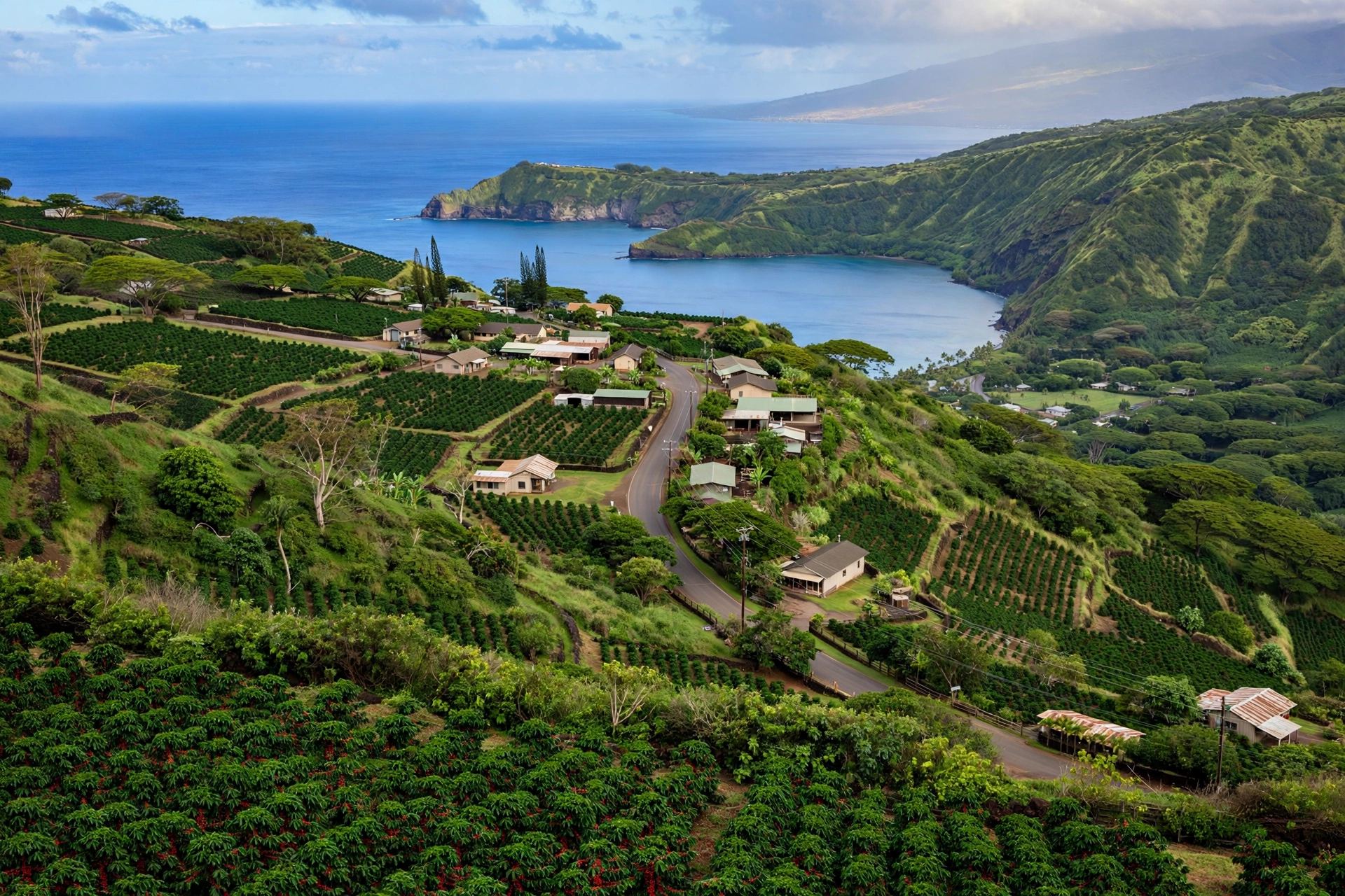
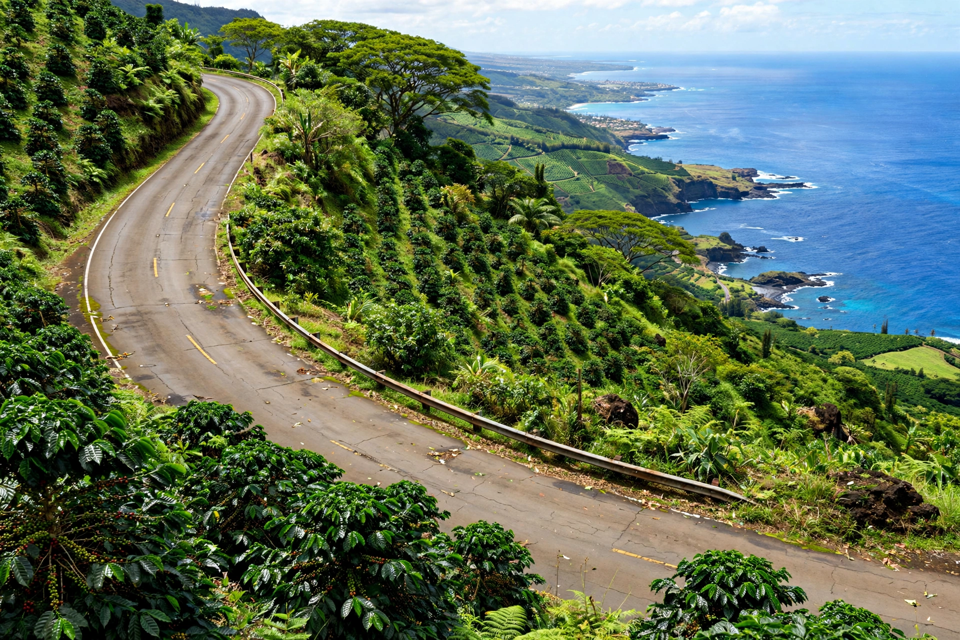
Captain Cook is a small rural town on the west side of the Big Island of Hawaiʻi, about 12 miles south of Kailua-Kona along the Māmalahoa Highway (Highway 11). It sits on the green, forested slopes above Kealakekua Bay at roughly 1,200 feet of elevation, in the heart of Kona coffee country. The town is a census-designated place with a population of around 3,400 residents, spread across a quiet landscape of coffee farms, macadamia orchards, and family homes shaded by mango and avocado trees.
Despite its small size, the name Captain Cook carries outsized weight in Hawaiian history. The town is named for Captain James Cook, the British explorer who anchored in nearby Kealakekua Bay in January 1779 and died there the following month in a confrontation with Hawaiians. The bay below the town is one of the most historically significant places in the islands: a marine life conservation district, a place of deep cultural importance, and the site of the white obelisk monument that marks where Cook fell.
Visitors come to the Captain Cook area for three main reasons. The first is Kealakekua Bay itself, a crescent of remarkably clear water famous for snorkeling, with the Captain Cook Monument standing on its far shore at Kaʻawaloa. The second is Kona coffee: the slopes around the town hold some of the oldest and most respected coffee farms in Hawaiʻi, many offering tastings and farm walks. The third is the area’s history and scenery, from the Amy B.H. Greenwell Ethnobotanical Garden to the dramatic coastline of South Kona.
Captain Cook is not a resort town and has no beaches of its own. It is a working agricultural community that happens to sit above one of the most beautiful bays in Hawaiʻi. Travelers who stay here or pass through are looking for a quieter, more local side of the Kona coast, and the town delivers exactly that.
The Town of Captain Cook
The town of Captain Cook stretches along Highway 11 as it climbs from the coast toward the uplands of South Kona. There is no single town center in the conventional sense. Instead, the community is a loose collection of homes, farms, small businesses, a post office, schools, and churches spread along the highway and its side roads. Life here moves at a rural pace, and the town’s character is defined by agriculture rather than tourism.
Elevation shapes everything in Captain Cook. At around 1,000 to 1,500 feet, the town sits above the hot coastal strip and below the cooler uplands. Afternoon clouds roll in most days, bringing the brief showers that coffee trees love. Temperatures are mild year round, typically in the 70s during the day and cooler at night than the Kona coast below. Visitors driving up from Kailua-Kona notice the change within minutes: the dry lava fields give way to green pasture, then to dense vegetation as the road climbs.
A Working Agricultural Community
Coffee is the economic and cultural backbone of Captain Cook. The town lies within the Kona coffee belt, the narrow strip of volcanic slope between roughly 800 and 2,500 feet where Kona coffee has been grown since the 1800s. Family farms, some just a few acres, dot the hillsides. Many have been in the same families for generations, and the harvest season from late summer through winter is the busiest time of year.
Macadamia nuts are the other major crop. Large orchards spread across the slopes around the town, and the sight of macadamia trees in flower is one of the area’s quiet seasonal pleasures. Between the farms are homes on multi-acre lots, many with fruit trees, vegetable gardens, and the occasional horse or goat. This is a place where people grow things, and the landscape reflects it.
Daily Life and Services
Captain Cook has the essentials: a grocery store, a post office, banks, gas stations, schools, and a handful of local eateries. It does not have the shopping centers, resort restaurants, or nightlife of Kailua-Kona. Residents drive to Kona for major shopping and to Kealakekua, just north, for additional services. The neighboring community of Kealakekua is so close that the two blend together along the highway, and visitors often experience them as one continuous area.
The town’s pace is one of its defining features. Mornings start early with farm work. The highway carries a steady flow of commuters to Kona and back. Evenings are quiet. For travelers, this means Captain Cook works best as a base for people who want a peaceful place to sleep and easy access to South Kona’s attractions, not as a destination for dining or entertainment.
Kealakekua Bay and the Monument
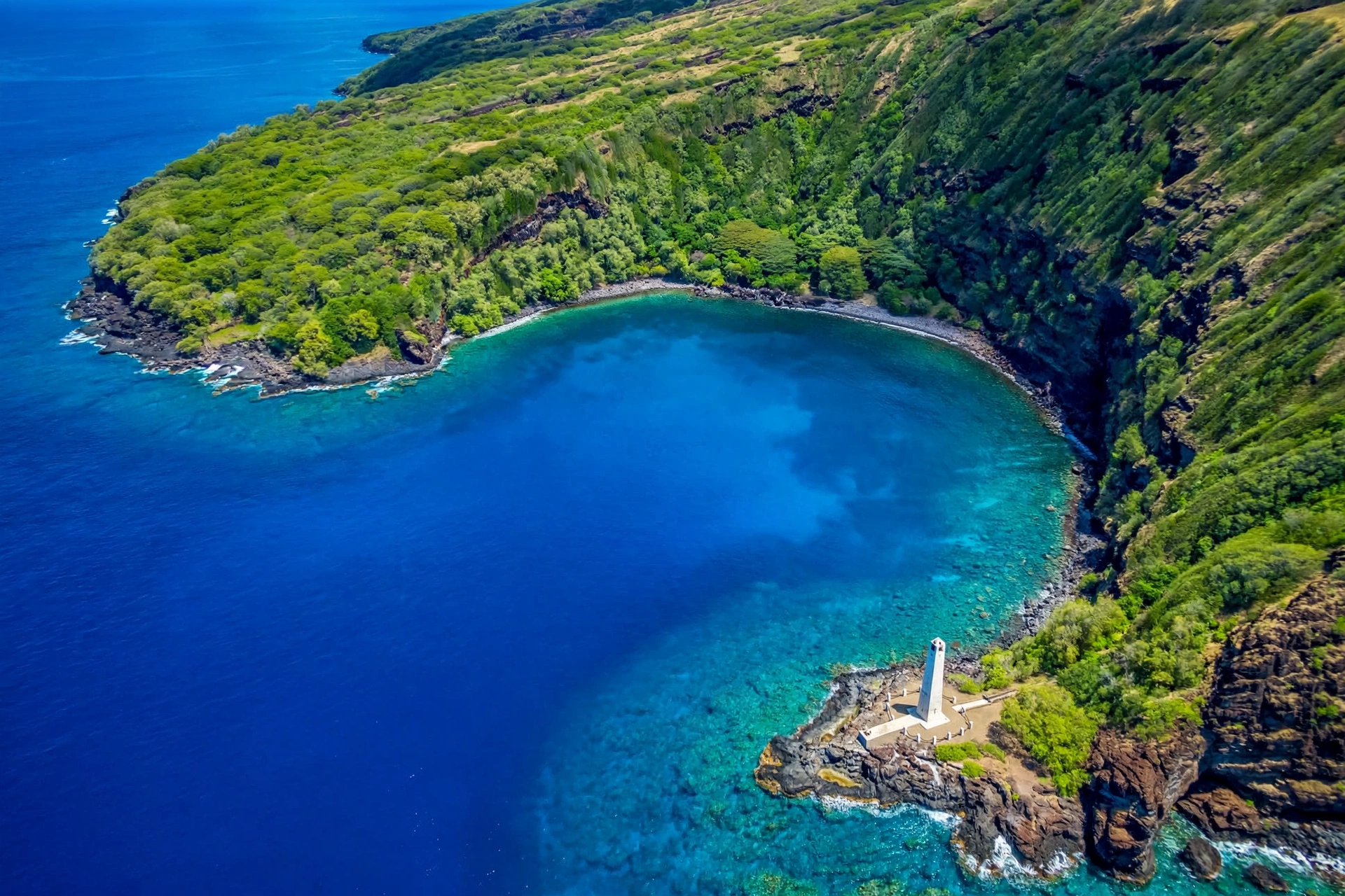
Kealakekua Bay lies directly below the town of Captain Cook, a deep, sheltered crescent of water that is widely considered one of the finest snorkeling spots in Hawaiʻi. The bay is a Marine Life Conservation District, which means fishing and the taking of marine life are restricted, and the result is an underwater environment of unusual clarity and abundance. Spinner dolphins rest in the bay during the day, green sea turtles cruise the shallows, and the coral gardens along the bay’s edges hold clouds of tropical fish.
The bay’s Hawaiian name, Kealakekua, means “the pathway of the god,” a reference to its deep cultural significance. In ancient times, the bay was a center of religious and political life. The cliffs and shoreline hold heiau (temples) and burial sites, and the area remains sacred to Native Hawaiians. Visitors should treat the entire bay with the respect due a place of worship: stay on established paths, do not disturb rocks or structures, and keep noise low.
The Captain Cook Monument
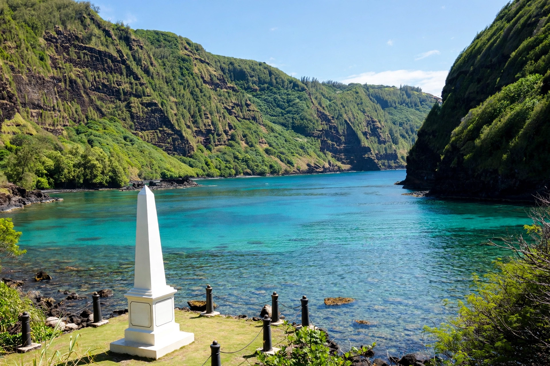
The white obelisk known as the Captain Cook Monument stands on the far shore of the bay at Kaʻawaloa, near the spot where Cook died on February 14, 1779. The monument was erected in 1878 and the small parcel of land around it was deeded to the United Kingdom, with the surrounding parcel deeded to the United Kingdom. A plaque at the site commemorates Cook’s voyages and his death.
Reaching the monument requires honest planning, because there is no road to Kaʻawaloa. The three options are the hike, the water, or a boat, and each has real constraints.
The Kaʻawaloa Trail
The Kaʻawaloa Trail descends from Napoʻopoʻo Road below Highway 11 to the bay’s north shore to the monument, dropping roughly 1,300 feet over about 1.9 miles each way. The trail is steep, rocky, and fully exposed to the sun, with no water and no shade for most of its length. Hikers should carry at least two liters of water per person, wear sturdy shoes, and start early in the morning. The descent takes about 45 minutes to an hour; the climb back up takes significantly longer, often 90 minutes or more, and the midday heat makes it genuinely strenuous. This is not a casual stroll. People in poor physical condition, or anyone unprepared for a hot, steep climb, should not attempt it.
At the bottom, the trail reaches a rocky shoreline near the monument. There are no facilities: no restrooms, no drinking water, no lifeguard. Snorkeling from this shore is excellent, but the entry is over sharp lava rock and the water drops off quickly. Bring reef-safe sunscreen, and pack out everything you carry in.
By Water
Many visitors reach the monument side of the bay by kayak or on boat tours departing from Keauhou or Kailua-Kona. Kayak access has specific rules: kayaks may only launch from authorized locations, and landing at Kaʻawaloa is restricted. Independent kayakers should check current State of Hawaiʻi DLNR Division of State Parks rules before going, because the regulations around the bay’s south shore have changed over the years and are actively enforced. Boat tours that visit the bay operate under commercial permits and are the simplest legal way to snorkel the monument side without hiking.
Whichever way you go, the bay rewards preparation. Go early for the calmest water and the best visibility. The bay’s clarity is legendary, but winter swells can make the water rough, and the south shore entry is not a sandy beach. This is a place to visit with respect for both the ocean and the history.
Coffee Country
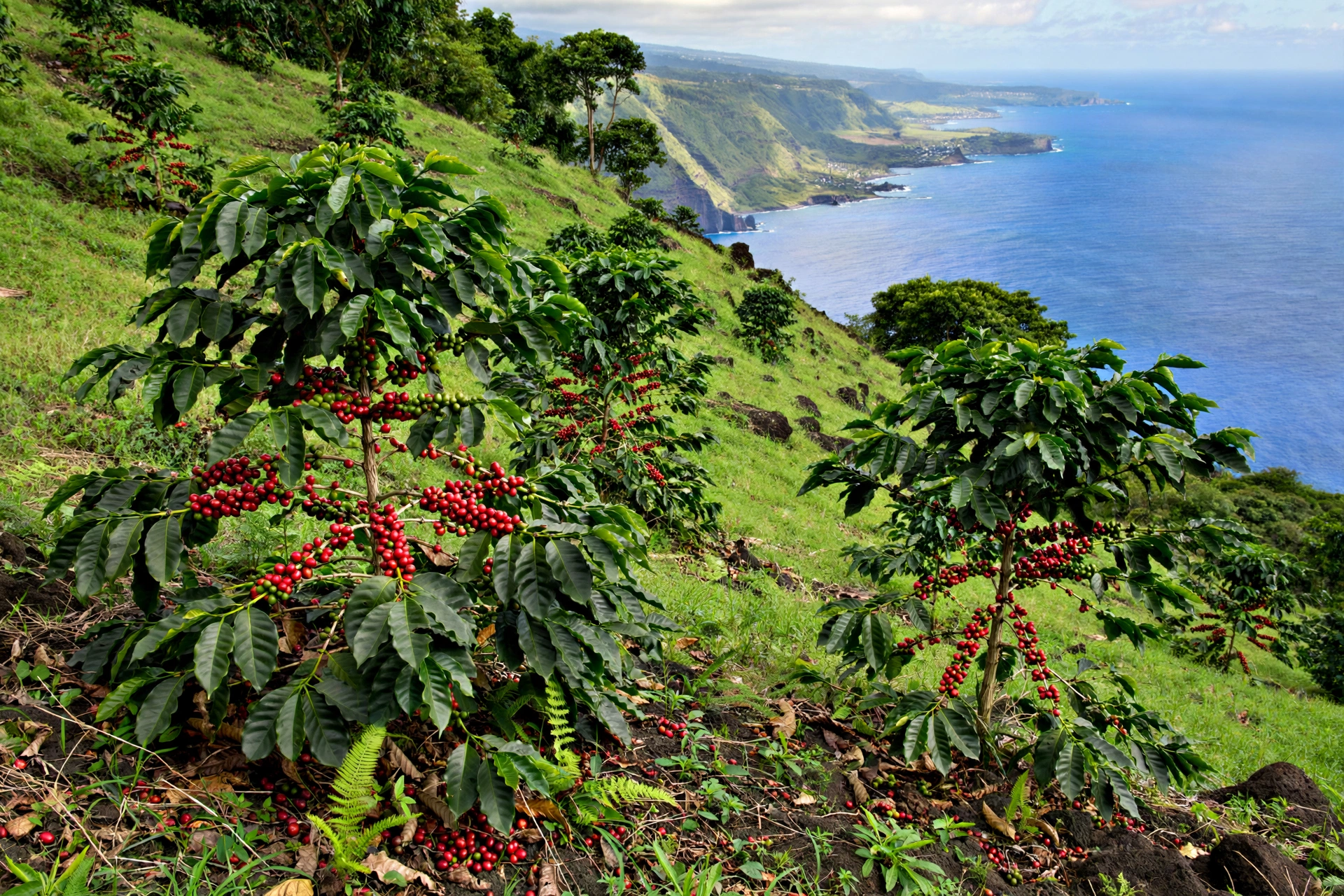
The slopes around Captain Cook are the heart of the Kona coffee district, one of the most famous coffee-growing regions in the world. Kona coffee grows in a narrow belt on the western slopes of Hualālai and Mauna Loa, roughly between 800 and 2,500 feet of elevation, where the combination of volcanic soil, morning sun, afternoon cloud cover, and gentle rainfall creates ideal growing conditions. The town of Captain Cook sits squarely in this belt, and coffee farms surround it on every side.
Coffee arrived in the Kona district in the early 1800s, and the industry took root in the late 1800s as small family farms replaced larger plantation experiments. The 20th century saw the rise of the smallholder model that still defines Kona coffee: hundreds of independent farms, many under ten acres, growing, picking, and processing their own beans. Harvest runs from late summer through early winter, and because Kona coffee is picked by hand, cherry by cherry, the harvest is labor intensive and the coffee commands premium prices.
Visiting Coffee Farms
Many farms around Captain Cook welcome visitors for tastings and farm walks. A typical visit includes a short walk through the coffee trees, an explanation of the growing and roasting process, and a tasting of several roasts. These visits are one of the best ways to understand the area: the farmers know the land intimately, and the setting, among the trees with the ocean glittering below, is beautiful.
A few practical notes. Farm visits are generally free or low cost, but they are working farms, not theme parks. Wear closed shoes, bring sun protection, and stay on the paths. During harvest season, the farms are busy and some may limit visits. It is always wise to check hours in advance. And when you taste, remember that 100 percent Kona coffee is the real article: blends labeled “Kona” may contain only a small fraction of Kona beans, so read labels if you buy.
Why the Slopes Matter
The geography that makes Captain Cook good for coffee is worth understanding. The town sits on the western flank of Mauna Loa, where young volcanic soils drain quickly and force coffee roots deep. The elevation keeps temperatures moderate. The daily weather pattern, sunny mornings and cloudy afternoons, protects the cherries from harsh midday sun while delivering regular moisture. No irrigation is needed in most years. This combination exists in very few places on earth, which is why Kona coffee tastes the way it does and why the farms cluster exactly here.
The History Behind the Name
The town is named for Captain James Cook, and the story of how that name came to be attached to this stretch of the Kona coast is one of the most consequential in Hawaiian history. It is also a story that deserves to be told carefully, because it involves first contact, cultural misunderstanding, and a death that changed the islands forever.
Cook’s Arrival
James Cook first reached the Hawaiian Islands in January 1778, landing at Kauaʻi. He named the archipelago the Sandwich Islands, after his patron the Earl of Sandwich. After exploring the North Pacific, he returned to Hawaiʻi in late 1778 and anchored in Kealakekua Bay on January 17, 1779.
The timing of his arrival mattered enormously. Cook sailed into Kealakekua Bay during Makahiki, the annual Hawaiian festival season honoring the god Lono, a time when warfare was suspended and tribute was collected. Some Hawaiians associated the tall sails of Cook’s ships with the traditional return of Lono, and Cook and his men were received with extraordinary ceremony and generosity. For several weeks, the British traded for provisions and explored the bay, while Hawaiian chiefs hosted them with feasts.
The Death at Kealakekua Bay
Cook departed the bay in early February 1779, but a broken foremast forced his ships to return within days. The Makahiki season had ended, the mood had shifted, and the Hawaiians’ patience with the visitors’ demands was wearing thin. Tensions escalated over a series of incidents, including the theft of a ship’s cutter. On February 14, 1779, Cook went ashore with armed marines intending to take the high chief Kalaniʻōpuʻu hostage until the boat was returned. A crowd gathered, a confrontation erupted, and Cook was killed on the shoreline at Kaʻawaloa, along with four marines. Several Hawaiians also died in the fighting.
The events at Kealakekua Bay marked a turning point. Cook’s voyages had put Hawaiʻi on European maps, and the decades that followed brought traders, missionaries, and eventually the overthrow of the Hawaiian Kingdom. The monument at Kaʻawaloa, erected by Cook’s countrymen in 1874, commemorates the explorer. But the bay’s deeper history belongs to the Hawaiians who lived there for centuries before his sails appeared, and any honest account of the place holds both histories at once.
The Town That Took His Name
The community of Captain Cook grew up in the late 1800s and early 1900s as coffee farming expanded across the Kona slopes. The post office adopted the name, and it stuck. Unlike the monument, which marks a specific historical event, the town’s name is a general tribute, a reminder of how thoroughly Cook’s brief visit reshaped the islands’ place in the world. Today the town is far better known for coffee than for its namesake, which is perhaps fitting: the land, not the explorer, is what endures.
What to See
The Captain Cook area rewards travelers who like to explore at a slow pace. The attractions here are natural and historical rather than commercial, and most are free or low cost.
Amy B.H. Greenwell Ethnobotanical Garden
Located just off the highway in Captain Cook, the Amy B.H. Greenwell Ethnobotanical Garden is a 15-acre garden devoted to the native and Polynesian-introduced plants of Hawaiʻi, organized by the four traditional land zones: coastal, lowland, upland, and highland. Operated by the Bernice Pauahi Bishop Museum, the garden is both beautiful and educational, with labeled plants and explanations of their traditional uses. It is one of the best places on the island to understand the relationship between Hawaiians and the land. Check current hours before visiting, as the garden’s schedule has varied.
Kealakekua Bay Overlook and Napoʻopoʻo
The village of Napoʻopoʻo sits at the head of Kealakekua Bay, below the town of Captain Cook. The bay overlook on the highway offers a stunning panoramic view, and the road down to Napoʻopoʻo leads to the bay’s shoreline, where the water is calm and clear. This side of the bay is the easiest place to experience Kealakekua’s water without the Kaʻawaloa hike. Snorkeling here is good, though the very best water is across the bay at the monument side.
Puʻuhonua o Hōnaunau
A short drive south of Captain Cook lies Puʻuhonua o Hōnaunau National Historical Park, one of the most important cultural sites in Hawaiʻi. This was a place of refuge in ancient times, where those who broke kapu (sacred law) could be absolved by reaching its grounds. The park preserves royal grounds, temples, fishponds, and the great wall that enclosed the refuge. It is an essential stop for anyone interested in Hawaiian history, and it pairs naturally with a visit to the Captain Cook area.
Hōlualoa Village
North of Captain Cook along the highway, the village of Hōlualoa is a small arts community with galleries, coffee shops, and historic buildings. It makes a pleasant stop on the drive between Kailua-Kona and Captain Cook, and its elevation offers sweeping views of the Kona coast.
Getting There
Captain Cook is an easy drive from anywhere on the Kona side of the Big Island. From Kailua-Kona, take Highway 11 (the Māmalahoa Highway) south for about 12 miles; the drive takes 20 to 30 minutes depending on traffic. From Keauhou, it is about 15 minutes south. From the Kona International Airport at Keāhole, allow 35 to 45 minutes via Highway 19 south to Highway 11.
From Hilo and the east side, the drive crosses the island via the Saddle Road (Highway 200) to Kona, then south on Highway 11: allow about two hours total. From Waimea, take Highway 190 south to Highway 11, about an hour.
A rental car is effectively essential. There is limited public bus service along the Kona coast, but it does not serve the farms, trailheads, and viewpoints that make the area worth visiting. Parking in Captain Cook itself is easy and free. At Kealakekua Bay, parking near Napoʻopoʻo is limited and fills early on weekends; arrive in the morning for the best experience. Fuel up in Kailua-Kona or Kealakekua, as gas stations are sparse south of town.
Frequently Asked Questions
Where exactly is Captain Cook, Hawaiʻi?
Captain Cook is a town on the west (Kona) side of the Big Island of Hawaiʻi, about 12 miles south of Kailua-Kona along Highway 11. It sits on the slopes above Kealakekua Bay at roughly 1,200 feet of elevation, in the heart of Kona coffee country.
Why is it called Captain Cook?
The town is named for Captain James Cook, the British explorer who anchored in nearby Kealakekua Bay in January 1779 and died there on February 14, 1779. The community adopted the name when it grew up around the coffee industry in the late 1800s.
How do I get to the Captain Cook Monument?
The monument stands at Kaʻawaloa on the far shore of Kealakekua Bay, with no road access. You can hike the steep Kaʻawaloa Trail (about 1.9 miles each way, 1,300 feet of elevation change, no shade or water), reach it by kayak launched from authorized locations under current state rules, or visit on a permitted boat tour. The hike is strenuous and should not be attempted unprepared.
Is Kealakekua Bay good for snorkeling?
Yes, it is considered one of the best snorkeling spots in Hawaiʻi, thanks to its protected status as a Marine Life Conservation District. The clearest water and healthiest coral are on the monument side of the bay. Go early in the morning for the calmest conditions.
Can I visit a Kona coffee farm near Captain Cook?
Yes. Many family farms around Captain Cook offer tastings and farm walks, usually free or low cost. These are working farms, so wear closed shoes, stay on paths, and check hours in advance, especially during harvest season from late summer through winter.
How far is Captain Cook from the Kona airport?
About 35 to 45 minutes by car from the Kona International Airport at Keāhole, via Highway 19 south to Highway 11. From Kailua-Kona, it is 20 to 30 minutes south on Highway 11.
Are there beaches in Captain Cook?
No. Captain Cook sits on the slopes above the coast and has no beaches of its own. The nearest ocean access is at Kealakekua Bay below the town, which is rocky shoreline rather than sand. Sandy beaches are a 20 to 30 minute drive north toward Kailua-Kona and beyond.
What is there to do near Captain Cook?
Snorkel Kealakekua Bay, hike to the Captain Cook Monument, tour Kona coffee farms, visit the Amy B.H. Greenwell Ethnobotanical Garden, and drive south to Puʻuhonua o Hōnaunau National Historical Park. The area suits travelers seeking nature, history, and a quieter side of the Kona coast.
Related Guides
- Where Is the Big Island in Hawaiʻi
- Hawaiʻi Volcanoes
- Where Is Hualālai in Hawaiʻi
- Puna, Hawaiʻi
- Big Island Hawaiʻi Weather
- Hawaiʻi Map
- Best Time to Visit Hawaiʻi
A Final Note
Captain Cook is a place where Hawaiʻi’s layers sit close together. A small farming town on a volcanic slope, named for an explorer who stayed only weeks, looks down on a bay that Hawaiians held sacred for centuries before his sails appeared. The coffee trees, the monument’s white obelisk, the clear water of the bay, and the quiet of the upland roads all belong to the same landscape, and understanding any one of them is easier when you know the others. Visit with curiosity and with respect, and the area will reward both.