North Shore Kauai: Hanalei, the Lighthouse, Ke’e Beach and the Na Pali Coast

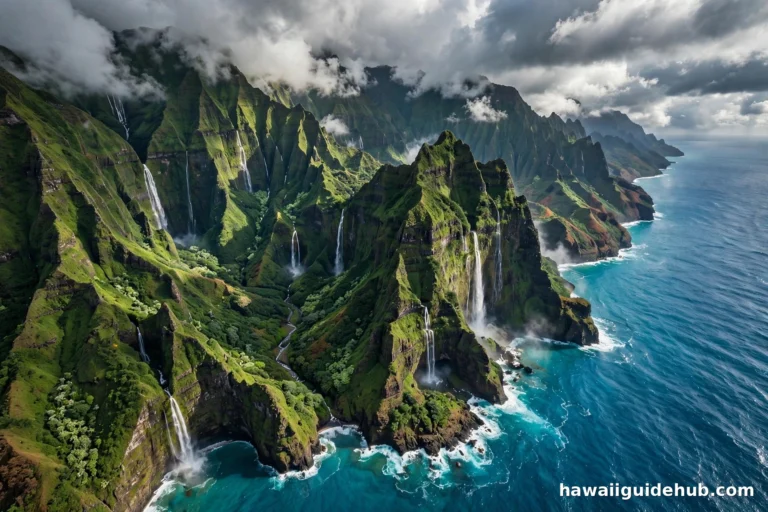
Kauaʻi’s North Shore is the part of the island that makes people gasp out loud. Green peaks shoot straight out of the ocean, waterfalls thread down cliffs after every rain, and the road itself gets narrower and wilder the farther west you drive. This is the Garden Isle at its most dramatic, and it packs an astonishing amount into roughly 17 miles of coastline between Kīlauea and Hāʻena.
This guide covers the whole North Shore from east to west: the towns, the beaches, the lighthouse, the trailheads, and the practical details that make or break a visit. Read it before you go, because this side of the island rewards planning more than almost anywhere else in Hawaiʻi.
Where Exactly Is Kauaʻi’s North Shore
The North Shore begins where Kūhiō Highway leaves the east side and bends north past Kīlauea. From there, the road, numbered Highway 56 and then Highway 560 past Princeville, traces the coast through Hanalei and keeps going until it simply ends at Hāʻena State Park. There is no way through to the west side by car. The Nā Pali Coast begins where the pavement stops.
Geography shapes everything here. The North Shore faces the open North Pacific, so it takes the full force of winter swells. It is also the wettest side of the island, sitting in the shadow of Mount Waiʻaleʻale, one of the rainiest spots on earth. That rain is the reason the cliffs are so green and the waterfalls so constant. Pack a light rain jacket no matter the season.
Hanalei Bay: The Heart of the North Shore
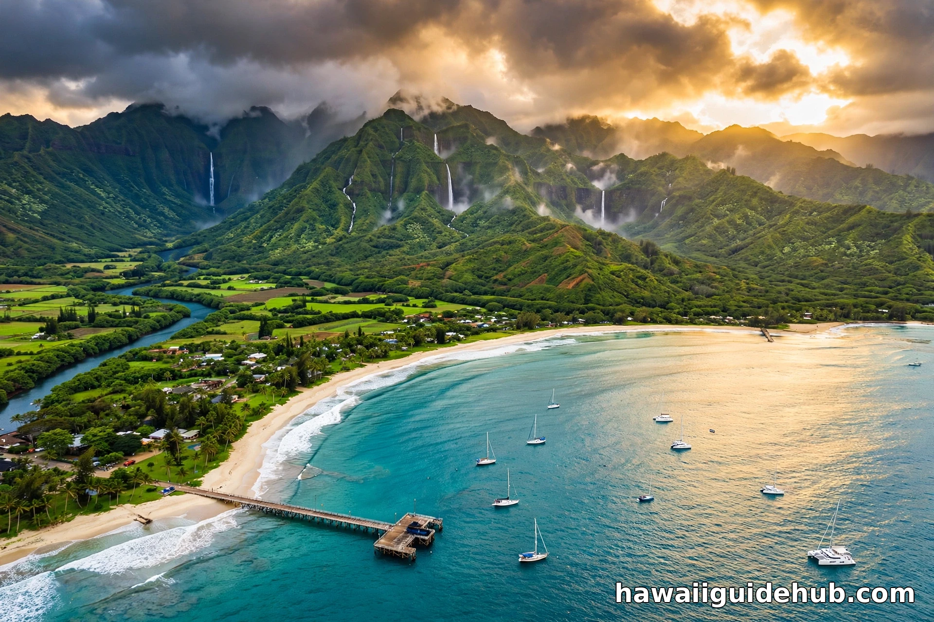
If the North Shore has a center, it is Hanalei Bay. The bay is a sweeping two-mile crescent of sand framed by emerald mountain ridges, and it is consistently ranked among the most beautiful beaches in Hawaiʻi. The water changes personality with the seasons. In summer, from about May through September, it is calm and swimmable, with gentle waves and good conditions for paddleboarding. In winter, the North Pacific sends in powerful surf, and the bay becomes a show for surfers and spectators instead.
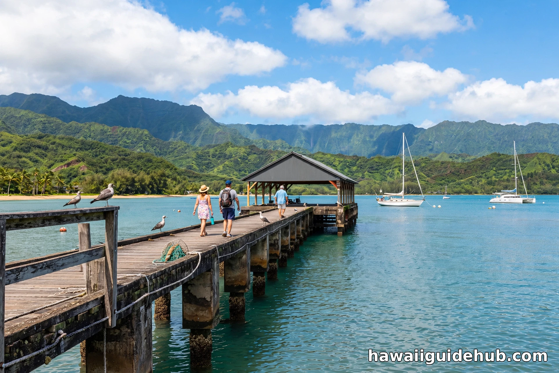
The Hanalei Pier juts into the middle of the bay and is the classic photo stop. The pier was originally built in 1892 to serve the rice trade and was rebuilt in concrete in 1921. It has appeared in films and countless postcards, and walking to its end at sunset with the mountains behind you is one of the signature Kauaʻi moments. For a deeper look at the bay itself, see our complete guide to Hanalei Bay.
Hanalei Town and the Valley Lookout
Hanalei town is a small surf community of plantation-era buildings housing surf shops, galleries, shave ice stands, and food trucks. It is the kind of place where one main street is all you need. Parking fills up by mid-morning in high season, so come early or be patient.
Before you drop down into town, stop at the Hanalei Valley Lookout on Highway 560. The view takes in the Hanalei River winding through patchwork taro fields with misty peaks behind them. Much of this farmland sits within the Hanalei National Wildlife Refuge, established in 1972 to protect endangered Hawaiian waterbirds like the nēnē, the Hawaiian coot, and the Hawaiian stilt. Taro has been grown in this valley for centuries, and it remains one of the most important taro-growing regions in the state. Our Hanalei things to do guide has more ideas for filling a day here.
Princeville: Resorts, Golf, and Queen’s Bath
Just east of Hanalei, Princeville sits on a bluff above the bay. It is a planned resort community with vacation rentals, condos, the 1 Hotel Hanalei Bay, and the Princeville Makai Golf Club, whose oceanfront holes are among the most scenic in Hawaiʻi. The bluff-top paths offer sweeping views down into Hanalei Bay and are worth a stroll even if you are not staying here.
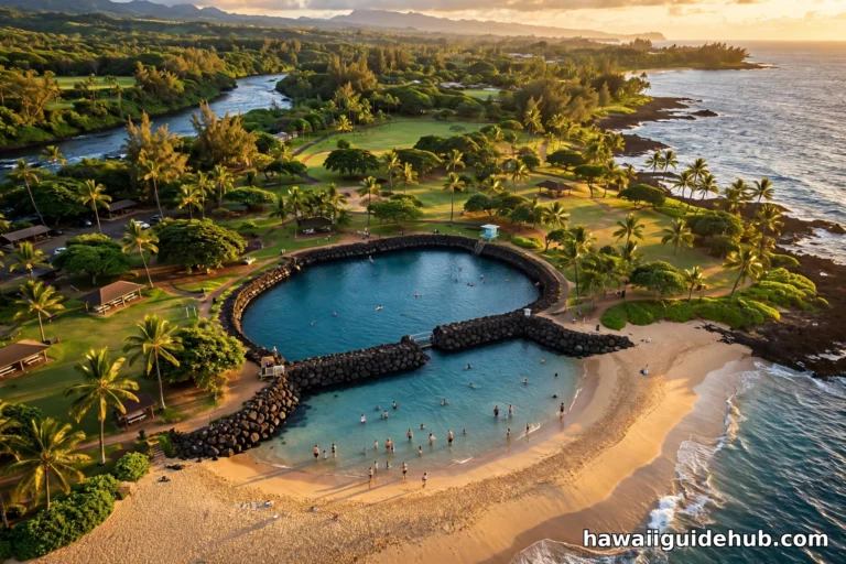
Princeville is also the access point for Queen’s Bath, a natural tide pool in the lava rock below the cliffs. It is beautiful and genuinely dangerous. Waves can sweep across the rocks without warning, and rescues and drownings have occurred here, especially in winter. If you go, visit only on a calm summer day, check ocean conditions first, wear sturdy shoes for the muddy trail, and never turn your back on the sea. When in doubt, admire it from the overlook and skip the swim.
Kīlauea and the Kīlauea Lighthouse
The town of Kīlauea, a few miles east of Princeville, is worth a stop for its plantation-era charm and the Kong Lung Market Center, a good spot for coffee and local goods. But the main attraction is at the end of Kīlauea Road.
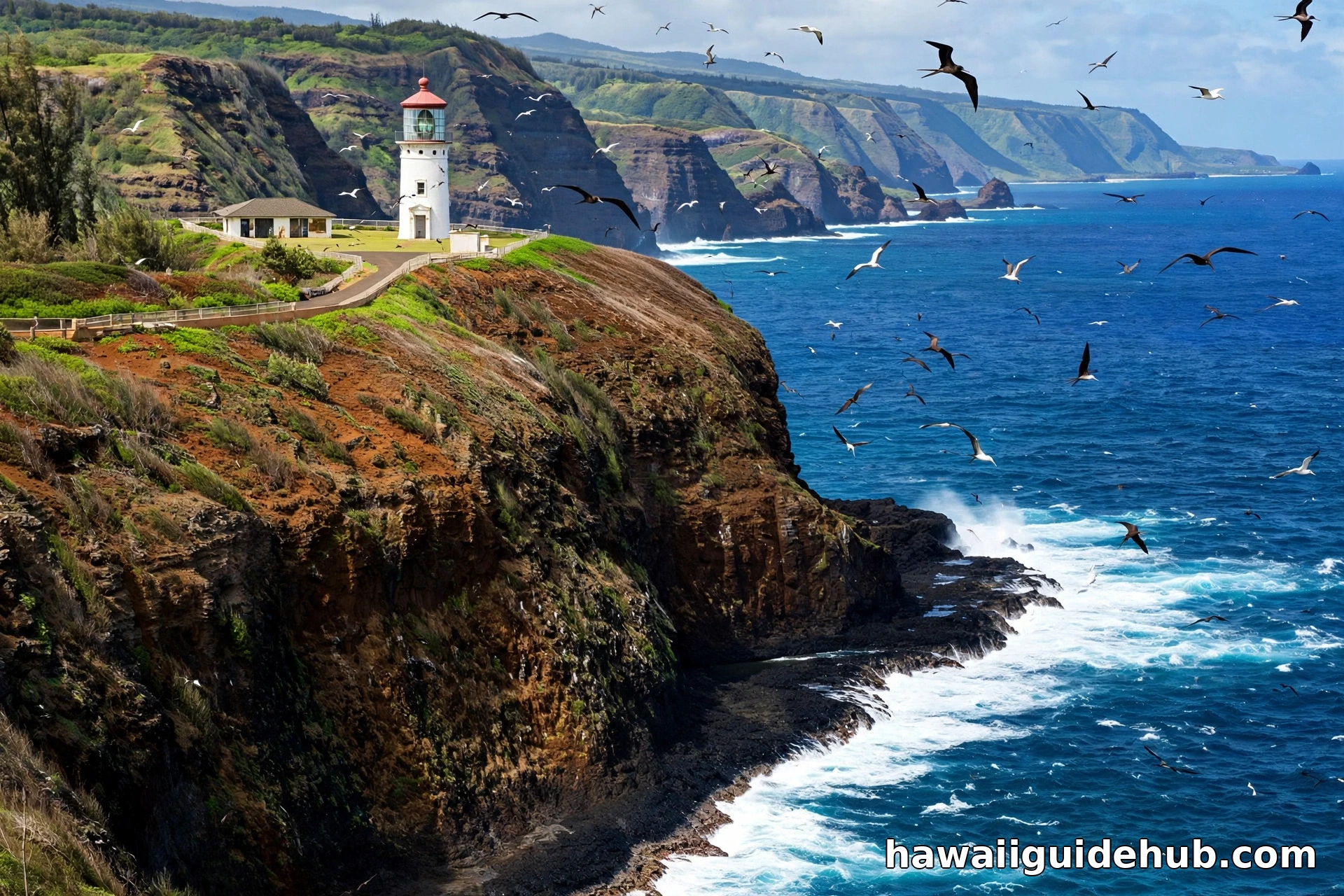
The Daniel K. Inouye Kīlauea Point Lighthouse was completed in 1913 as a navigation aid for ships in Hawaiian waters and now anchors the Kīlauea Point National Wildlife Refuge. The refuge protects nesting seabirds including red-footed boobies, Laysan albatrosses, and great frigatebirds, plus nēnē and, in season, humpback whales offshore. The lighthouse sits on a cliff 180 feet above the ocean with some of the finest coastal views on the island.
Status alert (October 2026): the refuge is temporarily closed for post-hurricane repairs after Hurricane Lowell, and the ticketed-entry reservation system is currently unavailable. Check the official U.S. Fish and Wildlife Service page for Kilauea Point before visiting. When the refuge is open, it operates Wednesday through Saturday, 10 AM to 4 PM, with last entry at 3:30 PM. Reservations are required through Recreation.gov, and admission is $10 per adult plus a small reservation fee, with children 15 and under free. Interior lighthouse tours are currently suspended, so visits focus on the grounds, exhibits, and viewpoints. When open, book well ahead, because entry slots fill up.
Anini Beach: The Calm Snorkeling Refuge
Anini Beach sits just west of Kīlauea and is protected by one of the longest barrier reefs in Hawaiʻi, stretching roughly two miles offshore. The reef keeps the water calm and shallow, making Anini one of the most reliable snorkeling and swimming spots on the North Shore, even when other beaches are rough. The county park has restrooms, showers, picnic tables, and campsites, and the beach is popular with windsurfers on the outer reef. Go in the morning for the clearest water and lightest wind.
Tunnels Beach: Summer Snorkeling at Its Best
Tunnels Beach, known locally as Makua, sits just before Hāʻena and is many visitors’ favorite snorkel spot on the island. In summer, the inner reef is calm and clear, with coral gardens, reef fish, and frequent green sea turtles. The beach is also a favorite launch point for scuba divers heading to the outer reef formations.
The seasonal warning matters here more than almost anywhere: in winter, Tunnels can have dangerous surf and strong currents. Only snorkel when conditions are calm, check the daily ocean report, and stick to the protected inner reef. Parking is extremely limited along the road, so arrive early.
Hāʻena and Kēʻe Beach: The End of the Road
Past Tunnels, the highway narrows and winds through Wainiha before reaching Hāʻena, where the road ends at Hāʻena State Park. This is the gateway to the Nā Pali Coast and home to Kēʻe Beach, a reef-protected lagoon that is lovely for summer snorkeling and famous for its sunsets, with the peak of Makana, nicknamed Bali Hai, rising behind the beach.
Access is managed through a reservation system. Non-residents need advance reservations to enter Hāʻena State Park: park entry is $5 per person, parking is $10 per vehicle, and there is also a shuttle option from Waipā. Reservations open 30 days in advance and the popular slots sell out quickly, so book the moment your date becomes available. Near the park entrance, stop at the Maniniholo Dry Cave and the two wet caves, Waikanaloa and Waikapalae, sea caves left high and dry as the shoreline receded. Swimming is not allowed in the wet caves.
The Kalalau Trail and the Nā Pali Coast
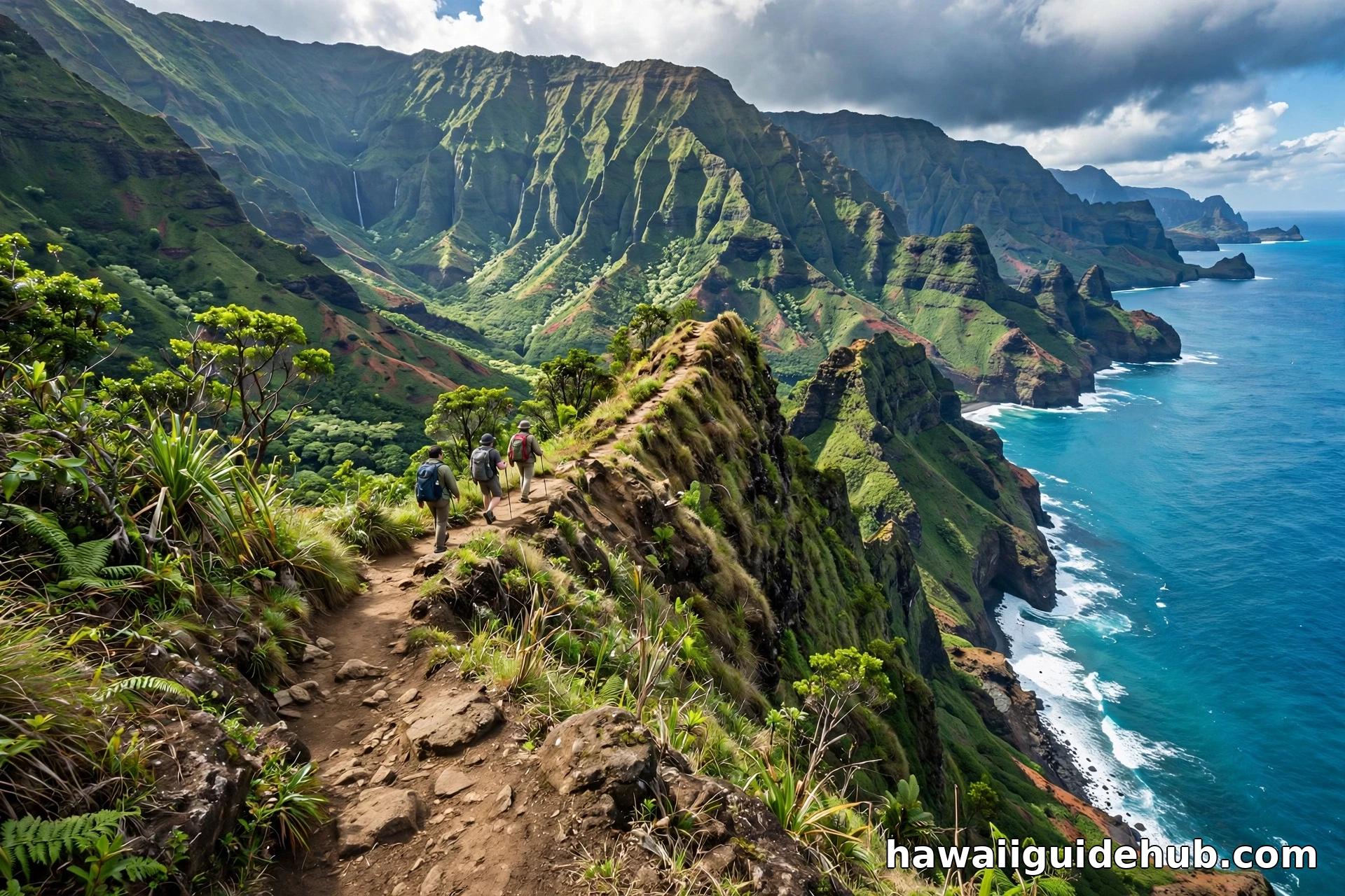
The Kalalau Trail begins at Kēʻe Beach and runs 11 miles along the Nā Pali Coast to Kalalau Valley, crossing five valleys on one of the most celebrated hikes in the world. The first two miles to Hanakāpīʻai Beach make a strenuous but doable day hike, with an optional two-mile side trip to Hanakāpīʻai Falls. Beyond Hanakāpīʻai, a Nāpali Coast camping permit is required even for day hiking, and those permits open 90 days ahead and go fast.
An important status note: Hāʻena State Park and the Kalalau Trail were closed after Hurricane Lowell struck Kauaʻi in September 2026, and as of this writing the Division of State Parks has not announced a reopening date. Check the DLNR park notices before building any plans around the trail, and have a backup day ready. If the trail is closed during your visit, you can still experience the Nā Pali Coast by boat tour or helicopter flightseeing from elsewhere on the island. See our things to do on Kauai guide for alternatives.
Limahuli Garden and Preserve
Just before the end of the road, Limahuli Garden and Preserve, part of the National Tropical Botanical Garden, protects native plants and ancient taro terraces in a lush valley. The self-guided garden loop climbs to a viewpoint over the coast and is one of the most peaceful stops on the North Shore. Reservations are required, and the garden is closed on Sundays and Mondays. It pairs naturally with a Hāʻena beach day.
When to Visit the North Shore
Summer, roughly May through September, is the classic North Shore season: calm water, swimmable beaches, and the best snorkeling. This is also the busiest and most expensive time. Winter, roughly October through March, brings big surf, dramatic wave watching, and whale season from December through April, but many beaches become unsafe for swimming. Shoulder months like April and September can offer a nice balance of decent conditions and smaller crowds.
Rain is a year-round companion. Brief, intense showers are normal, and the mountains seem to manufacture their own weather. A morning can start clear in Princeville and pour in Hāʻena. Embrace it. The waterfalls are at their best right after rain.
Driving the North Shore: What to Know
Past Hanalei, Kūhiō Highway becomes a narrow, winding two-lane road with several one-lane bridges. The etiquette is simple: yield to oncoming traffic, cross slowly, and never stop on a bridge for photos. Drive with your headlights on and give yourself more time than the map suggests.
Parking is the North Shore’s scarcest resource. Tunnels, Kēʻe, and Hanalei all fill early. Arrive before 9 AM on weekends and holidays, park only in marked areas, and never on vegetation or blocking driveways. Tickets and towing are real here.
For first-time visitors to Hawaiʻi, the North Shore is best as a full day trip from a base elsewhere on Kauaʻi, or as a multi-night stay in Princeville or Hanalei if the budget allows. Either way, it belongs at the top of any Kauaʻi itinerary.
See the North Shore on Video
North Shore Kauai FAQs
How many days do you need for Kauai’s North Shore?
One full day covers the highlights from Kīlauea to Hāʻena if you start early. Two days lets you slow down, add the lighthouse and Limahuli Garden, and revisit a beach. Three or more days makes sense if you plan to hike part of the Kalalau Trail or want a relaxed beach rhythm.
Is the North Shore swimmable in winter?
Generally no. Winter swells make most North Shore beaches dangerous for swimming from about October through March. Anini Beach, behind its barrier reef, is the main exception, though conditions still vary. Always check the daily ocean safety report.
Do you need reservations for the North Shore?
Two stops require them: Hāʻena State Park, including Kēʻe Beach and the Kalalau Trailhead, and the Kīlauea Point National Wildlife Refuge with the lighthouse. Book both as far ahead as the systems allow.
Can you drive all the way around Kauai?
No. The road ends at Hāʻena State Park on the North Shore and at Polihale State Park on the west side. The Nā Pali Coast between them is accessible only on foot, by boat, or by air.
What is the best beach on Kauai’s North Shore for families?
Anini Beach is the safest bet thanks to its protective barrier reef and calm, shallow water. In summer, Hanalei Bay and Kēʻe Beach are also good family choices. Pair your beach days with outdoor adventures across Hawaii for a fuller trip.
A Coast Worth Slowing Down For
Kauaʻi’s North Shore is not a checklist destination. The best moments here come from lingering: a second lap around Hanalei town, a sunset at Kēʻe, a slow morning at Anini while the water is still glass. The reservations and the narrow road and the rain are all part of the deal, and they are a small price for a coastline that looks the way Hawaiʻi is supposed to look. Plan carefully, check the current park statuses, and give the North Shore the unhurried time it deserves.