
Ko ʻOlina on the Map
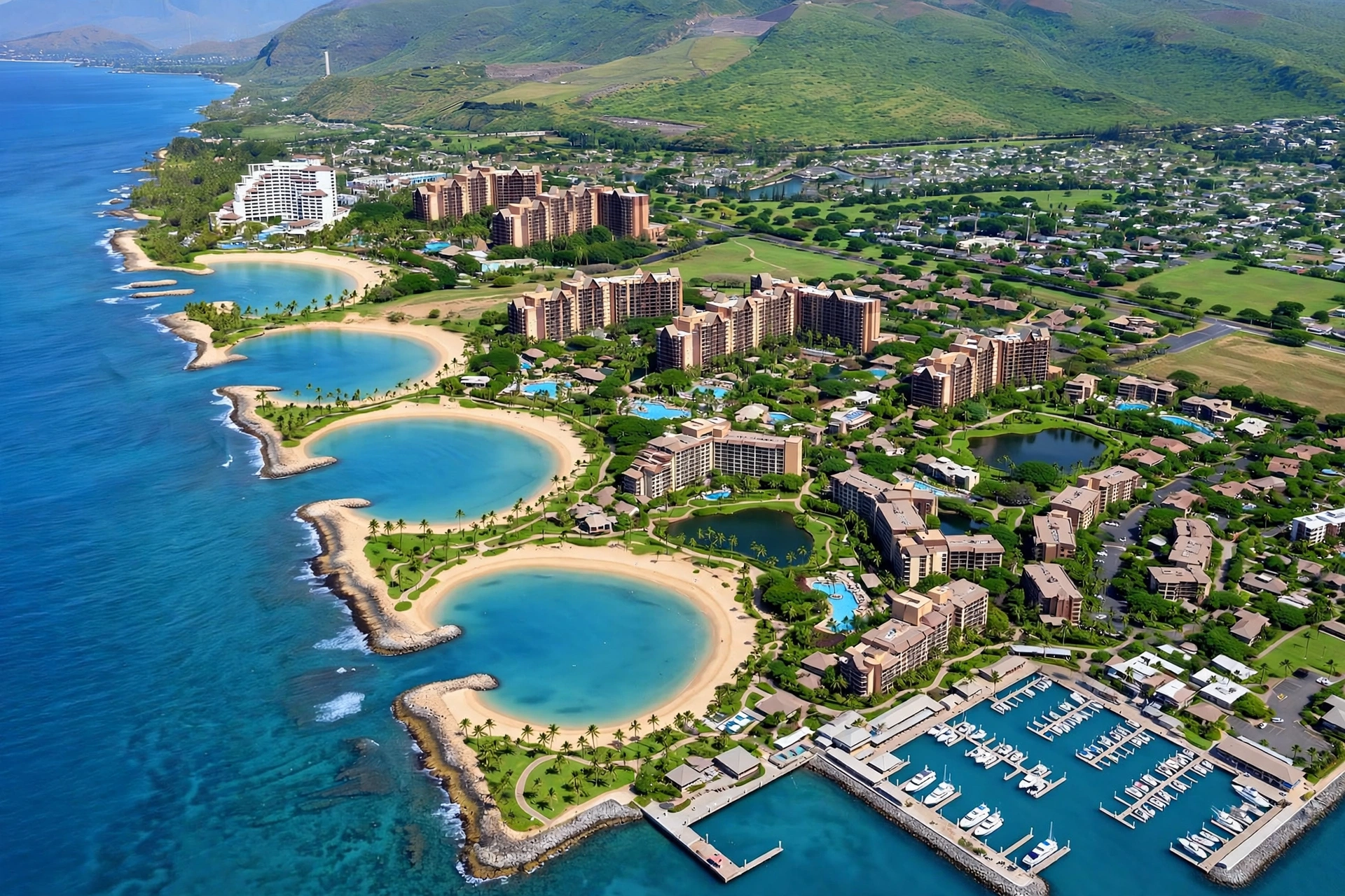
Ko ʻOlina sits on Oʻahu’s leeward coast, on the southwestern side of the island near the city of Kapolei. If you picture Oʻahu as a roughly diamond-shaped island, Honolulu and Waikīkī occupy the southeastern corner, the Waiʻanae coast runs up the western side, and Ko ʻOlina lies at the southwestern corner where the island turns north toward Waiʻanae. It is a master-planned resort community of roughly 650 acres, sitting between Kapolei to the east and the open ocean to the west, with the Waianae Range rising inland to the north.
Ko ʻOlina is about 17 miles from Honolulu International Airport and about 17 miles from downtown Honolulu. The drive from Waikīkī typically takes 35 to 45 minutes in light traffic and longer during commuter rush hours. The name Ko ʻOlina translates to “place of joy,” and the community has been developed as a resort destination since the mid-1980s, with major resorts, a golf course, a deep-draft marina, and four man-made oceanfront lagoons.
Ko ʻOlina is part of the City and County of Honolulu and carries the Kapolei mailing address (96707), but it functions as its own self-contained community. Access is by road: the H-1 freeway runs west from Honolulu to Kapolei, where Ko ʻOlina is reached by exit. There is no rail station at Ko ʻOlina, no airport, and no ferry. Public bus service reaches the edge of the community via Farrington Highway, but a rental car is the practical way to get here and to explore the surrounding area.
The leeward side of Oʻahu is the island’s driest and sunniest region, and Ko ʻOlina sits squarely in this rain shadow. The Waiʻanae Range blocks the northeast trade winds, so while the windward side and the mountain interior get frequent rain, Ko ʻOlina typically gets far less. This dry microclimate is one of the reasons the area was chosen for resort development: sunshine is the norm here in a way it is not on the windward coast. The trade-off is heat and exposure, especially on the open shoreline pathways and in the small lagoon parking lots, so sun protection and drinking water matter more here than in most other parts of the island.
On a map, look for Ko ʻOlina between two useful reference points: Kapolei, Oʻahu’s “second city,” about 10 minutes to the east, and the town of Waiʻanae, about 20 minutes to the north up the coast. The H-1 freeway ends near Kapolei, and Farrington Highway (Route 93) continues north from there along the Waiʻanae coast toward Waiʻanae town and Kaʻena Point at the island’s northwestern tip.
The Resort Community, Laid Out
Ko ʻOlina is a single master-planned community of about 650 acres, laid out along roughly two miles of oceanfront on Oʻahu’s southwestern shore. The community is organized around four man-made lagoons, which are numbered and named, running from north to south along the coast. Everything else in Ko ʻOlina, the resorts, the residential neighborhoods, the golf course, the marina, is arranged around these lagoons and the road network that serves them.
Aliʻinui Drive is the main road through the resort, running roughly north to south and connecting the lagoon parking areas, the resorts, and the residential areas. Waipahe Place, Olani Street, and other internal roads branch off Aliʻinui Drive to serve specific resorts and neighborhoods. Coming from H-1 westbound, the Ko ʻOlina exit leads directly onto the resort property through a gate, crossing a historic railroad right-of-way on the way in.
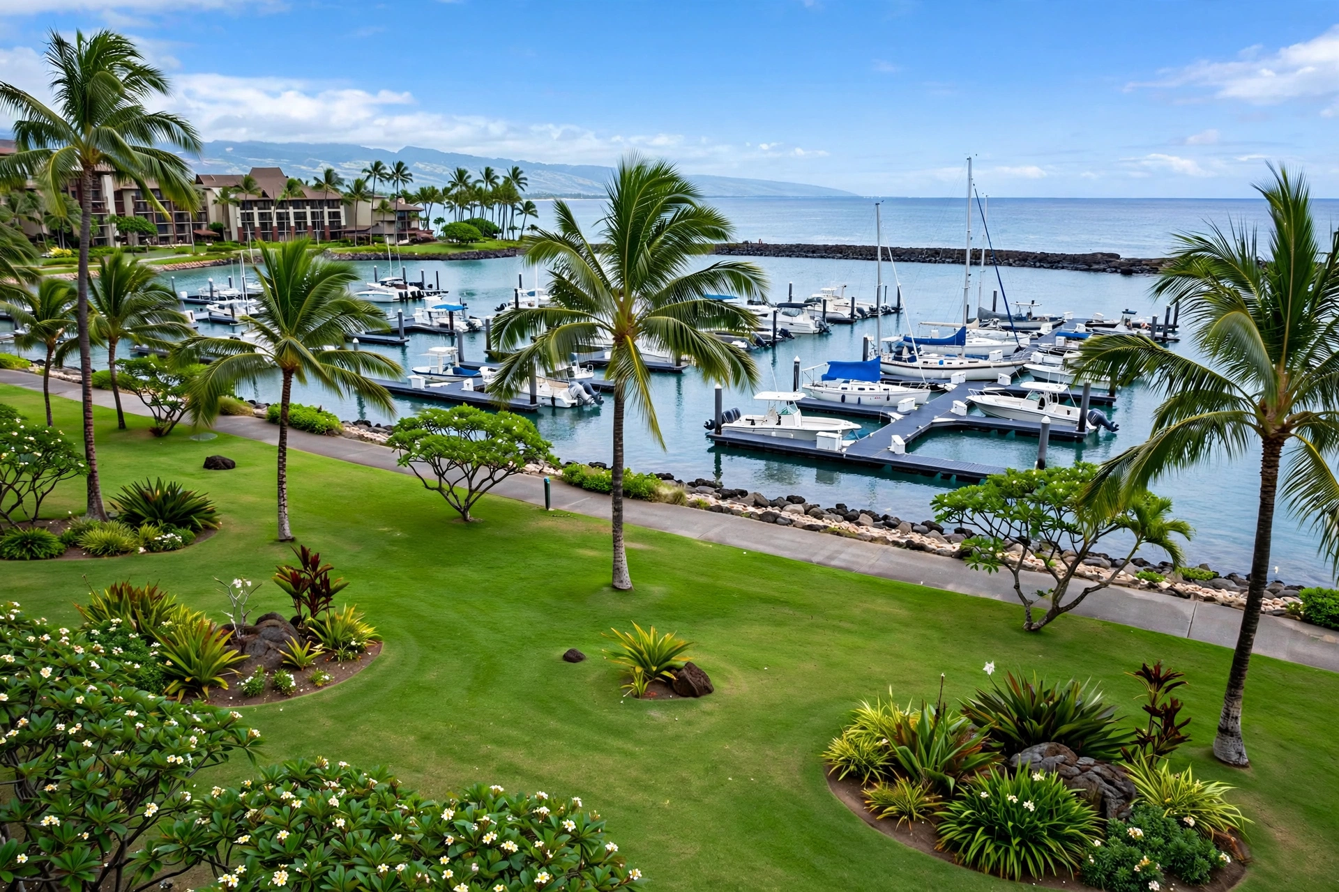
The northern end of the community is anchored by the nature preserve of Lanikūhonua, whose name means “where heaven meets the earth,” a quiet natural area of oceanfront land just north of the northernmost lagoon. Moving south, the four lagoons are strung along the coast in order: Kohola, Honu, Naiʻa, and Ulua. The large resorts sit behind and between the lagoons, each with frontage on one or more of the coves. The Ko ʻOlina Marina sits at the southern end of the community, with a broad grassy park, the grand lawn, spreading along the marina’s edge near the southernmost lagoon. The marina is Hawaiʻi’s only private deep-draft marina and serves as the departure point for fishing, sailing, snorkeling, and whale-watching trips, which makes the southern end of Ko ʻOlina the community’s main ocean-activity hub.
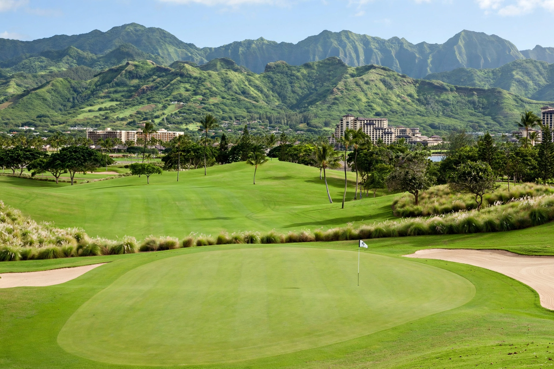
To the east of the resorts, across Aliʻinui Drive and the internal road network, lies the Ko ʻOlina Golf Club, an 18-hole course that occupies a large portion of the community’s eastern half. The course is set against the backdrop of the Waiʻanae Range, and its position on the map, east of the resort core and west of the residential neighborhoods, makes it the green buffer between the tourist zone and the residential side of the community. Beyond the golf course to the east are residential neighborhoods, and beyond those the town of Kapolei. The community is designed so that the 1.5 miles of landscaped shoreline pathways connect the lagoons, the marina, and the resorts in one continuous walking and running route, so once you are inside Ko ʻOlina you can walk the entire oceanfront from the northern lagoon to the marina at the south.
The Four Lagoons
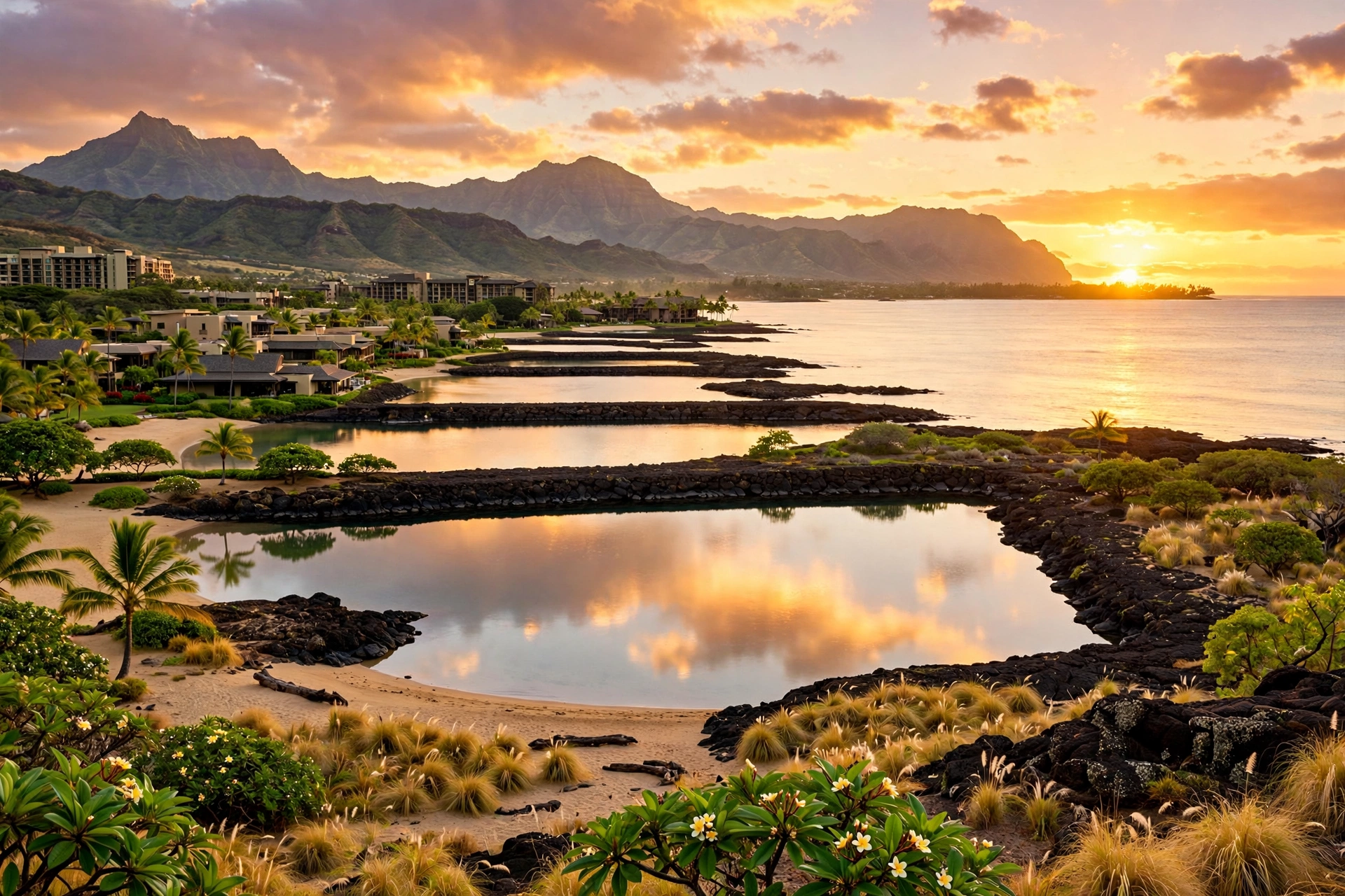
The four Ko ʻOlina lagoons are the community’s signature feature: man-made, crescent-shaped ocean coves carved into the coastline, each with a white-sand beach, a protective offshore reef or breakwater that keeps the water calm, and a small public parking lot. They are numbered from north to south, Lagoon 1 through Lagoon 4, and each also has a Hawaiian name: Kohola (whale) to the north, then Honu (turtle), Naiʻa (dolphin), and Ulua (jack fish) at the southern tip. The lagoons are public beaches, open to everyone with no entrance fee, and each has a map showing area facilities.
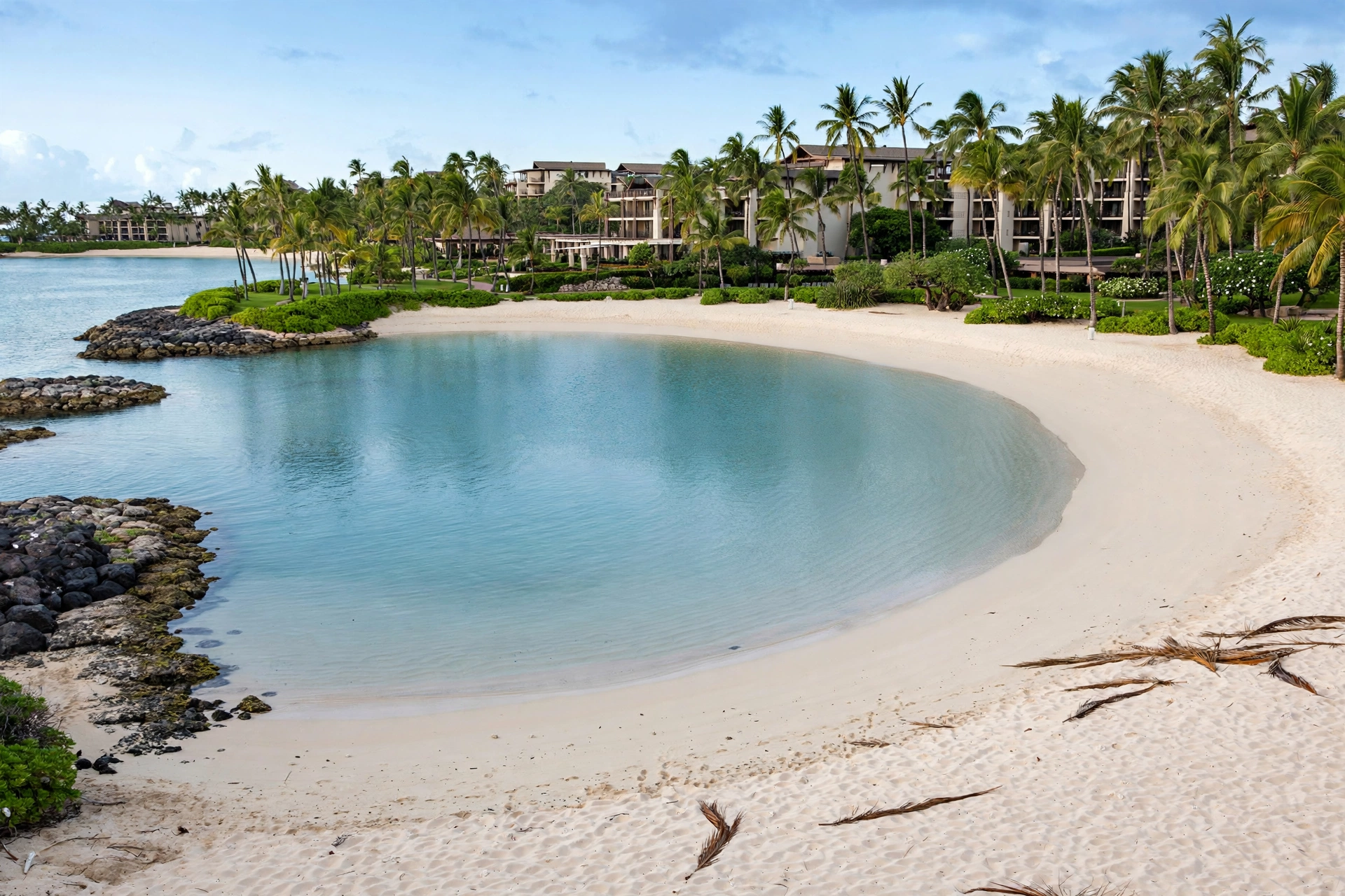
Lagoon 1, Kohola, sits at the northern end of the lagoon chain, just south of Lanikūhonua. It is the lagoon closest to the Disney-area resorts and the northern residential areas. Lagoon 2, Honu, is roughly in the middle of the chain and is one of the most visited, with showers, restrooms, and easy parking access. Lagoon 3, Naiʻa, continues the pattern of calm, family-friendly swimming, and Lagoon 4, Ulua, sits at the southern end near the marina and the grand lawn, a broad grassy park that makes it a popular choice for picnics and gatherings.
Each lagoon has the same basic setup: a small public parking lot, showers, restrooms, a choice of sand or grass for spreading a towel, and shade umbrellas made of wood and palm fronds scattered through the landscaping. The water in the lagoons is generally calm because of the offshore barriers, which makes them some of the most consistently swimmable beaches on Oʻahu’s leeward coast. That calmness, plus the facilities, makes them popular with families, and they can be busy on weekends and holidays.
Parking is the main practical challenge. Each lagoon’s public lot is small, and on weekends and holidays the lots can fill, sometimes requiring a wait for a spot to open. If the lagoon lots are packed, the fallback is the marina area near Lagoon 4, where paid all-day parking has historically been available for around 10 dollars. Avoiding commuter traffic is also wise: traveling to the lagoons just after the morning rush and leaving before the afternoon rush makes the H-1 drive much easier.
Key Roads to and From Ko ʻOlina
The H-1 freeway is the single most important road for reaching Ko ʻOlina. H-1 is Oʻahu’s main east-west freeway, running from Honolulu through Pearl City and ʻAiea to Kapolei at the western end of the island. From Honolulu, Waikīkī, or the airport, take H-1 westbound all the way to the Ko ʻOlina exit near Kapolei. There are no tolls on Oʻahu’s roads, and the drive is straightforward freeway the whole way.
Ko ʻOlina is the last major destination on H-1. Just past Kapolei, the H-1 freeway ends near Campbell Industrial Park, and Farrington Highway (Route 93) continues north from that point along the Waiʻanae coast. Farrington Highway is the coastal road that serves Waiʻanae town, Mākaha, and the northwestern shore all the way to Kaʻena Point. If you are coming to Ko ʻOlina from the Waiʻanae side, Farrington Highway south to the Kapolei area, then the Ko ʻOlina exit, is the route.
Within the resort, Aliʻinui Drive is the main north-south road, connecting all four lagoon parking areas, the resorts, and the residential neighborhoods. The lagoon parking lots are accessed directly from Aliʻinui Drive, starting with Lagoon 1 at the north end as you enter the property. Local streets like Olani Street, Waipahe Place, and Waiomea Street serve specific resorts and neighborhoods. The shoreline pathway system is separate from the roads: a 1.5-mile landscaped walking route that runs along the ocean from the northern lagoon to the marina, open to pedestrians and joggers.
For getting around the wider area, the H-1 is also the route back to Honolulu, Pearl Harbor, and ʻAiea to the east, and to Kapolei’s shopping and dining about 10 minutes away. Farrington Highway north is the route to Waiʻanae town, Mākaha Beach, and Kaʻena Point State Park at the island’s northwestern tip. Traffic on H-1 follows commuter patterns: heavy eastbound into Honolulu in the morning and heavy westbound out of Honolulu in the afternoon, so plan lagoon visits and airport runs around the rush hours.
Nearby Areas
Kapolei
Kapolei is the closest town to Ko ʻOlina, about 10 minutes east by car, and it functions as the commercial center for the whole leeward side. Often called Oʻahu’s “second city,” Kapolei has the area’s main shopping centers, grocery stores, restaurants, and services, so it is where Ko ʻOlina visitors go for supplies and where many resort workers live. The Wet’n’Wild water park sits between Ko ʻOlina and Kapolei. Kapolei Hale, the City and County of Honolulu’s leeward civic center, is here as well, reached from H-1 westbound at the Kapolei exit via Makakilo Drive and Farrington Highway.
Waiʻanae
Waiʻanae town lies about 20 minutes north of Ko ʻOlina up the coast on Farrington Highway. It is a long-established residential community and the commercial center of the Waiʻanae coast, with local shops, restaurants, and services. The Waiʻanae coast beyond it includes Mākaha, known for its beach and surf, and the road continues north to the end of the paved highway at Kaʻena Point State Park. The leeward coast north of Ko ʻOlina is noticeably less developed than the resort community itself, and it gives a clear sense of the rural-to-suburban character of this side of Oʻahu.
Kaʻena Point
Kaʻena Point is the northwestern tip of Oʻahu, reachable by Farrington Highway north from Ko ʻOlina past Waiʻanae and Mākaha to the end of the road, followed by a hike into Kaʻena Point State Park. The point is a remote, windswept natural area with native seabird nesting colonies and a protected coastal ecosystem, and it is one of the most distinctive day trips from the Ko ʻOlina area. The drive from Ko ʻOlina to the trailhead takes roughly 40 to 50 minutes, and the hike itself is exposed and hot, so an early start and plenty of water are essential.
ʻEwa Beach and the South Shore
To the east of Ko ʻOlina, back toward Honolulu on H-1, the communities of ʻEwa Beach and the ʻEwa plain offer additional beaches, parks, and the shopping and dining of the growing ʻEwa-Kapolei corridor. Pearl Harbor, the Arizona Memorial, and the museums of the Pearl Harbor historic sites are about 25 to 30 minutes east on H-1, making Ko ʻOlina a workable base for a Pearl Harbor day trip. Honolulu and Waikīkī are about 35 to 45 minutes east in light traffic.
Reading the whole leeward side on a map helps explain why Ko ʻOlina sits where it does. The H-1 corridor from Honolulu through ʻAiea, Pearl City, Waipahu, and ʻEwa to Kapolei is the island’s main suburban and industrial belt, and Ko ʻOlina is the last stop before the freeway ends and the coast turns rural toward Waiʻanae. This position gives the resort community a useful dual character: it is close enough to Honolulu and Kapolei for easy day trips and supply runs, yet far enough west to feel separated from the city’s traffic and density. Visitors who plan day trips from Ko ʻOlina, whether to Pearl Harbor, to the North Shore via the central island, or up the Waiʻanae coast to Kaʻena Point, should always check traffic before leaving, because every one of these routes depends on the H-1, and the H-1’s commuter congestion sets the rhythm for the entire leeward side.
Navigating Ko ʻOlina Day to Day
A rental car is the practical way to navigate Ko ʻOlina and the surrounding area. The resort community is spread out, the lagoon parking lots are small and fill on weekends, and the nearest town with full services, Kapolei, is a 10-minute drive. Most visitors arriving by air rent a car at Honolulu International Airport, about 17 miles east, and drive H-1 west to the Ko ʻOlina exit. Taxis and rideshare services operate in the area, and some resorts offer shuttle services, but for exploring the lagoons, Kapolei, and the Waiʻanae coast, a car is close to essential.
Once inside Ko ʻOlina, the 1.5 miles of shoreline pathways make the oceanfront walkable end to end, from the northern lagoon to the marina. Walking between lagoons is easy and pleasant, and many visitors park once and walk the coast. TheBus, Oʻahu’s public bus system, serves the Ko ʻOlina area with routes along Farrington Highway, including the 40, C, PH1, and 93 lines, with stops near Farrington Highway and Waiomea Street, about a 25 to 30 minute walk from the resort core. The bus is workable for patient travelers but slow compared to driving.
Parking strategy matters. Use the small public lot at the lagoon you want to visit, arrive early on weekends and holidays, and if the lots are full, head to the marina area near Lagoon 4 for paid all-day parking. Avoid the H-1 commuter rush when traveling to and from the Honolulu side: go in after the morning rush and leave before the afternoon rush. The leeward side is the driest, sunniest part of Oʻahu, so sun protection and water are more important here than on the windward side, and the calm lagoon water, while inviting, still calls for normal ocean awareness.
Frequently Asked Questions
Where is Ko ʻOlina in Hawaiʻi?
Ko ʻOlina is a master-planned resort community on the southwestern, leeward coast of Oʻahu, near Kapolei. It is about 17 miles west of Honolulu and about 17 miles from Honolulu International Airport, reached by taking H-1 westbound to the Ko ʻOlina exit.
Is Ko ʻOlina a town or a resort?
Ko ʻOlina is a resort community, not an incorporated town. It is part of the City and County of Honolulu and uses a Kapolei mailing address (96707). It functions as a self-contained, roughly 650-acre community with resorts, a golf course, a marina, four lagoons, and residential neighborhoods.
What are the four Ko ʻOlina lagoons?
The four man-made lagoons run north to south as Kohola (Lagoon 1), Honu (Lagoon 2), Naiʻa (Lagoon 3), and Ulua (Lagoon 4). Each has a white-sand beach, calm water, a small public parking lot, showers, and restrooms. They are public beaches with no entrance fee.
How far is Ko ʻOlina from Waikīkī?
Ko ʻOlina is about 25 miles from Waikīkī by road. The drive via H-1 takes about 35 to 45 minutes in light traffic, but it can take much longer during morning and afternoon commuter rush hours.
Can the public visit the Ko ʻOlina lagoons without staying at a resort?
Yes. The lagoons are public beaches, open to everyone with no entrance fee. Each lagoon has a small public parking lot, showers, and restrooms. Parking lots can fill on weekends and holidays, so arriving early is the best strategy.
What is the main road into Ko ʻOlina?
From Honolulu, take H-1 westbound to the Ko ʻOlina exit near Kapolei. Inside the resort, Aliʻinui Drive is the main north-south road connecting the lagoon parking areas, resorts, and residential areas. Farrington Highway (Route 93) continues north from the end of H-1 toward Waiʻanae and Kaʻena Point.
What is near Ko ʻOlina?
Kapolei, the leeward side’s main commercial city, is about 10 minutes east. Waiʻanae town is about 20 minutes north on Farrington Highway, with Mākaha and Kaʻena Point State Park further up the coast. Pearl Harbor is about 25 to 30 minutes east on H-1, and Honolulu is about 35 to 45 minutes east in light traffic.
Do I need a car at Ko ʻOlina?
A rental car is strongly recommended. The resort community is spread out, Kapolei’s services are a 10-minute drive, and the wider leeward coast is best explored by car. TheBus serves the area along Farrington Highway, but service is slow and stops are a 25 to 30 minute walk from the resort core. Within Ko ʻOlina, the 1.5 miles of shoreline pathways make the oceanfront walkable.
Related Guides
For more on the islands around this guide, see our Oʻahu Travel Guide, our Where Is Oʻahu Located in Hawaiʻi guide, our Waikīkī, Hawaiʻi guide, our Where Is Mānoa in Hawaiʻi guide, and our Hawaiʻi Map overview.
Ko ʻOlina makes the most sense on a map when you see it in context: the last resort community on the H-1, at the corner where Oʻahu turns north toward Waiʻanae, with Kapolei’s services a few minutes east and the open leeward coast stretching north. Knowing the lagoon order, the road layout, and the parking realities turns the area from a confusing cluster of resorts into a readable, walkable coastline. Keep a map of the lagoon numbers on hand, note which lot you parked in, and the whole community becomes easy to navigate.