
How Far Is Hawaii From the Equator? Miles, Latitude and What It Means

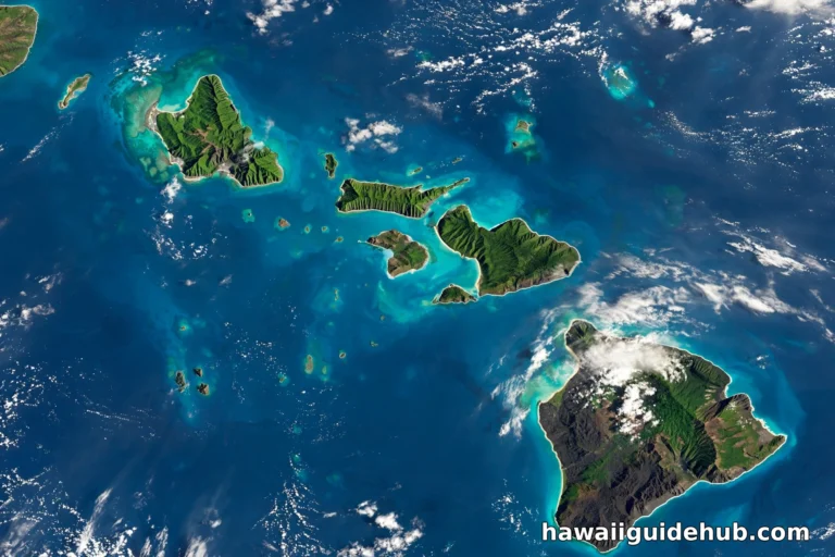
Hawaii sits about 1,470 miles north of the equator, measured due south from Honolulu per the Hawaii Data Book. It is the US state closest to the equator, entirely in the Northern Hemisphere, and its position between the equator and the Tropic of Cancer shapes everything about its climate: the trade winds, the warm winters, the rain, and the famous Lahaina Noon when the sun stands directly overhead. This is the single complete guide to Hawaii’s distance from the equator and what that distance means.
This page covers the exact distance in miles and degrees, the latitude of each island, whether Hawaii is below the equator (it is not), the Tropic of Cancer connection, how the position creates Hawaii’s climate, and FAQs. Everything about Hawaii and the equator is here on this one page.
How the Distance Is Measured
A word on methodology, because “distance from the equator” has more than one answer. The Hawaii Data Book’s 1,470 mile figure is the distance due south from Honolulu along a meridian: a straight north-south line. The great circle distance, the shortest path over the curved earth to the nearest point on the equator, is nearly identical because Honolulu sits almost directly north of its nearest equatorial point. One degree of latitude equals about 69.04 miles everywhere on earth, so you can convert any Hawaiian latitude to an equator distance yourself: multiply the degrees by 69. Sailors use nautical miles instead, 60 per degree, which gives about 1,278 nautical miles from Honolulu to the line.
Hawaii vs Other Tropical Destinations
Hawaii’s 19 to 22 degrees north puts it in interesting company. Cancun sits at about 21°N, nearly the same latitude as Honolulu, which is why the Yucatan and Hawaii share that intense Caribbean-Pacific light. Bali is at 8°S, much closer to the equator, with even less seasonal variation. The Maldives straddle the line itself at 3°N. Tahiti is at 17.5°S, Hawaii’s southern mirror. What sets Hawaii apart is not the latitude but the isolation: every other destination at this latitude has a continent nearby moderating its weather, while Hawaii has 2,400 miles of ocean in every direction, which is why its climate is uniquely stable.
Does Latitude Affect Jet Lag?
Only indirectly. Jet lag comes from crossing time zones, not latitudes, and Hawaii is 5 to 6 hours behind the US mainland depending on daylight saving (which Hawaii does not observe). But the latitude matters for recovery: Hawaii’s early sunsets, around 6 to 7 PM year round, and bright mornings help reset your body clock fast. Most west coast visitors adjust in a day. The practical tip: get morning sun on day one, stay up until local bedtime, and let the 20th parallel do the rest.
The Equator’s Effect on Ocean and Surf
Hawaii’s position shapes its famous waves. The islands sit in the trade wind belt, where consistent easterly winds generate the windswell that wraps the east shores year round. In winter, North Pacific storms send massive swells down to the north shores: Waimea Bay, Pipeline, Jaws. In summer, South Pacific storms do the same for the south shores. The Coriolis effect, which spins storms, is weak near the equator and strengthens with latitude; at 20°N it is strong enough to organize hurricanes, which is why Hawaii gets hurricane threats (rarely direct hits) but the equator itself does not. The ocean temperature, 74 to 82°F year round, is the latitude’s gift to swimmers.
Time, Sun, and Shadows: What Visitors Notice
Three latitude effects surprise mainland visitors. First, the sun sets fast: near the equator the sun drops almost vertically, so twilight is short and darkness arrives quickly after sunset. Second, the sun is brutal at midday but the air stays mild, which tricks people into skipping sunscreen on breezy days. Third, there is no daylight saving time in Hawaii, so summer evenings end earlier than mainlanders expect. Plan dinners and sunset activities accordingly: the golden hour is brief and beautiful.
The latitude has one more gift: the night sky. From 20°N, Hawaiian observers see stars from both the northern and southern celestial hemispheres across the year, including the Southern Cross low on the southern horizon in spring. It is one reason the Mauna Kea observatories were built here: world class seeing, and a sky that belongs to two hemispheres at once.
The Antipode: What’s Directly Opposite Hawaii
If you drilled straight through the earth from Honolulu, you would surface near Ghanzi, Botswana, in southern Africa: Honolulu’s antipode, about 12,417 miles away per the Hawaii Data Book’s tables. It is a fun symmetry: Hawaii’s distance from the equator southward is 1,470 miles, and its mirror point sits the same distance north of the equator’s opposite side, in the Kalahari. The antipode of Ka Lae lands in the South Atlantic off Namibia. Few places on earth have antipodes as remote from each other as Hawaii’s: ocean in every direction, land at the far end of a tunnel through the planet.
Common Myths
Myth one: Hawaii is south of the equator. False, as established: 1,470 miles north. Myth two: Hawaii has no seasons. False: it has subtle ones, wetter winters, drier summers, shifting surf, whale season. Myth three: the closer to the equator, the hotter. False in Hawaii’s case: the ocean and trades keep it milder than continental spots at the same latitude. Myth four: you can see the equator from Hawaii. False: it is 1,400 miles of open ocean away, with nothing to see but water.
The Short Answer
Honolulu is 1,470 miles due south to the equator, per the State of Hawaii Data Book’s distance tables (USGS source). The main Hawaiian islands span roughly 19 to 22 degrees north latitude: the southern tip of the Big Island at Ka Lae is the closest point at about 1,307 miles, and Kauai’s north shore is the farthest of the main islands at about 1,536 miles. The full archipelago stretches much farther north to Kure Atoll at about 28.4 degrees north, nearly 1,960 miles from the equator.
Hawaii’s Distance From the Equator, Point by Point
Distances below are calculated from the latitudes published in the Hawaii Data Book, at 69.04 miles per degree of latitude.
| Point | Latitude (per Hawaii Data Book) | Miles from equator | Notes |
| Ka Lae, Big Island | 18°56′ N | ~1,307 | Southernmost point of the US; closest to the equator |
| Hilo, Big Island | 19°43′ N | ~1,361 | East side reference point |
| Honolulu, Oahu | ~21.3° N | 1,470 (Data Book figure) | The standard reference; capital city |
| Kauai north shore | 22°15′ N | ~1,536 | Farthest north of the main islands |
| Kure Atoll | ~28°25′ N | ~1,962 | Northernmost point of the archipelago |
Is Hawaii Below the Equator?
No. This is one of the most common geography mix-ups, and the answer is unambiguous: all of Hawaii is north of the equator, in the Northern Hemisphere. The confusion probably comes from how far south Hawaii feels compared to the rest of the US, and from its tropical climate. But the equator is roughly 1,400 miles south of the islands. Hawaii is closer to the equator than any other state, closer than Florida, Texas, or Southern California, but it is still firmly north of the line.

The Tropic of Cancer Connection
Here is the nuance most articles miss. The Tropic of Cancer sits at 23.5 degrees north, and the main Hawaiian islands lie just south of it, between 19 and 22.2 degrees. That means Hawaii is in the tropics proper, not the subtropics. Twice a year, the sun passes directly overhead at local noon, an event Hawaiians call Lahaina Noon: shadows disappear, flagpoles cast no shadow, and for a few minutes the islands experience the vertical sun. It happens around late May and mid July, on different dates per island. Nowhere else in the United States gets this.
What the Distance Means for Hawaii’s Climate
Hawaii’s nearness to the equator explains its weather. The islands sit in the path of the northeast trade winds, steady breezes that cool the coasts and wring rain out of the mountains’ windward sides. Day length barely changes through the year: roughly 11 hours in winter versus 13 in summer, compared to the dramatic swings of the mainland. Temperatures hover in a narrow band: highs in the 80s Fahrenheit in summer, 70s in winter at sea level.
But latitude is only half the story. The ocean is the great moderator: surrounding water keeps temperatures stable year round. And elevation does the rest: drive from a Kona beach to the Mauna Kea summit and you pass through desert, rainforest, and alpine tundra in two hours, with snow possible at the top in winter. Hawaii contains nearly every climate zone on earth, which is why the simple “tropical island” label undersells it. For seasonal detail, see what time of year it rains in Hawaii.
Why Hawaii Feels Hotter Than Its Latitude Suggests
At 20 degrees north, Hawaii shares its latitude with places like Cuba, southern Mexico, and the Sahara’s southern edge. Yet Hawaii feels milder than those places, and the reason is the ocean plus the trades. The constant sea breeze and the surrounding Pacific, which stays in the 70s Fahrenheit year round, prevent the extreme heat that continental locations at the same latitude endure. The flip side: the sun’s UV is intense because it passes through less atmosphere at these latitudes. Sunburn in 20 minutes is normal. Reef safe sunscreen is not optional.
How Navigators Used These Stars
The Polynesian voyagers who settled Hawaii read latitude in the stars. Sailing north from Tahiti, they watched the North Star climb higher each night; when it reached the altitude matching Hawaii’s latitude, they knew to turn and search east-west for land. The 1,400 mile open ocean gap between the equator region and Hawaii was crossed by reading swells, birds, and stars, one of humanity’s great navigation feats. Modern visitors cross the same water in five hours by jet; the distance has not changed, only our relationship to it.
For trip planning, see the best island in Hawaii for first time visitors and your full Hawaii bucket list.
Video: Hawaii Geography Facts
Twenty geography facts about Hawaii: isolation, volcanoes, and the science of the islands.
Frequently Asked Questions
How many miles is Hawaii from the equator?
About 1,470 miles due south from Honolulu, per the Hawaii Data Book. The closest point, Ka Lae on the Big Island, is about 1,307 miles.
Is Hawaii above or below the equator?
Above: north of the equator, in the Northern Hemisphere. All 50 states are north of the equator.
What is Hawaii’s latitude?
The main islands span about 19 to 22.2 degrees north latitude. Honolulu is at about 21.3°N.
Is Hawaii in the tropics?
Yes. The main islands lie just south of the Tropic of Cancer (23.5°N), in the tropics proper.
Which US state is closest to the equator?
Hawaii, by a wide margin. Florida’s southern tip is at about 25°N, roughly 300 miles farther from the equator than Honolulu.
What is Lahaina Noon?
The twice yearly event when the sun passes directly overhead in Hawaii and shadows disappear. It happens around late May and mid July.
How far is Hawaii from the North Pole?
About 4,740 miles from Honolulu to the North Pole, per the Hawaii Data Book: the equator is roughly three times closer.
What is on the opposite side of the earth from Hawaii?
Honolulu’s antipode is near Ghanzi, Botswana, in southern Africa, about 12,417 miles away through the planet.
Hawaii’s distance from the equator is the invisible architecture of the islands: it sets the trade winds, the temperature band, the vertical sun, and the whole tropical character. One thousand four hundred seventy miles south of Honolulu, the line itself runs through open ocean, unmarked and unseen. But its effects are everywhere you look in Hawaii, from the rainbows to the reefs to the light.