
Hawaii Hotspot Geology: How the Islands Were Born and Why They Line Up

Every Hawaiian island is a volcano, and the islands line up in age order like beads on a string: the Big Island is the baby, still growing, while Kauai, 300 miles northwest, is a five-million-year-old eroded ruin. That lineup is the fingerprint of one of geology’s most elegant mechanisms: a stationary plume of superheated rock deep in the Earth, with the Pacific tectonic plate sliding slowly over it. Understanding the Hawaii hotspot changes how you see every island you visit.
This is the single complete guide to Hawaii hotspot geology. It explains how the hotspot works, the island age timeline and what it proves, the Hawaiian-Emperor chain stretching to Alaska, the future island growing offshore today, what the hotspot explains and what it does not, where to see the geology yourself, and FAQs. Everything about the Hawaii hotspot lives on this one page.
How the Hotspot Works
Deep beneath the Pacific, a column of abnormally hot rock rises from near the Earth’s core-mantle boundary. Geologists call it a mantle plume. Where it reaches the base of the oceanic crust, it melts rock and feeds magma upward, building a volcano on the seafloor. Eruption after eruption, the volcano grows until it breaks the ocean surface as an island.
The critical twist: the plume stays put while the Pacific Plate drifts northwest over it at about 3 to 4 inches per year, roughly the speed your fingernails grow, per USGS measurements. Each volcano is therefore carried away from its magma supply as the plate moves. Starved of fresh magma, it goes dormant, then extinct, then spends millions of years being carved by rain, waves, and its own weight until it erodes back beneath the sea. Meanwhile a new volcano starts growing over the plume. The result is a conveyor belt of islands, youngest in the southeast, oldest in the northwest.
The Island Age Timeline: What the Ages Prove
The ages are the evidence. If the hotspot model is right, ages must increase steadily to the northwest. They do, per USGS dating.
| Island | Age (per USGS) | Volcano status | What it shows |
| Hawaii (Big Island) | Less than 1 million years | Active: Kilauea and Mauna Loa | Sitting over the hotspot right now |
| Maui | About 1.3 million years | Dormant: Haleakala last erupted ~1790 | Recently left the hotspot |
| Lanai | About 1.3 million years | Extinct, deeply eroded | Same generation as Maui |
| Molokai | About 1.5 to 1.9 million years | Extinct; dramatic north cliffs | Erosion outpacing the volcano |
| Oahu | About 2.5 to 3.5 million years | Extinct; two eroded shield volcanoes | Reefs and erosion reshaping it |
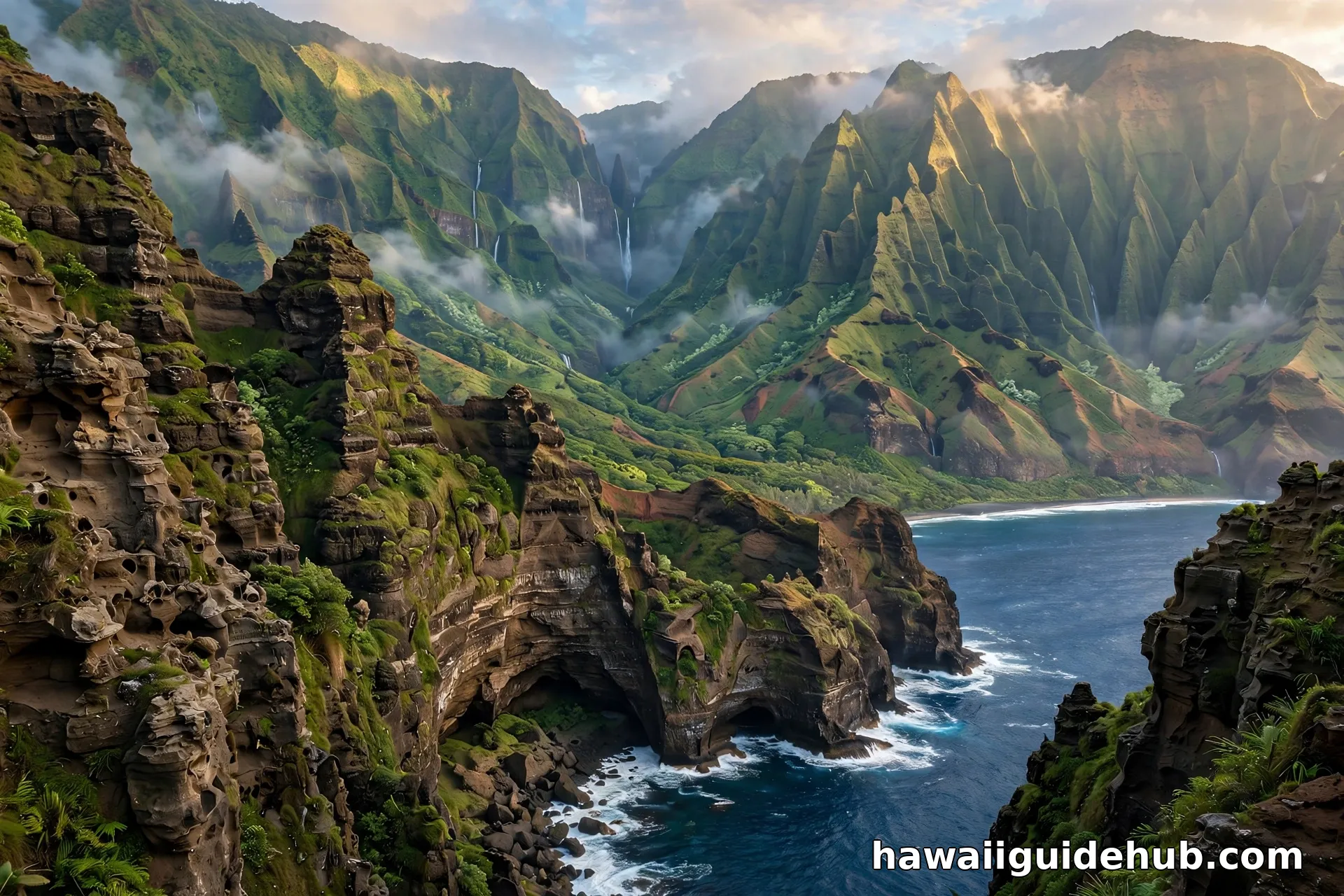
| Kauai | About 5.1 million years | Extinct; deeply canyoned | The oldest main island, farthest along |
Notice the pattern has no exceptions: no old island sits southeast of a young one. That single fact, confirmed by radiometric dating of lava rocks, is what convinced geologists the hotspot model was correct. J. Tuzo Wilson proposed the hotspot idea in the 1960s largely to explain exactly this Hawaiian age progression.
What the Hotspot Explains, and What It Does Not
The hotspot model is powerful but not all-powerful. An expert view separates what it cleanly explains from what needs more.
| Observation | Hotspot explanation | The nuance |
| Islands age steadily northwest | Plate moves NW over a fixed plume | The textbook case; confirmed by rock dating |
| Only the Big Island erupts today | Only it sits over the plume now | Haleakala is dormant, not extinct: it erupted ~1790 |
| The chain bends sharply near Midway | Plate direction changed ~47 million years ago | Per USGS: the Hawaiian-Emperor bend records the turn |
| Deep earthquakes under the Big Island | Island weight bends the plate (flexure) | Not magma movement; the crust flexing under load |
| Rejuvenated eruptions on old islands | Not fully explained by the simple model | Oahu’s Diamond Head is a late encore, mechanism debated |
| Why the plume exists at all | Not explained | Mantle plume origins remain an active research question |
That last row matters. Geology is honest about its open questions, and the ultimate origin of mantle plumes is one of them. What is settled is the conveyor belt itself: the ages, the bend, and the active-to-extinct progression all fit.
The Chain That Reaches Alaska
The Hawaiian Islands are just the youngest end of a 3,600-mile trail. The Hawaiian-Emperor seamount chain stretches northwest across the Pacific to the Aleutians, a line of islands, atolls, and drowned seamounts recording roughly 80 million years of hotspot activity. The oldest dated rocks in the chain are about 81 to 85 million years old. Every dot on that line was once a Hawaiian-style island sitting where the Big Island sits now, before the plate carried it away to erode and sink. Kauai’s future is written in the seamounts northwest of it.
The Next Island Is Already Growing
About 20 miles southeast of the Big Island, an underwater volcano called Kamaehuakanaloa (formerly Loihi) is actively growing toward the surface. It already rises thousands of feet from the seafloor but remains well below the waves. Scientists estimate it will take tens of thousands of years, somewhere between 10,000 and 100,000, before it breaks the surface as Hawaii’s newest island. The hotspot is not history. It is happening right now, in real time, off the Kona coast.
Where to See the Geology Yourself
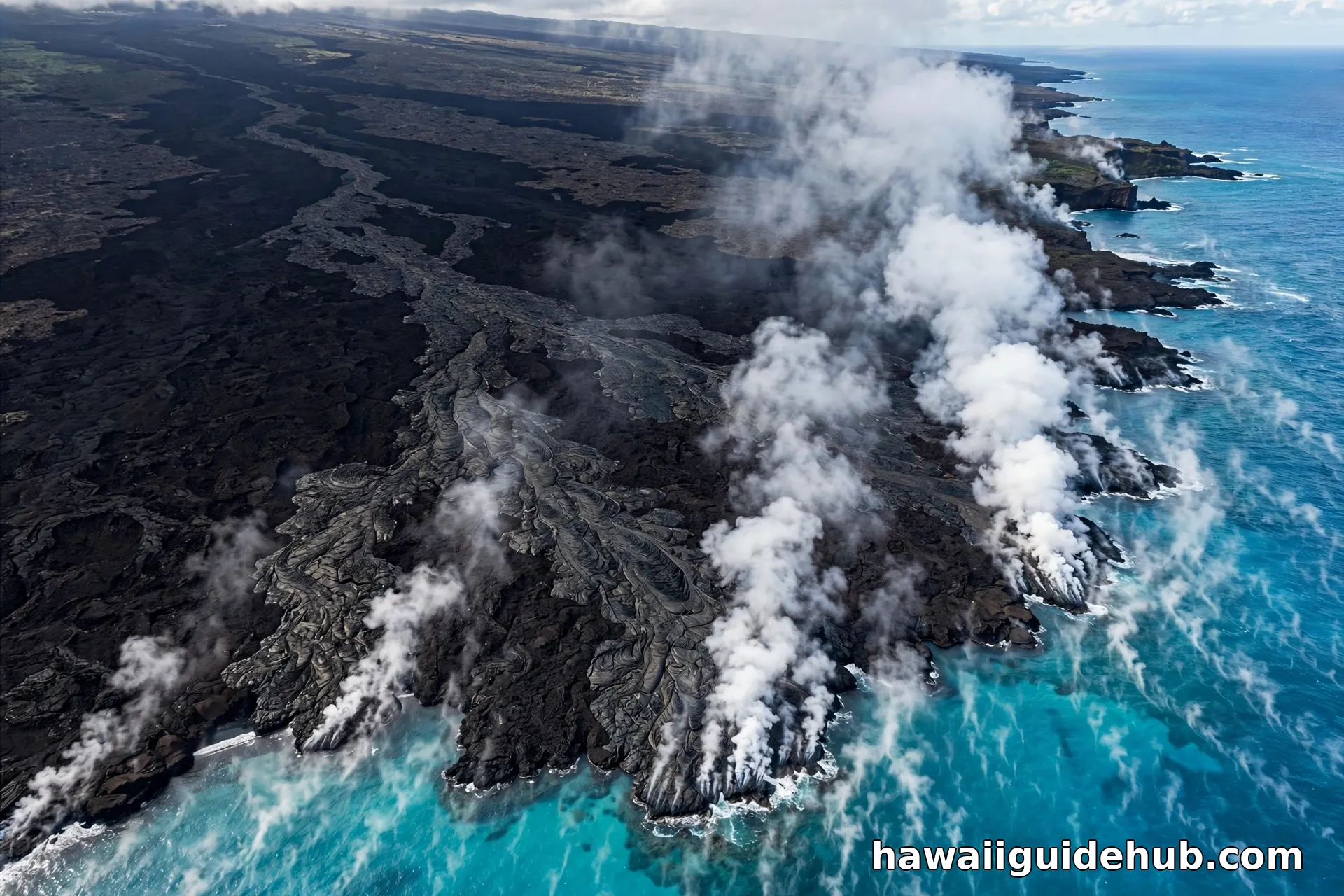
The hotspot story is visible from any island if you know what to look at. On the Big Island, Hawaii Volcanoes National Park is the hotspot’s live laboratory: fresh lava rock, steam vents, and craters sitting directly over the plume. On Maui, the vast shield of Haleakala shows what a volcano looks like just after leaving the hotspot: enormous, quiet, and slowly eroding. On Oahu, the windward cliffs are the collapsed remains of the Koolau volcano’s flank, and Shark’s Cove sits in an ancient volcanic rock formation. On Kauai, Waimea Canyon is erosion’s masterpiece on the oldest island. Each island is a different chapter of the same story.
Shield Volcanoes: Why Hawaiian Eruptions Look Different
Hawaii’s volcanoes are shield volcanoes, built by runny basaltic lava that flows far before hardening, creating broad gentle domes rather than steep cones. That fluid lava is why Hawaiian eruptions are famously approachable: lava fountains and rivers rather than the explosive blasts of steeper composite volcanoes like Mount St. Helens. Mauna Kea, measured from its base on the seafloor, is the world’s tallest mountain at over 33,000 feet, taller than Everest, though only about 13,800 feet rise above the waves. The islands’ gentle profiles are a direct signature of hotspot basalt.
How Geologists Actually Date the Islands
The age timeline above is not guesswork. Geologists date Hawaiian lava rocks with radiometric methods, most famously potassium-argon dating, which measures the slow decay of potassium-40 into argon-40 inside the rock. Because the clock starts when lava cools and crystallizes, each flow carries its own timestamp. By dating the oldest exposed flows on each island, scientists established the northwest age progression that the hotspot model predicts. The dates have been cross-checked across methods and islands for decades, which is why the timeline commands such confidence.
Pele and the Hotspot: The Cultural Layer
Long before geologists described mantle plumes, Native Hawaiians explained the same age progression through Pele, the volcano goddess. In tradition, Pele traveled down the island chain from the northwest, digging fire pits on each island before settling at Kilauea on the Big Island. The mythic journey runs in exactly the direction science later confirmed: from the oldest islands to the youngest, ending where the hotspot burns today. It is a striking case of traditional knowledge and geology converging on the same story, and a reminder to treat the volcanoes with the cultural respect they command. Stay on marked trails, never take lava rocks, and learn the protocols before visiting sacred sites.
Visiting the Hotspot: Practical Tips
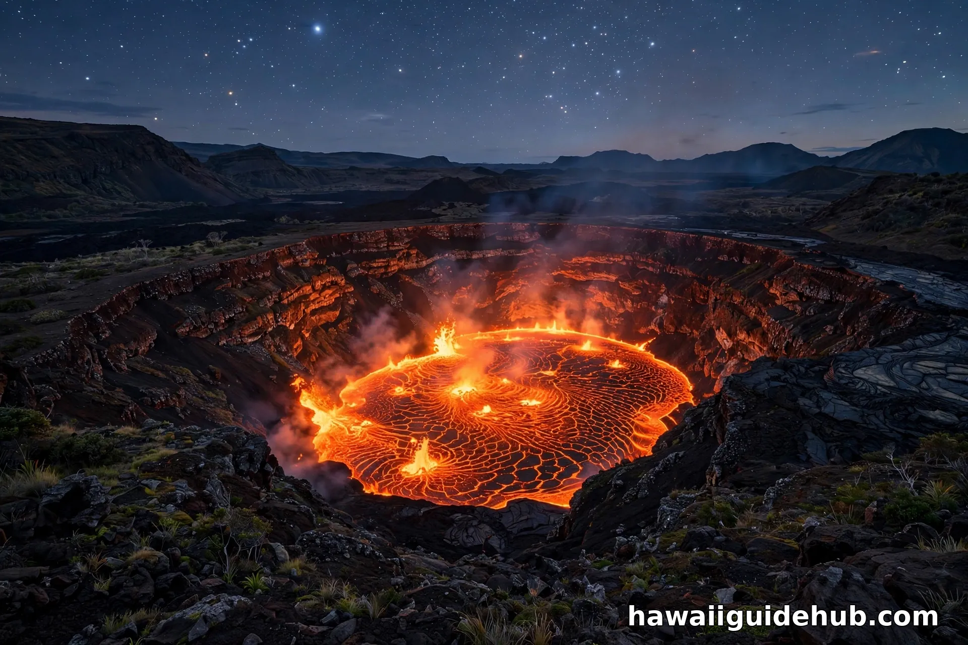
To stand over the hotspot, go to Hawaii Volcanoes National Park. Check the USGS Hawaiian Volcano Observatory’s daily updates before your visit: eruption status, gas levels, and trail closures change frequently, and vog (volcanic smog) can affect air quality across the island on active days. Bring layers; the summit sits above 4,000 feet and runs far cooler than the beaches. After dark, the glow viewing areas are the park’s signature experience. On Maui, Haleakala’s summit at sunrise shows the dormant end of the conveyor belt, but book the sunrise reservation well ahead. On Kauai, the Kalalau Lookout frames the eroded end: five million years of rain written in green cliffs.
Watch: How Did Hawaii Form?
Hawaii Hotspot FAQs
What is the Hawaii hotspot?
A stationary plume of abnormally hot rock rising from deep in the Earth’s mantle beneath the Pacific Plate. It melts through the crust and builds volcanoes. The plate drifts northwest over it, so new islands form in the southeast while older ones are carried away, go extinct, and erode.
Why are the Hawaiian Islands in a line?
Because the Pacific Plate moves in one direction over a fixed hotspot. Each island formed over the plume, then rode the plate northwest. The line is the plate’s motion track, with ages increasing steadily to the northwest, exactly as USGS rock dating confirms.
Which Hawaiian island is the oldest?
Kauai, at about 5.1 million years old, is the oldest of the main islands. Niihau is close behind. The Big Island of Hawaii, at under a million years, is the youngest and the only one with active volcanoes.
Will a new Hawaiian island form?
Yes, eventually. The underwater volcano Kamaehuakanaloa is growing about 20 miles southeast of the Big Island. Scientists estimate tens of thousands of years before it reaches the surface. The hotspot keeps working whether or not anyone is watching.
Is the hotspot the same as the Ring of Fire?
No. The Ring of Fire is volcanism at plate boundaries, where plates collide or separate. Hawaii sits in the middle of the Pacific Plate, thousands of miles from any boundary. That mid-plate location is exactly what makes the hotspot explanation necessary.
Can I visit an active volcano in Hawaii?
Yes, at Hawaii Volcanoes National Park on the Big Island, where Kilauea and Mauna Loa are monitored by the USGS Hawaiian Volcano Observatory. Check the park’s current conditions before visiting, since eruption activity and access change.
The Bend: When the Plate Changed Direction
The Hawaiian-Emperor chain is not straight. Near Midway, it kinks sharply, like an elbow. That bend, dated to about 47 million years ago, records the moment the Pacific Plate changed direction, shifting from a more northerly drift to its current northwesterly course. Because the hotspot stayed fixed, the kink is drawn into the seafloor like a signature. It is one of the most famous features in plate tectonics: a single bend in a chain of dead volcanoes that tells you exactly when an entire tectonic plate turned. Everything northwest of the bend belongs to the Emperor Seamounts; everything southeast is the Hawaiian Ridge we know today.
The Conveyor Belt Beneath Your Feet
Stand on a black sand beach on the Big Island and you are standing on rock younger than the human species. Stand on Kauai’s canyon rim and you are looking at five million years of rain undoing a volcano. Both are the same process at different moments: a fixed plume, a moving plate, and time doing the rest. Hawaii’s hotspot is geology’s clearest demonstration that the ground beneath us is not still, and every island in the chain is a timestamp. The next time you island-hop, remember you are traveling through time as well as space, from the newborn southeast to the ancient northwest, along a trail that runs all the way to Alaska. Few places on Earth let you walk across millions of years in a single vacation. That is the real gift of the hotspot: deep time, made visible.