Kuliʻouʻou Ridge Trail: Oʻahu’s Classic East Side Hike to the Koʻolau Summit

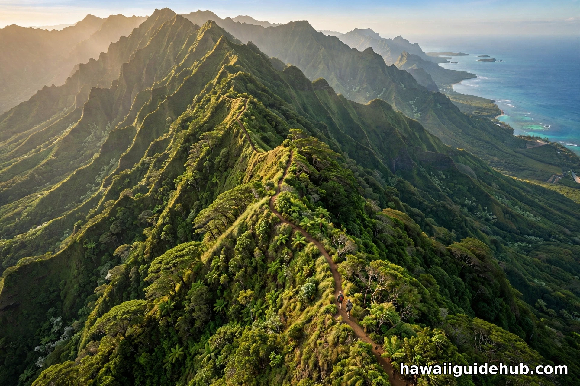
There is a particular kind of morning in Hawaiʻi Kai when the trade winds have swept the sky clean overnight and the Koʻolau mountains stand sharp against the blue. If you are lucky enough to be in East Oʻahu on one of those mornings, there is no better place to spend it than on the Kuliʻouʻou Ridge Trail. This is the east side’s classic ridge hike: 2.5 miles up through changing forest, a rest stop at a weathered shelter, and a summit finish with a view that stretches from Waimanalo Bay all the way around the windward coast. The tree itself is covered in The Koa Tree.
It is not the easiest hike on the island, and it is not the hardest either. What it is, is honest. The trail asks for steady legs and a bit of determination, and it pays you back with one of the finest panoramas you can earn on foot anywhere on Oʻahu. Here is everything you need to know before you go.
Why Hike the Kuliʻouʻou Ridge Trail?
Ask a local hiker in Honolulu to name a favorite training hike, and Kuliʻouʻou comes up fast. The reasons are simple. First, the trail is close to town. From Waikīkī or downtown Honolulu you can be at the trailhead in about 25 to 30 minutes on a weekend morning, which makes it practical for a half-day outing rather than a whole expedition. Second, the hike packs a remarkable amount of variety into a single morning: a quiet access road, an arid lower forest full of ironwood and Norfolk pine, a shady guava grove, and an open native forest near the summit where the trade winds finally find you.
Third, and most importantly, the payoff is enormous. The trail ends at the very crest of the Koʻolau Range, and when you step out of the trees at the top, the entire windward side of Oʻahu opens up below you. Waimanalo’s long white beach curves away to the north, the deep green valleys fold into the mountains, and on the clearest days you can trace the coastline for miles in both directions. It is the kind of view that makes people quiet.
If you are building a list of the island’s great hikes, this one belongs next to the classics. Our guide to outdoor adventures in Hawaii covers more of the state’s best trails, but Kuliʻouʻou deserves its own deep dive, which is what this article is.
Kuliʻouʻou Ridge Trail Fast Facts
Before we get into the details, here are the numbers that matter, sourced from the State of Hawaiʻi’s Na Ala Hele Trails and Access Program, which maintains the trail:
- Distance: 2.5 miles one way, 5 miles round trip out and back.
- Elevation gain: About 2,000 feet from trailhead to the Koʻolau summit.
- Difficulty: Moderate to difficult. The lower trail is manageable for fit beginners, but the upper section past the shelter gets steep and is only occasionally maintained.
- Time: Plan 3 to 4 hours round trip at a steady pace.
- Trailhead: End of Kalaʻau Place in Hawaiʻi Kai. Street parking only.
- Managed by: Hawaiʻi DLNR, Na Ala Hele program.
Getting to the Trailhead
The trail starts in a residential neighborhood in Hawaiʻi Kai, which surprises some first-time visitors. From the Kalanianaʻole Highway, turn mauka (toward the mountains) onto Kuliʻouʻou Road and follow it up into the valley. Turn right onto Kalaʻau Place and drive to the end, where you will find street parking along the road.
A few important notes on parking. Do not park at the very end of the cul-de-sac where the signs say no parking. Find a legal spot along Kalaʻau Place and be respectful of the neighborhood: keep noise down, do not block driveways, and take all your trash with you. From your car, walk on foot to the end of the road, pass the cable gate on the access road, and look for the trail beginning on the right at the hunter and hiker check-in station. Sign in if the register is there. It helps the state track trail use.
The trailhead is about 25 to 30 minutes from Waikīkī by car in normal traffic. Go early on weekends, because the street parking fills up and the late morning heat makes the exposed sections tougher. If you are new to the island, our Oʻahu island guide has more on getting around the east side.
The Hike, Section by Section
The Kuliʻouʻou Ridge Trail is really two hikes in one: a moderate forest walk for the first two-thirds, and a steeper, wilder ridge climb for the final third. Here is what each part feels like.
The Access Road and Valley Trail Junction
The walk begins on a wide access road past the cable gate. After about 0.2 miles on what is signed as the Kuliʻouʻou Valley Trail, watch for the ridge trail branching off to the right and heading up. This junction is the one spot where people occasionally wander the wrong way, so keep an eye out for the markers. From here, the path narrows into proper singletrack and the climbing begins in earnest.
The Lower Ridge and Exotic Forest
The lower two-thirds of the ridge passes through what botanists call an exotic forest, meaning most of the trees were introduced to Hawaiʻi rather than being native. You will walk under towering ironwoods with their whispering needle-like foliage, past Christmas berry shrubs, haole koa and Formosa koa, and the unmistakable tiered silhouettes of Norfolk pines. It is shady, fragrant, and pleasantly cool in the morning.
The grade here is steady but never punishing. Roots and rocks keep you watching your footing, and after rain the trail can be slick, so wear shoes with real tread. This section is where most casual hikers turn around if they are short on time, and honestly, even a partial hike through this forest is a lovely morning.
The Shelter and Picnic Tables
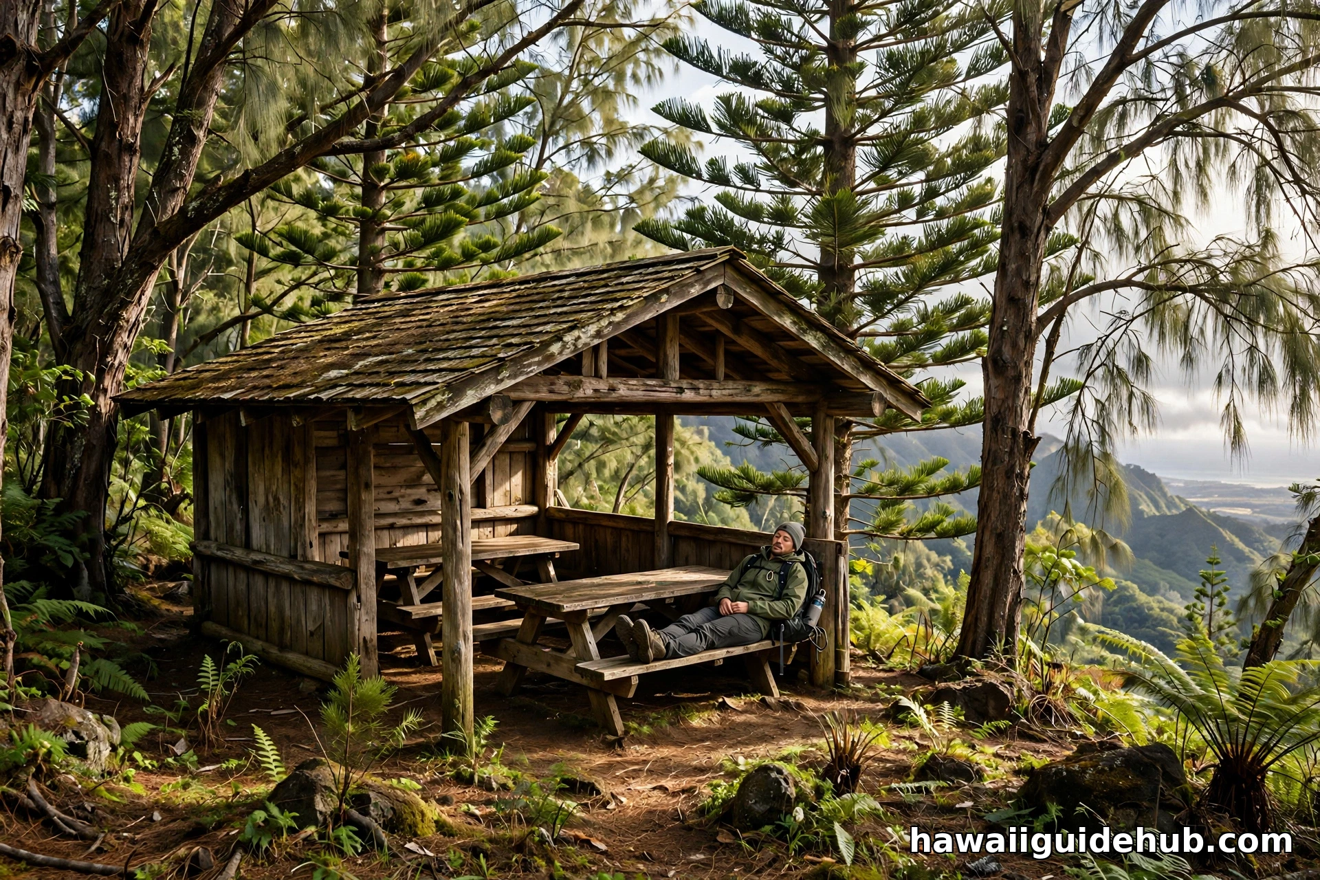
About two-thirds of the way up, you will reach a welcome landmark: a rustic wooden shelter with two picnic tables. This is the natural rest stop, and most hikers pause here for water and a snack. Catch your breath, because from this point on, the character of the hike changes.
The Upper Ridge to the Summit
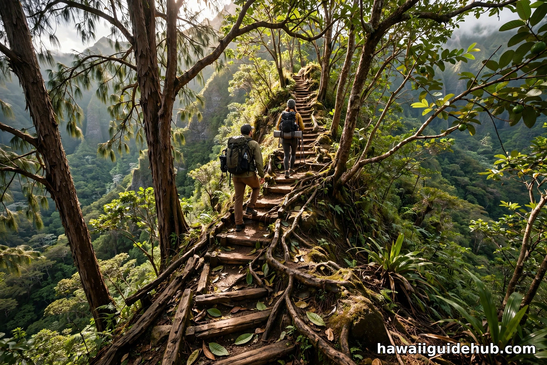
Past the shelter, the trail leaves the guava forest and breaks out into open uluhe, ʻōhiʻa, koa, and lama forest. It also gets noticeably steeper. This upper portion is only occasionally maintained, and the state is direct about it: it may be difficult for inexperienced hikers. The path follows the narrow ridge crest, with stairs and root ladders in the steepest pitches. Take your time, use the trees for handholds where needed, and do not rush the descent either, since downhill on tired legs is where most slips happen.
The reward for the effort arrives all at once. The trail ends at the summit of the Koʻolau Range, and the forest opens to reveal the windward side spread out below.
The Summit View
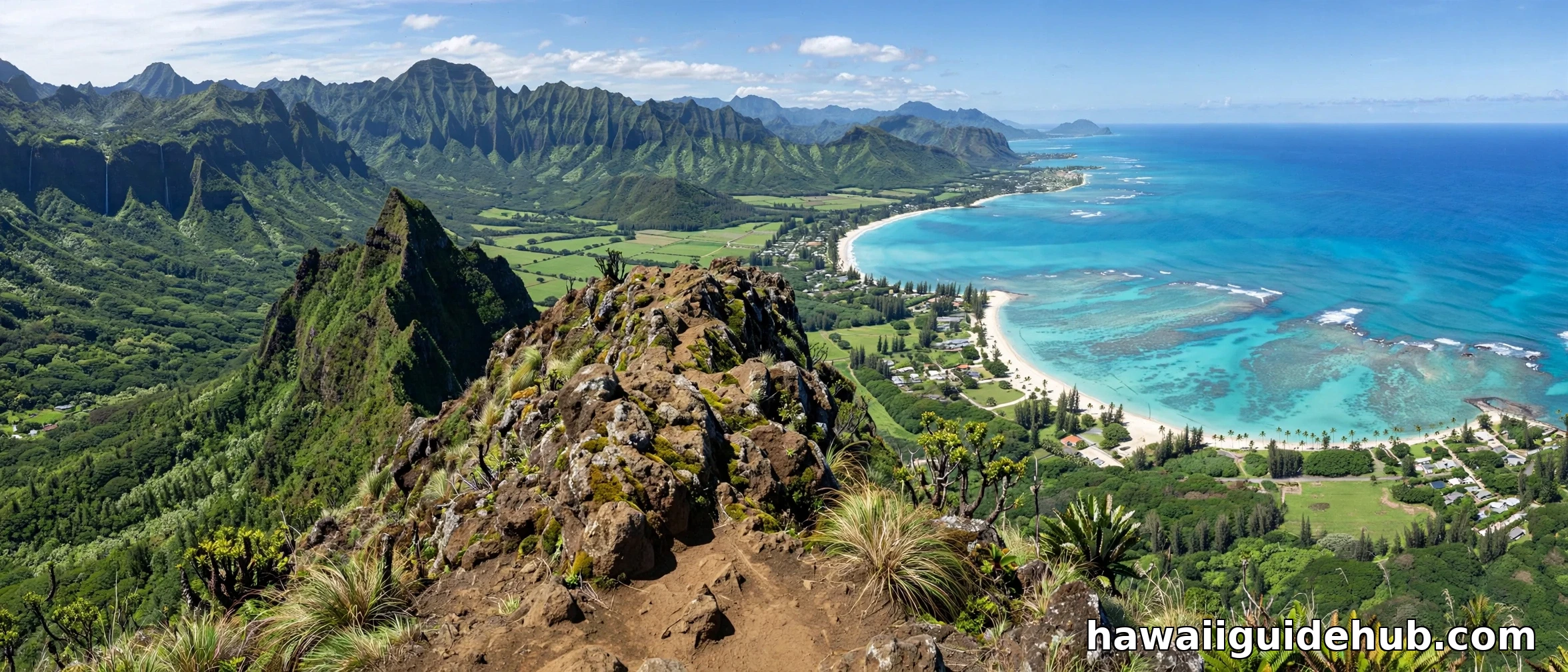
Stand at the top on a clear morning and turn slowly. To the north, Waimanalo Bay curves away in shades of turquoise, with its long beach and the offshore islets. Below you, the deep green folds of the Koʻolau valleys drop toward the sea. Looking back the way you came, you can trace the ridge you just climbed, and on exceptionally clear days the view wraps nearly 360 degrees around the island.
Mornings are almost always clearer than afternoons on this side of the island, which is another reason to start early. Clouds tend to build over the Koʻolau crest by midday, and while the misty version has its own beauty, the postcard view belongs to the early birds. Bring a light windbreaker: the summit catches the trades and can feel ten degrees cooler than the trailhead.
What You Will See Along the Way
One of the underrated pleasures of this hike is how much the plant life changes as you climb. The lower trail is dominated by introduced species, but keep an eye out for the transitions. The ironwoods with their feathery, pine-like branchlets are hard to miss, and the Norfolk pines rise above everything with their perfect geometric tiers. In the guava forest near the shelter, you might spot fallen fruit in season.
Higher up, the native forest takes over: uluhe ferns forming dense green mats, ʻōhiʻa trees with their gnarled trunks, and koa with its sickle-shaped leaves. Birders should listen for native honeycreepers in the upper forest, especially in the early morning when the birds are most active. Feral pigs root along the trail edges in places, so you may see their diggings even if you never see the animals themselves.
Difficulty: Is This Hike Right for You?
Honest assessment: the Kuliʻouʻou Ridge Trail is a solid intermediate hike. If you can comfortably walk 5 miles with 2,000 feet of climbing, you will be fine. If your hiking experience is limited to flat coastal walks, the upper third will be a genuine challenge, and there is no shame in turning around at the shelter. The lower trail still delivers a beautiful forest walk.
This is not a hike for small children, and it is not ideal for anyone with knee problems, since the descent is long and steep in places. Trekking poles help enormously on the way down. If you are visiting and this is your first Hawaiian hike, consider it a step up from the popular beginner trails. First-time visitors who want something gentler can find easier options, then come back to Kuliʻouʻou when their legs are ready.
What to Bring
There are no water fountains, restrooms, or trash cans on the trail, so you carry in everything you need and carry out everything you bring. The list is short but non-negotiable:
- Water: At least 2 liters per person. There is no water on the trail.
- Snacks: You will burn real calories on the climb. Bring more than you think you need.
- Footwear: Trail shoes or hiking shoes with good tread. The trail is slippery after rain.
- Sun protection: Hat, sunscreen, and sunglasses. The upper ridge is exposed.
- Light rain jacket: Mountain weather changes fast, and the summit is windy.
- Phone and offline map: The trail is well marked, but a backup never hurts.
- Trekking poles: Optional but genuinely helpful on the steep descent.
Leave the Bluetooth speaker at home. The forest sounds better without it, and your fellow hikers will thank you.
Parking and Practical Details
There is no parking lot at the trailhead, which is the single most common surprise for first-timers. You park on the street along Kalaʻau Place, and on busy weekends the good spots go early. Arrive by 7:00 or 7:30 in the morning for the easiest parking and the coolest hiking.
Be a good neighbor. The trailhead sits in a quiet residential area, so keep voices down in the early morning, never block driveways or fire hydrants, and do not leave valuables visible in your car. Take every scrap of trash with you, including fruit peels and tissues. Dogs are allowed on the trail but must stay on leash at all times.
There are no restrooms at the trailhead, so plan accordingly. The nearest public restrooms are at the shopping centers down in Hawaiʻi Kai.
Best Time to Hike Kuliʻouʻou Ridge
Year-round is the short answer, since East Oʻahu never really has a bad hiking season. But some times are better than others. Winter months bring more rain, which makes the trail muddier and the upper sections slippery, though the air is cooler. Summer tends to be drier underfoot but hotter, especially on the exposed upper ridge, so an early start matters even more.
Time of day matters more than time of year. Start at or before 8:00 in the morning for the clearest summit views, the coolest temperatures, and the easiest parking. Afternoon clouds frequently cap the Koʻolau summit, and hiking down in the dark is no fun, so give yourself a firm turnaround time and stick to it. If you are planning a broader east side day, the North Shore makes a fine contrast for a second day, though that is a separate drive.
See the Trail on Video
Watching the trail before you hike it is one of the best ways to know what you are signing up for. The video above follows the full route in 4K, including the stairs on the upper ridge and the summit panorama, so you can judge the difficulty for yourself.
A Ridge Worth the Climb
The Kuliʻouʻou Ridge Trail does not have a waterfall at the end or a famous landmark waiting at the top. What it has is something better: an honest climb through a changing forest, a quiet shelter two-thirds of the way up, and a summit view that reminds you why people fall in love with Oʻahu’s mountains in the first place. Go early, bring water, respect the neighborhood at the trailhead, and take your time on the upper ridge. The windward side will be waiting when you get there.