
Captain Cook Hawaiʻi Map
Captain Cook on the Map
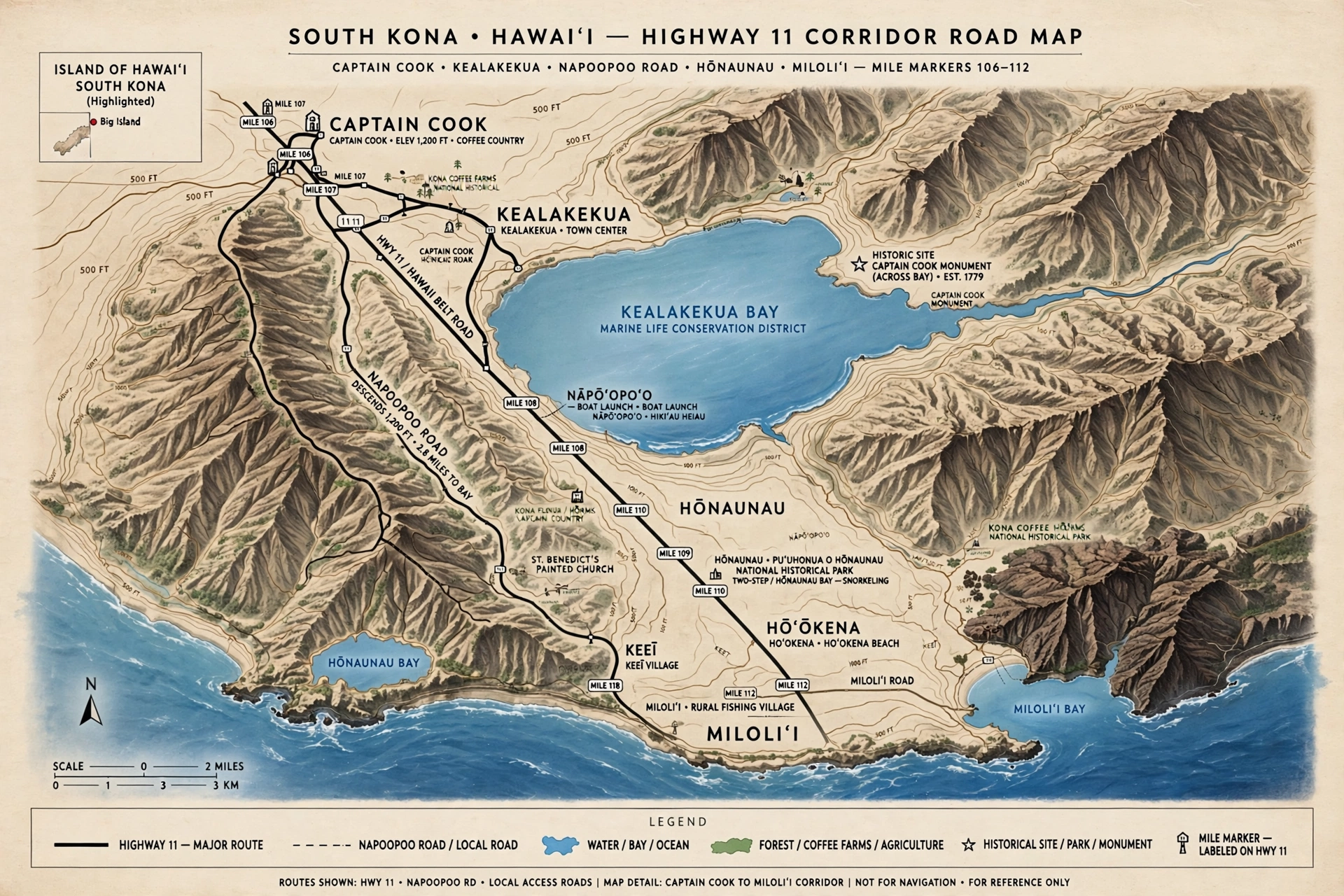
Captain Cook sits on the west coast of the Big Island of Hawaiʻi, in the South Kona district, strung along Māmalahoa Highway (Highway 11) roughly 12 miles south of Kailua-Kona. On a map of the island it occupies a narrow band of the Kona slope, with the town center clustered near mile markers 109 to 111 and residential neighborhoods spreading both mauka (toward the mountain) and makai (toward the ocean) from the highway.
The first thing to understand about reading a map of this area is that Captain Cook is not a compact town with a grid of streets. It is a census-designated place, which means the name covers a spread-out community rather than a single incorporated downtown. The commercial heart is a short stretch of Highway 11, and nearly everything visitors need to find, from the trailhead for the Captain Cook Monument to the turnoff for Kealakekua Bay, is measured by mile markers on that one highway.
Geographically, the town sits on the lower western slopes of Hualālai volcano, in the heart of the Kona coffee belt. Elevations in the community range from sea level at the shoreline up to around 2,000 feet in the upper subdivisions. This slope is the reason Captain Cook feels like two places at once: a highway town up on the ridge, and a waterfront destination down at Kealakekua Bay. The bay itself lies directly makai (seaward) of the town, a crescent of deep blue water tucked into the coastline about two miles downhill from the Highway 11 corridor.
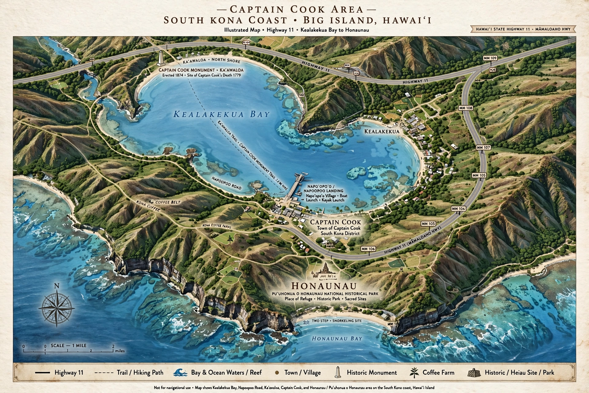
For orientation, keep three reference points in mind. To the north along Highway 11 lies Kealakekua, a neighboring community that blends almost seamlessly into Captain Cook. To the south lies Hōnaunau, home to Puʻuhonua o Hōnaunau National Historical Park. And directly below the town, reached by a winding downhill road, lies Kealakekua Bay and the white obelisk of the Captain Cook Monument on its far shore. If you are looking for the “where is it” story behind the name and the history, our companion guide at Where Is Captain Cook in Hawaiʻi covers the town, the bay, and Captain James Cook’s arrival in full detail. This page is the map companion: the roads, the landmarks, and how the pieces fit together.
It also helps to picture the island as a whole. The Big Island is roughly circular, with Kailua-Kona on the west coast, Hilo on the east, and the saddle between Mauna Loa and Mauna Kea in the middle. Captain Cook sits on the southwest quadrant of that circle, on the leeward (dry, sheltered) side of the island. This leeward position is why the weather here is typically sunny and calm even when Hilo is rainy: the trade winds drop their moisture on the windward slopes long before reaching Kona. On a statewide map, find the Kona coast’s gentle curve, follow it south from Kailua-Kona past Keauhou, and Captain Cook is the next named community where the highway mile markers cross 110.
The Town on the Map
On paper, Captain Cook looks like a line rather than a dot. The town’s businesses, the Manago Hotel (a longtime local landmark near mile marker 110), small shops, eateries, and services sit directly on or just off Highway 11. There is no bypass and no alternate main street, so the highway is the town. Mile markers are the local address system, and visitors quickly learn to navigate by them: the South Kona Green Market area sits near mile 110, and the Napoʻopoʻo Road junction that leads down to Kealakekua Bay is just south of mile marker 111.
Mauka of the highway, the land rises toward Hualālai through coffee country. This uphill side holds residential subdivisions, coffee farms, and the winding side roads that branch off the highway into the neighborhoods. Many of these roads are narrow, and some climb steeply, so a map that shows only Highway 11 understates how much of Captain Cook lies hidden in the green slopes above the road. Makai of the highway, the slope drops toward the ocean, with scattered homes, farm lots, and the roads that descend to the shoreline at Napoʻopoʻo and other small coastal access points.
The town’s northern edge blurs into Kealakekua. The two communities share the same highway corridor, the same school and service area, and in everyday speech locals often treat them as one continuous place. If your map shows Kealakekua just north of Captain Cook, that is correct, and you should not expect a clear boundary sign between them. Captain Cook’s ZIP code is 96704, which it shares with parts of the surrounding South Kona area.
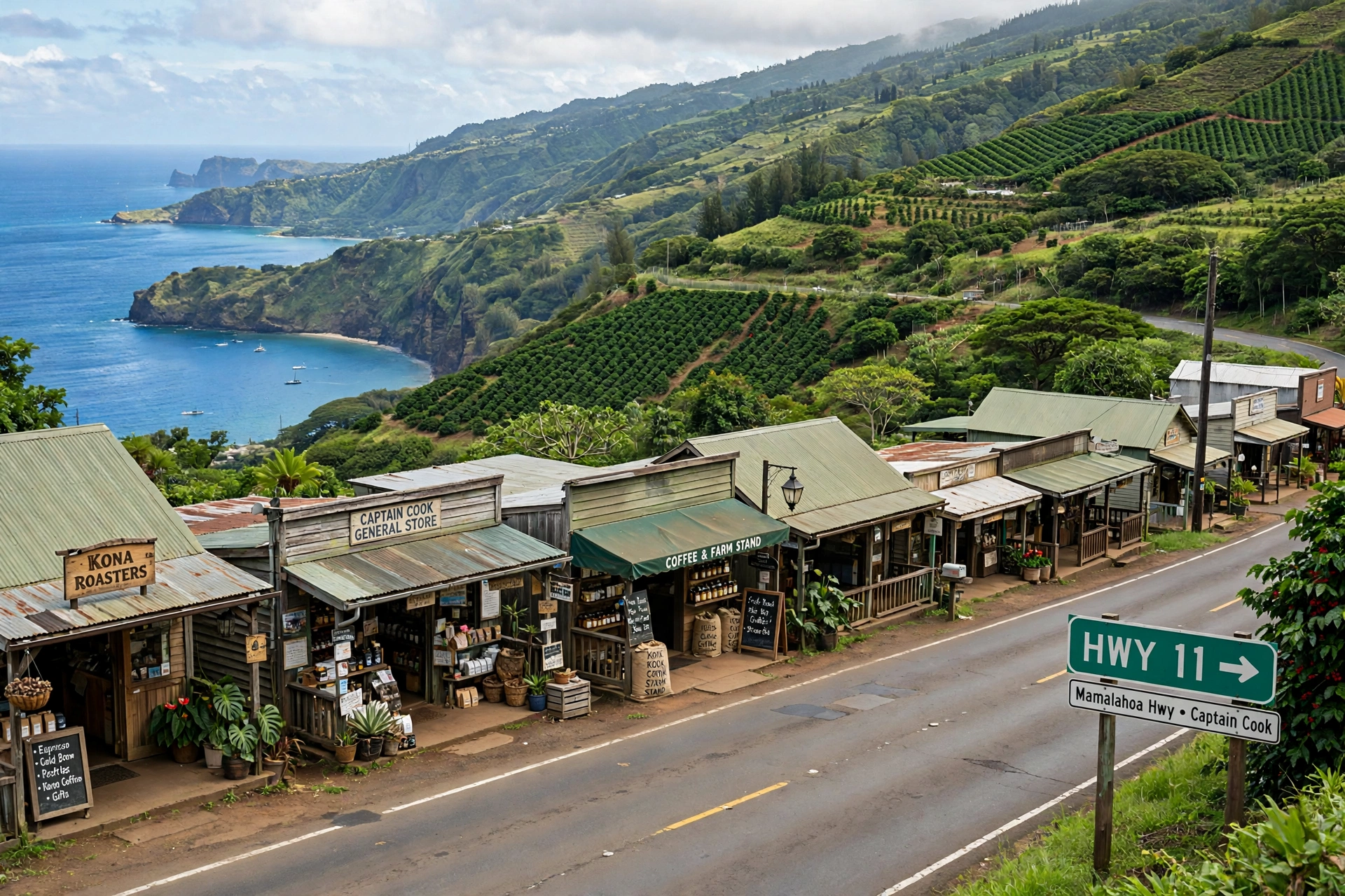
One practical map detail: because the town is linear, distances here are best measured along the highway rather than as the crow flies. Two places that look close on a map can be several minutes apart by road if one is mauka and the other is makai, since the connecting roads wind down the slope. When planning your day, trace the actual route on Highway 11 and the side roads rather than estimating straight-line distance.
Kealakekua Bay on the Map
Kealakekua Bay is the defining feature on any map of the Captain Cook area. The bay sits about 12 miles south of Kailua-Kona, directly below the town, and its crescent shape is easy to spot on satellite views: a deep bite out of the Kona coastline, ringed by steep green cliffs on its north side and opening to the ocean on the west.
Two place names on the bay matter for navigation. At the south end of the bay sits Napoʻopoʻo, a small coastal community reached by Napoʻopoʻo Road descending from Highway 11. This is where the public shoreline access, the small boat pier, and the public shoreline access and the small boat pier are found (launching or landing kayaks and other vessels at Napoʻopoʻo Wharf is prohibited). At the north side of the bay sits Kaʻawaloa, a flat lava shelf where the white obelisk of the Captain Cook Monument stands. The monument marks the approximate location where Captain James Cook died on February 14, 1779, after first sighting the bay on January 17 of that year.
Here is the critical map fact about the monument: no road reaches it. The monument at Kaʻawaloa is accessible only on foot via the Kaʻawaloa Trail or by water. The trailhead begins on Napoʻopoʻo Road, about 500 feet from its intersection with Highway 11, and the trail descends roughly 2 miles to the bay with significant elevation change. Hikers should allow several hours for the round trip, carry ample water, and start early, since the trail is hot, dry, and exposed. There are no restrooms and no water along the way.
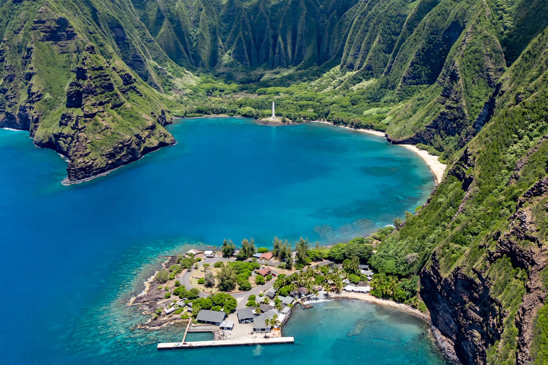
By water, the monument is reached by boat or kayak from the Napoʻopoʻo side. State conservation rules for the bay are strict: private kayaks, stand-up paddleboards, surfboards, and bodyboards may cross Kealakekua Bay only under a DLNR Division of State Parks non-commercial vessel permit; launching or landing at Napoʻopoʻo Wharf is prohibited, and landing at Kaʻawaloa requires a separate DLNR landing permit (limited to 10 per day). Commercial kayak tours operate under their own permits, a regulation designed to protect the bay’s marine life and its resident Hawaiian spinner dolphins. Boat tours depart from several harbors along the Kona coast, including Keauhou Bay and Honokōhau Harbor north of Kailua-Kona.
The bay itself is a protected area in two overlapping designations: Kealakekua Bay State Historical Park covers the shoreline and historic sites, and the Kealakekua Bay Marine Life Conservation District, protected since 1969, covers the waters. Fishing is prohibited in the northern half of the conservation district (Subzone A, including the monument side); in the southern half (Subzone B) it is limited to hook-and-line and thrownet, which is one reason the snorkeling around the monument is considered among the best in the state. The waters near Kaʻawaloa are exceptionally clear, and the coral reef there is one of the healthiest on the island.
On the map, note that the bay’s south shore at Napoʻopoʻo is the only part of Kealakekua Bay reachable by car. Everything north of that point, including the monument shoreline, must be reached by trail or by water. This single fact shapes every visit, so mark it clearly on your mental map before you go.
Key Roads
Highway 11, known locally as Māmalahoa Highway, is the spine of the entire Captain Cook area and part of the Hawaiʻi Belt Road that circles the island. It runs north to south through South Kona, and every major turnoff in the Captain Cook area branches off it. Mile markers increase as you travel south, which makes them a reliable navigation aid: if you are heading south from Kailua-Kona, the numbers climb from the 100s toward 110 and beyond as you approach Captain Cook.
The most important junction is Napoʻopoʻo Road (State Highway 160), which leaves Highway 11 just south of mile marker 111 and winds downhill to Napoʻopoʻo and the south end of Kealakekua Bay. This narrow road is the gateway to the bay, the Kaʻawaloa Trailhead (which sits near the top of the road, just off the highway), and the shoreline access at the bottom. Drive it slowly: it is winding, and in places it is barely wide enough for two cars.
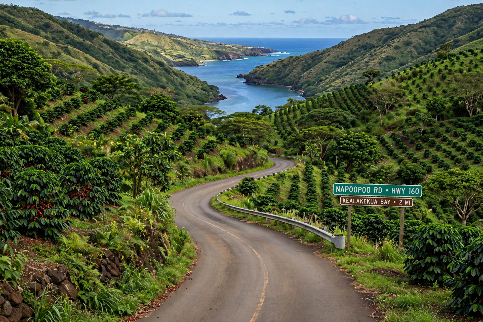
South of Captain Cook, Highway 11 continues toward Hōnaunau and then on to the remote South Kona coast and Miloliʻi. There is no coastal highway paralleling the shore here; Highway 11 stays on the upper slope, and the shoreline communities are reached by short downhill spur roads. North of Captain Cook, the highway runs through Kealakekua and on to Keauhou and Kailua-Kona, a drive of about 20 to 25 minutes.
A few practical notes for drivers. Gas up in Kailua-Kona or Keauhou before heading south, since fuel options thin out along this stretch. Cell coverage is generally fine along Highway 11 but can drop in the dips and valleys of the side roads. And when asking for directions, use the local vocabulary: mauka means toward the mountain (uphill, inland), makai means toward the ocean (downhill, seaward). An address “mauka of the highway” is on the mountain side; “makai” is on the ocean side. These two words will orient you faster than any compass.
South of Hōnaunau, Highway 11 keeps climbing the South Kona slope toward the upland communities and eventually the junction with Highway 180 and the routes toward South Point and the Kaʻū district. Most visitors to the Captain Cook area will not need to go that far, but it is worth knowing the highway continues: if you miss your turn for Hōnaunau or Miloliʻi, you can simply turn around, since Highway 11 is the only through route and everything branches off it. There are no shortcuts and no parallel roads, which makes navigation here refreshingly simple. Stay on 11, watch the mile markers, and take the marked downhill spur when you reach your destination.
Nearby Areas
Kealakekua
Directly north of Captain Cook along Highway 11, Kealakekua is the closest neighboring community and in practice an extension of the same town corridor. The name is the same as the bay’s, and the community sits on the slopes above the bay’s eastern shore. Visitors driving south from Kona pass through Kealakekua just before reaching Captain Cook, and the boundary between the two is invisible on the ground. Services, shops, and homes are intermingled along the highway through both.
Hōnaunau
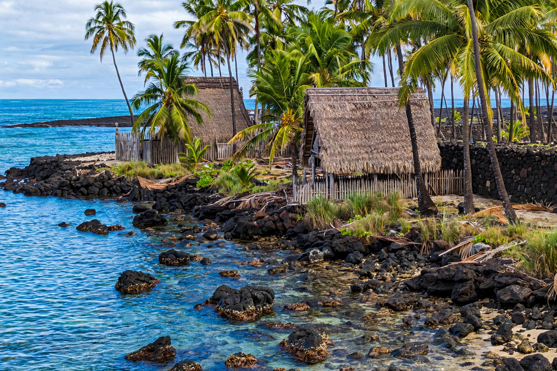
About 9 miles south of Captain Cook town along Highway 11 lies Hōnaunau, home to Puʻuhonua o Hōnaunau National Historical Park, one of the most significant cultural sites on the island. The park preserves a traditional place of refuge, with reconstructed temples, thatched structures, and royal fishponds along a beautiful black and white sand shoreline. Hōnaunau Bay, just north of the park and locally known for its easy shore-entry snorkeling, sits at the bottom of a downhill road off the highway. The drive from Captain Cook takes roughly 15 to 20 minutes.
Miloliʻi
Farther south along Highway 11, then down a long spur road to the ocean, sits Miloliʻi, a small and remote fishing village that feels a world away from the Kona coast’s resort areas. Miloliʻi is one of the last traditional fishing communities in Hawaiʻi, and its isolation is part of its character. The road down is long and winding, facilities are minimal, and visitors should treat it as a quiet residential community rather than a tourist stop. From Captain Cook, allow the better part of an hour each way.
Kailua-Kona and Keauhou
To the north, Kailua-Kona (about 12 miles, 20 to 25 minutes) is the region’s main town, with the island’s west-side airport, shops, restaurants, and services. Keauhou, between Kona and Kealakekua, is a smaller resort and residential area with a sheltered bay that serves as a departure point for boat trips to Kealakekua Bay. Most visitors base themselves in or near Kona and day-trip south to Captain Cook, which makes the Highway 11 corridor the most traveled route on this side of the island.
Navigating Captain Cook
A rental car is effectively essential for exploring the Captain Cook area. Public transportation exists in the form of the island’s Hele-On bus, which runs along Highway 11, but service is infrequent (a handful of trips per day) and it will not get you down Napoʻopoʻo Road to the bay or to the trailhead on your own schedule. Rideshares are scarce this far south of Kona.
Parking deserves advance thought. The Kaʻawaloa Trailhead has only a small informal parking area near the top of Napoʻopoʻo Road, and it fills early on popular days. Down at Napoʻopoʻo itself, parking near the pier and shoreline is very limited. Arrive early in the morning for the best chance at a spot, and never block driveways or the narrow road: tow trucks patrol these areas.
When planning drive times, build in a margin. The posted distances are short, but the roads are winding, and you will want to stop at overlooks. Captain Cook to Kailua-Kona is about 12 miles and takes 20 to 25 minutes in normal traffic. Captain Cook to Hōnaunau is roughly 15 to 20 minutes. Captain Cook to the trailhead or the bay turnoff is a matter of minutes, but the drive down Napoʻopoʻo Road to the water adds another 10 to 15 minutes of slow, careful downhill driving.
Finally, respect the map’s limits. Paper maps and phone apps sometimes show old plantation roads and 4WD tracks as through routes. The Kaʻawaloa Trail itself appears on USGS maps as an old 4WD road, but it is a hiker-only trail: no bikes, no vehicles, no pets, no camping. Stick to the public roads described here, and when a road looks questionable, it probably is.
One more planning tip: pair your map stops in geographic order to avoid backtracking. A natural southbound day runs Kailua-Kona to Kealakekua Bay (via Napoʻopoʻo Road) in the morning, back up to Highway 11 for the Captain Cook town corridor and a coffee farm stop at midday, then south to Hōnaunau for the national historical park in the afternoon. Everything sits along the same highway line, so a single southbound run with well-chosen downhill detours covers the whole district without retracing your route.
Frequently Asked Questions
Where is Captain Cook on the Big Island?
Captain Cook is on the west (Kona) coast of the Big Island in the South Kona district, strung along Highway 11 about 12 miles south of Kailua-Kona, directly above Kealakekua Bay. For the full location story, see our Where Is Captain Cook in Hawaiʻi guide.
Can you drive to the Captain Cook Monument?
No. The monument at Kaʻawaloa on the north shore of Kealakekua Bay is unreachable by road. It is accessible only by hiking the Kaʻawaloa Trail (about 2 miles each way from the trailhead near Highway 11 and Napoʻopoʻo Road) or by water.
How do you get to Kealakekua Bay by car?
Take Napoʻopoʻo Road (Highway 160) off Highway 11 just south of mile marker 111 and follow it downhill to Napoʻopoʻo at the south end of the bay. This reaches the shoreline, the pier, and the kayak launching area, but not the monument, which is on the opposite side of the bay.
How far is Captain Cook from Kailua-Kona?
About 12 miles by road, roughly a 20 to 25 minute drive south on Highway 11 in normal traffic.
What is near Captain Cook?
Kealakekua borders it to the north, Kealakekua Bay sits directly below it, Hōnaunau and Puʻuhonua o Hōnaunau National Historical Park are about 9 miles south, and the remote fishing village of Miloliʻi is farther south still. Kailua-Kona is 12 miles north.
Can you kayak in Kealakekua Bay on your own?
State conservation rules prohibit personal kayaks, stand-up paddleboards, surfboards, and bodyboards from entering the bay unless they are part of a tour with a licensed local operator. Check current regulations before you go, since rules can change.
What do mauka and makai mean?
Mauka means toward the mountain (inland, uphill) and makai means toward the ocean (seaward, downhill). Locals use these words for directions constantly, so learning them will help you navigate the Captain Cook area.
Do you need a car in Captain Cook?
Yes, for practical purposes. The island bus runs along Highway 11 only a few times a day, and it does not serve Napoʻopoʻo, the trailhead, or the shoreline. A rental car gives you full access to the town, the bay, and the surrounding South Kona area.
Related Guides
- Where Is Captain Cook in Hawaiʻi: the companion location guide with the town, bay, monument, and history in full detail
- Ko Olina Hawaii Map: the resort coast on Oʻahu’s leeward side, plotted street by street
- Hawaiʻi Map: the island-by-island overview for planning your route
- Where Is the Big Island: position, districts, and getting oriented
- Big Island Beaches: shoreline access around the island, including the Kona coast
With Highway 11 as your reference line, mile markers as your addresses, and the bay sitting directly makai of town, the Captain Cook area is one of the easiest parts of the Big Island to read on a map. The town runs along the ridge, the bay lies below it, the monument waits across the water at Kaʻawaloa, and South Kona unfolds to the south. Learn those four relationships and the whole district makes sense.