
Quick Answer: Where Is Mānoa?
Mānoa is a lush valley neighborhood of Honolulu on the island of Oʻahu, about three miles inland from Waikīkī and just east of downtown Honolulu. It sits at the back of a narrow valley carved between the ridges of the Koʻolau mountain range, with its upper end pressed against the island’s wettest mountain wall and its lower end opening onto the Honolulu plain. If you are driving from Waikīkī, you reach Mānoa in about 10 to 15 minutes; from Honolulu International Airport, the drive is roughly 25 to 30 minutes depending on traffic.
Mānoa is best known for four things: the University of Hawaiʻi at Mānoa, the state university’s flagship campus; the Mānoa Falls Trail, a short rainforest hike ending at a 150-foot waterfall; Lyon Arboretum, a 193-acre botanical garden run by the university; and its nickname, the Valley of Rainbows, earned because afternoon showers and low sun produce rainbows over the valley almost daily. Mānoa Road is the valley’s single main artery, winding past university buildings, older wooden houses, and dense tropical vegetation until it ends at the trailheads and the arboretum near the back of the valley. The valley’s boundaries are defined by its ridges: to the east, the ridge separates Mānoa from the Pālolo valley; to the west, another ridge separates it from the Makiki and downtown watersheds. Within Mānoa, small neighborhood pockets have their own character. The lower valley around the university is denser and younger, filled with student housing and longtime faculty homes. Mid-valley streets climb the side ridges with houses tucked into the forest. Upper Mānoa, past the marketplace, is the greenest and quietest stretch, where the road narrows, the canopy closes overhead, and the sound of the streams takes over from traffic.
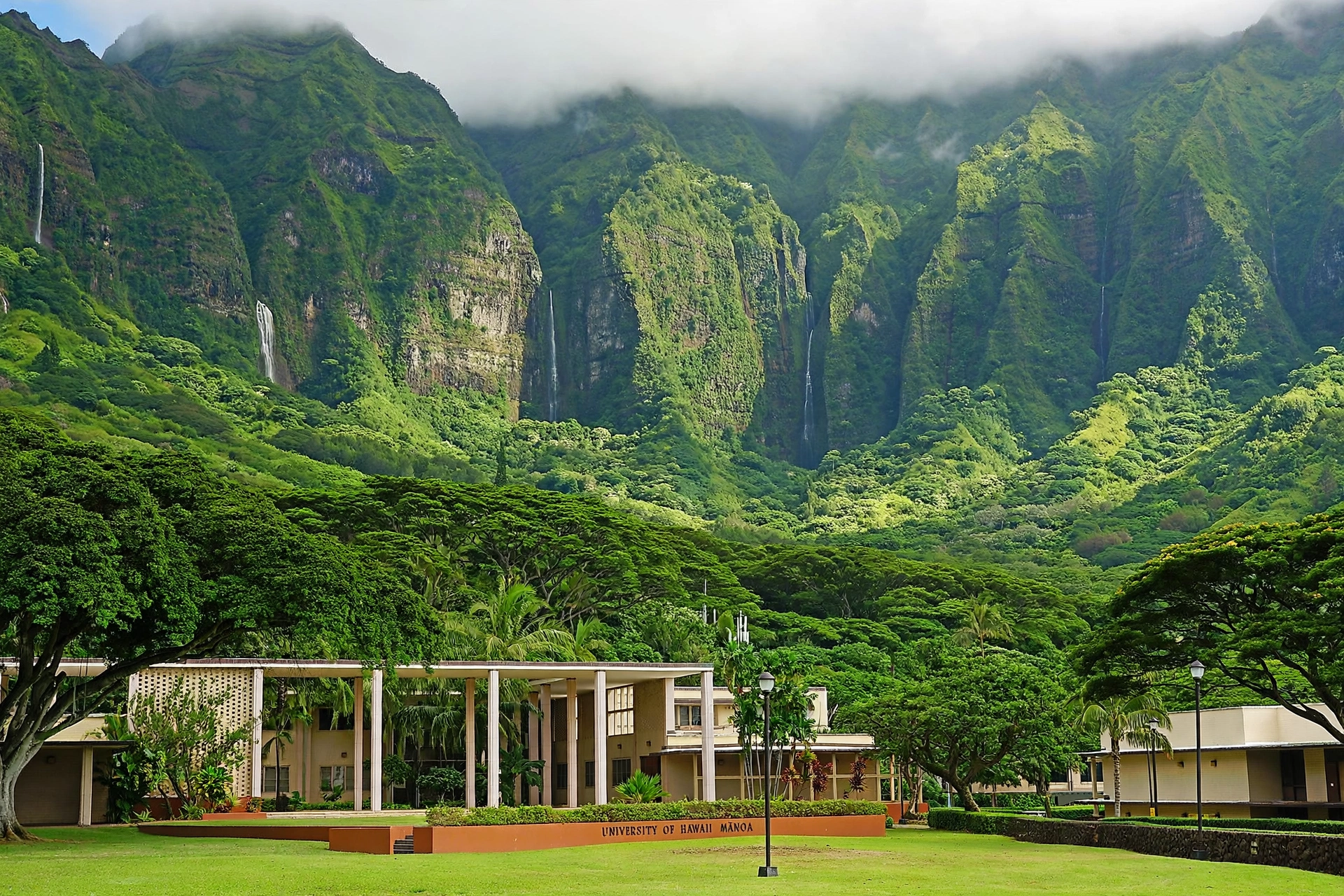
The Valley
Mānoa Valley runs roughly two miles from the Honolulu plain up into the Koʻolau mountains. It is one of the wettest inhabited valleys on Oʻahu, receiving on the order of 100 inches of rain a year in its upper reaches, which explains both the astonishing greenery and the near-daily afternoon showers that feed the waterfall. The valley’s shape is an amphitheater of steep ridges, with the Mānoa Stream running down its center, joined by tributaries like Waihi Stream before the water eventually drains toward the Ala Wai watershed.
Because the trade winds pile moist air against the Koʻolau wall, Mānoa’s weather can differ sharply from the coast. Mornings are often clear and bright, while clouds build over the ridges by early afternoon. This pattern matters for planning: hikers do the Mānoa Falls Trail in the morning when the path is drier and the falls have overnight water, while rainbow watchers look east across the valley in the late afternoon when low sun angles through the mist. The valley stays a few degrees cooler than Waikīkī year round, and mosquito repellent is worth carrying anywhere near the streams.
Residential Mānoa is one of Honolulu’s oldest suburbs, with a mix of plantation-era wooden cottages, mid-century homes, and student rentals clustered near the university.
The science behind the Valley of Rainbows nickname is straightforward and visible from almost any mid-valley vantage point. Trade-wind showers move through the valley on a daily cycle, and when the low afternoon sun shines from the west onto rain falling against the eastern ridges, the geometry is nearly ideal for rainbow formation. Double rainbows are common, and on the best afternoons the arc lands directly over the university campus. Residents treat the daily rainbow as ordinary weather; visitors tend to treat it as an event. Both are right.
Mānoa Marketplace, a modest shopping center near the valley entrance, serves as the neighborhood’s commercial hub with a grocery store and local eateries. There are no resorts, no nightlife strip, and no beaches here; Mānoa’s appeal is entirely its greenery, its institutions, and its quiet residential character. The valley’s plant life is a mix of the native and the introduced. Native ʻōhiʻa lehua and koa still grow on the upper ridges, while the lower valley and gardens hold an extraordinary collection of introduced tropical species: banyans, monkeypods, rainbow shower trees, African tulip trees, and towering bamboo. Birders can spot native honeycreepers on the higher trails, though most of the valley’s common birds, like the Japanese white-eye and the red-vented bulbul, are introduced species. The Mānoa watershed is managed as part of the Honolulu Watershed Forest Reserve, and its streams feed the island’s water supply, which is why staying on trails and keeping the water clean matters here.

University of Hawaiʻi at Mānoa
The University of Hawaiʻi at Mānoa is the flagship campus of the state’s public university system and the dominant institution of the lower valley. Founded in 1907 as a college of agriculture and mechanical arts, it has grown into a research university whose campus covers much of lower Mānoa. Its academic strengths reflect its location: marine science, tropical agriculture, volcanology, Pacific and Asian studies, astronomy, and Hawaiian studies.
For visitors, the campus is open and walkable, with a few landmarks worth noting. Bachman Hall houses the administration and sits near the historic center of campus. The East-West Center, adjacent to the campus, is a federally funded institution promoting relations between the United States and Asia-Pacific nations, and its grounds include a Japanese garden. The campus art galleries host rotating exhibitions, and the Stan Sheriff Center and Les Murakami Stadium host University of Hawaiʻi athletics. Visitors interested in the campus can walk it freely; parking on campus is restricted and paid, so most visitors arrive by bus, bike, or on foot from the surrounding neighborhood. The campus also anchors the valley’s intellectual life. Its Hamilton Library holds one of the finest Pacific collections anywhere, and the campus regularly hosts public lectures, concerts, and cultural performances that visitors can often attend. The university’s presence shapes the whole lower valley: coffee shops, bookstores, and affordable eateries cluster along University Avenue and the surrounding streets, giving lower Mānoa a livelier, younger feel than the quiet upper valley.
Mānoa Falls
The Mānoa Falls Trail is the valley’s most popular hike and one of Oʻahu’s most visited short trails. The trail is 0.8 miles each way, climbing about 800 feet of elevation through dense rainforest to a viewpoint at the base of a 150-foot waterfall. Most hikers complete the round trip in one and a half to two hours. The trail follows Waihi Stream through bamboo groves, tree ferns, and giant banyan trees, and the route has been used as a filming location for productions including Jurassic Park and Lost, which partly explains its fame.
What you will see on the trail
The trail begins at the end of Mānoa Road, just past the Lyon Arboretum entrance, and climbs steadily through a forest that feels far removed from the city below. The first stretch passes through groves of bamboo so tall and dense that the light turns green. Further up, the trail crosses small bridges over Waihi Stream and threads between giant banyan trees whose aerial roots form natural archways. Tree ferns, wild ginger, and philodendron crowd the understory. The final approach opens onto a rocky clearing at the base of the falls, where the 150-foot cascade drops down a sheer amphitheater wall into a boulder-strewn pool. After heavy rain the falls thunder; in dry spells they narrow to a ribbon, which is why morning visits after overnight rain give the best showing.
Access and practical details
As of 2026, no permit or reservation is required to hike the Mānoa Falls Trail. The trail itself is free to access. Parking is available at the Paradise Park lot at the trailhead, which charges a fee of about $7 per vehicle, with discounts for Hawaiʻi residents and military. Limited free street parking exists on nearby residential roads, but restrictions are actively enforced and the Lyon Arboretum lot next door is not for trailhead use. The trail is generally open during daylight hours, and morning starts are strongly recommended: parking fills early on weekends, the path is less muddy before the afternoon rains, and the waterfall runs fuller earlier in the day.
Safety
Swimming is not allowed at Mānoa Falls. The pool at the base of the falls carries a risk of leptospirosis, a bacterial infection present in Hawaiʻi’s freshwater streams, and falling rock is a genuine hazard near the cliff face. The trail is often muddy and slippery even in dry weather, so wear sturdy shoes with grip, and bring a light rain jacket and insect repellent. Flash flooding is possible during heavy rain; if streams rise or rain intensifies, turn back. Check the Hawaiʻi Department of Land and Natural Resources and the National Weather Service Honolulu office for closure notices and weather before you go.
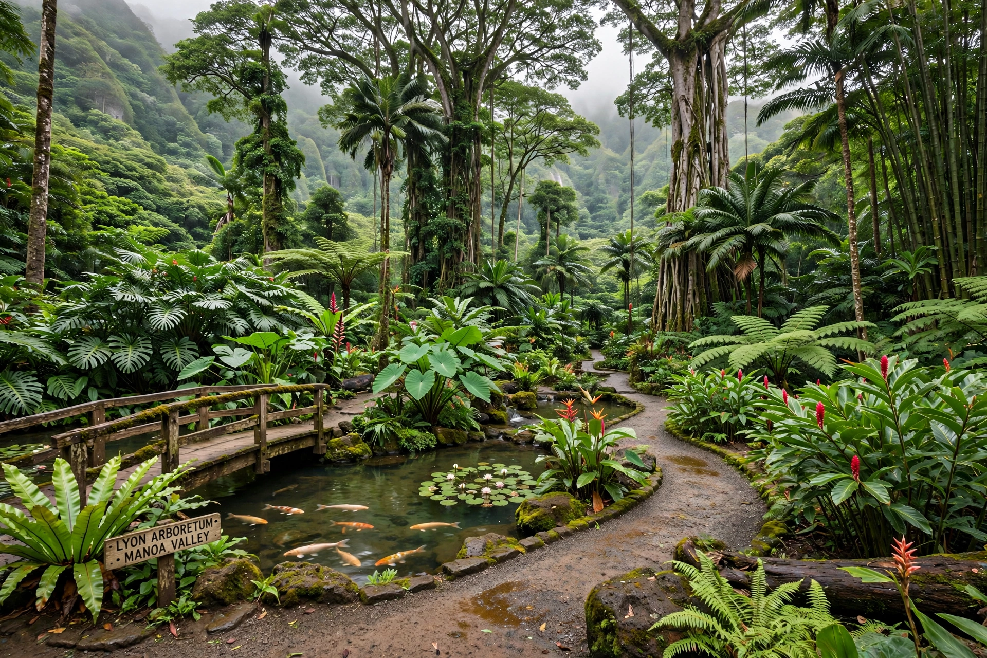
Lyon Arboretum
The Harold L. Lyon Arboretum is a 193-acre botanical garden and research facility operated by the University of Hawaiʻi at Mānoa, sitting at the very back of the valley at 3860 Mānoa Road. It holds one of the most significant collections of tropical plants in the United States, with an emphasis on Hawaiian native plants, palms, and economically important tropical species. It also maintains an active seed bank for endangered Hawaiian plants, banking tens of millions of seeds from hundreds of threatened taxa.
Visiting requires planning. The arboretum is open Monday through Friday from 9 a.m. to 3 p.m., is closed on weekends and holidays, and admission is by reservation only. Entry is free, though a suggested donation supports the garden’s upkeep. Docent-led tours are available and worth booking for the depth they add to the collections. Bring mosquito repellent and rain gear; the upper garden trails are steep and the grounds sit in the valley’s wettest zone. Do not confuse the arboretum with the adjacent former Paradise Park parcel, a separate property. The garden’s collections are organized into themed sections that reward slow exploration. The Native Hawaiian Garden gathers plants found only in the islands, many of them rare or endangered in the wild. The Economic Section shows the tropical plants humans depend on, from spices to fibers. Towering palm collections, aroids, and heliconias fill the lower grounds, while trails climb toward a small waterfall and overlooks. The arboretum was established in 1918 through the bequest of Harold Lyon, a plant pathologist with the Hawaiʻi Sugar Planters Association, and it became part of the university in 1953. Its research mission continues today through the seed bank and field programs that propagate native plants for restoration across the islands.
History of Mānoa
Mānoa was a significant agricultural valley in the Hawaiian Kingdom era, with taro loʻi fed by the valley’s abundant streams and fishponds near the coast. In the 19th century, the valley became one of Honolulu’s first suburbs as wealthy residents built homes up the valley to escape the heat of the town, and dairy farms operated on the valley floor into the early 20th century. The College of Hawaiʻi, which became the University of Hawaiʻi, was established in lower Mānoa in 1907, anchoring the valley’s institutional character.
The valley’s watershed history is also a conservation story. Much of the upper valley sits in the Honolulu Watershed Forest Reserve, and reforestation efforts in the early 20th century repaired damage from grazing and logging. The Mānoa Heritage Center, located near the valley’s historic sites, preserves the valley’s cultural landmarks, including the Kūkaʻōʻō Heiau, and offers guided tours by reservation. The valley’s nickname, the Valley of Rainbows, reflects generations of residents watching daily rainbows arc between the ridges. In the plantation era, the valley’s water was a contested resource. Ditches and tunnels diverted Mānoa’s streams toward Honolulu’s growing population and toward sugar lands elsewhere, and the politics of water in Mānoa foreshadowed the island-wide water battles of the 20th century. The establishment of the watershed reserve and the eventual public ownership of key lands marked a turn toward protecting the valley’s forests as a water source, a status they retain today. The university’s own history is woven into this story: its agricultural college origins reflected the territory’s plantation economy, and its later growth into a research university mirrored Hawaiʻi’s shift toward education, science, and services. Walking the campus today, the oldest buildings near Bachman Hall still carry the proportions of that early institutional era, while the newer science and marine buildings face the Pacific research world the university now serves.

What to See
A visit to Mānoa usually centers on the falls trail and the arboretum, but the valley holds a few more stops. The Mānoa Heritage Center offers cultural tours of the valley’s historic sites. The Lyon Arboretum’s grounds include several garden sections, from the Native Hawaiian Garden to spice and ethnobotany collections. Near the valley entrance, the university campus rewards a stroll, particularly around the East-West Center gardens and the campus mall.
Mānoa Marketplace provides the valley’s everyday commercial life and a practical lunch stop before or after a hike. For a longer day, the valley connects conceptually to the island’s watershed and ridge trails, including the steep ʻAihualama and Waiʻanae-side routes, though these are advanced hikes and should not be attempted casually. Most visitors combine Mānoa with nearby Honolulu sights: the Bishop Museum, about 15 minutes away, and the downtown historic district, about 10 minutes away. Photography is excellent throughout the valley. The falls trail offers its best light in the morning when sun angles through the canopy, while the valley overlooks along Mānoa Road give sweeping views back toward Honolulu and the ocean. Rainbow photography works best in the late afternoon from the mid-valley looking east. If you visit on a weekday, consider timing a morning hike with an afternoon reservation at the arboretum, the two pair naturally and both close by mid-afternoon.
Getting There
Mānoa is reached via the H-1 freeway, exiting onto University Avenue or Punahou Street and heading mauka, toward the mountains, until the road becomes Mānoa Road and narrows into the valley. From Waikīkī the drive is about 10 to 15 minutes; from the airport, about 25 to 30 minutes. TheBus serves the valley on several routes, including service to the university area, and the falls trailhead is reachable by bus plus a short walk, though a car is more convenient. Parking at the trailhead is paid; on-campus parking is restricted. Because Mānoa Road is the valley’s only through route, traffic concentrates there during university commute hours, so mid-morning arrivals work best. Visitors relying on public transit should check TheBus schedules in advance, since service into the upper valley is less frequent than service to the campus. Rideshare services operate throughout Mānoa, though drivers can be harder to find for pickups at the trailhead during off-peak hours. Cyclists will find the valley ride pleasant but should know that Mānoa Road narrows considerably past the marketplace, with limited shoulder in the upper stretches.
Frequently Asked Questions
Where exactly is Mānoa in Hawaiʻi?
Mānoa is a valley neighborhood of Honolulu on Oʻahu, about three miles inland from Waikīkī, running from the Honolulu plain up into the Koʻolau mountains. It is not a separate town or city.
Is Mānoa a city or a neighborhood?
A neighborhood. Mānoa is part of the City and County of Honolulu. It has its own ZIP code and a distinct valley identity, but it is administratively part of Honolulu and has no separate local government.
Do I need a reservation for the Mānoa Falls Trail?
No. The trail requires no permit or reservation and has no entrance fee. Parking at the Paradise Park lot at the trailhead costs about $7 per vehicle.
Can you swim at Mānoa Falls?
No. Swimming is prohibited at the falls because of the risk of leptospirosis in the water and the danger of falling rock near the cliff face.
Do I need a reservation for Lyon Arboretum?
Yes. The arboretum admits visitors by reservation only, Monday through Friday from 9 a.m. to 3 p.m. It is closed on weekends and holidays. Admission is free.
How long does the Mānoa Falls hike take?
The round trip is about 1.6 miles and takes most hikers one and a half to two hours, depending on trail conditions and time spent at the falls.
Why is Mānoa called the Valley of Rainbows?
Afternoon showers over the valley, combined with low sun angles against the Koʻolau wall, produce rainbows over Mānoa almost daily. The nickname reflects generations of residents watching them, and visitors who stay through a late-afternoon shower are the most likely to see one.
How far is Mānoa from Waikīkī?
About three miles inland, or 10 to 15 minutes by car. It is one of the easiest nature escapes from the Waikīkī and Honolulu hotel districts.
Is the Mānoa Falls Trail suitable for children?
The trail is generally considered family-friendly because of its short distance, but the muddy, slippery sections and stream crossings mean small children need close supervision and sturdy footwear. There are no guardrails along much of the route.
What should I wear for the Mānoa Falls hike?
Sturdy closed-toe shoes with good grip, light clothing that can get wet, and a light rain jacket. Bring insect repellent. Avoid white or delicate clothing; the red-brown mud stains permanently.
Mānoa rewards visitors who arrive early, dress for rain, and respect the valley’s working institutions and quiet streets. It is Honolulu’s greenest neighborhood, and one of the few places where a world-class university, a botanical research garden, and a rainforest waterfall sit within a single small valley a few minutes from the city. Whether you come for the falls, the arboretum, the campus, or simply to watch the afternoon rainbows form over the ridges, Mānoa offers a side of Oʻahu that the beach districts cannot: a living valley where the island’s water, forests, and institutions all begin.