
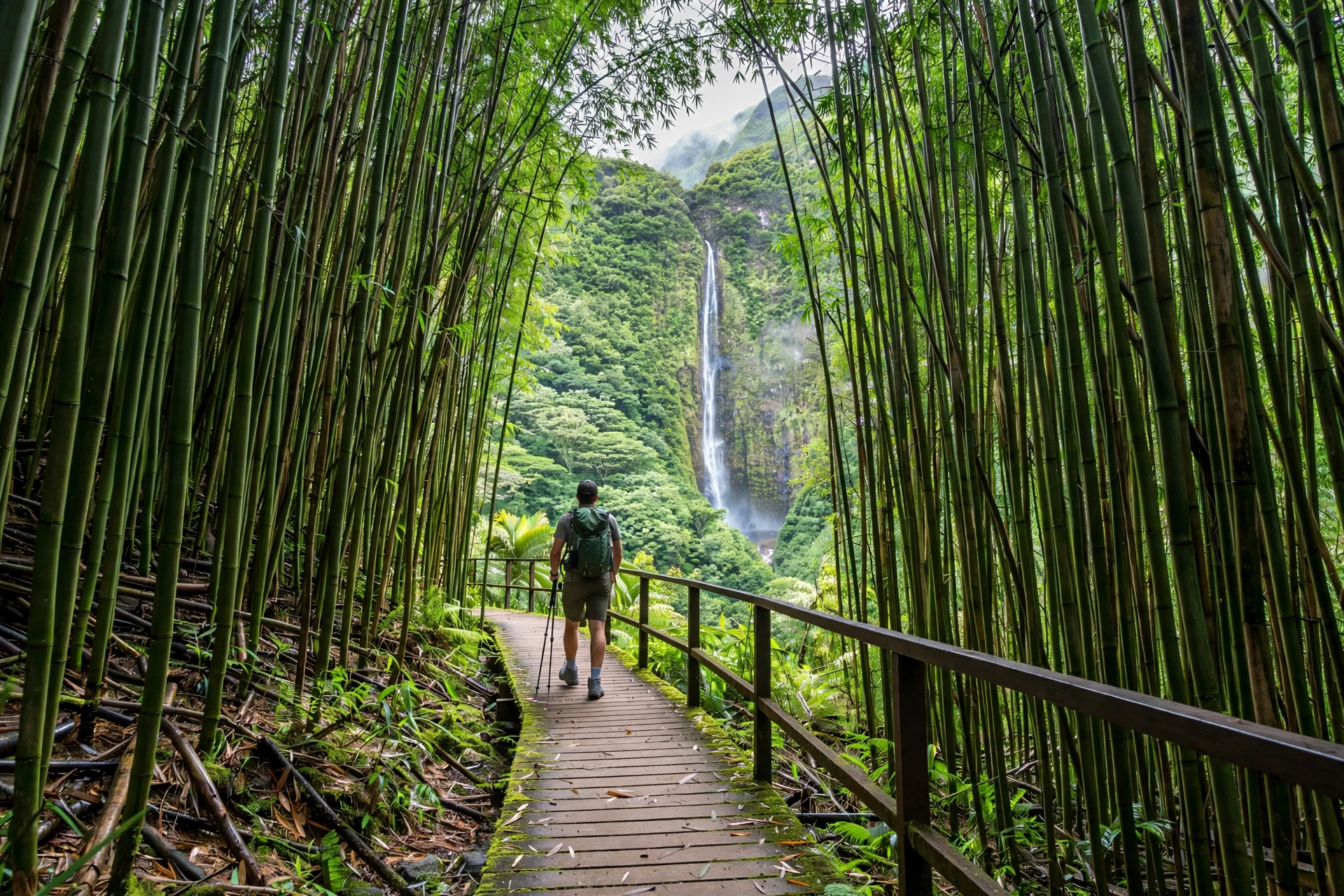
Maui offers the most varied hiking of any Hawaiian island. Within a single trip you can walk a paved shoreline path past luxury resorts, climb through cloud forest on a knife-edge ridge, descend into the vast volcanic crater of Haleakalā, and finish the day on a black sand beach trail. The island’s two volcanic masses, the older West Maui Mountains and the younger Haleakalā, create completely different trail characters, and the famous Road to Hāna corridor adds rainforest waterfall hikes found nowhere else on the island. This guide covers twenty trails across every difficulty level, with honest assessments of what each one demands and delivers.
On This Page
Quick Comparison: All 20 Trails
Use this table to shortlist trails by difficulty, distance, and what you want to see. Every trail below is described in full detail in its difficulty section.
| Trail | Distance (RT) | Elevation Gain | Difficulty | Best For |
|---|---|---|---|---|
| Kapalua Coastal Trail | 3.5 mi | ~100 ft | Easy | Sunset walk, ocean views |
| Wailea Beach Path | 3.0 mi | ~50 ft | Easy | Stroller-friendly stroll |
| ʻĪao Valley State Monument | 0.6 mi | ~100 ft | Easy | Culture, lush valley views |
| ʻOhai Loop Trail | 1.2 mi | ~150 ft | Easy | Coastal cliffs, blowhole views |
| Twin Falls (Hoʻolawa) | 1.8 mi | ~200 ft | Easy | Waterfalls, swimming |
| Dragon’s Teeth (Makalua-Puna) | 1.2 mi | ~80 ft | Easy | Lava formations, sunset |
| Nakalele Blowhole Walk | 1.2 mi | ~200 ft | Easy | Blowhole, coastal scenery |
| Waiheʻe Ridge Trail | 5.0 mi | 1,563 ft | Moderate | Ridge views, cloud forest |
| Pipiwai Trail | 4.0 mi | 650 ft | Moderate | Bamboo forest, Waimoku Falls |
| Mahana Ridge Trail | 8.5 mi | 1,800 ft | Moderate | Long ridge walk, solitude |
| Kahakapao Loop Trail | 5.2 mi | 1,200 ft | Moderate | Forest loop, birdwatching |
| Hoapili Trail (King’s Highway) | 5.5 mi | ~200 ft | Moderate | Lava coast, history |
| Makamakaʻole Stream (13 Crossings) | 2.5 mi | ~600 ft | Moderate | Stream crossings, waterfalls |
| Polipoli Springs Loop | 4.5 mi | ~800 ft | Moderate | Redwoods, cool mountain air |
| Halemauʻu Trail | 7.5 mi | 1,400 ft | Moderate/Hard | Crater switchbacks, cinder cones |
| Sliding Sands (Keoneheʻeheʻe) | 11.0 mi | 2,800 ft | Hard | Volcanic crater, otherworldly |
| Kaupō Gap | 9.0 mi | ~6,000 ft | Hard | Extreme descent, backcountry |
| Lahaina Pali Trail | 5.0 mi | 1,600 ft | Hard | Workout, historic trail, views |
| Haleakalā Skyline Trail | 8.0 mi | 2,500 ft | Hard | High-altitude ridge, solitude |
| Waiʻānapanapa Coastal Trail | 3.0 mi | ~300 ft | Easy/Moderate | Black sand, sea arches |
Easy Hikes (Relaxed & Family-Friendly)
These trails require no special fitness and work for children, older hikers, and anyone who wants scenery without suffering. Most are under two hours and can be done in athletic shoes.
Kapalua Coastal Trail
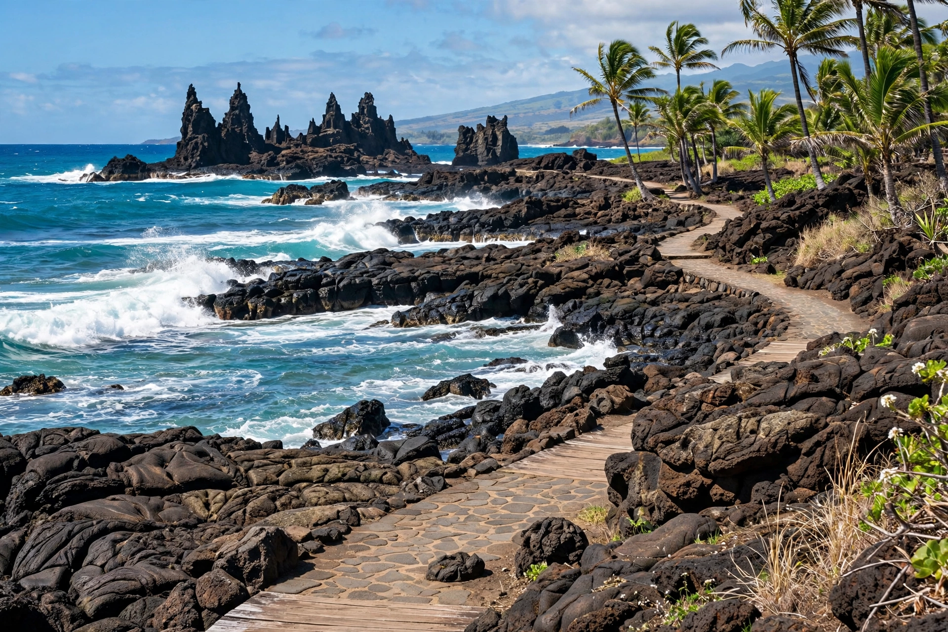
This is Maui’s prettiest easy walk, a shoreline path connecting Kapalua Bay, Oneloa Bay, and D.T. Fleming Beach along West Maui’s most scenic coastline. The trail surface alternates between boardwalk, dirt path, and beach sand, passing tide pools, ironwood trees, and the famous Dragon’s Teeth lava formation at Makalua-Puna Point. Go at sunset when the light turns the water gold and the crowds thin. There is no shade for long stretches, so bring water even though the distance is short. Parking is available at Kapalua Bay or D.T. Fleming Beach Park.
Trailhead: Kapalua Bay parking lot or D.T. Fleming Beach Park. Facilities: Restrooms at both beach parks.
Wailea Beach Path
A paved, mostly flat coastal promenade linking the Wailea resort beaches from Ulua Beach to Polo Beach. This is less a hike than a spectacular walk, and that is exactly its appeal: stroller-friendly, wheelchair-accessible in sections, with constant ocean views and public beach access points along the way. Early morning is the sweet spot, before the heat builds and while the water is calmest. Each beach has its own character, from the snorkeling at Ulua to the wide sand at Keawakapu. Public parking is available at the beach access lots between resorts.
Trailhead: Ulua Beach Park or Keawakapu Beach access. Facilities: Restrooms and showers at beach parks.
ʻĪao Valley State Monument
A short paved loop through one of the most culturally significant valleys in Hawaiʻi, where the Battle of Kepaniwai was fought in 1790. The trail climbs gently to a viewpoint of the ʻĪao Needle, a 1,200-foot vegetated rock pinnacle rising from the valley floor, with the West Maui Mountains wrapped in clouds behind it. The ethnobotanical loop identifies plants brought by Polynesian voyagers. Non-residents must book parking and entry in advance through the state system. Combine it with a stop in Wailuku town for a half-day trip.
Trailhead: ʻĪao Valley State Monument parking lot, end of ʻĪao Valley Road. Facilities: Restrooms at the monument.
ʻOhai Loop Trail
A relatively new coastal loop on Maui’s rugged north shore near the Nakalele Blowhole, offering dramatic cliff views without the crowds of the blowhole itself. The trail traces the edge of sea cliffs with views back toward the West Maui Mountains, passing native coastal plants and nesting seabirds in season. It is fully exposed, so morning or late afternoon is best. The loop format means no backtracking, and the distance suits families with older children. Stay behind the railings and fencing near cliff edges.
Trailhead: Small pullout on Kahekili Highway near the blowhole parking area. Facilities: None; nearest restrooms at the blowhole lot.
Twin Falls (Hoʻolawa)
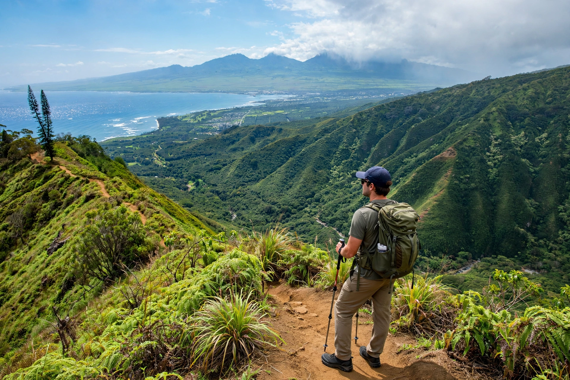
The first worthwhile waterfall stop on the Road to Hāna, at Mile Marker 2, on private land managed for public access. A farm road leads past taro patches and fruit stands to the lower falls, a short climb up a rocky trail reaches the upper falls with a swimmable pool. The water is refreshing rather than cold, and the setting is pure East Maui rainforest. Arrive before 9 AM to beat the Hāna highway traffic. Do not jump from the falls; submerged rocks cause injuries every year. Parking requires a fee paid at the farm stand.
Trailhead: Twin Falls farm stand, Mile Marker 2, Hāna Highway. Facilities: Portable toilets and a farm stand at the trailhead.
Dragon’s Teeth (Makalua-Puna Point)
A short spur off the Kapalua Coastal Trail leading to one of Maui’s strangest geological features: jagged black lava formations that hardened as wind-blown spray, creating tooth-like spires along the point. The contrast of black rock, white surf, and blue ocean is striking, and the offshore views toward Molokaʻi are excellent. The lava is sharp, so wear closed shoes and keep children from climbing on the formations. Sunset here is superb, and it pairs naturally with the full coastal trail walk.
Trailhead: Kapalua Coastal Trail, access via the Ritz-Carlton Kapalua beach path. Facilities: None at the point; restrooms at Kapalua Bay.
Nakalele Blowhole Walk
A short, steep descent from the Kahekili Highway to one of Hawaiʻi’s most powerful blowholes, where ocean swells force water through a lava tube opening with explosive force. The walk itself is brief but the footing is uneven volcanic rock, and the final approach to the blowhole rim is genuinely dangerous. People have died here after being swept in by unexpected surges. View the blowhole from the marked safe distance, never approach the opening, and never turn your back on the ocean. The heart-shaped rock formation nearby is a popular photo stop.
Trailhead: Nakalele Point parking lot, Mile Marker 38.5, Kahekili Highway. Facilities: Portable toilets at the parking lot.
Moderate Hikes
These trails demand real fitness, proper footwear, and half a day. Expect mud, elevation gain, stream crossings, or all three. They deliver the classic Maui hiking experiences most visitors remember.
Waiheʻe Ridge Trail
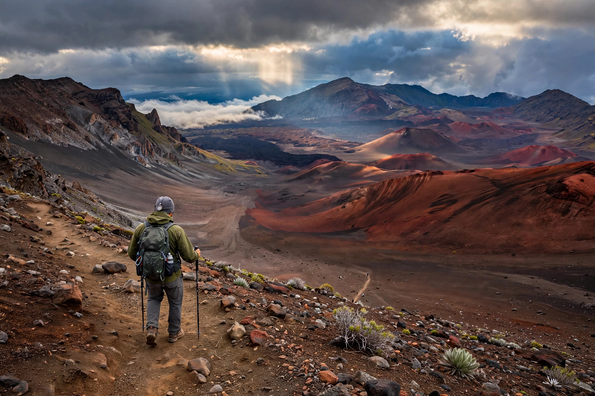
The best ridge hike on Maui’s west side and one of the island’s most popular trails for good reason. The path climbs steadily through guava forest and then breaks onto an open ridge with sweeping views down the Waiheʻe Valley on one side and across the central valley to Haleakalā on the other. On clear mornings the view extends to Molokaʻi. The upper section enters cloud forest where the trail turns muddy and the boardwalk sections get slippery. Start before 8 AM for the best odds of clear views; clouds typically swallow the ridge by midday. Parking is limited to about 25 spots, and the lot fills early on weekends.
Trailhead: End of Maluhia Road, past Mendes Ranch. Facilities: Portable toilets at the trailhead.
Pipiwai Trail
Maui’s most famous rainforest hike, in the Kīpahulu District of Haleakalā National Park at the end of the Road to Hāna. The trail passes Makahiku Falls at the half-mile mark, then enters a vast bamboo forest where the stalks clack together in the wind, a sound hikers never forget. Boardwalk bridges cross Pipiwai Stream before the final push to 400-foot Waimoku Falls, which pours down a sheer lava rock wall. The falls viewpoint is fenced; the area beyond is closed due to rockfall danger. Swimming is prohibited. Park entry is $30 per vehicle, valid for three days at both park districts. This trail pairs perfectly with the ʻOheʻo Gulch pools nearby.
Trailhead: Kīpahulu Visitor Center parking, end of Hāna Highway. Facilities: Restrooms and water at the visitor center.
Mahana Ridge Trail
A long, quiet ridge walk through the West Maui Forest Reserve above Kapalua, notable for how few people you will meet. The trail climbs through ironwood and Norfolk pine plantations, remnants of watershed reforestation, before reaching native forest higher up. Views open across the Pailolo Channel to Molokaʻi. Most hikers turn around at the 2.5-mile ridge junction, which captures the best views without the full commitment. The trail can be overgrown and muddy after rain, and the upper sections have hunting activity on weekends, so wear bright colors. Bring more water than you expect; there is no water on the trail.
Trailhead: D.T. Fleming Beach Park, follow signs up the ridge road. Facilities: Restrooms at D.T. Fleming Beach Park.
Kahakapao Loop Trail
The premier loop hike in the Makawao Forest Reserve, winding through a working watershed forest of eucalyptus, pine, and native ʻōhiʻa. The loop format and moderate grade make it popular with trail runners and mountain bikers, so expect company on weekends. Native birdwatchers come for the ʻapapane and ʻamakihi in the upper sections. The trail is well marked but rooty and can be slick after rain, which is frequent in this part of Upcountry. The trailhead sits at about 2,800 feet elevation, so temperatures run 10 to 15 degrees cooler than the beaches.
Trailhead: Kahakapao Road, Makawao Forest Reserve. Facilities: Portable toilets at the trailhead.

Hoapili Trail (King’s Highway)
A coastal walk across stark black lava fields from La Perouse Bay, following the historic Hoapili Trail, a coastal path improved in the 1800s under Governor Hoapili. The landscape looks almost lunar: ropey pāhoehoe lava, anchialine pools, and kiawe trees twisted by the wind. The trail leads past Kanaio Beach to the Cape Hanamanioa lighthouse ruins. There is zero shade and the black rock radiates heat, so this is strictly a morning hike. Carry at least two liters of water per person. The cultural sites along the way, including fishing shrines and petroglyphs, should be viewed respectfully without touching.
Trailhead: La Perouse Bay parking, end of Mākena Road. Facilities: Portable toilets at La Perouse Bay.
Makamakaʻole Stream (13 Crossings)
A West Maui valley adventure that crosses Makamakaʻole Stream thirteen times en route to a waterfall and swimming hole. The crossings are the point: rock-hopping, wading, and route-finding through a lush valley that feels far from the resort coast just a few miles away. Water shoes with grip are essential, and the trail should be avoided entirely during or after heavy rain because flash floods are a real and documented danger in this valley. Leptospirosis is present in Hawaiian freshwater streams, so cover open cuts and do not drink the water. The waterfall pool at the end is a worthy reward on a safe day.
Trailhead: Pullout on Kahekili Highway near Mile Marker 35. Facilities: None.
Polipoli Springs Loop
An unexpected experience: hiking through redwood and cedar groves at 6,000 feet on a tropical island. The Kula Forest Reserve loop combines the Redwood Trail, Plum Trail, and Tie Trail through towering introduced conifers planted for watershed restoration, with native forest mixed in. Temperatures can dip into the 40s Fahrenheit in winter, and morning fog is common, so bring a warm layer. The access road (Waipoli Road) is rough dirt and requires high clearance after rain. Hunters use the area on weekends; wearing bright colors is wise.
Trailhead: Polipoli Springs State Recreation Area, end of Waipoli Road. Facilities: Restrooms and cabins (reservable) at the recreation area.
Halemauʻu Trail
The classic descent into Haleakalā crater from the west rim, starting at 8,000 feet and switchbacking 1,400 feet down through cinder and native shrubland to the crater floor. The trail passes the cinder cone of Puʻu Nāue and reaches the crater floor near the Kapalaoa Cabin area. Many hikers combine it with Sliding Sands for the famous 11-mile crater traverse, arranging a shuttle or two cars between trailheads. Weather at the start can be near freezing with wind, while the crater floor is warm and still. Carry layers, sun protection, and far more water than seems necessary.
Trailhead: Halemauʻu Trailhead, mile 8 of Haleakalā Crater Road. Facilities: Restrooms at the trailhead; none on the trail.
Challenging Hikes
These are full-day undertakings for fit, prepared hikers. Altitude, exposure, heat, and remoteness all factor in. Do not attempt them casually.

Sliding Sands (Keoneheʻeheʻe) Trail
Maui’s signature backcountry hike and one of the great volcanic walks in the United States. Starting at the Haleakalā Visitor Center at 9,740 feet, the trail descends 2,800 feet across sliding cinder slopes into a crater that is seven miles across, passing cinder cones in impossible colors: rust red, ochre, charcoal black. The turnaround at the crater floor near Nāue or the Kapalaoa Cabin makes for an 11-mile round trip, all of it above 6,500 feet where the air is thin and the sun is brutal. Altitude affects everyone differently; headaches and nausea are common. Start at sunrise, carry 3+ liters of water per person, and save energy for the grinding climb back out. The 11-mile Sliding Sands to Halemauʻu traverse, done with a car shuttle, is the definitive Haleakalā day.
Trailhead: Haleakalā Visitor Center, end of Crater Road. Facilities: Restrooms and water at the visitor center.
Kaupō Gap
The most demanding maintained route on Maui: a descent from the Kaupō Gap trail junction near the crater rim all the way down to the Kaupō coast, dropping roughly 6,000 feet over nine miles. The upper section crosses loose cinder and rock, the middle traverses steep grassy slopes with exposure, and the lower section pushes through dense rainforest. This is a one-way hike requiring a car shuttle or pickup at the remote Kaupō trailhead, and most parties take a full day. Overnight trips require a backcountry permit from the park and a stay at the Palikū or Hōlua cabins or campgrounds. Do not attempt in wet conditions; the trail becomes treacherous.
Trailhead: Kaupō Gap junction via Sliding Sands, or Kaupō trailhead for the ascent. Facilities: Backcountry cabins and campgrounds by permit only.
Lahaina Pali Trail
A historic trail crossing the pali (cliffs) between Lahaina and Māʻalaea, once part of the island’s footpath network. The modern trail climbs relentlessly through dry, exposed terrain with panoramic views of the ʻAuʻau Channel, Lānaʻi, and Kahoʻolawe. Wind turbines from the Kaheawa wind farm spin on the ridgeline above. There is no shade and no water, and the dark rock amplifies the heat, so start at dawn and carry at least two liters per person. The trail can be done one way with a car shuttle between the Māʻalaea and Ukumehame trailheads. Watch for loose rock on the descent.
Trailhead: Māʻalaea side (off Honoapiʻilani Highway) or Ukumehame side. Facilities: None at either trailhead.
Haleakalā Skyline Trail
A high, lonely ridge walk along the southwest rift of Haleakalā, starting near the Polipoli Springs area and climbing toward the summit region through subalpine shrubland. The trail offers a completely different Haleakalā experience from the crater trails: no crowds, sweeping views down to the central valley and across to the Big Island on clear days, and native silversword plants in the upper sections. The elevation profile is a steady grind, and weather can change fast with fog and wind. This is a hike for experienced parties comfortable with navigation, as the trail is less traveled and can be faint in places.
Trailhead: End of Waipoli Road near Polipoli Springs. Facilities: Restrooms at Polipoli Springs.
Hikes by Region
Maui’s regions cluster trails naturally, which makes planning efficient. Here is how to group them.
West Maui (Lahaina, Kāʻanapali, Kapalua)
The Kapalua Coastal Trail, Dragon’s Teeth, Mahana Ridge, and D.T. Fleming access cluster within a few miles of each other, making Kapalua the best West Maui hiking base. The Waiheʻe Ridge Trail and Makamakaʻole Stream sit on the eastern side of the West Maui Mountains, about 30 minutes from Lahaina. The Nakalele Blowhole and ʻOhai Loop are on the remote north shore via the winding Kahekili Highway. A single day can combine the coastal trail in the morning with Dragon’s Teeth at sunset.
South Maui (Kīhei, Wailea, Mākena)
The Wailea Beach Path is the region’s signature easy walk. The Hoapili Trail at La Perouse Bay offers the best moderate coastal hiking on the island. Serious hikers can pair a morning on the Lahaina Pali Trail (20 minutes from Kīhei) with an afternoon beach recovery. South Maui’s dry, sunny weather makes it the most reliable region for hiking year-round.
Central Maui & ʻĪao Valley
The ʻĪao Valley State Monument is a 20-minute drive from Kahului and works as a half-day trip combined with Wailuku town. There is little other hiking in the central valley itself; it functions mainly as the transit corridor between regions.
Upcountry & Haleakalā Summit
This is the island’s premier hiking zone. The Sliding Sands, Halemauʻu, and Kaupō Gap routes all start from the summit area via Crater Road, while the Kahakapao Loop and Polipoli Springs trails sit in the Upcountry forests below. Budget a full day for any summit hike, and note that the drive from the coast to the 10,023-foot summit takes about two hours. The Skyline Trail connects the Polipoli area to the high mountain.

East Maui & the Road to Hāna
The Pipiwai Trail is the crown jewel, at the end of the Hāna Highway in the Kīpahulu District. Twin Falls at Mile Marker 2 works as a morning stop on the drive out. Waiʻānapanapa State Park’s coastal trail pairs with the famous black sand beach. Note that Waiʻānapanapa requires advance reservations for entry. East Maui hikes demand an early start and a full day; do not try to rush the highway.
What to Pack for Maui Hiking
Maui’s trails span sea level to 10,000 feet, so packing depends entirely on where you are going. These are the non-negotiables.
- Footwear: Trail shoes or hiking boots with real tread for anything beyond the paved coastal paths. The mud on Waiheʻe Ridge and the cinder on Sliding Sands defeat sneakers. Water shoes with grip for Makamakaʻole’s stream crossings.
- Water: One liter per two hours of hiking is the minimum; three liters for Sliding Sands or Lahaina Pali. There is no reliable drinking water on any Maui trail. Dehydration is the most common reason for rescue calls.
- Sun protection: Reef-safe sunscreen (Hawaiʻi law bans oxybenzone and octinoxate), a hat, and sunglasses. The UV index at Haleakalā’s altitude is extreme, and the crater offers zero shade.
- Layers: A warm layer and rain shell for anything above 4,000 feet. Summit temperatures can be 30 degrees colder than the beach, and Polipoli can dip into the 40s in winter.
- Rain gear: A packable rain jacket for East Maui and windward trails. Afternoon showers are routine in Hāna and the West Maui mountains.
- Navigation: Download offline maps before you go. Cell service vanishes in the crater, in Kaupō, and along much of the Hāna Highway. The free version of a GPS trail app with downloaded Maui maps is sufficient.
- First aid basics: Blister treatment, antiseptic, and any personal medications. The lava rock on coastal trails is unforgiving to bare skin.
- Headlamp: For any hike that might run long, especially crater traverses and Kaupō Gap. A phone flashlight is not a substitute.
Build a custom list: Use our Hawaii Packing List Generator to create a packing list matched to your islands, activities, and travel dates.
Trail Safety & Etiquette
Maui’s trails are beautiful and can be unforgiving. Most incidents share the same causes: heat, dehydration, flash floods, and ocean exposure at coastal trailheads.
- Heat and water: The Lahaina Pali Trail, Hoapili Trail, and Sliding Sands have no shade and no water. Start early, carry more water than you think you need, and turn back if anyone in the group shows signs of heat illness: headache, nausea, or stopped sweating.
- Flash floods: East Maui and West Maui valleys can flood with terrifying speed when rain falls in the mountains, even under blue skies at the trailhead. Never enter a narrow valley or cross a rising stream during or after heavy rain. Makamakaʻole and the streams along the Hāna Highway deserve particular respect.
- Leptospirosis: This bacterial infection is present in Hawaiian freshwater streams. Cover open cuts, do not drink stream water, and avoid swimming with open wounds. The risk is low for brief contact but real.
- Stay on the trail: Cutting switchbacks accelerates erosion and damages fragile native plants. In Haleakalā’s crater, the silversword plants grow only here and take decades to mature; one footstep off trail can kill one.
- Respect kapu areas: Some coastal and valley areas are culturally sensitive or outright closed. Heed posted signs. Do not move or stack rocks at cultural sites.
- Ocean awareness: Several trails end at the ocean (Nakalele, Dragon’s Teeth, Hoapili). Never turn your back on the ocean, never approach a blowhole opening, and check surf conditions before coastal hiking in winter.
- Wildlife: Nēnē (Hawaiian geese) nest near Haleakalā trails; give them wide berth and never feed them. Feral pigs are common in Upcountry forests and are best avoided quietly.
- Leave No Trace: Pack out everything, including fruit peels and tissues. Maui’s trailheads have limited trash service, so plan to carry waste back to town.
Do not trespass for social media hikes. Several “secret” Maui hikes promoted online cross private land or closed conservation areas. Trespassing can result in fines, and rescue from illegal areas is dangerous for everyone involved. The twenty trails in this guide are all legal and sufficient.
Best Time to Hike Maui
Maui hiking is year-round, but conditions vary by region and season in ways worth planning around.
Morning is always best. Start summit and ridge hikes at or before sunrise when possible. Clouds build over the West Maui Mountains and Haleakalā by midday, obscuring the views that are the whole point. Coastal trails are pleasantest before 10 AM, before the heat and the crowds.
Dry season (April through October) brings the most reliable trail conditions island-wide. South and West Maui are at their driest, the Hāna Highway streams run lower, and the crater trails are most accessible. This is also the busiest season, so popular trailheads fill early.
Wet season (November through March) greens up the West Maui Mountains beautifully and brings dramatic waterfalls to East Maui, but it also means muddier trails, higher flash flood risk, and more cloud cover on ridges. Winter swells make coastal trails on the north shore spectacular to view but dangerous to approach. Upcountry and summit trails can be cold and windy.
Whale season bonus (December through April): Coastal trails on the west and south shores, including the Kapalua Coastal Trail and the ʻOhai Loop, double as whale watching platforms. Bring binoculars.
Frequently Asked Questions
What is the best hike on Maui for first-time visitors?
The Pipiwai Trail. It delivers the complete East Maui rainforest experience, bamboo forest, and a 400-foot waterfall in four miles, and it sits at the natural turnaround point of a Road to Hāna day. Go early to avoid the midday crowds.
Do I need a reservation to hike in Haleakalā National Park?
Sunrise entry (3 AM to 7 AM) requires a reservation through recreation.gov, booked well in advance. Daytime hiking entry does not require a separate reservation beyond the $30 park entrance fee, which covers both park districts for three days.
Can I hike Sliding Sands and Halemauʻu in one day?
Yes, this 11-mile crater traverse is a classic Maui achievement. It requires a car shuttle or two vehicles, one parked at each trailhead. Most hikers start at Sliding Sands (the harder direction is descending first) and exit via Halemauʻu. Allow 7 to 9 hours.
Are Maui trails safe for solo hikers?
The popular trails (Pipiwai, Waiheʻe Ridge, Kapalua Coastal) see enough traffic for comfortable solo hiking during daylight. Remote routes like Kaupō Gap, Skyline, and Mahana Ridge are better done with a partner. Always tell someone your plan and expected return.
What should I do if I get lost on a Maui trail?
Stop, stay calm, and retrace your steps to the last known trail marker. Maui’s established trails are well marked; getting lost usually means wandering off trail. If you cannot find the trail, stay put, conserve water, and call 911. Cell service is unreliable in the crater and Kaupō, which is why offline maps matter.
Can you swim at the waterfalls on Maui hikes?
It depends on the waterfall. Twin Falls has swimmable pools. Swimming is prohibited at Waimoku Falls (Pipiwai Trail) due to rockfall danger and at ʻOheʻo Gulch pools when conditions are unsafe; check with rangers. Never swim in streams during or after rain because of flash flood risk, and be aware of leptospirosis in all freshwater.
How difficult is the Waiheʻe Ridge Trail really?
It is a solid moderate: 5 miles round trip with 1,563 feet of gain, mostly on a well-maintained path. Fit beginners can do it in 3 to 4 hours. The challenge comes from mud after rain and the exposed upper ridge in wind. The views are worth every step on a clear morning.
Is the Road to Hāna drive required for the Pipiwai Trail?
Yes, the trailhead is in the Kīpahulu District at the end of the Hāna Highway, about 2.5 to 4 hours of driving from central Maui. Most visitors make it a full-day trip combining the drive, the trail, and stops along the way. There is no alternate road access.
What is the hardest hike on Maui?
Kaupō Gap, by consensus: 9 miles one way with roughly 6,000 feet of elevation change, remote trailheads, and no bailout options. The Sliding Sands to Halemauʻu traverse is the hardest popular day hike. Both demand excellent fitness, preparation, and respect for the mountain.
Are dogs allowed on Maui hiking trails?
Dogs are prohibited on all Haleakalā National Park trails and in most state parks and forest reserves, including Waiʻānapanapa. The Kapalua Coastal Trail and Wailea Beach Path allow leashed dogs. Check current rules for county beach parks before bringing a dog.
Do I need hiking boots for Maui?
For the easy coastal walks, sturdy athletic shoes suffice. For Waiheʻe Ridge, Pipiwai, and anything in the crater or Upcountry forests, wear trail shoes or boots with real tread. Maui’s mud is legendary and its lava rock is sharp; proper footwear prevents the two most common hiking injuries.
Can I hike Haleakalā for sunrise without a tour?
Yes, self-guided sunrise hiking is allowed with a recreation.gov sunrise reservation for your vehicle. Many hikers watch sunrise from the summit and then descend Sliding Sands. Dress far warmer than you expect; pre-dawn temperatures at 10,000 feet regularly sit in the 30s Fahrenheit with wind.
Related Guides
Maui’s trails connect naturally to the island’s other outdoor experiences. These guides go deeper:
- Oʻahu Hikes: The Complete Guide , twenty trails across the Gathering Place, from Diamond Head to Kaʻala
- Big Island Hikes: The Complete Guide , volcano trails, Waipiʻo Valley, and the island’s vast backcountry
- Hawaii Hikes: The Complete Guide , the statewide overview across all islands
- Maui Beaches: The Complete Guide , where to recover after the trail
- Maui Map: Complete Reference Map & Area Guide , regions, driving times, and trip planning
- Road to Hāna Map: Complete Reference Map & Area Guide , mile-by-mile stops for the drive to the Pipiwai Trail
- Hawaii Waterfalls: The Complete Guide , the islands’ best falls, including Maui’s
- Hawaii Packing List Generator , build a custom packing list for hiking and beach days
Planning Your Maui Hiking Days
Maui rewards hikers who match the trail to the day rather than forcing a fixed itinerary. Summit and ridge trails belong to the early morning, before clouds gather and heat builds. The Road to Hāna corridor deserves a full, unhurried day with the Pipiwai Trail as its centerpiece. Coastal walks fill the afternoons when the light turns golden and the whales breach offshore in winter. Build rest days between hard efforts, because the combination of altitude, sun, and elevation gain accumulates faster than most visitors expect. The island’s trails span from sea level to above 10,000 feet, and that range is the whole story: within a single trip, Maui lets you walk through rainforest, desert, and alpine cinder in the span of days. Plan around the weather, carry more water than seems reasonable, and leave the overcrowded social media spots to everyone else. The twenty trails in this guide are more than enough for several trips.