
Maui Map
On This Page
Maui is the second largest island in the Hawaiian archipelago, and its map tells the story of how the island was built. Two massive shield volcanoes, Haleakalā in the east and the West Maui Mountains in the west, are joined by a low, flat isthmus about six miles wide. That narrow valley floor is what gives Maui its nickname, the Valley Isle, and it is the reason the island looks like two separate landmasses stitched together when you first study a Maui map.
Understanding this shape is the key to planning any Maui trip. The island covers roughly 727 square miles, making it larger than O‘ahu but far less densely populated. Distances that look short on the map can take much longer to drive than visitors expect, particularly along the winding Hāna Highway in the east and the narrow coastal roads of West Maui. This guide breaks the island down region by region, with driving distances, airport orientation, and practical navigation advice so you can read any Maui map with confidence before you arrive.
Maui Island Overview: Reading the Map
Maui sits in the middle of the island chain, southeast of O‘ahu and northwest of Hawai‘i Island. On a map of Hawai‘i, you will find it between Moloka‘i and Lāna‘i to the northwest and the Big Island to the southeast. Maui County also includes Moloka‘i, Lāna‘i, and the uninhabited island of Kaho‘olawe, though this guide focuses on the island of Maui itself.
The island was formed by two volcanoes. The older one, Mauna Kahālāwai (commonly called the West Maui Mountains), rises to 5,788 feet at Pu‘u Kukui and has been deeply eroded by millions of years of rainfall into dramatic ridges and valleys. The younger one, Haleakalā, dominates the eastern half of the island and reaches 10,023 feet above sea level at its summit. Haleakalā last erupted more than 200 years ago, and its massive summit depression is the centerpiece of Haleakalā National Park.
Between the two volcanoes lies the central isthmus, a flat plain where the towns of Kahului and Wailuku sit. Almost every visitor lands at Kahului Airport (OGG) on this isthmus, and from there the island fans out in every direction. Resort areas cluster along the sunny leeward coasts to the west and south. The windward north shore faces the trade winds and is known for big surf. Upcountry Maui climbs the western slopes of Haleakalā, where temperatures drop and the landscape turns green and pastoral. East Maui is the lush, rural side of the island, home to the famous Road to Hāna.
One practical note about reading distances on a Maui map: the island is 48 miles long and 26 miles wide, but winding coastal roads and mountain grades mean drive times rarely match what the mileage suggests. A route that measures 25 miles on the map can easily take 45 minutes or more. Plan your days by drive time, not by distance, and always allow extra margin when the Road to Hāna is involved.

West Maui Region
West Maui occupies the northwestern lobe of the island, wrapped around the eroded slopes of Mauna Kahālāwai. On the map it is the compact, mountainous section connected to the rest of Maui by the narrow corridor near Mā‘alaea. This region holds Maui’s most famous resort coastline and some of its most dramatic scenery.
Lāhainā
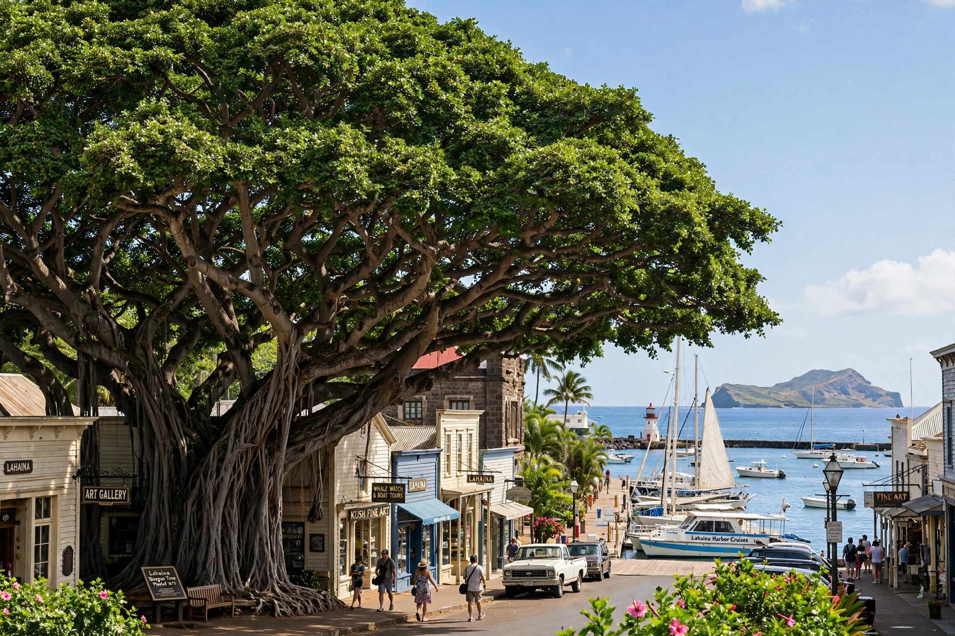
Lāhainā sits on the southwestern coast of West Maui and was once the capital of the Hawaiian Kingdom and a bustling 19th century whaling port. Its historic Front Street ran along the waterfront, lined with shops, galleries, and restaurants shaded by one of the largest banyan trees in the United States. In August 2023, a catastrophic wildfire destroyed most of the town. Recovery and rebuilding efforts are ongoing, and conditions in Lāhainā continue to change. Travelers should check current official guidance before planning a visit to this area, as access to parts of the town remains restricted while reconstruction proceeds.
Kā‘anapali
Just north of Lāhainā along the Honoapi‘ilani Highway, Kā‘anapali was Hawai‘i’s first planned resort community and remains one of its most popular. The three mile crescent of golden sand here is consistently calm for swimming in summer months, and the lava rock point known as Black Rock (Pu‘u Keka‘a) at the northern end offers excellent shore snorkeling. Whalers Village, an open air shopping center at the beach’s midpoint, serves as the area’s commercial hub.
Nāpili and Kapalua
Continuing north past Kā‘anapali, the coastline becomes quieter and more rugged. Nāpili Bay is a small, protected cove beloved for calm swimming and sea turtle sightings. Kapalua, at the northwestern tip of the resort corridor, is set among rolling hills and championship golf courses, with small pocket beaches like Kapalua Bay and Oneloa Bay offering some of the island’s clearest snorkeling water.
Honolua Bay and the Northwest Coast
Beyond Kapalua, the road narrows as it rounds the northern tip of West Maui. Honolua Bay is a marine life conservation district with no sandy beach but superb snorkeling in calm conditions, accessible by a short walk through a coastal forest. Past Honolua, the Kahekili Highway continues along spectacular sea cliffs through tiny communities like Kahakuloa. This stretch is narrow and winding, and many rental car agreements restrict travel on the northernmost section, so confirm your rental terms before driving it.

South Maui Region
South Maui runs along the southwestern flank of Haleakalā, from Mā‘alaea in the west to Mākena in the east. This is Maui’s sunniest and driest coastline, shielded from the trade winds by Haleakalā’s bulk. On the map it appears as a long, gently curving shoreline dotted with resort areas, and it is where many visitors choose to base their stay.
Mā‘alaea
Mā‘alaea sits at the western edge of South Maui where the road from Central Maui meets the coast. It is a small harbor town known for the Maui Ocean Center aquarium and as the departure point for whale watching and snorkeling boats heading to Molokini. The harbor area has condominiums and a handful of restaurants, but most visitors pass through on their way to the resort areas farther south.
Kīhei
Kīhei stretches for about six miles along South Kīhei Road, a lively strip of condominiums, local restaurants, and shops. Unlike the planned resort enclaves to the south, Kīhei has an unpolished, lived in feel that many travelers prefer. Its beaches, including the three Kamaole beach parks (Kam I, Kam II, and Kam III), offer good swimming and sunset views, and the town’s food scene leans local, with plate lunch spots and food trucks alongside sit down restaurants.
Wailea
South of Kīhei, Wailea is Maui’s most upscale resort district, a manicured landscape of luxury hotels, high end shopping at the Shops at Wailea, and a scenic coastal walkway connecting five crescent beaches. Wailea Beach fronts the largest resorts and offers calm morning swimming. The Wailea Beach Path is a paved 1.5 mile oceanfront walk popular for sunrise strolls.
Mākena
Past Wailea, the development thins out and the landscape turns wilder. Mākena State Park is home to Big Beach (Oneloa), one of Maui’s largest undeveloped beaches, known for its powerful shorebreak that demands respect from swimmers. Nearby, the lava fields of the Ahihi Kina‘u Natural Area Reserve mark the site of Haleakalā’s most recent lava flows, visible between ‘Āhihi Bay and La Perouse Bay on the far southern shore where the paved road ends.

Central Maui Region
Central Maui is the flat isthmus between the two volcanoes, and it is the island’s commercial and civic heart rather than a tourist destination in itself. Most visitors experience it only as the area around the airport, but it is worth understanding on the map because every road trip on Maui starts or passes through here.
Kahului
Kahului is Maui’s largest town and the island’s commercial center, home to Kahului Airport (OGG), the main harbor, big box stores including Costco, and the Queen Ka‘ahumanu Center mall. Travelers typically stock up on groceries and supplies here before heading to their resort area. The town itself has little of scenic interest, but its central location makes it the natural hub from which all island roads radiate.
Wailuku
Just west of Kahului, Wailuku is the county seat and an older town with a historic main street, government buildings, and a growing food and arts scene. It sits at the mouth of ‘Īao Valley, and the road through Wailuku is the gateway to ‘Īao Valley State Monument, where the 1,200 foot ‘Īao Needle lava remnant rises above a lush valley floor. The monument area has been subject to periodic closures for infrastructure work, so check the Hawai‘i DLNR website for current status before visiting.
Getting Oriented
On the map, Central Maui is where the island’s main highways converge. The Kuihelani Highway (Highway 380) and Honoapi‘ilani Highway (Highway 30) connect Kahului to West Maui. The Pi‘ilani Highway (Highway 31) runs south to Kīhei and Wailea. The Hāna Highway (Highway 36/360) heads east toward Pa‘ia and Hāna. The Haleakalā Highway (Highway 37/377/378) climbs southeast toward Upcountry and the summit. Learning these five corridors is the fastest way to make any Maui map make sense.
Upcountry Maui Region
Upcountry Maui climbs the western slopes of Haleakalā between roughly 1,000 and 4,000 feet of elevation. On the map it is the broad green band above Central Maui, and in person it feels like a different world from the beach resorts: cooler air, rolling pastures, flower farms, and small towns with a paniolo (Hawaiian cowboy) heritage.
Makawao
Makawao is the largest Upcountry town, with a western style main street of boutiques, art galleries, and restaurants. It retains a genuine ranch town character from its paniolo history and hosts the annual Makawao Rodeo every Fourth of July weekend. The town sits at about 1,600 feet elevation, noticeably cooler than the coast below.
Kula
Kula spreads along the upper slopes around 3,000 feet, an agricultural zone of flower farms, vegetable fields, lavender farms, and pastureland. The views from Kula stretch across the isthmus to the West Maui Mountains and, on clear days, to the Big Island across the ‘Alenuihāhā Channel. Morning is the best time for views, before clouds build over the summit.
Haleakalā Summit
The Haleakalā Highway climbs from Upcountry to the 10,023 foot summit, where Haleakalā National Park protects the vast summit depression and its otherworldly volcanic landscape. The sunrise viewing program requires advance reservations made through Recreation.gov, and the temperature at the summit can be 30 to 40 degrees cooler than at sea level. The road is well paved but winding, with many switchbacks above 7,000 feet.

East Maui & the Road to Hāna
East Maui is the lush, rural windward side of Haleakalā, and on the map it is the long eastern lobe of the island served by a single winding road. The Hāna Highway (Highway 360) is one of the most famous drives in the world, and it dominates any discussion of East Maui geography.
Pa‘ia
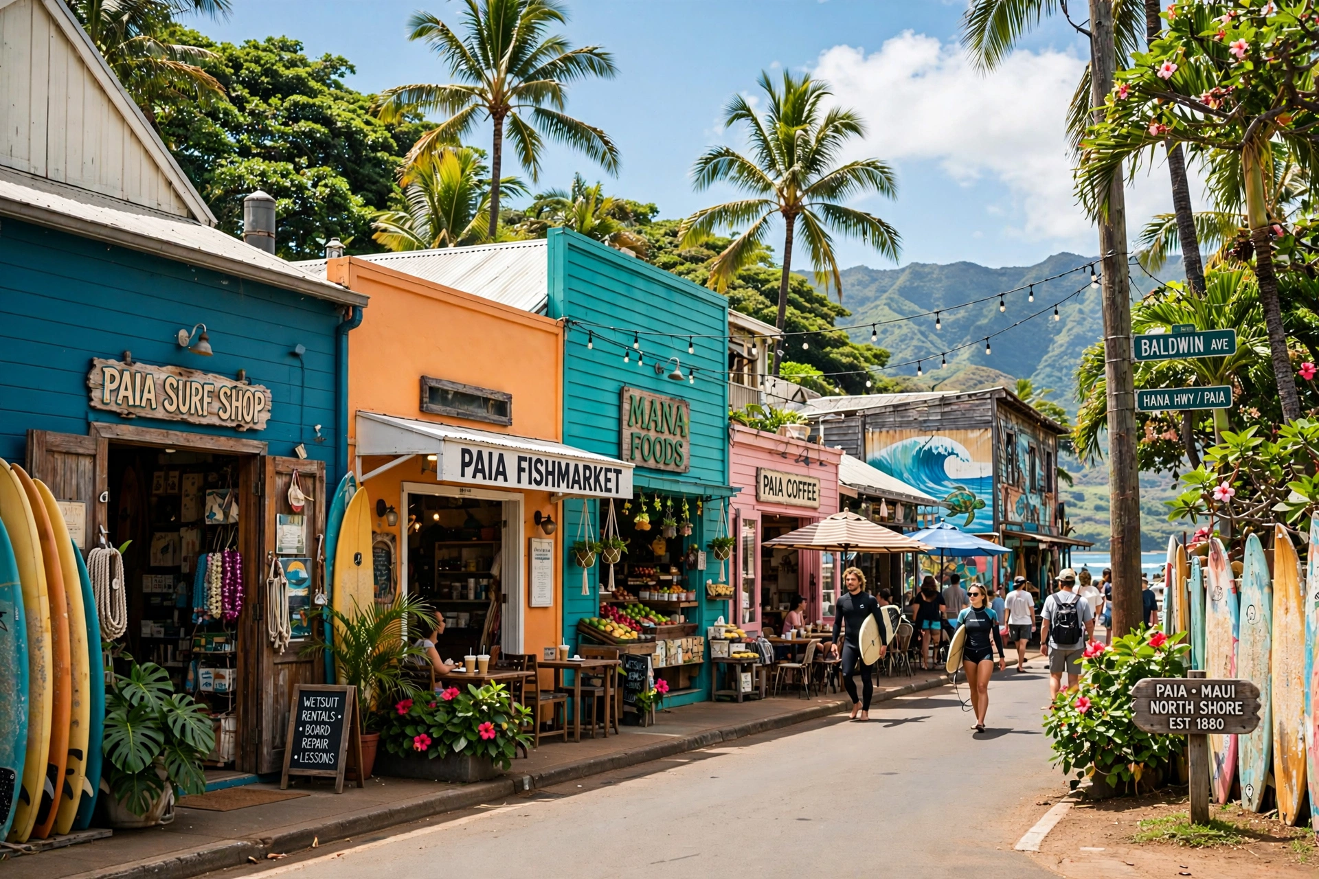
Pa‘ia is the last real town before the Road to Hāna begins, a former plantation town turned surf and arts hub. Its main street has restaurants, shops, and the last reliable gas and supplies before the long drive east. Nearby Ho‘okipa Beach Park is a world famous windsurfing and kiteboarding beach, and a good place to watch sea turtles resting on the sand in the late afternoon.
The Hāna Highway
From Pa‘ia, the Hāna Highway runs 52 miles to the town of Hāna, crossing more than 600 curves and 59 bridges, many of them single lane. Mile markers count from Pa‘ia, and the drive takes 2.5 to 4 hours without stops, though most travelers spend a full day with stops at waterfalls, arboretums, and coastal lookouts. There are no gas stations along the route, so fill up in Pa‘ia. The road demands full attention, and pulling over completely off the pavement is essential at every stop.
Hāna and Kīpahulu
Hāna is a small, isolated community at the end of the highway, with a slower pace that feels far removed from resort Maui. Wai‘ānapanapa State Park, just before town, is known for its black sand beach set against sea cliffs and lava formations. Reservations are required for entry. South of Hāna, the road continues to Kīpahulu and the coastal section of Haleakalā National Park, home to the ‘Ohe‘o Gulch pools and the Pīpīwai Trail through a towering bamboo forest to 400 foot Waimoku Falls. Note that the ‘Ohe‘o Gulch area has periodic closures, so check National Park Service alerts before going.
Maui Driving Distances Table
Use this table to plan realistic daily itineraries. Drive times assume normal conditions without heavy traffic; add time during morning and afternoon rush hours around Kahului and Wailuku, and always allow far more time than the mileage suggests on the Hāna Highway.
| Route | Distance | Typical Drive Time |
|---|---|---|
| Kahului Airport (OGG) to Lāhainā | 25 miles | 40 to 50 minutes |
| Kahului Airport (OGG) to Kā‘anapali | 28 miles | 45 to 55 minutes |
| Kahului Airport (OGG) to Kapalua | 38 miles | 60 to 75 minutes |
| Kahului Airport (OGG) to Kīhei | 20 miles | 30 to 40 minutes |
| Kahului Airport (OGG) to Wailea | 26 miles | 40 to 50 minutes |
| Kahului Airport (OGG) to Pa‘ia | 8 miles | 15 to 20 minutes |
| Kahului Airport (OGG) to Haleakalā Summit | 38 miles | 1.5 to 2 hours |
| Pa‘ia (Mile Marker 0) to Hāna | 52 miles | 2.5 to 4 hours |
| Hāna to ‘Ohe‘o Gulch (Kīpahulu) | 10 miles | 30 to 45 minutes |
| Lāhainā to Kīhei (via Central Maui) | 40 miles | 60 to 75 minutes |
| Kīhei to Haleakalā Summit | 45 miles | 1.5 to 2 hours |
| Wailuku to ‘Īao Valley State Monument | 4 miles | 10 to 15 minutes |
The single most important thing to take from this table is the Hāna Highway row. Fifty two miles looks modest on a Maui map, but the road’s curves and one lane bridges make it one of the slowest drives per mile anywhere in the state. Never plan to drive to Hāna and back in half a day, and never start the return trip late in the afternoon without a clear sense of how long the outbound leg took you.
Maui Airport (OGG) & Getting Around
Kahului Airport (OGG) is Maui’s primary airport and the only one most visitors will use. It sits on the north edge of the central isthmus, about two miles east of the town of Kahului. Direct flights arrive from many West Coast cities as well as inter island flights from Honolulu (HNL), Kailua Kona (KOA), Līhu‘e (LIH), and Hilo (ITO). Flight time from Honolulu is about 40 minutes. A smaller commuter airport, Kapalua Airport (JHM) in West Maui, handles limited inter island service.
On the map, the airport’s central location is ideal: it is roughly equidistant from the West Maui resorts, the South Maui resorts, and the start of the Road to Hāna. Rental cars are essential for most Maui trips. The island has limited public bus service (the Maui Bus), which works for basic travel between Kahului, Wailuku, Lāhainā, and Kīhei but does not reach trailheads, the Haleakalā summit, or East Maui. Rideshare services operate on the island but can be scarce and expensive outside the main resort areas, especially for the long drive to Hāna or the summit.
When you pick up your rental car at OGG, take a moment to orient yourself. The airport sits at the junction of the roads to every region: west on the Honoapi‘ilani Highway toward Lāhainā and Kā‘anapali, south on the Pi‘ilani Highway toward Kīhei and Wailea, east on the Hāna Highway toward Pa‘ia, and southeast on the Haleakalā Highway toward Upcountry. Download offline maps before you leave the airport, because cell coverage is unreliable in East Maui, on the Haleakalā summit road, and along parts of West Maui.

How to Use This Map for Trip Planning
A Maui map becomes a planning tool when you match regions to the number of days you have. The island rewards travelers who choose one or two home bases rather than trying to cover everything from a single spot.
Choose Your Base by Region
West Maui (Lāhainā, Kā‘anapali, Kapalua) suits travelers who want classic resort beaches, sunset views, and easy access to snorkeling. South Maui (Kīhei, Wailea, Mākena) suits those who want the sunniest weather, calmer water, and a mix of resort and local flavor. Staying in one region and day tripping to the others works well, since the drive between West Maui and South Maui via Central Maui is about an hour each way.
Group Your Day Trips Geographically
The most common planning mistake is zigzagging across the island. Instead, group activities by corridor. Pair the Road to Hāna with an overnight in Hāna if you can, or dedicate one very full day to it. Combine the Haleakalā summit (sunrise or sunset) with Upcountry towns like Makawao and Kula on the same day, since they share the same highway. Visit ‘Īao Valley on a morning when you are already passing through Wailuku. Each of these pairings follows the natural lines of the Maui map rather than fighting them.
Respect the East Maui Commitment
East Maui is the region most underestimated by first time visitors. On the map it looks like a manageable lobe of the island, but the Hāna Highway makes it effectively a separate world. Treat any trip to Hāna as a full day at minimum. If your itinerary is shorter than five days, consider whether the Road to Hāna fits at all, or whether your time is better spent on the West and South Maui coasts and a Haleakalā sunrise.
Account for Elevation
Maui’s map is two dimensional, but the island is intensely vertical. The drive from Kahului at sea level to the Haleakalā summit climbs 10,000 feet, with temperature drops of 30 to 40 degrees. Upcountry towns sit 1,000 to 3,000 feet up and can be sweater weather in the evening even when the beaches are 85 degrees. Pack layers for any day that includes elevation, and remember that the summit can be near freezing at sunrise in winter.
Planning tip: Print or screenshot the driving distances table above before your trip. Cell service drops out along the Hāna Highway, on the road to the Haleakalā summit, and in parts of West Maui, so do not rely on live navigation alone.
Maui Map FAQ
Where is Maui located in Hawai‘i?
Maui is in the central part of the Hawaiian island chain, southeast of O‘ahu and northwest of Hawai‘i Island (the Big Island). It sits between Moloka‘i and Lāna‘i to the northwest and Kaho‘olawe to the southwest. On a map of the Pacific, the Hawaiian Islands are roughly 2,400 miles southwest of California.
How big is Maui compared to the other islands?
Maui is the second largest Hawaiian island at about 727 square miles, after Hawai‘i Island (about 4,028 square miles) and ahead of O‘ahu (about 597 square miles). It is 48 miles long and 26 miles wide at its broadest points.
What are the main regions of Maui?
Maui is commonly divided into West Maui (Lāhainā, Kā‘anapali, Kapalua), South Maui (Kīhei, Wailea, Mākena), Central Maui (Kahului, Wailuku), Upcountry Maui (Makawao, Kula, Haleakalā slopes), East Maui (Pa‘ia, Hāna, Kīpahulu), and the North Shore (Ho‘okipa, windsurfing coast). Each region has distinct weather, scenery, and character.
How long does it take to drive around Maui?
There is no single loop road around the entire island that most rental cars can complete, because the back side of Haleakalā (the Pi‘ilani Highway past Hāna) is rough, partially unpaved, and restricted by many rental agreements. A realistic full day of driving covering West Maui, Central Maui, and South Maui runs 100 to 150 miles and 4 to 6 hours behind the wheel. The Road to Hāna alone is a full day.
Which airport do I fly into for Maui?
Kahului Airport (OGG) is the main airport and handles all major airline service. It is centrally located on the isthmus, 20 to 40 minutes from the main resort areas. Kapalua Airport (JHM) in West Maui offers limited inter island flights.
Is the Road to Hāna on the north or south side of Maui?
The Hāna Highway runs along the northern (windward) coast of East Maui, from Pa‘ia in the northwest to Hāna in the east, then continues south to Kīpahulu. The lush, waterfall lined section most travelers picture is the windward stretch between Pa‘ia and Hāna.
How far is Haleakalā from the beach resorts?
From Kahului Airport to the Haleakalā summit is 38 miles and typically 1.5 to 2 hours of driving. From Kā‘anapali or Wailea, allow 2 to 2.5 hours each way. The road climbs from sea level to 10,023 feet, so plan for the full drive time plus at least an hour at the summit.
Can I see other islands from Maui?
Yes. On clear days, Moloka‘i and Lāna‘i are visible from West Maui, Kaho‘olawe is visible from South Maui, and the Big Island’s peaks are visible from Haleakalā’s summit and sometimes from South Maui. The ‘Alenuihāhā Channel between Maui and the Big Island is about 30 miles wide.
Do I need a 4WD vehicle on Maui?
No, for all standard tourist routes. The highways to Lāhainā, Kā‘anapali, Kīhei, Wailea, Pa‘ia, Hāna, ‘Īao Valley, and the Haleakalā summit are all paved and suitable for regular cars. Avoid unpaved back roads, including the back side of Haleakalā past Hāna, which most rental agreements prohibit.
What is the best map app to use on Maui?
Download offline maps in Google Maps before your trip, since cell coverage is unreliable in East Maui, on the Haleakalā summit road, and in parts of West Maui. A paper road map of Maui is a useful backup and is available at the airport and bookstores. For hiking, download trail maps in advance as well.
Related Guides
- Hawai‘i Map: Complete Reference Map & Area Guide, the full island chain, inter island distances, and how Maui fits into the archipelago
- Road to Hāna Map: Complete Reference, with mile by mile detail for the Hāna Highway, stops, and driving strategy
- Maui Beaches: The Complete Guide, covering every major beach by region, with swimming and snorkeling conditions
- Maui Hikes: The Complete Guide, with trails ranked by difficulty across all regions
- Maui Weather: The Complete Guide, covering microclimates, trade winds, and the best time to visit each region
- Hawai‘i Snorkeling: The Complete Guide, covering the island’s best snorkeling spots including Honolua Bay and Molokini
A Final Note on Reading Maui
Maui’s map rewards a second look. The island that first appears as two blobs joined by a narrow waist reveals, on closer study, a compact world of microclimates: rainforest and desert, alpine summit and tropical beach, ranch country and resort coastline, all within an hour’s drive of the airport. The travelers who get the most from Maui are the ones who let the map shape their days, grouping adventures by region, respecting the slow roads of the east, and leaving room for the island’s weather to redirect them. Study the regions before you go, keep the driving times handy, and Maui’s geography will do much of your planning for you.