Saddle Road: The Complete Guide to Driving Hawaii’s Cross-Island Highway

Few drives in Hawaii change character as fast as Saddle Road. You leave Hilo under a ceiling of green rainforest, climb past grazing cattle and misty ohia trees, and within an hour you are rolling across a high volcanic plain where the air feels thin and dry, with two of the tallest mountains on Earth rising on either side. Then you descend toward the sunny Kona side, and the whole island feels smaller than you thought. This is Hawaii Route 200, better known as Saddle Road, and it is the fastest way across the Big Island.
For years the road had a rough reputation, and rental car companies once banned their cars from it outright. Those days are over. After a rebuild that cost more than $300 million, Saddle Road is a modern two-lane highway and the main cross-island artery for commuters, freight, and travelers. It still demands respect, though. Fog can erase the road in seconds, the elevation can leave you lightheaded, and there is not a single gas station on the high middle stretch. Drive it prepared, and it becomes one of the great road trips in the state.
What Is Saddle Road, Exactly?
Saddle Road is the local name for Hawaii Route 200, officially the Daniel K. Inouye Highway. It runs about 53 miles from Hilo on the east side of the Big Island to its junction with Route 190 (Mamalahoa Highway) south of Waimea on the west side. The name comes from the saddle, the broad high plain the road crosses between the island’s two great shield volcanoes, Mauna Kea to the north and Mauna Loa to the south.
The highway climbs to a maximum elevation of 6,632 feet, which makes it the highest major road in Hawaii. It is mostly one lane in each direction, with two lanes on the uphill climbs. Because it cuts straight across the island instead of following the coast, it saves 30 to 45 minutes compared with the coastal Belt Road routes, and it is the route most locals use to get between Hilo and Kailua-Kona.
Beyond commuters, the road is the only paved access to the Pohakuloa Training Area, Mauna Kea State Recreation Area, and the road up to the Mauna Kea observatories. If you are planning a wider island itinerary, our guide to the best things to do on the Big Island shows how a Saddle Road crossing fits into a full trip.
The Route: From Hilo to the Kona Side
Heading west, Saddle Road starts in Hilo. Mile marker 0 sits near the intersection of Waiānuenue Avenue and Kamehameha Avenue, and the route follows Waiānuenue Avenue, then Kaumana Drive, climbing steadily out of town. The first stretch winds through wet, green neighborhoods and past Rainbow Falls, and the air stays humid and cool.
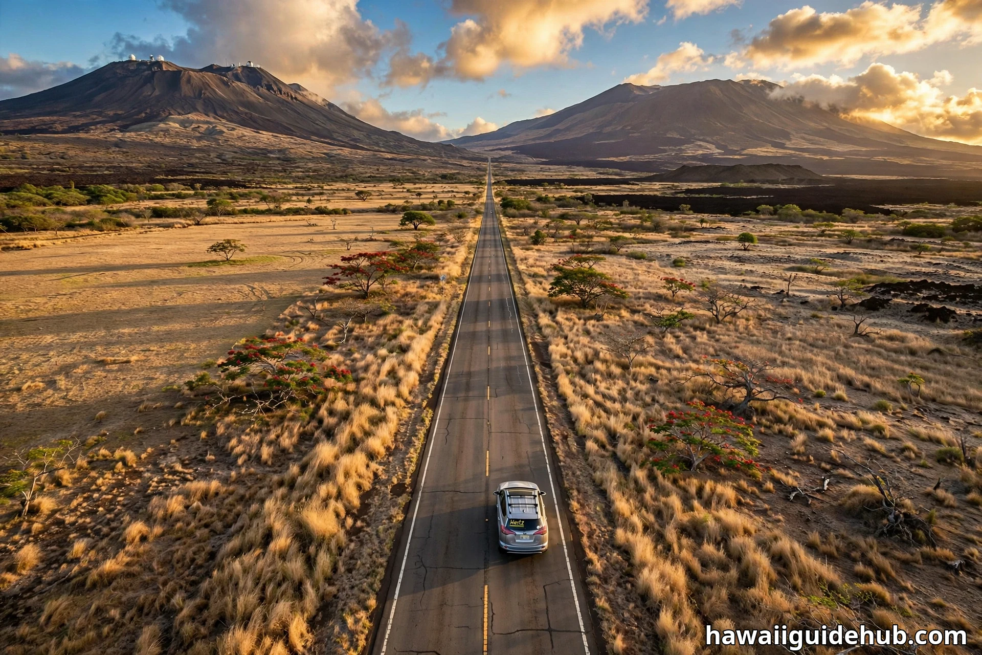
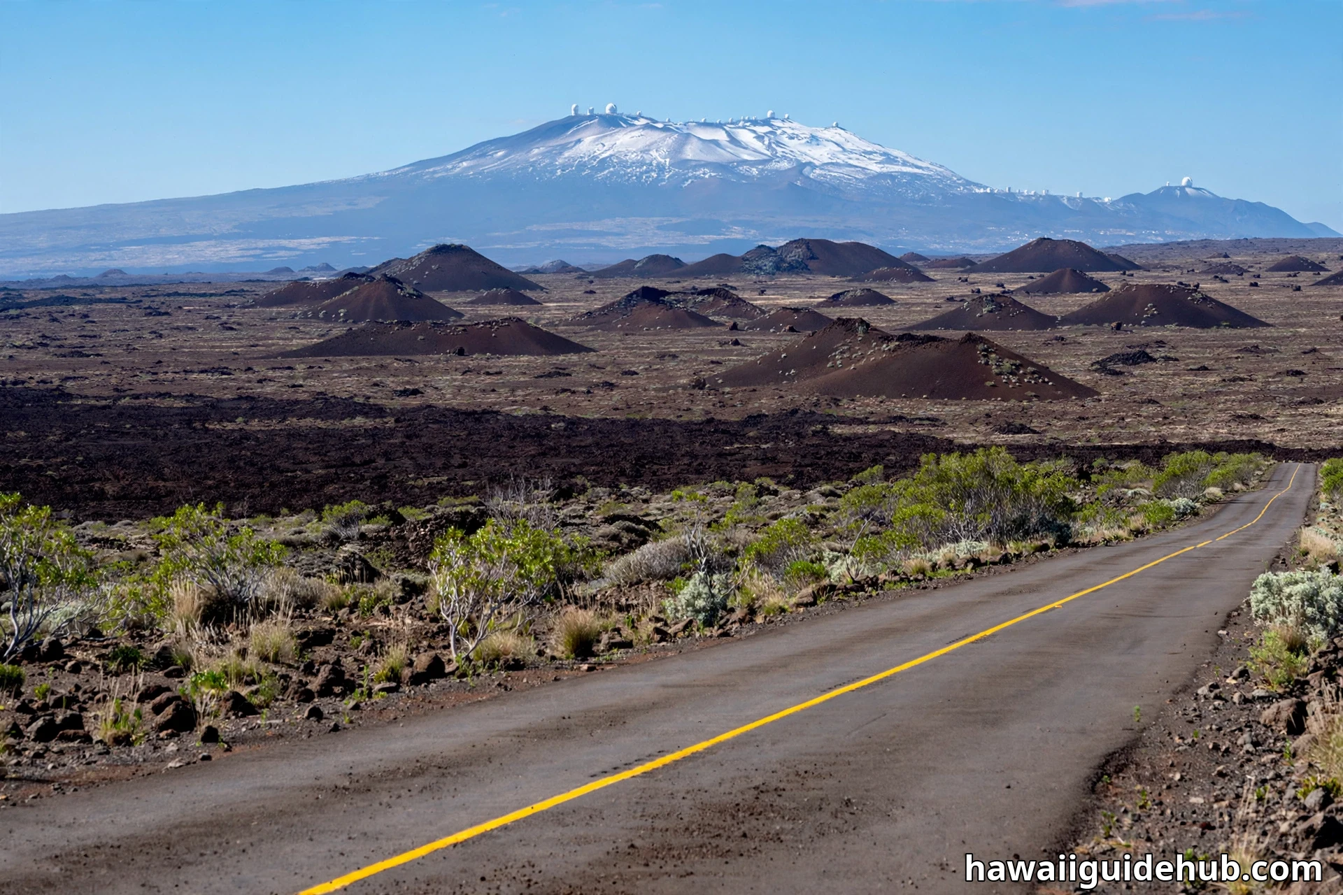
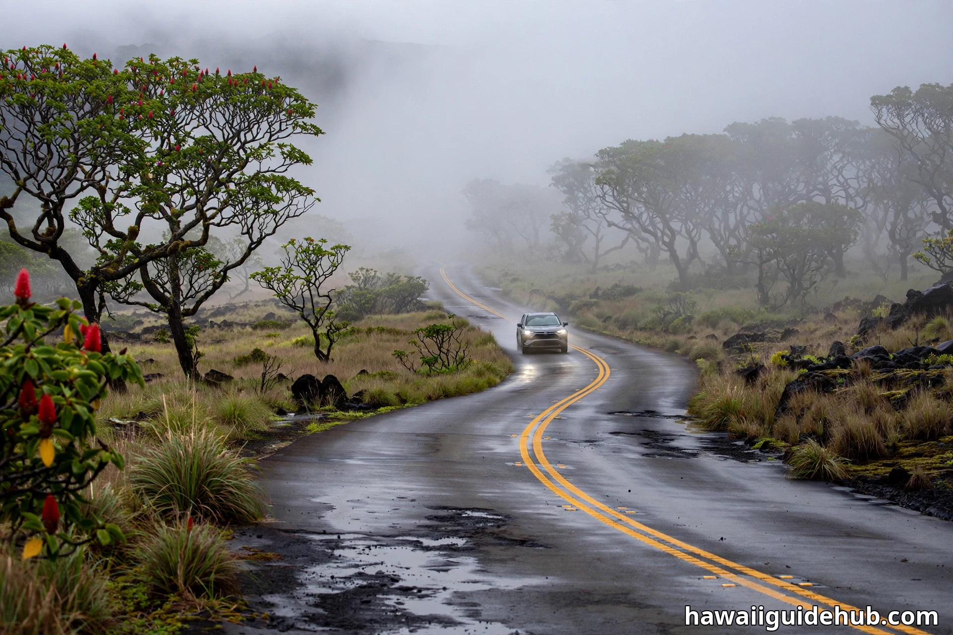
As the road gains elevation, the rainforest thins into pasture land. You will see cattle grazing on the slopes and, on clear days, the summit of Mauna Kea appearing ahead with its white observatory domes. The middle section is the saddle itself: open grassland, old lava flows, and cinder cones scattered across a wide plain. This is where the sky feels enormous and the island’s volcanic bones show through the thin soil.
Around mile marker 28, a well-signed intersection marks the Mauna Kea Access Road, which climbs to the Mauna Kea Visitor Information Station at 9,200 feet and continues to the summit. Past that junction, Saddle Road descends through dry ranch country toward its western end at Route 190. From there, drivers turn toward Waimea and the Kohala Coast, or head south to Kailua-Kona. If the Kona side is your destination, our list of things to do in Kona is worth a look before you set out.
Allow about 1 hour and 15 minutes to 1 hour and 30 minutes for the full crossing without long stops, and longer if you plan to pull over for photos, which you will.
A Short History of the Road
Saddle Road began in 1942, when the U.S. Army built a rough one-lane track across the saddle to connect its military training facilities. For decades it stayed that way: narrow, patched, and notorious. Old-timers remember one-lane bridges, crumbling shoulders, and long stretches where drivers simply straddled the center line because the edges were too rough to use.
The transformation came in stages. Working with the Federal Highway Administration, the Hawaii Department of Transportation rebuilt nearly 48 miles of the road to modern standards, straightening the alignment, widening the pavement, and adding climbing lanes. The work wrapped up in 2017 at a total cost of about $316.5 million, with the U.S. Army contributing more than $100 million of it.
In 2013, the state legislature renamed the upgraded highway the Daniel K. Inouye Highway, honoring Hawaii’s longtime U.S. senator. Locals still call it Saddle Road, and both names refer to the same highway. Road signs use both, so do not be confused if your map says one and the sign says the other.
What You Will See Along the Way
Saddle Road is not just a shortcut. It is a drive-through lesson in how the Big Island was built, and the scenery changes every few miles.
Mauna Kea and the Observatories
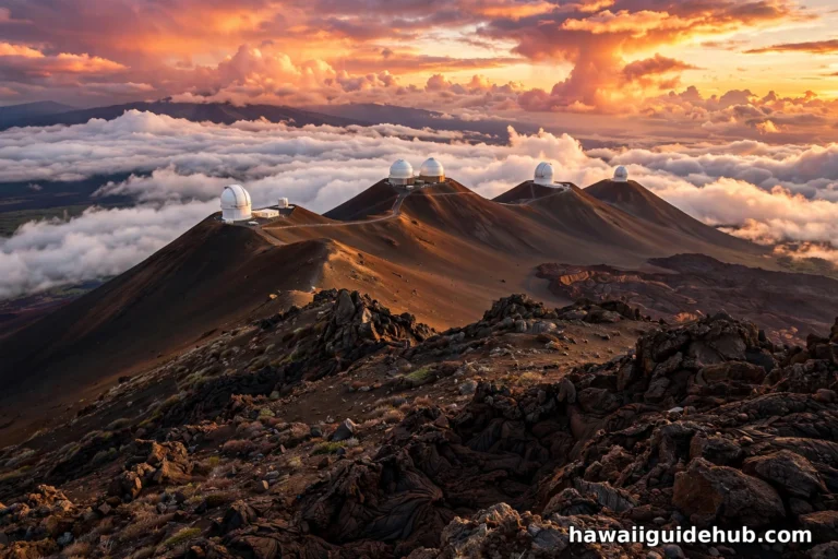
The dominant sight on the northern side is Mauna Kea, the dormant volcano whose summit rises to 13,796 feet above sea level. On clear mornings the white domes of the observatories stand out against the sky, and in winter the summit sometimes wears snow. The mountain holds deep cultural significance for Native Hawaiians, and the summit area is a place to treat with respect. You cannot miss the signed turnoff for the Mauna Kea Access Road near mile marker 28. Standard rental cars can reach the Visitor Information Station, but the unpaved summit road above it is a different matter, which we cover below.
Mauna Loa and the Lava Fields
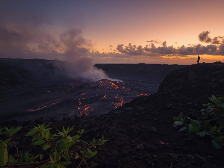
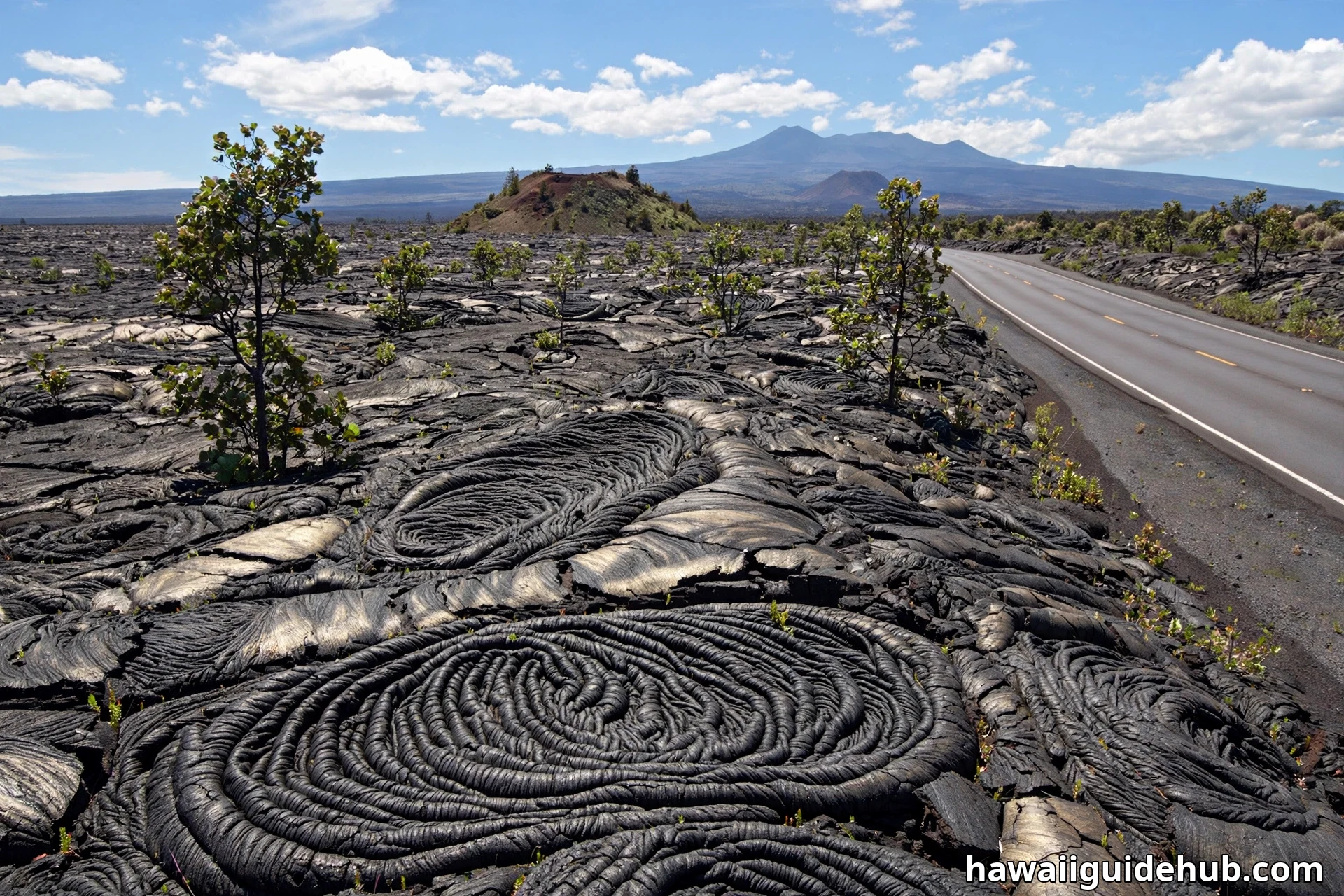
To the south sprawls Mauna Loa, the largest active volcano on Earth by volume. Much of the lava rock you see along the middle of Saddle Road came from its flows. Look for ropy pahoehoe textures frozen into the roadside rock, dark a’a fields, and the small cinder cones called pu’u dotting the plain. During the 2022 Mauna Loa eruption, lava fountains were visible from parts of the highway, and thousands of vehicles used Saddle Road to reach the viewing areas. The eruption ended, but the fresh black flows remain a striking reminder that this island is still growing.
Ranchlands and Native Forest
The lower slopes on both ends of the road are working ranch country. Parker Ranch, one of the largest cattle ranches in the United States, spreads across the Waimea side, and you will likely see cattle grazing against a backdrop of volcanoes. Higher up, patches of native forest survive, with ohia trees and their red lehua blossoms, plus the silversword’s hardy alpine cousins clinging to the cinder. Early morning is the best time to spot Hawaii’s native birds, including the nene, the Hawaiian goose, foraging near the roadside.
Travelers interested in the island’s volcanic side often pair this drive with Hawaii Volcanoes National Park, which sits south of Hilo and makes a natural companion stop on a cross-island day.
Weather on the Saddle: Expect Everything
The single biggest surprise of Saddle Road is how fast the weather changes. According to the Hawaii Department of Transportation, annual rainfall along the highway ranges from 10 inches on the dry western end to 200 inches on the wet eastern slopes. You can start in Hilo rain, climb through cloud, and break into bright sunshine above it all within 40 minutes.
Fog is the main hazard. Low clouds settle over the upper sections with almost no warning and can drop visibility to near zero. The road is not lit, so night driving in fog means relying on your headlights and the center line. If fog closes in, slow down, stay in your lane, and if you must stop, pull completely off the pavement.
Temperature drops with elevation. The saddle typically runs 20 to 30 degrees Fahrenheit cooler than the beaches, and wind makes it feel colder still. Daytime highs at the top of the road often sit in the 60s and low 70s, while nights can dip into the 40s. Pack a jacket even if you left your hotel in shorts. For a broader sense of island weather patterns, see our guide to when it rains in Hawaii.
Rental Cars and Saddle Road: The Rules
This is the question every visitor asks, and the answer has changed. Saddle Road itself is now permitted by the major rental car companies. The old blanket bans disappeared once the highway was rebuilt to modern standards. You can drive a standard rental car across the island on Route 200 without violating your agreement.
The Mauna Kea summit road is a separate issue. The paved road from Saddle Road to the Visitor Information Station at 9,200 feet is fine in a regular car. Above the station, the summit road climbs another 4,600 feet over rough, steep, partly unpaved terrain, and most rental contracts explicitly prohibit taking their vehicles up it. The road also requires true four-wheel drive with low-range gearing for the descent, because brakes can overheat and fade at that altitude. Rangers at the station strongly recommend 4WD and turn back vehicles that are not equipped for it.
The practical takeaway: crossing Saddle Road in your rental is allowed, but driving to the Mauna Kea summit in it usually voids your coverage and is genuinely unsafe in the wrong vehicle. Read the restricted-use section of your rental contract before you go, and if the summit is on your list, book one of the permitted guided summit tours instead. Their drivers, vehicles, and warm parkas are set up for exactly that trip.
Driving Tips for a Safe Crossing
Saddle Road is a good highway now, but it is still a high mountain road with real risks. In recent years the state has stepped up enforcement here after a string of serious speeding crashes, including declaring a traffic emergency zone on parts of the highway. Drive it like the mountain road it is.
Keep your speed in check. The long straight stretches tempt drivers to go fast, but the speed limit is 55 mph at most, lower in sections, and the road patrols it. More importantly, fog, free-ranging cattle near the ranchlands, and sudden rain mean the safe speed is often well below the posted one.
Stay alert for altitude effects. At 6,632 feet the air holds noticeably less oxygen. Most people feel nothing more than getting winded faster on a short walk, but headaches and shortness of breath are possible. Drink water, skip alcohol before the drive, and descend if you feel unwell.
Use low gear on the descents. The long downhill runs on both sides of the saddle can cook your brakes if you ride them the whole way down. Shift to a lower gear and let the engine help control your speed, especially in a loaded rental car.
Never stop in the travel lane for photos. The scenery begs for pictures, but Saddle Road has limited shoulders in places and fast-moving traffic. Use the signed pullouts and parking areas, and never park on vegetation. Much of the roadside is fragile native habitat or military land, and staying on paved surfaces protects both the landscape and you.
Tips for Visiting
Start with a full tank of gas. There are no gas stations, restaurants, or restrooms on the high middle section of the road, so fuel up in Hilo or on the Waimea and Kona side, use the restroom before you leave, and bring water and snacks. Cars also burn more fuel at elevation, so do not cut it close.
Choose your direction and timing. Driving west in the morning often means clearer views of Mauna Kea before the afternoon clouds build, and the light on the lava fields is at its best. Driving east in the late afternoon can deliver a spectacular sunset over the saddle, with the observatories silhouetted on the summit. Either way, try to avoid crossing in the dark on your first trip. The road is unlit, and fog after sunset is common.
Bring layers, sunglasses, and sun protection. The sun at 6,000 feet is intense even when the air feels cool, and the temperature swing from Hilo to the saddle can top 30 degrees. A light rain jacket covers both the Hilo drizzle and the summit wind.
Build in stops. The Mauna Kea Visitor Information Station makes a natural break, with restrooms, exhibits, and short walks among the cinder cones. The Gilbert Kaulukukui Memorial turnout and the scenic overlooks along the western descent are worth a few minutes each. Treat the crossing as a half-day experience rather than a commute, and it becomes one of the most memorable parts of a Big Island trip.
Saddle Road rewards the prepared driver with a cross-section of the entire island: rainforest, ranchland, lava desert, and alpine heights, all in about 75 minutes of driving. Respect the fog, respect the altitude, keep the tank full, and the saddle will give you one of the finest drives in Hawaii.