
Hawaiʻi Beach Map
In this guide:
- Hawaii Beach Map Overview: How to Read the Islands by Their Coasts
- Beaches by Island: A Geographic Reference
- North Shore vs. South Shore: Seasonal Patterns
- Finding Beaches: Access and Parking
- Beach Facilities Map: Lifeguards, Restrooms, and Picnic Areas
- Snorkeling Beaches Map
- Frequently Asked Questions
- Related Guides
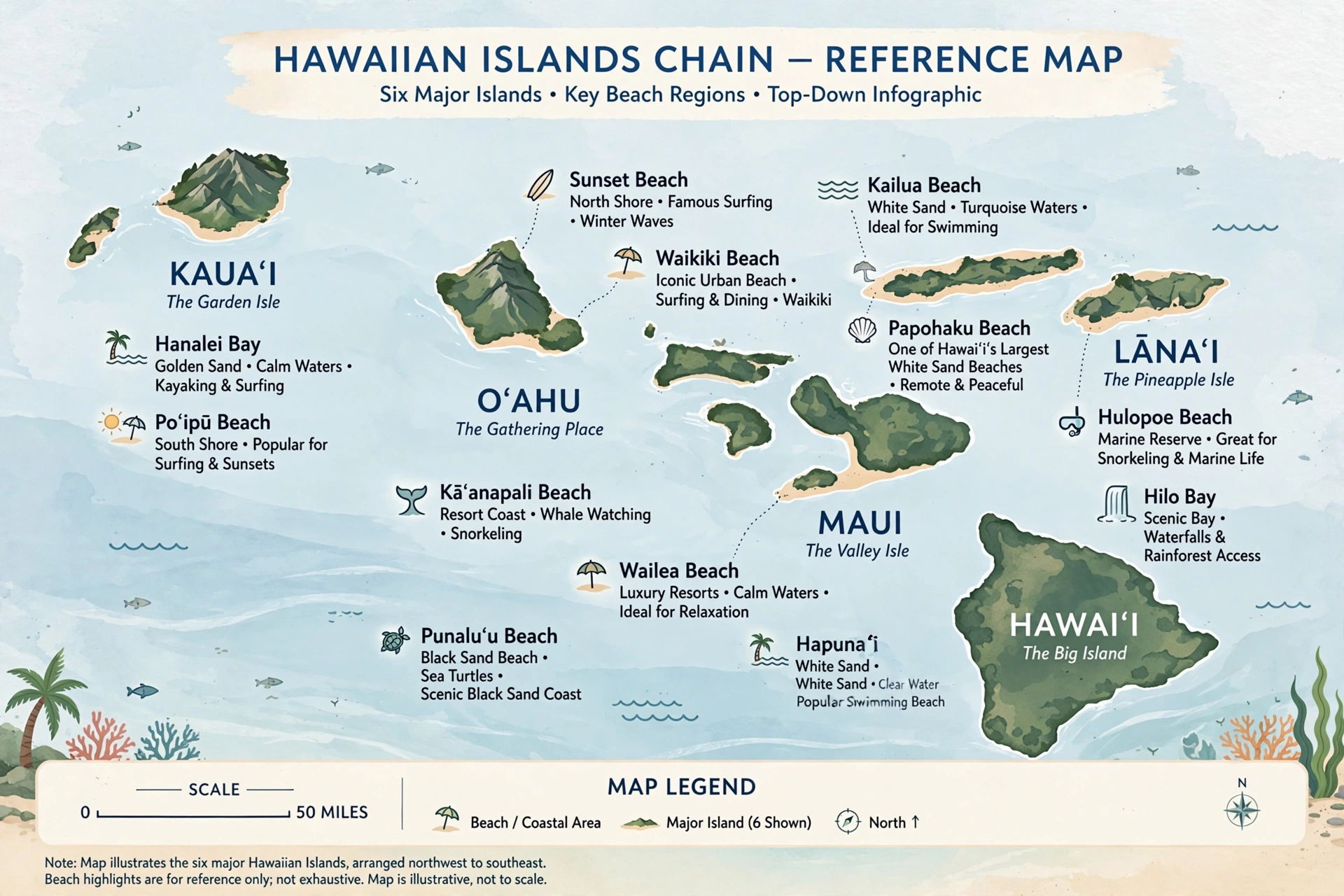
Hawaii Beach Map Overview: How to Read the Islands by Their Coasts
A beach map of Hawaiʻi does more than pin dots on an outline of the islands. It answers the questions that matter most to a visitor: which coast holds the beach you want, how long the drive takes from where you are staying, whether the surf is up or flat on the day you visit, and where you can park and find restrooms once you arrive. This guide is the geographic companion to our beaches coverage. Where the beaches guide describes the sand, the water, and the experience, this reference map page helps you locate every major beach by island, coast, and access route.
The first thing any Hawaiʻi beach map reveals is how strongly the islands are organized by coast. Hawaiʻi sits in the middle of the North Pacific, and its trade winds blow steadily out of the northeast for most of the year. That single fact shapes everything. The east and northeast coasts catch the trades and their chop. The south and southwest coasts sit in the lee of the islands and are calmer. The north shores absorb the full force of winter North Pacific swells. The west shores stay the most sheltered. Learn this pattern once and any island’s beach map becomes legible: north means winter surf, south means summer surf, west means calm mornings, east means breezy and rugged.
Hawaiʻi has six major islands with significant beach destinations: Oʻahu, Maui, the Island of Hawaiʻi (the Big Island), Kauaʻi, Molokaʻi, and Lānaʻi. Niʻihau and Kahoʻolawe have beaches but are effectively inaccessible to visitors, so they do not appear on practical visitor beach maps. Each island’s coastline can be read through the same compass logic, though local headlands, bays, and reefs modify it. Oʻahu’s geography is the cleanest example: the South Shore holds Waikīkī and Honolulu’s hotel strip, the North Shore holds the famous surf beaches along the Kamehameha Highway corridor, the Windward Coast holds the turquoise beaches of Kāneʻohe and Kailua, and the Leeward (west) Coast holds calmer resort beaches around Ko ʻOlina.
Road layout is the second thing to study on a Hawaiʻi beach map. On most islands, one coastal highway rings much of the perimeter, and beaches line up along it like beads on a string. Oʻahu’s Kamehameha Highway and Farrington Highway trace the island’s coasts. Maui’s Honoapiʻilani Highway runs the west coast and the Hāna Highway traces the east. The Big Island’s Māmalahoa Highway and the coastal Queen Kaʻahumanu Highway frame the Kohala and Kona coasts. Kauaʻi’s Kūhiō Highway circles the north and east, with Waimea Canyon Road cutting inland. Once you know the highway for a coast, you can read distance by mile markers and judge drive times between beaches.
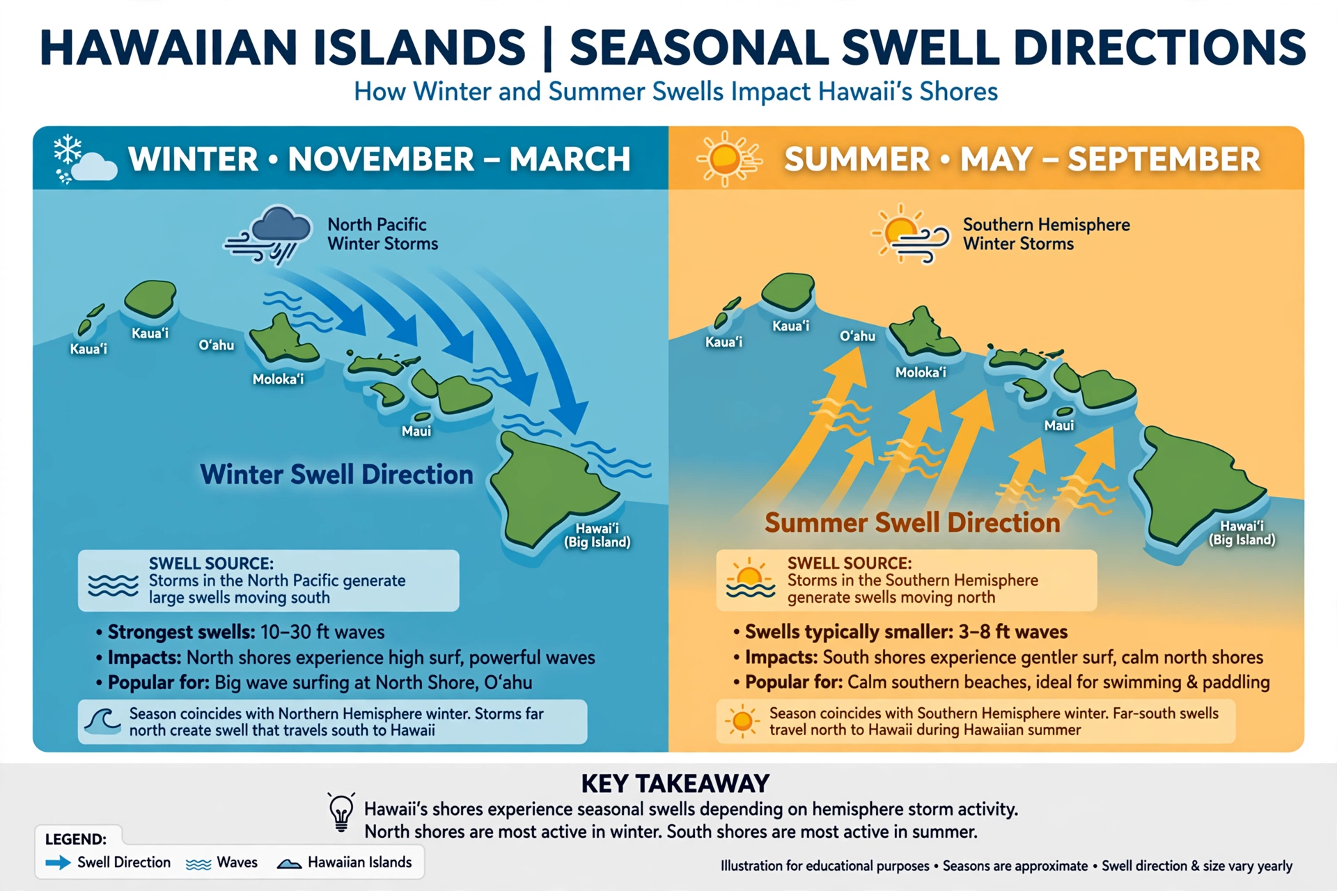
Seasonal swell direction is the third key to reading the map. Hawaiʻi’s surf arrives in two principal seasons from two directions. North Pacific winter storms send powerful swells to north- and northwest-facing shores from roughly October through March. South Pacific swells from southern-hemisphere storms reach south-facing shores from roughly April through September. On a beach map, this means the same beach can be a placid swimming spot in one season and a pounding surf break in another. Waikīkī faces south and wakes up in summer; the North Shore sleeps in summer and roars in winter. Matching the coast to the season is the single most important navigational decision a beachgoer makes.
Beach names add a layer of local geography worth understanding. Many of Hawaiʻi’s famous beaches carry both a Hawaiian name and an English descriptive name. Sunset Beach, Banzai Pipeline, and Waimea Bay sit side by side on Oʻahu’s North Shore, all within a few miles of each other along Kamehameha Highway. Mākaha Beach anchors Oʻahu’s west coast. On Maui, Kāʻanapali, Kapalua, and Nāpili trace the west coast from south to north, while Wailea and Mākena line the south. The Big Island’s Kona coast runs Hapuna, Mauna Kea, and ʻAnaehoʻomalu from north to south; the Kohala coast holds them. Kauaʻi’s Poʻipū anchors the south, Hanalei the north, and the Coconut Coast the east. Learning these sequences turns a map from a picture into a route.
Finally, a good beach map distinguishes between beach access types. Some beaches front resort developments with dedicated parking, restrooms, and lifeguards. Some are state or county beach parks with facilities but simple access. Some are reached by short hikes, gated roads, or four-wheel-drive tracks. The green-sand beach of Papakōlea on the Big Island, for example, requires either a long hike or a rough road. Knowing the access category before you drive saves hours. The sections below organize the islands beach by beach, coast by coast, with access notes for each.
Beaches by Island: A Geographic Reference
This section walks the six main islands in geographic order, locating the principal beaches by coast and region. Use it with the sections that follow: seasonal patterns to pick the right coast for your travel month, and access notes to plan the drive.
Oʻahu
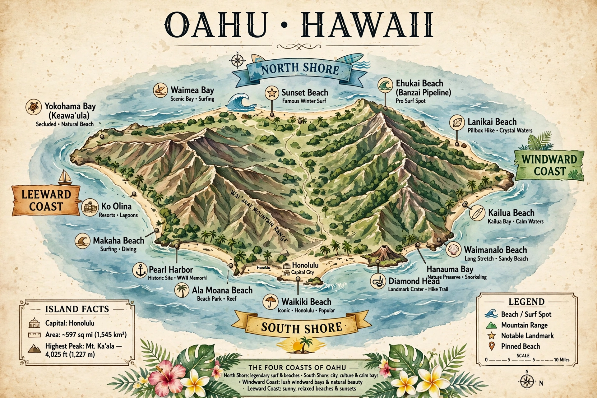
Oʻahu’s beach geography is the most straightforward in the state and the best template for understanding the rest. The island is roughly a diamond, and its four coasts each have a distinct beach character.
The South Shore runs from Diamond Head west to Pearl Harbor and centers on Honolulu and Waikīkī. Waikīkī Beach itself fronts the Waikīkī hotel district along Kalākaua Avenue; immediately west, Ala Moana Beach Park offers a broad sandy park with a protected reef, calm water, and extensive parking. Farther west, the lagoons of Ko ʻOlina on the southwest coast are artificial but calm and sheltered. South-facing shores catch summer south swells, which is why Waikīkī’s gentle surf peaks in the summer months.
The North Shore is a single famous corridor along Kamehameha Highway (Highway 83) between Haleʻiwa and Kahuku, roughly seven miles of the world’s most storied surf coastline. From west to east: Haleʻiwa Aliʻi Beach Park, then the string of surf breaks including Laniākea, Waimea Bay, Chun’s Reef, the Banzai Pipeline at ʻEhukai Beach Park, Sunset Beach, and Turtle Bay at the eastern end. This coast faces the winter North Pacific directly and produces the giant surf of the winter season. In summer it is quiet and swimmable. The drive from Waikīkī to the North Shore runs about 45 to 60 minutes via the H-2 and Kamehameha Highway or the scenic Kamehameha Highway route through Kāneʻohe.
The Windward (east) Coast holds the island’s most photographed turquoise water. Kailua Beach and Lanikai Beach sit back to back on the Kāneʻohe side, both reachable from the Pali Highway or H-3. Farther north along Kamehameha Highway, Waimānalo Bay stretches for miles of white sand, and the coast continues through Kāneʻohe and Kahana Bay to the North Shore junction. Trade winds make this coast breezy, and the offshore reefs keep the water shallow and bright.
The Leeward (west) Coast runs from ʻEwa Beach through Kapolei to Mākaha and beyond. Mākaha Beach Park is the anchor surf and swimming beach of the west side, and Yokohama Bay (Keawaʻula Bay) sits at the end of Farrington Highway where the road dead-ends at Kaʻena Point. West-facing shores are sheltered from both winter north and summer south swells and offer some of the island’s calmest winter swimming, though the drive from Honolulu runs 45 minutes or more.
Maui
Maui’s beach geography follows the island’s two-volcano shape. The west and south coasts hold the resort beaches; the north and east coasts are windward, rugged, and largely beach-free for swimming.
The West Coast runs from Kapalua in the north through Nāpili, Kāʻanapali, and Lahaina to Olowalu in the south along the Honoapiʻilani Highway (Highway 30). Kapalua Bay and Nāpili Bay are small, protected coves at the northern end. Kāʻanapali Beach is the long resort beach at the center, three miles of sand fronting the Kāʻanapali resort district. South of Lahaina, Olowalu offers reef access. The West Maui Mountains shelter this coast from the trades, and winter north swells can wrap in at the northern end while the southern end stays calm.
The South Coast runs from Māʻalaea through Kīhei and Wailea to Mākena along South Kīhei Road and Wailea Alanui Drive. Kamaole Beach Parks I, II, and III line Kīhei; Wailea Beach and Polo Beach front the Wailea resort district; Big Beach (Mākena State Park) and Little Beach anchor the southern end. South-facing shores catch summer swells and stay calm in winter, making Kīhei and Wailea Maui’s most reliable winter swimming coast.
The North Shore of Maui is windsurf country: Hoʻokipa Beach Park east of Paʻia faces the trades and the winter north swell, producing the island’s most famous windsurfing and big-wave conditions. Baldwin Beach Park near Paʻia is the more sheltered swimming option on this coast. The East (windward) Coast along the Road to Hāna holds Hāna Bay’s black-sand beach and the red-sand beach at Kaihalulu, reached by trails; these are scenic stops rather than swimming beaches, and the long drive from the resort coasts runs two hours or more each way.
Island of Hawaiʻi (Big Island)
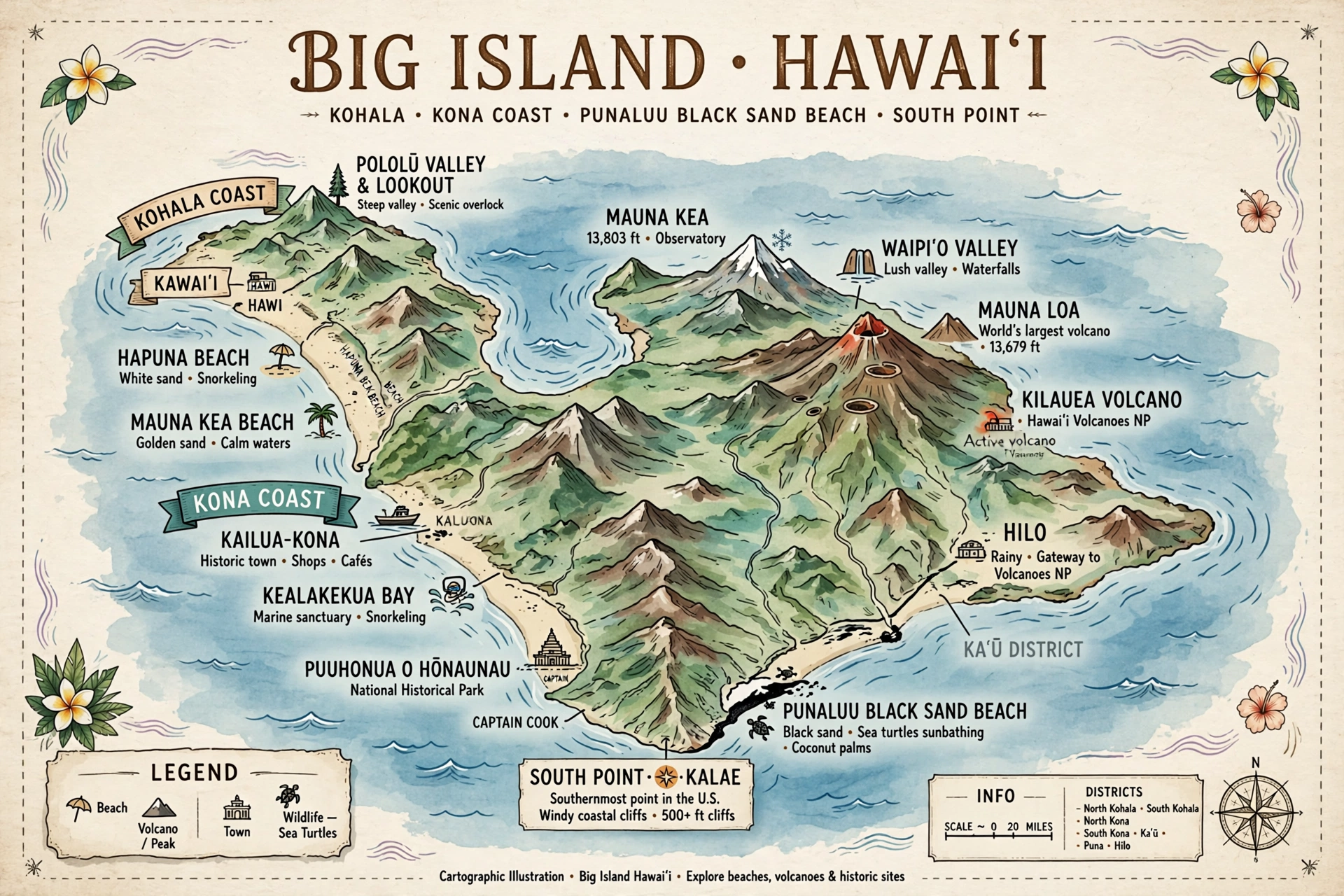
The Big Island’s beaches concentrate on the Kona (west) and Kohala (northwest) coasts; the east (Hilo) side is volcanic, rainy, and rocky with few sand beaches.
The Kohala Coast north of the Kona airport holds the island’s finest white-sand beaches. From north to south: Hapuna Beach State Recreation Area, with its wide crescent of sand; Mauna Kea Beach (Kaunaʻoa Bay), fronting the resort; ʻAnaehoʻomalu Bay at Waikoloa; and the beaches of the Waikoloa resort district. These face west and northwest and offer excellent winter calm, though winter north swells can reach the northernmost beaches.
The Kona Coast runs from Kailua-Kona south through Keauhou to the Captain Cook area. Kamakahonu Beach and the small beaches of Kailua-Kona town sit at the center; Kahaluʻu Beach Park south of town is the coast’s main snorkeling beach; farther south, Hōnaunau (Two Step) offers the island’s best shore snorkeling entry. The Kona coast is the Big Island’s calm-water stronghold, sheltered by the mass of Hualālai and Mauna Loa.
The south and east coasts hold the island’s specialty beaches. Punaluʻu Black Sand Beach sits on the southeast coast along Highway 11 between Volcano and Nāʻālehu, about a 90-minute drive from Kona. Papakōlea Green Sand Beach near South Point requires a 2.5-mile hike each way. On the east side, the Hilo area’s beaches are rocky; the closest swimmable sand is at Richardson Ocean Park east of Hilo.
Kauaʻi
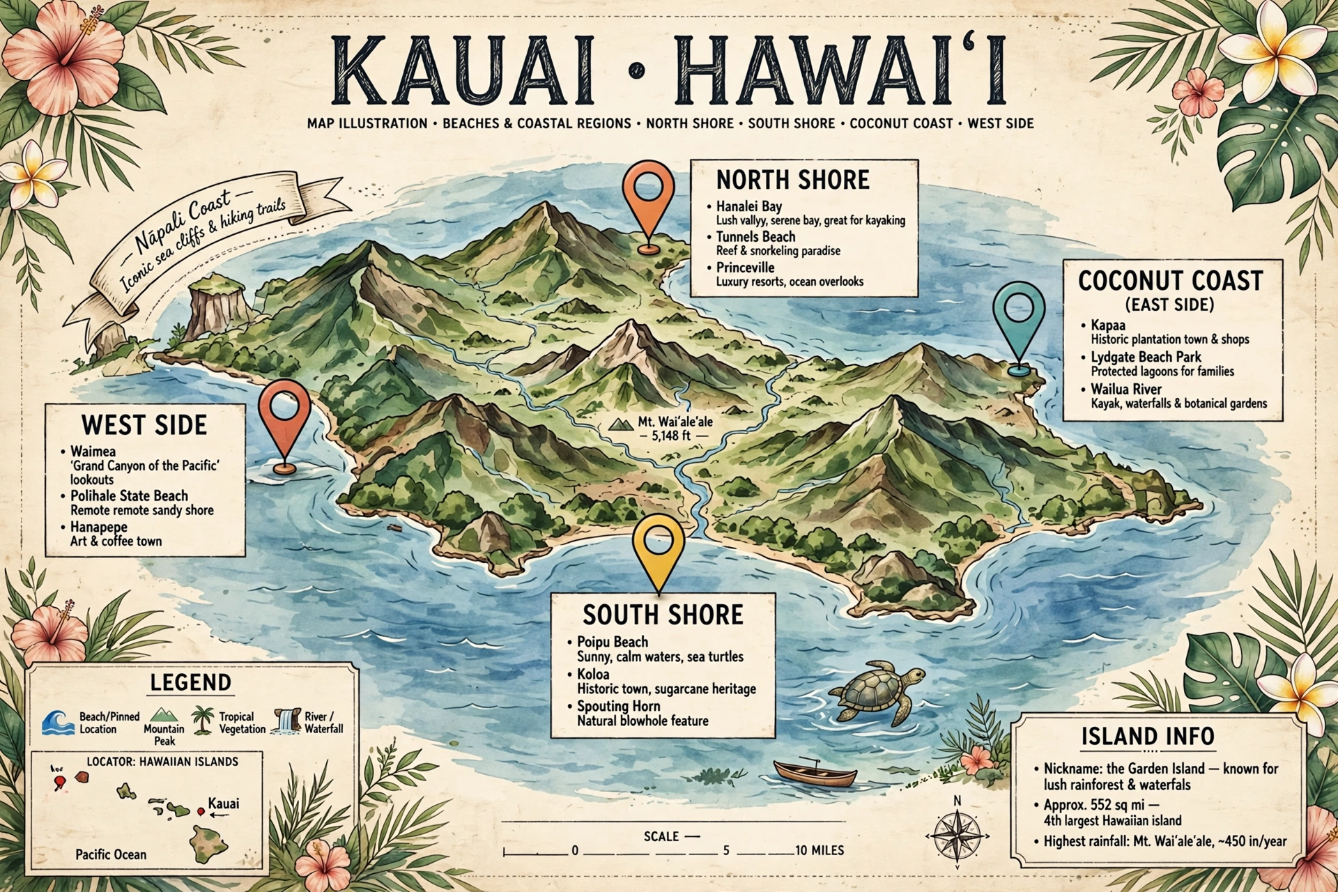
Kauaʻi’s beach geography reads as a ring: the north for scenery and summer calm, the south for winter calm and resorts, the east for long walks, the west for solitude.
The North Shore runs from Princeville through Hanalei to Hāʻena and the Nā Pali Coast along the Kūhiō Highway (Highway 56/560). Hanalei Bay is the great crescent anchoring the coast; Lumahaʻi Beach and Tunnels Beach (Makua) lie farther west toward Hāʻena. This coast faces winter north swells directly and is calmest in summer. The highway ends at Hāʻena State Park, beyond which the Nā Pali Coast is accessible only by trail or boat.
The South Shore centers on Poʻipū: Poʻipū Beach Park, Brennecke’s, and Shipwreck Beach (Keoneloa Bay) line the coast along Hoʻowili and Poʻipū Roads. This coast faces south, catches summer swells, and is Kauaʻi’s calmest winter coast. The drive from Līhuʻe to Poʻipū runs about 25 minutes.
The East (Coconut) Coast holds long, breezy beaches: Lydgate Beach Park near Wailua (protected by a rock-enclosed pond, good for families), Wailua Beach, and the miles of sand toward Kapaʻa. The West Side holds Kekaha Beach and the long, empty sands toward Polihale State Park at the end of the road; Polihale’s remoteness means minimal facilities and rough access, and its surf can be powerful.
Molokaʻi and Lānaʻi
Molokaʻi’s most famous beach is Papohaku Beach Park on the west end, one of Hawaiʻi’s longest white-sand beaches, reached via Kaluakoʻi Road. The south shore holds shallow reef flats with limited swimming beaches; the north shore is the sea-cliff coast, beachless and trail-accessed. Lānaʻi’s signature beach is Hulopoʻe Bay Beach Park at Mānele on the south coast, a protected marine area with excellent snorkeling, reached from Lānaʻi City via Mānele Road. Both islands reward the beach map reader who plans the drive: facilities are few, distances are short, and the beaches feel empty by Oʻahu or Maui standards.
North Shore vs. South Shore: Seasonal Patterns
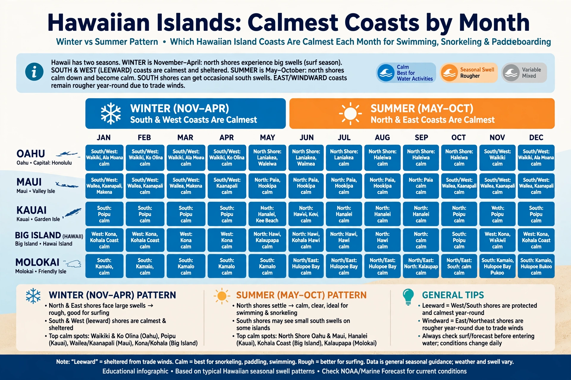
Every Hawaiian island has a version of the north shore versus south shore split, and understanding it is the most practical skill a beach map can teach. The pattern comes from the two swell seasons. From roughly October through March, storms in the North Pacific generate large swells that travel thousands of miles and strike Hawaiʻi’s north- and northwest-facing shores. From roughly April through September, southern-hemisphere winter storms send smaller but consistent swells to south-facing shores. The trades blow from the northeast year-round, ruffling east-facing beaches in every season.
In practical terms, this means north-facing beaches and south-facing beaches trade roles twice a year. Oʻahu’s North Shore produces the giant winter surf of the Vans Triple Crown season and then goes nearly flat in summer, when Waimea Bay becomes a calm swimming cove. Waikīkī reverses the pattern: gentle in winter, livelier in summer when south swells arrive. Maui’s Hoʻokipa rages in winter and rests in summer; Kīhei and Wailea stay calm through winter and pick up gentle surf in summer. Kauaʻi’s Hanalei Bay is a summer swimming beach and a winter surf beach; Poʻipū is the winter refuge and the summer surf spot.
The shoulder months of April, May, September, and October are transition periods when either coast can receive swell and conditions change week to week. During these months, checking the surf forecast matters more than the calendar. The National Weather Service Honolulu office publishes surf zone forecasts for each island’s coasts, and its high surf advisories are the authoritative signal for dangerous conditions. A beach map tells you which coast faces which swell; the forecast tells you what is arriving today.
West-facing shores occupy a useful middle ground. Sheltered from the direct hit of both winter north and summer south swells, beaches like Oʻahu’s Mākaha, Maui’s Kāʻanapali, and the Big Island’s Kona coast beaches offer the most consistent year-round calm. They are not immune to swell, since large swells wrap around island ends, but they change the least between seasons. Travelers visiting in winter who want swimming rather than surf watching should weight their beach map toward the west and south coasts; summer visitors wanting gentle water should weight it toward the north and west coasts.
East-facing windward beaches follow their own logic. The trades make them breezy and choppy in every season, and they rarely produce the dramatic seasonal swings of the north and south shores. Kailua and Lanikai on Oʻahu, the Coconut Coast on Kauaʻi, and Hilo-side beaches on the Big Island are morning beaches: calmest before the trades strengthen around midday. Reading the wind on the map matters as much as reading the swell.
Finding Beaches: Access and Parking
Locating a beach on the map is only half the task; reaching it is the other half. Hawaiʻi’s beach access falls into a few clear patterns, and knowing which pattern applies saves the frustration of circling a resort district or walking a hot road with no sidewalk.
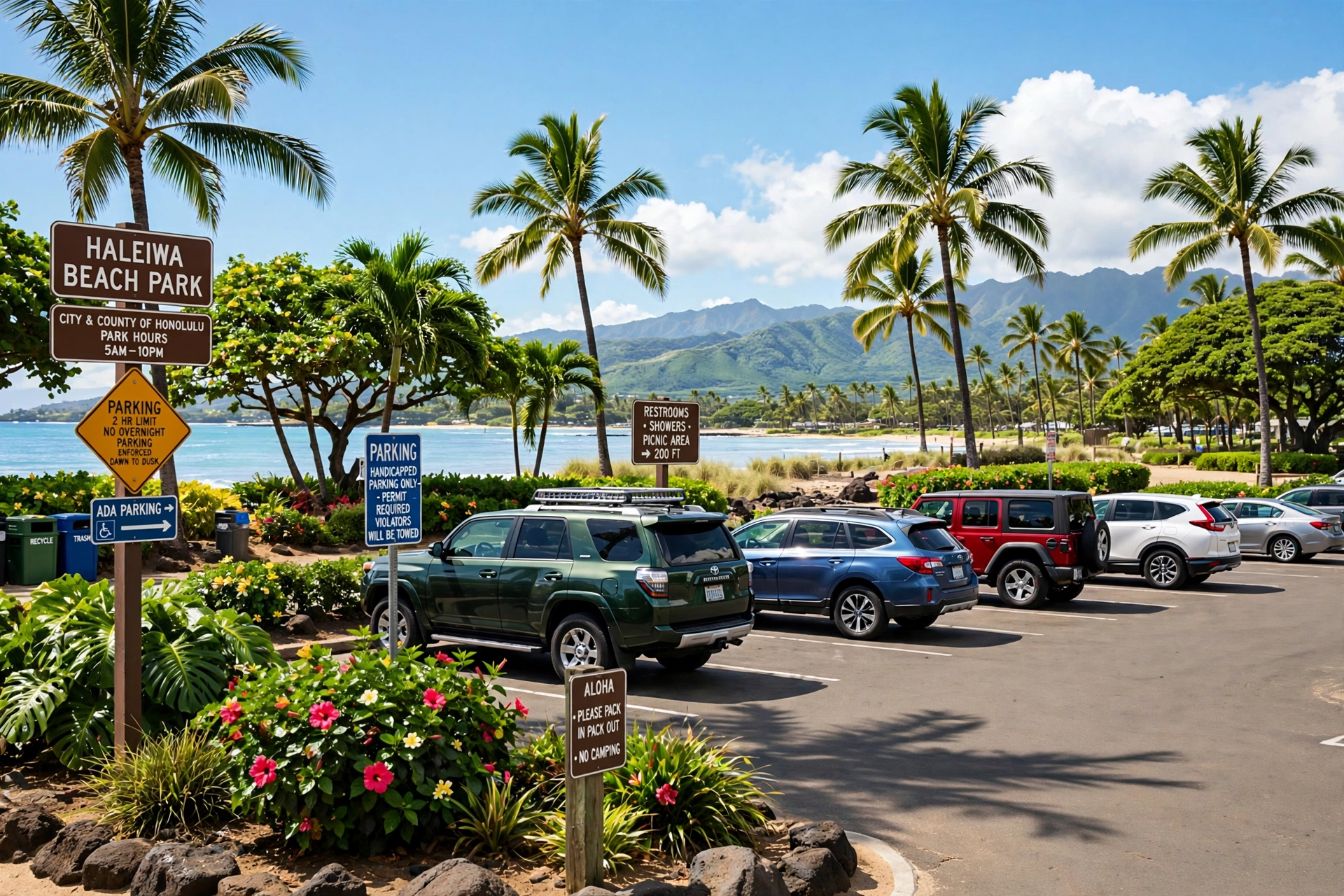
Beach parks are the easiest category. County and state beach parks such as Ala Moana Beach Park, Hapuna Beach State Recreation Area, and Poʻipū Beach Park have dedicated parking lots, and the lots fill on weekends and holidays. Arriving before 9 a.m. is the reliable strategy at popular parks; midday arrivals on Saturdays often mean circling. State park lots sometimes charge nonresident parking fees, so carry a card. Parking outside marked areas, on grass verges, or blocking gates risks a ticket and, at trailhead beaches, a tow.
Resort-front beaches require reading the access rules. Hawaiʻi law guarantees public access to all beaches, and resorts must provide public access paths, but the parking provided for beachgoers is often limited to a small signed lot. At Kāʻanapali, public beach access parking sits in marked stalls near the beach path entrances. At Wailea, public access lots are signed along Wailea Alanui Drive. At Ko ʻOlina, public parking serves the lagoons. The map skill here is identifying the signed public access point rather than the resort’s main entrance, and arriving early because the public stalls are few.
Neighborhood and shoreline-access beaches such as Lanikai on Oʻahu are reached through residential streets with limited or no dedicated parking. Visitors park along the street where legal and walk the public access paths between houses. These beaches reward early arrival and respectful behavior: keep noise down, pack out all trash, and never block driveways. Some access paths are unsigned and known mainly to locals, which is why a beach map with marked access points is worth more than a pin on a beach name.
Hike-in beaches form their own category. Papakōlea Green Sand Beach on the Big Island requires a roughly 2.5-mile hike each way across open ranchland with no shade and no water; the trailhead parking is at the end of South Point Road. Kaihalulu Red Sand Beach near Hāna is reached by a short but narrow cliffside trail. Polihale on Kauaʻi’s west side is reached by a rough dirt road rather than a hike, but the access logic is the same: the difficulty of the approach is part of the beach’s character, and visitors should carry water, sun protection, and sturdy footwear. Check current road and trail conditions before driving out, since washouts and closures change access seasonally.
Distances on the map translate into real drive times that surprise first-time visitors. Oʻahu’s North Shore is 45 to 60 minutes from Waikīkī. Maui’s Hāna coast is two hours each way from the resort areas. The Big Island’s Punaluʻu Black Sand Beach is about 90 minutes from Kona. Kauaʻi’s Hāʻena trailhead is about 75 minutes from Poʻipū. Plan beach days by coast rather than hopping coasts: pick the coast that matches the season and your lodging, and spend the day there instead of crossing the island twice.
Beach Facilities Map: Lifeguards, Restrooms, and Picnic Areas
A beach map that ignores facilities is only half a map. Lifeguard coverage, restrooms, showers, and picnic areas determine which beaches work for families, which work for a full-day outing, and which require a self-sufficient plan.
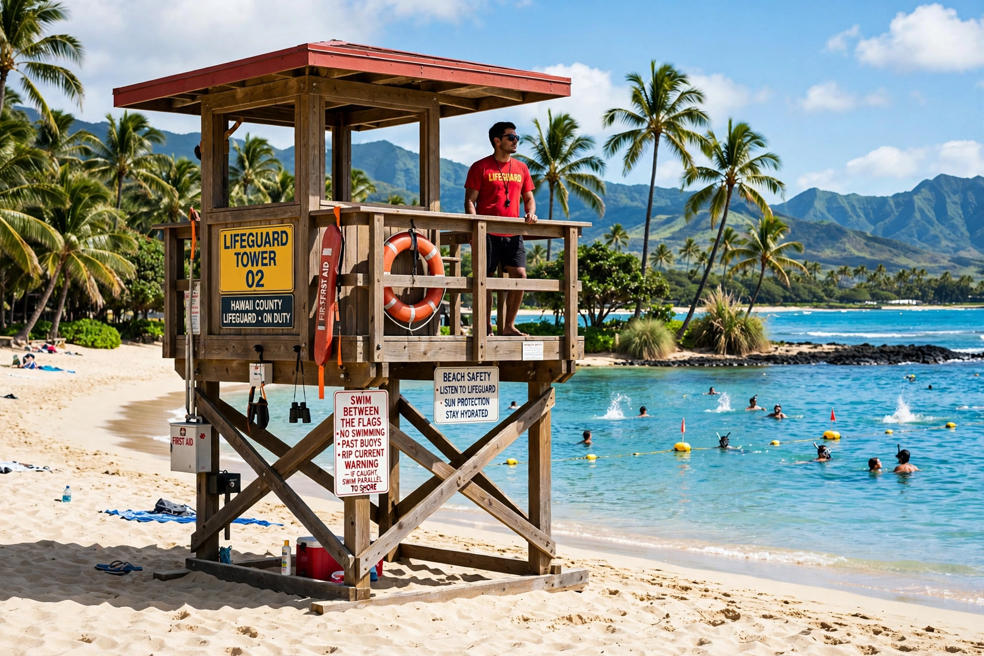
Lifeguarded beaches cluster at the most visited locations. On Oʻahu, lifeguard towers stand at Waikīkī, Ala Moana, Hanauma Bay, Sandy Beach, Mākaha, Waimea Bay, Sunset Beach, ʻEhukai (Pipeline), Kailua, and Bellows, among others; the City and County of Honolulu publishes its staffed beach list. On Maui, lifeguards cover Kāʻanapali, the Kamaole parks, Wailea, Big Beach, Baldwin, and Hoʻokipa. The Big Island stations lifeguards at Hapuna and a handful of other parks. Kauaʻi covers Poʻipū, Hanalei, Lydgate, and others. Lifeguard hours typically run mid-morning to late afternoon. Swimming at a lifeguarded beach during staffed hours, and asking the guards about current conditions, is the single best safety practice a visitor can adopt.
Restrooms and showers are standard at county and state beach parks and at resort-front beaches with public facilities. Hike-in and remote beaches such as Papakōlea, Polihale, and the Nā Pali trailheads have none; plan accordingly. Beach park restrooms vary in condition and some close at sunset along with the park gates, so a late-afternoon visit should not assume facilities will stay open.
Picnic areas and pavilions mark the full-day beaches. Ala Moana Beach Park, Kailua Beach Park, Hapuna, and Poʻipū Beach Park offer shaded tables and grassy areas that make them natural all-day bases. Many pavilions can be reserved through the county for gatherings; walk-in use is first-come. Shaded picnic infrastructure matters more than visitors expect: Hawaiʻi’s sun is intense year-round, and a beach day without a shade plan ends early.
Family-friendly markers on a facilities map combine several signals: lifeguard presence, restrooms, calm water, and shade. Lydgate Beach Park’s protected pond on Kauaʻi, the Ko ʻOlina lagoons on Oʻahu, Baby Beach in Lahaina on Maui, and ʻAnaehoʻomalu Bay on the Big Island all score on every axis. Families reading the map should filter for these combined markers rather than choosing by scenery alone.
Accessibility varies widely. Major beach parks increasingly offer accessible parking, paths, and restrooms, and some locations provide beach wheelchairs; availability and reservation rules differ by county. Remote and hike-in beaches are generally not accessible. Visitors with mobility needs should confirm current accessibility details with the county parks department for the specific beach before visiting.
Snorkeling Beaches Map
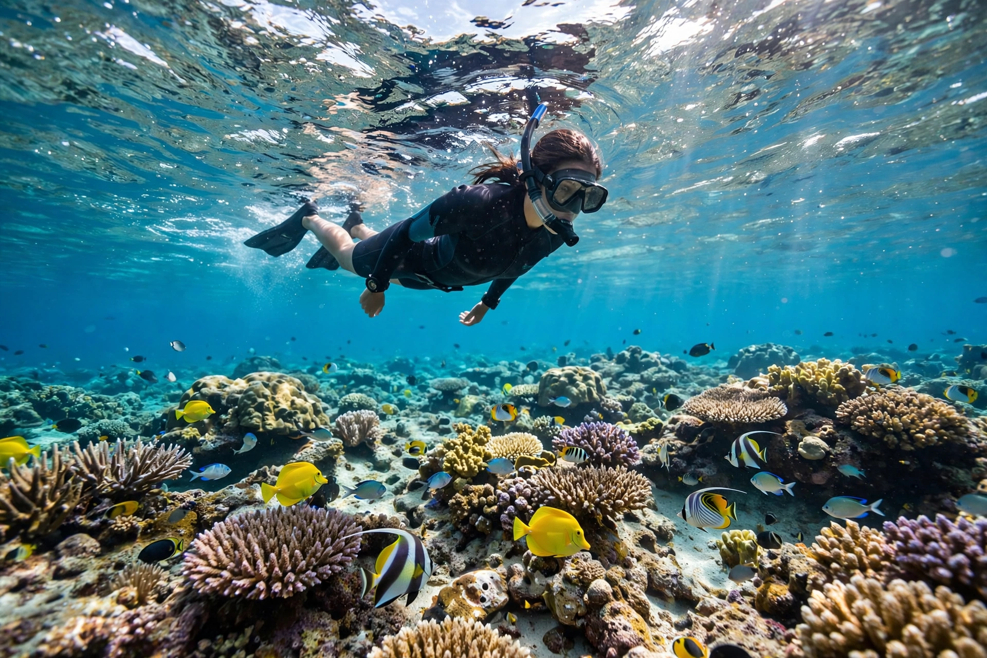
Snorkeling beaches form a distinct layer on the Hawaiʻi beach map: they cluster where reefs sit close to shore, water stays calm, and entry is sandy rather than rocky. The geography of good snorkeling follows the calm-water geography, which means the best snorkeling coasts shift with the seasons just as swimming beaches do.
On Oʻahu, Hanauma Bay Nature Preserve on the southeast coast is the island’s signature snorkeling beach, a flooded volcanic crater with a reef close to entry; it requires a reservation and an entry fee, and it is closed one day a week. Shark’s Cove on the North Shore is a summer-only snorkeling spot, calm when the winter surf is gone. Kuilima Cove at Turtle Bay offers a sheltered entry at the island’s northern tip.
On Maui, the west and southwest coasts hold the snorkeling beaches: Kapalua Bay, Nāpili Bay, Honolua Bay (a marine reserve, entry over rocks), and the reef at ʻĀhihi-Kīnaʻu Natural Area Reserve near Mākena. On the Big Island, Kahaluʻu Beach Park and Hōnaunau (Two Step) on the Kona coast are the two essential snorkeling beaches, both on the calm leeward side. On Kauaʻi, Poʻipū Beach Park and Lydgate’s protected areas work in winter; Tunnels Beach (Makua) on the North Shore is a summer snorkeling destination when the north swells subside. On Lānaʻi, Hulopoʻe Bay is a marine reserve with excellent shore snorkeling.
The seasonal rule applies directly: snorkel the coast that is in its calm season. Winter visitors should snorkel south and west shores; summer visitors can add north shore reef beaches. Reef-safe sunscreen, never standing on coral, and entering over sand rather than reef are the practices that keep these beaches healthy. For the full breakdown of sites, gear, and seasonal timing, see our Hawaiʻi Snorkeling Guide.
Frequently Asked Questions
Where is the best area to stay for beach access in Hawaiʻi?
It depends on the island and the season. On Oʻahu, Waikīkī puts the South Shore beaches at your door with the North Shore under an hour away. On Maui, Kāʻanapali and Wailea anchor the two calm-water coasts. On the Big Island, the Waikoloa and Kona coast resorts sit nearest the best swimming beaches. On Kauaʻi, Poʻipū is the winter base and Princeville the summer base. In every case, staying on the coast that is calm in your travel month matters more than staying near any single beach.
Which Hawaiian island has the most beaches?
Oʻahu has the highest count of named, accessible beaches because its coastline is the most developed for recreation and its four coasts each hold long beach systems. Maui and the Big Island follow, each with distinct resort-coast beach clusters. Kauaʻi’s beaches are fewer but include some of the state’s most scenic. Molokaʻi and Lānaʻi have a handful of excellent but remote beaches each.
Are all beaches in Hawaiʻi public?
Yes. Under Hawaiʻi law, all beaches are public up to the high-water mark, and shoreline access must remain open to everyone. Resorts fronting beaches must provide public access paths, though public parking near resort beaches is often limited. No beach can be reserved for private use, and access paths cannot be blocked.
What is the calmest beach coast in winter?
West- and south-facing coasts are calmest from October through March, when north swells dominate. Good winter bets include Waikīkī and the Ko ʻOlina lagoons on Oʻahu, Kīhei and Wailea on Maui, the Kona and Kohala coasts on the Big Island, and Poʻipū on Kauaʻi. Always check the surf forecast on the day, since large swells can wrap into sheltered coasts.
What is the calmest beach coast in summer?
North- and west-facing coasts are calmest from April through September, when south swells dominate. Good summer bets include the North Shore’s Waimea Bay and Chun’s Reef on Oʻahu, Kapalua and Nāpili on Maui, the Kohala coast on the Big Island, and Hanalei Bay and Tunnels on Kauaʻi. South-facing beaches like Waikīkī and Poʻipū pick up surf in summer.
Do I need a car to reach Hawaiʻi’s beaches?
On most islands, yes for any serious beach exploration. Oʻahu’s bus system reaches many beaches, and Waikīkī’s beaches are walkable, but the North Shore, Windward Coast, and West Side are far easier by car. On Maui, the Big Island, and Kauaʻi, the best beaches are spread along coastal highways with limited transit, so a rental car is effectively essential for a beach-focused trip.
Which beaches have lifeguards?
The most visited beaches on each island are lifeguarded during daytime hours, including Waikīkī, Ala Moana, Sunset Beach, and Waimea Bay on Oʻahu; Kāʻanapali and the Kamaole parks on Maui; Hapuna on the Big Island; and Poʻipū and Hanalei on Kauaʻi. County ocean safety agencies publish current staffed-beach lists. Swim at lifeguarded beaches during staffed hours and ask guards about conditions before entering the water.
How do I find beach parking on busy days?
Arrive before 9 a.m. at popular beach parks, use the signed public access lots at resort-front beaches, and have a backup beach on the same coast in mind. Weekend and holiday midday arrivals are the hardest. Never park on grass verges, in front of gates, or in ways that block emergency access; tickets and tows are common at busy trailheads and beach parks.
Related Guides
- Hawaiʻi Beaches: The Complete Guide: the companion guide to this map page, covering the sand, water, and experience of Hawaiʻi’s best beaches.
- Hawaiʻi Snorkeling Guide: every major snorkeling beach by island, with seasonal timing and reef etiquette.
- Hawaiʻi Map: Complete Island Reference: the statewide reference map covering all islands, regions, and driving routes.
- Oʻahu Beaches Guide: the island-level companion with full detail on Oʻahu’s four coasts.
- Maui Beaches Guide: the island-level companion for Maui’s west, south, and north shore beaches.
A beach map is a planning tool, not a promise. Swell, wind, and weather rewrite the conditions daily, and the same pin on the map can mean a glassy swimming cove in July and a closed-out surf break in January. The geography in this guide does not change: the trades still blow from the northeast, the winter swells still come from the north, and the calm water still sits on the coast facing away from the season’s surf. Learn the pattern, check the forecast on the day, and let the map do what maps do best: show you where the water you want is waiting.