Kalepa Ridge: The Honest Guide to Kauaʻi’s Famous Closed Ridgeline

The Short Answer: It Is Closed Right Now
Let us start with the fact that matters most. As of October 2026, Kalepa Ridge is completely off limits. Hurricane Lowell struck Kauaʻi in early September 2026, and the Hawaiʻi Department of Land and Natural Resources (DLNR) closed every parcel of state land on the island. That includes Kōkeʻe State Park, Kōkeʻe Road, and the Kalalau Lookout where this route begins. DLNR has described catastrophic, unmitigated hazards across Kōkeʻe and has urged the public to stay out. There is no announced reopening date.
This article tells you the full honest story: what Kalepa Ridge is, why hikers seek it out, why it is dangerous, and what to do instead. If you are planning a Kauaʻi trip, read the closure section first, then the alternatives at the end.
Kalepa Ridge at a Glance
| The question | The answer | What it means |
|---|---|---|
| Where is it | Kalalau Lookout, end of Highway 550, Kōkeʻe State Park, Kauaʻi | You start at a lookout, not a trailhead; there is no official start |
| How long | About 1.9 miles round trip, 2 to 3 hours | Short but serious; the difficulty is the terrain, not the distance |
| Elevation change | Roughly 500 feet | Steep, muddy ridgeline; every foot of it is earned |
| Difficulty | Hard (experienced hikers only) | Not a first-hike-in-Hawaiʻi trail, however short it looks |
| Official status | Not an official state trail; posted CLOSED | No maintenance and no guarantees; the signs mean it |
| Current access (Oct 2026) | CLOSED: all Kauaʻi DLNR lands shut after Hurricane Lowell | Check DLNR before planning anything around this ridge |
| The payoff | Ridgeline views into Kalalau Valley and along the Nā Pali Coast | The view that keeps experienced hikers watching the closure notices |
What Kalepa Ridge Actually Is
Kalepa Ridge is not a park trail in the way most visitors understand the word. It is an unmarked, unmaintained hunter-access route that leaves from the Kalalau Lookout parking area and follows the narrow spine of land between Honopu Valley and Kalalau Valley. The state does not maintain it, does not sign it as a trail, and posts a CLOSED sign at the point where it begins, just past the lookout fence.
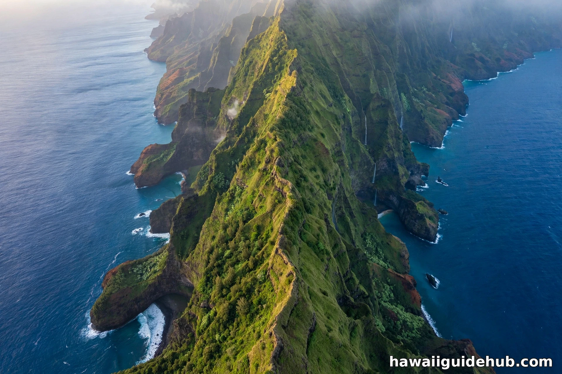
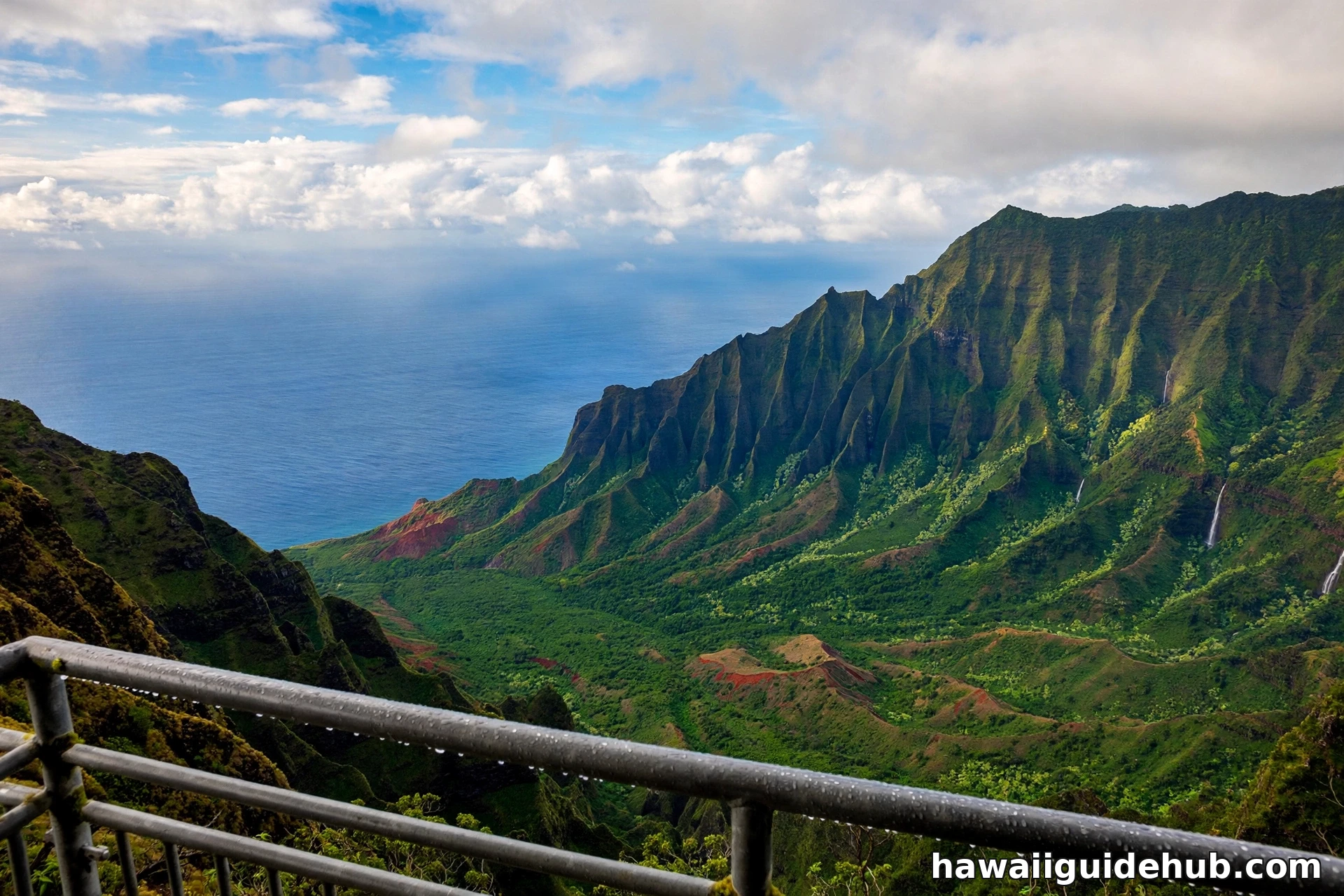
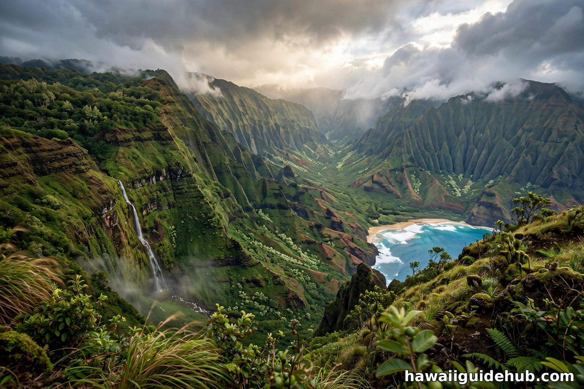
Despite that, it became famous. The route runs along an exposed ridgeline with the green fluted walls of Kalalau Valley falling away on one side and Honopu on the other. On a clear morning the views are among the most photographed on Kauaʻi: the full sweep of Kalalau Valley, the Nā Pali cliffs marching toward the horizon, and Kalalau Beach far below. The whole walk is only about a mile each way, which is exactly why it draws people. It promises helicopter-level scenery for the price of a short hike.
That promise is also the problem. Everything that makes the ridge beautiful makes it dangerous.
The Honest Truth About Safety
This section is not here to lecture. It is here because the facts are stark and search results do not always say them plainly.
The ridge is a knife edge
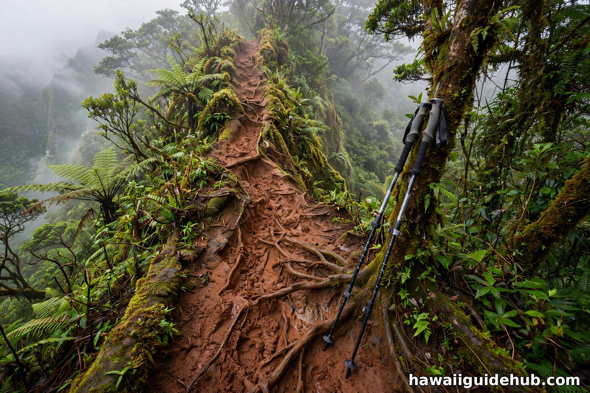
For much of its length the route follows a narrow crest with drops of a thousand feet or more on both sides. In dry weather with good boots, experienced hikers manage it. In wet weather the red dirt turns to slick mud, and Kōkeʻe is one of the wettest places on earth (see what time of year it rains in Hawaii). Wet conditions change this route from challenging to genuinely life-threatening.
It is unmaintained and unsigned
There are no railings, no maintained tread, no mile markers, and no cell phone coverage. If you are hurt, rescue is slow and difficult. Helicopter extractions from this terrain have taken multiple attempts in past incidents.
People get hurt here
Local rangers report injuries on this route every year, mostly slips and falls. The most dangerous moments come when people leave the route itself to chase a better photo near the edge. A slip at the wrong spot has no second chance.
The state says it is closed
A CLOSED sign stands at the start. Hiking past closure signage on state land can technically result in a citation. Whether or not that is enforced, the sign exists because the state considers the route unsafe for public use.
Current Closure: Hurricane Lowell (September 2026)
This is not a minor trail closure. On September 8, 2026, Hurricane Lowell caused widespread damage across Kauaʻi. DLNR closed all of its lands on the island, and in a September 16 news release the department specifically urged the public to avoid Kōkeʻe State Park and Kōkeʻe Road, citing numerous serious hazards including massive treefall across roads and trails. As of DLNR’s October 8, 2026 park notice update, Kōkeʻe Road remains closed and all other Kauaʻi state parks remain closed. Only Wailua River State Park partially reopened.
What this means for you: you cannot reach the Kalalau Lookout right now, because the road to it is closed. The ridge, the lookout, and the entire surrounding park are off limits until DLNR declares them safe. Do not attempt to enter closed areas. Conditions include unstable terrain and flash flooding risk.
If your Kauaʻi trip is coming up soon, rebuild your plans around places that are open. Start with our guide to things to do on Kauaʻi and our complete guide to Poʻipū, and check the DLNR park notices page before you travel. Closures like this can last months.
What the Route Is Like (For Reference)
The following describes the route as it existed before the closure, for information only. Do not use it as a reason to enter a closed area.
The start is unmarked. From the Kalalau Lookout parking lot, the route begins near a break in the fence on the left side as you face the ocean. The first section drops steeply through brush and muddy red dirt, and many hikers use their hands or trekking poles here. After the initial descent the path levels somewhat and follows the ridgeline outward, weaving through tree groves, tall grass, and open exposed sections.
About a third of the way along there is a fork; the right branch leads to a viewpoint worth seeing before rejoining the main route. Continuing on, the exposure increases and the views open fully: Kalalau Valley spreads below, Honopu’s sea arch sits offshore to the west, and on the clearest days you can trace the Nā Pali cliffs all the way along the coast. The route ends at a narrow point where the ridge narrows dramatically. Experienced hikers turn around here. The narrowest sections beyond this point are where the serious accidents happen.
Then you climb back the way you came, which most hikers say is the harder half.
Getting There When the Area Reopens
When Kōkeʻe State Park reopens, the drive itself is part of the experience. From Waimea on the west side, take Highway 550 (Waimea Canyon Drive, which becomes Kōkeʻe Road) up through Waimea Canyon State Park and into Kōkeʻe. The road climbs to about 4,000 feet over roughly 18 miles of winding mountain road. Kalalau Lookout sits at the very end of the highway, past the Puʻu o Kila Lookout. There is a parking lot with restrooms at the lookout.
Plan this as a half-day trip from the west side or a full day from elsewhere on the island. The drive from Lihue takes about an hour and a half each way. From Poipu it is closer to two hours. Fuel up before you climb; there are no gas stations on the mountain road.
Best Conditions and Timing
If and when the area reopens, timing matters enormously here. Go early. The standard advice from everyone who knows this ridge is to start between 8:30 and 9:00 in the morning. By late morning the clouds roll over the pali and the views vanish. An early start also gives you the driest, most stable conditions of the day.
Check the weather the night before and the morning of. Do not attempt this route in rain, after heavy rain, or when the forecast is uncertain. Kōkeʻe’s weather changes fast, and a dry trail at 9 AM can be a mud slide by noon. The dry season, roughly April through September, offers your best odds, but mountain weather never guarantees anything.
Wear aggressive-traction hiking boots, not sneakers and never sandals. Bring trekking poles. Carry more water than you think you need, sun protection, and a rain shell even on a clear morning. Tell someone your plan.
What to Bring If You Go
When the area reopens and if you are an experienced hiker attempting this route in dry conditions, pack like the mountain demands. Aggressive-traction hiking boots are non-negotiable; the red dirt offers no grip to smooth soles. Trekking poles make a real difference on the steep descent at the start and the climb back out. Carry at least two liters of water per person, because there is no water on the route and the climb back is exposed. Bring a rain shell even on a clear morning, sun protection, a basic first aid kit, and a fully charged phone, knowing it will have no signal on the ridge. A headlamp is wise insurance if you misjudge your timing. And tell someone exactly where you are going and when you expect to return.
Legal Alternatives With the Same Views
You do not need to risk a closed, unofficial ridge to see Kalalau Valley. These legal options deliver the scenery without the danger.
Kalalau Lookout itself
The official lookout at the end of Highway 550 gives you the classic postcard view of Kalalau Valley from behind a railing. It is free, safe, and spectacular. When the park reopens, this should be your first stop.
Puʻu o Kila Lookout
Just before the end of the road, this lookout offers a slightly different angle into the valley and is the trailhead for the Pihea Trail, a maintained route with big views.
Awaʻawapuhi Trail
This official Kōkeʻe trail descends about 3 miles to a viewpoint over the Nā Pali Coast and is one of the finest maintained hikes on the island. It is strenuous but legal, signed, and maintained.
Nuʻalolo Trail
Another Kōkeʻe classic with sweeping coastal views, often combined with Awaʻawapuhi for a long loop by experienced hikers.
Boat and helicopter tours
Seeing the Nā Pali Coast from the water or the air is unforgettable and completely safe. Tour operators run from Port Allen and Hanalei when ocean conditions allow. Pair it with our picks for the best Kauaʻi beaches for swimming.
Note: the Kōkeʻe-area trails above are also currently closed under the Hurricane Lowell closure. They are listed here for future trip planning, not for visiting today.
See the Ridge on Video
The video below shows what the Kalepa Ridge route and the surrounding Nā Pali viewpoints look like, filmed before the current closure. It gives a good sense of the exposure and the scenery.
Video: Hiking The Na Pali Coast in Kauai, Kalepa Ridge and Waimea Canyon, by Mike and Laura Travel.
Frequently Asked Questions
Is Kalepa Ridge Trail open right now?
No. As of October 2026, all Kauaʻi state lands managed by DLNR are closed after Hurricane Lowell, including Kōkeʻe State Park and Kōkeʻe Road. There is no reopening date. Do not enter closed areas.
Is Kalepa Ridge an official trail?
No. It is an unofficial, unmaintained hunter-access route. The state does not maintain it and posts it as CLOSED at the Kalalau Lookout.
Is it illegal to hike Kalepa Ridge?
The route is posted closed by the state, and hiking past closure signage on state land can technically result in a citation. It is not a sanctioned public trail.
How long is the Kalepa Ridge Trail?
About 1.9 miles round trip with roughly 500 feet of elevation change. Most hikers take 2 to 3 hours.
How dangerous is Kalepa Ridge?
Very, in the wrong conditions. The ridge is narrow with drops of a thousand feet or more on both sides. It becomes extremely slippery when wet, and there is no cell coverage. Injuries are reported every year. It should only be considered by experienced hikers in dry conditions, and even then the state considers it closed.
Where is the Kalepa Ridge trailhead?
The informal start is at the Kalalau Lookout parking area at the end of Highway 550 in Kōkeʻe State Park, near a break in the fence on the left side of the lot. The lookout and the entire park are currently closed.
The Bottom Line
Kalepa Ridge offers some of the most dramatic views on Kauaʻi, and that is exactly why it demands respect. It is unofficial, unmaintained, posted closed, and genuinely dangerous in wet weather. Right now it is also completely inaccessible, along with the rest of Kōkeʻe, while Kauaʻi recovers from Hurricane Lowell. When the island’s parks reopen, the Kalalau Lookout itself and the maintained trails of Kōkeʻe will give you the Nā Pali views you came for, legally and safely. Check DLNR’s park notices before you go, start early, and never chase a photo past the point of safety.