Port of Hilo: Hawaii’s Working Harbor, Cruise Gateway, and Visitor Guide

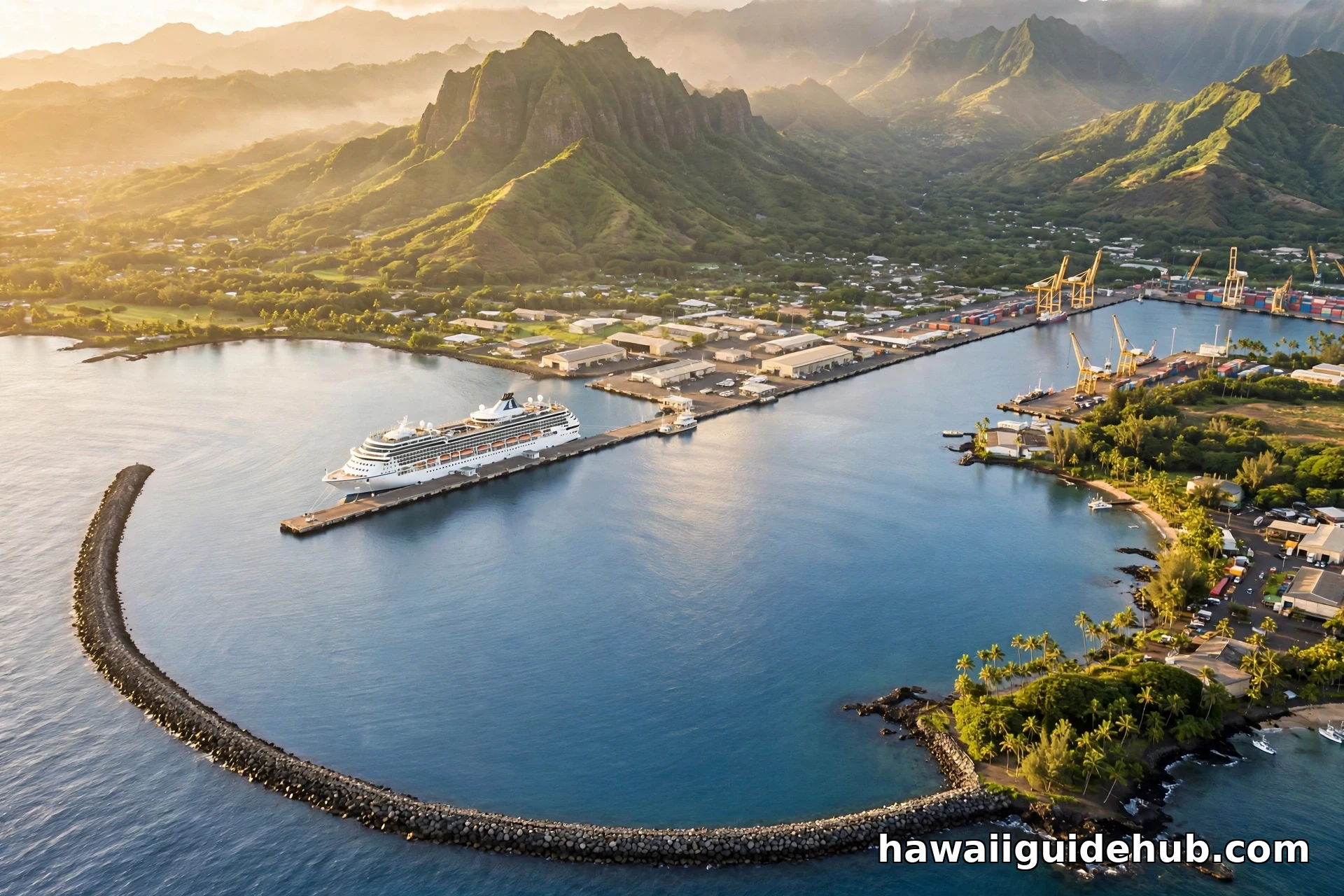
Most people meet the Port of Hilo through a cruise ship rail. After days at sea, the Big Island appears as a green wall on the horizon, and then the ship slows into one of the most distinctive harbors in the Pacific: a wide calm bay guarded by a two mile wall of volcanic rock. That is the Port of Hilo, the island east side working harbor and its only cruise gateway. It is not a polished marina and it does not try to be one. It is a busy, honest port where container barges unload groceries, fuel barges tie up, and, in the same harbor, passengers stream down gangways to spend a day chasing waterfalls and volcanoes.
This guide covers how the port works, which ships call here, the piers and the famous breakwater, a short history of Hilo Harbor, the best places to watch ships come and go, and what to see within minutes of the docks.
Where the Port of Hilo Is
Hilo Harbor sits on Hilo Bay on the east coast of Hawaiʻi Island, at the foot of Kalanianaole Avenue, roughly 2.5 miles from downtown Hilo. It is run by the Hawaii Department of Transportation, Harbors Division. From anywhere on the island you reach Hilo on Highway 19 from the Hamakua Coast, Highway 11 from the south, or Saddle Road from the west, then follow the signs toward downtown Hilo and the bayfront.
The setting is what makes the port memorable. Hilo Bay is a broad natural harbor ringed by the slopes of Mauna Kea to the north and Mauna Loa to the south, and it is protected by the Hilo breakwater, a man made wall of rock that turns rough open ocean into a calm basin. Inside that basin is the port itself: about 74 acres of harbor water plus another 14 acres of cargo handling and storage land. If you are still choosing islands, read our guide to the best things to do on the Big Island before you plan.
A Working Harbor First
The first thing to understand is that the Port of Hilo is a working commercial harbor, not a cruise terminal district. The freight side is the backbone. Overseas container ships and interisland barges bring in nearly everything the east side of the island consumes, while liquid bulk carriers deliver fuel for distribution island wide. In 2012, the harbor moved 1.97 million tons of freight aboard 637 commercial vessels, making it the fourth busiest port in the state of Hawaii.
The design depth at the piers runs 33 to 35 feet, with 2,605 feet of total berth length, which is what lets the port take the big interisland barges, fuel carriers, and large cruise ships. Kawaihae Harbor on the west side of the island handles cargo but none of the cruise ships. Hilo gets all the cruise traffic for the island. Because cargo and passengers long shared the same aprons, federal funds from the Hawaii Port Infrastructure Expansion Program were used to separate interisland cargo operations from passenger and tour operations, improving safety and efficiency for everyone.
The Piers: What Each One Does
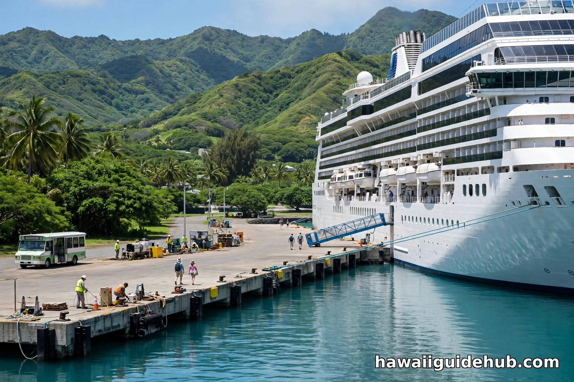
The harbor has four main piers, and each has its job. Pier 1 (Kuhio Wharf) is the front door: cruise ships, container barges, and cargo ships all work here, and it is where passengers, tour buses, and taxis gather on ship days. Pier 2 is primarily an interisland barge pier. Built in the early 1920s, its narrow apron limits modern container equipment, and for years cargo work spilled into the space between Piers 1 and 3, mingling freight with cruise passengers. Pier 3 is mostly a fuel barge pier, with overflow berthing for cruise ships and bulk carriers when schedules overlap.
Pier 4 is the newest chapter. The $55 million interisland cargo terminal project dredged about eight acres of harbor, built a container yard, and added a new pier plus entrance improvements at Kumau Street. The project moved interisland freight onto its own modern terminal so cargo and cruise passengers no longer share working aprons. Groundbreaking was in 2011, and the state celebrated the dedication and blessing in 2016.
Cruise Ships in Hilo
Hilo is the Big Island cruise port, full stop. Every cruise ship that visits the island calls here, and the harbor typically welcomes well over 200,000 cruise passengers in a normal year. There have been busier eras: in 2007, at the height of the island passenger ship boom, around 500,000 cruise passengers arrived.
The ship most regulars know is Norwegian Cruise Line Pride of America. She is the only large ship sailing Hawaii year round, running a seven day interisland itinerary from Honolulu that calls at Maui, Hilo, Kona, and Kauai. Pride of America is US flagged, which is what lets her sail between American ports, and her Hilo call is the centerpiece day for passengers heading to the volcano and the waterfalls. She calls weekly for most of the year.
Seasonal ships join her from roughly October through May: longer repositioning and Pacific itineraries to or from the US West Coast, Vancouver, or the South Pacific. Princess, Holland America, Royal Caribbean, and Celebrity vessels have all called here. The state Harbors Division publishes the cruise schedule, with arrival times listed off port (dockside is typically 30 to 45 minutes later). Ships usually arrive in the morning and sail in the late afternoon or evening, and most excursions fan out to Hawaii Volcanoes National Park or Akaka Falls. If the volcano is on your list, our guide to the best things to do in Hawaii Volcanoes National Park will help you prioritize a short ship day.
The Breakwater
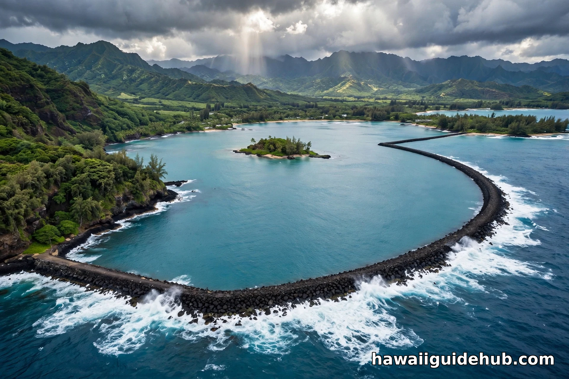
You cannot talk about the Port of Hilo without the breakwater. It is a roughly two mile long rubble mound wall arcing across the bay mouth, eligible for listing in the National Register of Historic Places. Construction started in 1908 under engineer Delbert Metzger, the wall was extended in 1911, and it was completed in 1929. Stones weighing several tons each were quarried in Puna and hauled to the bay on the Hilo Railroad, then placed on a submerged coral reef known as Blonde Reef.
The reef name has its own story. Hilo Bay was surveyed in 1825 by Charles Robert Malden of HMS Blonde, and the reef on the eastern side of the bay took the ship name. One local note that surprises visitors: the breakwater was designed to calm harbor waters for shipping, not as a tsunami barrier. It handles everyday swells beautifully, giving ships a calm basin even when the open ocean is rough. Tsunamis are another matter, and Hilo Bay is sometimes called the tsunami capital of the United States. The April 1946 tsunami killed between 165 and 173 people in Hilo Bay, and the May 1960 tsunami from Chile killed 61. The Pacific Tsunami Museum in downtown Hilo tells that story, and it is one of the most meaningful stops near the port.
A Short History of Hilo Harbor
Hilo was one of the first settlements in the Hawaiian Islands, established between 300 and 600 AD. The ancient Hawaiian name for the village on the bay was Waiakea, and Kamehameha kept canoe fleets in the bay. The modern harbor story starts with a stone pier built in 1861 by Thomas Spencer, the first structure in the bay. Between 1845 and 1865, Hilo transformed under whaling ships, the sugar industry, missionaries, and visiting foreign vessels. Sugar was the engine, and Hilo Bay became the east side shipping point, with the railroad connecting cane fields to the waterfront.
The harbor as we know it began in 1908: three piers and the breakwater were built and the basin dredged, the whole program complete by 1929. That was the golden age of Hilo as a sugar port. Over the twentieth century sugar faded and the harbor adapted, freight first, then fuel, then cruise ships, each era leaving its mark on the piers and the shoreline.
Watching Ships Arrive and Depart
You cannot walk onto the piers as a visitor. The port is a working cargo facility with security zones and fenced areas. But Hilo is a wonderful place to watch ships, because the bayfront wraps around the harbor and several public spots have clear views.
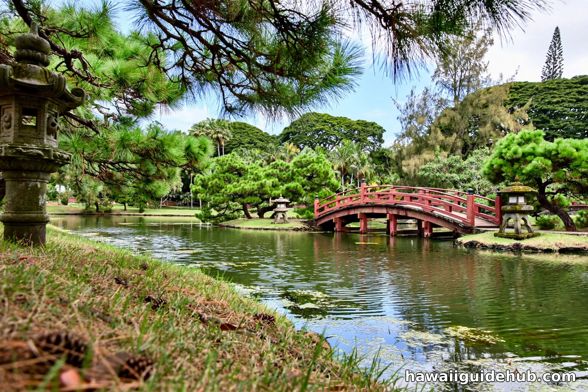
The best viewpoint is Liliʻuokalani Gardens, the Japanese style garden on Banyan Drive near downtown Hilo. From the shoreline you can watch a ship round the breakwater, slow into the basin, and ease alongside Pier 1. Early morning is the magic hour: ships usually arrive in the morning, the bay is calmest, and the light is soft. Coconut Island (Moku Ola), reached by a footbridge, gives a different angle on the harbor mouth. The Hilo Bayfront along Kamehameha Avenue offers long views across the water to the piers.
Ships usually sail in the late afternoon or evening, and departure is worth watching too: the ship turns in the basin and heads out past the breakwater as the sun drops.
Getting to the Port
By car, the harbor is reached from Kalanianaole Avenue, the two lane road running parallel to the harbor on its south side, with direct access via Kuhio Street and Kahanu Street. Parking on port property is for employees, contractors, and visitors on port business. There is no large public visitor lot at the piers, which is another reason the bayfront parks are the practical viewpoints.
Cruise passengers do not need to think about any of this: tour buses, taxis, and shuttles stage right at Pier 1, and the port has designed traffic flow for tour operations. Visitors staying in Hilo can reach the bayfront viewpoints by car, or take TheBus to downtown Hilo and a taxi or rideshare the last couple of miles. One note for first-time visitors: Hilo is the wet, lush side of the island, and morning showers are common. Bring a light rain jacket even on a sunny morning.
What Is Near the Port
The port location is one of its best features. Within minutes of the docks you can reach Liliʻuokalani Gardens and Coconut Island, both free and both beautiful in the morning. Downtown Hilo, about 2.5 miles away, holds the Pacific Tsunami Museum, the Mokupapapa Discovery Center, the Hilo Farmers Market, and Suisan Fish Market, where locals buy fresh fish and poke.
Rainbow Falls and Boiling Pots sit minutes from downtown in Wailuku River State Park. Akaka Falls State Park, with its 442 foot waterfall, is about 30 minutes up the Hamakua Coast and is the most popular half day excursion from the port. Hawaii Volcanoes National Park is roughly 45 minutes to an hour away and is the excursion most cruise passengers choose. For travelers building a bigger itinerary, our roundup of outdoor adventures in Hawaii covers hiking, snorkeling, and more across the islands.
Tips for Cruise Passengers
A few practical points make a Hilo ship day smoother. Hilo is a dock port for the big ships, so you walk off on a gangway, which is faster than tendering. Excursions to the volcano sell out, so book early or have a backup plan like Akaka Falls or the gardens. The port area has limited shade and the sun is strong even on hazy days, so bring reef safe sunscreen, water, and a hat. Allow buffer time getting back: traffic on Kalanianaole Avenue can slow when a ship is in port, and the all aboard time is not flexible.
See the Port on Video
Port of Hilo FAQs
Where do cruise ships dock in Hilo?
Cruise ships dock at Pier 1 (Kuhio Wharf) in Hilo Harbor, about 2.5 miles from downtown Hilo. Pier 3 can handle overflow berthing when schedules overlap. Passengers walk off via gangway onto the pier, where tour buses, taxis, and shuttles stage.
Can you visit the Port of Hilo if you are not on a cruise?
You cannot enter the piers as a tourist. Hilo Harbor is a working cargo port with security zones and restricted areas. The best way to experience the port is from the public bayfront: Liliʻuokalani Gardens, Coconut Island, and the Hilo Bayfront all offer clear views of ships, the breakwater, and the harbor.
Which cruise ships visit Hilo?
Norwegian Pride of America calls weekly year round on her seven day interisland itinerary. Seasonal ships from lines like Princess, Holland America, Royal Caribbean, and Celebrity call from roughly October through May on longer Pacific and repositioning itineraries.
How far is the Port of Hilo from Hawaii Volcanoes National Park?
The national park is about 45 minutes to one hour by road from the port. It is the most popular cruise excursion from Hilo, and most ship tours allow four to five hours in the park.
When is the best time to see a cruise ship in Hilo?
Cruise season peaks from October through May, when seasonal ships join the weekly Pride of America call. Ships usually arrive in the morning, which is also when Hilo Bay is calmest and the light is best for photos.
The Harbor That Built East Hawaii
The Port of Hilo has never been the prettiest harbor in Hawaii, and it has never needed to be. It is the harbor that built the east side of the island: the sugar port that became the freight port that became the cruise gateway, all behind the same wall of rock laid down between 1908 and 1929. When your ship rounds the breakwater on a clear morning, with Mauna Kea rising behind the bay and the gardens green along the shore, you are seeing more than a century of that history in a single view. Take the photo, then go see the island it serves.